


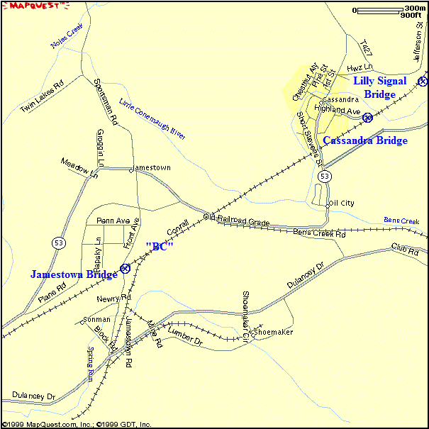
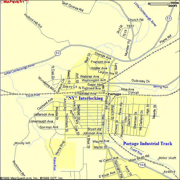
Overview Map of the Lilly to Portage, PA Area
Background
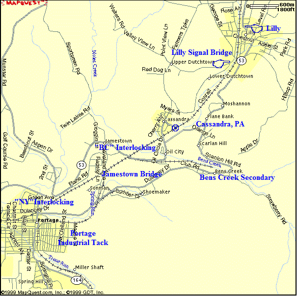
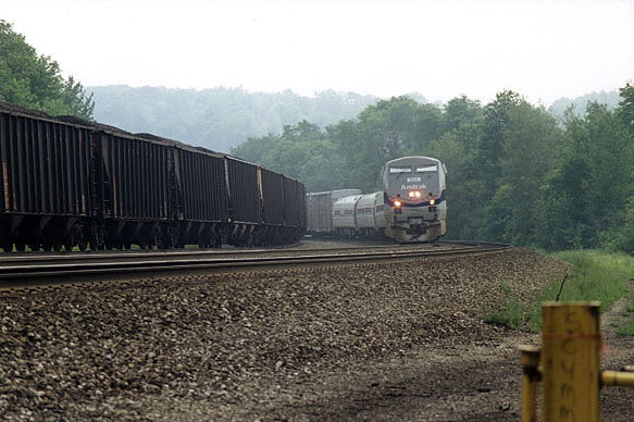
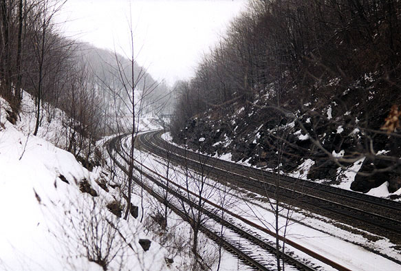
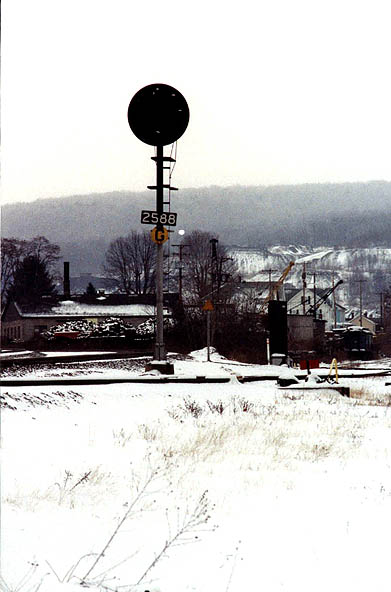
The "Lilly" detector is located at Milepost 253.1 (Carney's Crossing). There is a dragging equipment detector and a hot box detector.
Lilly is located about 3 miles south of Cresson on PA Rt 53.
In the center of town is a concrete overpass (Over Bridge Street) with views East and Westbound.
At milepost 255.8 is the abandoned iron bridge at Cassandra. Note that the bridge is closed to vehicles.
To get to the iron bridge, continue on Rt 53 from Lilly. When you reach the bottom of the hill at the Gas Station/car wash/convenience store turn right onto Cassandra Road/main Street into Cassandra.
To continue on to the Jamestown Bridge (located at Milepost 257.2) , follow Rt 53 until you reach Township Road 406 (Jamestown Road}. Turn left.
Located east of "BC" is the site of the former Cassandra, PA station.
The "Portage" Dragging Equipment detector is located at milepost 258.8.
NY tower once stood at milepost 259.1 and controlled train movements on several branches between Wilmore and Lilly.
The Portage Industrial track was formerly named the "BC Secondary". The track diverges at "NY", which can be reached by following South Railroad Street westward along the Portage Industrial Track from PA route 164.
NOTE: The track was the original alignment of the mainline until 1896. It cut through town and rejoins the main line at "BC" (milepost 256.8). The realignment between "NY" and "BC" shortened the distance but increased the grade to more than 1% (the steepest grade on the west slope). A Map of the "NY" Interlocking / "BC" Secondary is Available Here.
Lilly
Carney's Crossing
Overview
The "Lilly" detector is located at Milepost 253.1 (Carney's Crossing). There is a dragging equipment detector and a hot box detector.
To get to Carney's Crossing, proceed south on Rt 53 out of Cresson. Cross over new PA Rt 22. Continue south until you reach Carney's Crossing Road (about a mile on your right; marked by an orange traffic sign). Turn right.
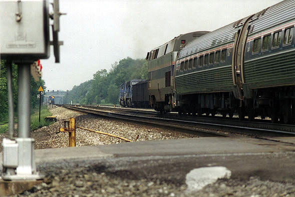
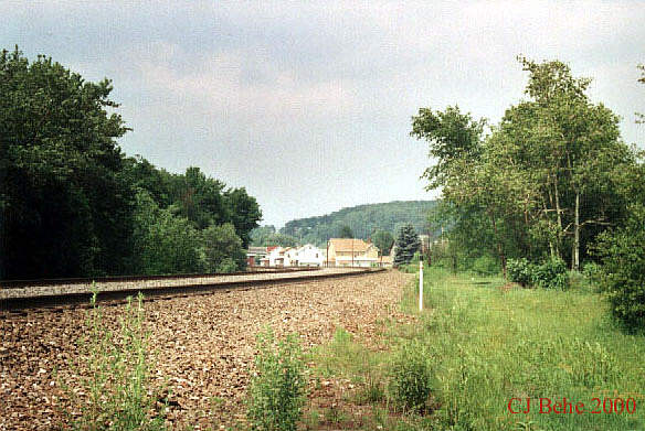
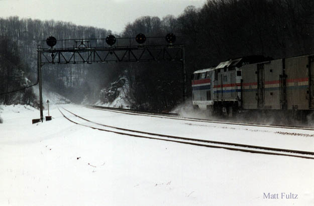
A view to the West. (6/26/98) A view to the East. Note the signal bridge and the (Cresson) Rt 22 Overpass in the background. (6/26/98) A view to the East. Note the signal bridge and the (Cresson) Rt 22 Overpass in the background. (5/23/97)
Lilly
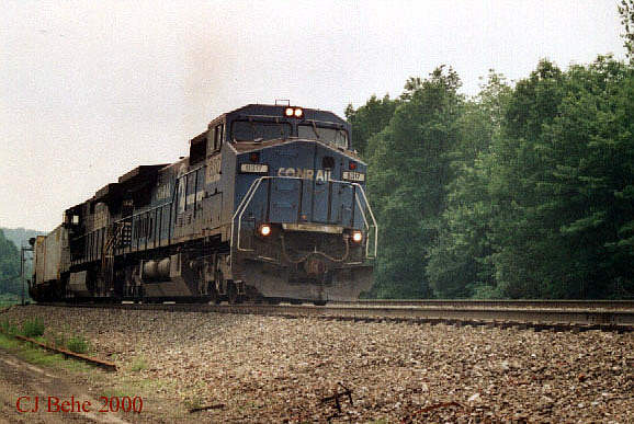
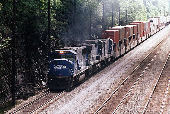
NS at Lilly, PA
"Eastbound meet light helpers westbound bound for Johnstown at Lilly, PA. November 3, 2007."
m3ohwell - Video by Jay B. of NO KLUE PRODUCTIONS
edited by Ed K. OH WELL PRODUCTIONSHistory of Lilly
Lilly is located about 3 miles south of Cresson on PA Rt 53, on the western slope of the Alleghenies along the headwaters of the Little Conemaugh River. The present site of Lilly was originally land densely forested with hemlock, spruce, and oak. Lilly was known at various times as "Dundee", "Foot of Four", "Hemlock", "Lilly's Mill", and "Lilly's Station." The borough was incorporated June 11, 1883 and named "Lilly" for Richard Lilly.
"On August 16, 1802, Joseph Moyer settled here on a 332 acre tract. Aided by his large family, he built a log cabin, cleared land for crops, dug a mill race and erected a water powered grist mill.
Joseph Liilly, whose family fled England because of religious intolerance, purchased this mill on March 23, 1823. Following his death five months later, his son, Richard Lilly assumed ownership. During this period, new settlers (mainly Scotch and Irish) arrived, forming a little village.
Lumbering became an early industry with construction of a water powered (later steam driven) saw mill. Added to the growth of the village in 1825 was coal mining, developed first by Matthew and Michael Myers. This coal was transported in sacks by pack horse over the Alleghenies for use by blacksmiths in the Juniata Valley.
In 1832, the Pennsylvania State Canal Commission authorized construction of a unique canal boat portage over the Allegheny Mountains. Here, Sylvester Welch, principal engineer, set up tents, established local headquarters, and from this village, began forest cutting and clearing for construction of the Allegheny Portage Railroad.
With its location at the foot of Incline Plane No. 4, the community flourished. In succeeding years, Lilly continued to prosper not only with extensive mining of the area's rich coal resources but also with the location thought the community of the Pennsylvania Railroad's east-west, all rail line."(1)
A view to the West. (6/26/98) A view to the East. Note the signal bridge and the (Cresson) Rt 22 Overpass in the background. (6/26/98) A view to the East. Note the signal bridge and the (Cresson) Rt 22 Overpass in the background. (5/23/97) Looking East from Railroad Street & Grant Street. The overpass is visible in this photo. (6-13-00) Looking East from the West end of Railroad Street. (6-13-00) Looking West from the West end of Railroad Street. (6-13-00) Looking West from the West end of Railroad Street. (6-13-00) RR Street and Washington Street. Looking West. 12-7-00 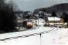
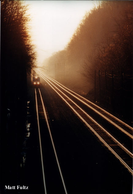
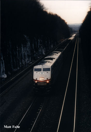
Looking East from the West end of Railroad Street. 12-7-00 By Matt Fultz. Looking west from the West end of Railroad Street. 12-7-00 By Matt Fultz. A telephoto lens view of the signal bridge at Lilly, PA. Looking East from the "island" located east of the Cassandra Bridge. (01/30/1998)
- At the north end of town, (railroad East), turn off of Rt 53 onto Church Street. This road ends at Railroad Street. You can find good locations anywhere along Railroad Street.
- In the center of town is a concrete overpass (Over Bridge Street) with views East and Westbound.
- At the south (railroad west) end of town, there is a signal bridge at the curve.
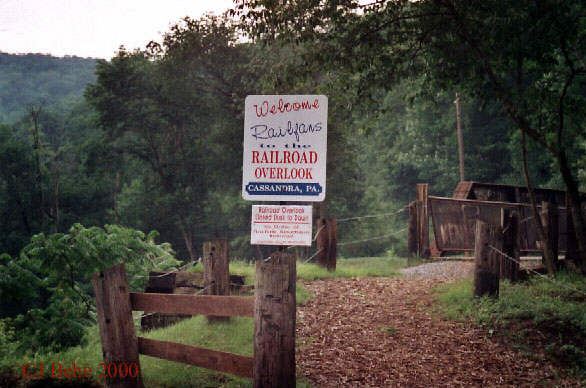
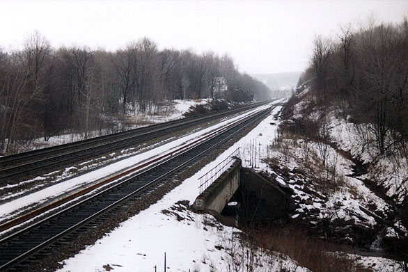
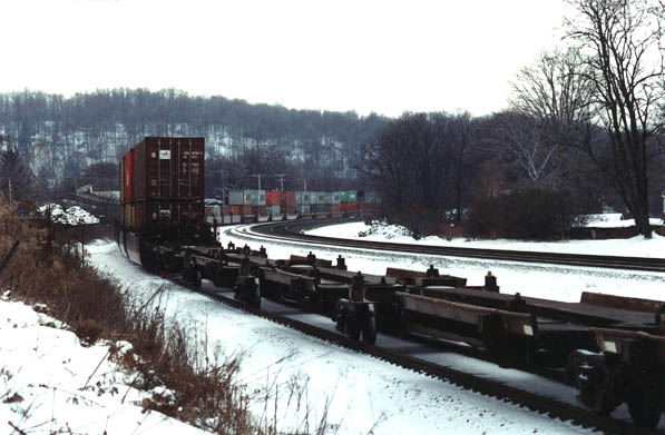
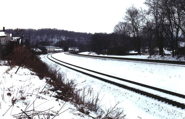
At milepost 255.8 is the abandoned iron bridge at Cassandra. Note that the bridge is closed to vehicles.
To get to the iron bridge, continue on Rt 53 from Lilly. When you reach the bottom of the hill at the Gas Station/car wash/convenience store turn right onto Cassandra Road/main Street into Cassandra.
To continue on to the Jamestown Bridge (located at Milepost 257.2) , follow Rt 53 until you reach Township Road 406 (Jamestown Road}. Turn left.
The "Portage" Dragging Equipment detector is located at milepost 258.8.NY tower once stood at milepost 259.1 and controlled train movements on several branches between Wilmore and Lilly.
Cassandra and Jamestown
Overview Map of Both Cassandra and Jamestown
Overview
The "Lilly" detector is located at Milepost 253.1 (Carney's Crossing). There is a dragging equipment detector and a hot box detector. (Lilly is located about 3 miles south of Cresson on PA Rt 53.) At milepost 255.8 is the abandoned iron bridge at Cassandra. To get to the iron bridge, continue on Rt 53 from Lilly. When you reach the bottom of the hill at the Gas Station/car wash/convenience store turn right onto Cassandra Road/main Street into Cassandra. The town of Cassandra had recently cleared some of the brush and placed a park bench at the Bridge for the purpose of attracting railfans. Note that the bridge is closed to vehicles.
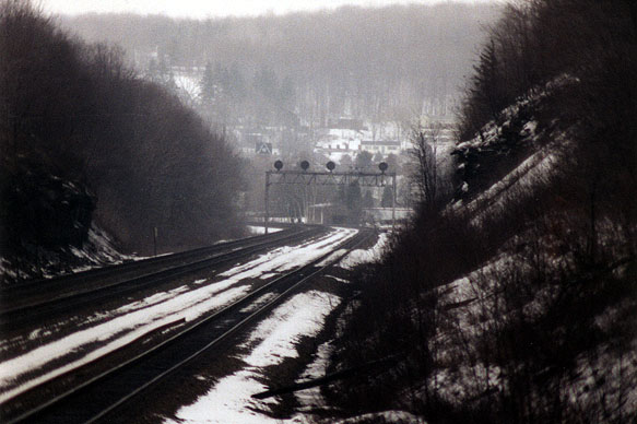
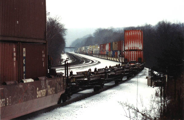
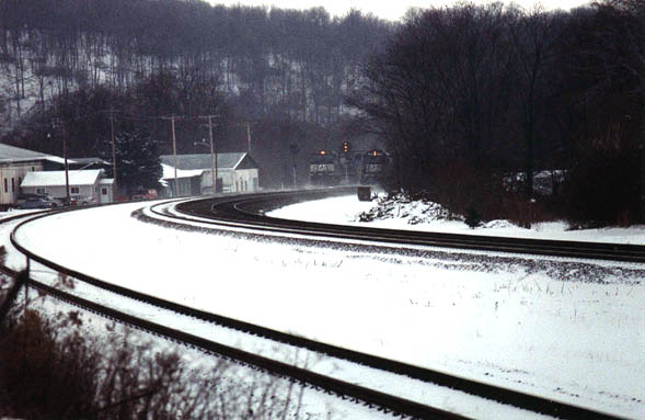
From the Bridge, looking West towards Portage, you will see the Jamestown Bridge off in the distance as well as a signal tower. This is a long straight-away view. If you look East, you will see the track curve off to the left. There is an "island" to the right of that curve. From that island, you can see both the signal bridge at Lilly and the Cassandra Bridge.
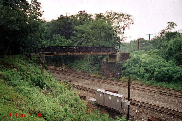
The Interchange (milepost 256.8) for the Portage Industrial Track (formerly the Ben's Creek Secondary; "BC") is just west of the Cassandra Bridge. The Secondary was the original alignment of the mainline until 1896. Located east of "BC" is the site of the former Cassandra, PA station. The Jamestown Bridge is visible to the west at milepost 257.2 A Map of the "NY" Interlocking / "BC" Secondary is Available Here.
To continue on to the Jamestown Bridge (located at Milepost 257.2) , follow Rt 53 until you reach Township Road 406 (Jamestown Road}. Turn left.
The track shown as "old railroad grade" no longer exists. Located east of "BC" is the site of the former Cassandra, PA station.
The "Portage" Dragging Equipment detector is located at milepost 258.8.NY tower once stood at milepost 259.1 and controlled train movements on several branches between Wilmore and Lilly.
The Portage Industrial track was formerly named the "BC Secondary". The track diverges at "NY", which can be reached by following South Railroad Street westward along the Portage Industrial Track from PA route 164.
NOTE: The track was the original alignment of the mainline until 1896. It cut through town and rejoins the main line at "BC" (milepost 256.8). The realignment between "NY" and "BC" shortened the distance but increased the grade to more than 1% (the steepest grade on the west slope).
Cassandra
Cassandra, Pennsylvania
August 14, 2009 — "Action at THE CASSANDRA OVERLOOK; d K. cp Laurel Run OH WELL PRODUCTIONSHistory of Cassandra
"About the middle of the 19th Century, the old Portage Railroad pushed across the Alleghenies as laborers, led by surveyor's stakes and trailed by stone ties and iron rails laid across the mountains, arrived in this region. These laborers, comprised of mainly Welsh and Irish immigrants, established a small settlement at Leap's Crossing located along the roadbed of the railroad and only a few hundred yards from Number Three Plane. The settlers changed the name to Derby when a store and a hotel were built.
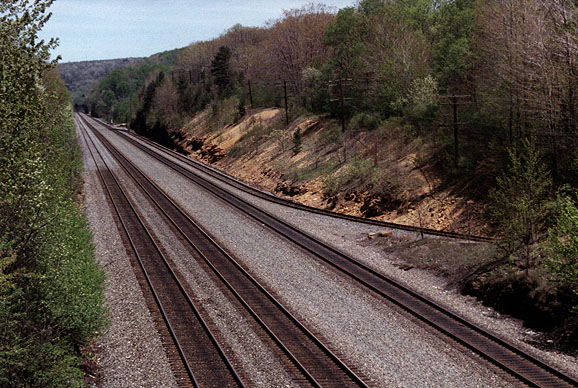
To the south of the underpass sat a group of homes the settlers called Oil City. Beyond Oil City, an oil pump station was built near the railroad and dam of water. This area, called Myra, was located at the bottom of "Peanut Hill," the end of the road coming down from Bens Creek. One of the original water supply sources remains today. As the coal mines of Bens Creek prospered, Derby grew to nearly 100 homes, and more stores opened. A good road was built connecting with the Sonman Road at Bens Creek.By the turn of the century (1900), Derby was a thriving community. The railroad station located above the underpass that was the entrance to Derby was called the Ben's Creek Station. The picture above shows an eastbound view through the "Big Cut". This area is known as the deepest cut on the mainline because of the mountainous terrain that had to be cut through. In 1898, the new Pennsylvania Railroad Line was completed as these four tracks were laid from Lilly to Wilmore. The bridge in the far distance is the Iron Bridge at Cassandra.
In 1888, the town was laid out on 13 acres of property owned by Mathiot Reade as shown on a 1908 surveyor's drawing of the proposed borough. On September 23, 1908, the town was incorporated as a borough and named Cassandra after Mr. Reade's daughter. " (3)
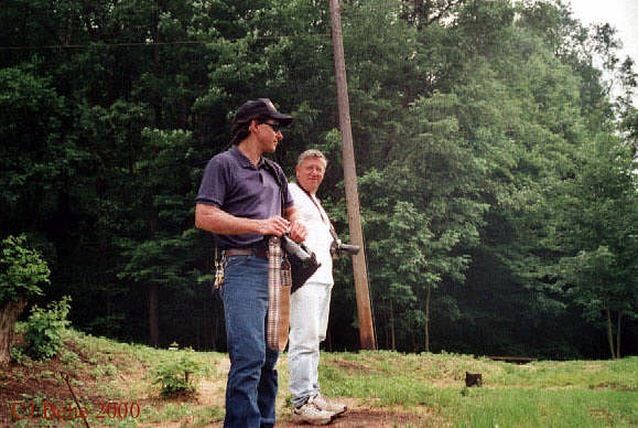
Looking West toward Cassandra from the "island." Note the bridge. (1/30/98) Looking West from the bridge. (6/97) The Town of Cassandra has recently done some landscaping and beautification to the Iron Bridge Railroad Overlook. (6-13-00) Looking West toward Cassandra from the "island." Note the bridge. (1/30/98) Looking East from the bridge. Note the "island" to the right. (6/97) Railfans (and my co-workers) at the Iron Bridge Overlook (6-13-00). L-Matt Fultz; R-Dave Shultz Looking West from the bridge. By Matt Fultz Looking West from the bridge. By Matt Fultz The Town of Cassandra has recently done some landscaping and beautification to the Iron Bridge Railroad Overlook. (6-13-00) Looking West from the bridge. By Matt Fultz Looking East toward Lilly from the "island." Note the signal bridge. (1/30/98) The Town of Cassandra has recently done some landscaping and beautification to the Iron Bridge Railroad Overlook. (6-13-00) "At one time, Old Route 53 wound through the town and what is known as "The Iron Bridge" allowed vehicular traffic to cross over the railroad tracks into Cassandra. When the bridge became unsafe for vehicle traffic, it was reclassified as a pedestrian bridge only.
For years the Iron Bridge has been just part of Cassandra-it was always there. All who have grown up in this little town have memories of this bridge. Grandparents and great grandparents may remember its importance as a vehicle bridge allowing traffic on Route 53 to flow through Cassandra. When this was no longer the case and the bridge became a pedestrian bridge, it was somewhat forgotten except for the town's residents.
In the Cassandra of 1999, it seems as though the Iron Bridge has been "rediscovered." This bridge spans the railroad's longest straight-away (three miles) and deepest hillside cut. Railroad enthusiasts have been stopping at the bridge to watch the trains and take advantage of this view. With their cameras and video cameras, they wait patiently to catch a glimpse of the trains as they chug east to west and west to east. In 1998, a local businessman who also doubles as the town mayor noticed an increase in cars with out-of- state license plates flowing through town. His curiosity got the best of him, and he began to investigate. To his surprise, their destination was the Iron Bridge. He immediately began a visitors Register for them to sign. In just a short period of one year, he had between 700 and 800 signatures from all over the United States as well as countries from around the world such as Australia, Great Britain, Denmark, Canada, and Germany to name but a few. There are signatures from all but three of the states east of the Mississippi River. It just may be true when they say, "Sometimes the best things can be found right in your own backyard!" "(3)
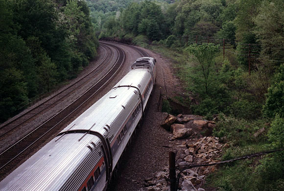
A view from the Jamestown Bridge towards the (RR) East. Looking toward Cassandra, PA. (photo taken 5-23-97) A view from the Jamestown Bridge towards the (RR) West. Looking toward Portage, PA. (photo taken 4-23-98
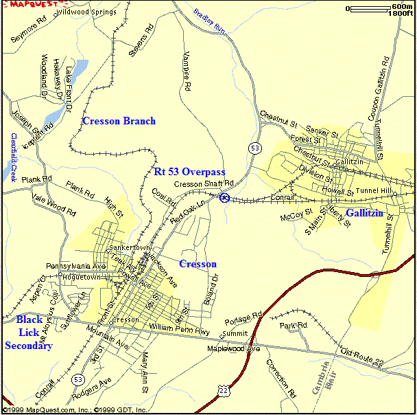
Portage
Portage is located in the southeastern part of Cambria County, situated on the mouth of Trout Run near the Little Conemaugh River. The creeks and rivers that flow from the Portage area eventually drain into the Ohio River system. These are the Little Conemaugh, Bens Creek, Trout Run and Cain Run.Portage sits on the edge of the Appalachia Plateau. It is an area of many ridges and valleys. Prior to the settlement of this area, there was a dense forest of pine trees along the Little Conemaugh. Nearby on the hillsides could be found an abundance of ash, maple, white oak, and red oak trees. The area also contained hickory, black cherry, hemlock, beach, walnut and birch trees.
American Indians were the first to live in these mountains. In the early 1930s, a rock was found in Portage which bore ancient carvings. Known as the Achannessink rock, it provided a link with the area's Indian past. It is thought that the carvings on this rock indicate that Portage had been the headquarters of the Turtle Clan, a division of the Delaware Indian Tribe.
About 1820, settlements started to appear in Bedford County. These early residents would use Cambria and Blair Counties for hunting. During this early period, this area wasn't readily accessible due to the dense forests and the rugged terrain. The natural waterways and the Indian trails were used by anyone passing through.
Since the commercial and banking center of Pennsylvania during the early 1800's was located in Philadelphia, in the eastern section of Pennsylvania, it appeared advantageous to complete a transportation system that would link the Philadelphia area with the Pittsburgh area. The natural waterway from the Columbia and Philadelphia Railroad existed across the southeastern counties of Pennsylvania, the Schuylkill River, the Susquehanna River, and the Juniata River to Hollidaysburg. In the western section of the state the natural waterway started in Johnstown on the Conemaugh River. It progressed to the Kiskimenetas Rivers and the Allegheny River. From the Allegheny River the boats could progress to the Pittsburgh area and the Ohio River. It was in 1826 that the Pennsylvania Board of Canal Commissioners was given approval by the General Assembly to begin building the Pennsylvania Canal." (2) The railroad soon followed. For further information, visit "The History of Portage".
The former PRR station is now the Portage Station Museum: It is located at: 400 Lee Street, P.O. Box 45, Portage, PA 15946; 814-736-9223
Map of Portage
Portage
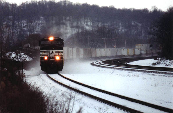
The West Slope at Portage Pa, Nov.12 2009
"Rail grinder working east on track #1 with Freight Train Passing on track #2"
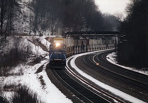
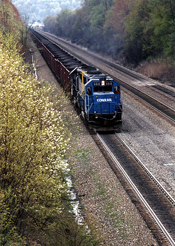
MrtrainwatcherCoal Train at Portage, PA
"SD70's with loud turbos lead a coal train up grade through Portage.
The 108 car Norfolk Southern coal train is passing Portage assisted by SD40-2 pushers on the rear as a stack train passes it on track 2."
jwallacect
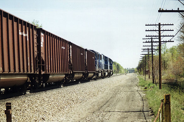
The "Portage" Dragging Equipment detector is located at milepost 258.8. NY tower once stood at milepost 259.1 and controlled train movements on several branches between Wilmore and Lilly.The Portage Industrial track was formerly named the "BC Secondary". The track diverges at "NY", which can be reached by following South Railroad Street westward along the Portage Industrial Track from PA route 164.
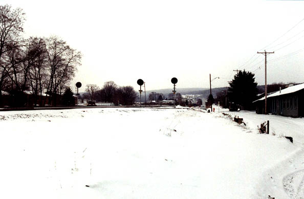
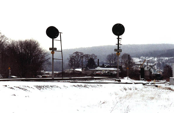
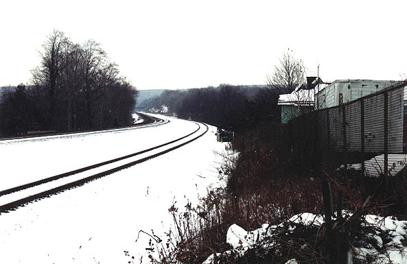
Signal Masts at South Railroad Avenue. "NY" Interlocking. 12-7-00 Signal Masts at South Railroad Avenue. "NY" Interlocking. 12-7-00 Looking East. From the Alley Behind the Station. 12-7-00 Signal Masts at South Railroad Avenue. "NY" Interlocking. 12-7-00 Looking East. From the Alley Behind the Station. 12-7-00 Looking East. From the Alley Behind the Station. 12-7-00 Looking west. From the Alley Behind the Station. 12-7-00 Looking west. From the Alley Behind the Station. 12-7-00 Looking west. From the Alley Behind the Station. 12-7-00 Looking west. From the Alley Behind the Station. 12-7-00 NOTE: The industrial track was the original alignment of the mainline until 1896. It cut through town and rejoins the main line at "BC" (milepost 256.8). The realignment between "NY" and "BC" shortened the distance but increased the grade to more than 1% (the steepest grade on the west slope).
For further information on the history of Portage-Gallitzin as well as the PRR, see the following locations:
- Visit the Portage Station Museum: Location: 400 Lee Street Mail: P.O. Box 45 Portage, PA 15946 814-736-9223
- For further information on Portage, visit PortagePA.us .
- Visit RGUSRAIL.COM & Two Generations on the Portage Railroad"
- Cambria County Historical Society
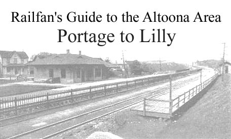
Photographs are by Chris Behe unless otherwise noted. Title Photo of the Portage Station is from a 1915 postcard. (1) from an article titled "Lilly - How it was named". Author and publication unknown; (2) from Chapter 1, "The Early Years", publication and author unknown; (3)From the "St Agnes Catholic Church 90th Anniversary" commemorative book.
![]()
Revised March 25, 2017


