


|
Route
of the Hiawatha Trail
|
The Hiawatha
Rail Trail reopened the former Milwaukee Road (MILW) route over the
rugged Bitterroot Mountains in NW Idaho. Finished in 1910, the
line served the MILW for 75 years, when the MILW abandoned the Pacific
NW region in an effort to stave off bankruptcy.
This section of the trail features 9 tunnels, including the 1.8 mile long St. Paul tunnel, and 7 high trestles. All photos from 7/12/2006. |
|
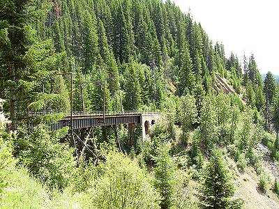 This is a 500 ft long, 120 ft high trestle on the upper leg of the switch back. |
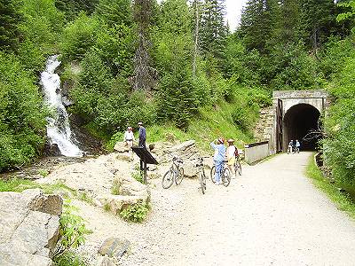 This is the Roland site showing the [RR] west portal of the 1.8 mile long St. Paul Pass ("Taft") Tunnel, a waterfall, and one of many interpretive signs along the trail. |
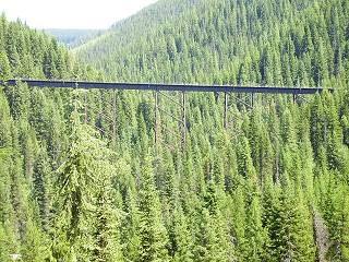 Looking across the valley from the lower leg of the switch back, we see the 800 ft long, 230 ft high Kelly Creek trestle. We'll be crossing this one in another 2 miles and 2 more tunnels. |
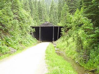
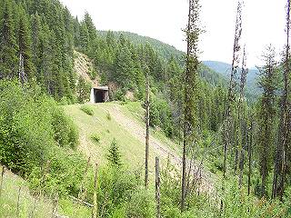 A section of the upper leg with the [RR] east portal of tunnel #6 in view. |
 This is the snowshed at the eastern portal of the St. Paul Tunnel. This is one of the wettest tunnels I've ridden as you can see by the stream which drains the tunnel; if you don't have fenders or a rack on your bike, you'll have a mud stripe up your back! |
| Rails to Trails | next> |


