


|
This page is an agglomeration of pictures from twenty years. And some maps that arrived after I wrote the original page in 2009. Many of my pictures could be better. Some days I just took what I saw. And there's plenty of trees hiding the view.
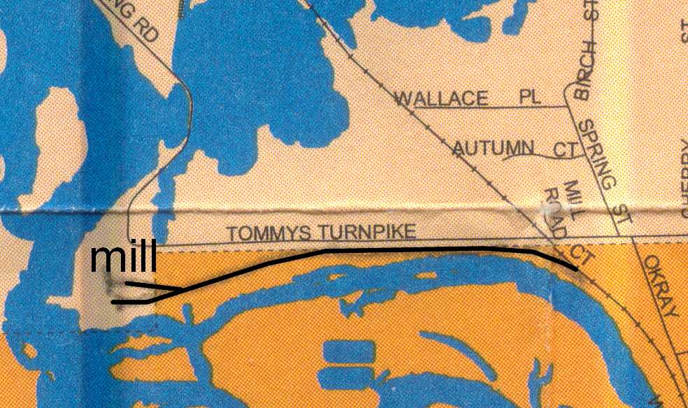
Below is a Map, south of Whiting, Wisconsin. |
|
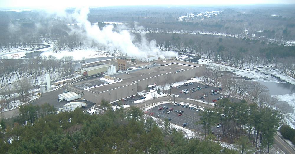
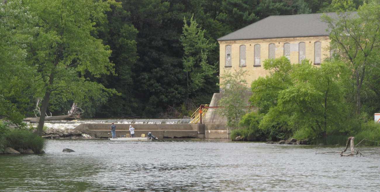
There is a small paper mill at a bend in the river channel. I named this page 'Little Rag Mill of Whiting' because it is small compared to the big mill that was a mile north (that was demolished in 2014). (and not to be confused with the 'stink mill', Stevens Point Pulp and Paper Company, that has completely disappeared from McDill Pond, two miles to the northeast.) Sometimes I don't use owner's names for the mills, I use the location, because owners change over the years. This mill started as the Plover-Whiting Paper Mill. Kimberly Clark had their name on it for a while. Currently, it is the Neenah Paper Whiting Mill.
There is a low dam west of the buildings, about 10 feet of head. Not much. Most mills would also receive coal for the boiler for steam heat to dry the paper, but I don't have any history of how or where the track was for that. Natural gas would have been available 40 years ago. But I could GUESS that a coal car could go to the end of the south track, close to the boiler room? |
|
Here's a note from Greg B. in 2009: I was reading your page on Neenah Paper Whiting Mill. . . . We make fine paper, writing, text, and cover. And I'm pretty sure they have always been that type of mill. It used to be refered to as a Rag Mill (rags had a high quality fibre) They made a lot of paper with cotton. And made a Water Marked Paper, and still do. |
|
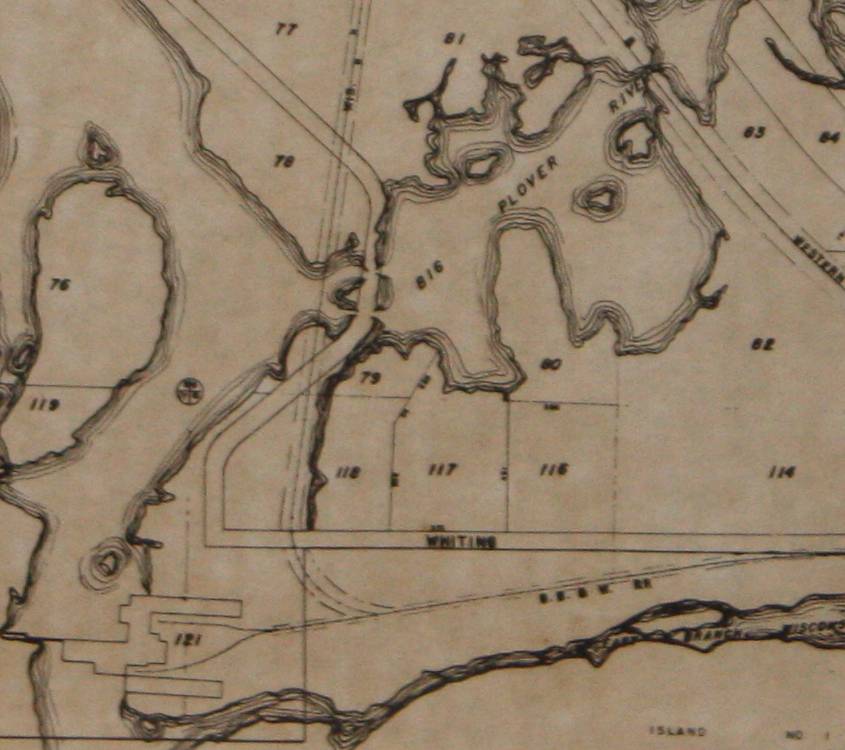
And a few hours after I posted this page in 2009, Greg Brooks sent a plat map drawn in 1949. That was great and very timely, so I included it on this page as soon as I saw it.
Now I understand how the original Wisconsin Central RR served the paper mill. |
.
|
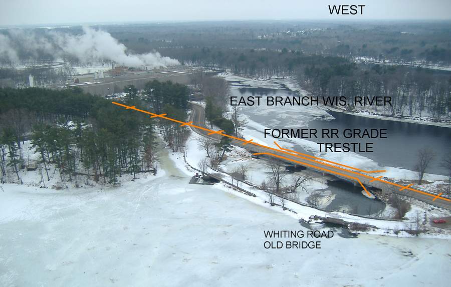
Many years ago, the original Wisconsin Central had a rail spur into the plant from the north. My father-in-law remembered the track. There was a trestle over the mouth of the Plover River, where it enters the Wisconsin River. In the springtime high water, they would park gondolas of rock on the trestle every night to hold it down so the ties wouldn't float off the bents. This was about in the 1950's. I don't know when the trestle was removed. The pilings were sawed off at the waterline, and some still show. About ten years ago, Old Whiting Road was re-aligned and a new concrete bridge was built directly over the location of the trestle. The road is also a dam of the Plover River. A water power canal goes south past the parking lot, I don't know if its actually used any more. I marked the photo below with the information. |
|
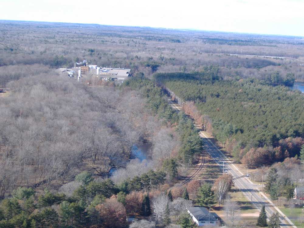
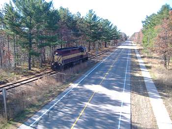
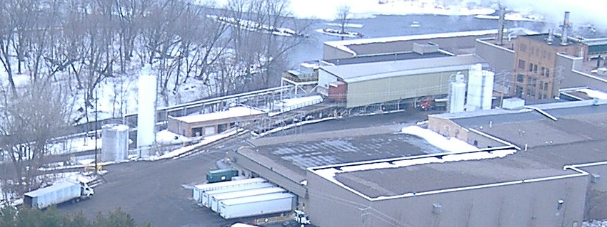
The next picture shows the current rail route into the mill. This picture is looking west along Tommy's Turnpike in Whiting. |
|
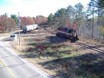
Two pictures of the Commercial Job going to the mill in 2009: Entering the spur, and squeezing between Tommy's Turnpike and a river bank. |
 . . . . . . .
.
.
|
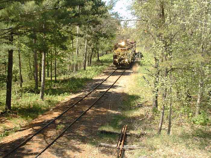
Then the tracks leave the side of Tommy's Turnpike and drop down to the riverbank, 30 feet lower.
They used to switch the mill about mid-day before 2009, but in current times, I think they just push cars from Plover to here. In the evening or night? |
.
|
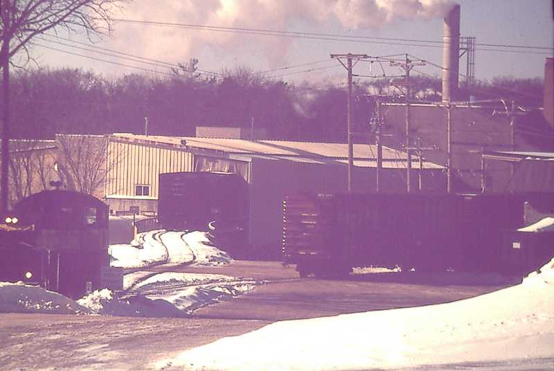
This picture is from 20 years ago, before fences and security cameras. The switcher is partially hidden by the slope of the ground along the river bank. There's just two tracks at the end. The left (south) one is on a trestle over the river. The curved trestle shows on the outside, and continues curved under the loading shed. I think two or three boxcars fit in there. |
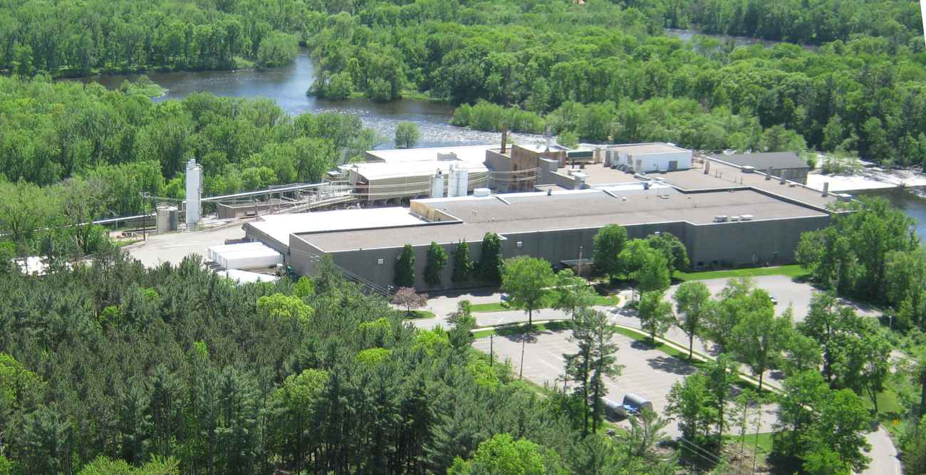
| Looking southwest at the whole mill in 2009: |
| Close up view of the rail spur, the south one. |
In 2020, it looks the same.
Looking Northeast at the mill, in 2019. The track comes in from the right, hidden by trees.
The river branches 3 ways below the mill, and with a map you can get a boat below the mill. It can be a 3-hour adventure.
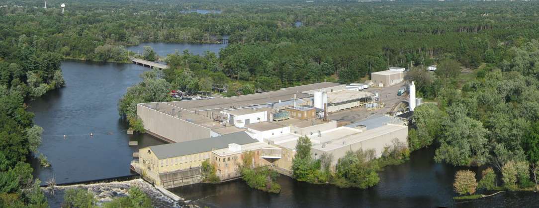
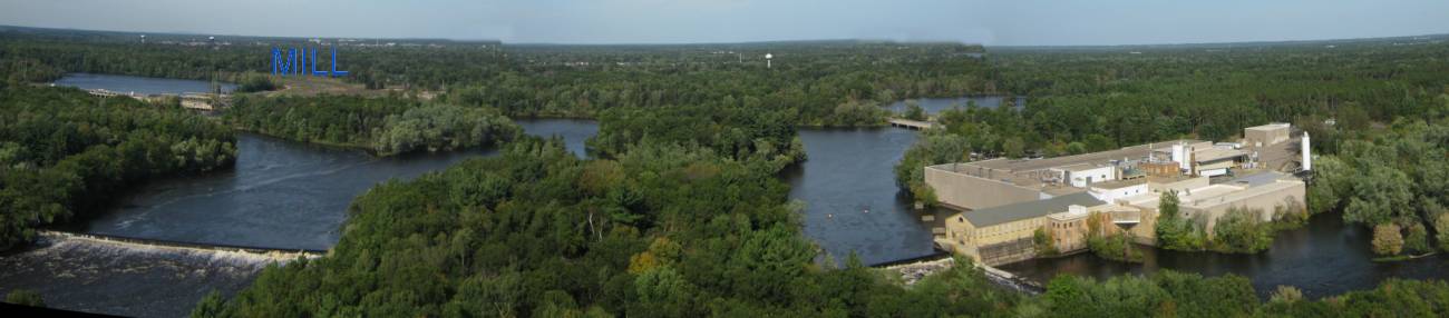
Below is a wider view of the area. On the left / west / is the main channel of the Wisconsin River.
The east channel runs by the buildings, also over a dam.
I put the blue word ' MILL ' on the upper left of the picture, pointing out the location of the really big mill that was removed in about 2014.
Just the water power dam remains on the river.
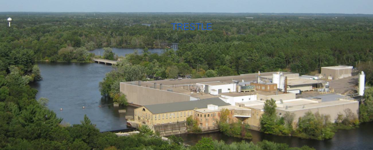
I put the word TRESTLE on this picture, showing the current trestle on the main track.
In the 'old days' , there were 3 trestles in this area, two built by the WC and one by the GB and W.
Just the GBW location survives.
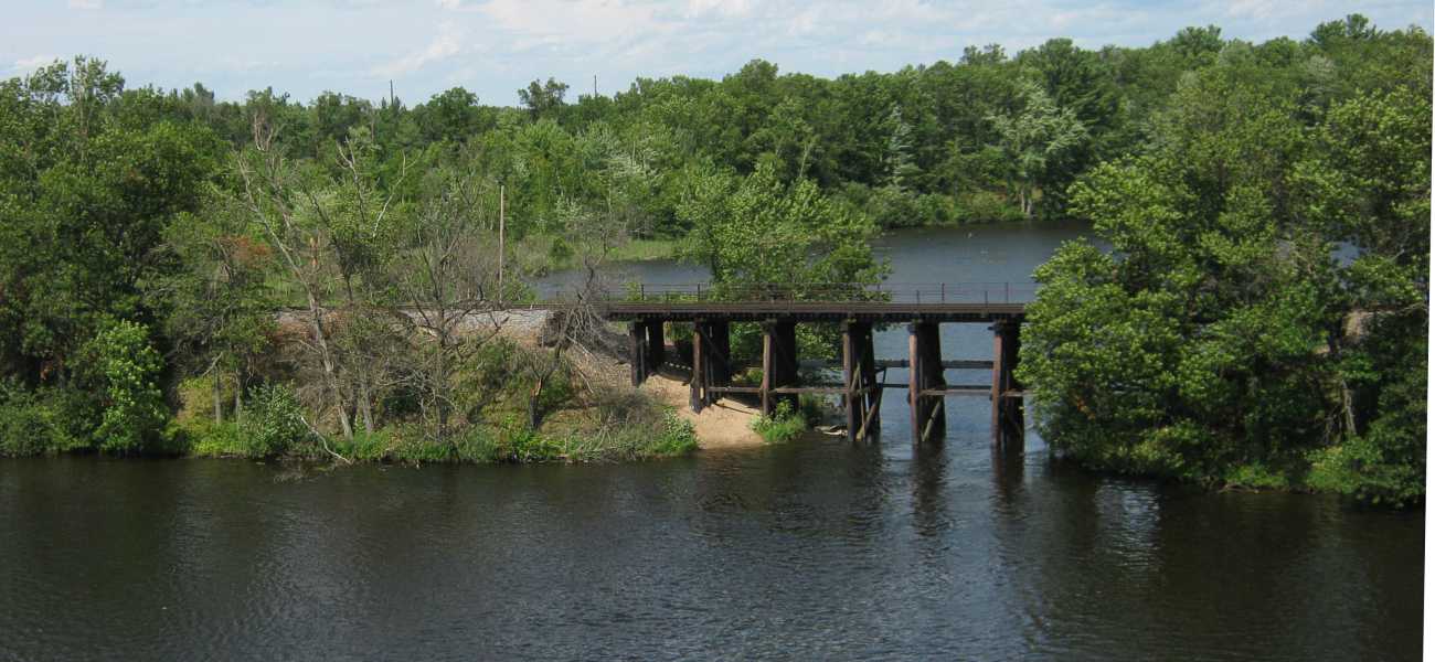
The Plover River and Green Circle Trails are popular.
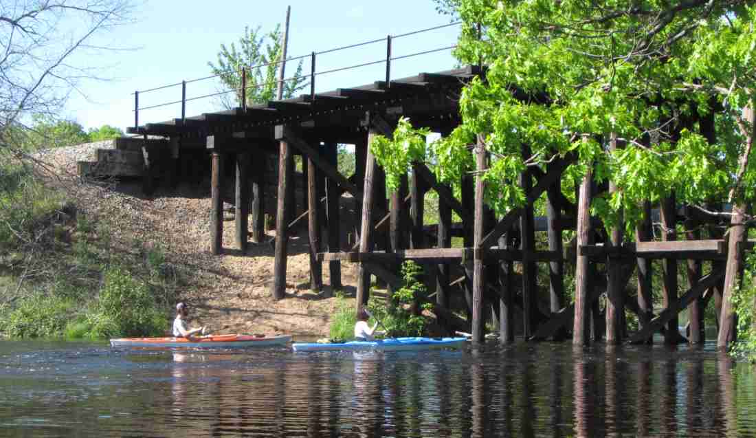
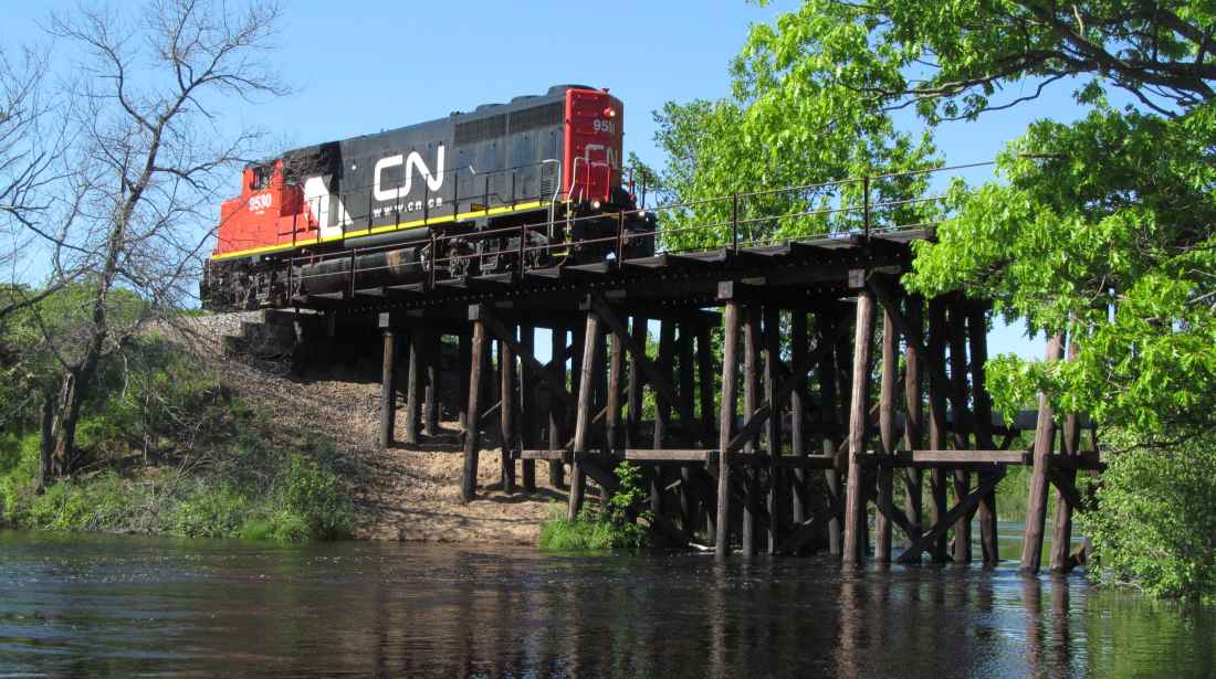
I heard the Plover turn blow their horn (the P-line is not silent territory), so I knew they were coming.
I just didn't remember which direction the loco was facing. They came running in reverse. I could have paddled to get a different view, if I knew that.
.
Here was a note from Tom K. in 2009:
Everything looks accurate to my knowledge of the area. Great presentation as always.
This mill is also documented by the Library of Congress . Here is a link to the pictures. I think this information dates to the mid 80's.
That 2009 link doesn't work, but here's how to find it in 2020:
Library of Congress
click tab for Digital Collections
then see the tab: Historic American Buildings Survey / Historic American Engineering Record / Historic American Landscapes Survey
and then search a location:
Whiting, Wisconsin
or in this order, Wisconsin, Portage County, Whiting
and see the list, which should show the Whiting-Plover Paper Mill, 3243 Whiting Road, Whiting, WI
.
It's interesting that the Plover Whiting paper mill got into the library, but many other mills around the state didn't. I don't know their criteria for selection.
I did find an interesting building in Wisconsin, Waupaca County, Waupaca, the roller mill.
.
Link to my original site, with no advertising, and a complete chronological list of my pages of ALL sites,
to My Main Index Page on the TrainWeb site.
the original page was wrote Feb 14; 2009; and was updated and reposted in June 2020


