 C&I Maps
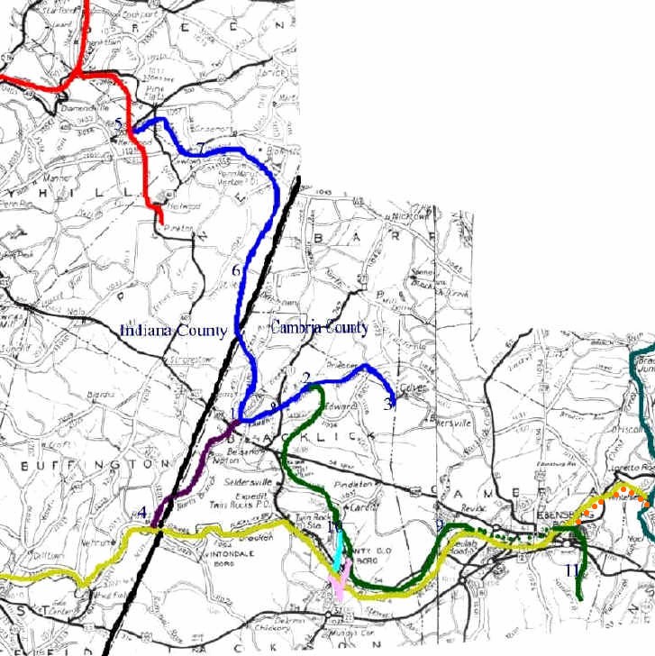
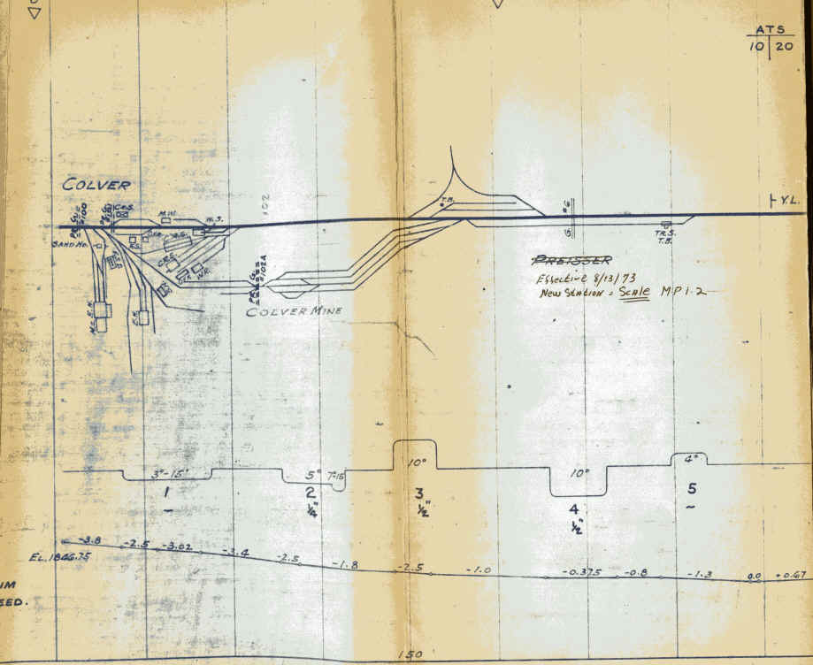
1 - Elkdale Junction/Adele Crossing/ White Mill 2 - Regan Junction 3 - Colver 4 - Rexis 5 - Manver
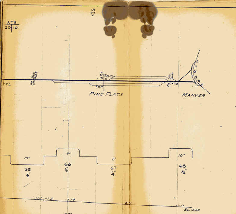
6 - Stiles 7 - Glory Crossing 8 - Concrete Bridge Crossing 9 - Revloc 10 - Eleanor Yard 11 - Cambria Slope Mine 33
Elkdale Junction was originally named Dobson Jct. after W.E. Dobson, C&I auditor, general auditor and traffic manager from 1911 to 1922; Regan Junction was named after M.J. Regan, a C&I brakeman, conductor and yardmaster from 1911 to 1922.
Cambria and Indiana Railroad
Blue - C&I Main Line Purple - Rexis Branch Green - Cambria Branch*
Aqua - Springfield Branch Pink - Nanty Glo Branch
*Green dotted line indicates C&I trackage rights over the Blacklick Secondary through Ebensburg.
**Orange dots: section of the former PRR Blacklick Secondary purchased by the C&I.
Pennsylvania Railroad and successors
Gold - Blacklick Secondary** Teal - Cresson Secondary
Cherry Tree & Dixonville RR
Red - Cherry Tree and Dixonville RR (later CT&D Branch of PC, then CR, now RJC PA Lines) The Manver Secondary (originally the Possum Glory Branch) which ran from Heilwood to Wandin has been removed.
Rails-to-trails info: The Ghost Town Trail runs on the former Blacklick Secondary from Josephine eastward to Ebensburg and along the Rexis Branch from Rexis northward to US 422. There has also been discussion to convert much of the remaining abandoned C&I right of way into rail-trails to be known as the C&I Trail and the Manver Line Trail.
From 1922 until 1975, the New York Central (and its successors) owned 40% of the C&I. Here's an NYC map of the C&I from the 1940's:
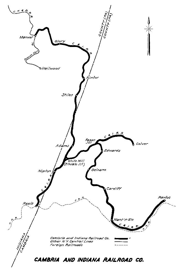
special thanks to Henry Statkowski for the above NYC map.
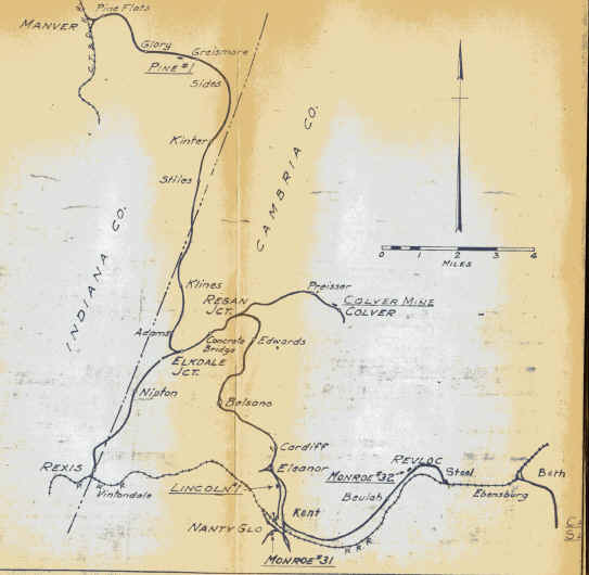
special thanks to Jack Hill for the above map and for the track charts below: