By: Carl Morrison,
MoKnowsPhotos.com
E-Mail: Carl@TrainWeb.com
(Double-click any photo to see a
double-sized copy, click BACK in your browser to return to this
page.)
Richard resumed his comments on the
rail-side vistas after our stop in San Luis Obispo. As we climbed
Questa Grade, he pointed out Seven Sisters (ancient volcano cones)
stretching west from SLO with the last of the seven being Morro Rock in
Morro Bay,
CA.
The movie, "Daylight, the Padres
Trail," made in 1939 was started at 6 pm by Richard in the
theater on the lower level. The Daylight used to make the San
Francisco to Los Angeles run, from sunrise to sunset, in nine hours and
45 minutes. It was recognizable in it's red, orange and black
color scheme. In their diner, they featured the Southern Pacific
Salad, all you can eat.
After the movie, we waited for our dinner call in the Parlour Car,
watching the late afternoon sun light the velvety hills,
cattle, and ranches dotted with solitary California Oaks. At San
Ardo, we saw oil wells pumping like giant aging wood peckers. Oil
pumps
soon gave way to extensive farm fields near Salinas. We enjoyed
the excellent piano music which Richard had playing on his sound system
before dinner.
I noticed a quote on the front of the menu by Harry Truman, "You get a
real feeling of this country and the people in it when you are on a
train."
The next morning, since we were running a couple of hours late, Richard
began his morning talk on Mt. Shasta. The schedule says would
pass it between 5 and 6 am, but our lateness gave us the opportunity to
have Richard point all the geological characteristics of this region.
Mossberry Falls used to be the site of a bottling plant for Shasta
water, then Shasta soda. However, they were caught using tap
water and business declined.
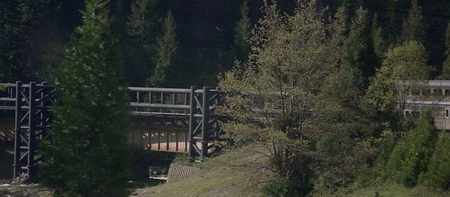
Shasta Trinity National Park is north of Dunsmuir, California.
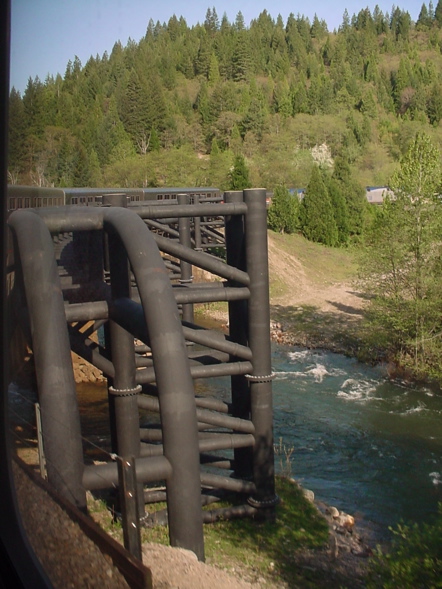
We went through a horseshoe curve. In the 1980s a car derailed
here, spilling pesticides into the creek, killing all life in the
river down to Shasta Lake. Now there is a massive barrier built
to prevent this (below).

|
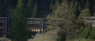
Notice the size
of our double-deck train in relation to the barrier built beside the
bridge.
|
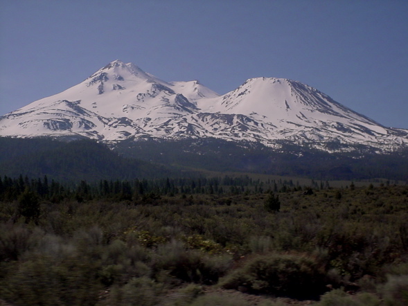
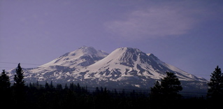
Richard explained the geographic
movement that took place in this area causing the Coastal
Mountain Range and Cascade Range to be formed with Mt. Shasta, a
volcano vent, to be formed as well. Mt. Shasta has errupted every
300 years and Mt. Rainier every 500 years and we are due for both to
erupt now. With an erruption, glaciers melt, and mud and rock
flow
down like Mt. St. Helens.
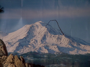
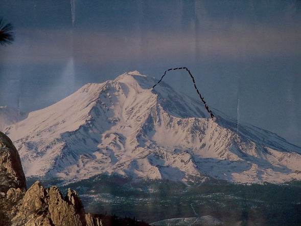
Richard had a
large picture he used to show how the mountain used to look.
|
He held up the
photo at precisely the correct moment for us to see the same image.
|
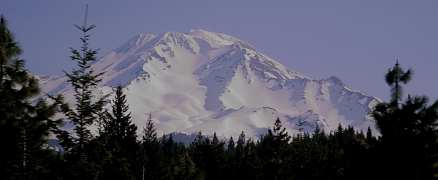
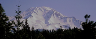
As we slowly
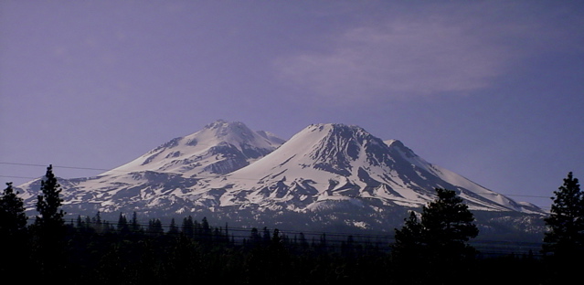
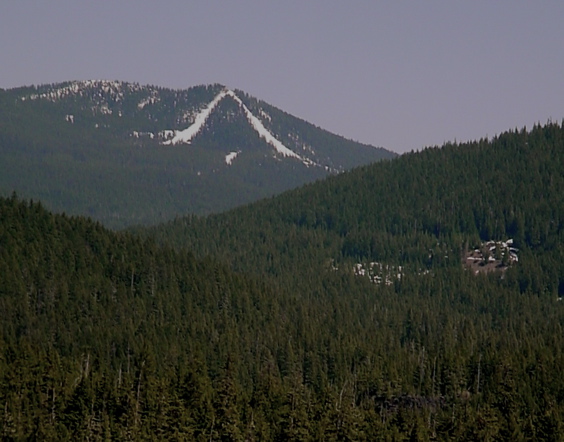
rounded the mountain, he pointed out other features of Mt. Shasta.
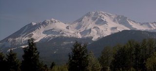
|
Finally we
could see that it was two peaks, Mt. Shasta and Shastina (Little
Shasta).
|
Satellites can detect precursors of
volcanic eruptions: earth deformation, escaping gas, and
warming. Richard related that Mt. Shasta City is a
hotbed of Power Point Worship. There are seven Power Points in
the world: Mt. Shasta; Sedona, AZ; the Pyramids, Machu Picchu and
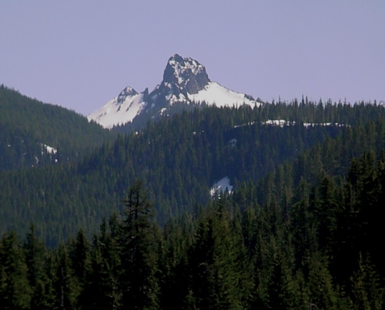
three others. Mt. Shasta is 14,262 ft. tall! It is so tall
and solitary that it 'snags' its own weather.
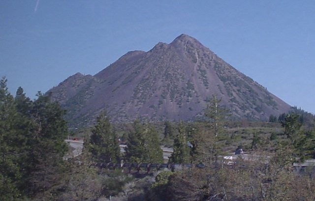
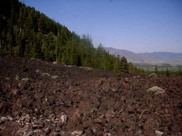
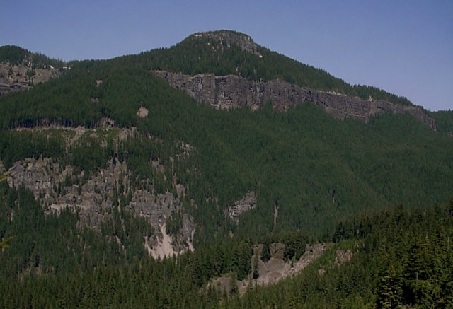
We passed Black Butte, a cinder cone on the west side of the tracks
(below left), and lava flows (below right). Water flowing through
volcanic pumice fields pick up the brown silt and form brown river
water.
We were able to see Mt. Shasta for more than an hour as we circle the
base on the western side. We slowly curve and twist through the
lava flows and humics (mounds.) We passed Grass Lake, the highest
point on the railroad route, 5000 ft., and Klamath National
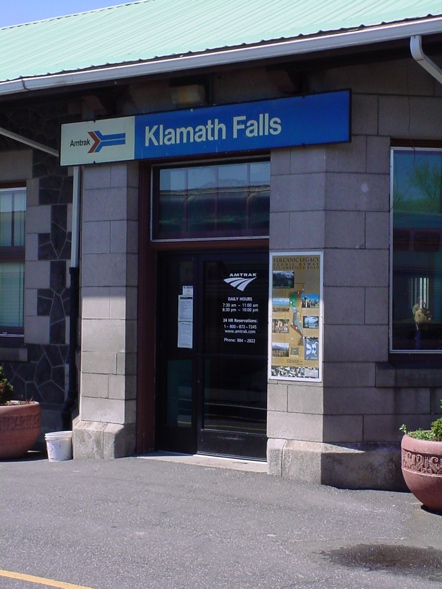
Forest. Finally we passed through a tunnel and we are at the
California/Oregon border, and Klamath Falls Station. Richard
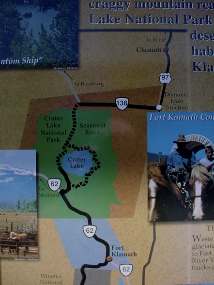
pointed out, from the diner, Mt. Scott, which holds Crater lake.
Klamath Falls has geothermal heating in the homes from hot
springs.
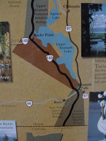
We soon entered Upper Klamath National Wildlife Refuge and Klamath
Falls Wetlands.
Rails to Refuges
Seventy-five percent of the Pacific Flyway has been lost in the last
100 years. The loss started in 1906 when wetlands were being
filled in for farmland, a proposal of the federal government.
Theodore Roosevelt saw the loss and started the National Wildlife
Refuges (NWRs). Klamath Wetlands were the first created by this
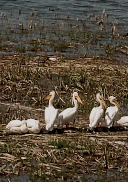
refuge program. This NWR is the most frequently visited on the
west coast. Birds use this as s stop as they fly south from
Alaska, the
East and Northeast. Common are white pelicans, cormorants,
egrets, snow geese, great blue heron, and now bald eagle since they are
nesting here!
Benefits of wetlands are numerous. They provide life for the oceans by
filtering water. The local economy gets a boost. Wetlands
absorb ocean surges, and provide food for migrating birds. Most
birds can fly 25 miles, using the 'necklace' of wetlands unless they
are destroyed. Fifty percent of the fish come from one percent of
the ocean, and 2/3 of the fish feed, span, or nurse in the wetlands.
The Bureau of Reclamation handles the distribution of water. In
2000 there was a drought and in 2003 they ran out of water in this
area, so they cut the agricultural allotment. There were the
"Water Wars of Klamath Falls" and Pres. Bush started taking water out
of the wetlands for agriculture. 70,000 salmon died as a
result. They reversed their decision and salmon fishing on the
west coast was banned until 35,000 salmon again come upriver to
span. Only 21,000 came up this year.
There is now a program to restore the wetlands and farms are being
changed back to wetlands.
The future of water seems to be in desalinization. Marin County
has such a project and is the first of 28 such projects in
California. GE invested $3 billion in desalinization.
Klamath Lake is shallow and has more life than the 1000-ft. deep Crater
lake.

|
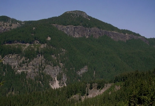
Evidence of glacial scraping near dome.
|
|
|
We topped the summit and started down Salt Creek Canyon, a drop from
4,800 ft. to 1,200 feet, through 21 snow sheds and tunnels, down to the
Willamette River. Snowsheds were built to protect the tracks from
avalanches and runoff. Some snowsheds have pillars on the
downhill
side distinguishing them from tunnels. Propane tanks along the
track, near siding switches, are
used in winter to melt snow and ice so the switches will work when told
to from the Omaha, NB, control center!
The longest tunnel, origianally wood, then sprayed with concrete,
caught on fire from a diesel coming uphill. A Union Pacific Vice
President, in his infinite wisdom, felt they could 'blow out the fire'
so they placed fans at the entrance and, of course, this made the fire
burn harder. Finally the tunnel was closed and the fire was
snuffed out, but it closed the track for 2 weeks. We passed some
cars in a ravine that were derailed in 1964.
Our time with Richard ended after wine tasting and dinner this second
day on the Coast Starlight. The wine tasting notes for both days
can be found by clicking "wine tasting" in the menu below.
I learned so much on this trip
from Richard that I feel I have taken a couple of college
courses! He is so informative both in his commentaries of the
sights we pass, and during the two wine tasting sessions per trip.
Richard came highly recommended, but I had no idea it would be this
enjoyable traveling with him as our Parlour Car Attendant on the Coast
Starlight from Los Angeles to Seattle.
If you would like to experience an Amtrak train ride with Richard
Talmy, there is a 25 percent chance, if you book a sleeping car on the
Coast Starlight, that you will find that he is your Parlour Car
Attendant.
When you go into the Parlour Car from your sleeping car accommodations,
for the first time on the Coast Starlight, if Richard is the
Attendant, tell him
you read about him at TrainWeb.com! You'll enjoy your trip with
Richard, I guarantee it!
Now read about our
day in Seattle and our return trip to Los Angeles on Train 11 by
clicking "A Day in Seattle" below.