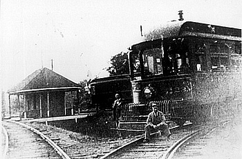
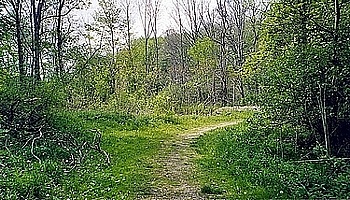
The Junction, as the name implies, was a place where the Cleveland & Eastern line from Gates Mills split. It was located near the confluence of the two upper branches of the Chagrin River. One C & E line followed the north fork upstream to Fowlers Mill, Bass Lake and on to Chardon. The other struck off in a southeasterly direction through gently rolling hills, roughly following the other fork of the river upstream to Newbury. Here it left the river and headed for Burton to the east. The Junction Station was at a remote location between Heath and Rockhaven roads in Munson Township and served only as a transfer point as no road reached its location. The first photo shows Car #23 and Freight Motor #45 at the Junction. The area has since been reclaimed by trees and the roadbed is now a nature trail, as can be seen in the second photo, taken in 2003.
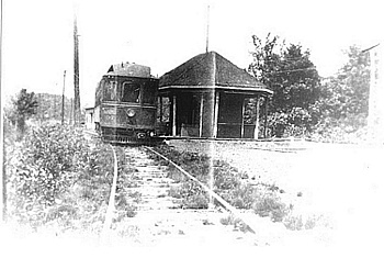
At various times during the C & E's brief history, through cars from Cleveland ran either to Chardon or Middlefield. Passengers bound for the other destination, or trying to travel between the two, frequently found themselves at the Junction Station to change cars. The line also had a freight station located there for mail, parcel and milk transfers. The end of the freight station can be seen just beyond Car #53 in the third photo. The fourth photo, also taken in 2003, shows the extent of re-forestation owing in part to a large pond created by beaver dams along the river.
There was also another a small building at the Junction which was used to house storage batteries (and later an electrical substation). As the cars got farther away from the powerhouse at Gates Mills the line voltage dropped due to resistance in the copper wire. The batteries at the Junction supplied additional power as the cars neared the ends of the line. When the cars stopped or ran downgrade, drawing little or no power from the overhead lines, the batteries would draw off the excess current to recharge.
The rails and structures are now only a memory and the Junction is now part of a Geauga County Park. About one half mile of each of the branches of the roadbed exist today as a nature trail. They are bordered by beaver ponds, forests and one of the largest Blue Heron rookeries in Northeast Ohio. The trail features a covered bridge which crosses the Chagrin River. It is built on the original footings and steel spans used by the Interurbans, as seen in photos five and six. The bridge structure remains only because the isolation of the area made it impractical to salvage for scrap metal during World War II.
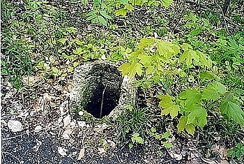
Walking the trail today other evidence of the line can still be seen. In addition to the many fills and cuts in the terrain there are also a few remaining concrete 'post holes,' which were used to secure the wood line poles. One is featured in the last photo, complete with its metal grounding strap. To learn more about the Rookery visit the Geauga Park District's web site through the link on our 'Other Fun Stuff' Page.