


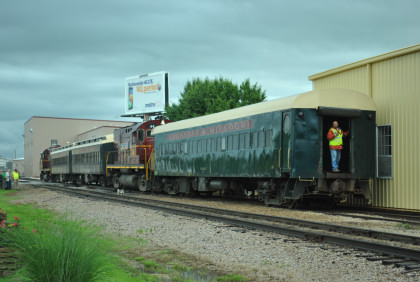
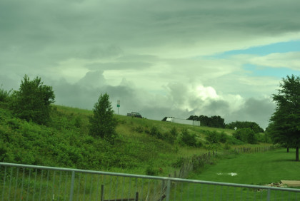
I left my hotel at 5:50 AM and drove to McDonald's for my usual breakfast then went to the Holiday Inn to work this morning's trip to Bentonville. We took the school bus down to the Arkansas & Missouri Railroad train and I saw the Arkansas & Missouri Railroad museum which had just been completed. There was a morning safety meeting then I went onto the train to get my car ready to board but detrained for a few pictures.
Welcome to the Northwest Arkansas RegionThis part of the United States is one of the most prosperous in the country. Driven by the success of local companies like Walmart, Tyson Foods, and JB Hunt, thousands of other companies have located nearby. For example, most Fortune 500 manufacturers have representatives in the region. The quad cities of Fayetteville, Springdale, Rogers and Bentonville, as well as Lowell, Johnson, West Fork and other smaller towns in the region, have all boomed, changing from quiet rural communities to a large metropolitan network of industries, subdivisions and shopping malls. For example, during the 1990s, more than 2,000 people a month moved to the region and the unemployment rate is typically half of the national average.
According to the 2012 State of the Northwest Arkansas Region Report, "The Northwest Arkansas region is defined as the Fayetteville-Springdale-Rogers metropolitan statistical area, which is comprised of Benton, Madison and Washington counties in Arkansas and McDonald County in Missouri. The region includes 50 incorporated cities and 15 unincorporated communities. According to 2011 U.S. Census estimates, the population of the Northwest Arkansas region was 473,830 and grew at a rate of 1.7 percent between 2010 and 2011."
Nevertheless, the region is still blessed with miles of heavy woods and countryside. Much of the area still has few if any roads and only local farms dot the hillside. Most of the towns on the area railroads have populations of less than a thousand, with many residents commuting to the larger cities for jobs. However, industry does exist with poultry plants, feedmills and many other potential rail shippers across the area. Tourism is a major business for the area with its many state parks, lakes and historic attractions.
Northwest Arkansas HistoryArkansas can be a confusing state for many people, depending upon which part they visit. For many people, it is a mountainous state, for others, it's part of the Mississippi River delta. Both are right as Arkansas can be split into two parts - the highlands in the northwest and the lowlands of the southeast. Northwest Arkansas is part of the Ozark Plateau, which includes the Ozark Mountains. Divided by the Arkansas River, to the south of Fort Smith are the Ouachita Mountains. These two mountain ranges are part of the Interior Highlands region, the only major mountainous region between the Rocky Mountains and the Appalachian Mountains.
Arkansas summers can be hot and wet, with a June average high temperature of 84 degrees in Fayetteville, with an average low of 64 degrees. Fort Smith is normally about 3 degrees warmer. Arkansas' all-time record high is 120 degrees F at Ozark on August 10, 1936, and the all-time record low is -29 degree F at Gravette on February 13, 1905. Rainfall averages 40 to 60 inches a year, with June often featuring three inches or more, often from short but strong thunderstorms.
As you travel through the woods of Northwest Arkansas and Southwest Missouri, it should be pointed out that trees are a recent addition to a large part of the region. Until the 20th Century, much of the area along the railroad was primarily prairie, kept down by the herds of bison and elk and later farmers and their crops. Only small areas of original prairie still exist in the region, although efforts are under way to restore more prairie lands. Two early reports explain what it was like in the early 1800s.
Henry Rowe Schoolcraft and Levi Pettibone explored the area from November 1818 to February 1819, covering the area from Missouri to the White River and Osage Creek regions of northwest Arkansas. They surveyed the geography, geology, and mineralogy of the area. A report of the trip was published by Schoolcraft in 1821 entitled Journal of a Tour into the Interior of Missouri and Arkansas. This was the first written account of an exploration of the Ozarks and tallgrass prairies of northwest Arkansas.
In the report, Schoolcraft wrote, "Our route this day has been over barrens and prairies, with occasional forests of oak, the soil poor, and covered with grass, with very little under-brush. One of the greatest inconveniences we experience in travelling in this region arises from the difficulty of finding, at the proper time, a place of encampment affording wood and water, both of which are indispensable. This is a difficulty which attends us this evening, having been compelled to stop in an open prairie, where wood is very scarce, and the water bad-general course of traveling south-weather pleasant, the rain having ceased shortly after day-light. Lands poor; trees, oaks; game observed; deer and elk."
Schoolcraft continued: "In calling this a high-land prairie, I am to be understood as meaning a tract of high-land generally level, and with very little wood or shrubbery. It is a level woodless barren covered with wild grass, and resembling the natural meadows or prairies of the western country in appearance. The inducements for hunting are, however, great; and large quantities of bear, deer, elk, and beaver skins, might be collected."
"The prairies, which commence at the distance of a mile west of this river, are the most extensive, rich, and beautiful, of any which I have ever seen west of the Mississippi river. They are covered by a coarse wild grass, which attains so great a height that it completely hides a man on horseback in riding through it. The deer and elk abound in this quarter, and the buffaloe is occasionally seen in droves upon the prairies, and in the open high-land woods."
Also in 1819, naturalist Thomas Nuttall journeyed through the Arkansas Territory and documented a "vast and trackless wilderness of trees" and "great prairies and canebrakes". Nuttall reported bison, eastern elk, swans, passenger pigeons, ruffed grouse and prairie chickens among the abundant wildlife populations that made their homes in the Arkansas Territory during this time.
Not long thereafter, however, as the territory became settled, species began to disappear. Less than a century after Nuttall's journey through Arkansas, little remained of the virgin upland and bottomland forests and tall grass prairies. The eastern elk lived in eastern hardwood forests and prairies and were native to northwest Arkansas. Historical accounts indicate elk were the first game species to be killed out, having vanished from the region by the 1840s, and becoming extinct soon thereafter. American bison herds were common to northwest Arkansas tall grass prairies. By 1870, none were left in Arkansas. Packs of gray wolves that often followed bison herds were exterminated from Arkansas after the beginning of the 20th century, and the red wolf disappeared by 1950. Today many animals such as bear, deer, elk and many game birds are back. Many are often seen from the train.
There's an old folk saying about the Ozarks: "It's not that the mountains are so high, it's just that the valleys are so deep." It's true. The Ozarks are a heavily eroded plateau, pushed up eons ago and carved out by hundreds of streams over thousands of years. Even the highest Ozark mountains barely exceed 2000 feet in elevation, but they are certainly rugged with the numerous streams eating out valleys to enjoy the views
.Until Europeans arrived, Arkansas was inhabited by the Caddo, Osage and Quapaw tribes. The first European explorer to visit Arkansas was Hernando de Soto in 1541. Jacques Marquette and Louis Jolliet followed in 1673. The first European settlement was at Arkansas Post (founded in 1686), originally a Quapaw village in eastern Arkansas on the Arkansas River. The name Arkansas actually comes from the Illinois tribe's name for the Quapaw people. The only American Revolutionary War battle fought in Arkansas happened at Arkansas Post during April 1783. After the Louisiana Purchase, Arkansas was briefly a part of the Missouri Territory before becoming the Arkansas Territory, including lands in Oklahoma. The Territory of Arkansas was admitted to the Union as the 25th state on June 15, 1836.
Northwest Arkansas and southwest Missouri have been the site of many historic activities throughout the history of the United States. Early Spanish explorers crossed this region in the 1500s looking for land and wealth. The French explored the edges of the region during the 1700s, primarily sticking to the surrounding waterways. However, with the acquisition of the land by the United States as a part of the 1803 Louisiana Purchase, more detailed exploration and settlement of the land began.
The Trail of Tears focused heavily upon northwest Arkansas. The Trail, a name describing the forced relocation of various Native American nations from southeastern parts of the United States, was actually a series of routes used following the Indian Removal Act of 1830. In 1831, the Choctaw were the first to be removed, with the Seminole removed in 1832, the Creek in 1834, the Chickasaw in 1837 and finally the Cherokee in 1838. The various tribes were moved using different routes, including a water route up the Arkansas River through Fort Smith, a land route from Memphis to Little Rock and then west along the river through Van Buren (Bell-Drane Route), a land route across the rugged Ozarks through Fayetteville (Benge Route), and a land route across Missouri through Springfield (MO) and along the route of the Arkansas & Missouri Railroad to Fayetteville and then west (Northern Route).
The Civil War also heavily impacted this region. The largest battle west of the Mississippi River was fought at Pea Ridge (Elkhorn Tavern) on March 7-8, 1862. 26,000 soldiers fought just a few miles north of Rogers to decide the fate of Missouri and the West and most of the battlefield is preserved as a National Military Park. Later that year on December 7, 1862, the Battle of Prairie Grove (southwest of Fayetteville) effectively removed northwest Arkansas as a route for Confederate troops to use to invade Missouri. The rest of the war primarily saw guerrilla activity and numerous battles between small units moving throughout the mountains. In fact, few towns in the area escaped being burned at least once.
Once peace returned, this mountainous area was settled mostly by farmers from similar mountainous areas to the east such as Tennessee and Pennsylvania. At one time or another, most of this area was planted in cotton and corn, but the thin soil didn't last long, and much of the land was essentially abandoned to forests. The forests in the more rugged areas were soon logged, leading to further erosion. During the 1940s through the 1960s, a series of dams were built on area rivers. Today, this combination of events has led to the area becoming a major vacation area as a combination of numerous lakes and parks attracts millions each year.
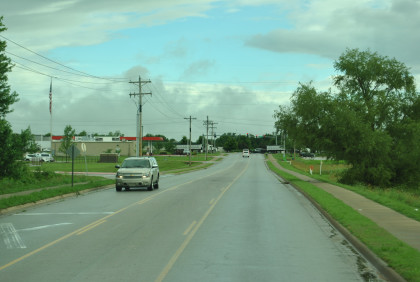
Moving on to todayFor those trying to understand the geography of the area, Interstate 540 runs north from Fort Smith (Arkansas' second largest city) to just north of Bentonville near the Arkansas-Missouri border. This seventy-five mile long highway basically parallels the Arkansas & Missouri Railroad, often crossing the railroad on towering bridges connecting ridge top to ridge top. The southern forty miles of the highway passes through a few rural communities, but basically dances along Ozark mountain tops. Once at Fayetteville, the Interstate passes through town after town, creating a narrow city. From south to north, the towns are Fayetteville, Springdale, Lowell, Rogers, Bentonville and Bella Vista.
Fayetteville, the state's third largest city with a population of 75,000, is the home of the University of Arkansas and until recently considered to be the "Capitol of Northwest Arkansas." Just to its north, Springdale is the state's fourth-largest city at more than 70,000. Tyson Foods, the world's largest producer of protein, has its headquarters here, as well as the Northwest Arkansas Naturals - the Double A affiliate of the Kansas City Royals. Next is Lowell, home of J.B. Hunt Transport Services, Inc., one of the largest transportation logistics companies in North America, and one of the first domestic trucking companies to move major parts of their business to rail intermodal.
Just north of Lowell is Rogers, population of 60,000 and home of Daisy Manufacturing Company since 1958. The Rogers Daisy Airgun Museum is located in downtown Rogers and is home to the world's largest collection of antique airguns, BB guns and commemorative rifles. Bentonville, the home of Walmart, is next. What until just a few years ago was a small mountain community is now the home of 36,000 and almost as many different corporate offices as New York City. Just south of the Missouri state line is Bella Vista, a community of 25,000 that primarily serves as an affluent retirement community.
About thirty minutes west of this line is Oklahoma and the western edge of the Ozarks. This area becomes drier and more prairie-like as you go west. Heading south, the Arkansas River valley passes between Van Buren and Fort Smith, with the Ouachita Mountains a bit farther south. Fort Smith, because of its location in the valley, is often the hottest city in Arkansas. Heading east, the Ozark Mountains get more rugged as numerous streams have cut down into the Ozark Plateau. Beaver Lake is here, the uppermost major dam and lake on the White River. Heading north, the country becomes more rolling as the Plateau becomes more pronounced and you enter Missouri.
Springdale HistoryAccording to several sources on the history of northwest Arkansas, people have lived in the area now called Springdale for about 12,000 years. Early settlers came and stayed because of abundant natural resources, just as later European settlers did. Osage Indians from farther north used the area for seasonal hunting in the late eighteenth and early nineteenth centuries. The Cherokee Treaty of 1828 allowed white settlers to lay claim to the area, and families from eastern states began settling here.
A spring in this area attracted both humans and animals. A community here started in 1838 and in 1839, John Fitzgerald and his wife, Mary, built an inn called Fitzgerald's Station near the spring. When the last of the native tribes of the east were moved to the Oklahoma area, the inn became a stop for those on the Trail of Tears. In 1843, the Shiloh Primitive Baptist Church was built on property donated by William Davidson Quinton and located near the spring. In 1858, the Butterfield Overland Mail route was located through what would become Springdale, and Fitzgerald's Station became an official station.
As the town grew, land speculators soon followed. One of these, John Holcombe, is considered to be the founder of the town that grew around the spring and small church. Though not an original settler, Holcombe was a charismatic man who understood that it was wise to buy land and organize a town. He was responsible for laying out the town plats on land he acquired and giving plots to business people so the town would prosper. Referred to as Holcombe Springs for a time, the church and settlement soon became known as Shiloh after the church.
While the next decade or so saw the community grow, the Civil War wasn't kind to the area. Holcombe Springs/Shiloh was burned several times during the war and many families fled to Texas to avoid the fighting. In 1868, Holcombe returned and drew up the first plat of the town and Shiloh Church was rebuilt. In 1872, when the town petitioned for a post office, another Shiloh already existed in the state. Sarah Reed Meek, the wife of James Meek, one of the town fathers, suggested the name Springdale, short for "springs in the dale." In 1878, the town was incorporated with the name of Springdale.
Transportation was always a challenge for the area, so when the Frisco was built through the town, Springdale really began to boom. Small orchards exploded in size and hundreds of carloads of apples, strawberries, peaches and grapes were shipped out by rail each year. All of this business caused the center of commerce to move along the railroad tracks and away from the spring. The Western Arkansas Fruit Growers and Shippers Cooperative Association, which organized in Springdale in 1888, provided a surge in growing, producing and marketing activities to the booming orchard industry. By the 1930s, Springdale's industries included the region's only roller mill for producing high-grade flour, bran and feed; a grape juice plant; a winery and distillery; and canneries. Steele Canning Company, founded by Joe Steele in 1924, grew to be one of the largest privately owned canning companies in the world, partly as a result of the introduction of Popeye brand spinach in 1965. In the early 1930s, John Tyson started the predecessor to Tyson Foods using his old truck to haul chickens out of the area to sell for farmers who owned hatcheries.
Trucking has long been an important industry in the area. Initially, the trucking industry grew primarily out of growers' needs to transport fruit to the canning factories and warehouses, but also to move poultry. For example, Harvey Jones went into the hauling business with a wagon and team of two mules in 1918, which launched Jones Truck Lines. After 1930 when U.S. Highway 71 was paved from Kansas City, Missouri, to Fort Smith, the number of trucking firms increased dramatically. In 2005, there were twenty-six truck lines operating out of Springdale. One of the nation's largest transportation companies in the United States - J.B. Hunt - has its headquarters just north of town.
As the area's population grew, more water was needed. During the early 1960s, Beaver Lake was built to the east of town on the White River. The lake and its recreational facilities attract many tourists each year, making tourism the second-largest economic boon to the area. Today, Springdale is a major industrial center in northwest Arkansas with a population that almost doubled between 1980 and 2000. Springdale has more than seventy-five manufacturing and poultry-processing plants. Springdale is the location of the headquarters of Tyson Foods, the largest meat producing company in the world, and has been dubbed the "Chicken Capital of the World" by several publications.
An interesting feature of Springdale is that it is the home to a Consulate of the Marshall Islands, one of only 11 Marshall Islands diplomatic and consular representations abroad. The Marshall Islands consulate general is one of 1,471 foreign representations in the United States, and the only foreign representation in Springdale. The consulate is located in Springdale since it is the home of between 4,000 and 7,000 Marshallese, making Springdale the site of the largest Marshallese population outside of the Marshall Islands.
For the tourist, there are a number of attractions that should be mentioned. Springdale is the home of the Rodeo of the Ozarks, a Fourth of July rodeo held by the Professional Rodeo Cowboys Association. Started in 1945, this professional rodeo is one of the top twenty-five rodeos in the nation. Parsons Stadium, where the rodeo is held, also features a year-long schedule of family friendly entertainment.
Also located in Springdale is Arvest Ballpark, named in 2008 as the Best New Ballpark in the country. It is the home of the Northwest Arkansas Naturals of the Texas League, having moved here from being the Wichita Wranglers. The Ballpark seats 6,500 and features group and corporate areas in addition to two separate play areas for the kids.
Located on 86 acres on the south edge of Springdale is the Botanical Gardens of the Ozarks. Attracting more than 40,000 visitors a year, the Garden is a collection of ten themed gardens and includes the region's only butterfly house. Located just west of Springdale is Tontitown, the location of several regionally famous Italian restaurants. It is also the home of Tontitown Winery, located in the "Taldo House" built in 1917, and the "Dixie Pride Bonded Winery 40." All of the wines are made on-site from local Tontitown grown grapes. To the east of Springdale is Saddlebock Brewery, the first production brewery in Northwest Arkansas. The brewery produces German-style beers and British and American ales.
For those that want to know more about the area, you can go to downtown Springdale and visit the Shiloh Museum of Ozark History, the "region's premier historical museum that captures the essence of life in the Ozark Mountains and our heritage." The Museum has an outstanding collection of historical photographs as well as other research material.
Bentonville Branch HistoryThe branch to Bentonville has a rather interesting history. During the early 1880s, a few citizens built a crude private railroad between Rogers and Bentonville. During May of 1898, the Arkansas & Oklahoma Railway was chartered with plans to acquire the private road, rebuild it and extend the line northwestward to Gravette on the Kansas City, Pittsburg & Gulf (later Kansas City Southern). It didn't take long to do as the railroad reached Gravette by fall of that year. The line soon drew the interest of the larger railroad and the Frisco bought it in November 1900, pushing the line on west into Indian Territory as far as Grove (Oklahoma) in 1909, for a total of just under fifty miles.
For several years (1914-1916), the Arkansas Northwest interurban, organized and built by the owner of the Park Springs Hotel and Resort at Bentonville, used the line between Rogers and Bentonville. The interurban used a McKeen motorcar to handle the passengers. However, the last train ran on June 11, 1916, when the Frisco ordered service stopped due to lack of payment for the trackage rights. The Rogers to Grove railroad primarily served local farmers, especially the local apple orchards and strawberry fields, but trucks soon took over the business. In 1937, the line west of Bentonville was abandoned. The line into downtown Bentonville was removed by the early 1990s, leaving a 4.6-mile long branch.
Our 2014 NRHS Convention this year has people from 40 states, DC and seven foreign countries, those being Australia, Austria, Canada, Japan, Netherlands, Norway and United Kingdom are registered for the convention in Arkansas.
The NRHS Arkansas & Missouri Railroad Bentonville Branch Train Trip June 10, 2014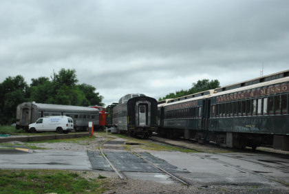
The new Arkansas & Missouri Railroad dome car "Silver Feather" built by Budd in 1948 as Western Pacific dome-coach 812. When retired it went into Auto Train service becoming 461. In the 1980's, it served on Texas Southern before turning into Washington Central 151, and in 1997 it moved to BC Rail and their Pacific Starlight Dinner Train but became "Moonglow". It was sold to Ontario Northland and renumbered 901. In December 2010 the car was sold to Arkansas and Missouri, numbered 108 and renamed "Silver Feather".
The train ready to go minus the south engine.
Some of my NRHS friends in Springdale.
They returned from making up our train.
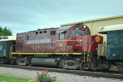
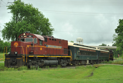
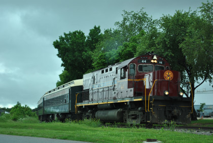
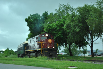
Arkansas & Missouri Railroad C-420 44, ex. Louisville and Nashville 1353, exx. Seaboard Coast Line 1214, nee Seaboard Coast Line 112 built by American Locomotive Company in 1965.
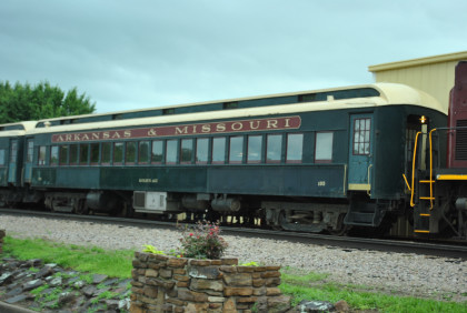
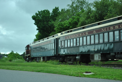
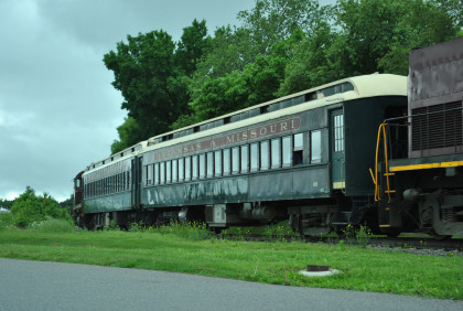
Arkansas & Missouri Railroad coach 105 "Golden Age", nee Central of New Jersey, built by Harlan and Hollingsworth in 1927.
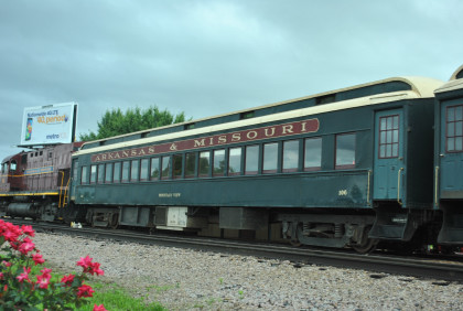
Arkansas & Missouri Railroad coach 106 "Mountain View", nee Central of New Jersey, built by Harlan and Hollingsworth in 1927.
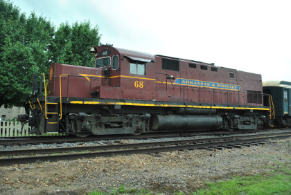
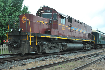
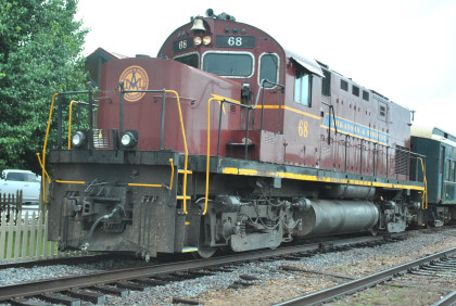
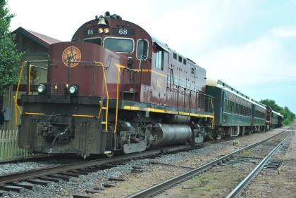
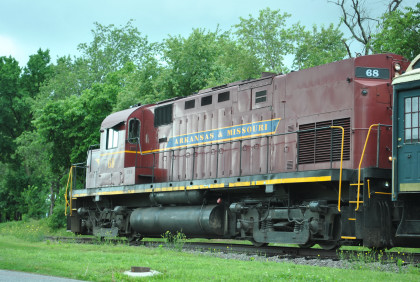
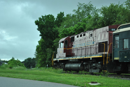
Arkansas & Missouri Railroad C-420 68, ex. Indiana Highrail 311, exx. Arkansas and Missouri 411, exxx. Delaware and Hudson 411, nee Lehigh Valley 411, built by American Locomotive Company in 1964.
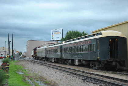
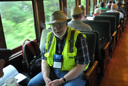
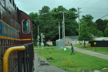
Our train was now ready to be boarded. I loaded my Car 105 and gave my safety speech as I do on all the NRHS trips I host. After the last passenger had boarded, we left Springdale just after 8:00 AM.
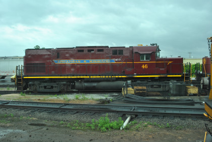
Arkansas & Missouri Railroad C-420 46, ex. Louisville and Nashville 1354, exx. Seaboard Coast Line 1215, nee Seaboard Air Line 113, built by American Locomotive Company in 1966, was out of the shop as we went by.
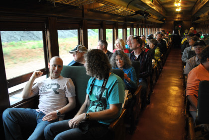
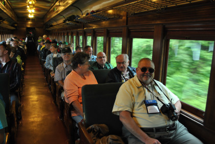
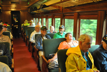
My coach load of passengers.
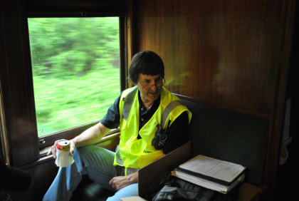
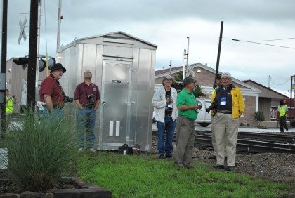
Bart Jennings.
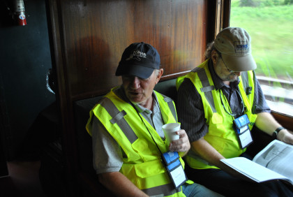
Steve Miller and Stan Hunter.
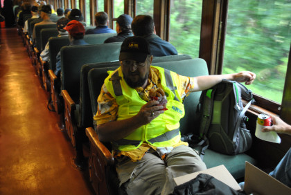
Steve Barry.
Greg Molloy, President of the NRHS at this point.
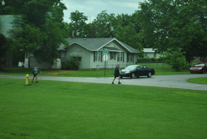
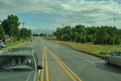
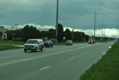
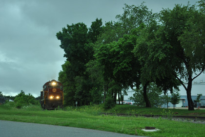
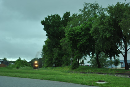
Our train was being chased by NRHS members and railfans this morning.
Nearing Bentonville Jct. Our train arrived there and once the switch was thrown, we started up the Arkansas & Missouri Railroad Bentonville Branch and my new mileage would begin. This was the first Arkansas & Missouri Railroad passenger train to go up the branch.
The train crossed North 5th Street.
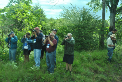
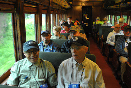
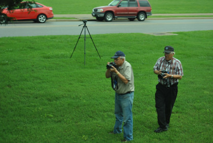
Some of my friends taking pictures of our special NRHS train today.
Crossing North 13th Street.
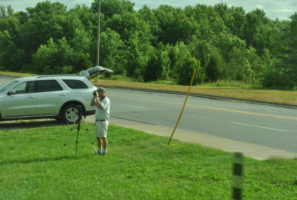
Another photographer.
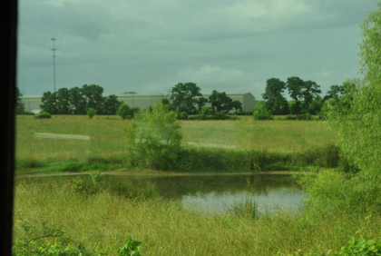
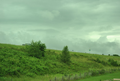
A pond along our route.
We crossed North Dixieland Street.
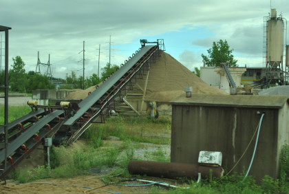
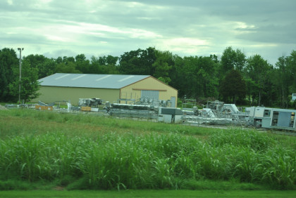
Sand & gravel loader.
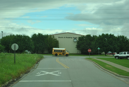
The train crossed North 24th Street.
We traversed West Hudson Street.
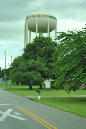
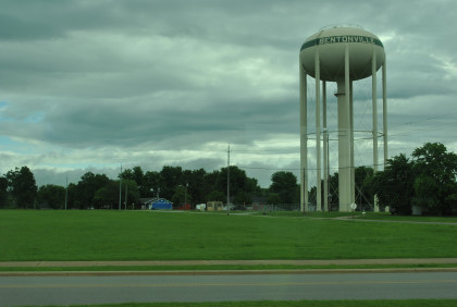
The Bentonville water tower is along Watertower Road.
More of my friends.

The train went under Interstate 49.
As we came to the end of westward trip.
This is as far as we went then returned east to the first grade crossing of Phyllis Street where we unloaded the train for Photo Runby 1.
Reverse move 1.
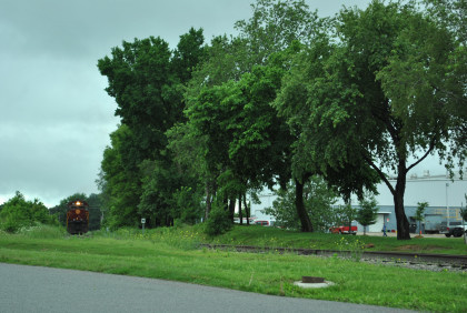
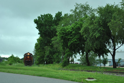
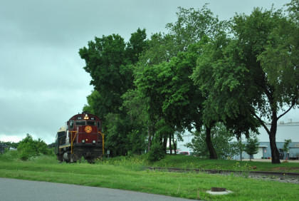
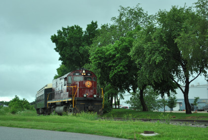
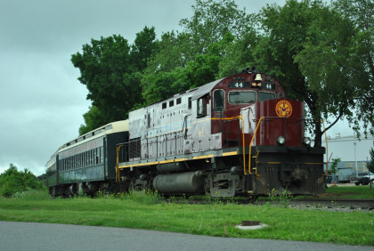
Photo runby 1 at Bentonville.
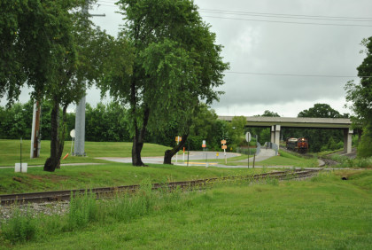
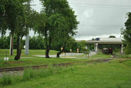
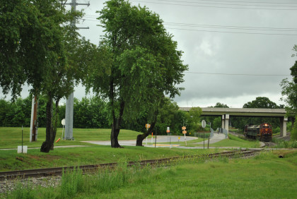
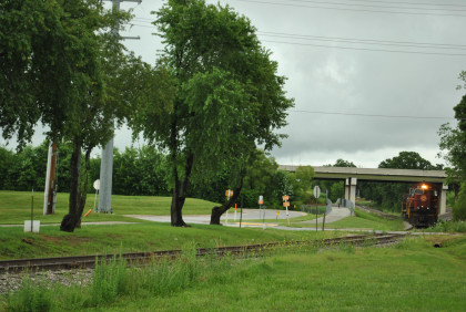
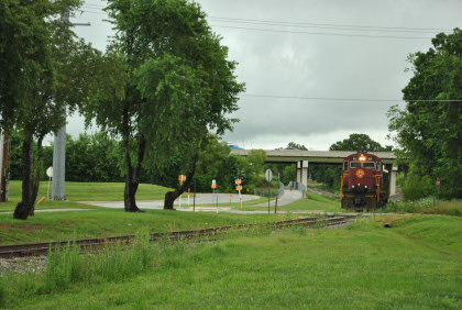
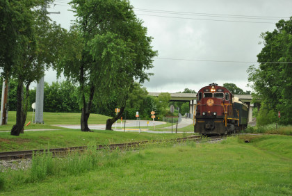
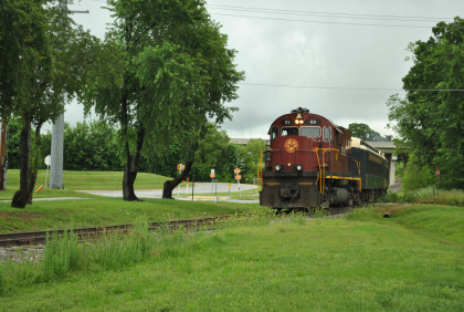
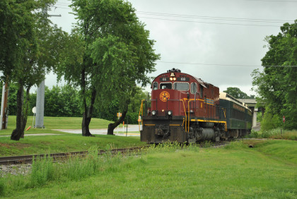
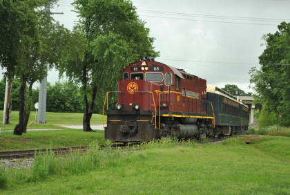
Photo Runby 2. The passengers reboarded the train and we headed east to Easy Street, unloading the train here for the next photo runbys.
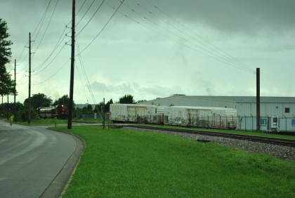
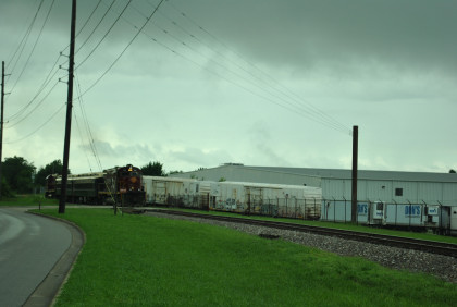
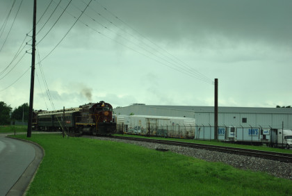
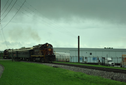
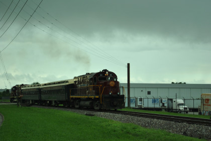
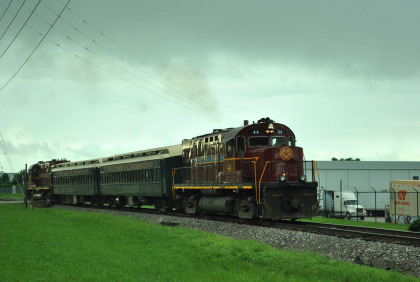
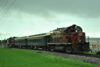
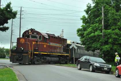
Photo runby 1 at Easy Street.
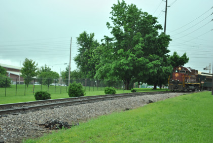
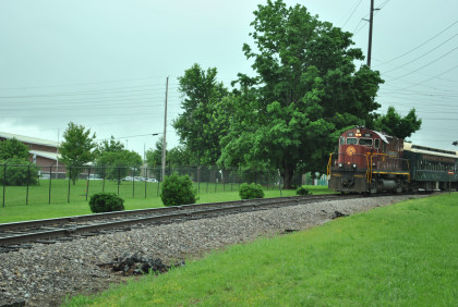
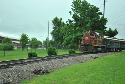
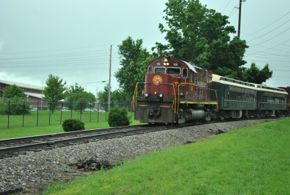
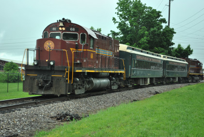
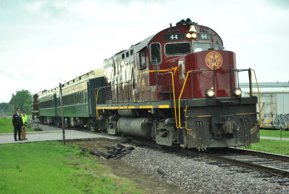
Photo runby 2. Once everyone was back aboard, we returned to the Arkansas & Missouri Railroad mainline and returned to Springdale, ending a great first convention trip. I helped load the first bus back to the Holiday Inn then went to a local restaurant for a steak lunch.
| RETURN TO THE MAIN PAGE |