


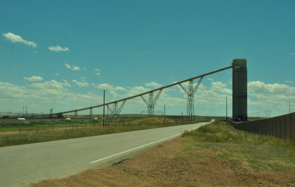
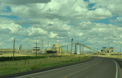
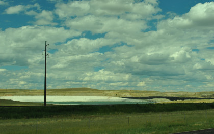
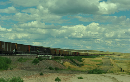
I decided to show Robin and Chris the Black Thunder Coal Mine so we pulled up to the road to take pictures.
Black Thunder Coal MineThe Black Thunder Coal Mine is a surface coal mine in Wyoming, located in the Powder River Basin which contains one of the largest deposits of coal in the world. Black Thunder is the second most productive mine in the United States, providing the country with eight percent of its coal supply. In 2007, the mine produced 86,196,275 short tons of coal, nearly 20 percent of Wyoming's total coal production, and higher than 23 other individual coal producing states.
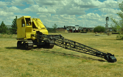
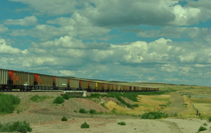
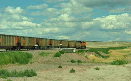
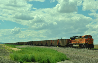
Black Thunder's dragline excavator is the biggest in the world and produces enough coal to load up to 20-25 trains per day. Draglines are not used to dig coal but only strip overburden. Black Thunder operates six draglines; coal is excavated by power shovels and loaded into haul trucks.
In 2010, the Black Thunder Mine dug up an estimated 115 million tons of coal, an increase of 34 million tons over 2009. The increase was a result of merging the Jacobs Ranch Mine - and its average 38 million tons per year - into the Black Thunder's annual production. With the acquisition of Jacobs Ranch Mine, Black Thunder is now the world's top coal producer.
Black Thunder was reported to have mined 101.2 million tons of coal in 2014.
HistoryThe mine was opened in 1977 and run by ARCO Coal until it was acquired in 1998 by Arch Coal. For most of its existence, Black Thunder has been the largest mine in the country (by production), but it was surpassed by the nearby North Antelope Rochelle Mine which was created after Peabody Energy purchased the Rochelle mine next door to their North Antelope Mine and consolidated operations. Arch Coal, Inc. announced on March 9, 2009 that it has agreed to purchase Rio Tinto's Jacobs Ranch mine adjoining Black Thunder, which resulted in Black Thunder once again becoming the largest mine in the world.
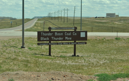
The sign at the Black Thunder Mine.
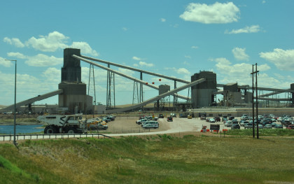
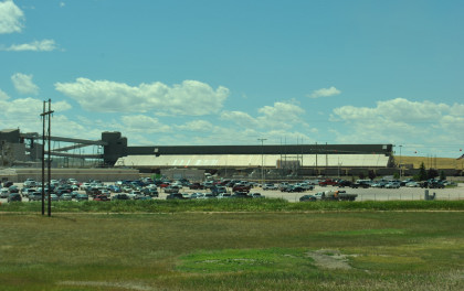
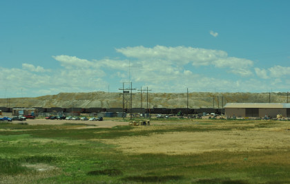
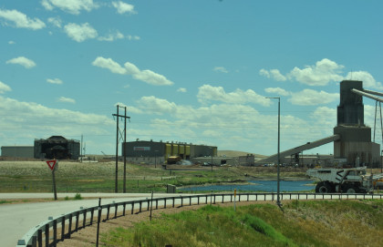
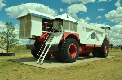
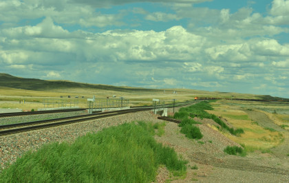
The Black Thunder Mine.
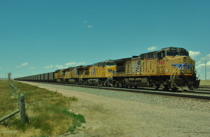
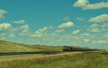
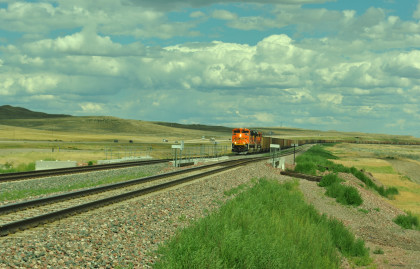
Union Pacific 5960 North at Reno Jct.
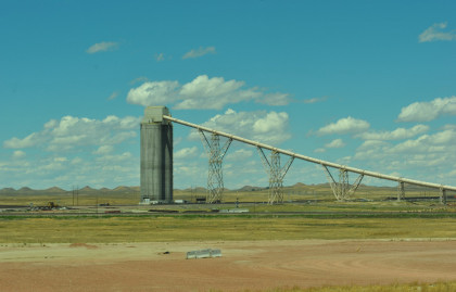
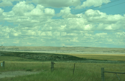
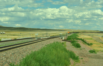
The West Thunder Mine. We went north on Hilight Road.
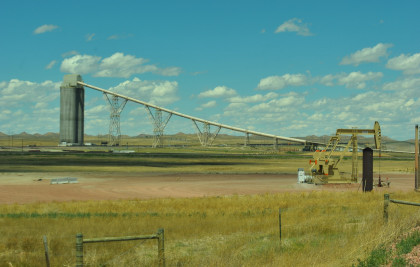
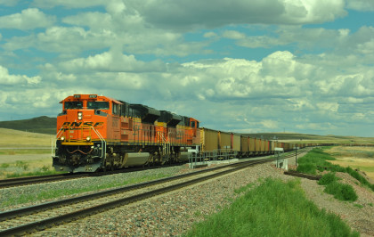
Union Pacific 5964 South. We continued north back to Wyoming 59.
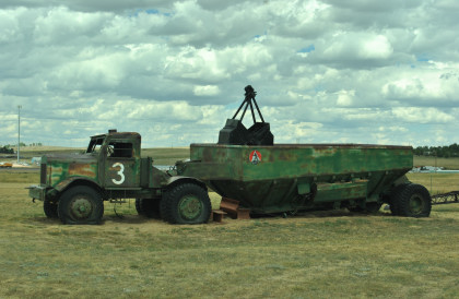
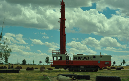
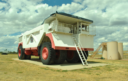
The Caballo Open Pit Mine. From here we went into Gillette for lunch where Robin and I had KFC and Chris Parker had Taco Bell. We next drove to the Mine Park in Gillette.
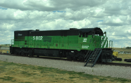
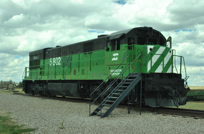
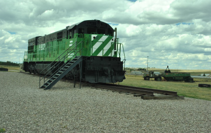
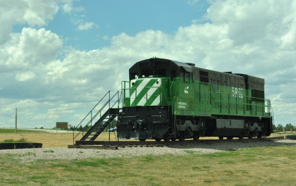
Burlington Northern U30C 5802, built by General Electric in 1972 as 5302.
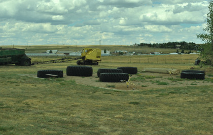
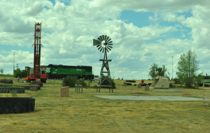
Tires in a children's play area.
An early mine truck.
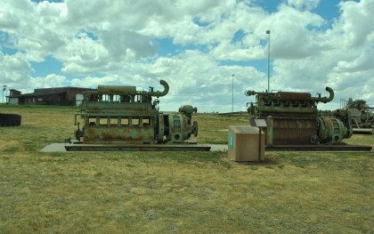
Two Worthington engines.
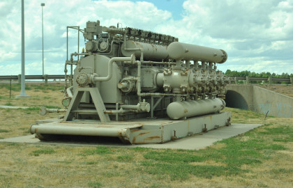
A gas engine.
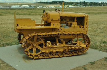
A Caterpillar tractor.
A crane.
Rotary drill.
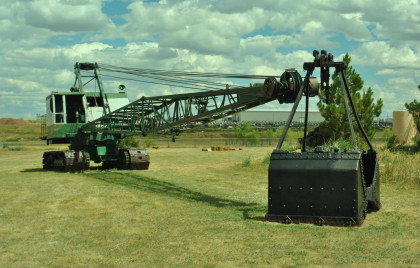
A crane and a bucket loader.
Another crane and a bucket loader.
Museum scene.
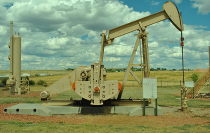
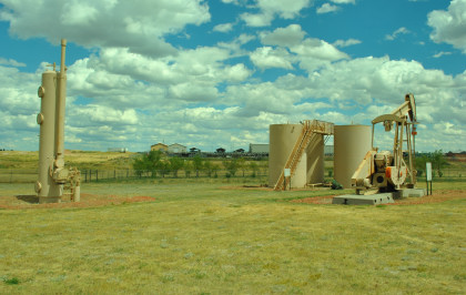
Typical oil well setup.
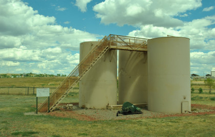
Typical tank battery.
Museum scene.
Unit rig truck.
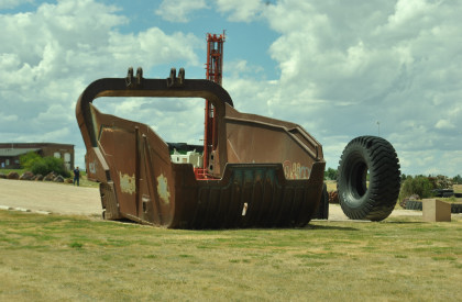
Coal shovel bucket.
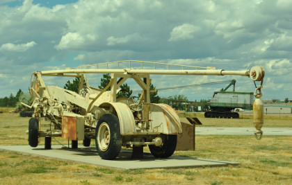
Pulling unit.
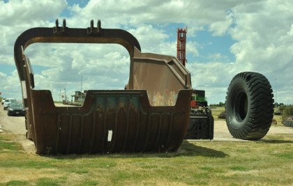
Coal shovel bucket.
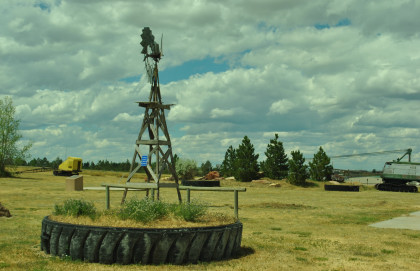
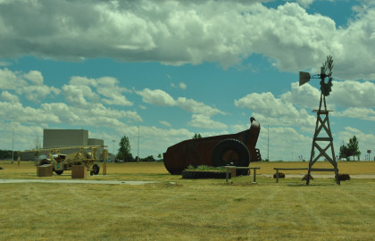
Wind mill.
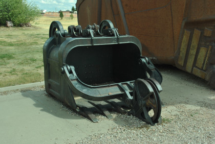
Coal shovel bucket.
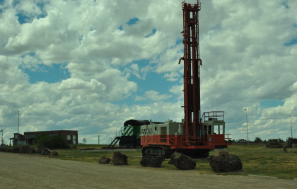
Rotary drill.
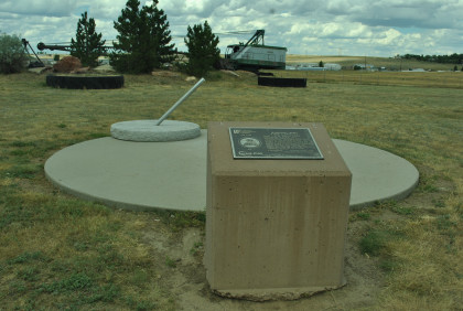
A sun dial.
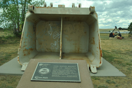
Coal shovel bucket.
BN 5802 with backward emblem on its east side. From here we headed east on old US 12.
The Donkey Creek Mine.
At this mine pit you can see the coal seam
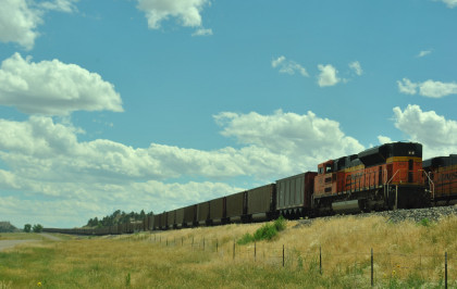
We caught the back of a train at Donkey Creek Jct.
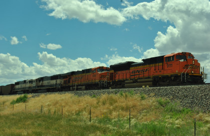
BNSF 9111 South at Donkey Creek Jct.
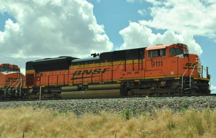
BNSF SD70 ACe 9111.
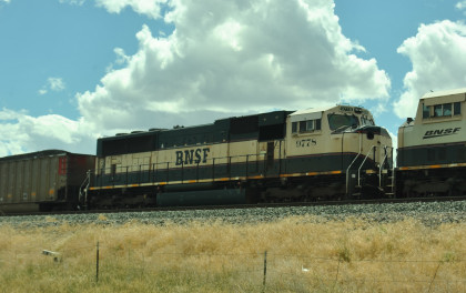
BNSF SD70MAC 9778.
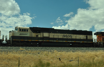
BNSF SD70MAC 9636. We headed east on US 12 but had to make another stop.
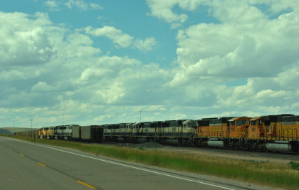
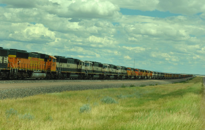
A long line of stored BNSF power, one of two at the Donkey Creek yard. We drove east, saw a headlight and turned on the first road we could.
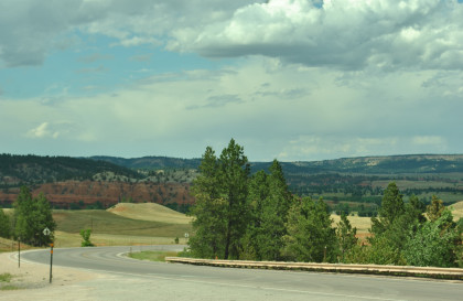
BNSF 8787 West just east of Rozet at Wessex Road. From here we drove east to Moorcraft then north to Devils Tower.
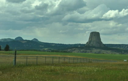
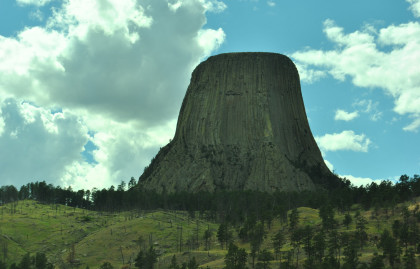
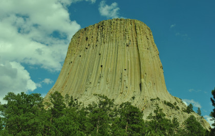
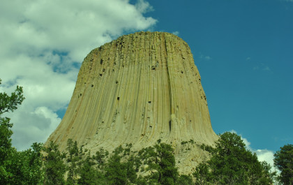
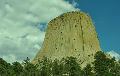
From a pull-off on Wyoming Highway 24.
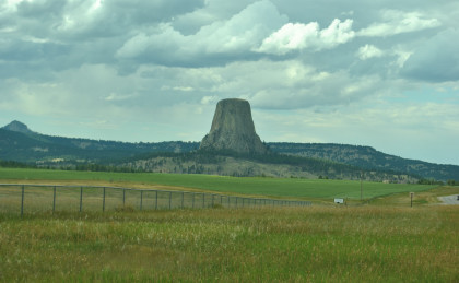
From another pull-off on Wyoming Highway 24.
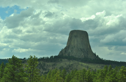
From a pull-off on Wyoming Highway 24. We drove up and used Robin's lifetime National Parks pass to get in for free which he had bought at the Painted Desert.
Devils TowerDevils Tower (Lakota: Matth Thipila ("Bear Lodge") or Ptehe Gi ("Brown Buffalo Horn"), Arapaho: (Wox Niiinon) is an igneous intrusion or laccolith in the Bear Lodge Mountains (part of the Black Hills) near Hulett and Sundance in Crook County, northeastern Wyoming, above the Belle Fourche River. It rises dramatically 1,267 feet above the surrounding terrain and the summit is 5,114 feet above sea level.
Devils Tower was the first declared United States National Monument, established on September 24, 1906 by President Theodore Roosevelt. The Monument's boundary encloses an area of 1,347 acres.
In recent years, about one percent of the Monument's 400,000 annual visitors climbed Devils Tower, mostly using traditional climbing techniques.
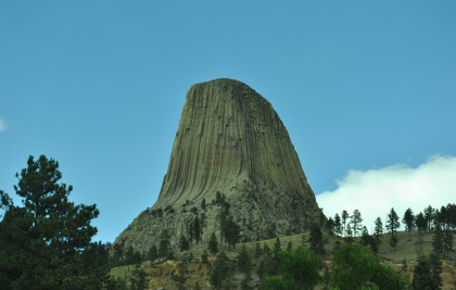
Devils Tower in geological context. The oval-shaped mesa around the Tower suggests the old volcano's shape. The red rock is the Permian-Triassic Spearfish Formation, and above that is the younger, white Gypsum Springs Formation.
Tribes including the Arapaho, Crow, Cheyenne, Kiowa, Lakota, and Shoshone had cultural and geographic ties to the monolith before non-Native Americans reached Wyoming. Their names for the monolith include: Aloft on a Rock (Kiowa), Bear's House (Cheyenne, Crow), Bear's Lair (Cheyenne, Crow), axpitcheeaasaao, "Home of bears" (Crow), Bear's Lodge (Cheyenne, Lakota), Bear's Lodge Butte (Lakota), Bear's Tipi (Arapaho, Cheyenne), Tree Rock (Kiowa), and Grizzly Bear Lodge (Lakota).
The name Devil's Tower originated in 1875 during an expedition led by Colonel Richard Irving Dodge when his interpreter misinterpreted the name to mean Bad God's Tower, which then became Devil's Tower. All information signs in that area use the name "Devils Tower", following a geographic naming standard whereby the apostrophe is eliminated.
In 2005, a proposal to recognize several American Indian ties through the additional designation of the monolith as Bear Lodge National Historic Landmark met with opposition from the United States Representative Barbara Cubin, arguing that a "name change will harm the tourist trade and bring economic hardship to area communities".
In November 2014, Arvol Looking Horse, an American Indian spiritual leader, again proposed renaming the geographical feature "Bear Lodge", and submitted the request to the Board of Geographic Names. A second proposal was submitted to request that the US acknowledge the "offensive" mistake and to rename the monument and sacred site Bear Lodge National Historic Landmark. The formal public comment period will end in fall 2015. Local state senator Ogden Driskill opposed the change.
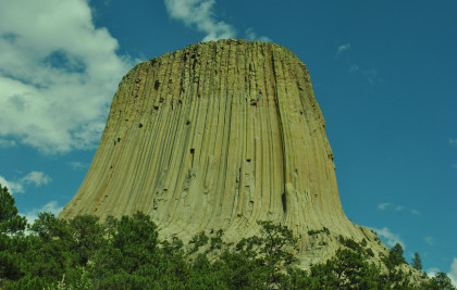
Geological historyThe landscape surrounding Devils Tower is composed mostly of sedimentary rocks. The oldest rocks visible in Devils Tower National Monument were laid down in a shallow sea during the Triassic period, 225 to 195 million years ago. This dark red sandstone and maroon siltstone, interbedded with shale, can be seen along the Belle Fourche River. Oxidation of iron minerals causes the redness of the rocks. This rock layer is known as the Spearfish Formation. Above the Spearfish formation is a thin band of white gypsum, called the Gypsum Springs Formation. This layer of gypsum was deposited during the Jurassic period, 195 to 136 million years ago.
Created as sea levels and climates repeatedly changed, gray-green shales (deposited in low-oxygen environments such as marshes) were interbedded with fine-grained sandstones, limestones, and sometimes thin beds of red mudstone. This composition, called the Stockade Beaver member, is part of the Sundance Formation. The Hulett Sandstone member, also part of the Sundance formation, is composed of yellow fine-grained sandstone. Resistant to weathering, it forms the nearly vertical cliffs which encircle the Tower itself.
During the Paleocene Epoch, 56 to 66 million years ago, the Rocky Mountains and the Black Hills were uplifted. Magma rose through the crust, intruding into the existing sedimentary rock layers.
Theories of formation
Geologists Carpenter and Russell studied Devils Tower in the late 19th century and came to the conclusion that it was formed by an igneous intrusion. Modern geologists agree that it was formed by the intrusion of igneous material, but not on exactly how that process took place. Several believe the molten rock comprising the Tower might not have surfaced; others are convinced the tower is all that remains of what once was a large explosive volcano.
In 1907, scientists Darton and O'Harra decided that Devils Tower must be an eroded remnant of a laccolith. A laccolith is a large mass of igneous rock which is intruded through sedimentary rock beds without reaching the surface, but makes a rounded bulge in the sedimentary layers above. This theory was quite popular in the early 20th century since numerous studies had earlier been done on laccoliths in the Southwest.
Other theories have suggested that Devils Tower is a volcanic plug or that it is the neck of an extinct volcano. Presumably, if Devils Tower was a volcanic plug, any volcanics created by it - volcanic ash, lava flows, volcanic debris - would have been eroded away long ago. Some pyroclastic material of the same age as Devils Tower has been identified elsewhere in Wyoming.
The igneous material that forms the Tower is a phonolite porphyry intruded about 40.5 million years ago, a light to dark-gray or greenish-gray igneous rock with conspicuous crystals of white feldspar. As the magma cooled, hexagonal (and sometimes 4-, 5-, and 7-sided) columns formed. As the rock continued to cool, the vertical columns shrank in cross-section (horizontally) and cracks began to occur at 120 degree angles, generally forming compact 6-sided columns. The nearby Missouri Buttes, 3.5 miles to the northwest of Devils Tower, are also composed of columnar phonolite of the same age. Superficially similar, but with typically 2 feet diameter columns, Devils Postpile National Monument and Giant's Causeway are columnar basalt.
Devils Tower did not visibly protrude out of the landscape until the overlying sedimentary rocks eroded away. As the elements wore down the softer sandstones and shales, the more resistant igneous rock making up the tower survived the erosional forces. As a result, the gray columns of Devils Tower began to appear as an isolated mass above the landscape.
As rain and snow continue to erode the sedimentary rocks surrounding the Tower's base, more of Devils Tower will be exposed. Nonetheless, the exposed portions of the Tower still experience certain amounts of erosion. Cracks along the columns are subject to water and ice erosion. Erosion due to the expansion of ice along cracks and fractures within rock formations is common in colder climates - a prime example being the featured formations at Bryce Canyon National Park. Portions, or even entire columns, of rock at Devils Tower are continually breaking off and falling. Piles of broken columns, boulders, small rocks, and stones - or scree - lie at the base of the tower, indicating that it was once wider than it is today.
Native American folkloreAccording to the Native American tribes of the Kiowa and Lakota, some girls went out to play and were spotted by several giant bears, who began to chase them. In an effort to escape the bears, the girls climbed atop a rock, fell to their knees, and prayed to the Great Spirit to save them. Hearing their prayers, the Great Spirit made the rock rise from the ground towards the heavens so that the bears could not reach the girls. The bears, in an effort to climb the rock, left deep claw marks in the sides, which had become too steep to climb. (Those are the marks which appear today on the sides of Devils Tower.) When the girls reached the sky, they were turned into the star constellation the Pleiades.
Another version tells that two Sioux boys wandered far from their village when Mato the bear, a huge creature that had claws the size of tipi poles, spotted them, and wanted to eat them for breakfast. He was almost upon them when the boys prayed to Wakan Tanka the Creator to help them. They rose up on a huge rock, while Mato tried to get up from every side, leaving huge scratch marks as he did. Finally, he sauntered off, disappointed and discouraged. The bear came to rest east of the Black Hills at what is now Bear Butte. Wanblee, the eagle, helped the boys off the rock and back to their village. A painting depicting this legend by artist Herbert A. Collins hangs over the fireplace in the visitor's center at Devils Tower.
In a Cheyenne version of the story, the giant bear pursues the girls and kills most of them. Two sisters escape back to their home with the bear still tracking them. They tell two boys that the bear can only be killed with an arrow shot through the underside of its foot. The boys have the sisters lead the bear to Devils Tower and trick it into thinking they have climbed the rock. The boys attempt to shoot the bear through the foot while it repeatedly attempts to climb up and slides back down leaving more claw marks each time. The bear was finally scared off when an arrow came very close to its left foot. This last arrow continued to go up and never came down.
Wooden Leg, a Northern Cheyenne, relates another legend told to him by an old man as they were traveling together past the Devils Tower around 1866 -1868. An Indian man decided to sleep at the base of Bear Lodge next to a buffalo head. In the morning he found that both he and the buffalo head had been transported to the top of the rock by the Great Medicine with no way down. He spent another day and night on the rock with no food or water. After he had prayed all day and then gone to sleep, he awoke to find that the Great Medicine had brought him back down to the ground, but left the buffalo head at the top near the edge. Wooden Leg maintains that the buffalo head was clearly visible through the old man's spyglass. At the time, the tower had never been climbed and a buffalo head at the top was otherwise inexplicable.
The buffalo head gives this story special significance for the Northern Cheyenne. All the Cheyenne maintained in their camps a sacred teepee to the Great Medicine containing the tribal sacred objects. In the case of the Northern Cheyenne, the sacred object was a buffalo head.
Recent historyFur trappers may have visited Devils Tower, but they left no written evidence of having done so. The first documented Caucasian visitors were several members of Captain William F. Raynolds' 1859 expedition to Yellowstone. Sixteen years later, Colonel Richard I. Dodge escorted an Office of Indian Affairs scientific survey party to the massive rock formation and coined the name Devils Tower. Recognizing its unique characteristics, Congress designated the area a U.S. forest reserve in 1892 and in 1906 Devils Tower became the nation's first National Monument.
The 1977 movie "Close Encounters of the Third Kind" used the formation as a plot element and as the location of its climactic scenes. Its release was the cause of a large increase in visitors and climbers to the monument.
A picture from the pay station. We drove to the Visitor Center and parked.
Devil's Tower. We then found a view on the south side of the tower.
One last view. We back-tracked to Moorcroft before drivinig to Newcastle.
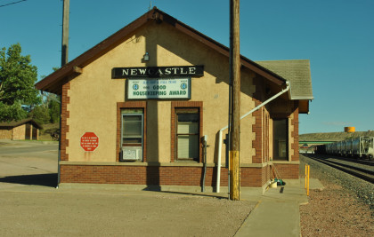
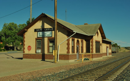
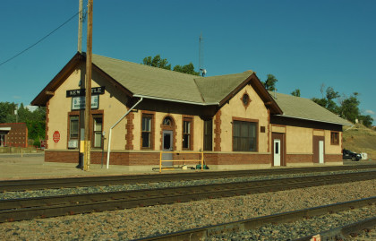
The Chicago, Burlinton and Quincy Newcastle station, built in 1936, after which we checked into Sundowner Inn for the night.
| RETURN TO THE MAIN PAGE |