


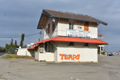
Before we left Felton, we drove out of the front gate and turned left and stopped opposite the Felton station but there was something else here of great interest.
Elk River Mill and Lumber Company 2 truck Climax 5 built by the company in 1928 and named "Bloomsburg". In 1959, Elk River Coal & Lumber was bought by the W. M. Ritter Lumber Company, which merged into the Georgia-Pacific Corporation the following year. In 1963, 3 was sold to Carroll Stahl to run on the tourist Carroll Park & Western Railroad in Bloomsburg, Pennsylvania. The railroad closed in 1972 and 3 was sold to the Roaring Camp in 1977.
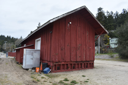
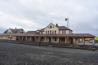
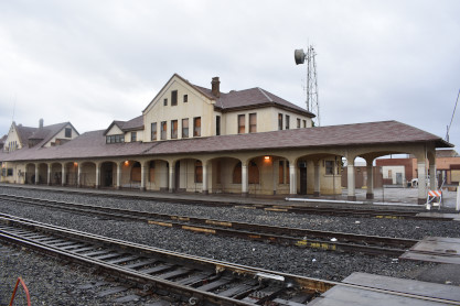
Southern Pacific Felton station built in 1894.
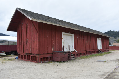
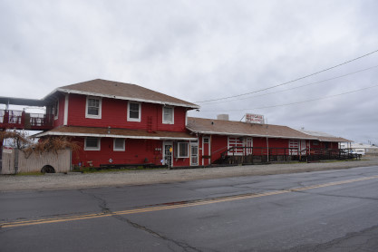
Southern Pacific freight house built in 1894 to the north of the station.
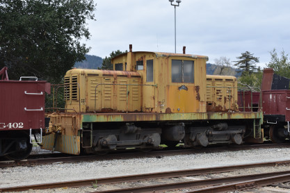
Big Trees and Pacific 45 ton switcher 20, ex. Lone Star Industries 5113, exx. Pacific Cement & Aggregates, nee United States Air Force 7489, built by Whitcomb in 1941. From here, we drove over to the Felton Covered Bridge Park.
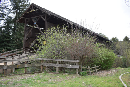
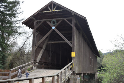
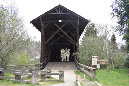
Felton Covered Bridge built in 1892, believed to the tallest covered bridge in the country and was the only entrance to Felton for forty-five years.
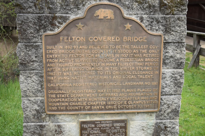
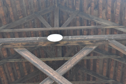
The plaque.

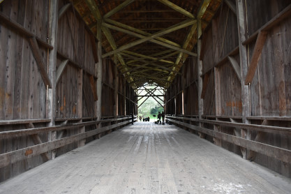
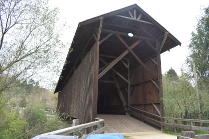
Three more views of the Felton covered bridge.
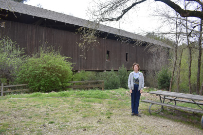
Elizabeth and the Felton covered bridge, a surprise for her as she did not know any covered bridges were part of our trip. We stopped for lunch at Carl's Jr before I drove a long, winding, twisty and slow Highway 130 for 65.4 miles which took over two hours.
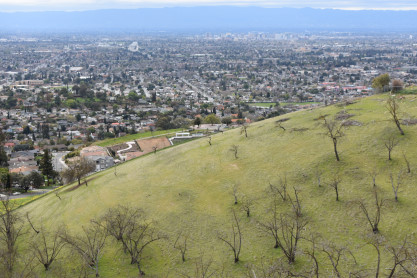
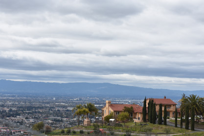
The view of the Silicon Valley from along this road as we climbed higher and higher. We came across a surprise as we kept on driving.
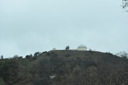
One of the Lick Observatories, which was closed.

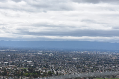
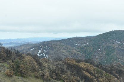
A scenery picture from along the road as we neared the summit of the Diablo Range, part of the California Coast Range of mountains.
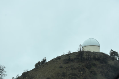
The main Lick Observatory.
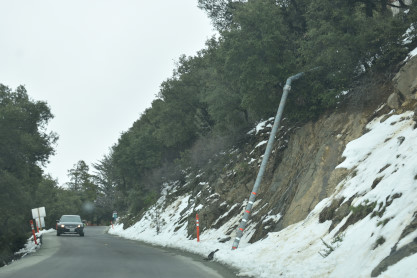
We were both surprised to see snow along our route but considering we were over 4,000 feet high, it made sense.
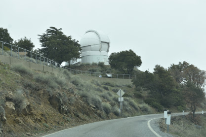
Another observatory building. Elizabeth did not expect to see three observatories here.

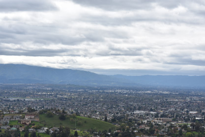
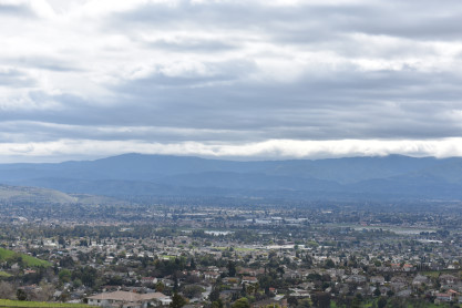
Pictures as we slowly descended down the other side of the mountains into more twists and turns. The road finally straightened out after the junction of the road that led to Livermore, 31 miles away. We made our way along Highway 130 and finally saw Interstate 5 which we went under and went into Patterson. We took CA 33 north but at a stop sign in Westley, I handed the camera over to Elizabeth for another picture.
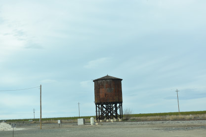
The Westley Southern Pacific water tower. From here we went to Vernalis for our last station of the day.

In Vernalis is the 1888 Southern Pacific Newman station. Elizabeth then took over the driving and drove extremely well along CA 132 to CA 99, with a stop north of Madera for an Arby's dinner before continuing the rest of the way to Bakersfield. We checked into the La Quinta Hotel and called it a night.
3/15/2021 We got up and both of us checked the Internet before Greg called me to inform us that IHOP, where we had planned to have breakfast, did not open until 8:00 AM. We walked across the street to Denny's only to learn that they could not serve breakfast because of the rain and indoor dining was not allowed. So Elizabeth found Maggie's Sunrise Cafe on her phone and called to make sure they were open. We drove over there where I had a waffle with bacon and Elizabeth had a Denver Omelette. We will definitely make this our official breakfast location in Bakersfield from now on. After checking out of the hotel, Marty accompanied us this morning while Greg drove himself. We filled the car with petrol and headed to our first location.
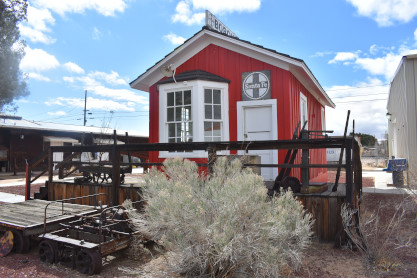
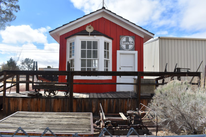
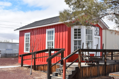
Santa Fe/Southern Pacific station in Seguro built in 1918.
The Bakersfield Southern Pacific station built in 1889. We followed the track into the Tehachapi Mountains.
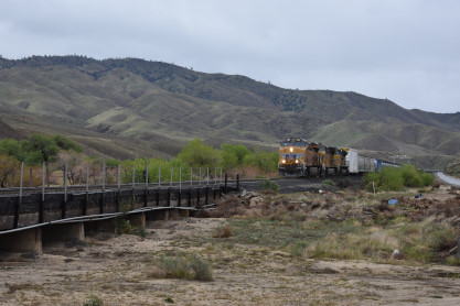
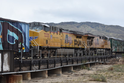
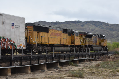
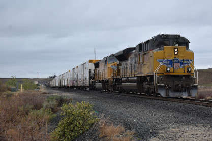
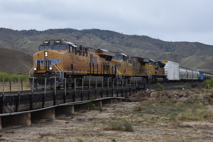
Union Pacific 7967 West with DPUs 7235 and 7634 at the Caliente Creek bridge east of Bena. The weather turned nasty with rain and cold winds so we drove to Caliente then straight to the town of Tehachapi.
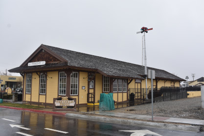
The replica Tehachapi station built in 2009 after the orginal building was destroyed by fire. On the way to Boron, we stopped at the rest area on CA 58 before arriving in Boron.
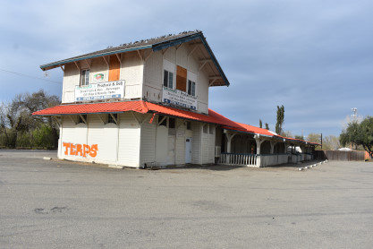
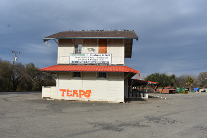
Former Santa Fe station in Boron built in 1905. Now part of the Twenty Mule Team Museum. We then drove to Calico and paid $8.00 apiece to enter.
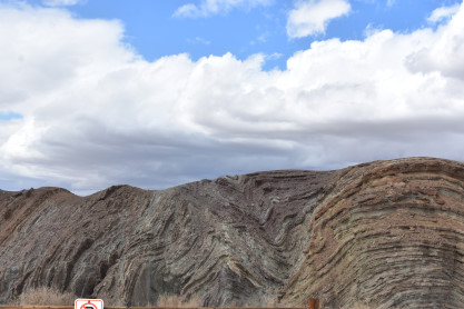
Interesting rock strata to the west of Calico with great clouds. The wind was blowing like crazy here.
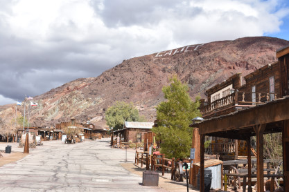

The main street of Calico.
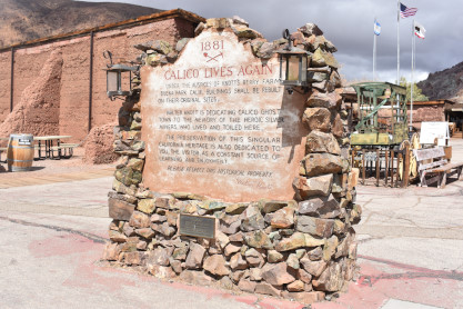
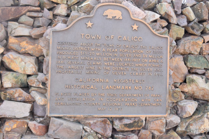
The historical markers of Calico Ghost Town.
History of CalicoIn 1881 four prospectors were leaving Grapevine Station (present day Barstow, California) for a mountain peak to the northeast. Describing the peak as "calico-colored", the peak, the mountain range to which it belonged, and the town that followed were all called Calico. The four prospectors discovered silver in the mountain and opened the Silver King Mine, which was California's largest silver producer in the mid-1880s. A post office was established in early 1882, and the Calico Print, a weekly newspaper, started publishing. The town soon supported three hotels, five general stores, a meat market, bars, brothels and three restaurants and boarding houses. The county established a school district and a voting precinct. The town also had a deputy sheriff and two constables, two lawyers and a justice of the peace, five commissioners nd two doctors. There was also a Wells Fargo office and a telephone and telegraph service. At its height of silver production during 1883 and 1885, Calico had over 500 mines and a population of 1,200 people. Local badmen were buried in the Boot Hill cemetery. The discovery of the borate mineral colemanite in the Calico mountains a few years after the settlement of the town also helped Calico's fortunes, and in 1890 the estimated population of the town was 3,500, with nationals of China, England, Ireland, Greece, France and the Netherlands, as well as Americans living there. In the same year, the Silver Purchase Act was enacted and drove down the price of silver. By 1896, its value had decreased to $0.57 per troy ounce, and Calico's silver mines were no longer economically viable. The post office was discontinued in 1898 and the school closed not long after. By the turn of the century, Calico was all but a ghost town and with the end of borax mining in the region in 1907, the town was completely abandoned. Many of the original buildings were moved to Barstow, Daggett and Yermo. An attempt to revive the town was made in about 1915, when a cyanide plant was built to recover silver from the unprocessed Silver King Mine's deposits. Walter Knott and his wife Cordelia, founders of Knott's Berry Farm, were homesteaded at Newberry Springs around this time, and Knott helped build the redwood cyanide tanks for the plant. The last owner of Calico as a mine was Zenda Mining Company. In 1951, Knott purchased the town from Zenda Mining Company. Knott began restoring it to its original condition, referencing old photographs. He installed a longtime employee named "Calico Fred" Noller as resident caretaker and official greeter. In 1966, Knott donated the town to San Bernardino County, and Calico became a County Regional Park.
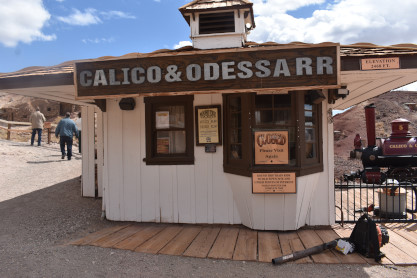
We walked over to the railroad and soon discovered that it was closed. The four of us were very disappointed but vowed to return when it was open again. In conversation with a railroad worker, he informed us that we were a day too early as he was waiting for the State to arrive this day and inspect the tracks since they had not run in over a year due to the pandemic. We understood the situation but were still sad.
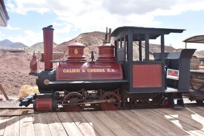
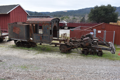
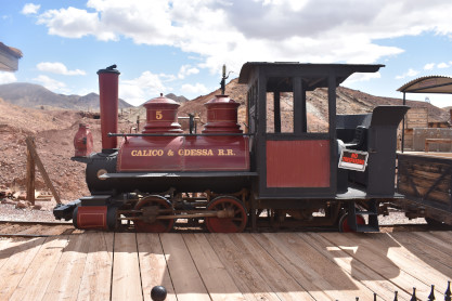
The gasoline-powered locomotive of the Calico and Odessa Railroad which had been converted from steam.
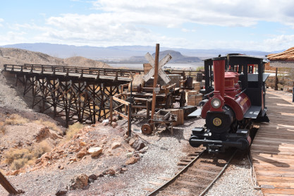
The train waiting for the passengers who will not come today.
How I wish this train would have run today.
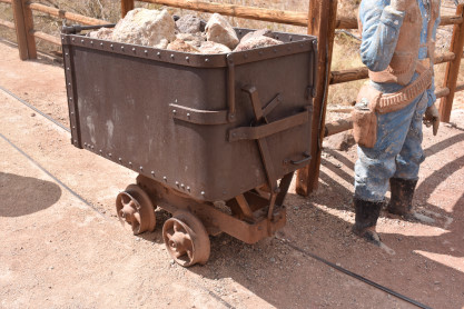
An ore car.
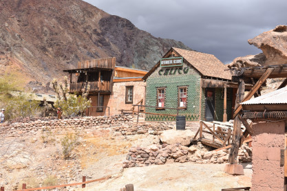
The Bottle House.
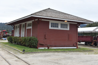
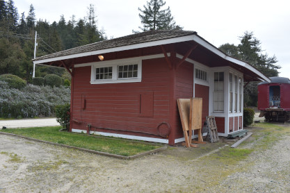
The closed station building.

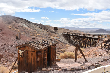
Two more views of the railroad none of us were able to ride today.
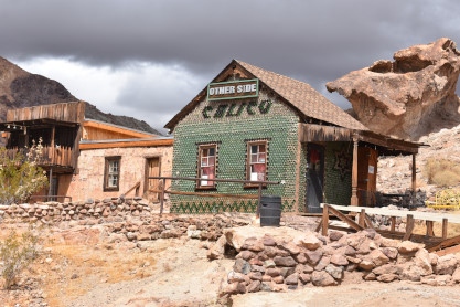
My last picture in Calico was the Bottle House again. Elizabeth and I left and drove down to Subway at Interstate 15 and we got lunch which we took to Daggett. Greg and Marty followed us. We parked at Daggett and started to eat lunch.

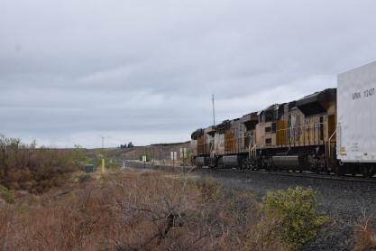
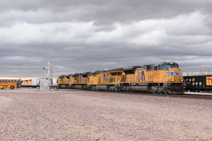
Union Pacific 6842 West at Daggett. This was Elizabeth's first train here.
Lunch was interrupted by Union Pacific 8519 East which came by while Union Pacific 6842 West was still passing us.
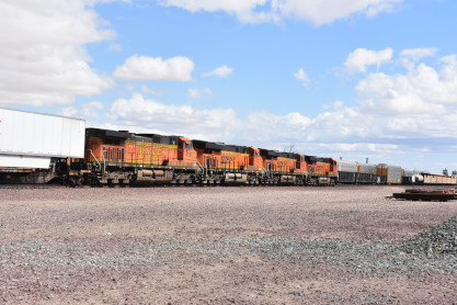
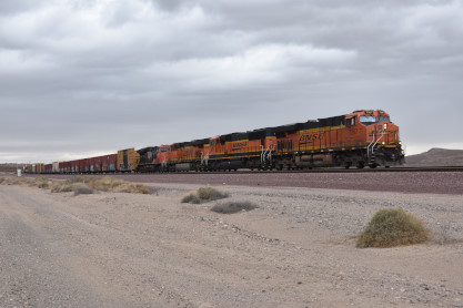
BNSF 7307 East also interrupted lunch and we could not believe our luck.
BNSF 3679 West was waiting for track availability so it could move into Barstow. Elizabeth and I said our goodbyes to Greg and Marty who started their drive back to Orange and we also started heading home to Santa Ana, but soon had to stop for more trains.
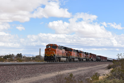
BNSF 4739 West was at Nebo.

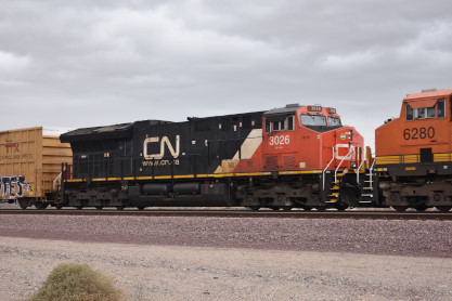
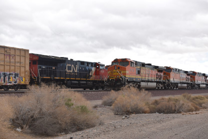
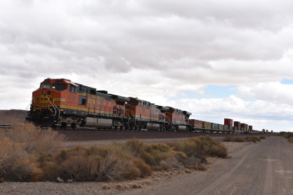
BNSF 7267 East with Canadian National ET44AC 3026 in the consist. We had seen this train on the bridge as we headed to Calico and were surprised it came by. Elizabeth drove us towards home on Interstate 40 to Interstate 15 to Interstate 215.
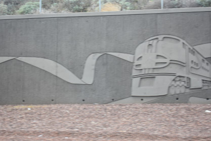
There is a BNSF train in the artwork along Interstate 215 in Highgrove. She continued driving, taking us down CA 91 West to CA 55 where we exited at Chapman Avenue and drove home. It had been an excellent trip to Niles Canyon Railway, Roaring Camp and Big Trees and Daggett.
| RETURN TO THE MAIN PAGE |