


Elizabeth and I awoke in Rawlins and we had a hot breakfast for $10 each which was filling. Greg and Marty joined us at the car and soon we were off to Casper with Greg driving.
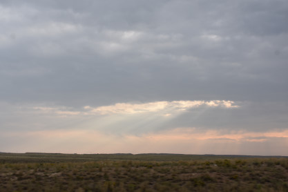
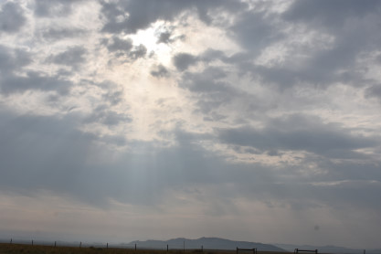
The morning sky outside of Rawlins as we travelled north toward Casper. We took Greg and Marty to a surprise location resulting from a posting on Trainorders.com about the shortline Bighorn Divide and Wyoming. It was only about five miles west of where we were going.
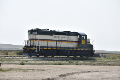
Bighorn Divide and Wyomimg SD18 2012, nee Duluth, Missabe and Iron Range 189, built by Electro-Motive Division in 1960, at Bishop, Wyomimg.
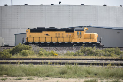
Rail Switching Services GP9u 8216, ex. Canadian Pacific 8216 2006, exx. St. Lawrence and Hudson 2816 1997, exxx. Canadian Pacific 8216 1988, nee Canadian Pacific GP9 8668, built by General Motors Diesel in 1956. It was declared surplus in July 2014 and acquired by Rail Switching Services in April 2015, retaining its number.
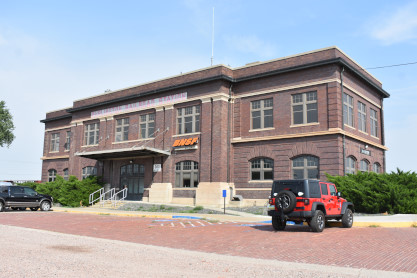
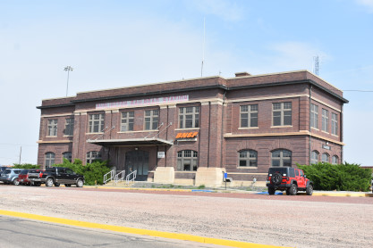
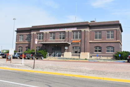
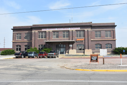
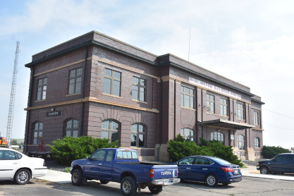
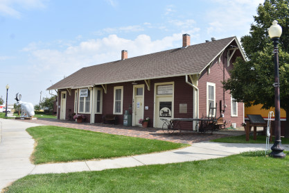
The Chicago, Burlington and Quincy Casper station built in 1916.
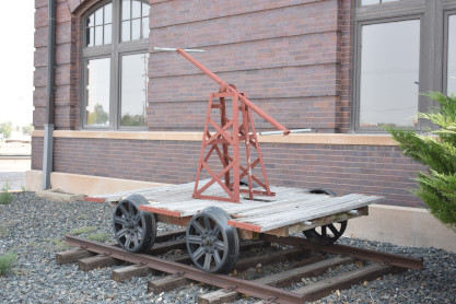
A handcar on display in Casper.
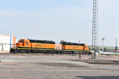
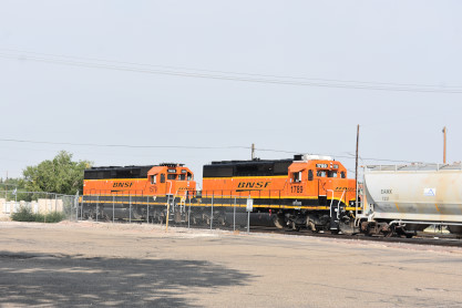
On the left is BNSF SD40-2 1798, ex. BNSF 7828 2003, exx. Burlington Northern 7828, nee Colorado and Southern 958, built by Electro-Motive Division in 1974. On the right is BNSF SD40-2 1736:2, ex. BNSF 6896, nee Santa Fe 5168, built by Electro-Motive Division in 1980.
On the left is BNSF SD40-2R 1579, ex. BNSF 6505, exx. Santa Fe 5856, nee Santa Fe SD45-2 5637, built by Electro-Motive Division in 1972. On the right is BNSF SD40-2 1789, ex. BNSF 7045, nee Burlington Northern 7045, built by Electro-Motive Division in 1978.
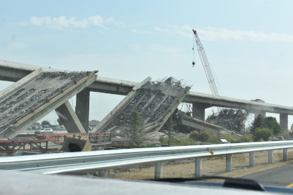
From here Greg drove us east to Douglas and on the way there, we saw a sight none of us had ever seen before, freeway de-construction in Casper. We continued on to our next stop.
About forty-five minutes later, we arrived at the Douglas Railroad Interpretive Center and the Chicago and North Western station. I took only two pictures as I have covered this museum twice before.
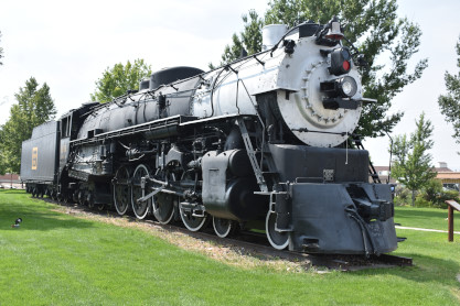
Chicago Burlington and Quincy 4-8-4 5633 built by the Chicago, Burlington and Quincy in 1940. After everyone visted the exhibits, I drove us north up Wyoming highway 59 into the Powder River Basin.
Powder River Basin The Powder River Basin is a geologic structural basin in southeast Montana and northeast Wyoming, about 120 miles east to west and 200 miles north to south, known for its coal deposits. The region supplies about forty percent of coal in the United States. It is both a topographic drainage and geologic structural basin. The basin is so named because it is drained by the Powder River, although it is also drained in part by the Cheyenne River, Tongue River, Bighorn River, Little Missouri River, Platte River and their tributaries.While the Powder River Basin is unified geologically, residents of areas distant from the Powder River proper do not think of themselves as living in a single geographic region. For example, residents of the Crow Reservation in the Big Horn River watershed, or of Sheridan in the Tongue River watershed, would locate the Powder River Basin as the region east of the Big Horn Mountains, using a definition based on watershed and topography. Major cities in the area include Gillette and Sheridan, Wyoming and Miles City, Montana. Outside of these main towns, the area is very sparsely populated and is known for its rolling grasslands and semi-arid climate. It is the single largest source of coal mined in the United States, and contains one of the largest deposits of coal in the world. Most of the active coal mining in the Powder River Basin actually takes place in drainages of the Cheyenne River. Because of the Powder River Basin, Wyoming has been the top coal-producing state in the United States since 1988. In 2007, the Powder River Basin alone produced 436 million short tons of coal, more than twice the production of second-place West Virginia, and more than the entire Appalachian region. The Powder River Basin is the largest coal producing region in the United States. The Black Thunder Coal Mine is one of the most productive coal mines in the United States; in 2006 this single mine produced 84 million metric tons of coal, more than any state except Wyoming, West Virginia, and Kentucky. The region is also a major producer of natural gas through a process called coal-bed methane extraction. Underground coal seams are dewatered through pumping, which reduces pressure and releases trapped gases up to the well head.
PhanerozoicThe Powder River Basin contains a section of Phanerozoic rocks up to 17,000 feet thick, from Cambrian to Holocene.
Cretaceous The thickest section of the Powder River Basin is composed of Cretaceous rocks, an overall regressive sequence of mostly marine shales and sandstones deposited in the Western Interior Seaway. TertiaryThe coal beds of the region began to form about 60 million years ago when the land began rising from a shallow sea. The rise of the Black Hills uplift on the east and the Hartville uplift on the southeast side of the basin created the present outline of the Powder River Basin.
When the coal beds were forming, the climate in the area was subtropical, averaging about 120 inches of rainfall a year. For some 25 million years, the basin floor was covered with lakes and swamps. Because of the large area of the swamps, the organic material accumulated into peat bogs instead of being washed to the sea. Periodically the layers of peat were covered with sediments washed in from nearby mountains. Eventually the climate became drier and cooler. The basin filled with sediment and buried the peat under thousands of feet, compressing the layers of peat and forming coal. Over the last several million years, much of the overlying sediment has eroded away, leaving the coal seams near the surface.
CoalPowder River Basin coal is classified as "sub-bituminous" and contains an average of approximately 8,500 btu/lb, with low SO2. Contrast this with eastern, Appalachian bituminous coal containing an average of 12,500 btu/lb and high SO2. PRB coal was essentially worthless until air pollution emissions from power plants became a concern. A coal-fired plant designed to burn Appalachian coal must be modified to remove SO2 at a cost estimated in 1999 to be around $322 per ton of SO2. If it switched to burning PRB coal, the cost dropped to $113 per ton of SO2 removed. Removal is accomplished by installing scrubbers.
The Powder River Basin is the largest coal mining region in the United States, but most of the coal is buried too deeply to be economically accessible. The Powder River Basin coal beds are shaped like elongated bowls and as mines expand from east to west in the Powder River Basin, they will be going "down the sides of the bowl." This means that the overburden (rock lying over the coal) will increase as will the stripping ratio (the ratio of rock that needs to be moved to get to a ton of coal).
The United States Geological Survey has conducted a series of studies on the economic accessibility of coal in the major coal producing regions of the country. The studies have typically found that only a small fraction of the coal will be economically accessible at the current price of $10.47/ton. In August 2008, the USGS issued an updated assessment of coal in the Powder River Basin. After considering stripping ratios and production costs, the USGS concluded that at the time of the economic evaluation, only 6 percent of the original resource, or 10.1 billion short tons of coal, was currently economically recoverable. At a price of $60/ton, roughly half (48%) of the coal is economic to produce.
Presently the approximately 15 mines in the Powder River Basin are working in areas where the stripping ratio is between 1:1 (i.e. one ton of rock for one ton of coal) and 3:1. As the mines expand the stripping ratio will increase. As more rock needs to be moved (using large electrically powered draglines and diesel and electric mining trucks) the production cost will also increase.
The United States uses about 1 billion tons of coal a year, with about 40 percent of the coal currently coming from the Powder River Basin. The amount of coal coming from the Powder River Basin has been increasing over the last 20 years.
Increasing the price paid for coal can increase the amount of economically recoverable coal, but increasing the price of coal will also increase the production cost for the coal. In addition, because coal is a solid, not a liquid, it cannot be produced from many scattered wells as oil and gas can be. Rather, coal has to be produced from mines that expand slowly by moving massive quantities of overburden.
The mines in the Powder River Basin typically have less than 20 years of life remaining. Almost all of the coal in the Powder River Basin is federally owned and further mine expansions will require a series of federal and state approvals, as well as large investments in additional mine equipment to begin the excavations.
The majority of the coal mined in the Powder River Basin is part of the Fort Union Formation (Paleocene), with the low sulfur and ash content of the coal in the region making it very desirable. Coal supplies about half of the United States' electricity supplies, with the Powder River Basin mines supplying around 40 percent of the coal that fuels those stations, mainly to the east of the Rocky Mountains, for generating electricity.
As of 2013 five coal export terminals were being proposed in the Pacific Northwest to export coal from the Powder River Basin to China and other Asian markets.
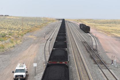
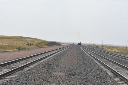
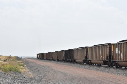
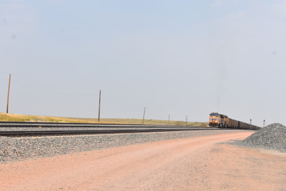
Our VisitI drove us out to County Road 48 to the bridge over the mainlines and we did not have a long wait for a train.
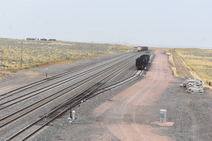
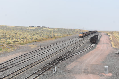

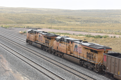
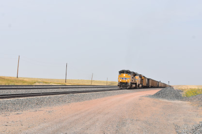
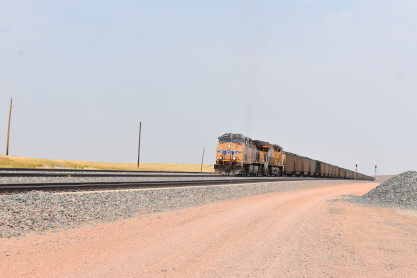
Union Pacific 7413 East at County Road 48.
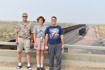
Elizabeth with Greg and Marty who were experiencing their first train in the Powder River Basin.
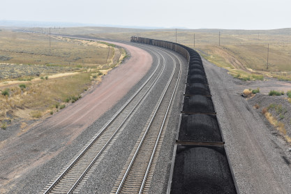
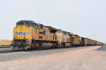
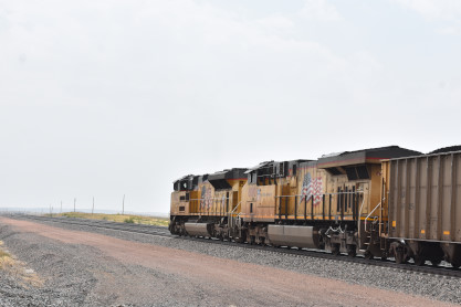
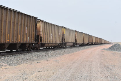
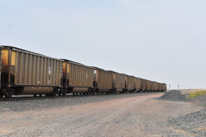
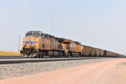
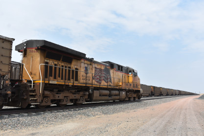
The rest of the passage of Union Pacific 7413 East at County Road 48. We next relocated to Robertson Road and parked the car on the west side of the tracks so we could have an escape plan.
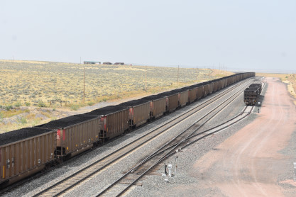
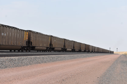
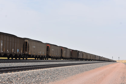
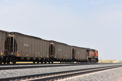
The DPU, BNSF 9260, of a westbound coal train at Robertson Road. Greg then drove the car to the east side of the tracks and you can guess what happened next.
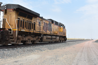
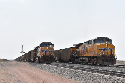
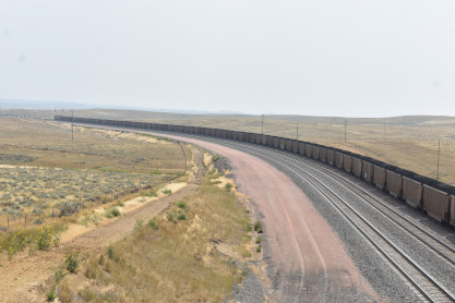
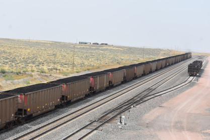
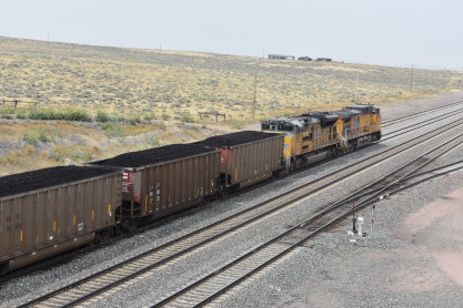
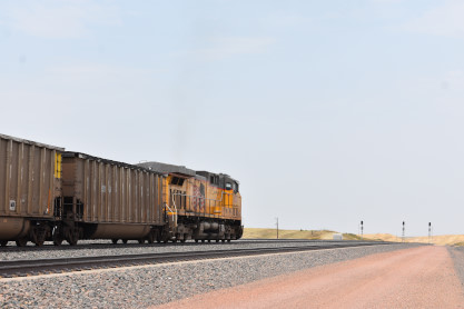
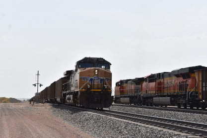
Union Pacific 8842 East with DPU 5868 came and stopped, blocking the crossing and we were stuck.
Union Pacific 5851 East with DPU 6327 then ran by our crossing blocked train.
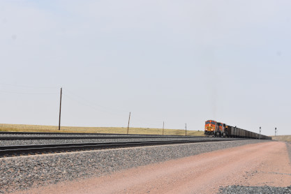
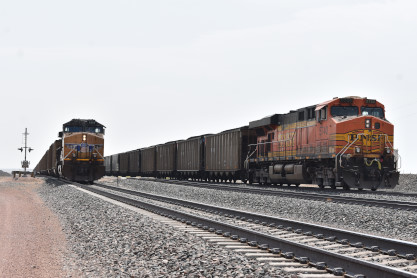
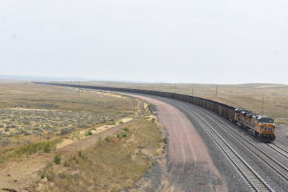
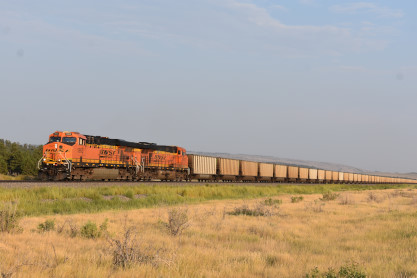
BNSF 5483 East with DPU 5740 at Robertson Road. After watching all the traffic head north down the maintanence road, we decided to follow it and made our escape back to Wyoming Highway 59. I drove us next to Reno Junction where I took the group first to the Black Thunder Mine and then back to Hilight Road.
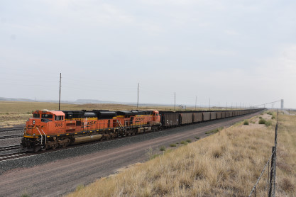
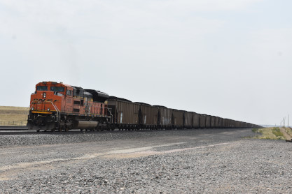
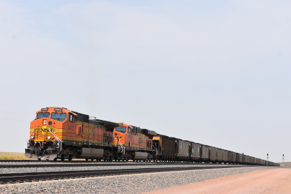
BNSF 9045 East along Hilight Road.
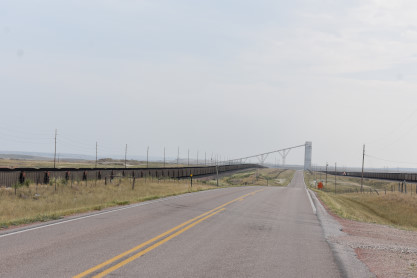
Looking back at Reno Jct. From here I drove us to Perkins Restaurant in Gillette for an early dinner. After the boys went to Walmart and we went to Osco for a few items, Elizabeth then drove us east out of Gillette.
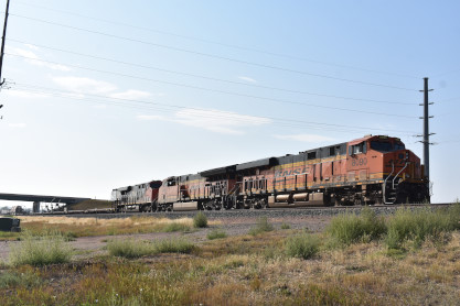
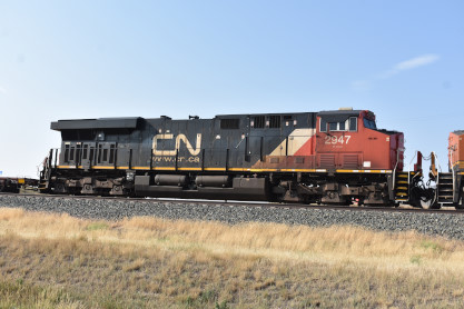
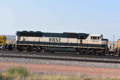
BNSF 8090 East with Canadian National ES44AC 2947 at Gillette.
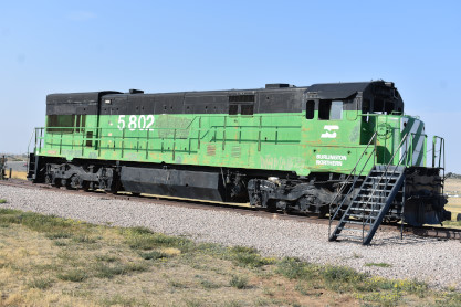
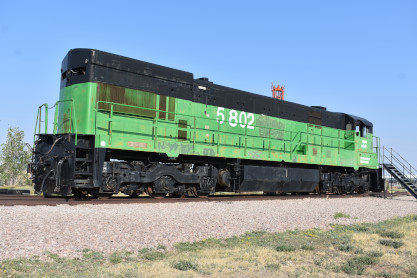
Burlington Northern U30C 5802 built by General Electric in 1972 as 5302, at the Gillette Energy Park.
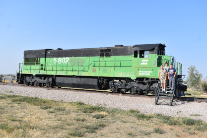
Greg, Elizabeth and Marty on the steps leading to Burlington Northern U30C 5802. Next we drove by all of the stored BNSF power at their Donkey Creek Yard.
BNSF SD70MAC 9532, built by Electro-Motive Division in 1995.
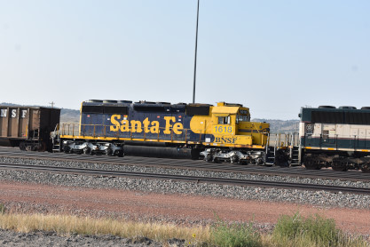
BNSF SD40-2 1618, ex. BNSF 6737, exx. Morrison-Knudsen 5078, nee Santa Fe 5078, built by Electro-Motive Division in 1979. We continued east towards Newcastle.
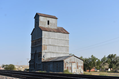
Grain elevator at Rozet.
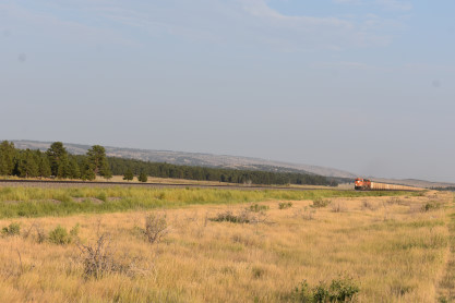
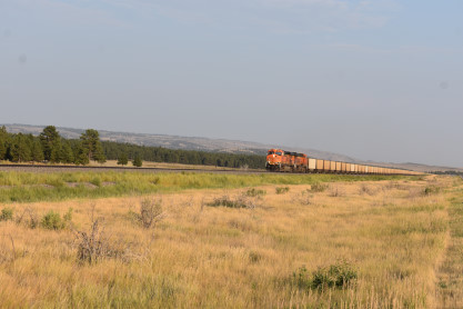
BNSF 5953 West east of Upton. We then drove to Newcastle and checked in to the Pines Country Inn for the night.
| RETURN TO THE MAIN PAGE |