


8/25/2022 We arose at the Holiday Inn Express in Alliance and had the hotel's breakfast then after checking the Internet, I drove us to Henry and just in Wyoming, found our Nebraska station.
Chicago, Burlingtom and Quincy Henry station just inside Wyoming. Our next stop was South Torrington with plenty of surprises.
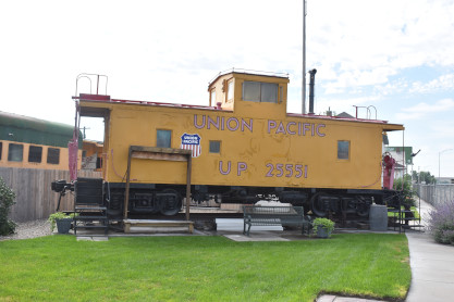
Union Pacific caboose 25551 built by International Car in 1964 and donated to the Homesteaders Museum in 1989.
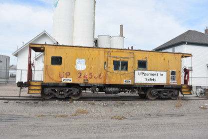
Union Pacific caboose 24566, built by International Car in 1964 as Chicago, Rock Island and Pacific 17148.
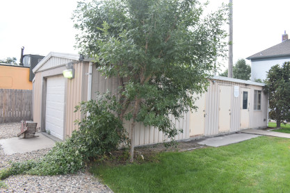
Union Pacific yard office.
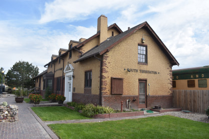
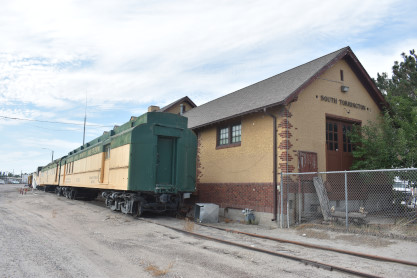
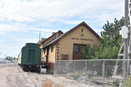
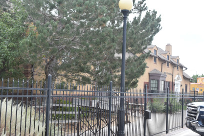
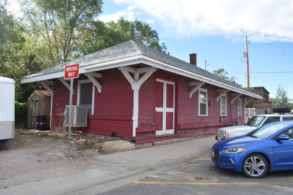
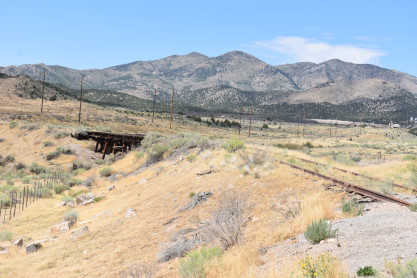
Union Pacific South Torrington station built in 1936. The line was principally intended to serve a sugar refinery in the vicinity and by 1928, it was extended to serve as a cutoff from the Union Pacific branch along the North Platte River to the main transcontinental line and was known as the North Platte Cutoff.
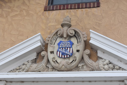
Union Pacific Overland Route symbol on the depot.
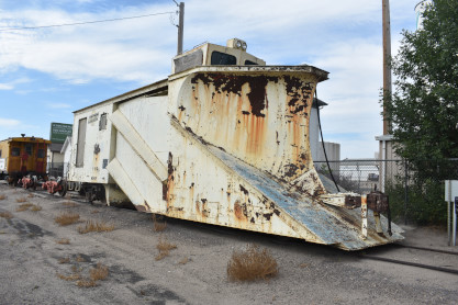
Chicago and North Western wedge snowplow built by Russell Snow Plow Company, number unknown.
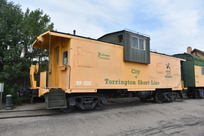
Burlington Northern caboose 12217 built by Pacific Coast and Foundry in 1978.
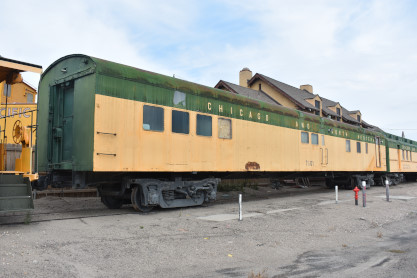
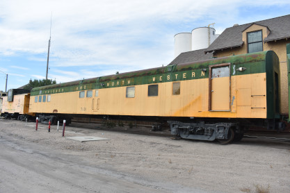
Chicago and North Western baggage-lounge 7501 built by Pullman-Standard in 1939.
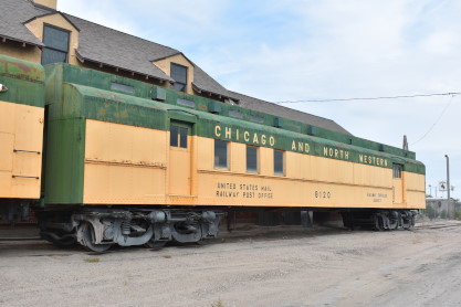
Chicago and North Western RPO-baggage car 8120.
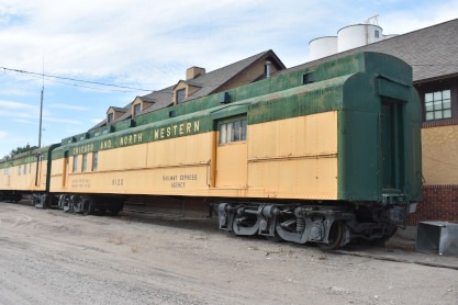
The passenger cars and the station.
South Torrington station. I drove us to the rest area right before Interstate 25 and Elizabeth took over driving and made our way through Douglas. West of there we saw a sign for Ayres Natural Bridge Park and decided to investigate.
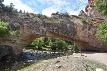
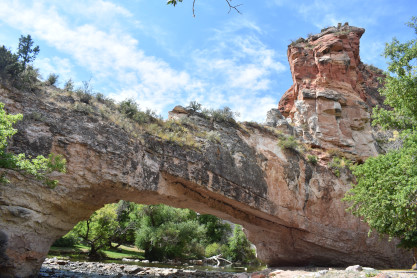
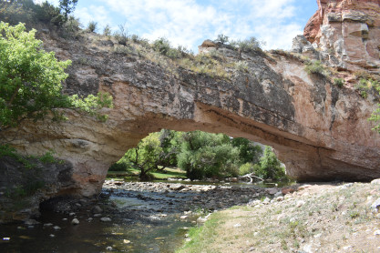
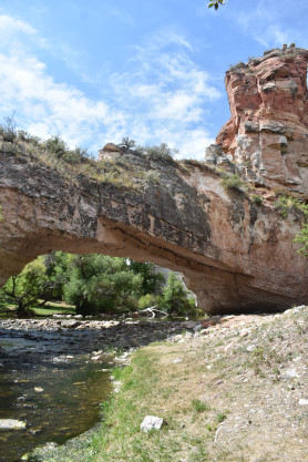
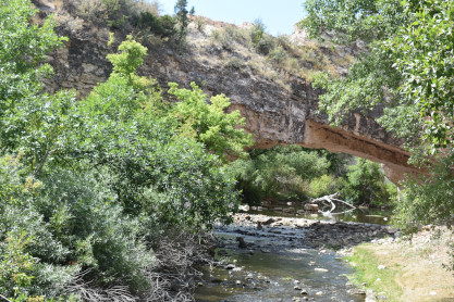
Ayers Natural Bridge. Most travellers on the Oregon Trail never strayed from their route unless they had to. Some, however, made time for sightseeing. Two miles south of the trail, about 12 miles southwest of present Douglas, in Converse County, Wyoming, La Prele Creek flows under a large, natural arch of limestone. A dam was constructed a short way farther upstream in the early 1900s; around the same time a modern road was built to the site. Before that time, visitors to the natural bridge had to climb down steep canyon walls and fight their way through heavy brush on the canyon floor. Few bothered; there are only a handful of accounts-but from them it is s clear the place left a permanent impression. In 1910, rancher Alvah Ayres won a patent on the land and in 1919, his son donated the land to Converse County. It remains a county park today.
Ayres Natural Bridge.
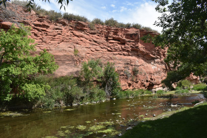
La Prele Creek.
Ayres Natural Bridge.
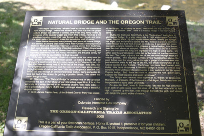
Natural Bridge and the Oregon Trail. I drove from here and through Casper to a rest area, where we swapped drivers again and Elizabeth drove us to Riverton.
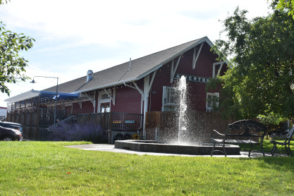
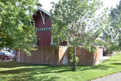
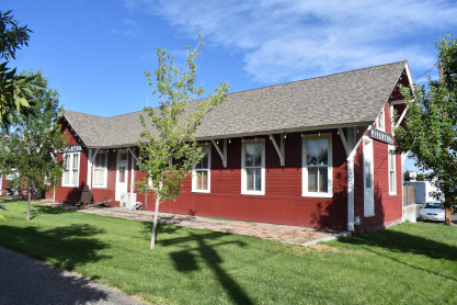
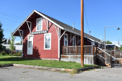
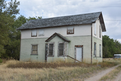
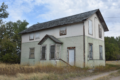
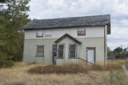
Chicago and North Western Riverton station built in 1907, now a Mexican restaurant. We had dinner at Smokehouse Burgers & Fries BBQ then the short distance to the Wind River Hotel for the night.
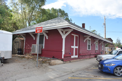
8/26/2022 We arose and following our morning preparations, I drove to the Trailhead Restaurant and we had an excellent breakfast before going to Lander for our last Chicago and North Western station of this trip.
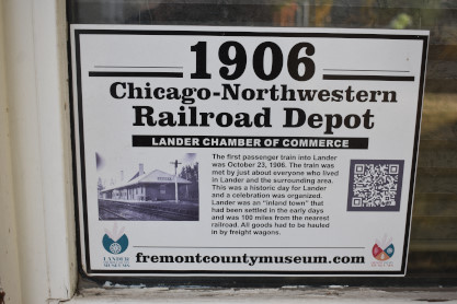
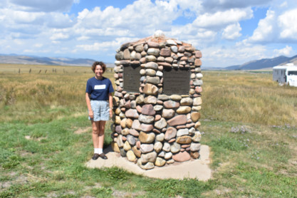
This station had a sign giving its history.
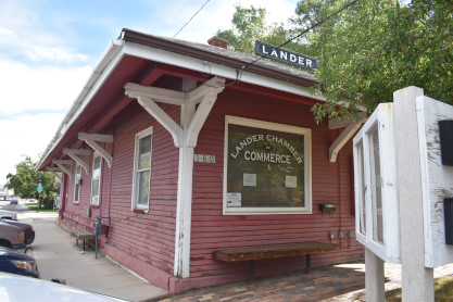
Chicago and North Western Lander station. From here we took US 287 to Kotey Place then Wyoming 26 through Atlantic City through Farson, and then Wyoming County 372 to US 189 to Kemmerer and drove west to Fossil and our next station.
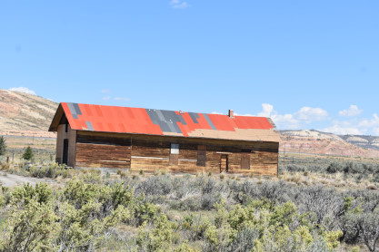
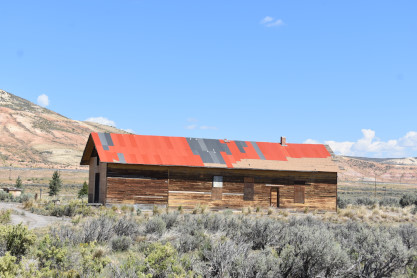
Union Pacific Fossil station built in 1883 by one of its predecessors, the Oregon Short Line. The Fossil Basin Institute is in the process of restoring it to its former glory. The railroad depot was part of the old Wyoming town of Fossil, near what is now Fossil Butte National Monument. The town's post office closed in the 1940s and in 1966 the highway was built straight through what was once Fossil. The depot was officially designated on the National Register of Historic Places in December 2013, with the help of the Fossil Basin Institute, which was established in May 2010 for the purpose of saving and restoring the Fossil Railroad Depot. The town of Fossil was actually moved once, and so the train depot moved along with it. In 1902, after the move, an addition created more space at the depot, and it has been in its current location ever since. The railroad depot officially stopped service in 1956.
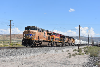
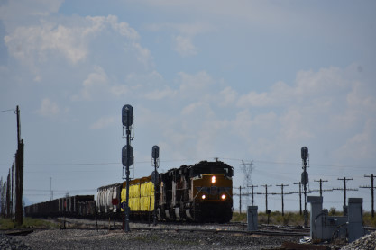
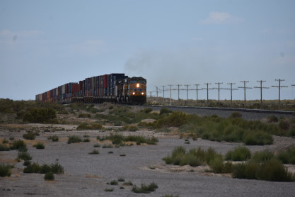
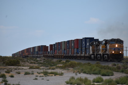
We drove west and caught up to a Union Pacific train and picked a grade crossing to photograph it.
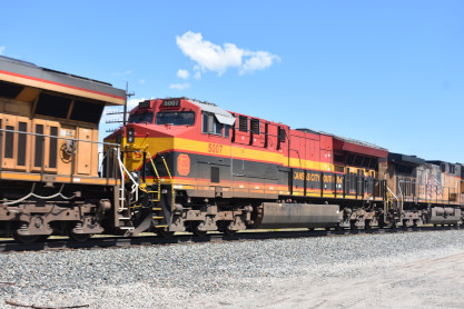
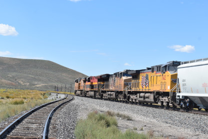
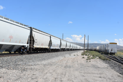
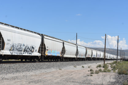
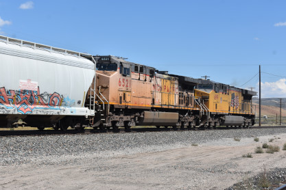
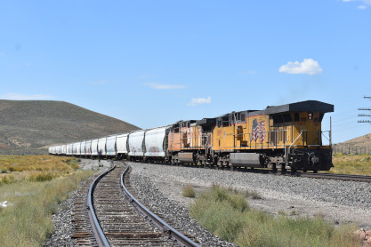
Union Pacific 7843 West at Cokeville. I drove us to the border of Idaho and stooped.
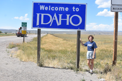
Elizabeth had never stepped into Idaho, but had been on the Empire Builder across it so we stopped for pictures of her in her 41st state. After this, road contruction delayed us enough that we had to change our routing.
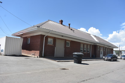
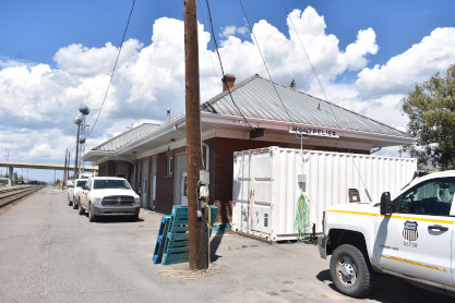
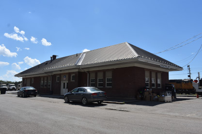
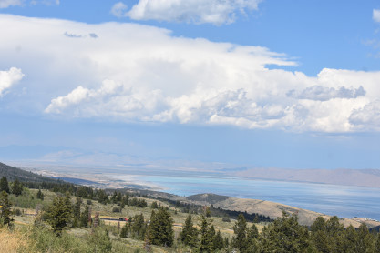
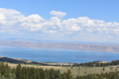
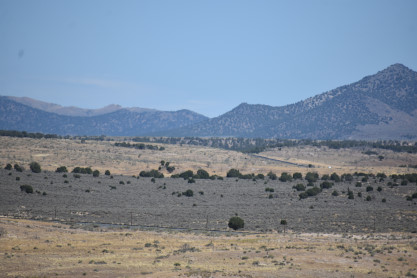
Union Pacific Montpelier station. From here we took US 89 south into Utah along Bear Lake and at Garden City, we drove up the hill and found a viewpoint and restroom stop.
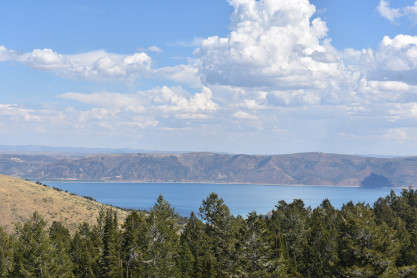
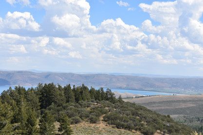
Bear Lake. We drove to Logan and got the car washed at Quick Quack Car Wash then drove over to Jersery Mike's for lunch. Elizabeth then drove us to Ogden to the Best Western High Country Inn. After settling into our room, we drove to the Ramblin Rose Dinner and I enjoyed the roast beef dinner and Elizabeth had a chef's salad. After that we just relaxed.
8/27/2022 We awoke after a good night's sleep and following our Internet browsing, we drove to the Black Bear Dinner and had a most wonderful breakfast. Elizabeth then drove us down Interstate 15 and I caught a train along that highway.
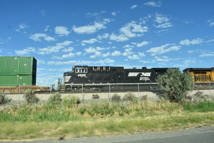
Norfolk Southern AC44C6M 4526 along Interstate 15. We took Interstate 215 to Interstate 80 to Saltair and our first stop of the day.
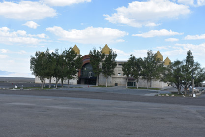
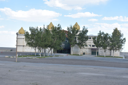
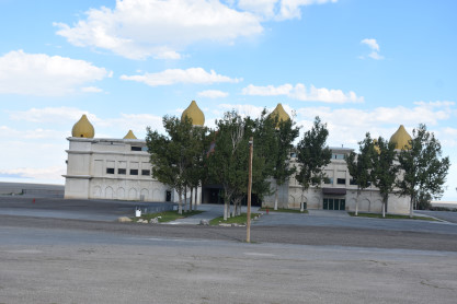
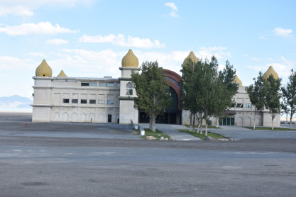
Saltair Palace is the Great Salt Lake has been a popular recreation site since the earliest days of white settlement, and a number of resorts have been built on its shores since the first two were constructed in 1870. The most popular and the best-remembered resort was the early Saltair. An important cultural symbol, it is deeply imbedded in Utah's history and has long interested artists, essayists, folklorists, and historians.
In 1893 the Mormon church built Saltair on the south shore of the Great Salt Lake, about sixteen miles from downtown Salt Lake City. They also built the railroad connecting the resort with the city. The church owned the resort until 1906, at which time it was sold to a group of private Mormon businessmen. The architect of Saltair was Richard K. A. Kletting, perhaps Utah's foremost architect at the turn of the century and the designer of the Utah State Capitol building.
In building Saltair the Mormon church had two major objectives: in the words of Mormon apostle Abraham H. Cannon, they wanted to provide "a wholesome place of recreation" under church control for Mormons and their families; and they also intended that Saltair be a "Coney Island of the West" to help demonstrate that Utah was not a strange place of alien people and customs. This was part of a larger movement toward accommodation with American society that had begun in the early 1890s as church leaders made a conscious decision to bring the church into the mainstream of American life. Saltair was to be both a typical American amusement park and a place that provided a safe environment for Mormon patrons. Those goals were somewhat incompatible, and in less than a decade the second had clearly triumphed at the expense of the first. Nonetheless, initially Saltair signified the Mormon church's intention to join the world while at the same time trying to minimize its influence and avoid its excesses.
Saltair opened on Memorial Day 1893, and was officially dedicated on 8 June. Its main attractions were always swimming in the Great Salt Lake, where people could bob around like corks, thanks to its 25 percent salt content, and dancing on what was advertised as the world's largest dance floor; but the resort always had a wide range of other attractions. They included a roller coaster, a merry-go-round, a ferris wheel, midway games, bicycle races, touring vaudeville companies, rodeos, bullfights, boat rides on the lake, fireworks displays and hot-air balloons.
Saltair reached the peak of its popularity in the early 1920s when it was attracting nearly a half-million people a year. However, in April 1925 it burned to the ground. Raymond J. Ashton and Raymond L. Evans designed a new pavilion along the general lines of the original one, and it was built the next year, but the resort never regained its former popularity. During the 1930s it had to battle the effects of the Great Depression; high maintenance costs as winds and salt spray ate away at wood and paint; a $100,000 fire in 1931; and receding lake levels, which in 1933 left it a half mile from the water. Saltair closed down during World War II. It reopened with high hopes after the war but continued to struggle, and it closed for good after the 1958 season. During the 1960's efforts to save it failed, and it stood forlorn and abandoned until fire destroyed it in November 1970.
In 1981 a new pavilion was built near the site of the original. It opened in July 1982, but struggled to survive as the lake first reached its highest level in history by 1984, putting the pavilion's main floor under five feet of water. In the late 1980s the water began to recede.
In the fall of 1992, the Great Salt Lake Land Company, headed by Salt Lake attorney and real estate developer Walter Plumb, bought the resort. Over the next six months the new owners restored the structure and added a concert stage where they intended to present local and national artists. It opened on 8 June 1993 -- Saltair's one hundredth anniversary.
Elizabeth drive us south to the Rio Tinto Tour center and we parked then checked in.
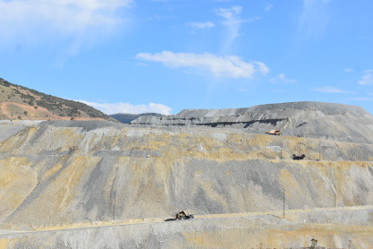
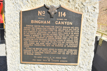
Bingham Canyon Copper MineBingham Canyon was a city formerly located in southwestern Salt Lake County in a narrow canyon on the eastern face of the Oquirrh Mountains. The Bingham Canyon area boomed during the first years of the twentieth century, as rich copper deposits in the canyon began to be developed, and at its peak the city had approximately 15,000 residents. The success of the local mines eventually proved to be the town's undoing, however: by the mid-twentieth century the huge open-pit Bingham Canyon Mine began encroaching on the community, and by the late twentieth century the Bingham townsite had been devoured by the mine. No trace of the former town remains today.
The geographic feature known as Bingham Canyon received its name from the location's two first settlers, the brothers Thomas and Sanford Bingham, who arrived in the canyon in 1848. Initially, the area was utilized for livestock grazing and logging, but the region's economic focus changed with the 1863 discovery of rich gold and silver ore bodies in the canyon. Mining activity in Bingham Canyon boomed after the Bingham Canyon and Camp Floyd Rail Road completed a line to the canyon in 1873, and as the region grew the focus shifted to the high-quality copper ores in the district. As the mines grew, the town of Bingham also expanded, spreading along the narrow and steep canyon floor below the mines.The Bingham Canyon mines experienced their greatest boom during the first years of the twentieth century, as the district's smaller mines were consolidated under large corporate ownership. The most significant development occurred in 1903, when Daniel C. Jackling organized the Utah Copper Company to begin surface mining at Bingham Canyon. The Utah Copper Company's mine prospered, and this brought a tremendous influx of new residents into the canyon. The town of Bingham Canyon was officially incorporated on February 29, 1904. By the 1920s, the city of Bingham Canyon was at its peak, with perhaps 15,000 inhabitants. Urban development spread for some seven miles along the single, narrow road winding up the steep canyon floor.
As with many western mining towns, the Bingham Canyon area evolved into a collection of diverse neighborhoods, many with pronounced ethnic affiliations. Many Scandinavians lived in the Carr Fork area, while southern and eastern Europeans congregated in Highland Boy, which was in another branch canyon toward the top of the main city. As the mainstreet in the bottom of the canyon grew, Copperfield became the name of the upper section of the main town. Bingham itself attracted British, French, Irish, Puerto Rican, Mexican, and other immigrants and ethnicities. Numerous other small neighborhoods and communities also existed. Most took the name of the mine where they were located. Commercial, Boston Con, and "the Niagara" were the first three communities to be mined away or covered, as the last one was by Galena Gulch waste dumps. Others were the Galena, Old Jordan, and Silver Shield (these three found in Galena Gulch), along with Niagara. Telegraph was in the upper part of the canyon, along with Copperfield, which was threatened when the mining excavating was expanded and a long one-way tunnel was built before 1940 to allow traffic to reach the upper communities. Many names were colorful: Terrace Heights, Dinkeyville, Jap Camp, and Greek camp were sections of Copperfield. The Frisco, Yampa, Phoenix and Apex were in Carr Fork along with Highland Boy. Further down the canyon were Markham, Freeman and Frog Town (lower Bingham).
The size and importance of the Bingham community began to fade as early as the 1920s. The canyon's difficult geography made urban development difficult, while exposing the town to the hazards of fire and avalanche. The first effort to reduce settlement in the canyon came in 1926, when Utah Copper established the town of Copperton on the flats east of the canyon mouth. This was a lovely community with many copper products used in the building of the houses, and the low rent encouraged company employees to live there. In 1956, Kennecott sold the homes to employees for $4,800 to $6,000. Increasing mechanization at the mine also reduced local employment-and hence, Bingham Canyon's population.>{?
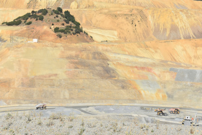
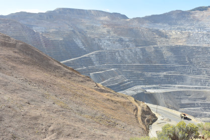
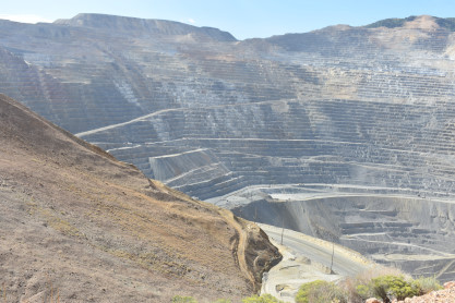
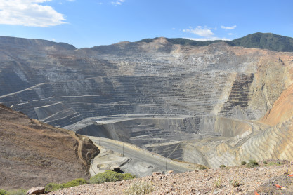
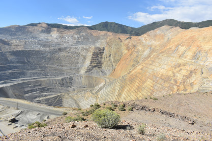
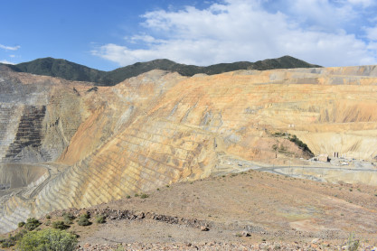
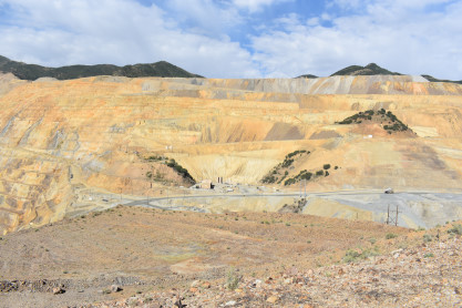
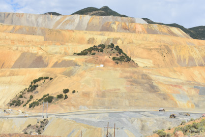
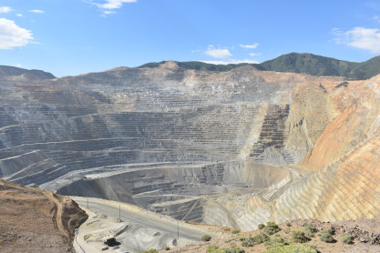
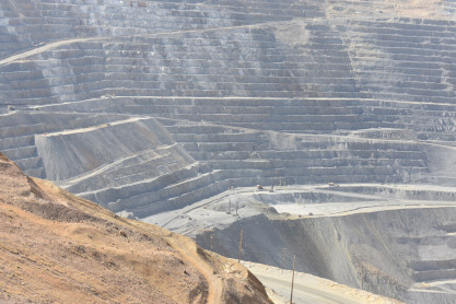
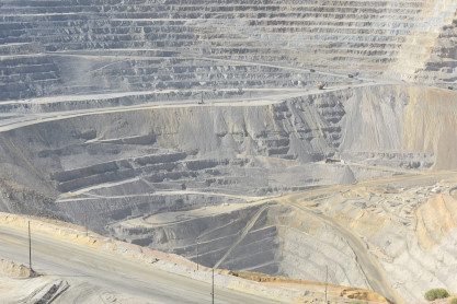
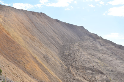
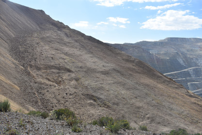
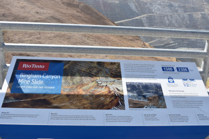
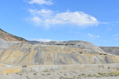
The Bingham Canyon Mine, more commonly known as Kennecott Copper Mine among locals, is an open-pit mining operation extracting a large porphyry copper deposit southwest of Salt Lake City. The mine is the largest man-made excavation in the world and is considered to have produced more copper than any other mine in history - more than 19 million tons. The mine is owned by Rio Tinto Group, a British-Australian multinational corporation. The copper operations at Bingham Canyon Mine are managed through Kennecott Utah Copper Corporation which operates the mine, a concentrator plant, a smelter, and a refinery. The mine has been in production since 1906, and has resulted in the creation of a pit over 0.6 miles deep, 2.5 miles wide, and covering 1,900 acres (three square miles). It was designated a National Historic Landmark in 1966 under the name Bingham Canyon Open Pit Copper Mine. The mine experienced a massive landslide in April 2013 and a smaller slide in September 2013. We boarded the buses and we were driven into the mine to the observation point. On the way in trucks were very busy moving ore to the conveyor belts. The old way of mining copper. From the top level I shot these pictures, then started down to the lower level. The north side of the mine. Looking down in the pit. A major slide zone, Manefey Landslide, that closed the production down for weeks. Bingham Canyon Historical Sign. Manefey Landslide occurred on April 9th, 2013. My last view of the mine. I have enjoyed my three visits to Bingham Canyon. Elizabeth, however, was extremely disappointed. She knew nothing about copper mining and was rightfully expecting a welcome and introduction during the tour bus ride to the overlook. Nothing like that occurred and the video screen at the front of the bus remained blank. When someone greeted the bus with a stepstool, Elizabeth exited and expected a short speech on what we were going to see, some details, statistics or the like. Again, absolutely nothing. Everyone was left to their own devices and although there were a half a dozen or so signboards and a history timeline of the Rio Tinto company, she was very underwhelmed by the whole experience. A tour should always have a welcome and some introduction and situational awareness of what one is going to see and this tour had none of that, and I agree with her. The last time I took the tour, in 2019, the video was shown on the way back (not the ideal time) and in the 1970's, trains ran instead of the conveyor belt. Elizabeth took the Bacchus Highway to West 11800 South and turned right on to Utah 85, south to Utah 68 along Utah Lake to US 6, which we took west. Rails and the old grade of the Denver and Rio Grande Tintic branch. An old bridge from the Denver and Rio Grande Tintic branch.
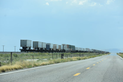
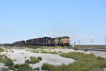
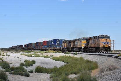
After passing through Eureka, Elizabeth drove us to the junction at Mammoth and I drove south for a while. At Lynndyl we found Union Pacific 8628 East waiting for a train. I drove us to Delta and we caught up to the train then turned down Utah 257 and the chase was on. Elizabeth photographed that train as we drove south. The last train of the trip, Union Pacific 5408 West at Clear Lake siding. We drove in Milford and gassed up the car then switched the driver. We went througgh some heavy rains on the way to Cedar City where we stopped at the Sizzler for dinner, Elizabeth then drove us the Mesquite where we checked into the Best Western Plus for the night. 8/28/2022 We arose on the last day of the trip and following our e-mail and Internet, we checked out and went to McDonald's for breakfast as there were really no decent breakfast restaurants in Mesquite. I drove us west on Interstate 15 to US 97 for petrol. We made it through Las Vegas with no problems but at Primm, the day fell apart. We were in a major traffic jam and moved very slowly down the highway and after an hour-and-a-half, we switched drivers. At the top of the grade, Interstate 15 was down to one lane. After a three-hour delay we passed that and were back up to normal speed, heading home. At Cima Road we picked up snacks then had no problems for a while. We stopped at Jersey Mike's on Lenwood Road in Barstow for dinner then encountered the normal traffic in Cajon Pass. From here it was Interstate 15 and CA Highway 91 to CA Highway 55 and off at Chapman Avenue and back to our apartment, where this wonderful and adventurous trip was complete. Over the past three weeks, we drove 7,065 miles.
RETURN TO THE MAIN PAGE