


We woke up at the River Inn in Susanville and after checking our Internet, Elizabeth and I went to breakfast at Lumberjacks Restaurant. Afterwards, I drove us to Westwood and we went depot hunting and found our target.
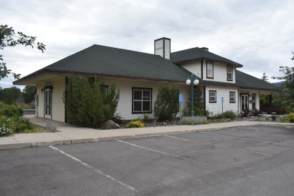
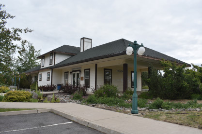
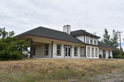
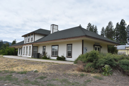
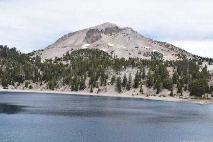
Southern Pacific Westwood station. From here we were on CA Highway 36 and got into a traffic mess due to today being Independence Day. While stopped I had the opportunity to take the following picture.
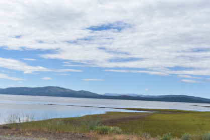
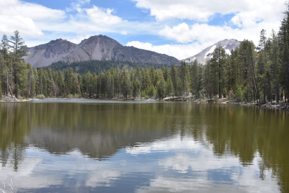
Lake Almanor. The town of Chester shut down the main highway for a parade so we took a detour on 1st Avenue to Watson Road then back to CA Highway 36 which meant no Collins Pine Museum or a steam engine, but the museum was not open today anyway. From here we took CA Highway 36/89 to CA 89 to Lassen National Park where I paid for a new American the Beautiful Pass senior pass so we could use it at various National Parks in the country. We then entered the park.
Mount Lassen National ParkLassen Volcanic National Park is an American national park in northeastern California. The dominant feature of the park is Lassen Peak, the largest plug dome volcano in the world and the southernmost volcano in the Cascade Range. Lassen Volcanic National Park is one of the few areas in the world where all four types of volcano can be found-plug dome, shield, cinder cone and stratovolcano.
The source of heat for the volcanism in the Lassen area is subduction of the Gorda Plate diving below the North American Plate off the Northern California coast. The area surrounding Lassen Peak is still active with boiling mud pots, fumaroles and hot springs.
HistoryThe Atsugewi have inhabited the area since long before white settlers first saw Lassen. They knew that the peak was full of fire and water and thought it would one day blow itself apart.
European immigrants in the mid-19th century used Lassen Peak as a landmark on their trek to the fertile Sacramento Valley. One of the guides to these immigrants was a Danish blacksmith named Peter Lassen, who settled in Northern California in the 1830s. Lassen Peak was named after him. Nobles Emigrant Trail was later cut through the park area and passed Cinder Cone and the Fantastic Lava Beds.
Inconsistent newspaper accounts reported by witnesses from 1850 to 1851 described seeing "fire thrown to a terrible height" and "burning lava running down the sides" in the area of Cinder Cone. As late as 1859, a witness reported seeing fire in the sky from a distance, attributing it to an eruption. Early geologists and volcanologists who studied the Cinder Cone concluded the last eruption occurred between 1675 and 1700. After the 1980 eruption of Mount St. Helens, the United States Geological Survey (USGS) began reassessing the potential risk of other active volcanic areas in the Cascade Range. Further study of Cinder Cone estimated the last eruption occurred between 1630 and 1670. Recent tree-ring analysis has placed the date at 1666.
The Lassen area was first protected by being designated as the Lassen Peak Forest Preserve. Lassen Peak and Cinder Cone were later declared as U.S. National Monuments in May 1907 by President Theodore Roosevelt.
Starting in May 1914 and lasting until 1921, a series of minor to major eruptions occurred on Lassen. These events created a new crater, and released lava and a great deal of ash. Fortunately, because of warnings, no one was killed, but several houses along area creeks were destroyed. Because of the eruptive activity, which continued through 1917, and the area's stark volcanic beauty, Lassen Peak, Cinder Cone and the area surrounding were declared a National Park on August 9, 1916.
The 29 mile Main Park Road was constructed between 1925 and 1931, just 10 years after Lassen Peak erupted. Near Lassen Peak the road reaches 8,512 feet, making it the highest road in the Cascade Mountains. It is not unusual for 40 feet of snow to accumulate on the road near Lake Helen and for patches of snow to last into July.
In October 1972, a portion of the park was designated as Lassen Volcanic Wilderness by the Congress. The National Park Service seeks to manage the wilderness in keeping with the Wilderness Act of 1964, with minimal developed facilities, signage and trails. The management plan of 2003 adds that "The wilderness experience offers a moderate to high degree of challenge and adventure".
In 1974, the National Park Service took the advice of the USGS and closed the visitor center and accommodations at Manzanita Lake. The Survey stated that these buildings would be in the way of a rockslide from Chaos Crags if an earthquake or eruption occurred in the area. An aging seismograph station remains. However, a campground, store and museum dedicated to Benjamin F. Loomis stands near Manzanita Lake, welcoming visitors who enter the park from the northwest entrance.
After the Mount St. Helens eruption, the USGS intensified its monitoring of active and potentially active volcanoes in the Cascade Range. Monitoring of the Lassen area includes periodic measurements of ground deformation and volcanic-gas emissions and continuous transmission of data from a local network of nine seismometers to USGS offices in Menlo Park, California. Should indications of a significant increase in volcanic activity be detected, the USGS will immediately deploy scientists and specially designed portable monitoring instruments to evaluate the threat. In addition, the National Park Service has developed an emergency response plan that would be activated to protect the public in the event of an impending eruption.
The Lassen Chalet, a large lodge with concession facilities was located near the southwest entrance but was demolished in 2005. A new full-service visitor center in the same location opened to the public in 2008. The Lassen Ski Area was located near the lodge; it ceased operation in 1992 and all infrastructure has been removed.
In August 2021, the Dixie Fire burned 40,928 acres within the park.
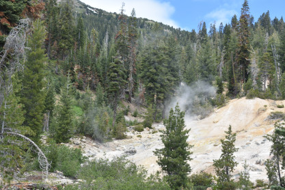
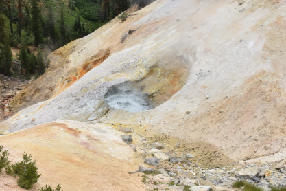
Our visitI drove Elizabeth to the first stop at the Sulphur Works where we parked. My parents had bought me here in the late 1960s.
One of the boiling mud pots.
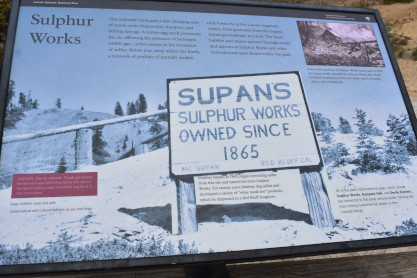
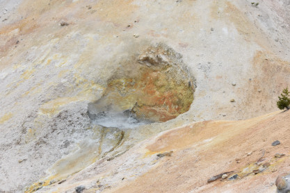
The information board about the Sulphur Works.
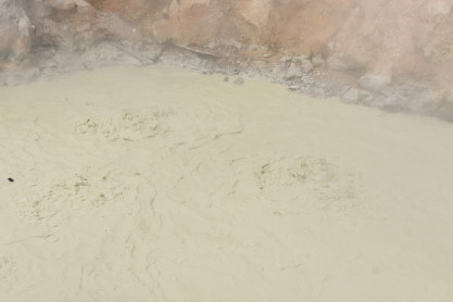
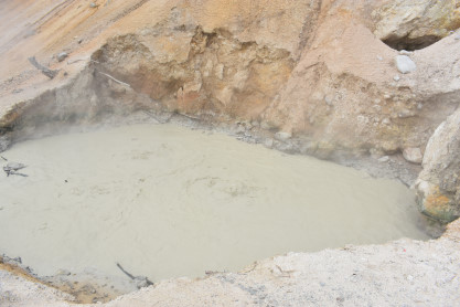
Boiling mud pot with the smell of sulphur.
More boiling mud pots with a distinct smell.
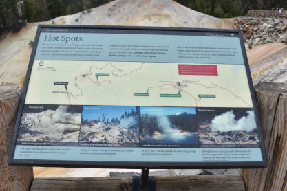
Information board about Hot Spots. From here we drove on north.
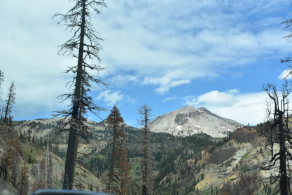
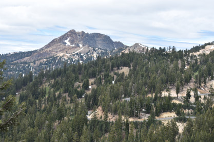
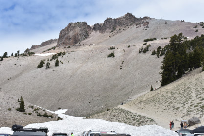
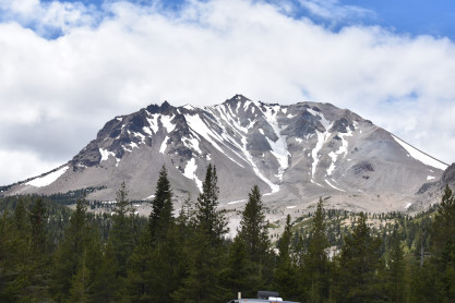
Lassen Peak 10,437 foot. We stopped at the Bumpass Trailhead.
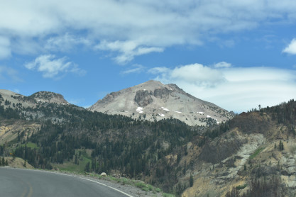
Lassen Peak.
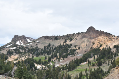
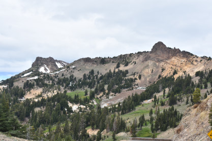
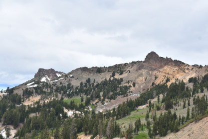
Brokeoff Mountain at 9,235 feet.
Loomis Peak at 9,542 feet.
A view to the south Bumpass Mountain at 8,736 feet. We next stopped at Helen Lake.
Brokeoff Mountain.
Lassen Peak.
Our next stop was at Lassen Peak Trailhead.
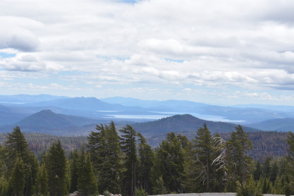
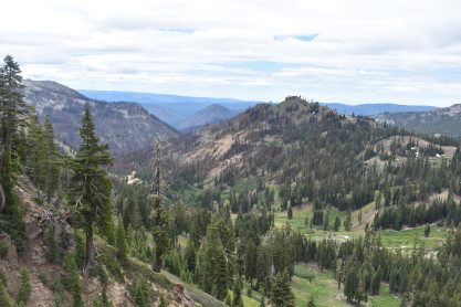
That was followed by Kings Creek Picnic Area where you can see Lake Alamanor.
The next viewpoint was at Summit Lake South.
The Devastated Area was the next stop. This side of the mountain blew off during the last eruption in 1915.
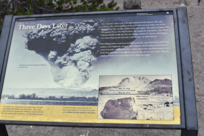
Three Days Later information board.
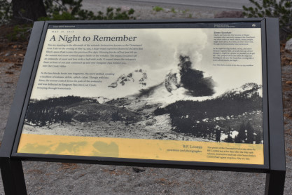
A Night to Remember information board. From here we drove to Hot Rock.
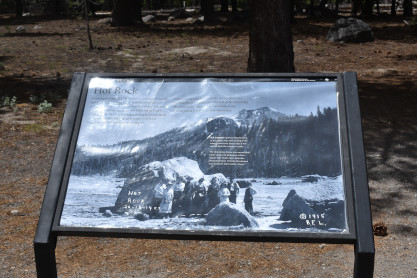
The Hot Rock information board.
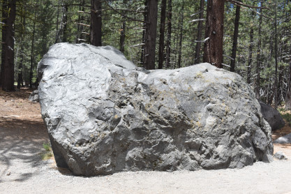
This Hot Rock was ejected from the volcano during its last eruption.
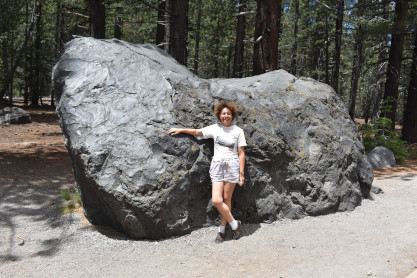
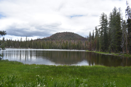
Elizabeth and Hot Rock. From here we drove to Reflective Lake and hiked to the north end.
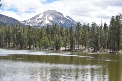
Loomis Peak and Mount Lassen.
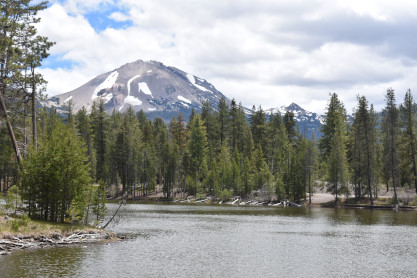
Two more views of Mount Lassen. From here we exited the park then drove CA Highway 89 to CA Highway 299 which we took to Burney but could not find the depot. So Elizabeth drove us to Redding where we checked into the Rodeway Inn for the night. That evening we went to the Hilltop Diner where I enjoyed a French Dip sandwich and Elizabeth a chicken pot pie then returned to the hotel for the evening.
| RETURN TO THE MAIN PAGE |