


West Coast Rail Tours advertised the "Bite of the Rock" Winter Festival Special Steam Excursion featuring Canadian Pacific Royal Hudson 2860 which would take place a few days before the 2010 Winter Olympic Games commenced in Vancouver. In addition, the City of Vancouver and the City of Brussels, Belgium had partnered on a demonstration project where two Belgian streetcars would be sent to Vancouver for the duration of the Olympics. I told Chris Guenzler about these events and he quickly decided to join us as he had not ridden behind the Royal Hudson before and there were Skytrain and light rail lines to ride also, plus a heritage streetcar to tour. Our weekend plans were now set.
On February 5th, after taking the Coast Starlight to Portland then Amtrak Cascades to Seattle, Bob and I picked up Chris at King Street Station and we took him to Snoqualmie Casino to have dinner and see a concert. Bob and I drove back to Seattle to see the musical "South Pacific" at the 5th Avenue Theatre, then drove back to Snoqualmie to pick him up and take him to Lynnwood for the night.
February 6th
The first stop of the day was Heritage Park in Lynnwood, where Seattle Everett Interurban 55 is on display. It is one of six interurban electric rail cars that provided commuter service from Alderwood Manor to Seattle and Everett from 1910 to 1939. The interurban was key to the development of Alderwood Manor and Snohomish County. People from the big cities travelled by trolley to relocate in the country, breathe the un-contaminated fresh air and learn how to raise poultry for profit at the Demonstration Farm. After the demise of the Interurban in 1939 due to the popularity of the automobile, Car No. 55 was retired, serving as a diner for several years, and in 1964, as a ticket office for the Snoqualmie Valley Railroad. The City of Lynnwood purchased the car in 1993 and began its restoration in 1996 with state and federal grants. Car No. 55 is the last remaining car of the original six that has been restored.
The first trip for the press of the Seattle-Everett Traction Company was April 30th, 1910 and the first public trip was two days later. The journey took an hour and thirty-five minutes to run the 26 miles with 29 stops from Seattle to Everett.
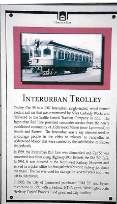
Arrangements had been made with Heritage Park for a 10:00 tour. We arrived and were met by Laurie Cowan and I started my photography with the information plaque on the wall of the open-sided building where No. 55 rests.
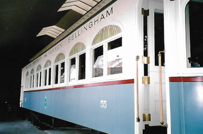
Seattle Everett Interurban car 55.
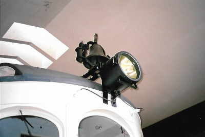
The headlight and bell.
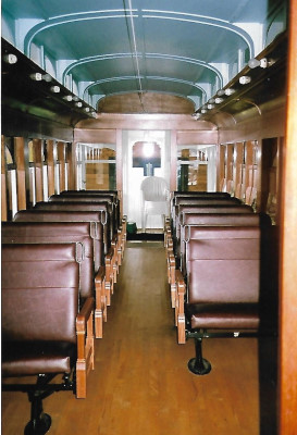
The refurbished interior of Car 55.
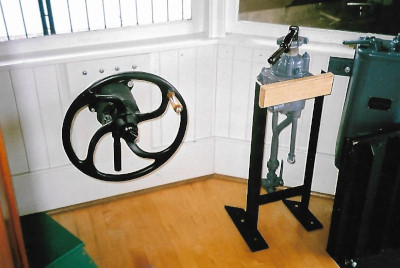
The control stand.
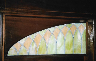
New stained glass above the windows.
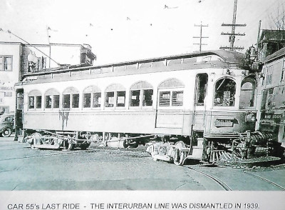
Photograph of the last run of this interurban car. Laurie then took us into the museum and a room dedicated to No. 55.
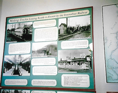
One of the displays about Seattle-Everett Interurban Railway.
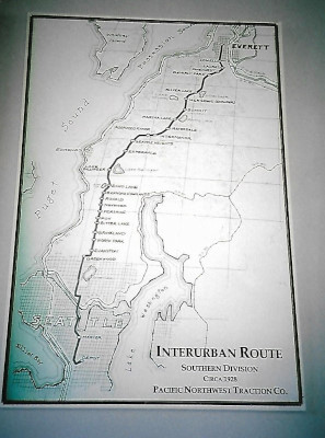
The Interurban Route.
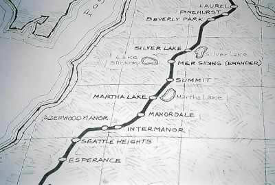
Close-up of the Alderwood Manor section. We then drove into Seattle, parked at Westlake Centre and walked over to the Westlake station of the South Lake Union Streetcar.
About the StreetcarOn December 12th 2007, the South Lake Union Streetcar begins service on a 1.3 mile route through Seattle's South Lake Union neighbourhood. Operated by King County Metro, the South Lake Union Streetcar marks the neighborhood's first streetcar service since 1941 and the first new rail line in Seattle since the waterfront streetcar (out of service since late 2005) was put into service in 1982.
RouteThe Seattle Streetcar connects Downtown Seattle to Denny Triangle and South Lake Union. Northbound trains begin at McGraw Square in Downtown Seattle, located next to the Westlake Center and Pacific Place. The terminal is also part of the Westlake transit hub, which includes the Seattle Centre Monorail terminal at Westlake Center and the Westlake station in the Downtown Seattle Transit Tunnel for Link trains. The dual-tracked line travels north via a set of curbside transit-only lanes on Westlake Avenue and stops at 7th Avenue to serve the Amazon headquarters campus (including the Amazon Spheres) and the U.S. Courthouse. The streetcar passes several high-rise office and residential buildings before reaching its next stop, located between 9th Avenue (Blanchard Street) and Denny Way just east of Denny Park. The northbound track splits from Westlake Avenue at Thomas Street, running parallel one block to the east on Terry Avenue; a set of platforms between Thomas and Harrison streets serve the center of South Lake Union's office district. The northbound track is also connected to a spur track along Harrison Street that travels east to the line's operations and maintenance facility. After stopping between Mercer and Republican streets, the parallel streetcar tracks pass through the Google campus and rejoin on the north side of Valley Street, stopping at the entrance of Lake Union Park near the Museum of History & Industry and Centre for Wooden Boats at a former naval armory. The tracks briefly travel east before turning northeast onto Fairview Avenue, traveling in the street's median for one block. It reaches the streetcar's northern terminus at Campus Drive on the Fred Hutchinson Cancer Research Center campus, while a tail track continues north for a half-block to allow vehicles to switch tracks.
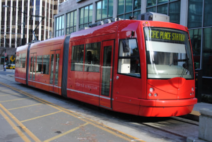
The Seattle Streetcar at Westlake Station, the terminus of the line.
At Campus Drive, the other end of the line. Once we had ridden a round trip, it was a short walk to the Westlake station of Link Light Rail where we boarded a Link train.
Link Light RailLink Light Rail currently serves Seattle, SeaTac and Tukwila, using trains of two to four cars that each carry 194 passengers. It connects the University of Washington and Downtown Seattle to the Rainier Valley and Seattle-Tacoma International Airport, using tunnels, elevated guideways, and surface-running sections. The line carries 23 million passengers annually and 72,000 on an average weekday, making it the busiest transit route in the Seattle region. The initial 13.9 mile segment of the line was opened on July 18th 2009, connecting the Downtown Seattle Transit Tunnel (a facility shared with buses until 2019) to Tukwila International Boulevard station. The line has since been expanded three times and spans 20.35 miles.
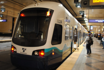
Our Link train at the Downtown Transit Tunnel.
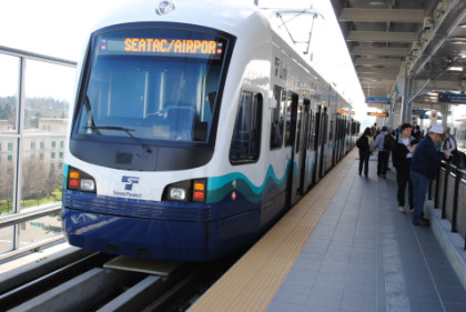
We rode it to Sea-Tac Airport which was the terminus in 2010. The line was extended to Angle Lake in 2016.
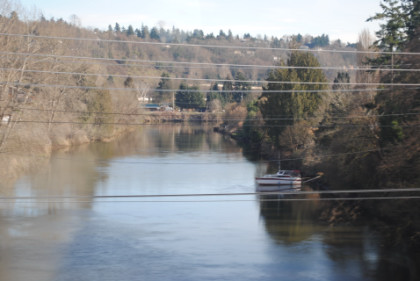
The Duwamish Waterway as seen from the train.
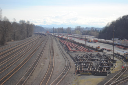
The BNSF Stacy Yard was empty this Saturday afternoon. We returned to Westlake Centre and drove home, then went to Black Angus for dinner before I helped Chris with today's story in the evening.
February 7thAfter breakfast, Bob dropped Chris and I off at the Edmonds station and he drove up to Vancouver so we would have a car to drive home the next
day.
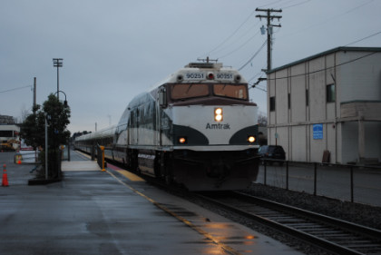
Amtrak Cascades 517 at Edmonds station. The two of us boarded Car 5 and enjoyed our ride, arrived at Pacific Central Station on time. After going through Customs and meeting up with Bob, we checked in to the Quality Inn Downtown, then walked over to the Yaletown/Roundhouse station of the Canada Line for our first ride on this new route which opened in August 2009.
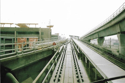
Canada Line History and RouteThe Canada Line is a rapid transit line in Greater Vancouver, British Columbia and is part of the SkyTrain system. The line is owned by TransLink and InTransitBC, and is operated by ProTrans BC. It operates as an airport rail link between Vancouver, Richmond and Vancouver International Airport. The line comprises 16 stations and 11.9 miles of track; the main line runs from Vancouver to Richmond while a 2.5 mile spur line from Bridgeport station connects to the airport. It opened on August 17th, 2009, ahead of the 2010 Winter Olympics.
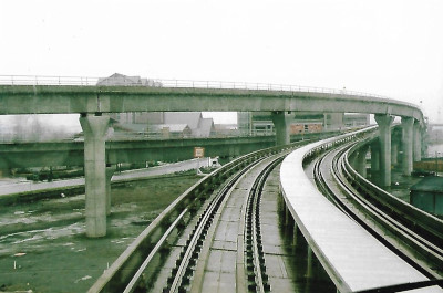
It begins in Downtown Vancouver at Waterfront station in a cut-and-cover subway tunnel beneath Granville Street. It quickly goes into twin-bored tunnels, heading southwest beneath Granville Street, then curving southeast to follow Davie Street through Yaletown. The tunnels then dive deeper to pass below False Creek before rising back up to Olympic Village station. There, the line transitions back to a cut-and-cover tunnel (which is noted by the tunnel changing from a circular to a square shape) heading south under Cambie Street, some portions of which have the two sets of tracks stacked vertically. The line emerges from the ground just south of 64th Avenue, climbing to an elevated guideway. The line continues elevated across the North Arm Bridge over the North Arm of the Fraser River, leaving Vancouver and entering Richmond. Just beyond Bridgeport station at the flying junction, the line splits, with the Richmond branch heading south on elevated tracks along No. 3 Road and terminating at Richmond-Brighouse station. The airport branch turns west and crosses the Middle Arm Bridge over the Middle Arm of the Fraser River, connecting to stations on Sea Island and terminating at YVR-Airport station. Portions of the airport branch are at grade in order to accommodate a future elevated taxiway for aircraft over the line. Both branches narrow to a single track as they approach their respective terminus stations. Just before Bridgeport station is the OMC (Operations and Maintenance Centre) facility, which houses the trains when not in use.
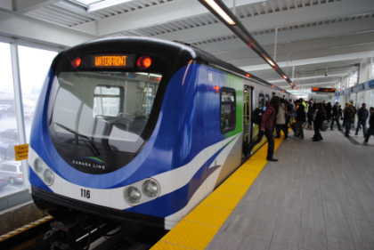
Canada Line train at Yaletown-Roundhouse before we boarded, bound for Bridgeport. We were very soon in the tunnel.
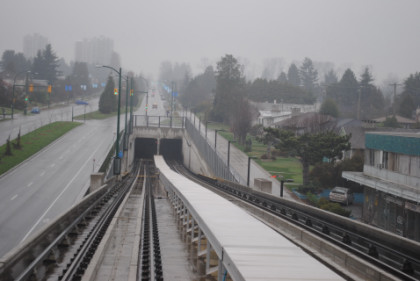
The route exited the tunnel just before the Marine Drive Station.
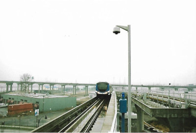
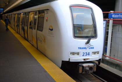
Canada Line train approaching Bridgeport station on a cloudy and damp day.
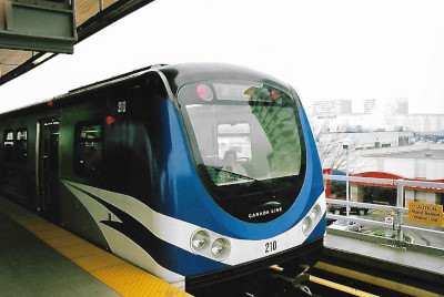
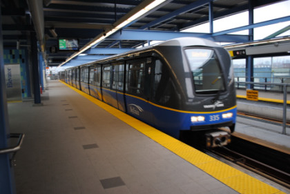
A Waterfront bound train at Bridgeport Station, with myself in the 'railfan' seat.
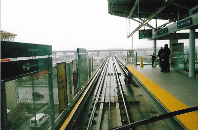
Our train departing Bridgeport station.
Two views of the junction between the Richmond Line (left) and the Airport Line (ahead).
A Waterfront-bound Canada Line train arriving at Olympic Village station. We detrained and followed the signs to our next train ride, another new line (and mode) for us. This was the experimental streetar line from Olympic Village to Granville Island.
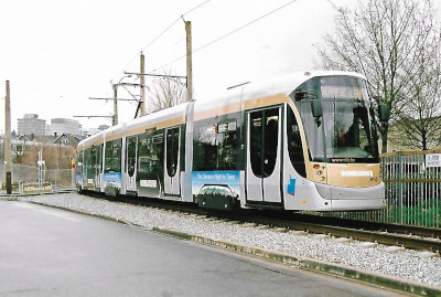
Experimental Streetcar LineFrom January 21st to March 21st, 2010, a 1.1 mile free demonstration service called the "Olympic Line" (named for the 2010 Winter Olympics) ran every six minutes, 18 hours a day on the Downtown Historic Railway between Cambie Bridge and Granville Island, using two modern Bombardier Flexity Outlook streetcars, numbers 3050 and 3051, borrowed from the Brussels tram system. The City of Vancouver and the administrators of Granville Island paid $8.5 million for associated upgrades to the infrastructure. The City considered the streetcar demonstration "a tremendous success", with over 550,000 boardings during the two months of the experiment. Bombardier received an award for "Exceptional Performance and Outstanding Achievement" at the 2010 CUTA awards, recognizing its operation of over 13,000 one-way trips with zero equipment failures, zero station delays and zero injuries. The Mayor of the day, Gregor Robertson, indicated a desire to continue operation of the line, with a potential extension to Main Street - Science World Station via False Creek South, but mentioned that the city alone lacks the millions of dollars needed to complete the construction and equipment purchases. Nonetheless, a streetcar along the alignment used by the Olympic Line was part of two of the proposals for rapid transit running east-west through the city of Vancouver in 2020. After the Olympic demonstration line ended, most of the overhead copper wires fell victim to theft and the line has remained unused.
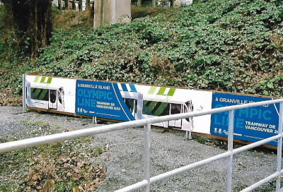
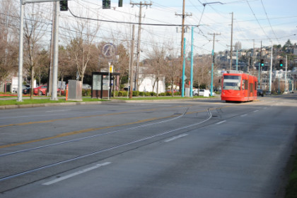
The Granville Island Olympic Line banner.
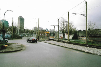
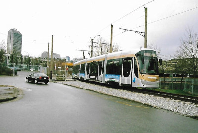
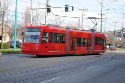
Our first views of the Belgian streetcars.
Front view.
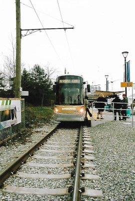
It was very popular and once we boarded, there was standing room only.
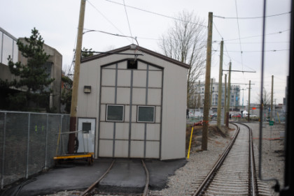
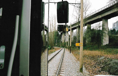
Once underway, we passed the streetcar barn of the Downtown Historic Railway, which operated on this trackage from 1998 to 2011.
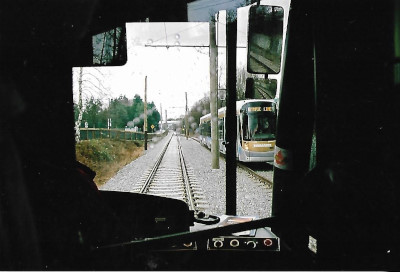
At the midway point, there is a siding and we passed the other streetcar.
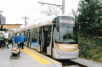
View looking ahead. We reached the Granville Island station and detrained.
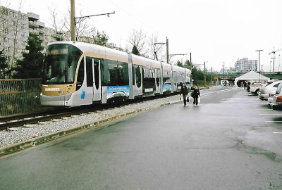
Our streetcar at Granville Island. We then reboarded for the return trip.
On the way back, we caught this Belgian streetcar parked behind the Downtown Historic Railway carbarn. Upon arrival at Olympic Village, we boarded a Skytrain to Waterfront Station and walked through the elevated covered bridge over the Canadian Pacific tracks.
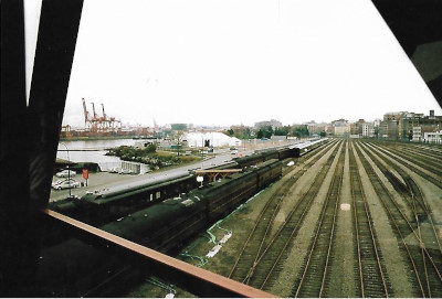
Canadian Pacific business cars and the Royal Canadian Pacific excursion cars parked at the former Canadian Pacific Station for the Olympics.
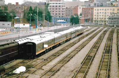
The Kansas City Southern business car fleet was also here.
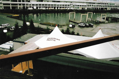
Canadian Pacific hospitality tent. Our train riding was not over yet though.
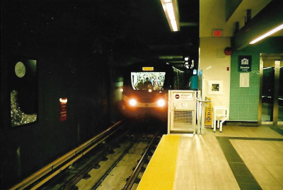
SkyTrainThe Expo Line is the oldest line of the SkyTrain rapid transit system in the Greater Vancouver region of British Columbia. The line is owned and operated by BC Rapid Transit Company, a subsidiary of TransLink, and links the cities of Vancouver, Burnaby, New Westminster and Surrey. The Expo Line travels underground from Waterfront to Stadium-Chinatown station, mainly through the Dunsmuir Tunnel, a tunnel that had been used by the Canadian Pacific Railway to connect its mainline tracks along Burrard Inlet to its former yard on False Creek. The line is elevated from Stadium- Chinatown to New Westminster stations, except for short at-grade sections between Nanaimo and Joyce-Collingwood stations in East Vancouver, and around the SkyTrain yards at Edmonds station in Burnaby. The line travels underground for a short stretch between New Westminster and Columbia stations. Just east of Columbia is a junction where the line splits. One branch crosses the Fraser River, via the SkyBridge, and is elevated for the rest of its run through Surrey, with King George as its terminus station. The other branch continues through New Westminster, first through a tunnel and then elevated until it terminates at Production Way-University in Burnaby. From just west of Nanaimo station all the way to New Westminster station, the Expo Line follows B.C. Electric's former Central Park Line, which carried interurbans between Vancouver and New Westminster from 1890 to the early 1950s.
The Millennium Line is the second line of the SkyTrain and links the cities of Vancouver, Burnaby, Coquitlam and Port Moody. The line was opened in 2002 and was named in recognition of the new millennium. The Millennium Line operates from VCC-Clark station in Vancouver to Lafarge Lake-Douglas station in Coquitlam. The line is elevated to Burquitlam station, where it then goes through a 1.2 mile bored tunnel to the City of Port Moody. In Port Moody, the line runs at grade level, rising to cross railway tracks. From Coquitlam Central station, the line is elevated to the terminus at Lafarge Lake-Douglas station.
The three of us went back into Waterfront Station and boarded a Skytrain Expo Line train to Commercial Broadway, where we transferred to the Millennium Line.
Our Skytrain at Commercial Broadway.
Passing a westbound Skytrain in the original livery of the line.
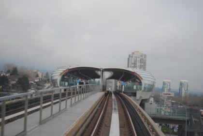
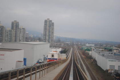
Some of the station architecture seems out of this world, such as the Brentwood station. We transferred back to the Expo Line and caught a train
bound for King George but detrained at New Westminster and walked over to the Keg Restaurant in the former Canadian Pacific Railway station.
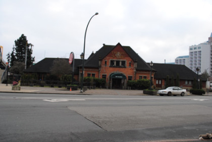
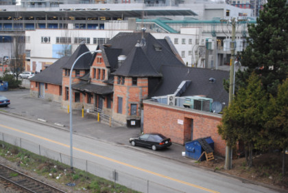
The 1899 Canadian Pacific Station in New Westminster.
After a very good meal, we took Skytrain back to Waterfront, transferred to the Canada Line to ride it as far as the Yaletown/Roundhouse station and walked back to the hotel for the night.
| RETURN TO THE MAIN PAGE |