Mid September of 2014 saw several new wildfires break out in Northern California. One of these, which started
in Pollock Pines along the US 50 Highway corridor, became known as the King Fire.
Over the next few weeks it would
go on to burn over 97,000 acres between its starting point and French Meadows Resevoir to the north.
Lying within the heart of the burnt area are the timber lands of Sierra Pacific Industries, once the Michigan-California Lumber Company
in this area. The majority of these lands were affected by the time the fire was contained.
Among the many historical
logging camp site burnt over are Camps 6, 7, 9, Claussenius, Old Pino, Cable Point, and even Pino Grande itself. Below are some images
taken from the fire perimiter map.
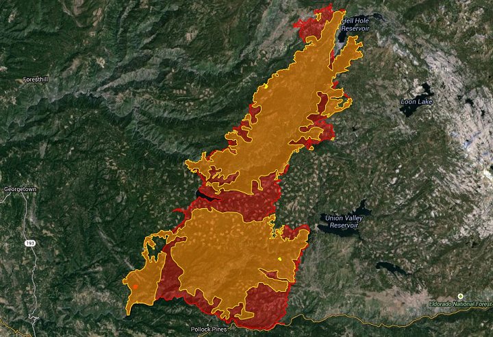
1. An overall view of the final fire perimeter. The dappled area are a series of logging clear cuts along
with previous lands cut over and recovering. This is all SPI, former Michigan-California, territory. As can be seen,
a huge preportion was affected.
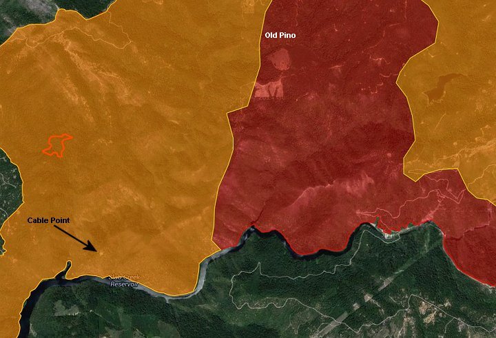
2. Cable Point and Old Pino within the fire boundery.
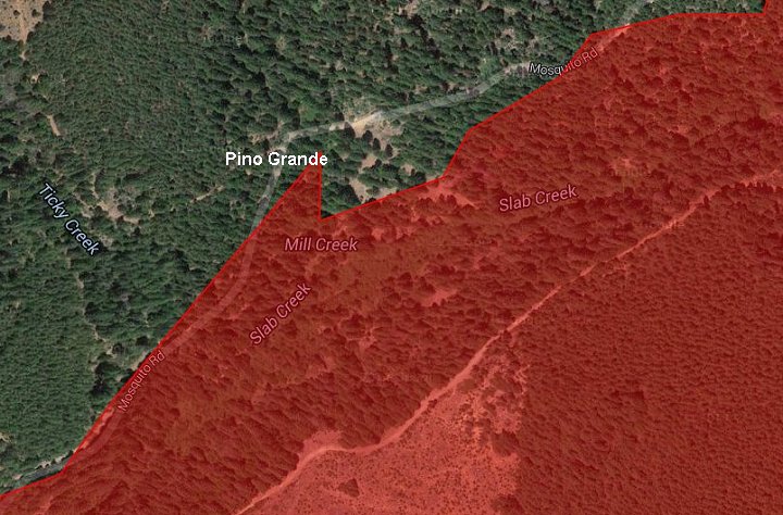
3. The Pino Grande location. In order to contain the fire, Mosquito Road was used as a base line and backfires
were lit here to burn into the fire and rob it of fuel to expand. Within the image it appears that only the mill and pond site
were burned by this backfiring procedure and not the rest of the site. Only later inspection will tell.
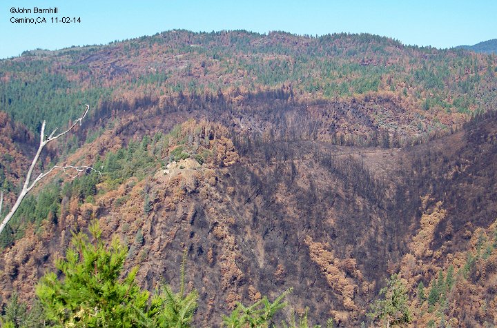
4. View of the burnt site of Cable Point and right of way heading toward Old Pino and eventually Pino Grande. Taken from just above South Cable.
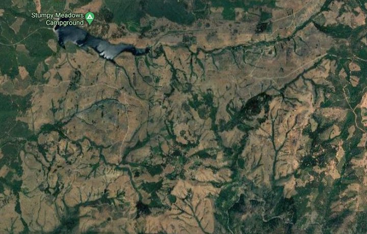
5. The years since the fire have seen much of the burnt timber logged off as evidenced by this 2020 Google Earth view.
When viewed closer on Google earth, this logging has exposed many miles of old railroad roadbed.


===============================================
This page and underlying code ©2014-2026 Barnhill Web Design unless noted.