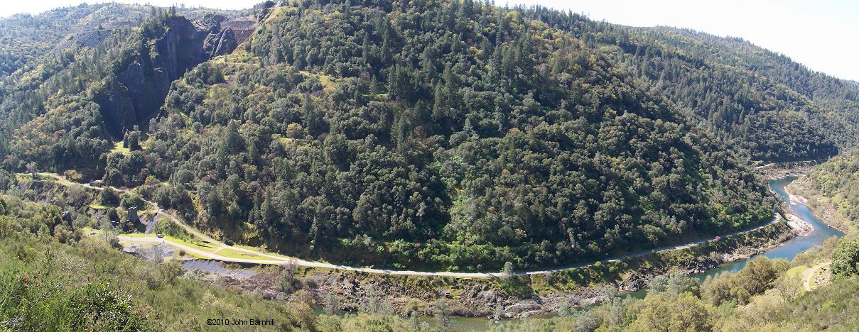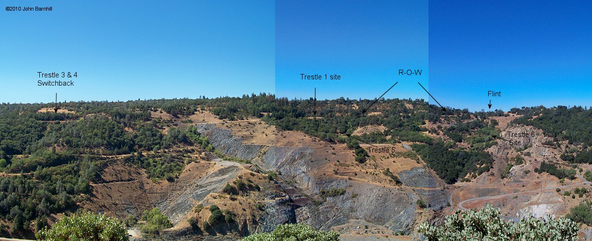
In this view taken from the south side of the canyon, starting at Flint(upper right), where the railroad connected to the Southern Pacific mainline and enters the canyon, the right of way works its way downgrade from right to left to a switchback. At this point it reverses direction eastward towards its eventual end at the quarry. Most of this area has been altered so badly due to construction prep for the proposed Auburn Dam that nothing remains. From Flint to the Trestle 1 site is now a paved road and nothing of the trestle itself exists anymore, though the site can basically be found. The hills and gully where Trestle 2 stood no longer exist. A paved road does continue over to Trestles 3 & 4 at the site of the switchback but does not follow the original line of the railroad. From this point back towards Trestle 5 is also completely wiped off the earth, though a short piece of roadbed can be found just across yet another road. The site of Trestle 6 is also obliterated with no remains or even landmarks. Just around the next hill though, the roadbed finally starts to show up with little alteration.
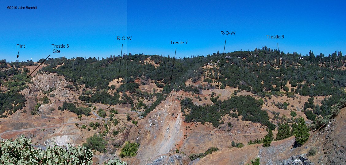
The next gully was crossed by one of the largest trestles on the line, Seven. New trailwork here provides great access that now continues the rest of the length of the line. Two cuts lead around the next hill to Trestle 8, which in turn is followed by another large cut that leads to the next trestle.
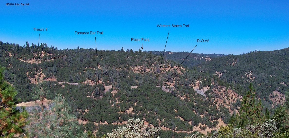
In this eastward view of Robie Point, we see the line used large fills from Trestle 9 to the tip of the point.
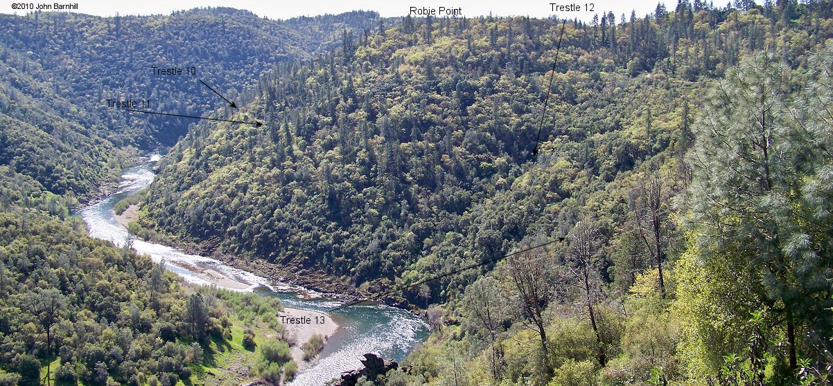
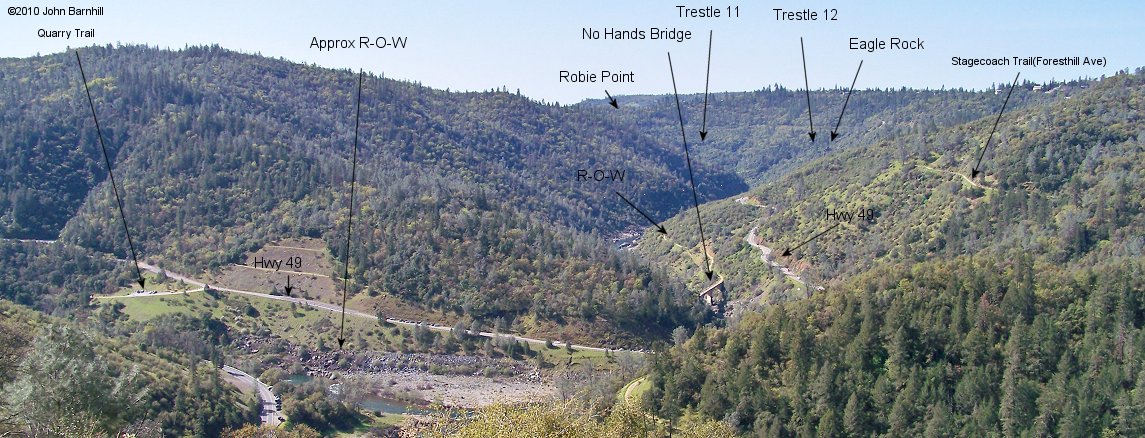
Taken from a turnout above Eagle Rock on Highway 49, this view looks back west at the opposite side of Robie Point. Trestle 10 lies just this side of the point. Trestle 11 and Trestle 12 follow along shortly on the hillside. Trestle 13 sits in the gully just west of Eagle Rock. This is also the location of the only know water tower, which remains lie where it once stood. Much work was done to clear this area of the railroad to make it a passable trail, especially between trestles 12 and 13.
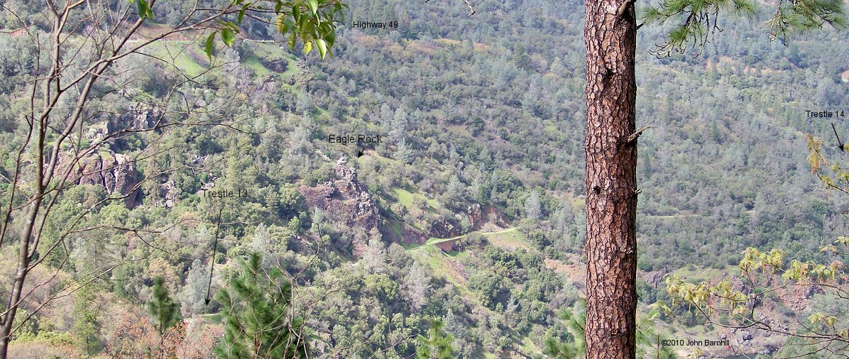
Looking east from Robie Point. Within this image are Trestle 13, Eagle Rock and just out of frame in the far gully is Trestle 14. This is one of the longest stretches between trestles and features many great views of the river as does the whole line. Also the Western States Trail joins the Railbed Trail near the water tank remains.
Between the above image and the next below, lies Trestle 14, Trestle 15, and Trestle 16. Trestle 14 crosses a year round creek that features the Black Hole Of Callcutta Falls that has been known to freeze over in winter. This is a great little destination for a short out and back walk from the parking area at Hwy 49.
From high above on the Foresthill Bridge, one can view the confluence of the North and Middle Forks of the American River along with the right of way approaching No Hands Bridge and the Hwy 49 grade crossing. Between the bridge and xing, used to lie the final trestle, Seventeen. Note, the hill just upstream from the road bridge slid off destroying both the roadbed and highway. Of course the highway was rebuilt. The quarry trail, middle left, shortly joins the eastern stretch of railroad and continues on to the quarry itself, as seen below.