|
|
|
Oregon & Northwestern Railroad Summit Station |
|
|
|
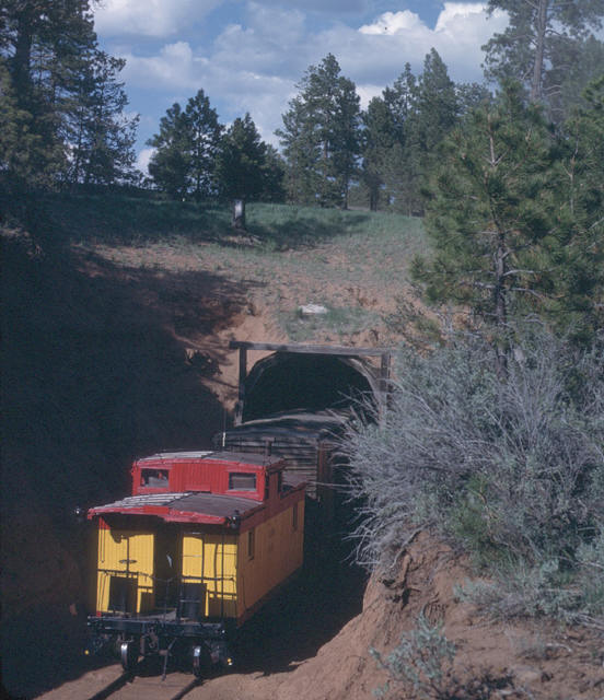
Summit Station marked the highest point on the Oregon & Northwestern. A 300-foot long tunnel was bored here to take the railroad under the watershed divide between Poison and Trout Creeks. A siding existed at this location for many years. |
|
|
![]() |
|
Standing on top of the tunnel looking down one of the canyons. Photograph is from the Harney County Historical Society collection and is courtesy of Martin Morisette. |
|
|
![]() |
|
A loaded log train arriving at Summit station. Photograph is from the Harney County Historical Society collection and is courtesy of Martin Morisette. |
|
|
![]() |
|
Inside the tunnel near Summit Station. Note the mid-identified railroad name written on the picture...this author's best guess is that the photographer assumed that this part of the Malheur Railroad would be taken over by the Union Pacific, as had the 30 miles built by the company between Crane and Burns. Photograph is from the Harney County Historical Society collection and is courtesy of Martin Morisette. |
|
|
![]() |
|
Caboose #300 about to enter the tunnel at Summit on 17 June 1982. Photo by and courtesy of Scott Anderson. |
|
|
|
|
|
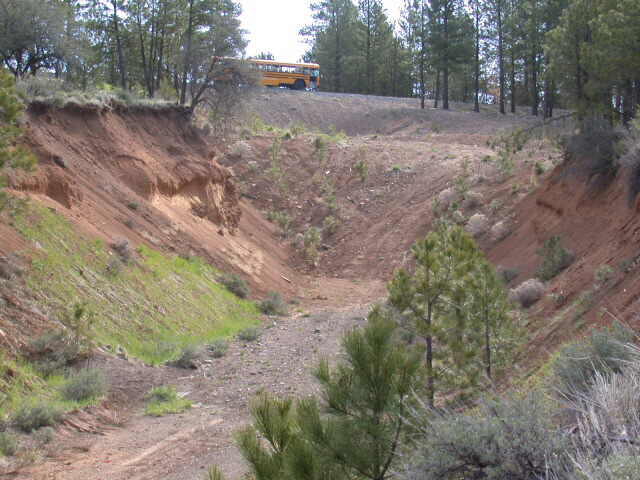
The same view as it appears today. Photo by and courtesy of Martin G. Morisette. |
|
|