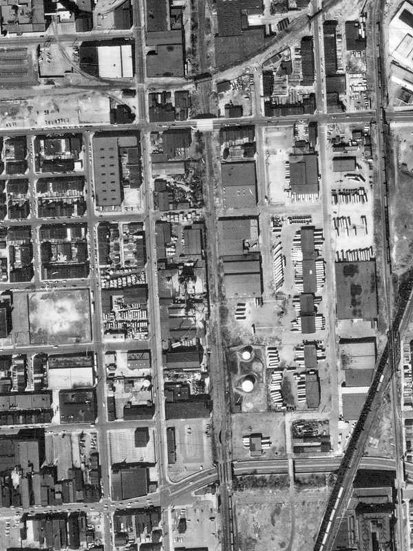
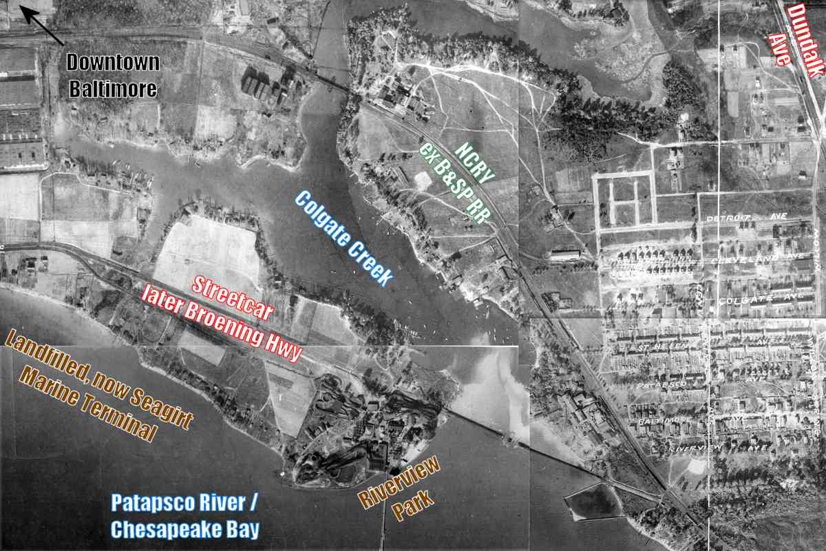
TrainWeb.org Facebook Page
B&SP Photo Tour


Baltimore & Sparrows Point Railroad
Modern day photo tour

Accompanying each photo below are:

Click a photo to see a larger view. Please send your comments and corrections to Steve.


<< Previous (west) | THIS PAGE: Orangeville to Dundalk | Next (east) >>

Baltimore & Sparrows Point Railroad (B&SP) - Brief Historical Background:

Map

Map
Mile: Date: 1948
Ease: View: N (up)
Area: RBL:
Map: Ba 44 B 4 Topographic Maps

The exact location at which in 1889 the B&SP's track began, as well as where the Northern Central connected to it has been lost to history. So for tour purposes we'll start where the NC's route to the Canton waterfront began during the 1870s near Orangeville, east of downtown Baltimore, upper left on this map. That spot still serves as the 0 milepost today. On this clip from a 1948 map made by the Canton Railroad, this tour progresses generally south then southeast along the orange/red line to Sparrows Point, found off the bottom-right corner.


Connection

Connection
Mile: -0.3 Date: Aug 2016
Ease: B View: E
Area: B- RBL:
Map: Ba 35 J 11 Topographic Maps

Trains of the Northern Central, by 1900 effectively a division of the Pennsylvania Railroad, reached Orangeville from the north and west via what is now part of Amtrak's Northeast Corridor. Amtrak engine 2014 is about to pass the NC's now-disused Canton route, the start of which is marked by wider-than-usual separation between catenary poles near photo center, right of the tracks.


Haven Street

Haven Street
Mile: 0.1 Date: Aug 2016
Ease: A View: N
Area: B- RBL:
Map: Ba 35 K 11 Topographic Maps

The NC's Canton route shows on maps from 1882 but whether it began life grade separated at this, it's northern end, is unclear. The stone supports push the date of bridge construction back to at least the early 20th century after which time concrete was typically employed. The distant bridge is for the Northeast Corridor.


Pulaski Highway

Pulaski Highway
Mile: 0.3 Date: Aug 2016
Ease: A View: E
Area: B- RBL:
Map: Ba 35 K 12 Topographic Maps

Aerial photos from 1972 show trains still using the connection, but these vines and trees tell a different story is true now. The bridge beyond the traffic signals carries the Northeast Corridor.

NC's alignment descends into a cut while it parallels Haven Street south (right) for about a mile.


Spur

Spur
Mile: 0.6 Date: Aug 2016
Ease: B View: W
Area: C RBL:
Map: Ba 35 K 13 Topographic Maps

North of Lombard Street, NC trains used to operate below and perpendicular to this disused B&O bridge to the Esskay Meat packing company. Off photo right, the NC alignment has been paved over for automobile parking.

We are reaching into Canton, on the east side of Baltimore, that was perhaps the first planned city in the United States. It is where Peter Cooper, of steam engine fame, during the 1820s bought about 3 miles of waterfront property. He and other entrepreneurs soon joined forces as the "Canton Company" to develop the land with wharves, factories, housing, and more. They were quite successful.


Eastern Avenue

Eastern Avenue
Mile: 1.0 Date: Jul 2016
Ease: A View: E
Area: C RBL:
Map: Ba 35 K 13 Topographic Maps

During 1930 Eastern Avenue, and its streetcar, were grade-separated from multiple railroad alignments via this cut. The distant bridge carried the NC, three tracks wide at this point.

Link: streetcar line 26


From O'Donnell Street

From O'Donnell Street
Mile: 1.4 Date: Jul 2016
Ease: A View: N
Area: C RBL:
Map: Ba 43 K 2 Topographic Maps

Norfolk Southern's main route from its Bayview Yard to the waterfront Boston Street Terminal previously crossed the NC alignment from upper right to lower left, but now it curves to join the ex-NC as it approaches O'Donnell Street.


Boston Street

Boston Street
Mile: 1.7 Date: Nov 2016
Ease: A- View: N
Area: C- RBL:
Map: Ba 43 K 2 Topographic Maps

Many of these photos look north, opposite to the direction of this tour, because doing so makes for better lighting. O'Donnell Street bridges in the distance but Boston Street has never been grade separated. The westbound auto on Boston Street has just crossed over the ex-NC track that leads toward Sparrows Point.


NS 9686

NS 9686
Mile: 1.7 Date: Nov 2016
Ease: A- View: S
Area: C- RBL:
Map: Ba 43 K 2 Topographic Maps

Though looking the other way yields sun glare, we can find NS 9686's horse kicking grass and CSX 3222's cat taking names in their shared yard south of Boston Street. NS's main activity in this area is delivery to Consol Energy, distant right in this view.


Octagonal Booth

Octagonal Booth
Mile: 2.0 Date: Nov 2016
Ease: B View: SE
Area: C+ RBL:
Map: Ba 44 A 3 Topographic Maps

From the shared yard, CSX can use the near tracks to reach Sparrows Point, while the NC used those on the far right. We'll be following the rightmost tracks to and beyond elevated I-95 and I-895 in the distance. The disused octagonal booth reveals the B&O had been here in earlier days.

Change for: B&O Sparrows Point Branch at this site


From I-895

From I-895
Mile: 2.2 Date: Aug 2017
Ease: A View: S
Area: B RBL:
Map: Ba 44 A 4 Topographic Maps

As seen from I-895, on the left CSX and the Canton Railroad share Penn Mary Yard, while on the right NS's coal hoppers await unloading at Consol Energy. In the middle, previously the site of Gorsuch Creek and pond, the ex-NC yard contains nothing much on this day.

Huge cranes in the distance unload and load huge ships at the Seagirt Marine Terminal. The ex-NC route we're following bypasses Seagirt in favor of the Dundalk Marine Terminal, adjacent but off photo left.

Newkirk Street parallels the tanks on the left.


From Newkirk Street

From Newkirk Street
Mile: 2.3 Date: Jul 2016
Ease: A View: S
Area: C RBL:
Map: Ba 44 A 4 Topographic Maps

From Newkirk Street the tanks look bigger.

The ex-NC track to Sparrows Point emerges from the yard to cross Newkirk Street just beyond the trailer parked on the left.

Beyond that runs elevated Keith Avenue.


From Keith Avenue

From Keith Avenue
Mile: 2.5 Date: Jul 2016
Ease: A View: N
Area: B RBL:
Map: Ba 44 A 4 Topographic Maps

Looking back from Keith Avenue, that's the grade crossing near photo center.

My original draft started this tour here since it was likely in this vicinity that in 1916 the NC and B&SP joined rails. Since 1) I do not know that exact location, and 2) I had photos of the NC alignment, I revised the tour to begin farther northwest.


Diamonds

Diamonds
Mile: 2.6 Date: Jul 2016
Ease: A- View: N
Area: C+ RBL:
Map: Ba 44 A 4 Topographic Maps

The ex-NC track crosses those of Penn Mary Yard at these diamonds. The only track diamonds in the Baltimore area are within a half mile of each other at either end of Penn Mary Yard, these at the south end.


Turn East

Turn East
Mile: 2.6 Date: Jul 2016
Ease: A- View: E
Area: C+ RBL:
Map: Ba 44 A 4 Topographic Maps

signal In this easterly view just past the diamond, the route we're following continues into the distance. That's elevated Keith Avenue on the right.

During the "old days" the diamonds had been a crossing between competitors B&O and NC/Pennsylvania, now CSX and NS. Guarding the crossing were unusual signals, a few of which survive. Extensive new fencing makes this an obstructed photo area now.

Link: Todd's site has pre-fencing pics


Amazon
Photo courtesy Google

Amazon
Mile: 2.8 Date: Feb 2017
Ease: View: N (up)
Area: RBL:
Map: Ba 44 C 4 Topographic Maps

Just east of the track diamonds (black, bottom left on map) a large Amazon warehouse (center) has taken the site previously occupied by a General Motors assembly plant. As of the date of this aerial photo, there appears to be no rail connection to the warehouse, meaning all Amazon's incoming goods arrive here via truck. The green line highlights the route we're following.


Broening Highway

Broening Highway
Mile: 3.2 Date: May 2017
Ease: A View: S
Area: C+ RBL:
Map: Ba 44 C 4 Topographic Maps

The first bridge encountered is this one over Broening Highway that, per Maryland State Archives, dates to the 1920s. The bridge is wide enough for four tracks but carries only one at this time.


Colgate Creek

Colgate Creek
Mile: 3.4 Date: Jul 2016
Ease: A- View: N
Area: B- RBL:
Map: Ba 44 C 4 Topographic Maps

Since the B&SP is described as extending from Colgate Creek to Sparrows Point, we can assume the first bridge here was built by the railroad. A 1915 atlas shows Sutton Station at right, on the other side of the tracks.

Originally, this was a swing bridge but aerial photos suggest it lost the ability to open sometime around 1970. During 2010 NS modified the bridge from a double-track into this single-track fixed span.


Riverview Park
Photos courtesy Johns Hopkins University
NEW! early-Mar 2021

Riverview Park
Mile: 3.4 Date: 1927
Ease: View: N (up)
Area: RBL:
Map: Ba 44 C 4 Topographic Maps

Aerial photos from 1927 (above) show another bridge downstream, that of a streetcar line to Point Breeze Hotel at Riverview Park. That bridge endured into the 1930s until supplanted by Broening Highway when the streetcar line was rerouted onto Dundalk Avenue.

Riverview Park 1924 
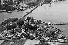
The streetcar ran adjacent the Riverview amusement park that had opened during the 1890s under the name Lowrey's Place. The park's roller coaster, perhaps the first in Baltimore, can be seen in the east-looking 1924 photo at right. It climbed to 75 feet above ground.

Roller coasters were inspired by the Mauch Chunk Switchback Railway in Summit Hill, Pennsylvania that opened in 1829 to carry coal. By the 1850s, thrill seekers were purchasing rides down the steep, gravity-powered railway.

Note the streetcar's turnaround loop on the north side of the park; the loop implies at least some streetcars did not continue 
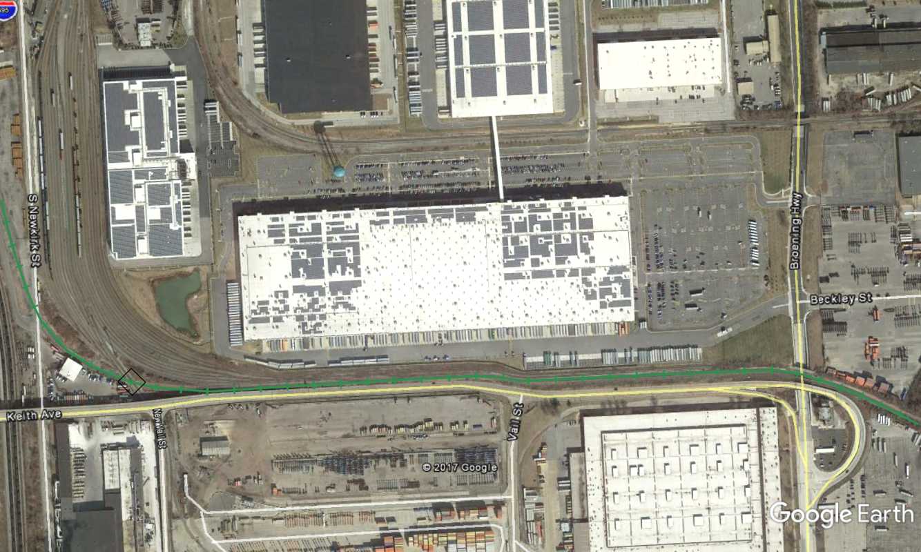
beyond to Sparrows Point. The park closed during 1929, and the site 
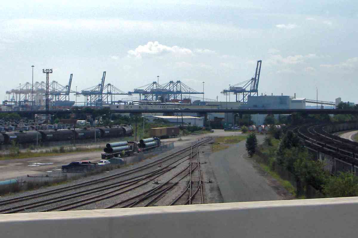
was repurposed for a Western Electric factory.

Links: 1919, riding the streetcar to Riverview Park


Milepost 4

Milepost 4
Mile: 3.9 Date: Jul 2016
Ease: A View: SE
Area: B- RBL:
Map: Ba 44 D 5 Topographic Maps

Southeast of the Edgewater Avenue grade crossing one can spy milepost 4, the only mile measure I found along the route


Rails Avenue

Rails Avenue
Mile: 4.1 Date: May 2017
Ease: A View: SE
Area: B- RBL:
Map: Ba 44 D 6 Topographic Maps

groundhog At the Rails Avenue grade crossing, Norfolk Southern marks its turf, but so does a groundhog.

There is not much "old railroad" to find here. I observed no RR artifacts dating to control by the NC or Pennsylvania Railroad.
map 1916

Unseen on the right, Broening Highway occupies the former right-of-way of Baltimore streetcar line number 26 that ran side-by-side with the B&SP / NC to Sparrows Point. Ahead, Broening Highway lifts over the tracks in order to continue to parallel them along the inland side. Flamm's 1916 map shows the streetcar line had similarly switched sides.


<< Previous (west) | THIS PAGE: Orangeville to Dundalk | Next (east) >>

Or, return to main page

Copyright Notice