TrainWeb.org Facebook Page
Huntingdon Avenue Viaduct Photo Tour


Huntingdon Avenue Viaduct
Modern day photo tour

Accompanying each photo below are:

Click a photo to see a larger view. Please send your comments and corrections to Steve.


Brief Historical Background: Huntingdon Avenue Viaduct

Survey 1894
Image courtesy Johns Hopkins University

Survey 1894
Mile: Date: 1894
Ease: View: N (up)
Area: BSTPY:
Map: Ba 34 K 7 (center) Topographic Maps

The viaduct, running diagonally through the center of this image, parallel to Remington Avenue, was less than a year old when documented on this detailed Baltimore topographical survey. That marked Balt. & Lehigh R.R. became Maryland and Pennsylvania Railroad (Ma & Pa).

Cedar Avenue is now Keswick Road, and "Avenue" at upper left is now West 33rd Street in the neighborhood of Hampden. The structure at the upper-right corner is Homewood Villa (also called Wyman Villa), a residence of the Wyman family that donated land for Johns Hopkins University's (JHU's) Homewood campus. The villa had been located about 100 feet southwest of where JHU's Hodson Hall would later be built.


Aerial 1927
Photo courtesy Johns Hopkins University

Aerial 1927
Mile: Date: 1927
Ease: View: N (up)
Area: BSTPY:
Map: Ba 34 K 7 Topographic Maps

By 1927 airplanes made photos of the surveyed area possible. The viaduct's dark shadow creates the illusion the structure bends where it crosses over Stony Run.

The US Marine Hospital's original fingered wings (photo upper right quadrant) were consolidated into one large, new building during 1934. JHU would remodel that building for academic purposes during the 2020s.


Aerial 1970
Photo courtesy Johns Hopkins University

Aerial 1970
Mile: Date: 1970
Ease: View: N (up)
Area: BSTPY:
Map: Ba 34 K 7 Topographic Maps

The viaduct endured until 1949, torn down after the automobile had supplanted streetcars in so many cities. A white line marks its former location on this 1970 aerial.

The arched masonry bridge near center is that for Wyman Park Drive. Note how south of the bridge Stony Run now simply disappears. An explanation follows next.


Wyman Park Drive Bridge

Wyman Park Drive Bridge
Mile: Date: Nov 2016
Ease: B- View: N
Area: D BSTPY:
Map: Ba 34 K 7 Topographic Maps

The road bridge was built around 1910, and rehabbed during 1960. Behind the photog, the waters of Stony Run pour into a huge drain that hurries them underground to the Jones Falls near 28th Street. This man-made dead end originates with the 28th Street bridge project of the 1960s.

big drain somewhere Fallen trees float downstream to the drain where they are too big to fit so gather into a pile (right). In a big city like Baltimore, a hidden drowning risk such as this rates as one of the more unexpected dangers. From somewhere under this unstable pile emanates the roar of Stony Run cascading into the drain.

This pile occupies roughly the area of a baseball field's infield. Satellite photos suggest it was cleared out after 2016, and then a new drainage system was implemented.

Link: Bridgehunter entry


Puzzling Photo
Photo courtesy Duke University

Puzzling Photo
Mile: Date: Feb 1914
Ease: A View: W
Area: B BSTPY:
Map: Ba 35 B 7 Topographic Maps

This 1914 photo looks west from Charles Street. The dark horizontal line beyond the trees could be the viaduct, however I have doubts it would look that way from the 31st Street area, which had been the purported location. Furthermore, what appears to be an old wooden barn stands in the foreground, while no such structure is shown by the detailed 1894 topo survey.

mirrored Could the photo have been mirrored when digitized? At left is a flipped version. It has issues as well. Neither view yields a match for what appears to be a distant bright masonry wall.

A better match for the topography is the area west of 28th Street, and the low spot beyond the barn might be Sumwalt Ice Pond. That pond was found along Howard Street between 28th and 29th Streets.

I have not defintively solved this photographic puzzle, but it gives me an excuse to include a few more old photos below in the hope one will present an answer.

Link: source photo


Charles Street Avenue
Photo courtesy Duke University

Charles Street Avenue
Mile: Date: Jan 1912
Ease: A View: N
Area: B BSTPY:
Map: Ba 35 B 7 Topographic Maps

transition 1912-2023 By the way, during the early 1900s, Charles Street was known as Charles Street Avenue. In this view north from around 30th Street, the spindly trees imply this photo dates to shortly after Charles was widened and modernized with electric lamps. The lowest point is near 31st Street, from which the prior photo purports to have been made, and where Sumwalt Run is now sequestered underground.

Link: source photo


Merrick Barn
Photo courtesy Johns Hopkins University

Merrick Barn
Mile: Date: 1924
Ease: View: SW
Area: BSTPY:
Map: Ba 35 A 6 Topographic Maps

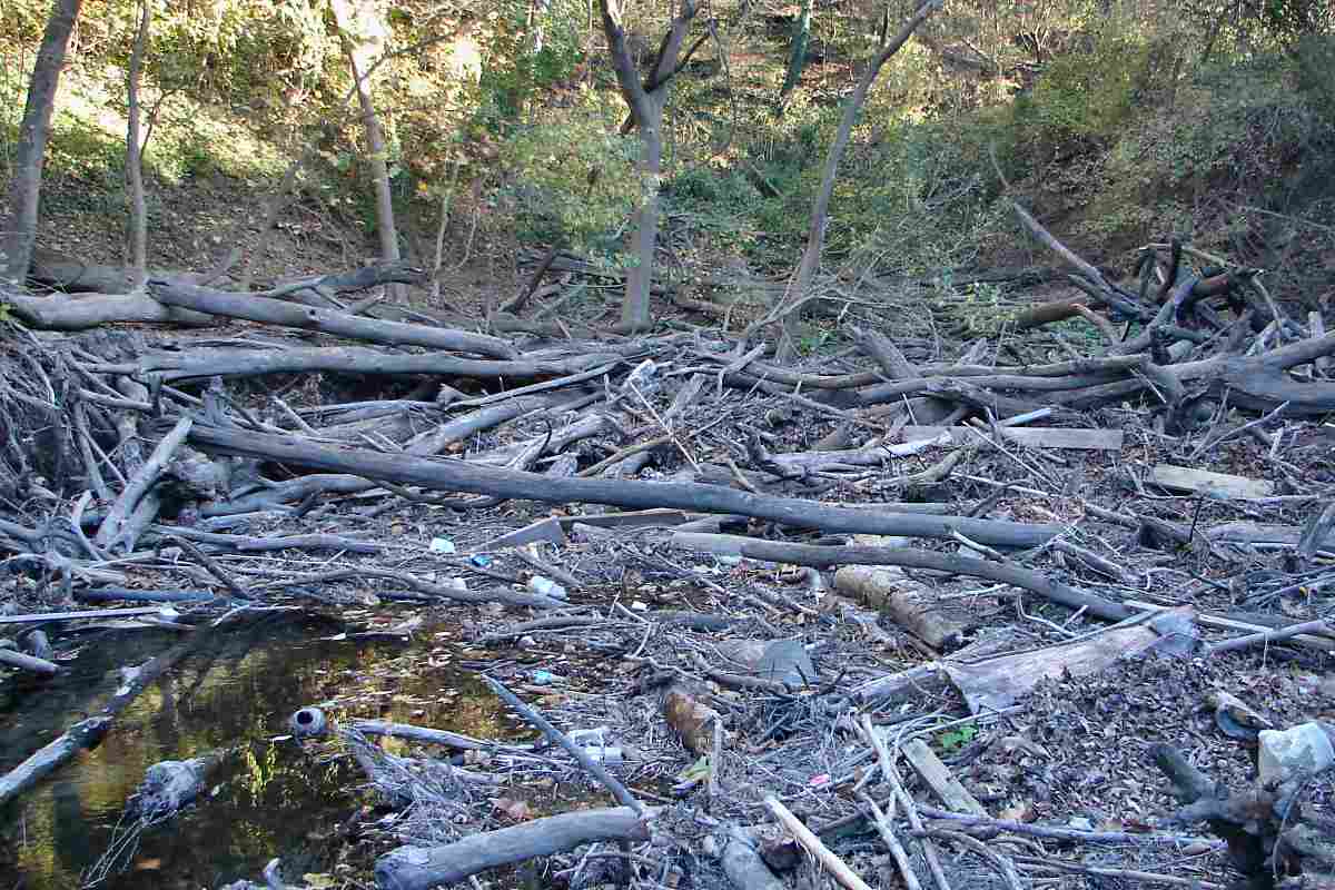
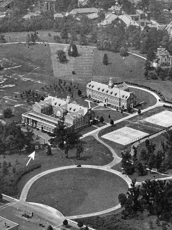
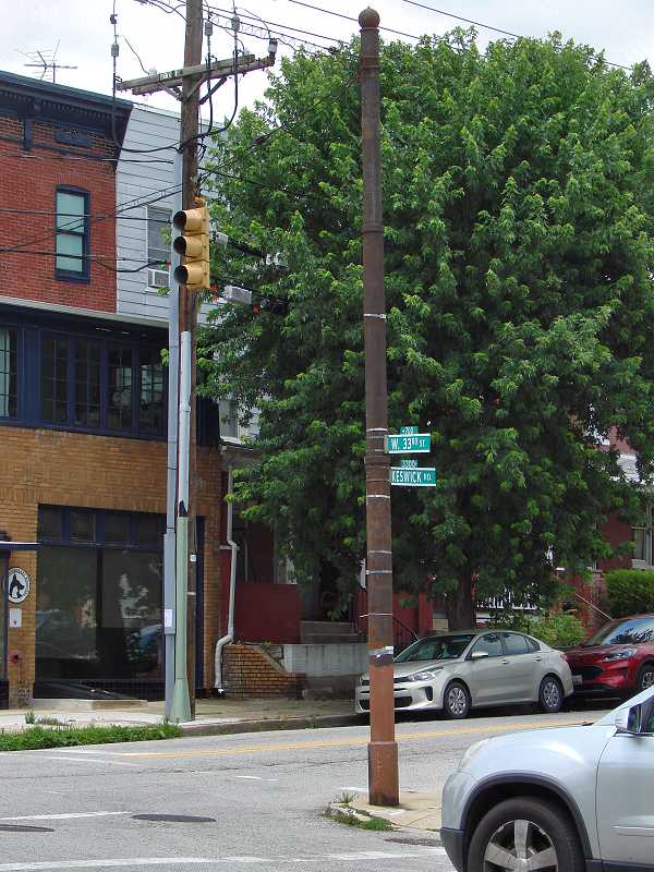
Since few photos exist that include both Charles Street and the viaduct, we have to rely on others to provide clues. This one looks into JHU's Homewood Campus from a bit north of 34th Street.

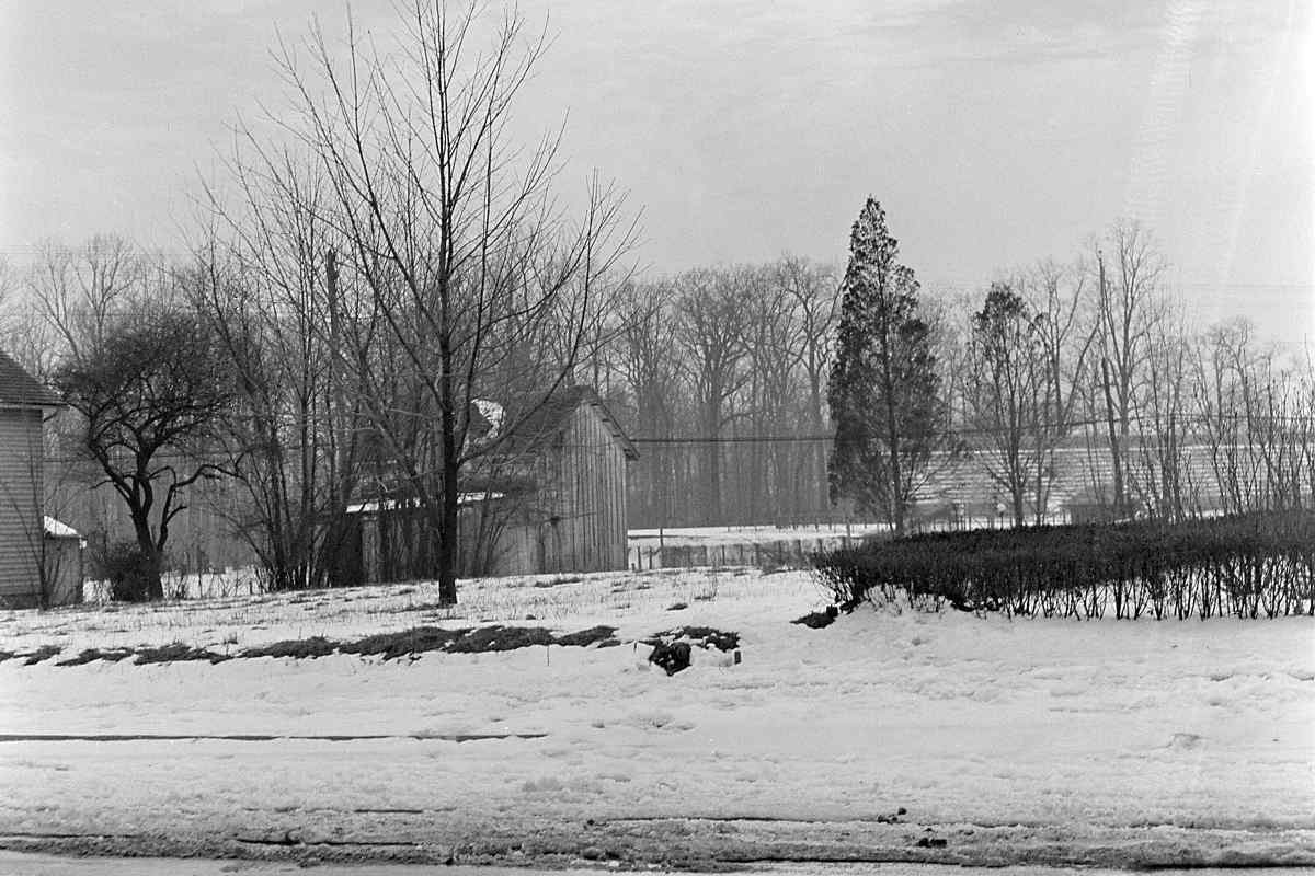
The arrow points to a barn, Merrick Barn, which would be a candidate for the barn in the puzzling 1914 photo except for the problematic detail that Merrick's is a masonry structure. As of 2022, the barn is home to a theater program run by JHU alum John Astin of The Addams Family fame. Homewood Villa, at the above photo's upper right edge, bears only a passing resemblance to the Addams Family mansion.

Homewood marker Feb 1983 
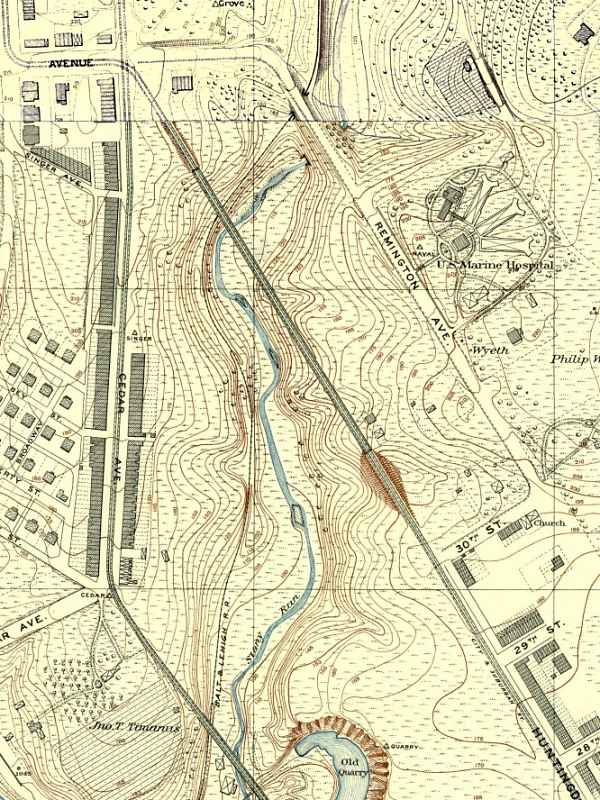
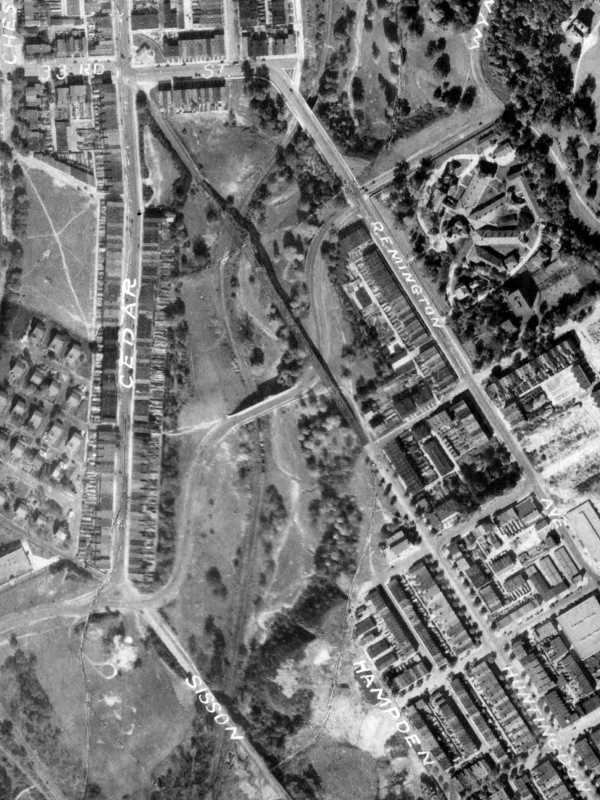
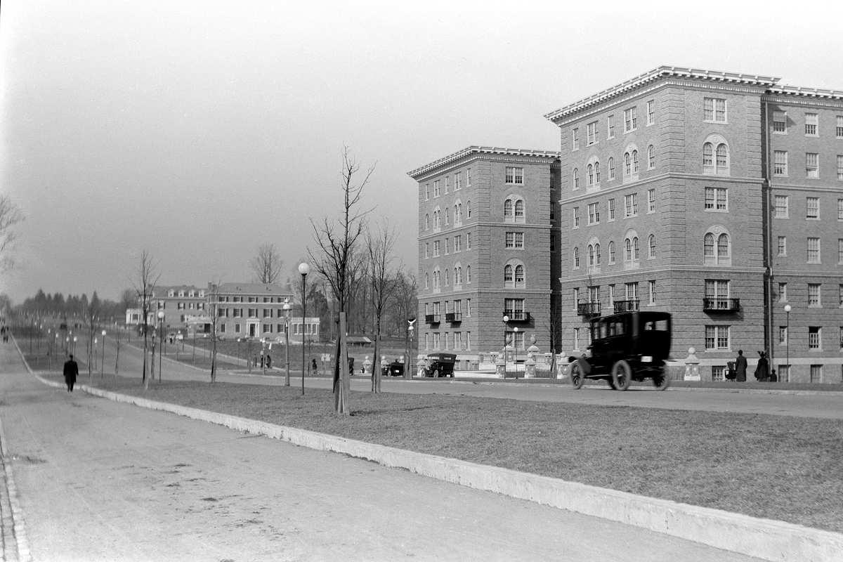
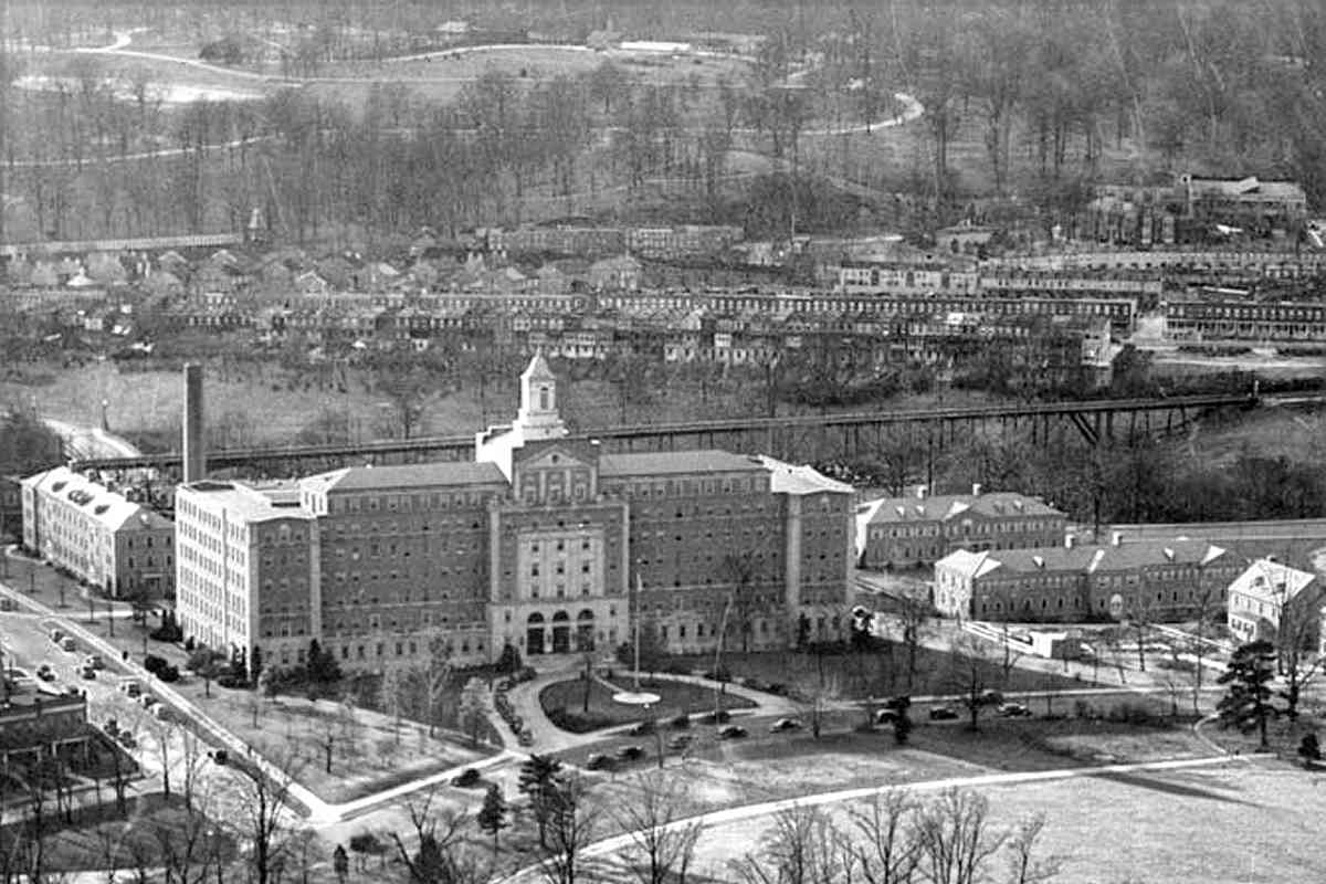
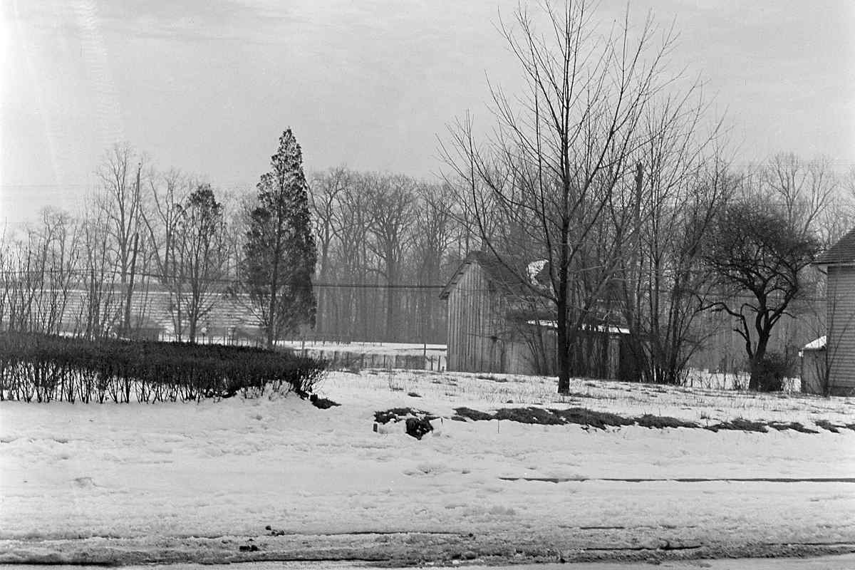
Though the main photo does not reach Stony Run, it does illustrate that the US Marine Hospital (top), which existed at the time of the puzzling 1914 photo, would block the view had that photo been snapped from here.

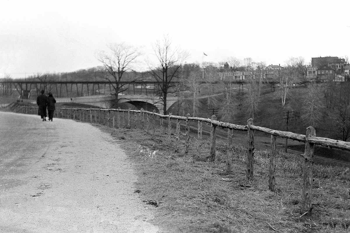
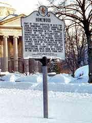
The nearby former residence of Charles Carroll, Jr., Homewood House, is a museum now. Many assume it lent its name to JHU's Homewood Campus, however, the earliest name reference is to a person: per the historical marker at right, the land was surveyed during 1670 for John Homewood. This marker is no longer extant.

Links: 1914, Merrick Barn ~1920, Homewood Villa


From West Side
Photo courtesy Duke University

From West Side
Mile: Date: Jan 1914
Ease: A View: NE
Area: B BSTPY:
Map: Ba 34 K 7 Topographic Maps

It could be the puzzling photo was not taken from Charles Street. It looks similar to this one that was snapped from Wyman Park Drive on the west side of Stony Run. Both the bridge and viaduct are clearly visible.

The viaduct was later modified via a steel arch to permit a wider Wyman Park Drive to pass underneath.

Link: source photo


South End
Photo courtesy Duke University

South End
Mile: Date: Jan 1914
Ease: A View: NW
Area: B BSTPY:
Map: Ba 35 A 7 Topographic Maps

During various eras, portions of streetcar 25's route were powered from underground, and some, like this, via overhead catenary. A semaphore signal regulated northbound access to the viaduct, and a matching signal was likely mounted at the other end. At periods of peak operation, a railcar lurched and clattered across the viaduct about every two minutes.

Links: source photo, the first electric streetcar


Shadow
Photo courtesy Johns Hopkins University

Shadow
Mile: Date: 1934
Ease: View: W (up)
Area: BSTPY:
Map: Ba 35 A 6 Topographic Maps

Note that north is to the right. The viaduct's shadow illustrates its height above the valley through which Ma & Pa's single track weaves. The intersection of Keswick and 33rd at upper right is this tour's destination.


Behind Hospital
Photo courtesy Baltimore Sun

Behind Hospital
Mile: Date: Jul 1939
Ease: View: W
Area: BSTPY:
Map: Ba 35 A 7 Topographic Maps

This US Marine Hospital, the second largest in the country, was about five years old at photo time. The viaduct traces a dark horizontal line behind it.

Link: source photo


Wyman Park Sign

Wyman Park Sign
Mile: Date: Nov 2016
Ease: A View: W
Area: B BSTPY:
Map: Ba 35 A 7 Topographic Maps

This sign was placed at what had been the south end of the viaduct.

Beyond here, streetcar 25's route took it through Mount Washington over the Kelly Avenue Viaduct, then to a terminal near Pimlico. Bus 25 traced much of the same route subsequently. As of 2022, bus route 94 is the closest mimic.


Wooden Sleepers
Photo credit Roland Nutrell

Wooden Sleepers
Mile: Date: 1940s (Nov 2016)
Ease: A View: N
Area: B BSTPY:
Map: Ba 35 A 7 Topographic Maps

The viaduct began where Huntingdon Avenue ends. Rails were mounted on wooden sleepers that rested upon steel crossties.

Prior to air conditioning being common, streetcars would offer "cool-off" rides that permitted summer evening passengers to ride from one end of the line to another, and back, for one fare.

Link: cool-off rides


Scene 2016

Scene 2016
Mile: Date: Nov 2016
Ease: A View: N
Area: B BSTPY:
Map: Ba 35 A 7 Topographic Maps

Some 70 years later the scene is much the same, including the house at right, but minus one viaduct. Gomez Addams arrived too late to employ it in his Trainwreck games.

Link: Trainwreck


Sideways Eiffel

Sideways Eiffel
Mile: Date: ~1940 (Nov 2016)
Ease: A- View: N
Area: B BSTPY: 79
Map: Ba 35 A 7 Topographic Maps

Even Paris's Eiffel Tower, built just four years earlier, and as tall as the viaduct was long (about 1000 feet), had not advanced to steel, instead sticking with older-tech wrought iron.

The viaduct predated Wyman Park Drive (foreground) so was modified around 1920 (my estimate) with the steel arch seen here to make room for a widened road to pass underneath. This arch does not appear in the 1914-dated photos above.

Link: Bridgehunter entry


Sans Viaduct

Sans Viaduct
Mile: Date: Nov 2016
Ease: A- View: N
Area: B BSTPY:
Map: Ba 35 A 7 Topographic Maps

This is the year 2016 view at the same spot. Steel has decent value as scrap, so upon disuse was not allowed to fester. If we're going to find viaduct remnants, we need to look for masonry.


Older Masonry

Older Masonry
Mile: Date: Nov 2016
Ease: B+ View: W
Area: B BSTPY:
Map: Ba 34 K 7 Topographic Maps

Older masonry is seen in this downward view to Stony Run from the northeast quadrant of the Wyman Park Drive bridge. My measuring says this is too far west to be a viaduct support remnant. Instead, it might be what's left of the base for a lamp that was removed by the bridge's 1960 rehabbing.


Signal Stand

Signal Stand
Mile: Date: Nov 2016
Ease: B View: N
Area: B- BSTPY:
Map: Ba 34 K 7 Topographic Maps

Down in the Stony Run valley... while the vine-covered concrete below and right of photo center may have been part of the viaduct's support system, old photos suggest it is not in the correct location to be such. Instead it is more likely a Ma & Pa leftover, perhaps a signal stand. In this vicinity are also rusty pipes that were probably Ma & Pa culverts.

I had thought November would be late enough to explore without greenery blocking the view, but streamside trees are among the last to lose their seasonal leaves. There are probably viaduct remnants hiding among the brush, but they will require a visit during mid-winter to find. If you locate some, please let me know.


Wyman Park

Wyman Park
Mile: Date: Jun 2022
Ease: A- View: SE
Area: B BSTPY:
Map: Ba 34 K 6 Topographic Maps

This neat area at the viaduct's northern reach is part of Wyman Park. Looking back from there, it's sweet the greenery is now helpful: the streetcars had run where the trees are more petite.

Link: 1914


Tree Gap

Tree Gap
Mile: Date: Jun 2022
Ease: A- View: NW
Area: B BSTPY:
Map: Ba 34 K 6 Topographic Maps

A similar tree gap exists when looking the opposite direction. An artifact is hiding among the trees at left...


Pole

Pole
Mile: Date: Jun 2022
Ease: A- View: NE
Area: B BSTPY:
Map: Ba 34 K 6 Topographic Maps

... it's a streecar pole, as identified by the round ball at its top. Poles like this supported the overhead cables and wires that supplied power to the streetcars.


Keswick and 33rd

Keswick and 33rd
Mile: Date: Jun 2022
Ease: A View: NW
Area: B BSTPY:
Map: Ba 34 K 6 Topographic Maps

pole on duty At one time, poles like these by the thousands had lined Baltimore's streets, so it's no surprise to find a few survivors scattered around the city. Not many remain as functional, though, as these at Keswick Road where the number 25 line had veered west (left) to briefly follow 33rd Street.

Now the three centenarians here support street signs as well as traffic signal wires.


Wooden Insulators

Wooden Insulators
Mile: Date: Jun 2022
Ease: A View: E
Area: B BSTPY:
Map: Ba 34 K 6 Topographic Maps

The system employed wooden insulators between the poles and the cabling that supported and pulled the trolley wires (the power supply wires) tight. Strictly speaking, Baltimore's was not a catenary system. Catenary employs cabling that instead supports power wires from above.

Other poles with wooden insulators are still found elsewhere in the city. A quick survey during 2022 suggested about one pole survives per mile of streetcar route. At peak during the early 20th century, there had been about 400 miles of streetcar routes in Baltimore. If you find a pole with wooden insulators like this, let me know the location, and if there are enough such poles perhaps I can assemble a page about them.


For more streetcars, see (offsite link) the last streetcar sites.

For other tours here, select from the map: clickable map

Or, return to main page

Copyright Notice