TrainWeb.org Facebook Page
PRR / Amtrak Photo Tour


PRR / Amtrak in Maryland
Modern day photo tour

Accompanying each photo below are:

Click a photo to see a larger view. Please send your comments and corrections to Steve.


Special Note: >>> The places described on this page host quiet, high-speed trains. Stay well clear! <<<

<< Previous (northeast) | THIS PAGE: Fulton Jct to Gwynns Falls | Next (south) >>

Fulton Junction
Photos credit unknown

Fulton Junction
Mile: 97.6 Date: 1932
Ease: C View: W
Area: D T6:
Map: Ba 34 G 11 Topographic Maps

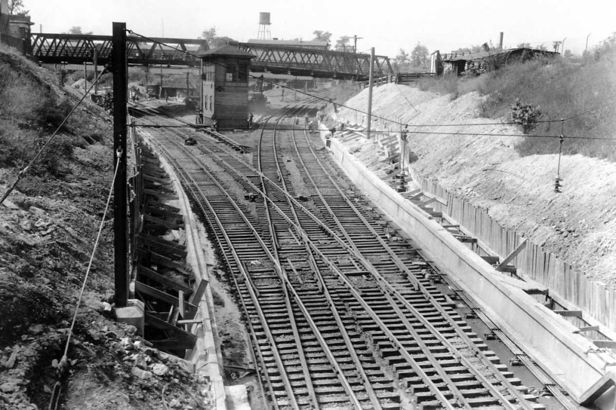
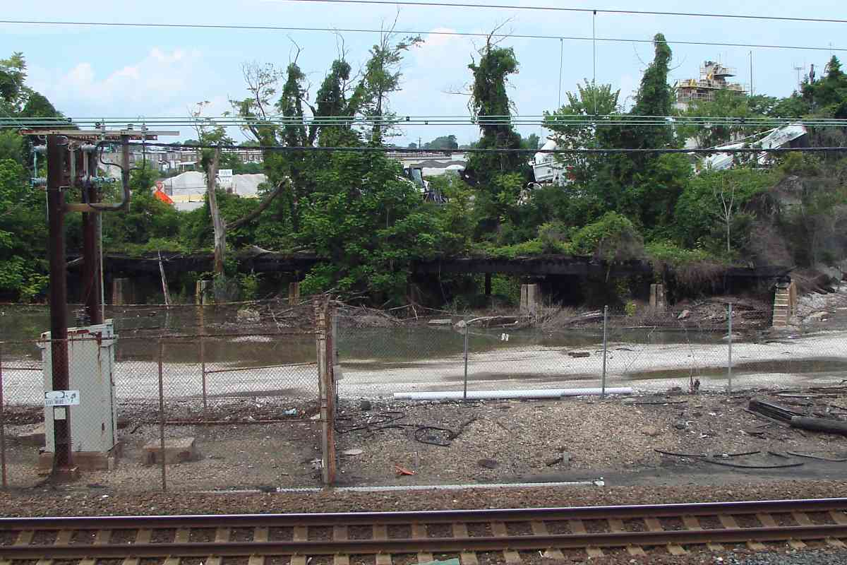
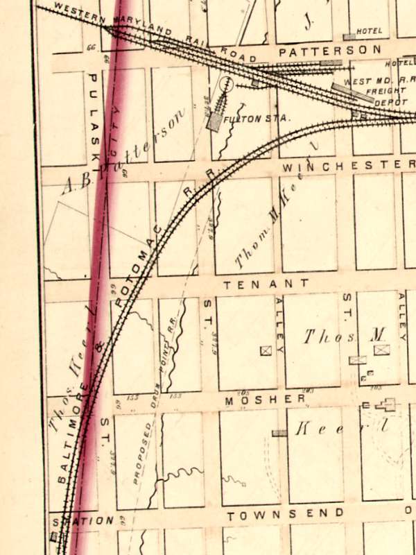
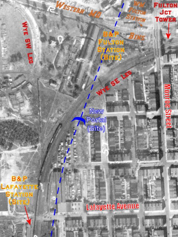
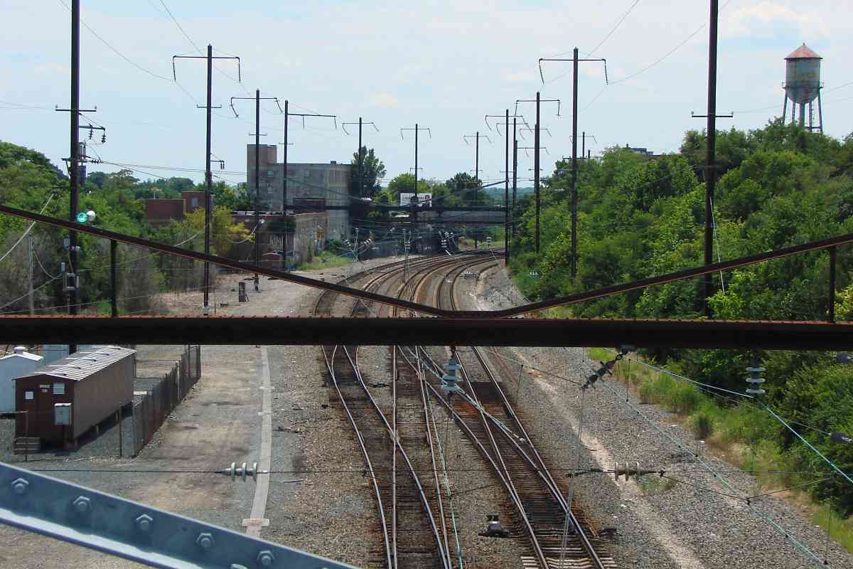
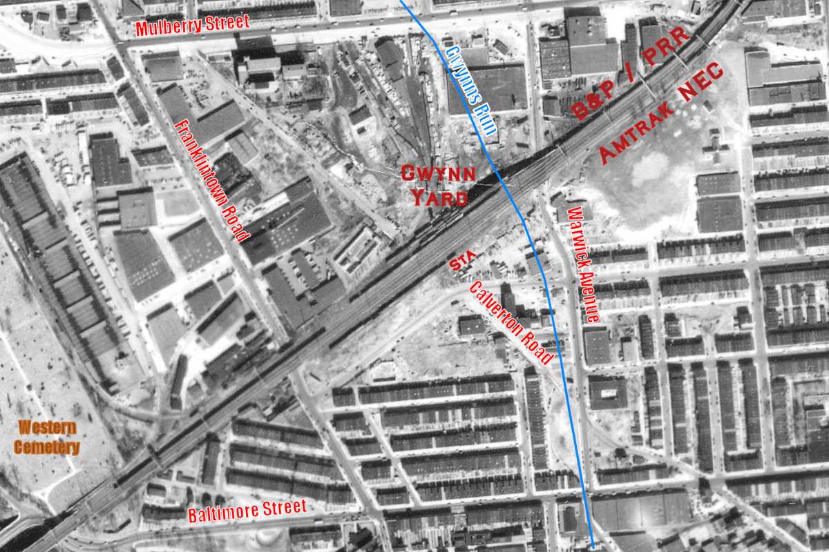
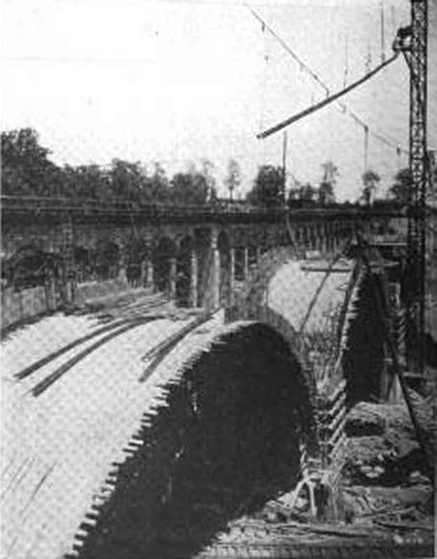
This wonderful photo captures the line undergoing electrification where the Western Maryland (WM) Railway splits right and PRR left. The photographer is standing at Fulton Avenue with the Baltimore and Potomac (B&P) tunnel's south/west portal not far behind him.

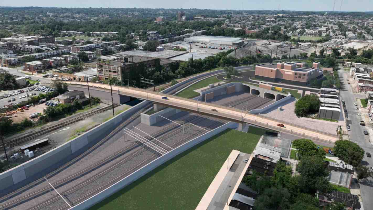
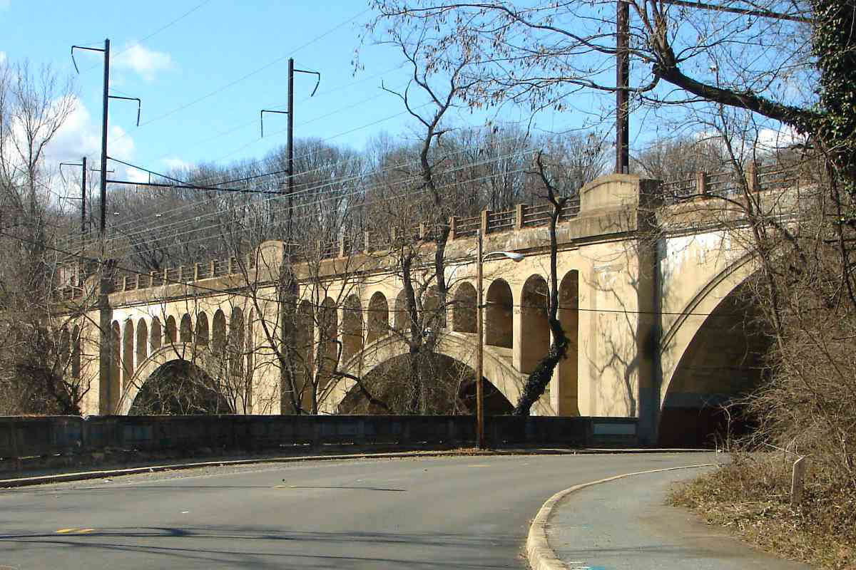
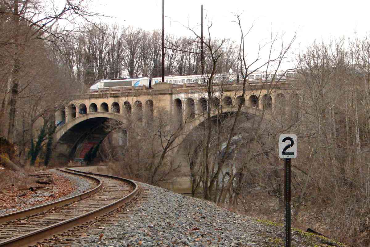
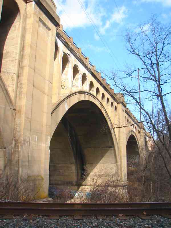
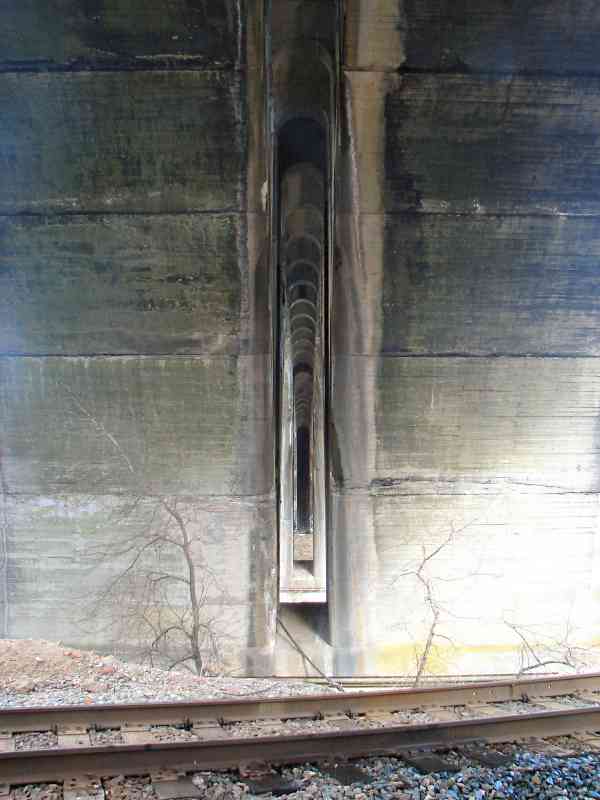
To make room for the catenary, the B&P Tunnel's floor was lowered by 18 inches, while outside the tunnel the grading had to be adjusted to match, hence the new concrete retaining walls at the sides here. Note 
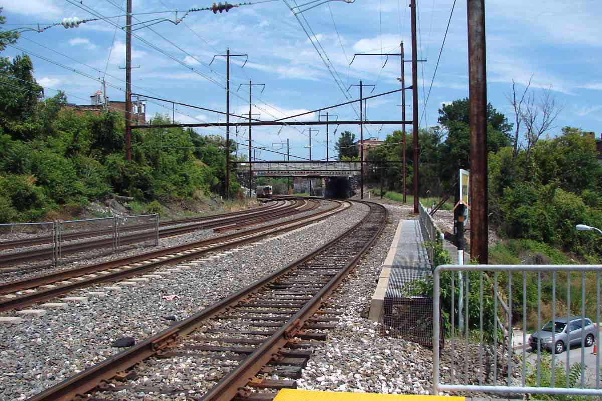
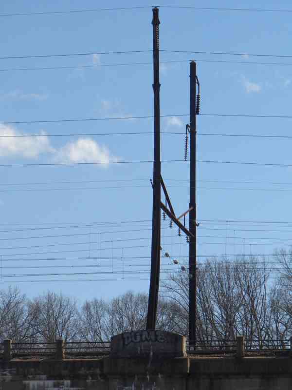
the beveled edges of the concrete footing for the catenary pole; such angling is characteristic of original footings, most of which remain extant as of this writing.

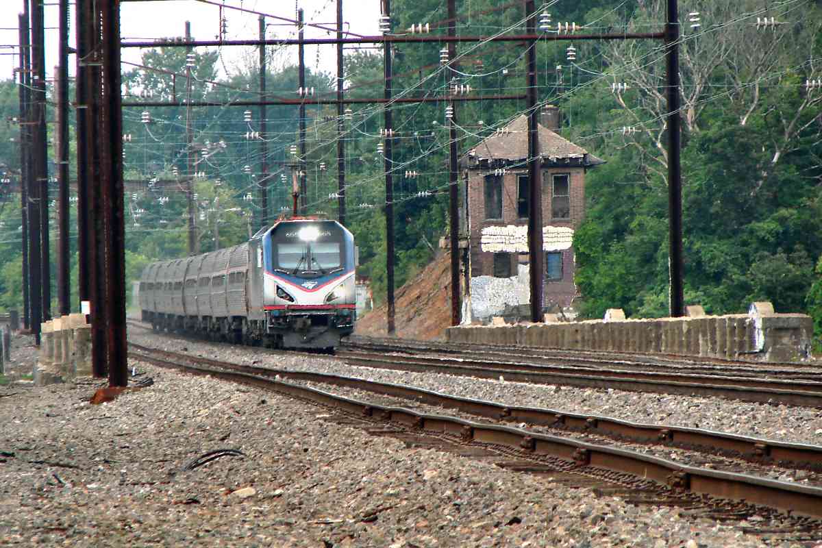
Fulton Junction Tower seen near center endured until 1965 when it was demolished because new tech allowed track switches to be controlled from B&P Junction Tower near Penn Station. Prior to that, Baltimore terminal's four PRR towers (B&P Junction, Fulton Junction, Union Junction, and Biddle Street) housed a total of 254 track control levers.

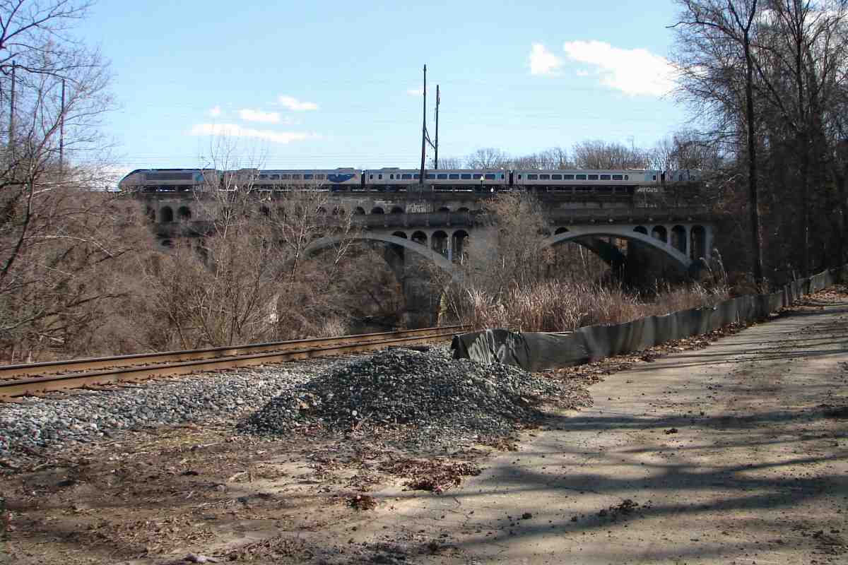
That's Monroe Street crossing over the tracks.

Links: source photo, LoC tower info (PDF)


Monroe Street

Monroe Street
Mile: 97.7 Date: Jul 2018
Ease: C View: SW
Area: C- T6:
Map: Ba 34 G 11 Topographic Maps

Monroe Street got a new bridge in 1986 around the time the connection with Western Maryland (foreground) was severed. WM's Fulton Station for freight stood on the right where Monroe Street's bridge now traverses.

Change for: WM Railway tour at this site


Pneumatic

Pneumatic
Mile: 97.7 Date: Jul 2018
Ease: C View: S
Area: D T6:
Map: Ba 34 G 11 Topographic Maps

The reservoir tank AMTK 2007 appears to be sniffing holds compressed air that powers track switches in the vicinity. PRR preferred air power for all its switches, but pneumatic systems are commonly substituted for electrical equipment at low spots like this one at Monroe Street where puddling water could cause a short.


Amtrak 649

Amtrak 649
Mile: 97.8 Date: Jul 2018
Ease: B View: NE
Area: D T6: 334
Map: Ba 34 G 11 Topographic Maps

Having recently emerged from B&P Tunnel, AMTK 649 leads southbound travellers toward Washington, DC.


Amtrak 661

Amtrak 661
Mile: 97.8 Date: Jul 2018
Ease: B View: NW
Area: D T6:
Map: Ba 34 G 11 Topographic Maps

Another of the ACS-64 model, AMTK 661, slows before being given the green light to enter B&P Tunnel.


Bins

Bins
Mile: 97.8 Date: Jul 2018
Ease: B View: N
Area: D T6:
Map: Ba 34 G 11 Topographic Maps

A minerals plant has occupied the inside of the Fulton Junction wye for many decades. In the past, hoppers unloaded various types of gravel, coal, etc. into these drop bins. Though long disused, old track still runs above them. B&P's Fulton Station had stood about 200 feet west of these bins.


1876 Map
Image courtesy Johns Hopkins University

1876 Map
Mile: ~98 Date: 1876
Ease: View: N (up)
Area: T6:
Map: Ba 34 G 11 Topographic Maps

During the brief 1870s period after the B&P began service but before its tunnel was completed in 1873, B&P trains started/ended at its Fulton Station (image upper center), with stagecoaches transporting passengers the rest of the way to central Baltimore.

Fulton Station is oriented for B&P access, but the lack of B&P tracks to it suggests this 1876 GM Hopkins map was drawn after the tunnel opened and B&P tracks to the station had been removed. The circle adjacent the station represents a turntable, which would have been needed to reverse the direction of steam engines before the tunnel opened. At map time, the turntable remained connected to WM trackage, so had likely been shared by both railroads. The turntable was located close to where the minerals plant now has a pit into which stone can be unloaded from hoppers by gravity.

The ill-fated Baltimore & Drum Point Railroad is shown connecting here, presumably to share the B&P Tunnel. The red line marks Baltimore City's western limit at the time. At map time, some of these streets existed only as plans and some names changed later, for example, that marked Townsend became Lafayette. The small creek depicted was long ago directed into underground pipes.


1927 Aerial
Photo courtesy Johns Hopkins University

1927 Aerial
Mile: ~98 Date: 1927
Ease: View: N (up)
Area: T6:
Map: Ba 34 G 11 Topographic Maps

The track arrangement revealed by this aerial shows both WM and PRR trackage extends to the drop bins. Many small sidings sprout to serve industry in this area.

The dashed blue line represents the approximate path of the new tunnel if it follows proposed route 3B. That path would take it directly under where B&P's Fulton Station had stood.

Some people ask me why this is called a "wye". Note the arrangement of the trackage: it resembles the letter Y.


Amtrak 2001

Amtrak 2001
Mile: 98.0 Date: Jul 2018
Ease: B View: NE
Area: D T6:
Map: Ba 34 G 11 Topographic Maps

AMTK 2001 negotiates what is left of the wye and the NEC's tightest curve in the Baltimore area. This curve will be lessened by the proposed alignment for a new tunnel. Mile 98 is here but its post is nowhere to be found. This is the line's highest elevation within the city.


Southwest Leg

Southwest Leg
Mile: 98.1 Date: Jul 2018
Ease: B+ View: N
Area: D T6: 334
Map: Ba 34 G 11 Topographic Maps

southwest leg 2016 Until about 1980, the southwest leg of the Fulton Junction wye had connected on the left; rusty rails continue to hide in the brush. If someday needed again, the leg could be reconnected behind the photographer with the new alignment, however there will not be sufficient room to restore the wye's northeast leg that had connected with Western Maryland.

As seen from the Lafayette Avenue bridge, part of the new tunnel's south (west) portal would be in the trees on the right. Inside the new tunnel, led the two-track line will pass under the existing tracks at the curve ahead.

Amtrak has swapped out the incandescent bulbs in these signals for LEDs. There is a downside to LEDs: they do not generate enough heat to melt snow so are at risk of being obscured by a snowstorm. As a group, these remind me of the glowing green blob in The Andromeda Strain.


Lafayette Avenue

Lafayette Avenue
Mile: 98.1 Date: Jul 2018
Ease: B+ View: E
Area: D T6: 334, 335
Map: Ba 34 G 11 Topographic Maps

The new alignment will pass in an open cut where Pulaski Avenue now does under the fortuitously extra-long Lafayette Avenue bridge; in this view, that's the far side of the bridge, with Pulaski barely visible and the NE Branch of Gwynns Run buried adjacent. This bridge had not yet been built in 1927, so note traffic waiting for the train to clear the grade crossing in the old aerial above.


Tunnel Project
NEW! early-Jun 2026

Tunnel Project
Mile: 98.1 Date: May 2026
Ease: A View: N
Area: D T6:
Map: Ba 34 G 11 Topographic Maps

May 2026 For construction purposes, the Frederick Douglass Tunnel project has commandeered over 12 acres of land adjacent to the south portal. This is the view from Lafayette Avenue bridge. Only by becoming or befriending a contractor can one obtain a decent look at the undertaking, though a quick glimpse is possible from a speeding Amtrak train (left). A new bridge for Layayette Avenue is part of the tunnel project.


Artist Concept
Image courtesy Amtrak
NEW! early-Jun 2026

Artist Concept
Mile: 98.1 Date: proj 2036
Ease: View: NW
Area: T6:
Map: Ba 34 G 11 Topographic Maps

Upon completion during the 2030s, the area around the new tunnel portal is expected to look like this. Note the single-track bypass on the left that heads for the old (B&P) tunnel.

Link: image source


Edmondson Avenue

Edmondson Avenue
Mile: 98.1 Date: Jul 2018
Ease: B+ View: S
Area: D T6: 334, 335
Map: Ba 34 G 11 Topographic Maps

Looking south, coming from the left the new alignment is to briefly join the existing for passage under the Edmondson Avenue bridge (ahead). A small yard had been on the left with Lafayette Station (also called Lafayette Avenue Station) below on the right.

The tracks divide and multiply from two to four. The line is quad-tracked for the next 5 miles, from here to Halethorpe Station. Plans call for quad-tracking to be extended south to Odenton.


Edmondson Station
Photo courtesy Google

Edmondson Station
Mile: 98.4 Date: Jul 2018
Ease: A View: S
Area: D T6:
Map: Ba 34 F 12 Topographic Maps

For PRR trains westbound from Washington, stopping in Baltimore has always been a problem due to the inability to turn around at Penn Station. Where Edmondson Avenue crosses the line, this building was built by PRR about 1920 as a substitute for Penn Station. Food/grocery/supplies stores came later. The idea was westbounds would stop here then bypass Penn Station by turning northwestward at North Avenue (the John Street Tunnel segment) via the incomplete tunnel there.

In part due to this station's location far from downtown, the idea was never fully implemented, however trains continued to stop here into the Amtrak era, per the 1979 schedule linked below. The structure along the left side of the building (at the "Pizza" sign) was part of a baggage elevator to the tracks below. Thanks go to Frank Wrabel for relaying this interesting PRR history.

The building was removed during 2025 as part of the Frederick Douglass Tunnel project.

Link: Amtrak Schedule 1979


Franklin Street

Franklin Street
Mile: 98.5 Date: Jul 2018
Ease: A- View: NE
Area: C- T6:
Map: Ba 34 F 12 Topographic Maps

From the area right of the distant MARC train, after squeezing under Edmondson Avenue, the new alignment is to shift west (left) of the existing and require a new bridge over Franklin Street, the road being negotiated by the auto at bottom right.

Into the 1930s, a siding split off to the right to serve the Amercan Ice Company. No evidence of the siding remains today. Several bread bakeries had been found in this area.


Keystone

Keystone
Mile: 98.5 Date: Jun 2011
Ease: A View: E
Area: C- T6:
Map: Ba 34 F 12 Topographic Maps

A few original Pennsylvania Railroad keystone logos lurked, such as this one embossed in concrete at Mulberry Street (US 40) next to the West Baltimore MARC station (left). This bridge is scheduled for replacement around 2030.


West Baltimore

West Baltimore
Mile: 98.5 Date: Jul 2018
Ease: A- View: SW
Area: C- T6:
Map: Ba 34 F 12 Topographic Maps

Westbound MARC 35 is pushing away from the West Baltimore MARC station that is to be rebuilt adjacent on the west side of the existing station. The new alignment will traverse a new bridge over Mulberry Street before rejoining the old/existing alignment from the right near the MARC train. The Gwynns Falls Viaduct in the distance would likely be rehabbed and the Pennsy's disused Gwynn Tower (center, distant) torn down.

Link: former stations in this area (archive)


Atlas 1894
Image courtesy Johns Hopkins University
NEW! early-Jun 2026

Atlas 1894
Mile: 98.7 Date: 1894
Ease: View: N (up)
Area: T6:
Map: Ba 34 F 13 Topographic Maps

West of Franklin and Mulberry, the line spanned Gwynns Run that drained Calverton Stock Yards and the adjacent Wilkens Curled Hair Factory. HL Mencken grave The irascible H.L. Mencken, who never lacked an opinion for the Baltimore Sun to publish, called it the "abomination" of the city. I say, "Complaints are easy, solutions hard." Animal hair that was used to stuff cushions gave way to the petrochemical polymers of foam rubber.

Henry Louis Mencken rests (right, engraved third from bottom) about 1000 feet from the Penn Line in Loudon Park Cemetery.

B&P/PRR served Calverton Stock Yards that were notable for paved ground -- uncommon during the 1800s -- to minimize mud. The area had been known as Snake Hollow. On the other side of the tracks stood B&P's/PB&W's/PRR's small Calverton Station (sometimes called Gwynns Run Station).

Warwick Avenue was added immediately east of Gwynns Run.

Link: H.L. Mencken quotes


Aerial 1972
Photo courtesy Johns Hopkins University
NEW! early-Jun 2026

Aerial 1972
Mile: 98.7 Date: 1972
Ease: View: N (up)
Area: T6:
Map: Ba 34 F 13 Topographic Maps

This is the same area about 80 years later. Though the Wilkens Curled Hair Factory closed by 1930, other industry kept Gwynn Yard active in 1972. Warwick Avenue traces a mostly-vertical path within the right half of this photo.


Warwick Avenue
NEW! early-Jun 2026

Warwick Avenue
Mile: 98.7 Date: May 2026
Ease: A View: S
Area: C T6:
Map: Ba 34 F 13 Topographic Maps

This steel bridge over Warwick Avenue dates to the 1930s when Gwynns Run was enclosed in pipes and its valley filled off photo right. B&P's bridge that towered 50 feet above Gwynns Run was removed at that time. At the same time, the track elevation was increased by about 10 feet to faciliate underpasses like this. The Warwick Avenue bridge will be removed but replaced as part of the tunnel project.

Link: study to daylight Gwynns Run (misleading title)


Amtrak 2035

Amtrak 2035
Mile: 98.8 Date: Jul 2018
Ease: B View: NE
Area: C T6:
Map: Ba 34 E 13 Topographic Maps

Southbound AMTK 2035 is crossing over Warwick Avenue.

There's room here for at least six tracks because it had been the location of Gwynn Yard, sometimes written Gwynn's Yard, Gwynns Run Yard, Gwinn Yard, and other permutations. These catenary poles lack horizontal crossbars perhaps because the railroad right of way is wide enough for cable-supported poles.

Links: historical marker, industry ~1900


Aerial 1953
Photo courtesy Johns Hopkins University

Aerial 1953
Mile: ~99.0 Date: Feb 1953
Ease: View: N (up)
Area: T6: 335
Map: Ba 34 F 13 Topographic Maps

Gwynn Yard, shown here near its peak, received freight service from bridge 98 the 1890s into the 1980s. B&P's small passenger station was located at the Calverton Road grade crossing on the southeast side of the tracks. The station appears in a 1938 aerial but not this one from 1953 on which STA marks the site. The blue line represents approximately where Gwynns Run flows underground.

As you may guess by its running athwart the street grid, Calverton is one of the oldest roads here. The Baltimore, Calverton and Powhatan Railway horse-drawn streetcar line crossed at grade where Calverton Road did. Powhatan is near Woodlawn Cemetery. Bridge 98 (right) spans Franklintown Road


Disused Cage

Disused Cage
Mile: 99.0 Date: Jul 2018
Ease: B View: W
Area: C T6: 336
Map: Ba 34 E 13 Topographic Maps

This likely held equipment related to track switches to the various industrial sidings at Gwynn. Graffitiers have been only partially successful at preventing phlogiston from escaping into the atmosphere.

Link: before rust there was phlogiston


Amtrak 665

Amtrak 665
Mile: 99.0 Date: Jul 2018
Ease: B View: SW
Area: C T6: 335
Map: Ba 34 E 13 Topographic Maps

Deep zoom shows AMTK 665 crossing the Gwynns Falls Viaduct. Disused Gwynn Tower is at right. It was preceded by VN tower that had been located at the Cemetery Lane (now Kinsey Avenue) grade crossing, not far from where the photographer is standing.

Link: 2013


From Baltimore Street

From Baltimore Street
Mile: 99.1 Date: Feb 2016
Ease: A View: W
Area: C- T6:
Map: Ba 34 E 13 Topographic Maps

looking west 1930 Views of the viaduct come easily since Baltimore Street curves under it. Before Baltimore Street's valley-spanning bridge opened during 1932, Ellicott Driveway coursed under the railroad here. The Ellicott family operated several mills near here.

The aerial view circa 1930 (courtesy Gwynns Falls Trail and Enoch Pratt Free Library) shows the railroad bridge in the foreground, with part of Gwynn Yard at right and Gwynn Tower at left. VN Tower stands at the near side of the tracks at photo right.

Link: Gwynns Falls Trail site


Gwynns Falls Viaduct

Gwynns Falls Viaduct
Mile: 99.2 Date: Dec 2015
Ease: B- View: W
Area: C T6:
Map: Ba 42 E 1 Topographic Maps

1913 The railroad's grand Gwynns Falls Viaduct stretches 580 feet across the valley, 85 feet above the stream. PB&W crafted this open-spandrel arch to replace B&P's double-tracked iron bridge at the same location. At left is bridge construction as Western Maryland (WM) trains witnessed it from below during 1913. Milepost 2 is part of the ex-WM, now CSX Hanover Subdivision.

Link: 1872 drawing
Change for: Western Maryland Railway at this spot


Spalling

Spalling
Mile: 99.3 Date: Feb 2016
Ease: B View: NE
Area: C- T6: 336
Map: Ba 34 E 13 Topographic Maps

1913 As you might guess from the arch indentation, the new bridge was constructed in halves while the WM operated below. First the north half was added adjacent the 19th century iron bridge, then trains were switched onto it. Next, the old bridge was torn down and a new south half built with two more tracks, seen at left under construction.

After more than a century, the concrete is spalling and the bridge will need repair if not total replacement during the 21st century.

Link: Railway Review article


Join Arches

Join Arches
Mile: 99.3 Date: Feb 2016
Ease: B View: NE
Area: C- T6:
Map: Ba 34 E 13 Topographic Maps

The Droste Effect creates a cathedral-like appearance where the two double-tracked halves meet.


Bridges 1913
Photo credit unknown

Bridges 1913
Mile: 99.3 Date: ~1913
Ease: B View: E
Area: C- T6:
Map: Ba 34 E 13 Topographic Maps

Gwynns Falls Trail signmakers, confused by the similar arches of the later rail and road bridges, mislabeled this photo. The photo is not of construction of Baltimore Street's bridge, but rather of the 1913 replacement railroad bridge for B&P's Gwynns Falls Valley bridge, seen with blurred train along its top.

The concrete details in this photo match those of the still-extant railroad bridge, not the Baltimore Street bridge that would later be built adjacent.

Link: Gwynns Falls Trail site


Bridges 2016

Bridges 2016
Mile: 99.3 Date: Feb 2016
Ease: B View: SE
Area: C- T6:
Map: Ba 34 E 13 Topographic Maps

bent

1977 The similar appearance of the arches is evident in this main photo: the grayer masonry carries Baltimore Street, the yellower behind it carries Amtrak. Amtrak now maintains its bridge, or defers maintenance, as the case may be.

Look! That catenary pole near AMTK 2011 is bent and probably about to tumble!

Uh, no. Per the HAER photo clip on the right it was bent and leaning when ex-Pennsy Amtrak GG1 910 powered by during the 1970s and probably was years before then, too.

Link: LoC source photo


Bridge 1895
Photo courtesy Maryland Historical Society

Bridge 1895
Mile: 99.3 Date: ~1895
Ease: B View: SE
Area: C- T6:
Map: Ba 34 E 13 Topographic Maps

B&P's original 1870s iron bridge across Gwynns Falls could be seen from an adjacent quarry. The river is on the left.

Link: source photo


Bridge 2016

Bridge 2016
Mile: 99.3 Date: Feb 2016
Ease: B View: SE
Area: C- T6:
Map: Ba 34 E 13 Topographic Maps

Looking from roughly the same location about 120 years later finds many differences. The masonry that replaced B&P's iron bridge is now over a century old.


<< Previous (northeast) | THIS PAGE: Fulton Jct to Gwynns Falls | Next (south) >>

Or, return to main page

Copyright Notice