TrainWeb.org Facebook Page
B&O Washington Branch Photo Tour


B&O Washington Branch
Modern day photo tour

Accompanying each photo below are:

Click a photo to see a larger view. Please send your comments and corrections to Steve.


Approaching

Approaching
Mile: 10.8 Date: Oct 2004
Ease: B View: NE
Area: A IC2:
Map: Ho 17 J 8 Topographic Maps
The first Washington Branch (CSX Capital Subdivision) CPLs west of Relay were these at milepost 10.4. The signals for both directions are mounted on the same pole, and therefore for unique identification purposes are assigned a suffix digit on their number boards: 1 for westbound, 2 for eastbound.

Number boards mean these are automatic signals; they are approach activated such that they light only when a train is in the block of track these signals control. The green on the left means a train is approaching.


Reds

Reds
Mile: 10.8 Date: Oct 2004
Ease: B View: NE
Area: A IC2:
Map: Ho 17 J 8 Topographic Maps

Indeed the eastbound train has arrived and passed, turning the signal red.


Night

Night
Mile: 12.9 Date: Dec 2008
Ease: B+ View: SE
Area: B IC2:
Map: Ho 17 E 12, AA 1 B 12 Topographic Maps

The visual clutter of platform lights of Dorsey Station can hide ordinary signals, but the dual-lamp-per-aspect CPLs can be picked out of the crowd.


Transition

Transition
Mile: 12.9 Date: Feb 2011
Ease: B+ View: S
Area: B IC2:
Map: Ho 17 E 12, AA 1 B 12 Topographic Maps

This CPL reveals a MARC train is approaching. Before year end, tt would be switched off permanently in favor of the successor in-line signals installed nearby.


Absolute

Absolute
Mile: 13.1 Date: Feb 2011
Ease: A- View: S
Area: B IC2:
Map: Ho 17 E 12, AA 1 B 12 Topographic Maps

A set of 4 absolute CPLs could be found near crossovers. Absolute means they are controlled by a dispatcher rather than simply by nearby train traffic.


Tower

Tower
Mile: 15.8 Date: Sep 2000
Ease: A View: SW
Area: B IC2:
Map: AA 5 G 4, Ho 20 K 5 Topographic Maps

For better visibility sometimes CPLs were mounted high on towers, like these at Jessup. MD 175 crosses overhead. Another CPL tower is in the distance.


Dwarf

Dwarf
Mile: 16.0 Date: Sep 2003
Ease: B View: NE
Area: B IC2:
Map: AA 5 G 5, Ho 20 J 5 Topographic Maps

This 9-lamp dwarf CPL watched over the track leading out of Jessup Yard.


GRS

GRS
Mile: 16.0 Date: Sep 2003
Ease: B View: SW
Area: B IC2:
Map: AA 5 G 5, Ho 20 J 5 Topographic Maps

The dwarf draws power via this General Railway Signal junction box, model 35485 - 2XD. GRS also manufactured CPLs. During 1998 the company was merged into Alstom Transport.


Sunlight

Sunlight
Mile: 17.9 Date: Oct 2003
Ease: A View: NE
Area: B IC2:
Map: Ho 20 G 9, AA 5 E 9 Topographic Maps

Bright sun can overcome even bright lamps. Here's the appearance of a cantilever-mounted CPL at Annapolis Junction; MD 32 bridges in the backround.


D Signs

D Signs
Mile: 18.0 Date: Oct 2003
Ease: A View: E
Area: B IC2:
Map: AA 5 E 9, Ho 20 G 10 Topographic Maps

The D signs remind operators of then-new rules concerning push-pull trains. In the blurry distance (inset, right), there's even a D sign on a post all its own. D Signpost Reader Al Moran wrote:

    "The 'D' is to allow passenger trains 40 mph, prepared to stop at the next signal when they stop at a station that the next signal is not visible from. It is similar to a 'DIB' sign in Norac territory and that stands for delay in block. Say they stop at Muirkirk, eastbound. They came in on a clear at Ammendale but now have stopped to let the passengers off. The 'D' allows them to continue at 40 mph, prepared to stop at Cherry Lane. That way if the dispatcher changed the route, he would still have to go into Cherry Lane looking out to stop."

In my opinion plastering D signs everywhere tends to make people tune them out.


Distant

Distant
Mile: 19.0 Date: Oct 2003
Ease: C View: SW
Area: B IC2:
Map: Ho 20 E 10, AA 5 B 9 Topographic Maps

Despite about a half-mile of haze the Leaning Tower of CPLs at the Savage crossover remains easy to read.


Leaning

Leaning
Mile: 19.4 Date: Aug 2013
Ease: B View: SW
Area: A- IC2:
Map: Ho 20 D 10 Topographic Maps

A decade later the tower is still leaning, but won't do so much longer since it is scheduled for decommission.


Spectrum

Spectrum
Mile: 19.4 Date: Aug 2013
Ease: B View: SW
Area: A- IC2:
Map: Ho 20 D 10 Topographic Maps

With new signals comes new switch equipment, this unit from Spectrum of Cleveland, Ohio. Paint it blue and it can be a stand in for Noo Noo (yes, for all the 2 year olds reading, that's a Teletubbies reference).

These units are switch heaters. They are installed most often where switches accrete ice due to proximity to water.

Against the background trees you may spot the branch's last-in-use run of old, wooden utility poles. At the peak, about 100 communication and power lines had paralleled the Washington Branch. You'll see some in the semaphore picture that follows below.


Towers

Towers
Mile: 19.5 Date: Aug 2013
Ease: A- View: NE
Area: A- IC2:
Map: Ho 20 D 10 Topographic Maps

Waiting their chance to shine are new, in line "Darth Vader" signals. To my knowledge, the old tower dates to around 1950.

Link: more pics in this vicinity


Semaphore
Photo courtesy Herb Harwood collection

Semaphore
Mile: 20.0 Date: 1931
Ease: C View: NE
Area: B+ IC2: 58
Map: Ho 20 B 11 Topographic Maps
marker

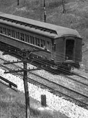
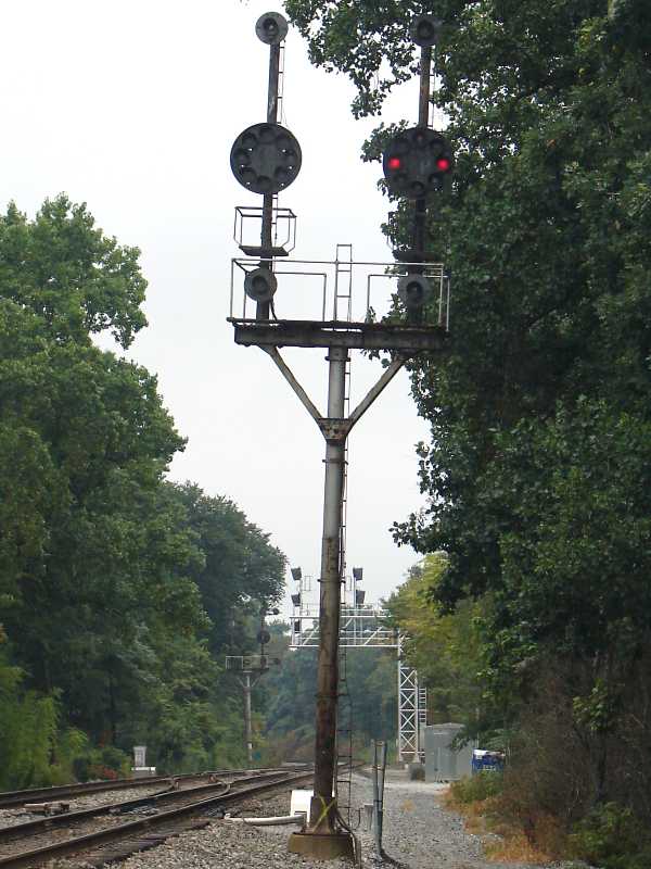
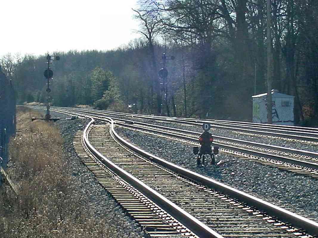
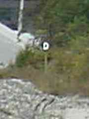
Before the CPLs, semaphore signals controlled the Washington Branch, this one labelled E194. I presume E is for eastbound, and 194 represents mile 19, 
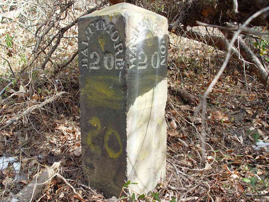
adjacent to utility post 40. With 40 posts to the mile, this puts the location near mile 20, and indeed milestone 20 appears to stand in the foreground.

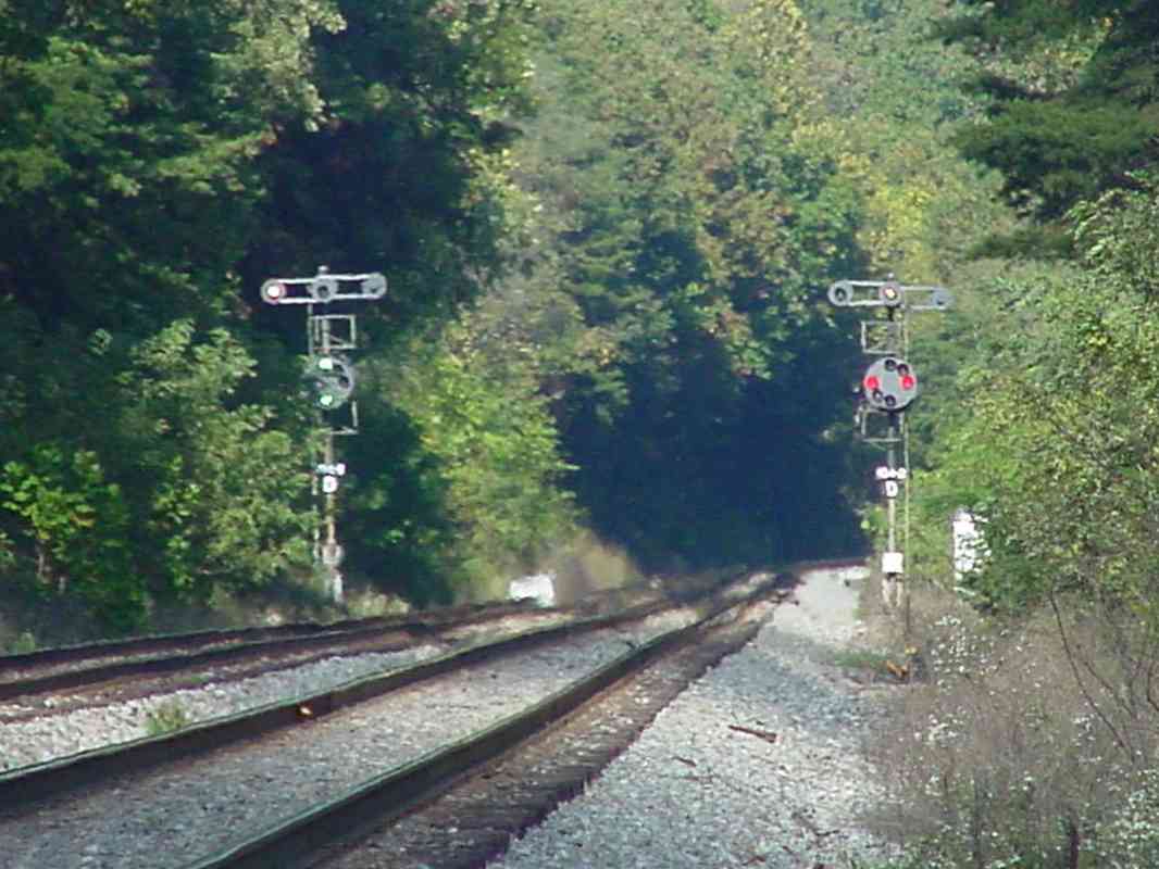
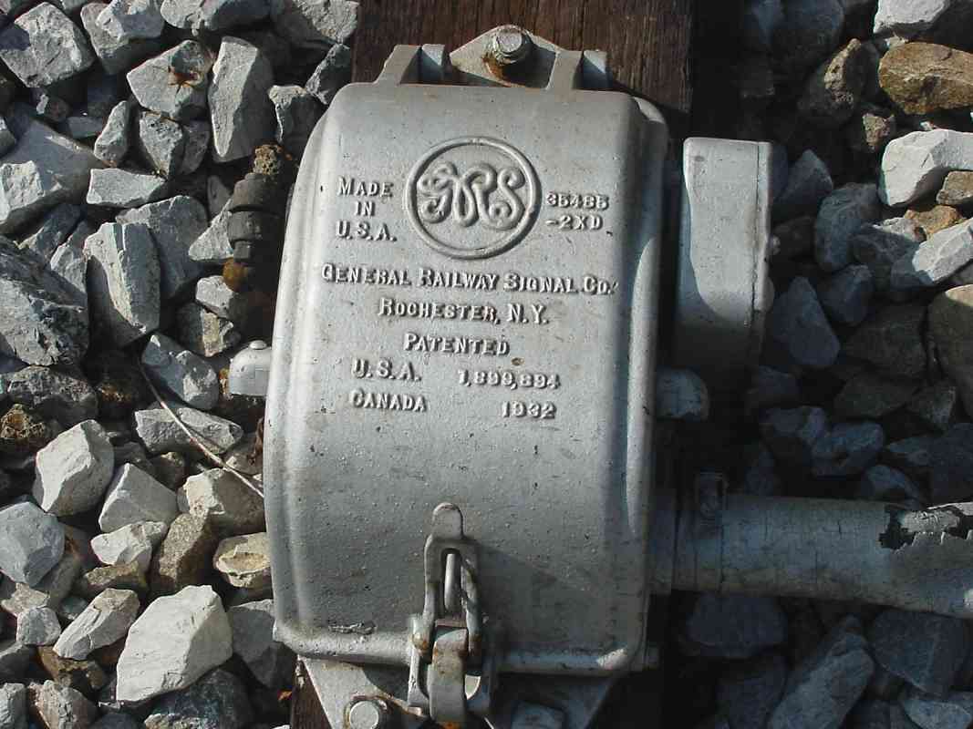
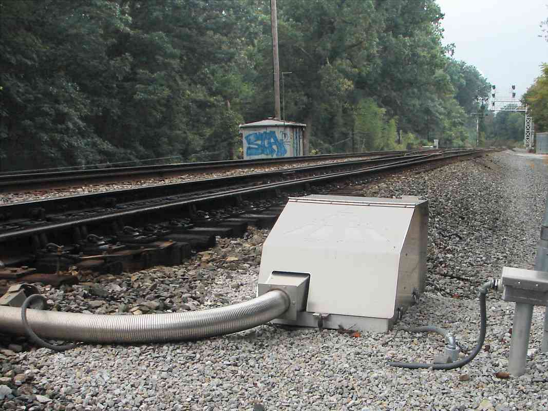
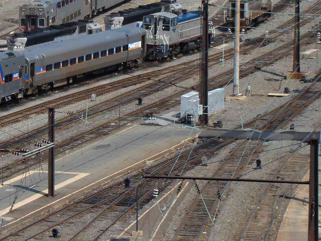
Across from the semaphore is its control box, several of which remain extant along this stretch. A fence of some sort between the control box and milestone appears to mark the boundary of neatly maintained ballast.

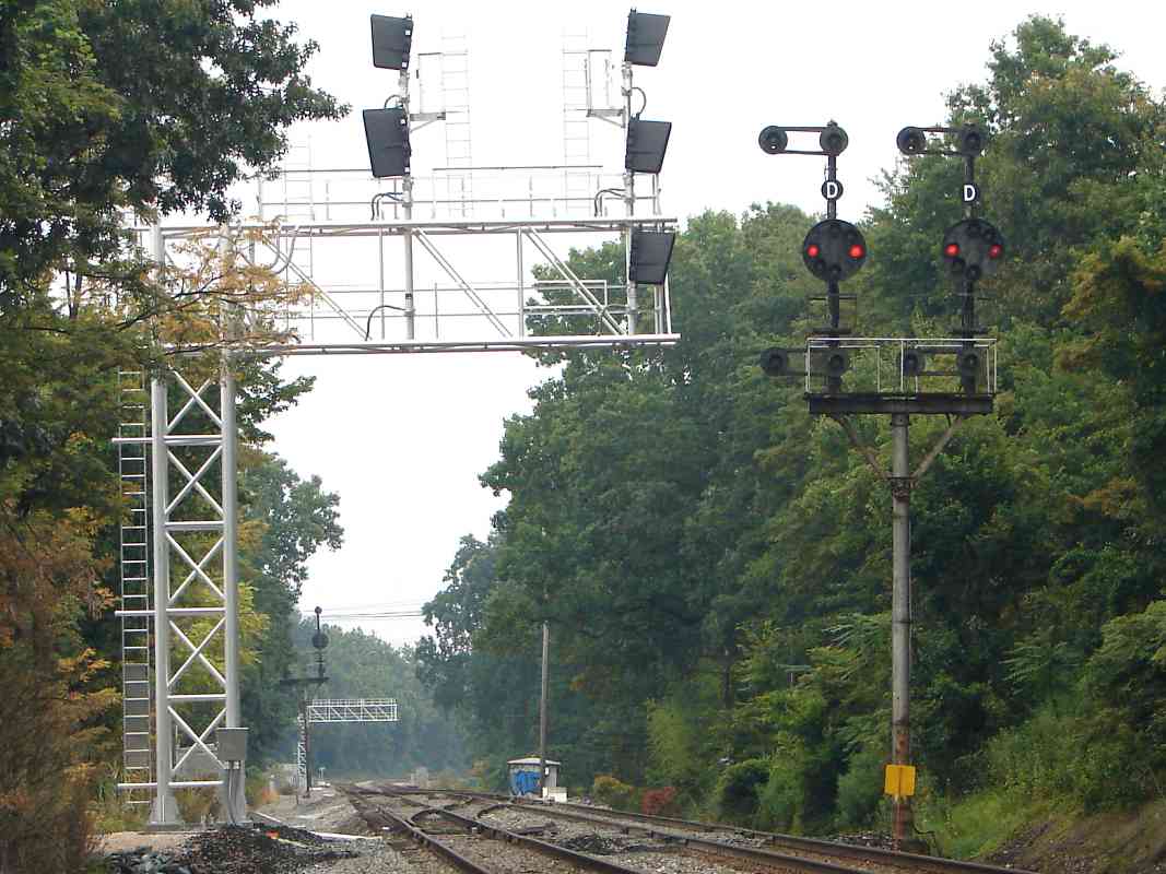
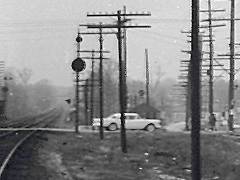
The hillside cut depicted here is the most significant of the Branch, and is now overgrown with trees.


Crossovers

Crossovers
Mile: 26.1 Date: Jan 2003
Ease: A- View: NE
Area: B IC2:
Map: PG 3 K 12 Topographic Maps

The crossover tracks at Ammendale west of Muirkirk get a set of four CPLs.


Greenbelt

Greenbelt
Mile: 29.1 Date: Dec 2003
Ease: A- View: SW
Area: B IC2:
Map: PG 7 H 7 Topographic Maps

The creature wearing a D hat says, "Take me to your leader."


Hyattsville

Hyattsville
Mile: 32.8 Date: Apr 2004
Ease: B+ View: S
Area: C IC2:
Map: PG 12 E 3 Topographic Maps

The Alexandria Branch (left) joins the main line at Hyattsville near the former location of JD Tower. Apparently at the time of the photo in-line signals were not yet ready, so CSX moved pole-mounted CPLs to the new structure.

Links to older pictures: tower in 1991, JD Tower history site


Bridge

Bridge
Mile: 33.6 Date: Apr 2004
Ease: A- View: E
Area: C IC2:
Map: PG 12 C 5 Topographic Maps
cpl

Slightly further west the new signal bridge is up but the CPL remains on a pole. During the 1950s, a grade crossing existed here where 42nd Place meets Rhode Island Avenue.

At the left edge of the inset photo at left (courtesy Herb Harwood collection) find this same CPL about 1957.


Back-to-Back

Back-to-Back
Mile: 34.8 Date: Jun 2004
Ease: B View: NE
Area: C IC2:
Map: PG 12 A 8 Topographic Maps

No crossovers to guard means the CPLs for both directions can be mounted on the same pole. The number boards get a hyphen and suffix digit to uniquely identify the signal, but the purpose of the extra 2 before the hyphen is a mystery to me. The back-to-back signals at milepost 10.4 did not have the extra 2.


Out with the Old

Out with the Old
Mile: 35.9 Date: Jun 2004
Ease: A View: NE
Area: C IC2:
Map: DC 10 J 10 Topographic Maps

A concrete doughnut marks the former location of a CPL.


Ivy City
Photo courtesy Dave Hiteshew

Ivy City
Mile: 37.3 Date: Oct 2008
Ease: B View: NE
Area: D IC2:
Map: DC 10 F 11 Topographic Maps

This left two of this CPL trio control the leg of the wye that connects the Metropolitan Branch to the Washington Branch. The rightmost CPL watches traffic out of Washinton's Union Station eastbound toward Baltimore. The tracks in the foreground under the catenary once hosted Pennsylvania Railroad traffic, but now see Amtrak Northeast Corridor trains and MARC Penn Line trains.


Pennsy
Photo courtesy Dave Hiteshew

Pennsy
Mile: 37.4 Date: Oct 2008
Ease: B View: NE
Area: D IC2:
Map: DC 10 F 11 Topographic Maps

The ex-Pennsylvania Railroad's signals in this area resemble B&O CPLs, but have notably smaller lenses.


Yard
Photo courtesy Dave Hiteshew

Yard
Mile: 38.5 Date: Oct 2008
Ease: B View: N
Area: B IC2:
Map: DC 10 D 13 Topographic Maps

Lots of tracks in the Union Station yard mean lots of signals, and a big bridge. The station adopted the B&O CPL format, but these look smaller to me and the marker lamps are somewhat different.

Links to pics of semaphores here: 1920, 1920s


Dwarves
Photo courtesy Dave Hiteshew

Dwarves
Mile: 38.8 Date: Sep 2008
Ease: B View: N
Area: B IC2:
Map: DC Dwn 9 A, PG 17 D 1 Topographic Maps
high

Union Station, where the Washington Branch ends, has more dwarves than Snow White. It has plenty of trains too: that's MARC 51 and 61 at top left, along with Amtrak switcher 533.

The small CPLs are positioned to control both incoming and outbound trains.

With so many tracks and platforms, at bottom-center of the photo there's even an example of the rare high-mounted dwarf CPL (magnified at left).


Thanks for looking at this CPL signal overview. Other sites have more info:
you may enjoy Todd's RR Signal Basics,
and Glossary of RR Signal Terms.

Return to main page


Copyright Notice