


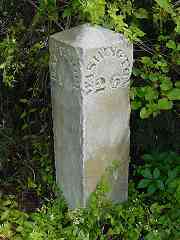
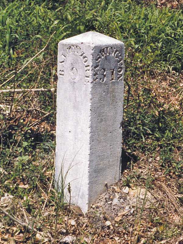
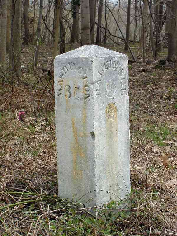
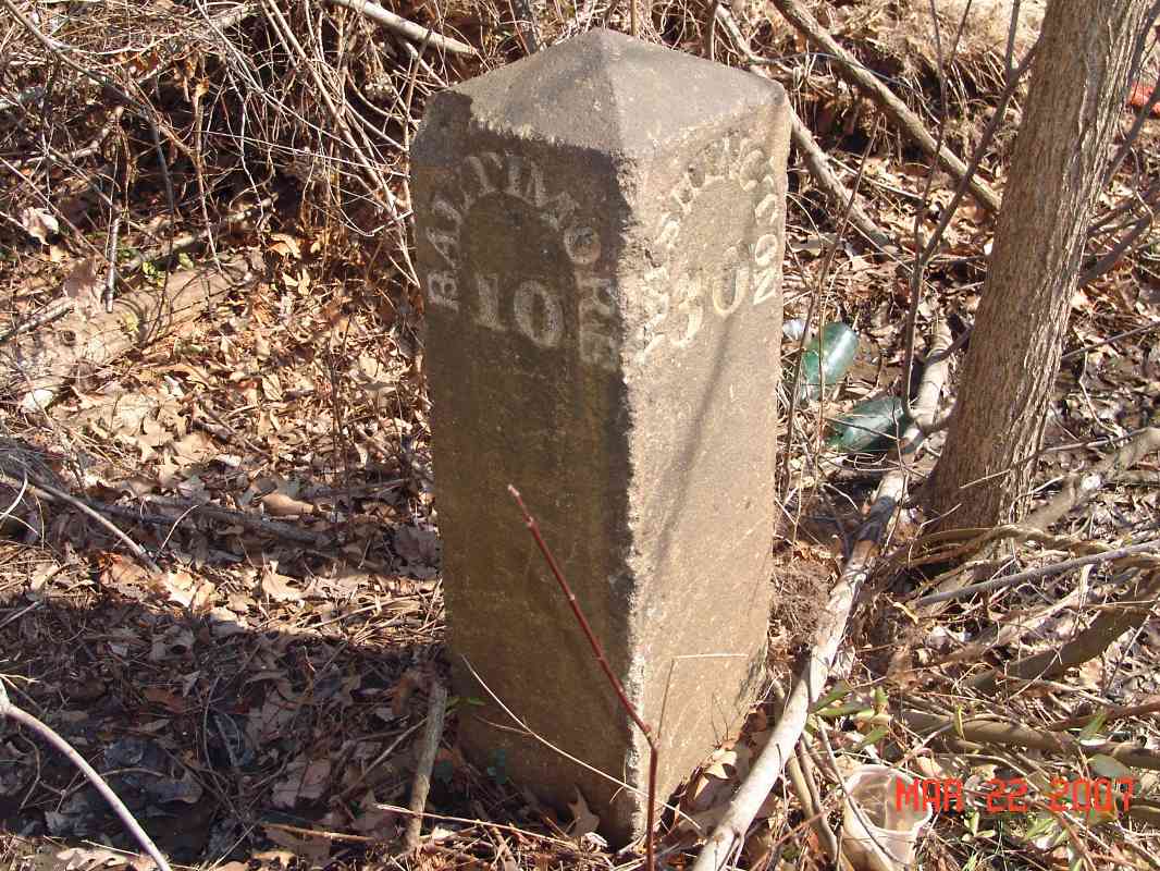
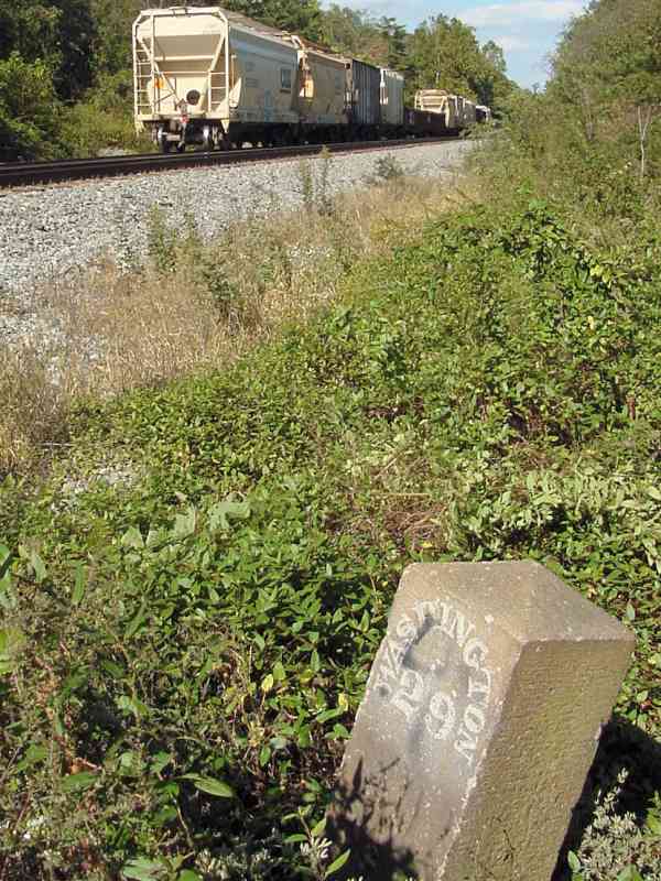
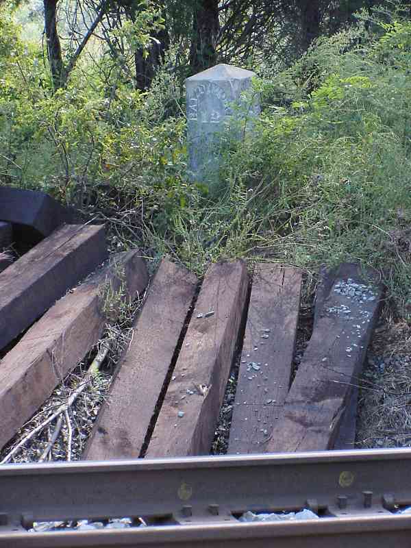
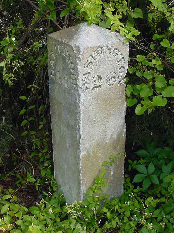
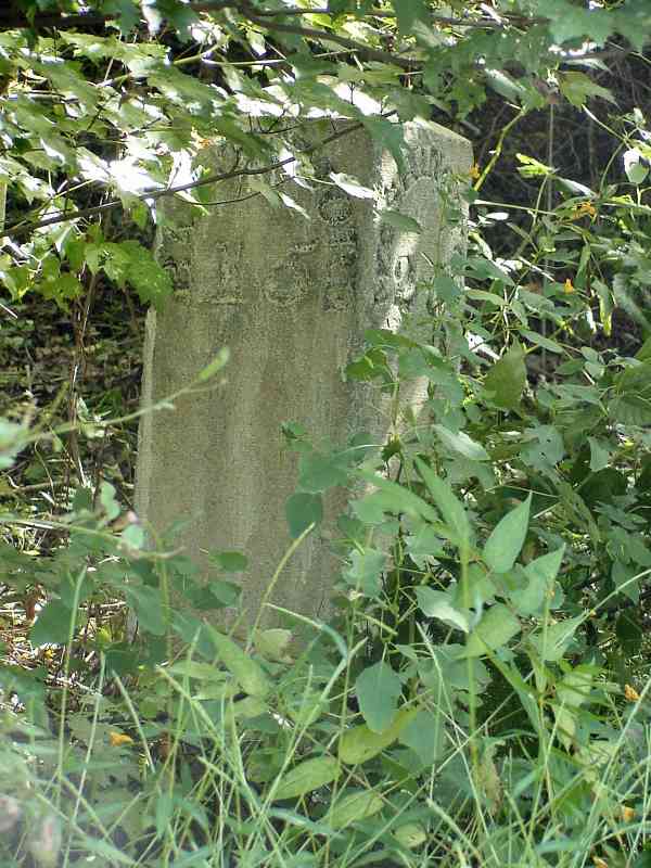
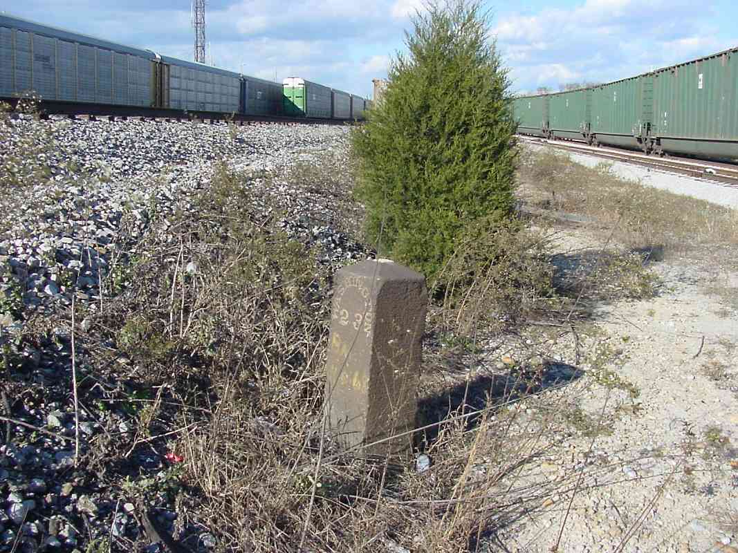
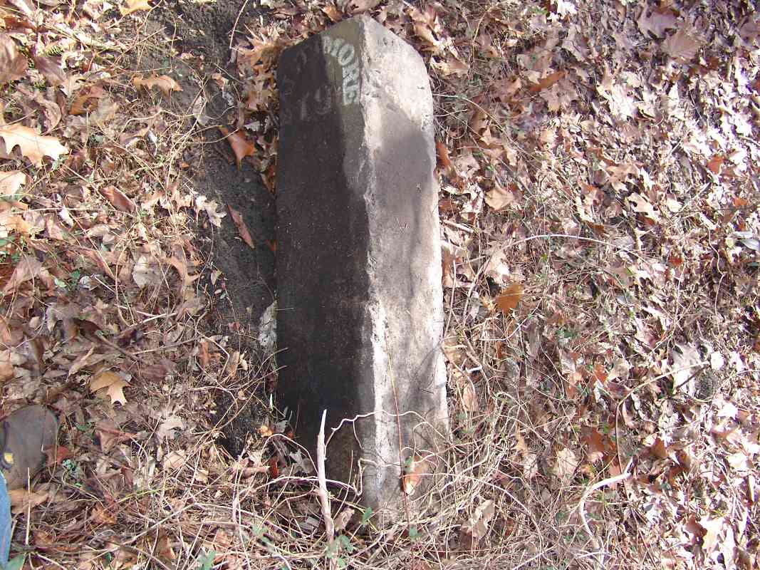
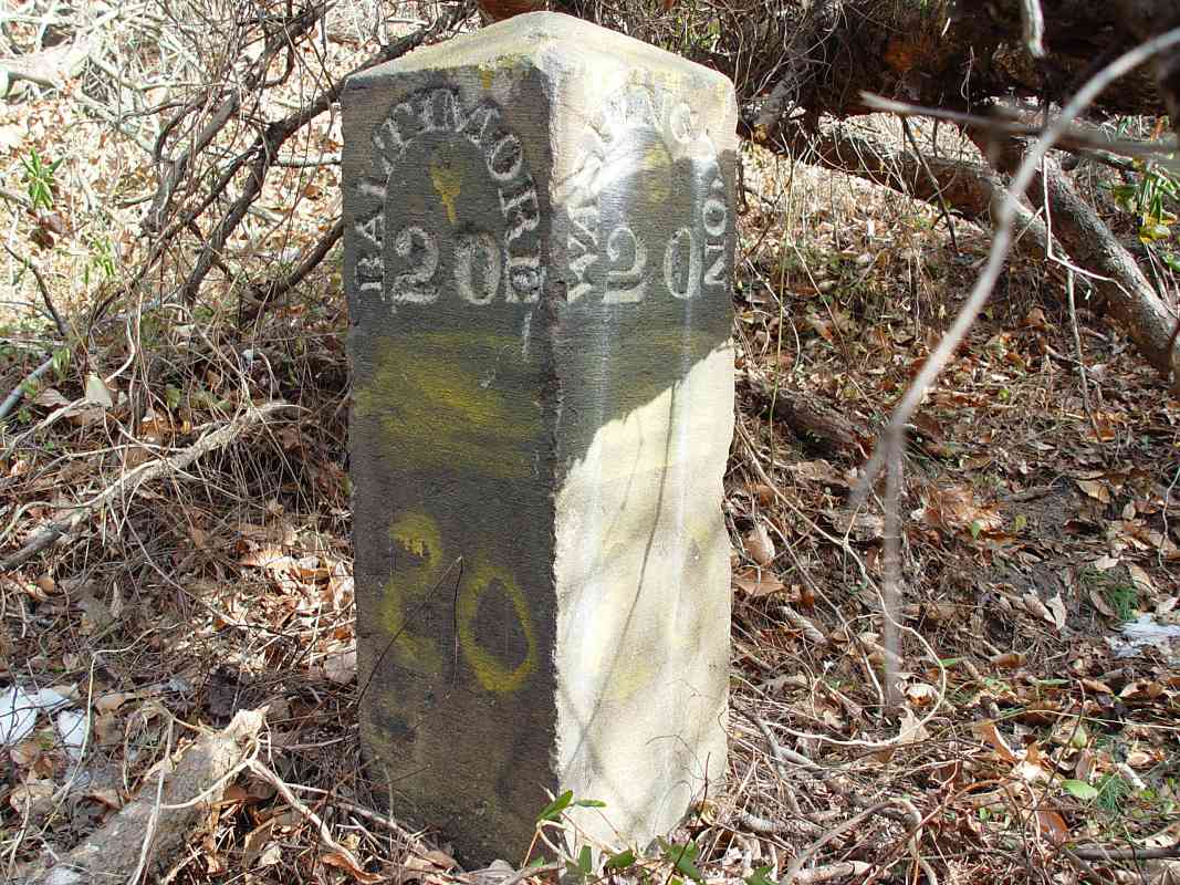
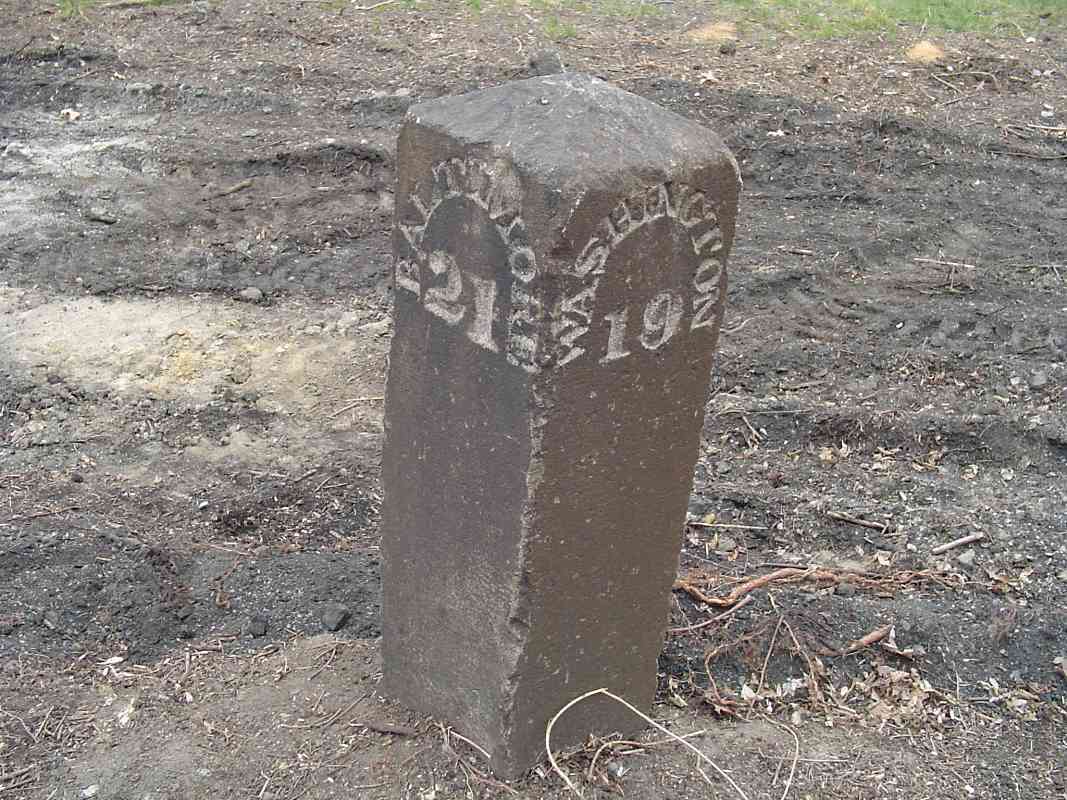
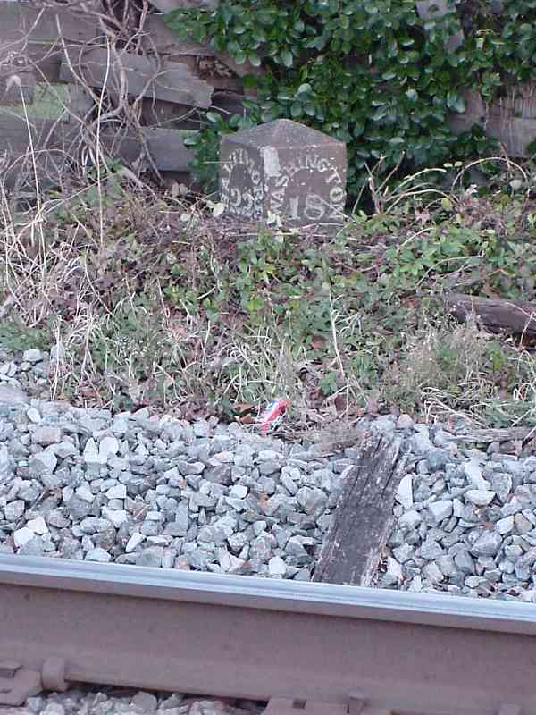
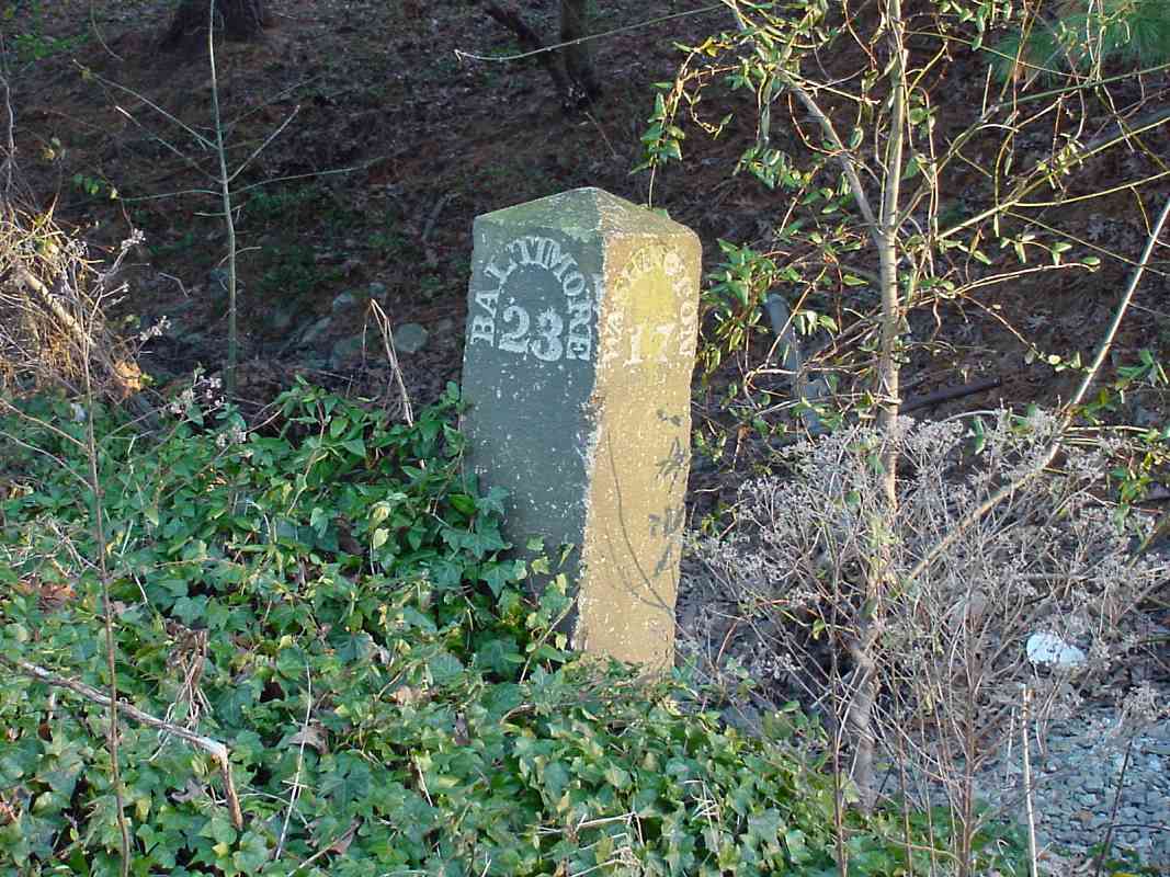
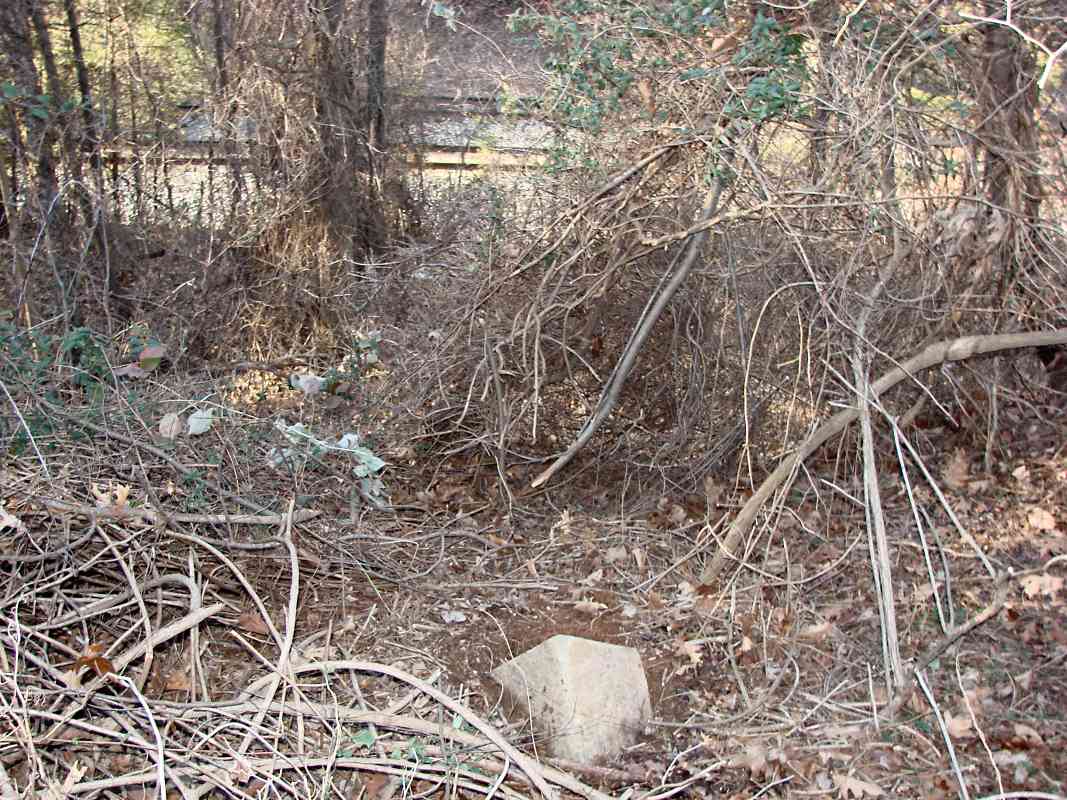
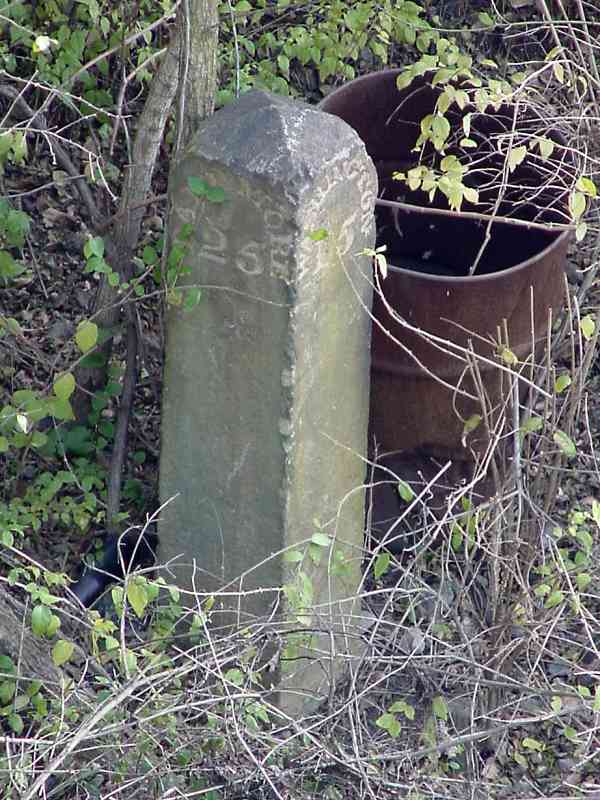
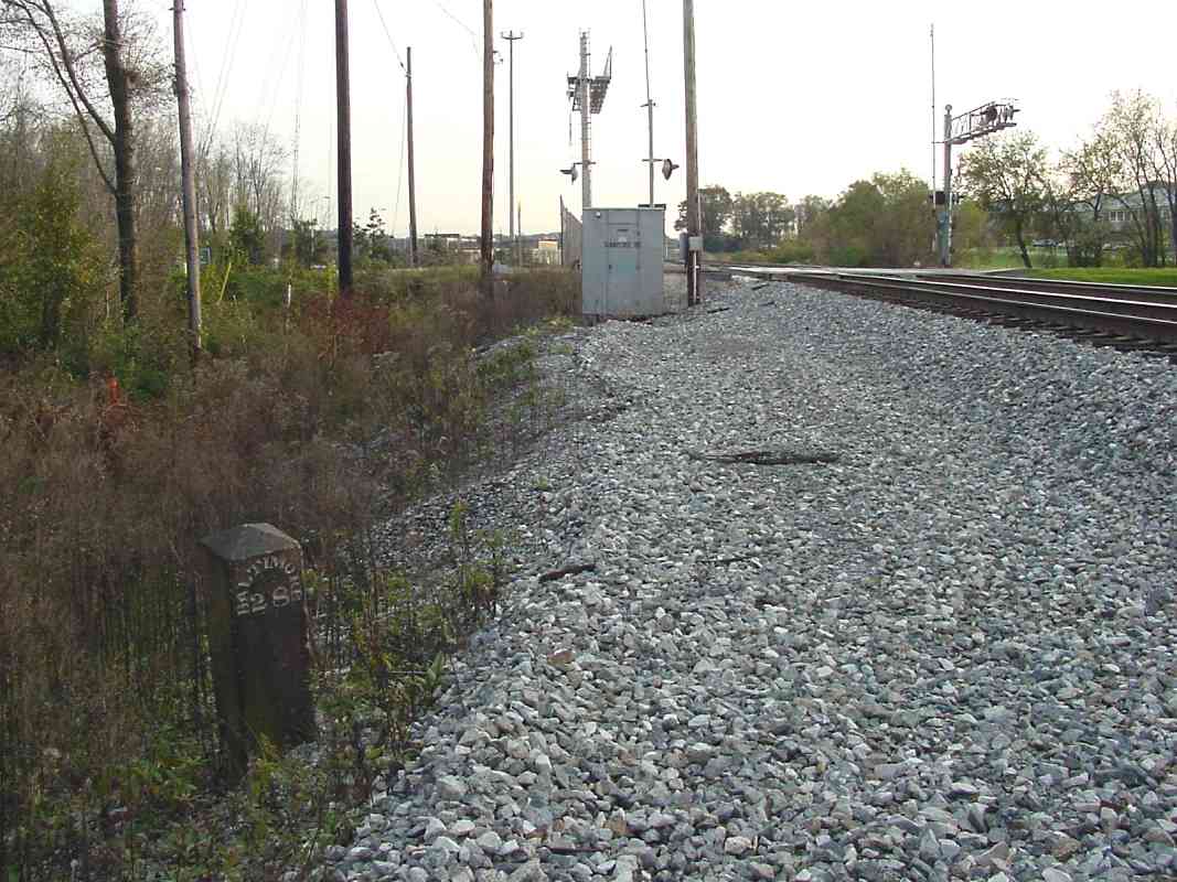
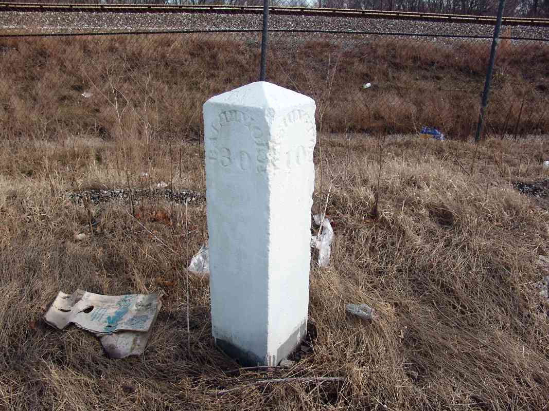
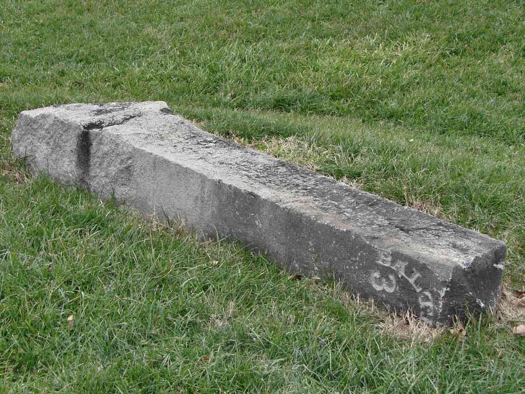
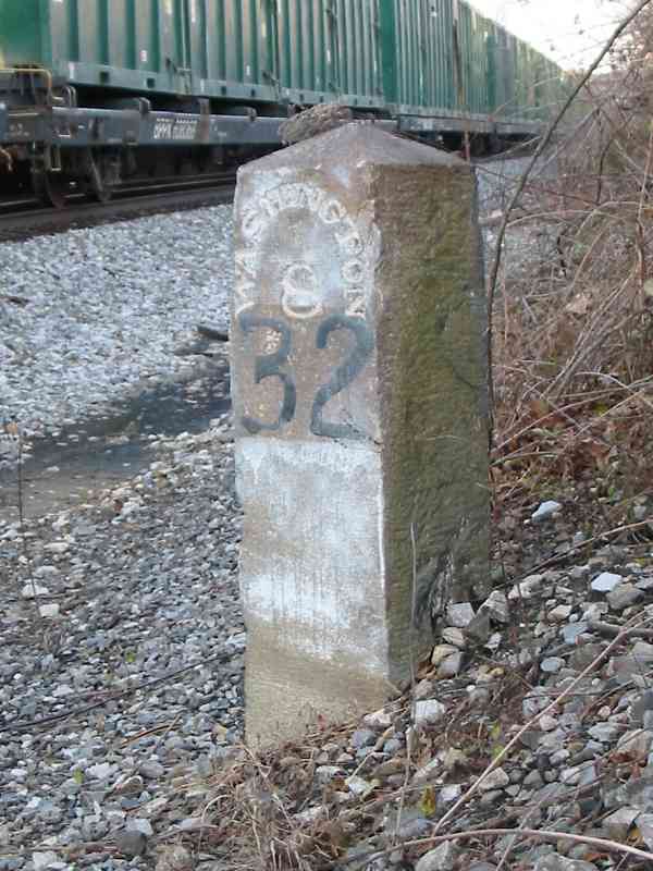
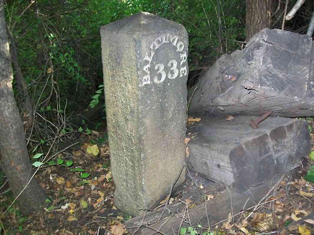
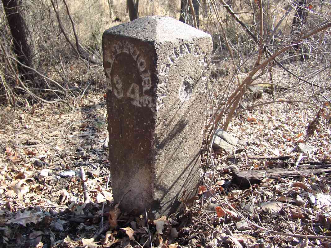
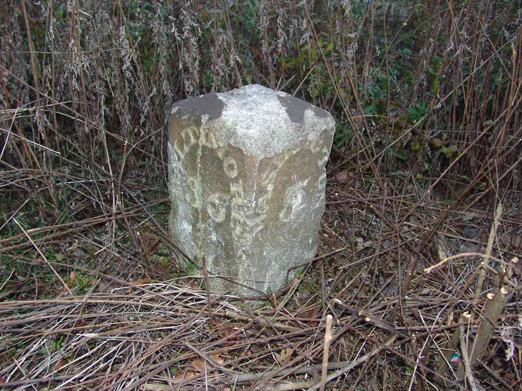
 When in 1835 the B&O Railroad built the Washington Branch from Relay, Maryland
to Washington, DC, they installed stone mile markers along the route.
Engraved into each stone
is the distance from Baltimore and Washington. The values always total 40,
since at the time, that was the distance between B&O's primary passenger
stations in those cities.
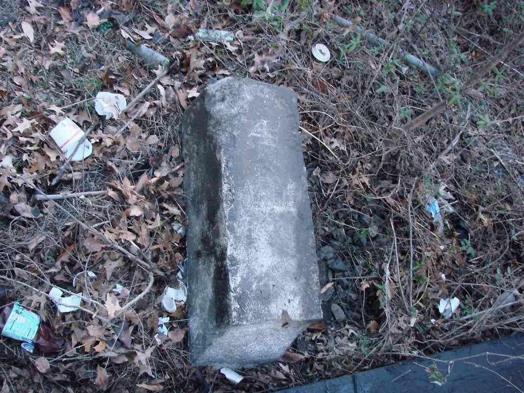
When in 1835 the B&O Railroad built the Washington Branch from Relay, Maryland
to Washington, DC, they installed stone mile markers along the route.
Engraved into each stone
is the distance from Baltimore and Washington. The values always total 40,
since at the time, that was the distance between B&O's primary passenger
stations in those cities.
No markers between Baltimore and Relay (the first 8 miles) have been found, suggesting they may never have existed.
Some of these original markers between Relay and Washington survive to the present. All the known ones are located on the southeast side of the tracks, except at Relay which had markers on both sides until removal by CSX. A steel "S" post can be found at some of the mile locations that designates the start/end of a measured mile for the purposes of locomotive speed tests.
The table below shows the status of the markers when last checked sometime within the first few decades of the 2000s.
Any comments? EMail me.
| MILE | NEAR | NOTES / PICTURES | ADC MAP |
|---|---|---|---|
| 9 | Relay | north *, south; both removed 2007 | Ba 41 H 12 |
| 10 | Paradise Ave. | extant * (DH) | Ho 17 K 7 |
| 11 | Patuxent Quarter Rd. | extant * | Ho 17 J 9 |
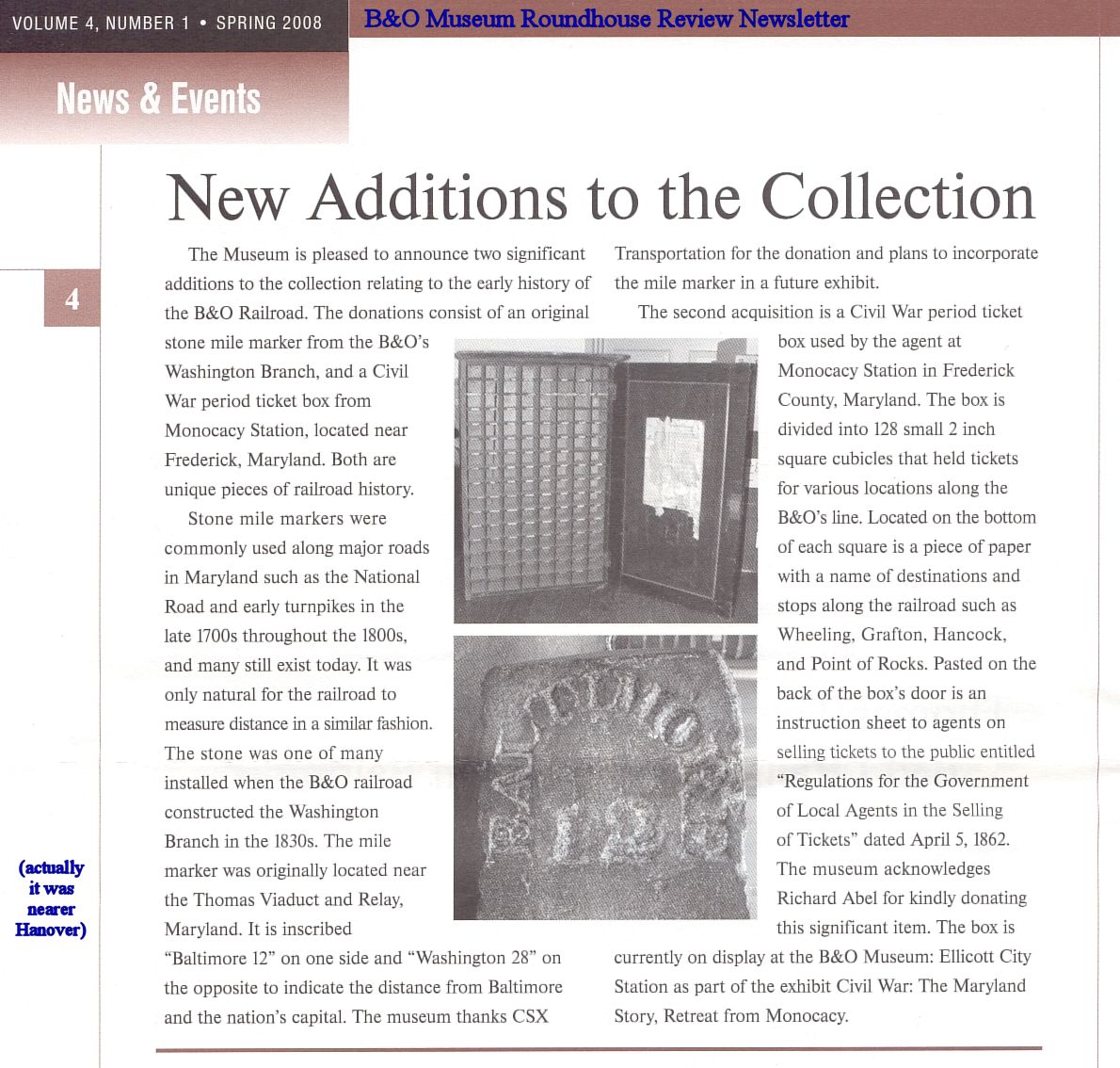
| 12 | Smith Ave. | removed, now at B&O Museum | Ho 17 F 10 |
| 13 | Dorsey Station | NO; S post | AA 1 B 12 |
| 14 | End Oak Ave. | damaged 2007; S post | AA 6 A 1 |
| 15 | Montevideo Road | removed, now found elsewhere | AA 5 J 3 |
| 16 | Jessup | NO | AA 5 G 5 |
| 17 | Jessup Yards | gone * | AA 5 F 7 |
| 18 | Main St. | gone * (DH) | AA 5 E 9 |
| 19 | Water Plant | extant * (DH) | AA 5 B 9 |
| 20 | Pfister Lane | extant * (DH) | AA 4 K 11 |
| 21 | Laurel Racetrack Station | extant * (DH) (RDV), west of modern mp 21 | AA 4 H 13 |
| 22 | Milestone Manor Apts | extant * | PG 4 H 4 |
| 23 | Holly St. | extant * | PG 4 G 7 |
| 24 | Cemetery | buried * (DH) | PG 4 D 8 |
| 25 | Muirkirk Road | extant * | PG 4 B 10 |
| 26 | Ammendale Road | NO, unless buried | PG 4 A 12 |
| 27 | Talbot Ave. | NO, unless buried | PG 7 J 2 |
| 28 | Sunnyside Ave. | extant * | PG 7 J 4 |
| 29 | Lackawanna St. | NO (Greenbelt Metro) | PG 7 H 7 |
| 30 | Greenbelt Road | extant * (DH) | PG 7 G 9 |
| 31 | Paint Branch | + rediscovered 2021 *, study underway; S post | PG 7 F 11 |
| 32 | NOAA | extant * (MH); S post | PG 12 E 1 |
| 33 | Kennedy St. | reported gone 2022 * (MH) | PG 12 D 4 |
| 34 | Northwest Branch | extant * (DH) | PG 12 C 6 |
| 35 | Newton Street | extant * (DH) | PG 12 A 8 |
| 36 | 24th Pl. | extant * (DH), was in place for 2002 video | DC 10 J 10 |
| 37 | Kendall St. | NO (original route followed WV Ave.) | DC 10 G 12 |
| 38 | 6th & I St. | NO | DC 10 E 13 |
| 39 | Louisiana & New Jersey Ave. | ? | DC 16 C 2 |
| < 40 | Pennsylvania Ave. & 2nd St. | ? | DC 16 C 2 |


