TrainWeb.org Facebook Page
B&O Washington Branch Photo Tour


B&O Washington Branch
Modern day photo tour

Accompanying each photo below are:

Click a photo to see a larger view. Please send your comments and corrections to Steve.


<< Previous (east) | THIS PAGE: Waterloo Branch | Next (Columbia Branch) >>

Brief Historical Background: Waterloo Branch

Please note that the Topographic Maps linked below date from around 1980. Many of the roads and intersections, particularly those near Columbia, have changed since that time.

Spur Start

Spur Start
Mile: 16.2, spur 0.0 Date: Sep 2002
Ease: B View: N
Area: B IC2:
Map: Ho 20 J 6 Topographic Maps

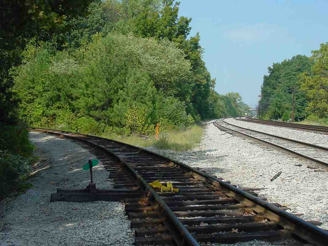
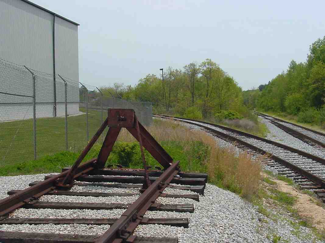
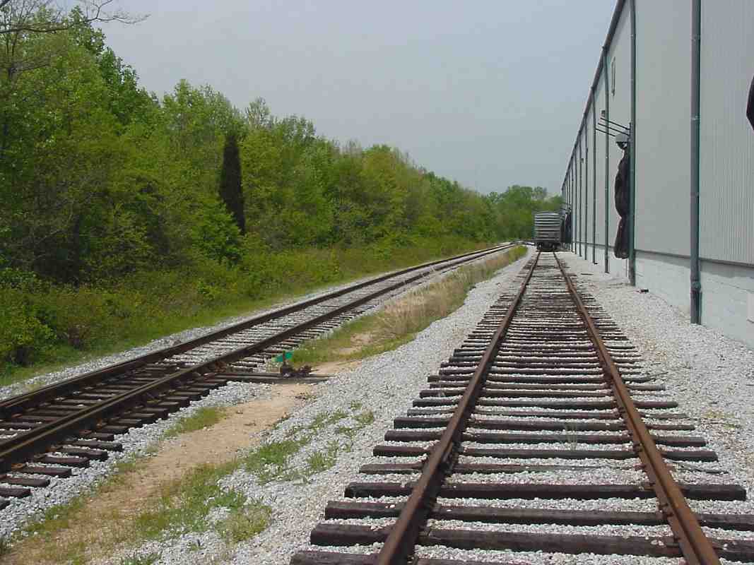
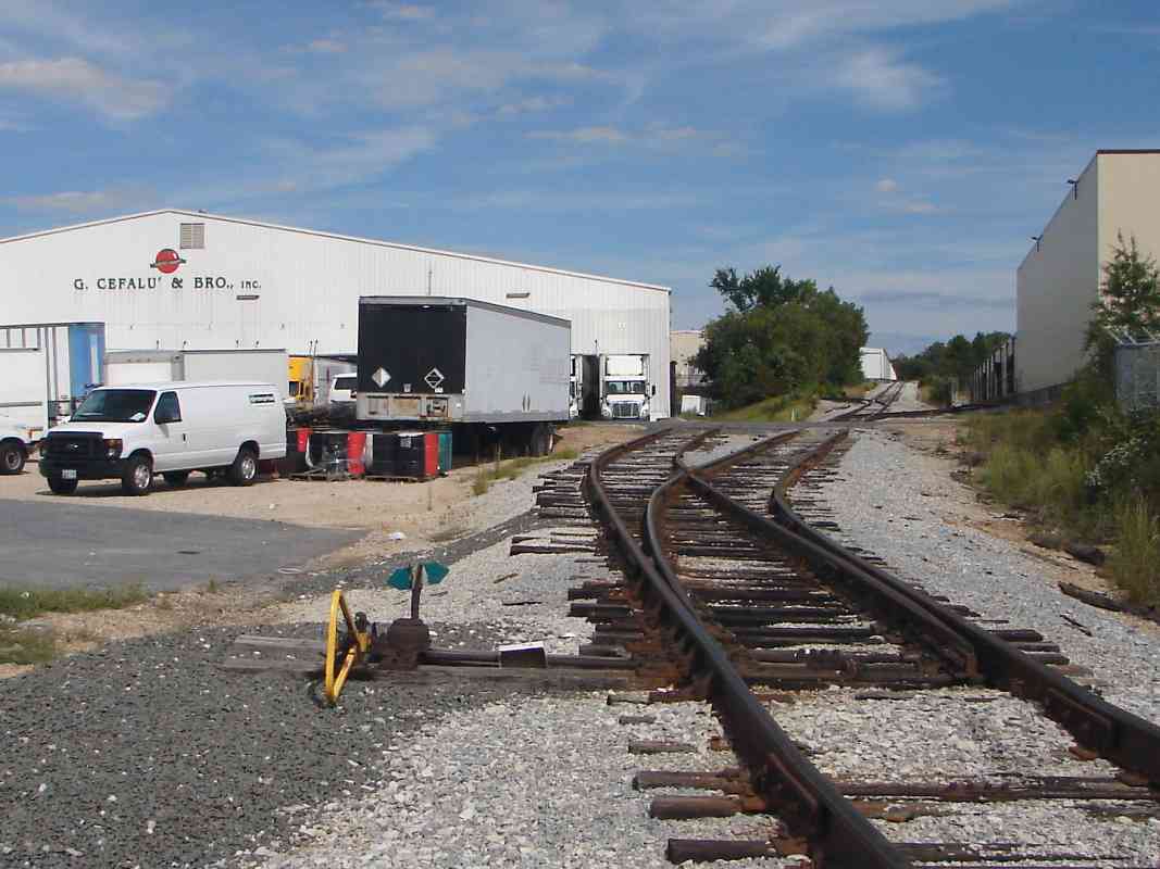
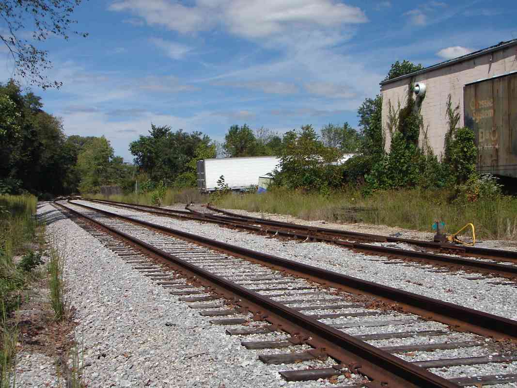
The Waterloo Branch starts here as it splits from the main line's siding and heads to the left in this picture.

The yellow-painted object in the foreground is a derail, a device that can either stop or derail a car. It can be closed to prevent train access from and to the spur.

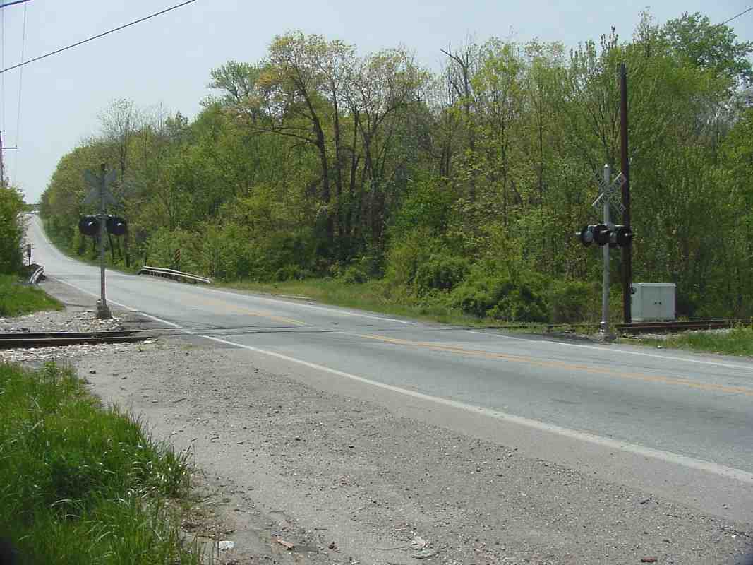
Off in the distance on the right, the signals shown on the previous page are barely visible alongside the mainline tracks.


Uneven Tracks

Uneven Tracks
Mile: 16.2, spur 0.1 Date: Sep 2002
Ease: B View: NW
Area: B IC2:
Map: Ho 20 J 5 Topographic Maps

Amidst the pine cones, the combination of jointed rail and a lack of maintenance on this low-speed spur shows here in the uneveness of the tracks.


Gap

Gap
Mile: 16.2, spur 0.2 Date: Sep 2002
Ease: B View: N
Area: B IC2:
Map: Ho 20 H 5 Topographic Maps

At least one of the gaps between the jointed rails is filled with some scrap steel, as seen in this closeup. Ostensibly, this is to reduce the amount of flexing in the joint as wheels pass over it.


Dorsey Run Road

Dorsey Run Road
Mile: 16.2, spur 0.4 Date: Apr 2002
Ease: A+ View: SW
Area: B+ IC2:
Map: Ho 20 H 5 Topographic Maps

CSX 6542 courtesy Kirk Nabors The only significant grade crossing for this spur is here at Dorsey Run Road. The road bridge a short distance away spans the Dorsey Run tributary of the Little Patuxent River. The spur basically parallels the tributary along its northeastern bank.

The CSX 6543 photo at left, courtesy Kirk Nabors, illustrates service on the line during April 2018.


Culvert

Culvert
Mile: 16.2, spur 0.4 Date: Apr 2002
Ease: A View: SW
Area: B+ IC2:
Map: Ho 20 H 5 Topographic Maps

There are no interesting stone arched bridges along the modern spur, just plain, boring piped culverts. I've included this one simply to show the unique design. It can be found just west of the grade crossing.


Bumper Post

Bumper Post
Mile: 16.2, spur 0.6 Date: Apr 2002
Ease: B View: SE
Area: B IC2:
Map: Ho 20 H 5 Topographic Maps

By its rusty condition and that of the rails, this modern bumper post, a "Hayes Type WD", would appear to not see much use, however this siding did have a few cars sitting on it. This bumper was later replaced with an Atlantic Track model AN3.

Other sidings split off the spur as well. This view looks back toward Dorsey Run Road.


Warehouse

Warehouse
Mile: 16.2, spur 0.6 Date: Apr 2002
Ease: B View: NW
Area: B IC2:
Map: Ho 20 H 5 Topographic Maps

Here's the view with the bumper post at my back. I neglected to note the name of the warehouse, but by the cars on the siding it does appear to actively use the railroad for shipping.

Reader Dean Cogar sent the following update:

    "Here is an update for the web page-I work for Sysco Foods-Baltimore and enjoy the daily passing of freight trains past our facility at Dorsey Run Road, and, up until about 4 months ago, we would receive about 2 to 3 box cars of frozen foods per week. But unfortunetly the early delivery of these boxcars 1 to 2 days before scheduled, and the railroad's insistence that we pay delay charges while they sat on the siding till there scheduled delivery time caused Sysco to end rail use for deliveries. It was with sadness as I watched construction workers take a torch to the rails to remove them for a warehouse expansion that is currently under construction."

Illinois Central Boxcar

Illinois Central Boxcar
Mile: 16.2, spur 0.7 Date: Apr 2002
Ease: B View: NE
Area: B IC2:
Map: Ho 20 H 4 Topographic Maps

a closeup of the modern paint scheme on IC 580860 next to the warehouse


Comp Bar

Comp Bar
Mile: 16.2, spur 0.8 Date: Apr 2002
Ease: B View: NE
Area: B IC2:
Map: Ho 20 H 4 Topographic Maps

A comp bar is employed to join the heavy-duty spur track with the smaller siding track.


Rappahannock Sidings

Rappahannock Sidings
Mile: 16.2, spur 1.1 Date: Sep 2014
Ease: A- View: E
Area: B IC2:
Map: Ho 20 H 3 Topographic Maps

Sidings beget more (rusty) sidings here and elsewhere along Rappahannock Avenue. When this spur was built truck-friendly I-95 was little more than a "Future Interstate Road" line on a Maryland map.

G. Cefalu and Bro., Inc. is a food distributor that has been in business for over a century. I wonder when their last incoming delivery arrived via train.

Link: GCefalu history pictures


B&O Boxcar

B&O Boxcar
Mile: 16.2, spur 1.1 Date: Apr 2002
Ease: A- View: NE
Area: B IC2:
Map: Ho 20 H 3 Topographic Maps

At least one prize awaits: a stranded boxcar wearing fading Chessie / B&O paint circa 1970, and now relegated to storage purposes.

This is the only boxcar with the B&O paint scheme I've seen surviving anywhere in the region. Its number is 475074. It sits on a siding behind a building near the western end of Rappahannock Avenue.


B&O Boxcar 2

B&O Boxcar 2
Mile: 16.2, spur 1.1 Date: Sep 2014
Ease: A- View: NE
Area: B IC2:
Map: Ho 20 H 3 Topographic Maps

Some twelve years later the boxcar is a little more rusty but still there. Since the time of the last photo, its siding has been disconnected.


Quieter

Quieter
Mile: 16.2, spur 1.1 Date: Sep 2014
Ease: A- View: N
Area: B IC2:
Map: Ho 20 H 3 Topographic Maps

Railroad activity on this spur appears less than it had been a decade ago.


Warehouses

Warehouses
Mile: 16.2, spur 1.4 Date: Sep 2014
Ease: B View: N
Area: B IC2:
Map: Ho 20 H 2 Topographic Maps

Ballast paths reveal the end of the spur had previously split even more directions. At the time of the photo this warehouse had limited activity, and one adjacent appeared shuttered. A distant trackside sign reads, "Track Out of Order Do Not Use".


Reflectors
NEW! late-May 2021

Reflectors
Mile: 16.2, spur 1.4 Date: Apr 2021
Ease: B View: E
Area: B IC2:
Map: Ho 20 H 2 Topographic Maps

This is the only switch stand I've seen equipped with colorized reflectors. The device shows a manufacturing year of 1979. Nearby track frogs are dated 1977.


ARMN 111339
NEW! late-May 2021

ARMN 111339
Mile: 16.2, spur 1.6 Date: Apr 2021
Ease: B View: N
Area: B IC2:
Map: Ho 20 H 2 Topographic Maps

This railcar near the end of the line tells us deliveries via train were still happening in 2021.

ARMN is a reporting mark employed by Union Pacific (UP) on some of its refrigerator cars. UP acquired the mark as part of its merger with the Missouri Pacific, who about 1973 had applied ARMN to cars it had acquired from the American Refrigerator Transit Company.


<< Previous (east) | THIS PAGE: Waterloo Branch | Next (Columbia Branch) >>

Or, return to main page

Copyright Notice