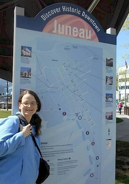
Kandace Tabern poses for a picture in downtown Juneau, Alaska
(Robert Tabern photo)
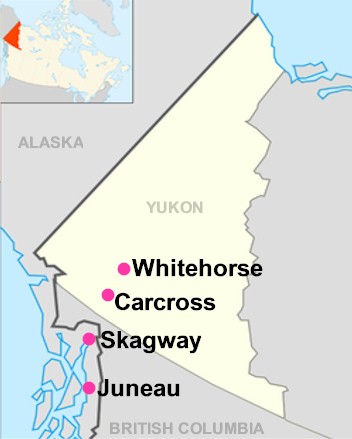
We arrived into
Juneau in the middle of the day, and had about an hour to walk around the
downtown area and grab some lunch. We were actually not very impressed with downtown
Juneau, as it seemed to cater very heavily to cruise passengers, with way too
many t-shirt shops and jewelry stores. After a few slices of pizza, it was time
to meet up with the bus that was part of a tour package associated with Alaska
Fjordlines, Inc. Joining the tour in
mid-progress, we missed the narrated downtown bus tour. However, we did still
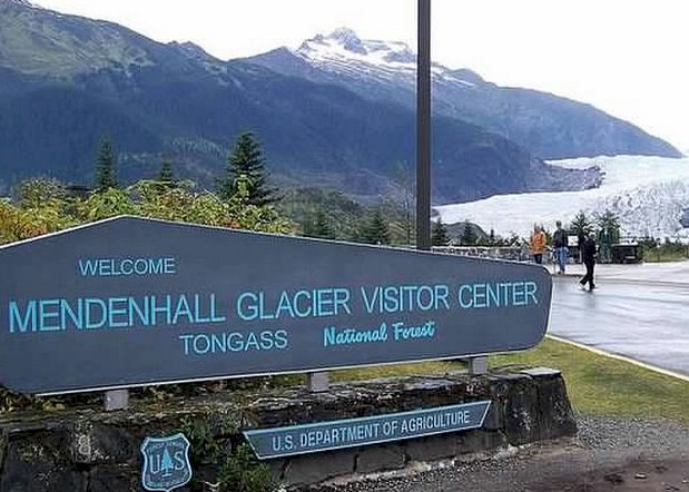
get to do the side-trip to Mendenhall Glacier.
Unfortunately, the tour only gave you one hour to see the beautiful site
buried deep in the Tongass National Forest. One could spend the whole day here,
in our opinion! If we ended up doing the complete tour with the company, we
would have been a little disappointed that you are given three hours (way too
much time!) in the tourist trap that is downtown Juneau, while only one hour to
explore the glacier and national forest landscape. With the hour allotted, we had enough time to
hike out to two overlooks, take some pictures, and explore around the visitor
center/museum. We really did not have much time to do anything else, nor take
the hike which would have taken you closer to the base of the glacier.
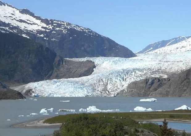
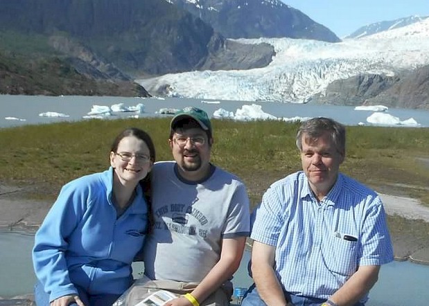 Photos from our visit to Mendenall Glacier in the Tongass National Forest
(Robert Tabern photos)
Photos from our visit to Mendenall Glacier in the Tongass National Forest
(Robert Tabern photos)
After our visit to Mendenhall Glacier, we caught the tour
bus which proceeded about 20 miles north on Alaska State Highway 7. This road
connects Juneau with Yankee Cove; this is where the highway ends and you have
to take a boat up the last part of the Inside Passage to travel farther north.
Along the highway we spotted a mother bear and her cubs. This was really
cool! Unfortunately, the highway was a
busy road and the bus could not stop very long – so a couple of quick pictures
and that were about it. It looks like the bears were oblivious to all of the
traffic as they were snacking on some dandelions.
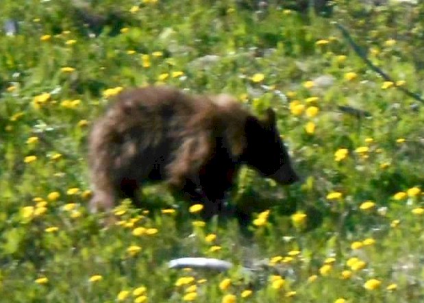 A bear, seen along the side of the road near Juneau, Alaska (blurry due to being on a moving bus!)
(Robert Tabern photo)
A bear, seen along the side of the road near Juneau, Alaska (blurry due to being on a moving bus!)
(Robert Tabern photo)
At Yankee Cove, we ditched the bus and got on the boat
that was owned by Alaska Fjordlines. It would take us on a three hour ride up
the Lynn Canal (Inside Passage) to Skagway. Robert sometimes gets sea sick and
isn’t a huge fan of boats, however the whole three hours we spent with Alaska
Fjordlines became one of the major highlights of the trip. The boat is a 65-foot
long, 48 passenger, high-speed catamaran.
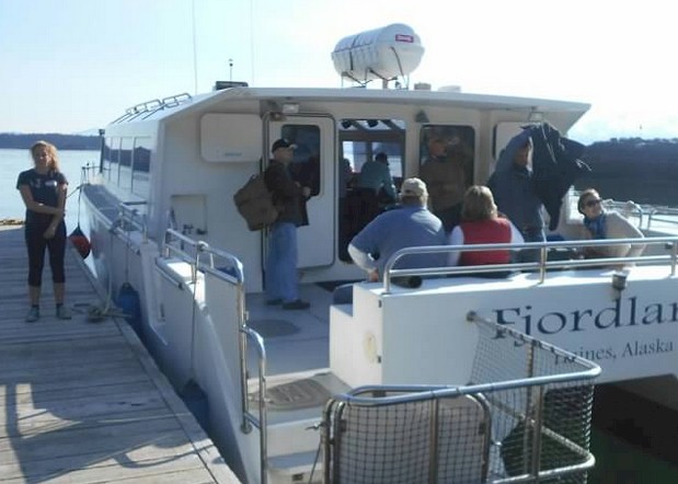
Various pictures of the "Fjordland", the boat that we took from Yankee Cove, Alaska to Skagway, Alaska
(Robert Tabern photos)
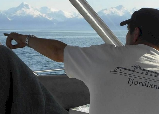
We learned from the owner/captain
that it was custom built for the waters of the Lynn Canal and specially
designed for viewing wildlife up close. And that we did!! We really lost count of all of the whales and
orca that we spotted during our time on the water. It was just amazing! This is
a complete five-star operation and a must-do for anyone who is planning a visit
to the southeast arm of Alaska.
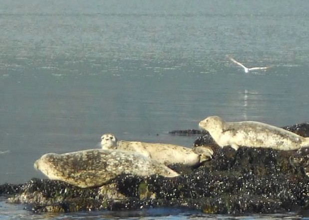
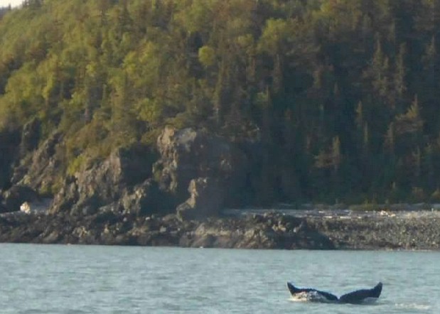
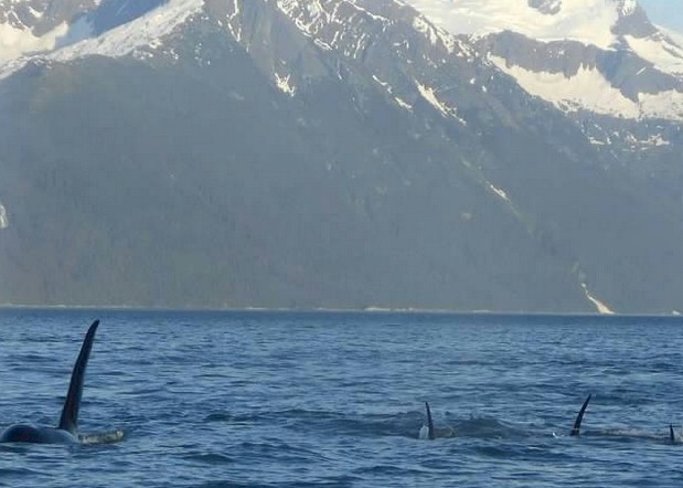
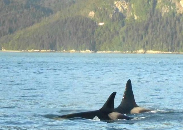
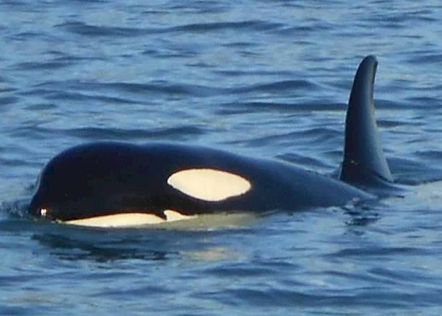 Photos of various sea life, as seen from the deck of the boat between Yankee Cove and Skagway, Alaska in Lynn Canal
(Robert Tabern & Mike Pace photos)
Photos of various sea life, as seen from the deck of the boat between Yankee Cove and Skagway, Alaska in Lynn Canal
(Robert Tabern & Mike Pace photos)
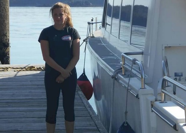
Alaska Fjordlines is owned and operated by Glen and
Alison Jacobson. They started their boating business as a water taxi between
Haines and Skagway in 1990. In 2001, they expanded their service running the
Fjord Express to Juneau. The whole experience remains family owned. On the
evening we were along, one of Glen and Alison’s daughters was along for the
ride and to help out passengers. She actually had an underwater camera; with a
monitor on the boat, we were actually able to see whales and orca under the sea
swimming. There was even a microphone broadcasted back to the deck so we could
hear some of the sounds the animals were making.
Again, a complete class act… and one of the
most memorable aspects of our whole 15-day vacation.
Passengers on the tour have the choice of taking the
Alaska Fjordlines boat to either Haines or Skagway from Juneau. It seemed to us
like half of the passengers got off the boat in Haines, and the other half
stayed on until we reached Skagway. Because of the way the mountains and the
ocean are positioned, Haines and Skagway are less than 20 miles from one
another by boat, but it would take you more than 10 hours to drive between
them. How interesting is that! No wonder
why the ferry service that the Jacobson family operated was so popular.
Obviously, we stayed on until Skagway, as that was where we would be spending
the next three nights.
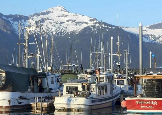 A view of the port at Haines, Alaska on Lynn Canal
(Robert Tabern photo)
A view of the port at Haines, Alaska on Lynn Canal
(Robert Tabern photo)
We spent two days and three nights in Skagway, Alaska during our
trip. Our hotel was the Historic Skagway Inn... it served as an old
brothel during the late 1800's. In fact, the guest rooms at the Inn are
named after the former "ladies of the night" who used to call the
residence home. The entire hotel is tastfully decorated in a brothel
theme with old clothes and historic items in the rooms and hallways.
Each morning they provided us a tasty breakfast and any directions or
suggestions we needed for sightseeing for the day. We would highly
recommend the hotel to everyone... it was a nice change from your
traditional chain motel. We got lucky and due to not a lot of people
staying there - got free upgrades to larger rooms.
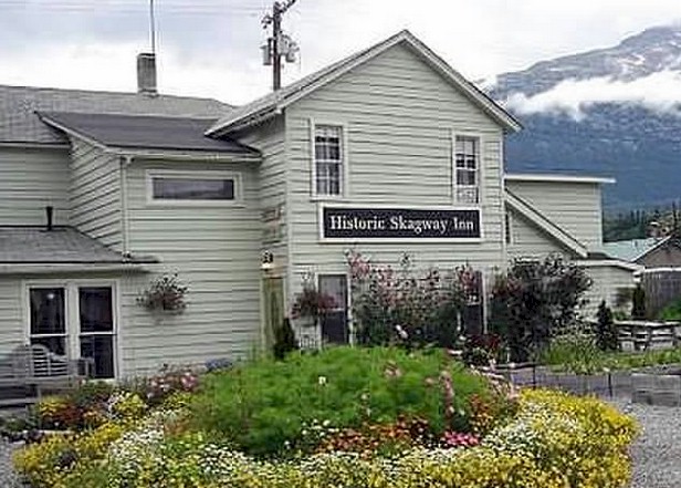
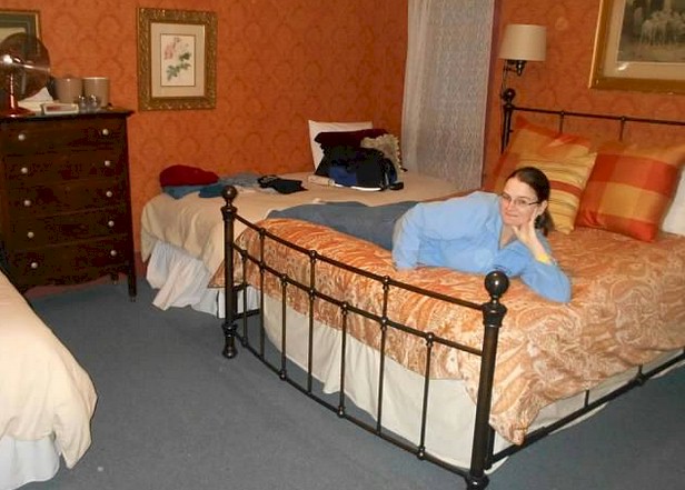 Some view of the Historic Skagway Inn - Skagway, Alaska
(Robert Tabern photos)
One
of the best tips we can give you about Skagway is get away from the
center of town during the day and then come back and explore in the
evening. We learned this from our local hosts at the Inn. See, about 95
percent or more of Skagway's visitors arrive on cruise ships. I think
every day we were in town there were three or four in port. From about
9:00am to 5:00pm you will be over-run by thousands of cruise ship
passengers flocking to fudge and jewelrey shops and t-shirt shops that
line the main street. We stayed in the main area of Skagway just long
enough to take a walking tour provided by the National Park Service and
then advoided the downtown strip until the cruise passengers were back
on the boat. It seems like a real interesting relationship the town and
the National Park Service has with the cruise industry. With such a
large volume of passengers arriving by cruise ship, the town would no
doubt be dead if it wasn't for it being a major stop on almost all
cruise lines. And, the businesses have paid to restore or reconstruct a
lot of the old shops, saloons, etc. that once lined main street. Where
else can you go to a National Park that has a fudge, t-shirt, and
diamond gold watch shop in it? But again, what would the National
Park look like if it didn't have the money coming in from these
businesses. So, sorta a love/hate relationship I guess you could say.
We thought it was a little tacky, but still looked pretty much
authentic.
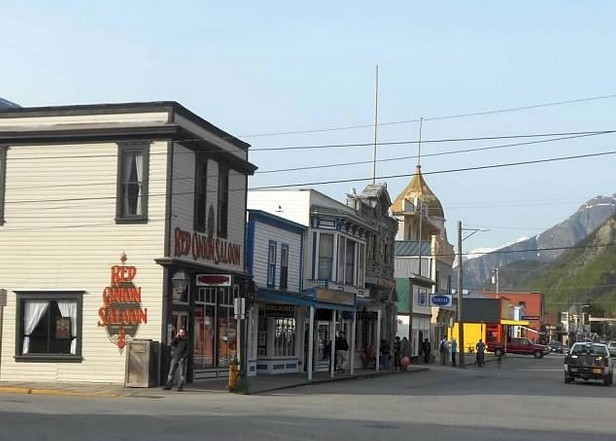 The main area of downtown Skagway, Alaska
(Kandace Tabern photo)
After a tour of the town on our first day, we hired a taxi/driver
service called "Dyea Dave" to take us around and show us some of the
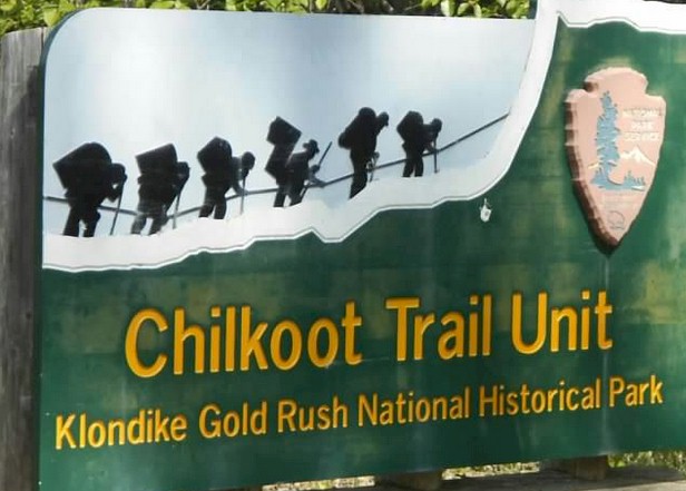
outskirts of the town. See, there were actually TWO gold rush towns
that were built in the area. You had Skagway and then Dyea. Both were
around the same size and featured trails to get over the tall mountain
peaks (separating the United States and Canada) and on to the gold
fields in the Yukon. People who came into Dyea would take the Chilkoot
Trail and people coming into Skagway would take the White Pass Trail.
Eventually, the trail from Skagway would be relaced by the railroad...
the White Pass & Yukon Route. With the convenience of the railroad,
almost everyone came into Skagway and no longer took the Chilkoot Trail
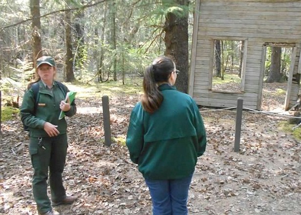
anymore. Dyea became a ghost town overnight. We ended up having a
private one-on-one tour of the Dyea town site from Elizabeth, a
National Park Service Ranger. We spent most of the afternoon of our
first day in the Skagway in the area with her exploring the remains of
the town site of Dyea, including the remains of an old saloon.
 Some scenic and historic views in the former town site of Dyea, Alaska, in the Klondike Gold Rush National Historical Park
(Robert Tabern photos)
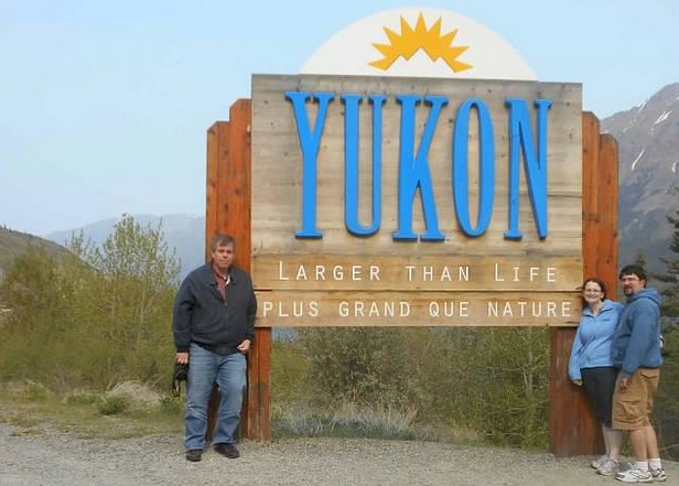
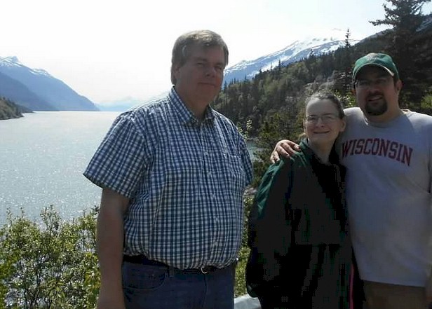
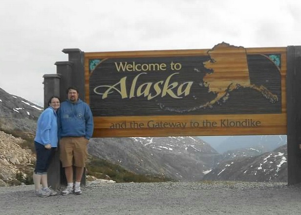 Some views of the drive between Skagway, Alaska and the Yukon
(Robert Tabern, Mike Pace, and Kandace Tabern photos)
Now
on to our next train... the White Pass and Yukon Route!! A little
history first though... The railroad began construction in 1898 during
the Klondike Gold Rush as a means of reaching the goldfields in Canada.
With its completion in 1900, it became the primary route to the
interior of the Yukon, almost eliminating the Chilkoot Trail and other
routes. The route continued operation until 1982. In 1988, it was
partially revived as a tourist railroad. Today, the railroad is a
subsidiary of Clublink and operated by the Pacific and Arctic Railway
and Navigation Company (in Alaska), the British Columbia Yukon Railway
Company (in British Columbia), and the British Yukon Railway Company,
originally known as the British Yukon Mining, Trading, and
Transportation company (in Yukon), which use the trade name White Pass
and Yukon Route. The White Pass and Yukon Route is a Canadian and U.S.
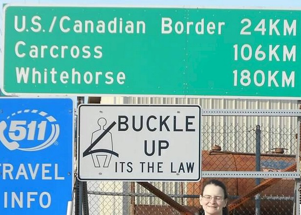
Class II Railroad, using 3 feet narrow gague railroad. At one time, the
tracks linked the port of Skagway, Alaska, with Whitehorse, the capital
of Yukon. While the tracks are still there, there is currently no rail
service anymore between Carcross, Yukon and Whitehorse, Yukon, however
there has been recent buzz about restroting the entire route so
passengers can ride the entire route. (For more information on this, check out this link to a 2012 newspaper article). Another interesting feature about
the White Pass and Yukon Route is that it is an isolated system and has
no direct connection to any other railroad. Equipment, freight, and
passengers are ferried by ship through the Port of Skagway, and via
road through a few of the stops along its route.
If you are planning a trip, you should note that there are a couple of
different options that the White Pass and Yukon Route offers to
passengers. It seemed like the most popular option was a simple
roundtrip ride between Skagway, Alaska and White Pass. This seemed like
the most popular option because it fit in with the cruise ship's
schedule and still allowed those coming to Skagway to enjoy some of the
other sites in town. Plus, since White Pass is right at the United
States-Canada border, someone without a Passport could still ride this
train. We decided that if we were going to do this trip, we wanted the
full experience -- and ride every inch of track possible. So, we took
the full excursion all the way to Carcross. Again, the end of the
usable track is in Carcross... so that meant having to board a bus to
get to Whitehorse. But, the cool thing about our trip in my eyes is
that we were actually using the White Pass & Yukon as actual
"public transportation" too - to get from Skagway where we arrived by
ship - to Whitehorse, where we would be spending one night and then
flying down to Vancouver to catch VIA's Canadian to continue our trip.
Below, enjoy a collection of some of our photos from the trip with a
brief explanation of some of the sights. After all, a picture is worth
a thousand words.
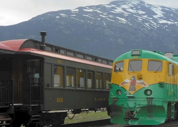
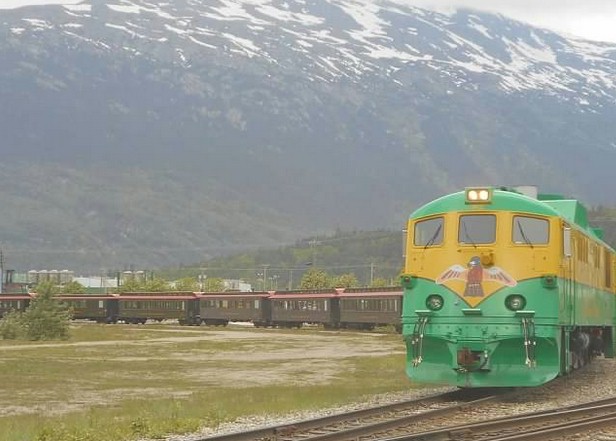
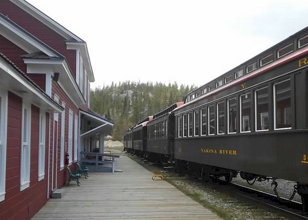
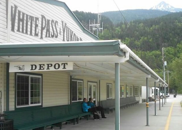 Boarding the train at the White Pass & Yukon Depot in Skagway, Alaska (Robert Tabern photo)
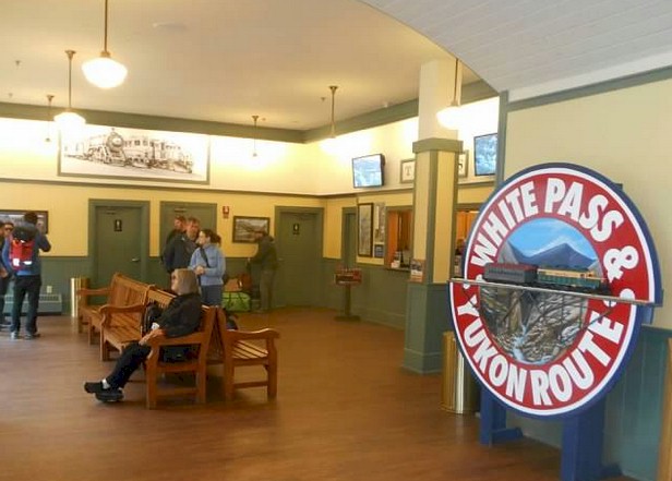
Mike Pace and Kandace (in the
distance) waiting inside the White Pass & Yukon Route station in
Skagway, Alaska (Robert Tabern photo)
Outside the White Pass & Yukon Route station in Skagway, Alaska (Robert Tabern photo)
Another view outside the White Pass & Yukon Route Station in Skagway, Alaska (Robert Tabern photo)
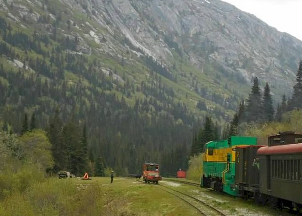
You begin climbing in elevation almost right after leaving the station in Skagway (Robert Tabern photo)
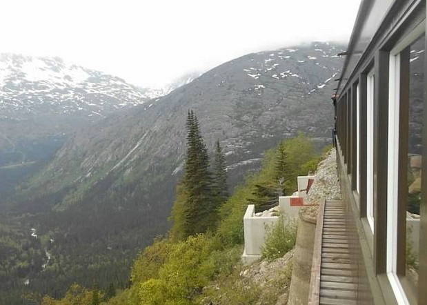
The view high in the mountains after 30 minutes after leaving Skagway... still in Alaska! (Robert Tabern photo)
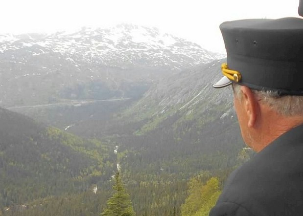
The conductor looks out of the open vestibule area of the train at the
tracks below we were just traveled (center, left) (Robert Tabern photo)
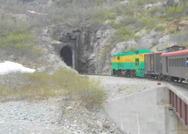
The train passes through a tunnel just before reaching White Pass Summit, Alaska (Robert Tabern photo)
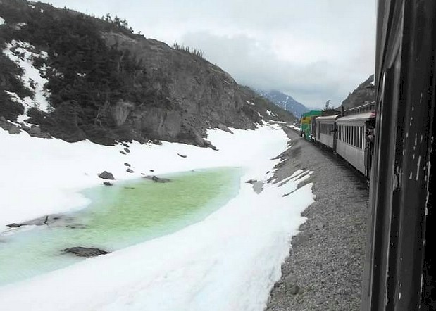
Yes, it's cold! It's late May 2014 and there is still snow and
ice near the approach to the White Pass, Alaska (Robert Tabern photo)
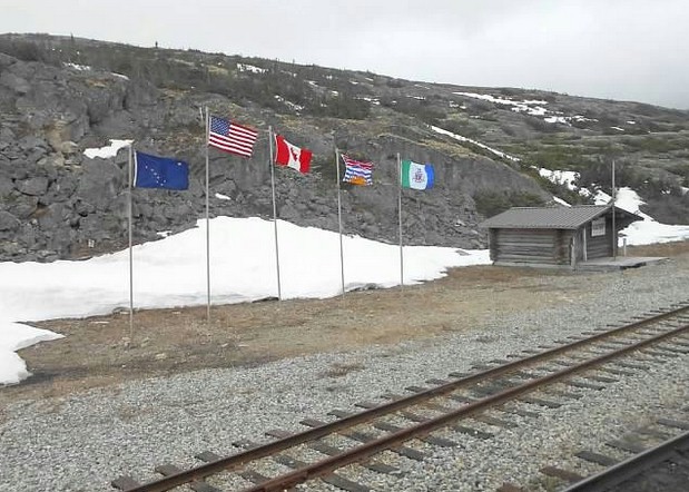
Approaching White Pass Summit - with the flags of Alaska, the United
States, Canada, British Columbia, and Yukon Territory (Mike Pace photo)
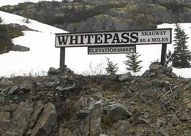
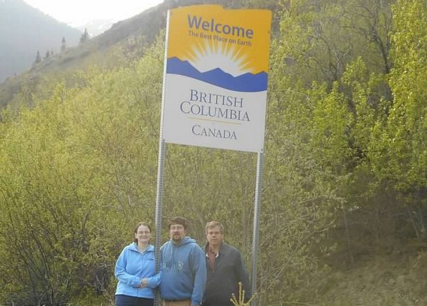
And there it is! We are leaving the United States and entering Canada.
In 20.4 miles, the train gains 2,888 feet in elevation! (Mike
Pace photo)
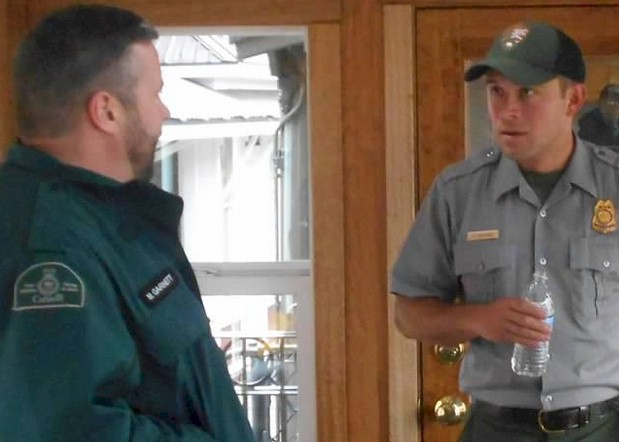
An interesting shot here; a National Park Service Ranger (right) hands
off narration duties to a Parks Canada Ranger (left) at the border.
(Robert Tabern photo)
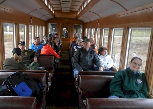
A look at the interior of our car.
Our only complaint about the whole trip was you were not allowed to
move between cars. (Robert Tabern photo)
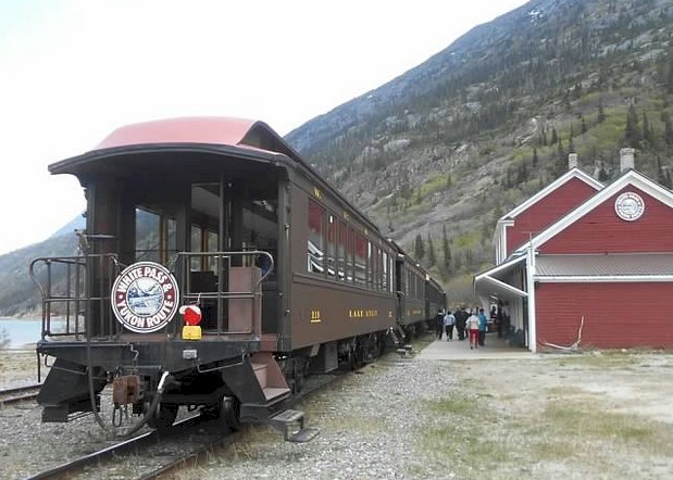
The train makes a stop at the Lake Bennett Station; everyone gets off and has a group lunch in the station (Robert Tabern photo)
Another view of the station in Lake Bennett where everyone gets off to have lunch (Robert Tabern photo)
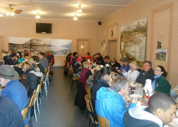
Mike Pace and Kandace (left) enjoy their meal in the crowded lunch room at Lake Bennett Station (Robert Tabern photo)
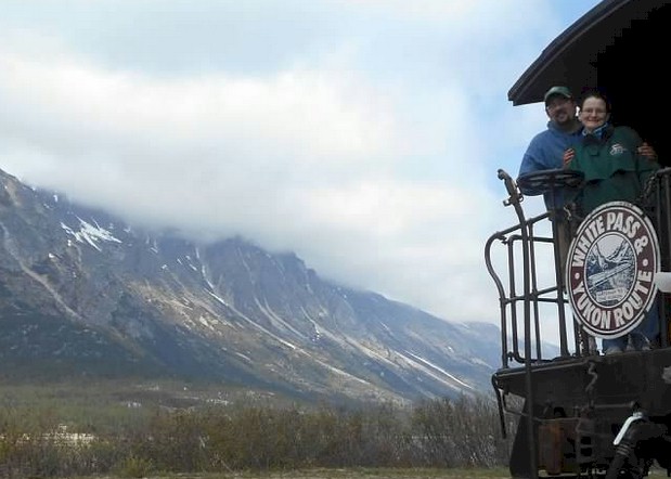
Robert and Kandace together on the rear of the White Pass & Yukon Route Train at Lake Bennett Lunch Stop (Mike Pace photo)
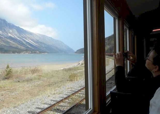
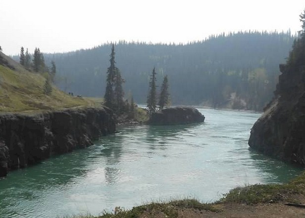
Some beautiful views from inside the train of Lake Bennett after the lunch stop (Kandace Tabern photo)
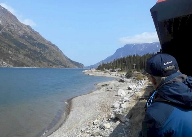
Enjoying some views of Lake Bennett from the open air platform (Mike Pace photo)
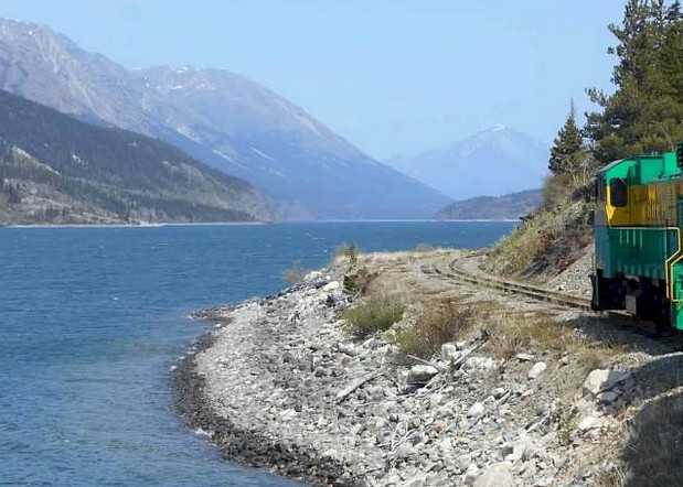
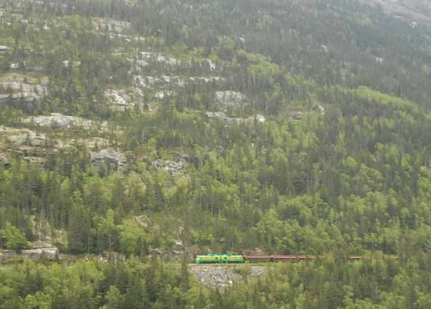
The train makes its descent into British Columbia and into the Yukon Territory (Robert Tabern photo)
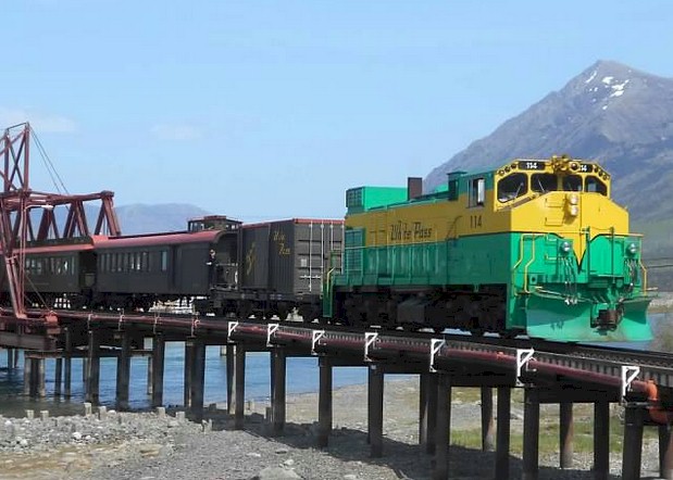
The train crosses one final bridge before arriving in the Carcross, Yukon Terminal (Mike Pace photo)
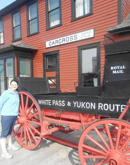
Kandace Tabern outside the Carcross White Pass & Yukon Route Depot (Robert Tabern photo)
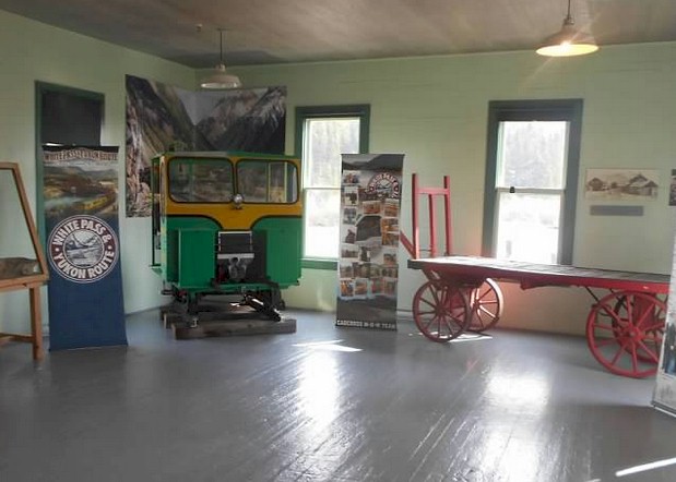
Some displays inside the White Pass & Yukon Route station in Carcross, Yukon (Robert Tabern photo)
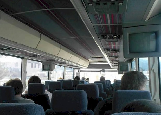
After a three hour layover in Carcross, a motor coach takes you the rest of the way into Whitehorse
(Robert Tabern photo)
We
hope you enjoyed the second part of our journey across Alaska and
Canada. The third and final part of this article will be released on
Train Web sometime in April. This article will cover a trolley ride in
Whitehorse, our time in Vancouver, ride across Canada on VIA's
"Canadian", and our ride back home to the Chicago area on Amtrak's
"Lake Shore Limited". Stay turned for the third and final installment
of our big rail/boat/driving trip to the Northland