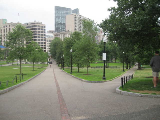
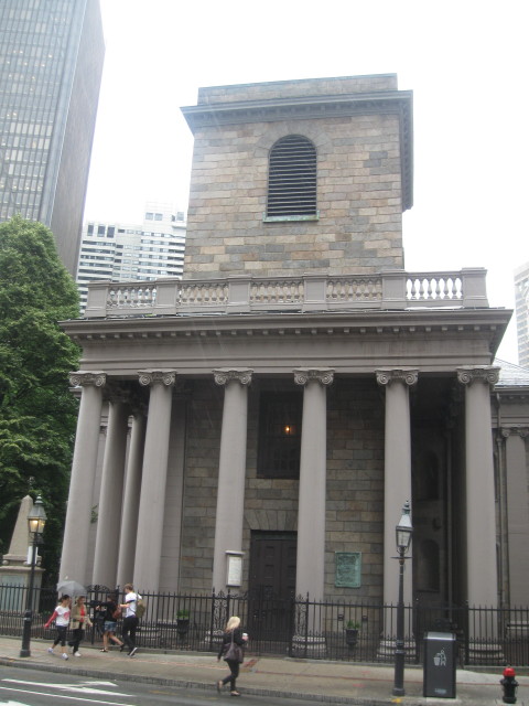
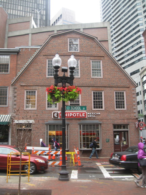
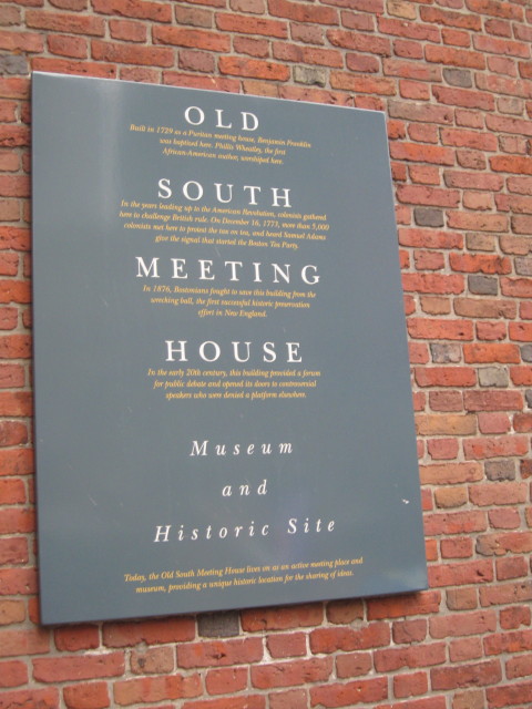
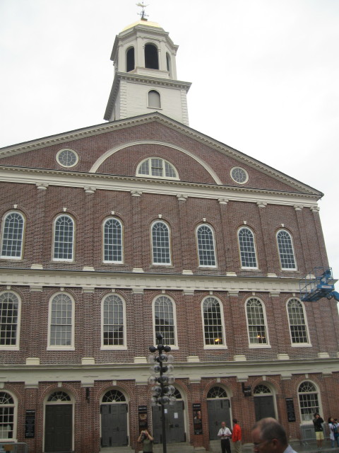
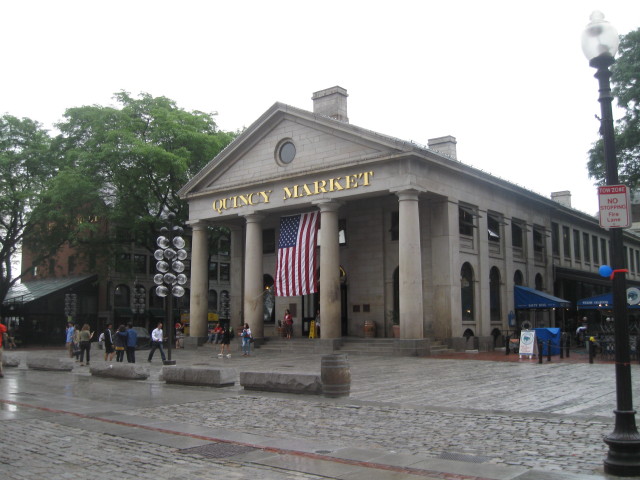
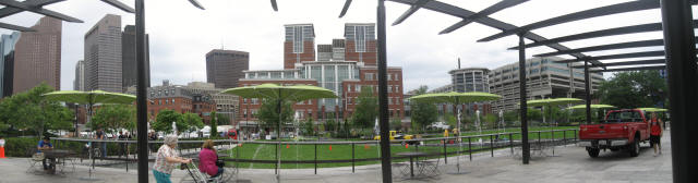
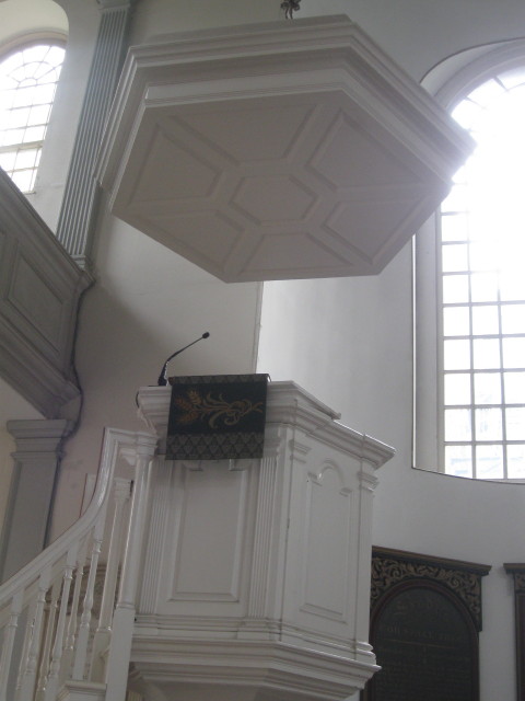
Opposite Faneuil Hall between
Clinton and Chatham streets is
Quincy Market. Constructed in
1825, the huge building features a
domed central pavilion and Greek
porticoes. For nearly 150 years
this area served as a retail and
wholesale distribution center for
meat and produce. Renovated in the
1970s, Quincy Market is the hub of
Faneuil Hall Marketplace, which
also encompasses two additional
long buildings (north Market and
South Market). Food stalls, shops,
restaurants, pushcart vendors, and
a gaggle of street entertainers
and musicians all add up to a
shopping and eating extravaganza.
Custom House Tower in left
background.
Quincy Market domed central
pavilion.
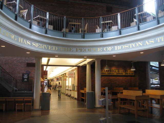
As it was nearing 8:45 am, I
thought this would be a good
place to stop for breakfast
and nutrition replenishment. I
found Bagelville here and
ordered an Egg and Cheese
bagel with bacon and side of
coffee then found a nice
eating area down the hall to
enjoy breakfast. After eating,
I felt refreshed and ready to
continue on the Freedom Trail.
Once outside I stopped by
several kiosks for trolley
tours and duck splash tours
and picked up several maps. On
my next visit I'll take one of
these tours to see more city
sights that I found out about
on this trip. A National Park
Service visitor center
occupies a portion of the
first floor in Faneuil Hall
and is the starting point for
ranger-led tours of both the
Freedom Trail and the Black
Heritage Trail.
NPS
Boston's Trails to
Freedom. Click
back button on
your browser to return to
this page.
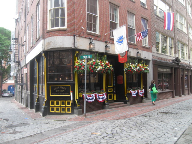
From the marketplace, I
followed the trail along
Union Street. To the right
of Union street is the
city's old business
district, known as the
Blackstone Block, where
pigs and chickens as well
as people walked the tiny,
winding dirt alleys in the
17th and18th centuries.
Items easily pictured on a
sign were often chosen for
tavern names (for example,
Bell in Hand or Boston
Stone). Some names have
been reincarnated and can
be seen marking the
entrances of newer
establishments-one such
watering hole is the
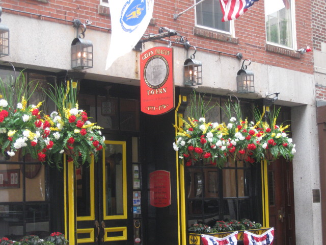
The
Green Dragon Tavern, which
takes its name from one of
Boston's most famous pubs
where secret meeting took
place during the
Revolution, likely over a
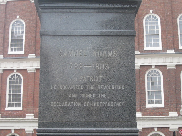
few mugs of ale. Samuel
Adams still lingers at
many a table, as the
patriot's image appears on
bottled lagers bearing his
name.
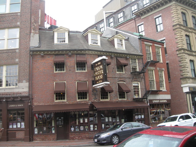
The
Union Oyster
House, built
around 1713, is one of
the oldest restaurants
in the country; it is
rumored that Daniel
Webster was a regular
patron.
Ask for the private
Kennedy Booth, where
then-Senator John F.
Kennedy sat on many a
Sunday afternoon, poring
over newspapers and
savoring mouthfuls of
lobster stew.
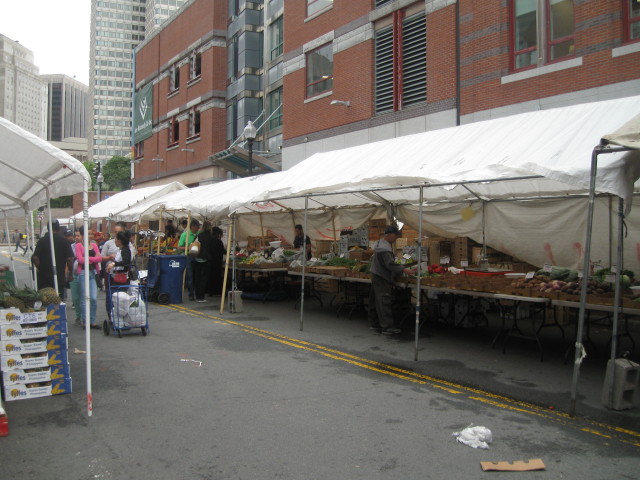
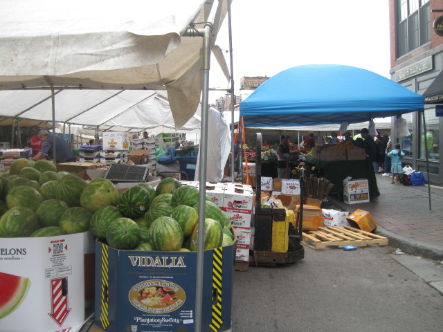
I continued to
Blackstone Street. On
Fridays and Saturdays
The Haymarket takes
place along Blackstone
between North and
Hanover Streets. Today
being Friday I lucked
out to see the market.
Vendors no longer sell
hay, but the open-air
gatherings
continues-the Boston
institution is a swirl
of sights, sounds and
smells. Savvy shoppers
and no-nonsense North
End vendors banter
over displays of
fruits and vegetables.
Saturday is busier,
and by the end of day
the area is usually
strewn with garbage
and left over produce.
First timers should
heed these two pieces
of advice: Do not
touch the displays,
and watch for a "heavy
thumb" on the scale.
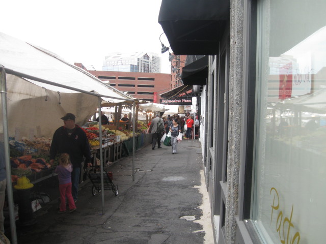
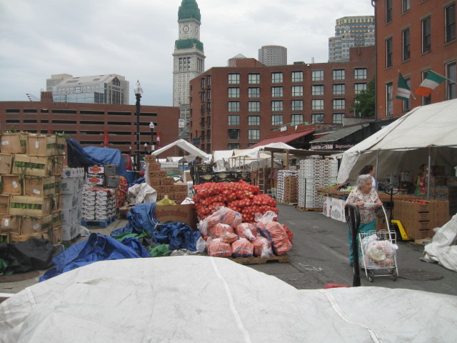
Haymarket has operated in
same location since 1830s.
Even if you're not
planning a picnic in the
Public Garden, the
longtime produce and meat
mart-where brazen pushcart
vendors alternate between
calling out rock-bottom
prices on avocados to
chiding "handsy" customers
squeezing the life out of
the merch- is a fun place
to people watch.
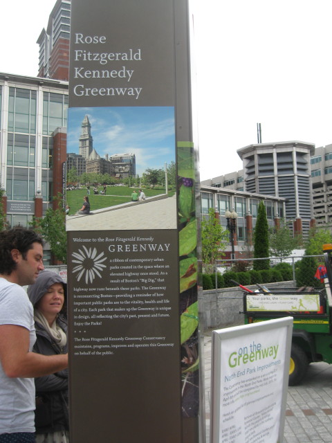
After passing over Blackstone
Street, I walked through a
portion of the Rose Fitzgerald
Kennedy Greenway - several
acres of linear urban green
space traversing the path of
the old elevated Central
Artery- toward Cross Street.
I-93 runs
underground here, site of the
big dig.
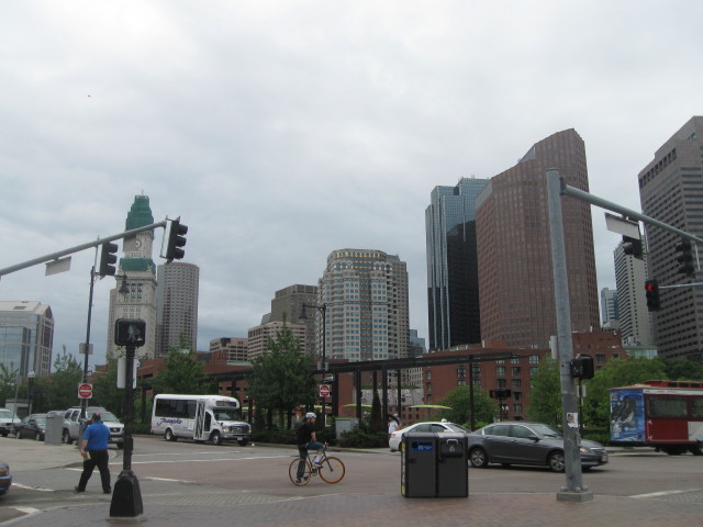
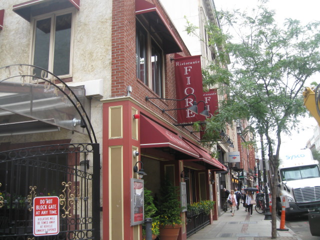
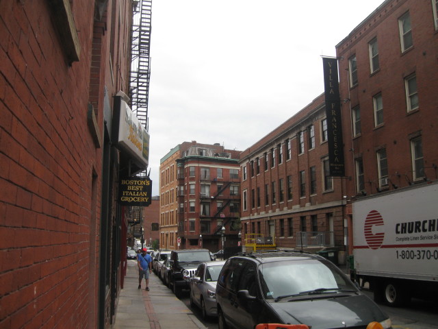
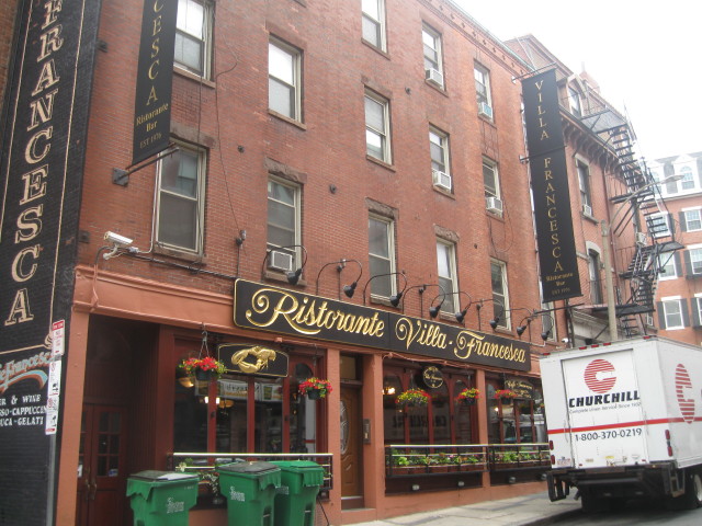
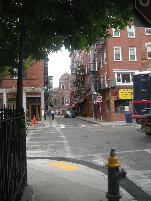
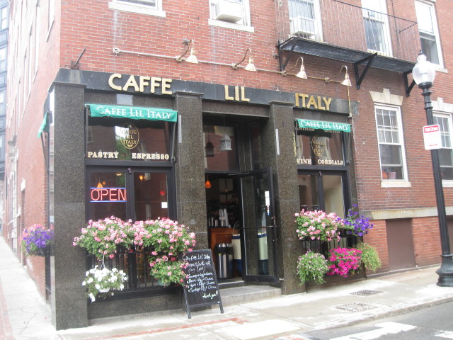
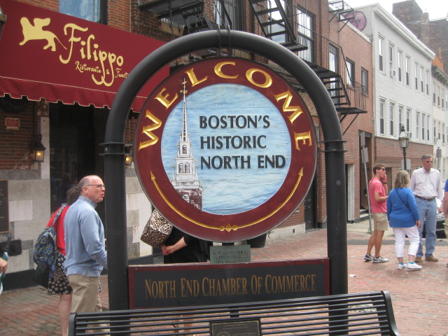
I am now entering North End,
Boston's Italian district. The
heart of Boston's first
neighborhood, Hanover Street
is lined with Italian
groceries and little cafes.
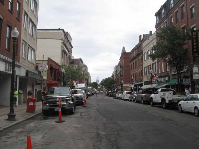
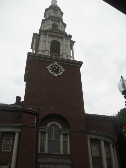
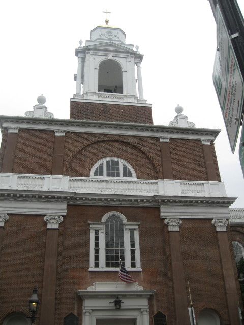
Looking down Hanover with St.
Stephen's Church in background
with white cupola and golden
dome.
Hanover Street.
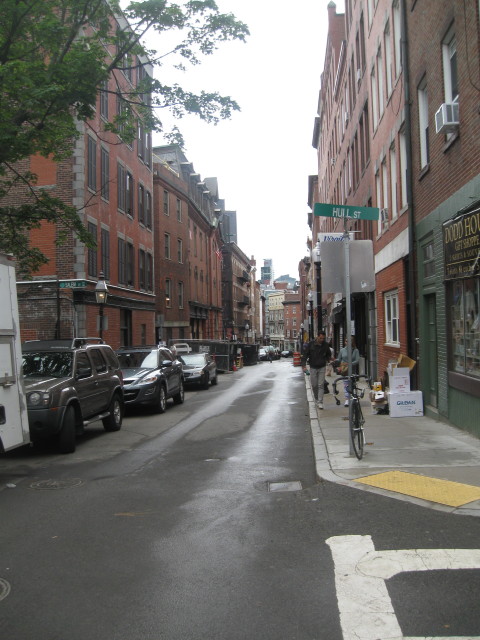
Red brick trail on Richmond
Street.
Richmond Street.
The Trail leads to my next stop,
the Paul Revere House on North
Street, the two-story clapboard
structure on the left
overlooking North Square.
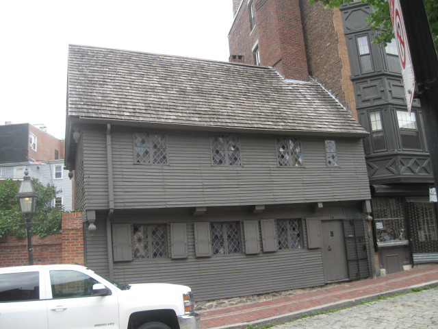
The Paul
Revere House through Time.
In the fall
of 1770, silversmith and
engraver Paul Revere and his
family moved into their newly
purchased home on North
Square, in Boston's North End.
Although comfortable and
spacious by 18th-century
standards, the house was by no
means new, having been built
about 1680 as a rich man's
dwelling. The first owner,
Robert Howard, was a wealthy
Puritan merchant. The house is
a rare example of early
Colonial urban architecture
and is said to be Boston's
oldest building. Puritan
ministers Increase Mather and
his son Cotton also lived on
the site. By the time Paul
Revere bought the house, it
had been altered several
times, and was no longer
fashionable, but the high
ceilings and relatively large
rooms demonstrated it had once
been an elegant residence.
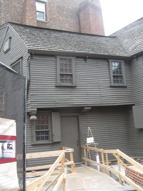
I paid the
entrance fee and toured the
house. There was restoration
work going on in the
courtyard.
Revere was
a silversmith by trade but
also dabbed in engraving,
copper plating and working as
express rider delivering
messages for the patriots. His
most famous jaunt took place
April 18, 1775; thanks to poet
Henry Wadsworth Longfellow,
nearly every school-aged child
is familiar with his midnight
ride.
Paul Revere owned the house
for 30 years, until 1800, but
he and his family may not have
lived here at some periods
during the 1780s and 90s. An
interesting fact I learned on
the tour was that Paul Revere
had 16 children.
After
Revere sold the building, it
soon became a tenement,and the
ground floor was remodeled for
use as shops. Throughout the
19th century, hundreds of
immigrant families made the
former Paul Revere House their
home.
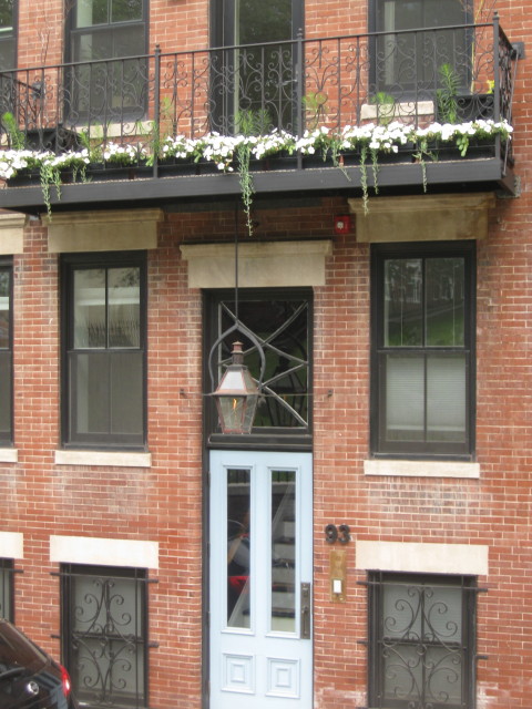
Apartments over looking the Paul
Revere House.
The Pierce/Hichborn House.
The Pierce/Hichborn House is
one of Boston's few remaining
examples of early 18th century
brick architecture. The house
was built about 1711 for Moses
Pierce, a glazier (window
maker) and later owned by
Nathaniel Hichborn, a boat
builder and Paul Revere's
first cousin. The
Pierce/Hichborn House
incorporated many features of
the then new English
Renaissance (Georgian)
architectural style, such as
brick belt courses between
floors,shallow arches over the
windows and doors, and a low
hipped roof. Noticeable
interior features include a
handsome original staircase,
unusual painted fireplaces and
heavy beaded framing.
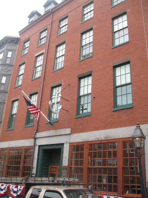
Also on North Square is the
brick Mariners' House, which
served as a refuge for sailors.
Note the anchor on front; it
still offers accommodations to
seamen. Across the square is the
church where Father Edward
Taylor once preached to Boston's
seamen; it is now an Italian
Catholic church.
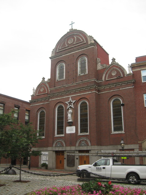
Sacred Heart Italian Church.
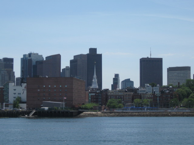
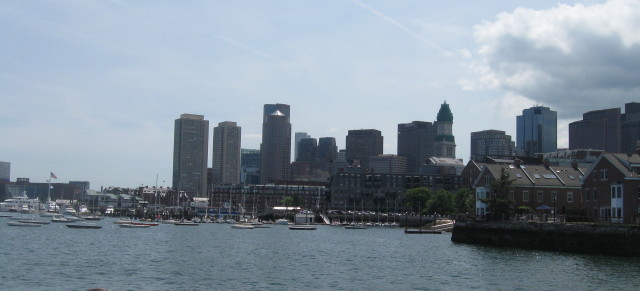
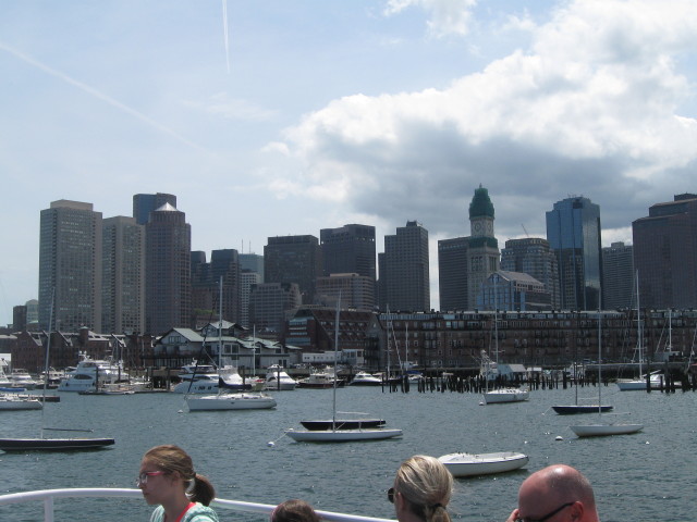
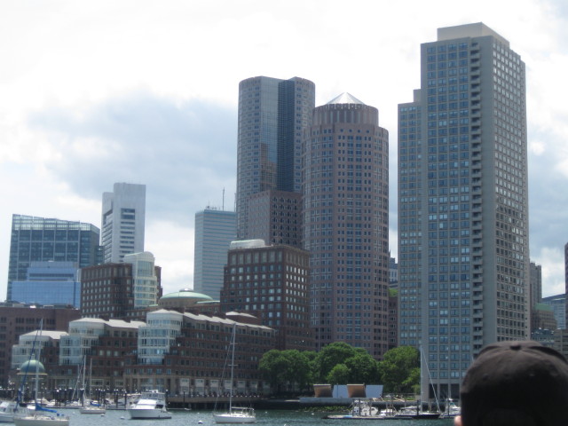
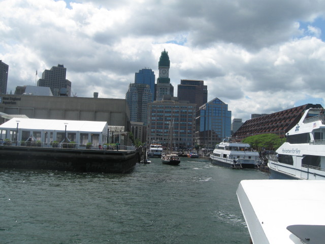
View of Inner Harbor.
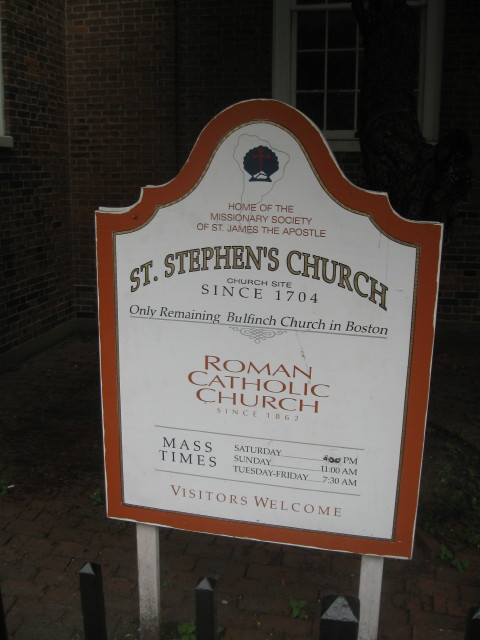
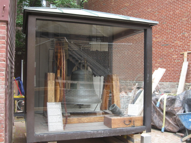
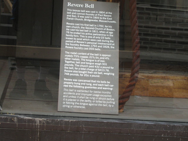
Built in 1804, Revere's firm,
Revere Copper and Brass, cast
the bell that was hung in the
belfry in 1805; a display inside
shows pieces of the Revere
copper that originally covered
the dome.
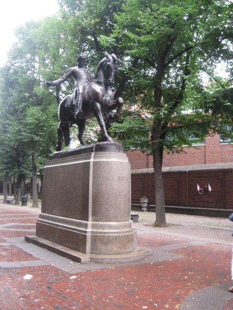
Across Hanover Street from St.
Stephen's Church are the brick
walls of Paul Revere Mall (also
called the Prado), which lies
between Hanover and Unity
streets. Laid out in the early
1930s, this restful tree-shaded
enclave features bronze plaques
saluting the achievements of
various North Enders. Near the
Hanover Street is Cyrus Dallin's
dashing equestrian statue of
Revere.
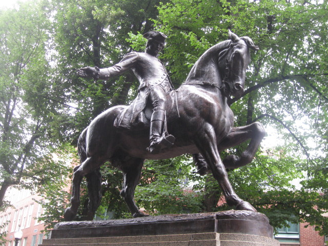
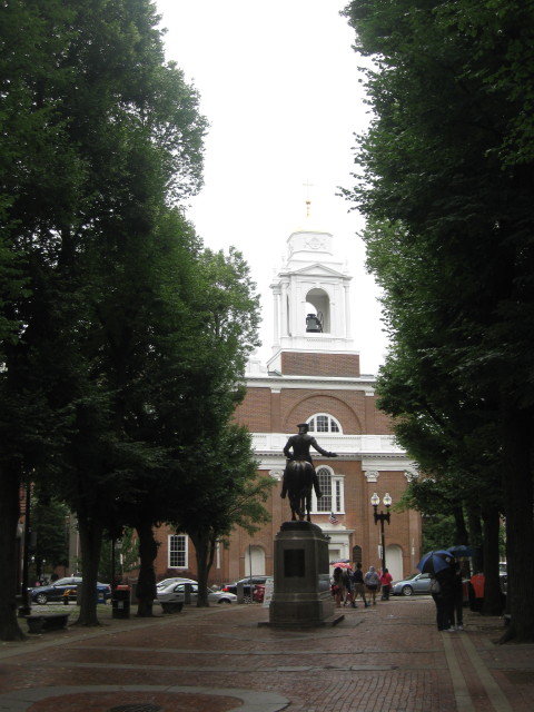
Paul Revere looking out on St
Stephen's Church.
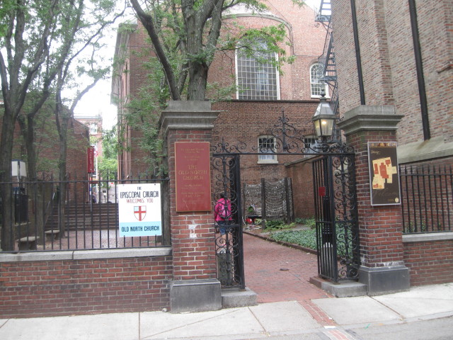
A gate at the opposite side of
the mall leads to courtyard
behind the Old North Church.
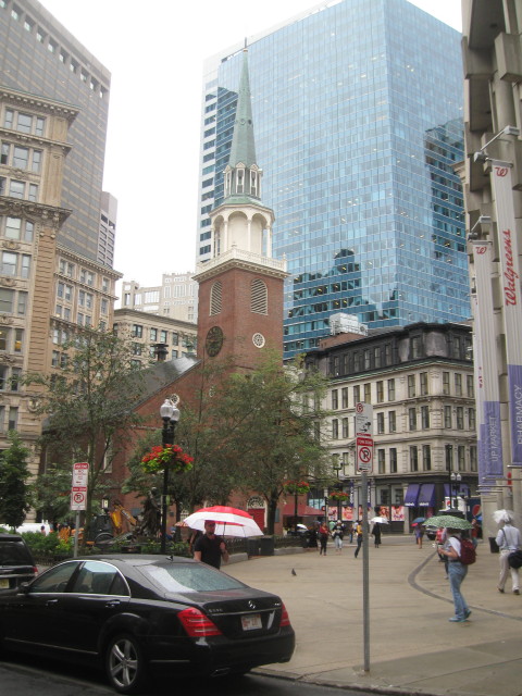
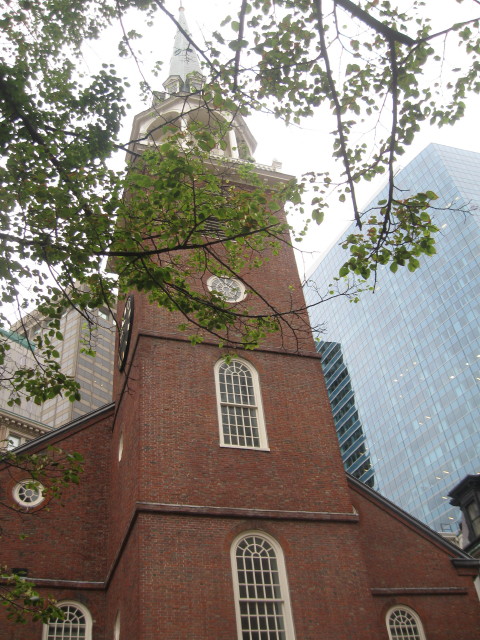
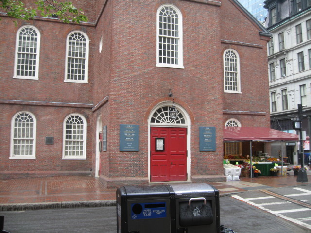
Ascend the stairs to the
church- perhaps Boston's most
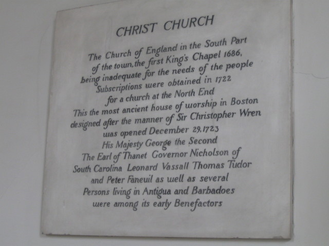
"revered" landmark. Built in
1723 and officially called
Christ Church, its the oldest
church building in Boston
(hence the nickname). The Old
North Church played a key role
in Paul Revere's celebrated
midnight ride, the subject of
Henry Wadsworth Longfellow's
much-recited lyrical poem. The
poet described how church
sexton Robert Newman hung
lanterns in the belfry arch of
the Old North Church - "one if
by land, two if by sea"- as a
signal from Revere that the
British were about to march.
Two lanterns were displayed in
the steeple to signal that
British soldiers were
advancing on Lexington by sea
and not by land. The lanterns
flickered for a short moment,
then Newman fled the church
(supposedly by climbing out of
a window), while Revere
mounted his horse "And so
through the night went his cry
of alarm, to every Middlesex
village and farm."
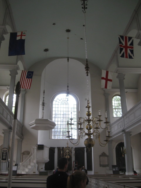
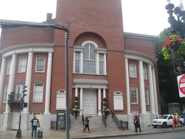
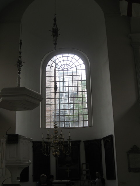
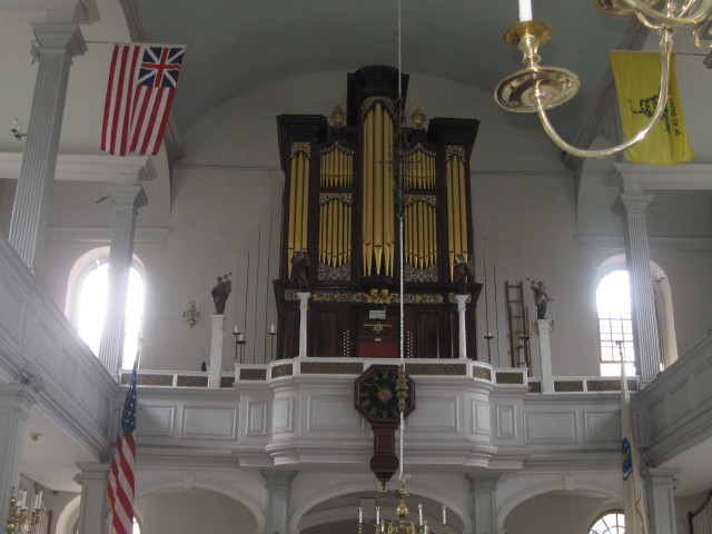
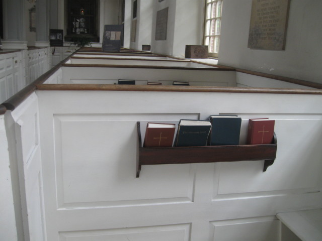
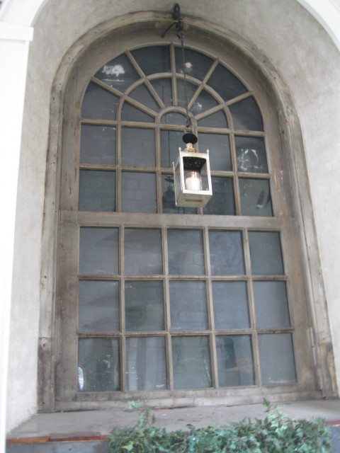
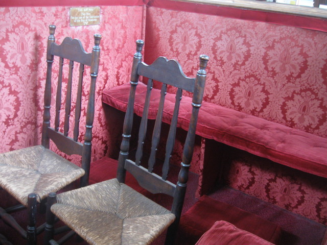
The church's exterior,
inspired by the London
churches by British architect
Christoper Wren, was
constructed using local-made
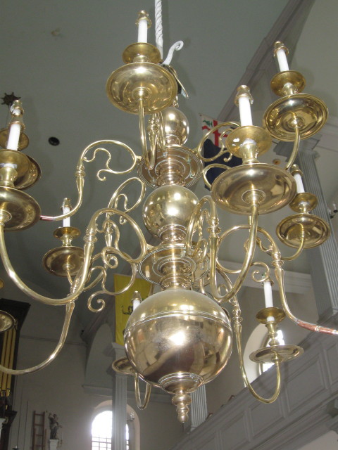
bricks. Inside, numerous
historical treasures can be
seen, including brass
nameplates that designate
family pews- the Reveres
occupied No. 54. Along the
church's right aisle is the
window through when Newman
fled the church; bricked over
in 1815, it was rediscovered
in 1989 during restoration
work. Newman also is
remembered with a plaque in
the small garden on the
church's north side. Looking
up, you'll see the 191-foot
tall steeple, which was blown
over twice by hurricanes but
was rebuilt according to
original plans; the eight
belfry bells were cast in 1744
and the range in weight from
620 to 1,545 pounds each. They
bear the inscription: "We are
the first ring of bells cast
for the British Empire in
North America.
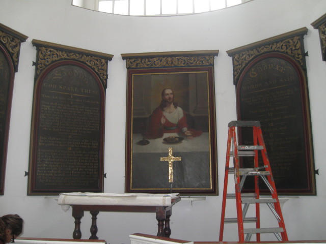
"The Bay Pew"
This pew for the use of the
Gentlemen of the Bay of
Honduras, 1717.
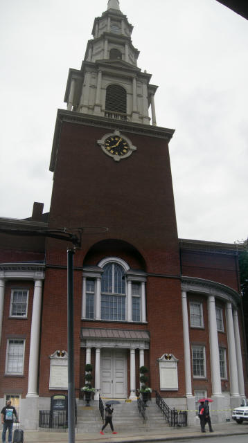
Heading uphill on Hull Street, I
turned around to catch a great
view of the Old North Church.
The steeple has been destroyed
and replaced twice following
violent storms; the present
191-foot steeple from 1954.
The plaque reads: "
The Signal
Lanterns of Paul Revere
Displayed in the Steeple of
the Church April 18, 1775
warned the country of the
march of the British Troops to
Lexington and Concord."
On April 18, 1775, a Boston
silversmith named Paul Revere
left his North Square home,
slipped out of the city in a
rowboat, borrowed a horse in
Charlestown, and began riding.
His mission: to warn Samuel
Adams and John Hancock in
Lexington that British troops
were marching from Boston to
arrest them and to seize
munitions hidden in Concord.
An active
Son of Liberty, Revere
undertook many other missions
for the Revolutionary cause.
From 1773 to 1775 he was
employed to carry dispatches
as far a Philadelphia. Paul
Revere died in 1818, aged 83,
having contributed not only to
the cause of American liberty,
but also to the cultural and
industrial independence of the
new nation.
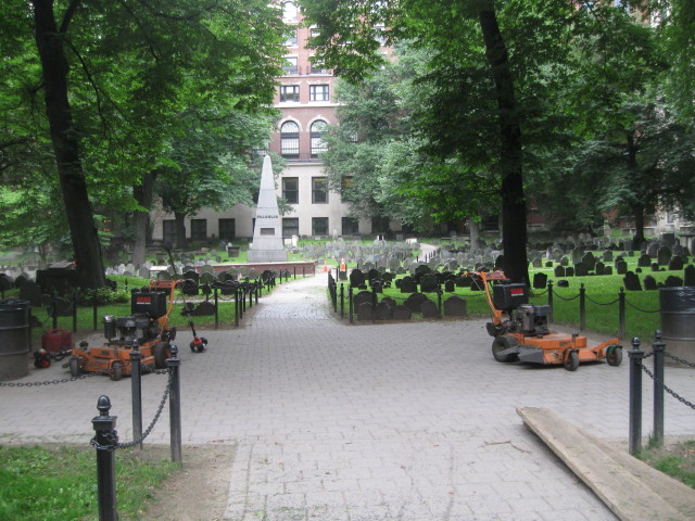
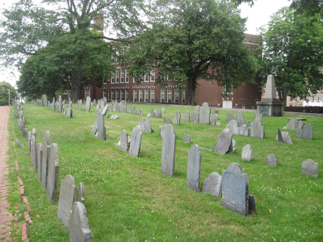
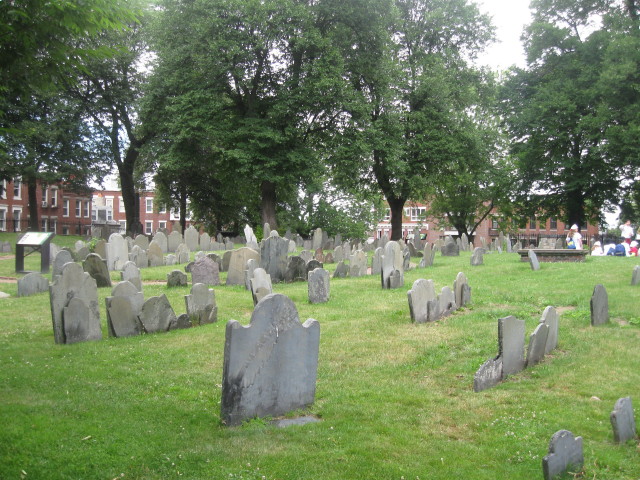
Continuing uphill on Hull
Street is Copp's Hill Burying
Ground (sometimes called
"Corpse Hill") is on the
right, on a promontory
overlooking Boston Harbor.
Atop North End's highest
point, the graveyard is named
for a shoemaker who originally
owned the land; it was
established as a cemetery
in1660 when the Kings Chapel
Burying Ground became
overcrowded.
Copp's Hill
holds the graves of Old North
Church sexton Robert Newman;
Increase Mather, his son
Cotton and Cotton's son
Samuel, all three Puritan
clergymen and educators; and
Prince Hall, who led Boston's
early free African-American
community. During the
Revolution, British soldiers
camped here.
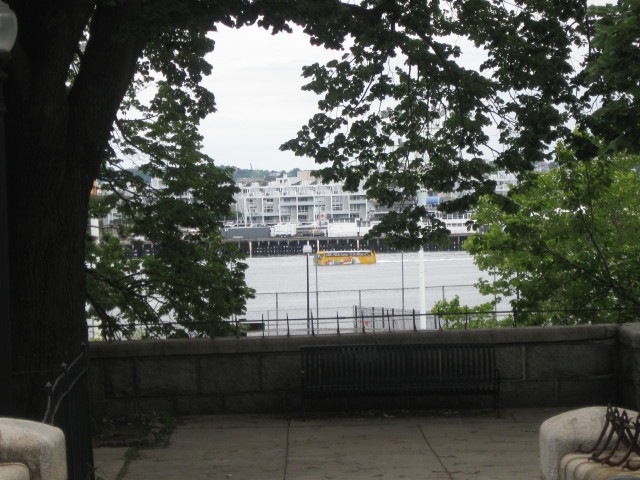
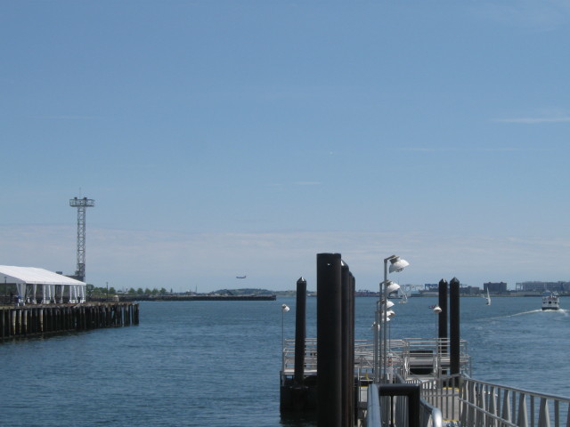
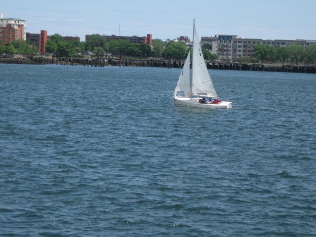
Super Duck Harbor Splash Tour in
middle of Inner Harbor.
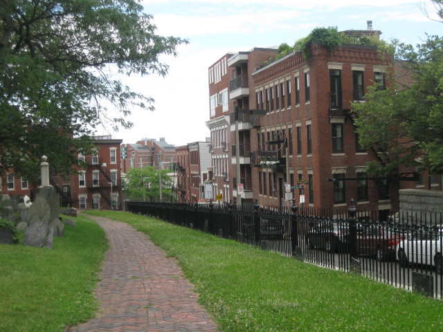
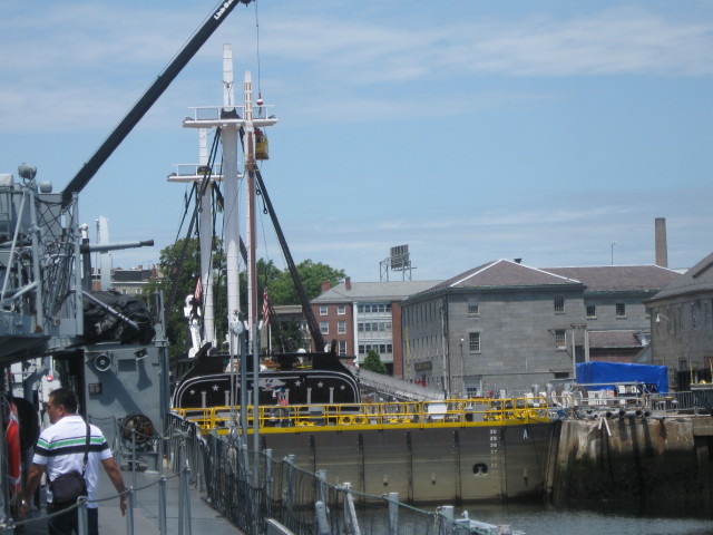
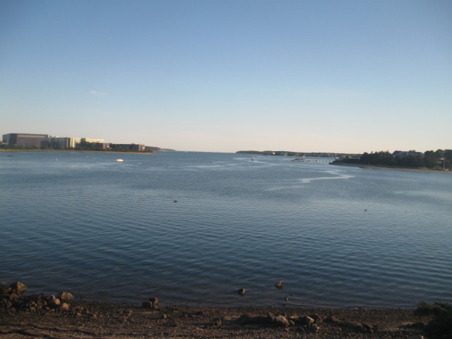
I continued past the cemetery to
Commercial Street. At this
point, the Freedom Trail travel
across the Charlestown Bridge
and visits Charlestown Navy Yard
and the Bunker Hill Monument.

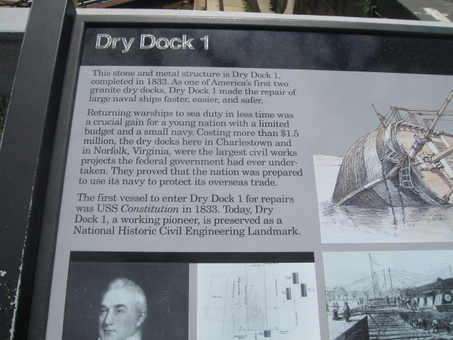
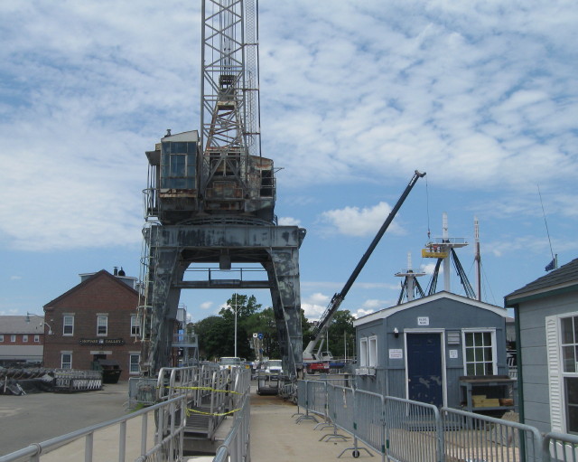
Charlestown Navy Yard with
Bunker Hill Monument. Solomon
Willard's 221-foot-tall obelisk
was dedicated June 17, 1843,
with a speech by Daniel Webster.
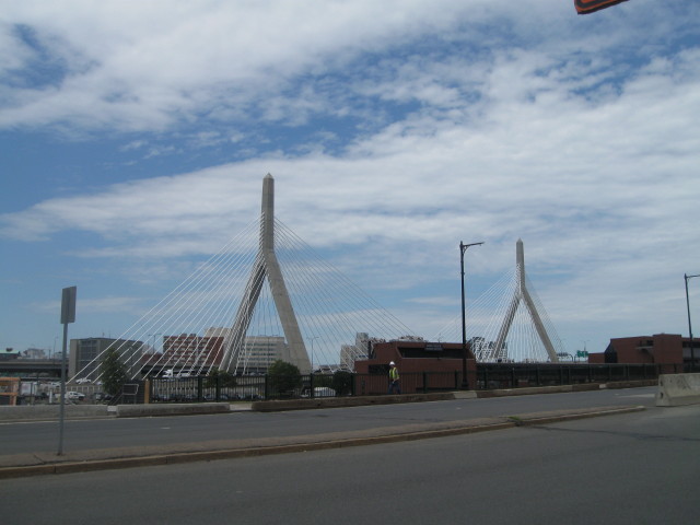
The Leonard P. Zakin Bunker Hill
Bridge (I-93) part of the Big
Dig Project, is the widest cable
stayed bridge in the world. I-93
begins and ends underground
travel here.
I arrived at the foot of the
Charlestown Bridge at noon
time. As it had been a long
morning with a lot of walking,
I decided to cross the bridge
and visit the Charlestown Navy
Yard by using the city bus. I
waited at the bus stop for the
correct bus to board. I
boarded the proper bus and
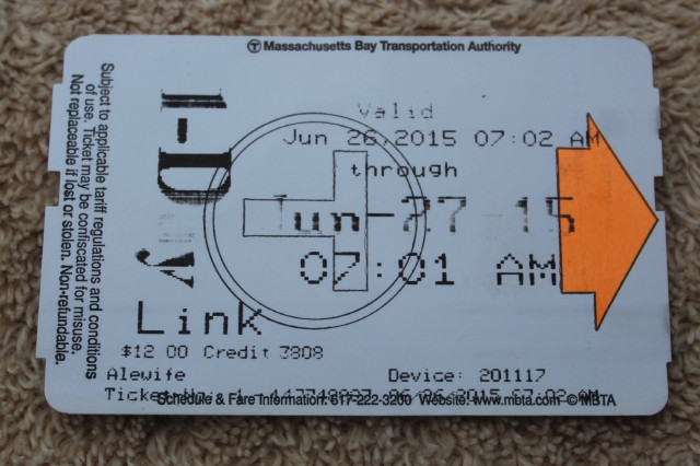
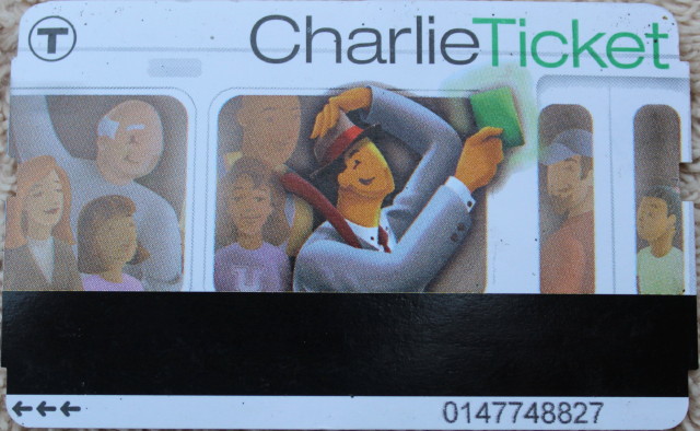
presented my Charlie
Ticket for the fare
requirement. Although the wait
for the bus was not short it
felt good to ride across the
bridge and save my feet.
At the foot of the bridge in
Charlestown is City Square,
the Puritans' point of
settlement in 1629. They named
the area after King Charles,
who issued the colony's
charter. Due to the lack of
fresh water, most of the
original settlers moved to
what is now Boston Common, and
until the Revolution,
Charlestown remained mostly
unpopulated grassland.
After
crossing on the bridge, the
bus then let me off at the
entrance to the Charlestown
Navy Yard and the beginning of
my visit to the USS
Constitution.
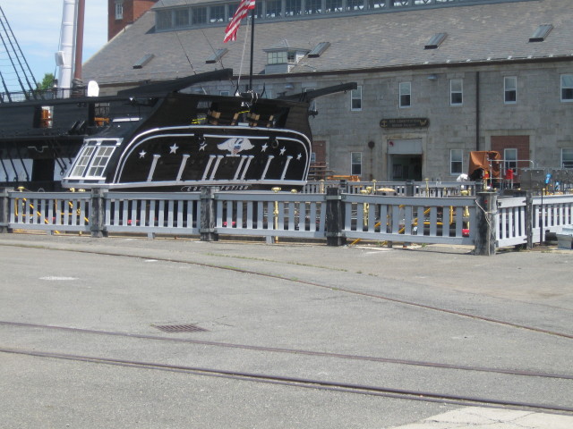
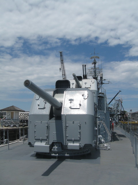
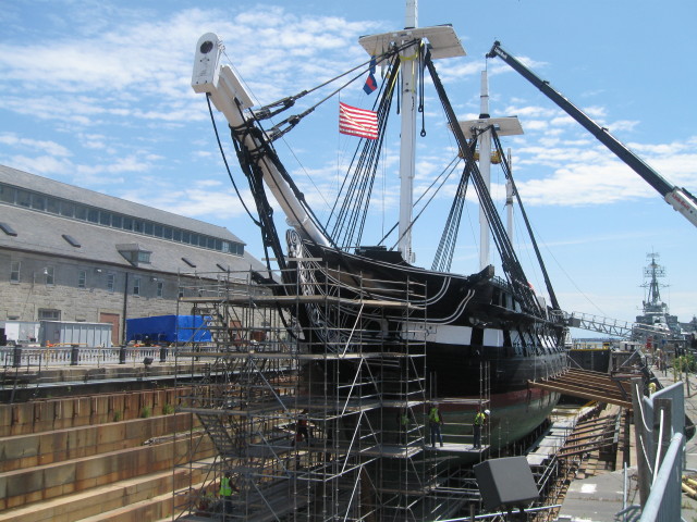
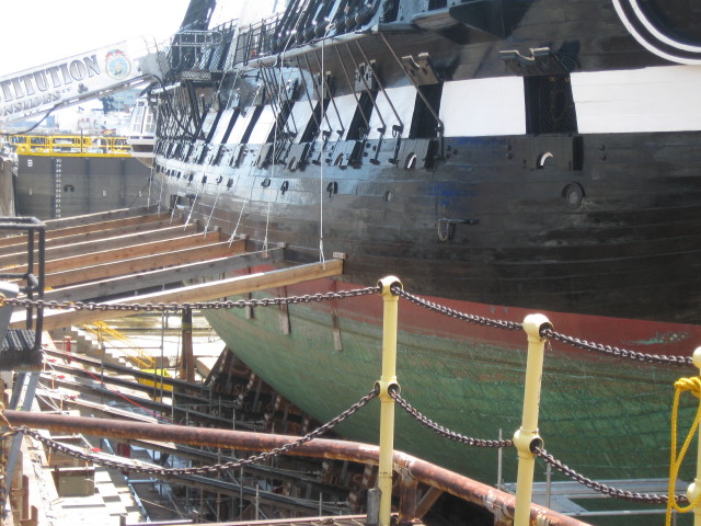
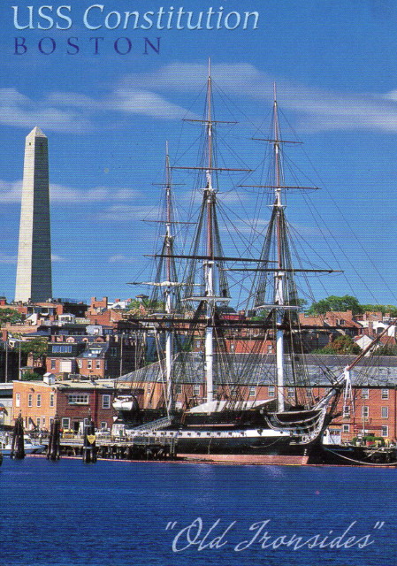 USS Constitution is a
wooden-hulled,
three-masted heavy frigate
of the United States Navy.
USS Constitution is a
wooden-hulled,
three-masted heavy frigate
of the United States Navy.
Named after the
Constitution of United
States of America by
President George
Washington, she is the
oldest commissioned naval
vessel afloat in the
world.
Photographer - Grant
Heilman.
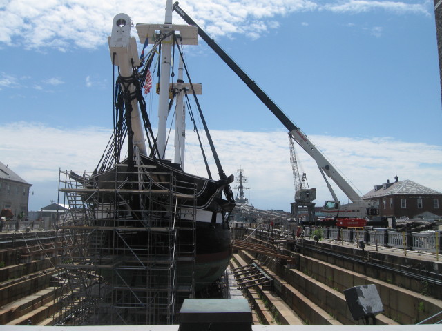
The
historic ship will be
dry-docked at Charlestown
Navy Yard through summer
2018 due to a 3-year
restoration project; only
the vessel's top deck will
be accessible to the
public during this time.
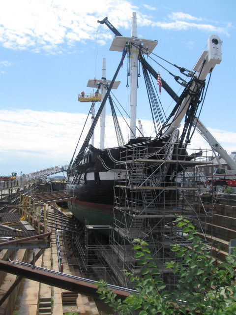
I now had another item
to check off of my
bucket list. Seeing
the USS Constitution,
whether in dry dock or
not. Living history in
the present.
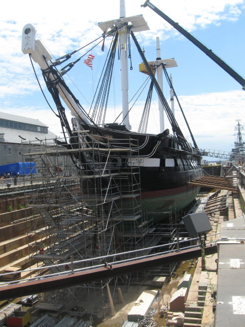
Built at Edmund
Hartt's shipyard in
the North End, the
ship was launched in
1797. Constructed from
live oak, red cedar,
white oak, pitch pine
and locust wood, the
54-gun warship was
designed to defeat
equal opponents and
out-sail stronger
ones. Paul Revere
provided the original
copper sheathing. The
Constitution
gained undying fame
and the nickname "Old
Ironsides" ( a
reaction to the
resiliency of the
ship's wooden sides)
as a result of
engagements with the
British during the War
of 1812.
As the area was an
active construction
zone, visitors were keep
a distance away. My next
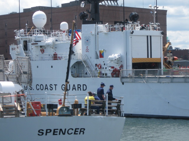
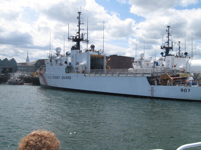
stop was at USS Cassin
Young DD793.
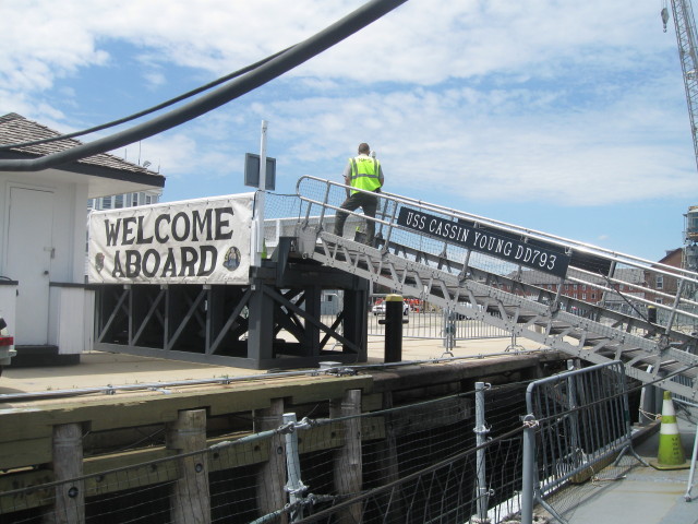
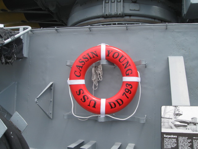
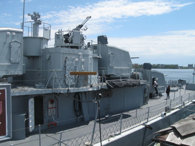
USS Cassin Young is
named in honor of a U.S
Navy commander, awarded
the Medal of Honor for
his heroism during the
attack on Pearl Harbor.
Restored at the
Charlestown Navy Yard in
the 1950s, the original
destroyer was
commissioned in 1943 and
served during World War
II and the Korean War.
Today, the ship is a
memorial to the men who
served on destroyers and
to their vessels.
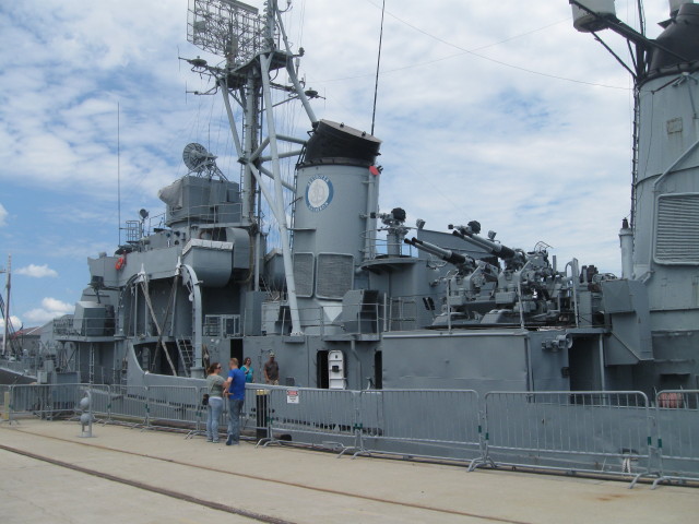
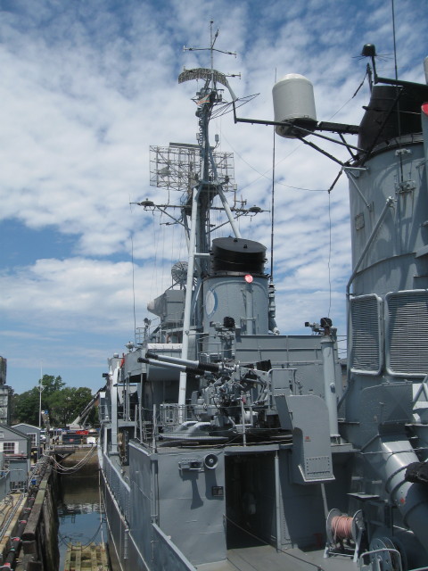
Taking a tour of this
ship was very
informative. My
questions were
answered by the
learned docents and I
was able to explore
most areas of the
ship.
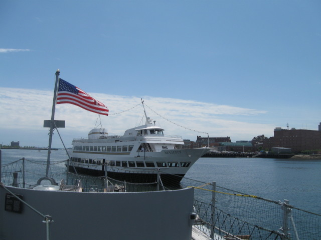
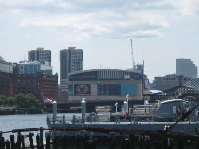
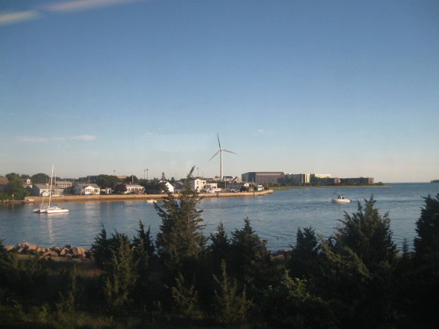
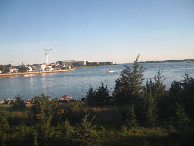
Ferry boat heading for
the dock next-door.
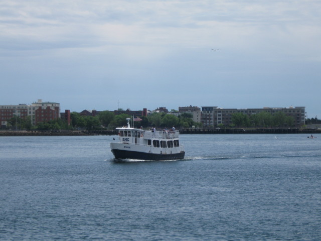
Water shuttle that I
will take across the
harbor to North End of
Boston.
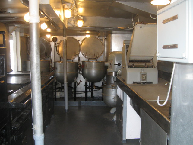
The Navy sails on its
stomach.
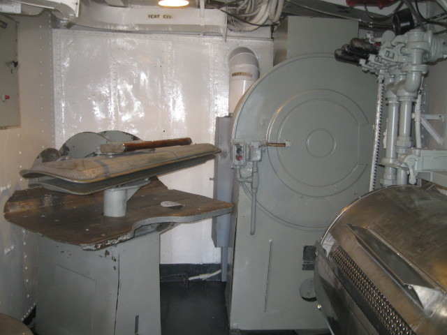
And you need clean
clothes while being at
sea for months.
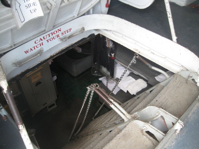
Bunks downstairs.
Another relic of the
past.
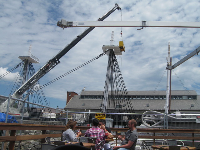
After my tour of the
USS Cassin Young, I
stopped for lunch at
Decca. Fast-casual nautical-style spot
set in ex-U.S.
Navy SONAR station
with burgers,
sandwiches &
snacks. I was able
to set on the
outdoor deck and
watch work going
on the USS
Constitution. I
topped off my
lunch with a
great, ice cold
bottle of
chocolate milk.
After making my final
look around, I decided
to leave here and seek
my new next adventure.
During the
restoration, visitors
will have access to
only the top (spar)
deck, but the ships
lower decks will be
off limits. Today the
top deck would be open
starting at 2:30pm but
that was still several
hours away and I
didn't think I would
see any more than what
I can see now.
When planning and
researching for this
trip, I saw that the
Inner Harbor Ferry
boats travel between
Boston's Long Wharf
and the Charlestown
Navy Yard. One way
fare is $3.50. Boats
depart every 30
minutes 9-3:30. I
thought this would be
a great and different
way to see the city.
Like not being able to
see the trees because
the forest. I was
expecting the views to
be outstanding.
The next step was to
find the correct wharf
for the departure
point. Arriving at the
correct location I
waited for the next
ferry boat.
Plane on approach to
Logan International
Airport.
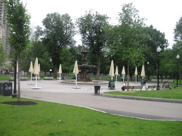
The Garden.
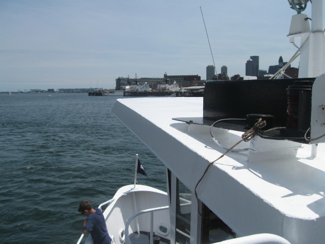
Bow on my ferry.
U.S. Coast Guard Base.
Approaching Long Wharf.
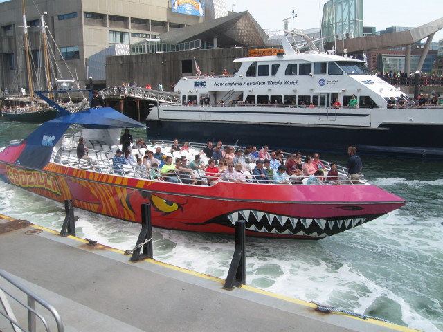
For thrill-seekers,
Codzilla is king. During
the 40-minute adventure
aboard a toothy
speedboat with a
2,800-horsepower motor,
riders zip across ocean
waves at speeds of up to
40mph.
After docking at the
wharf, we paid out
fare and exited the
boat. The fare was
included in my Charlie
Ticket so it was an
easy exit. As I was on
the Long Wharf, I
walked around taking
in the sights.
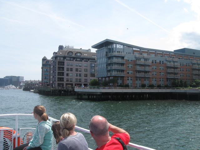
From the
Long Wharf I
walked along the
Harborwalk with
great views of the
bay and the
harbor. The Boston
Waterfront Marina
had some nice toys
scatted about.
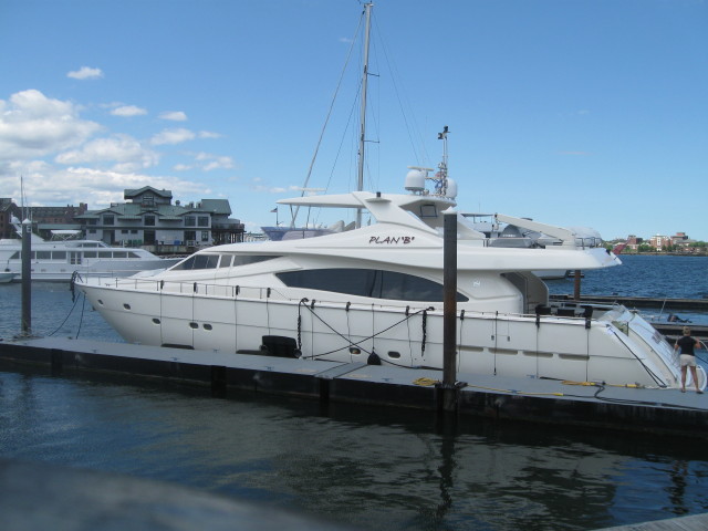
Mom always told me to
have a Plan B.
After the marina I
then walked inland to
explore the immediate
area.
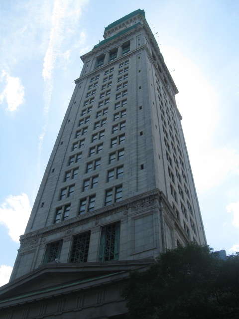
Custom House
Tower.
As the time was now
2:40 pm and I had some
free time until 5 pm
when I would meet
Chris at South
Station, I decided
that a ride on the "T"
would fill this
unexpected free time.
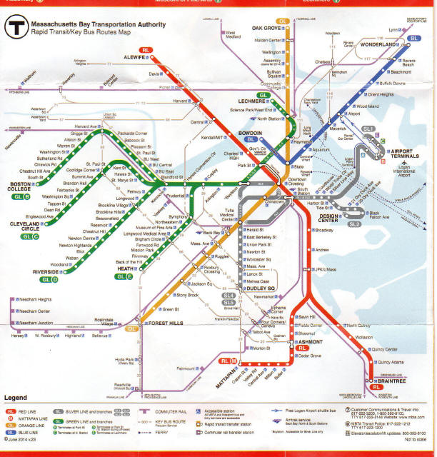
Looking at the route
map, going to Logan
Airport would be a
surprise adventure and
an interesting
destination. The
Blue Line has an
airport stop. Free
Massport shuttles run
every 15-20 minutes
daily from all five
terminals to the
Airport MBTA station
on Blue Line. As I was
near the Blue Line's
Aquarium stop, I
figure this excursion
was doable. I went to
the Aquarium stop,
used my Charlie Ticket
and about 20 minutes
later I was at the
Airport stop. The
shuttle bus was
waiting and the ride
to the airport was
short. I got off the
bus at one of the
terminals to go inside
for a quick look
around and say I was
here.
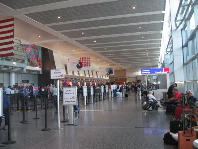
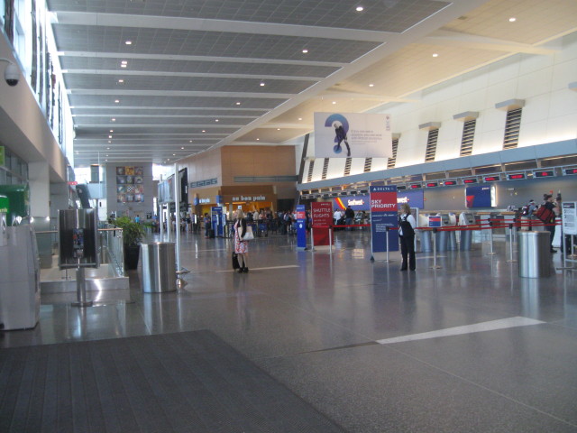
One of places I had on
my list to visit while
in Boston was the No
Name Restaurant.
Several people
recommend I stop
there. As it was on
the other side of the
Fort Point channel in
the Seaport District
on the Boston Fish
Pier, I didn't know if
I would have enough
time getting there on
public transportation.
So I passed on it this
visit, but on my next
visit I for sure will
make a visit.
My plan was to return
the same route,
shuttle back to Blue
Line. I got mixed up
on directions and was
on the wrong level to
catch the shuttle.
This unplanned delay
was not good. After
receiving more
information I found a
bus heading to the
South Station. How
fortuitous. I found
the Silver Line SL 1
bus rapid-transit
service, which also is
available from all
five airport
terminals, to reach
South Station on the
Red Line. The Silver
Line is free inbound
from the airport to
South Station and
includes a free
transfer to the Red
Line.
Greater Boston's MBTA
subway Silver Line is a
hybrid subway/
trolleybus/ bus,
underground/
above-ground line
connecting the South
Station Transportation
Center with the Boston
Convention &
Exhibition Center,
Boston's World Trade
Center, Logan Airport,
and Boston's Black
Falcon Cruise Terminal.
SL1
The SL1 line starts
underground beneath
South Station (where
there's also a Red
Line subway station).
Hybrid electric
trolleybus/
diesel-motor buses
travel underground as
trolleybuses for stops
at the Moakley
Courthouse and World
Trade Center before
coming above-ground to
the Silver Line Way
Station, where its
electric catenaries
give way to the diesel
engine.
It continues as a
diesel bus to Logan
Airport, where it
stops right at airline
Terminals A, B, C and
E, before returning to
the city via the same
route.
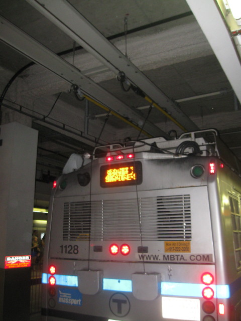
When I boarded the bus
I was unaware that I
was riding a trolley
bus/ diesel bus. The
look and the ride was
nothing out the
ordinary for a diesel
bus. We made all the
stops at the terminals
and then got on the
express way to Boston.
After arriving on the
other side of the
water, we stop at a
tunnel entrance, the
driver turns off the
engine and exits to
the outside back of
the bus. He then
connects the bus to
the catenaries. We are
now an electric bus
traveling underground.
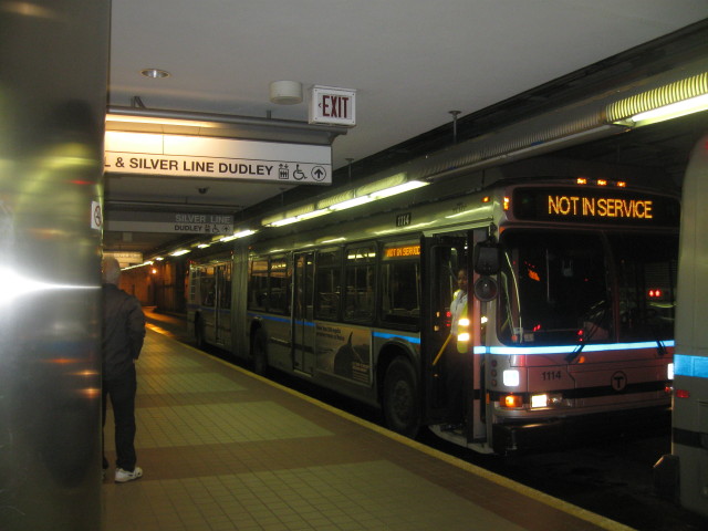
Front view of bus in
tunnel.
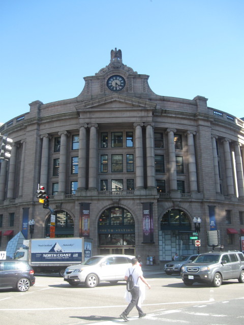
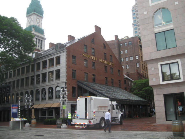
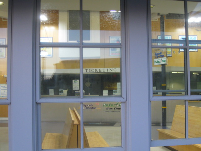
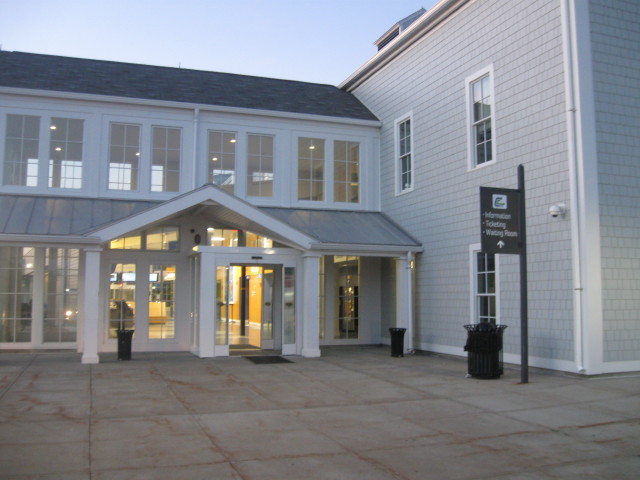
South Station.
I arrived at the South
Station shorty after 4
pm and received a call
from Chris that he was
running a few minutes
late. I walked around
the station and found
a place to get bite to
eat then I went
outside to see the
street scene.
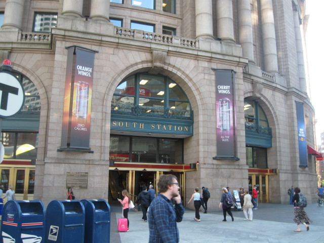
I returned to the
station to await
Chris' arrival. After
he arrived we had a
few minutes to wait
for our train and then
it was posted.
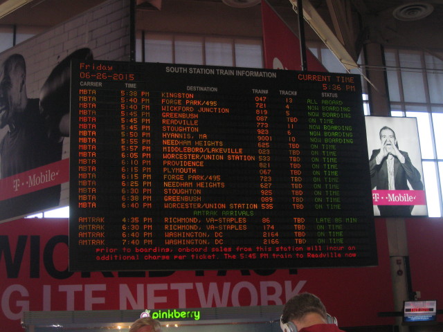
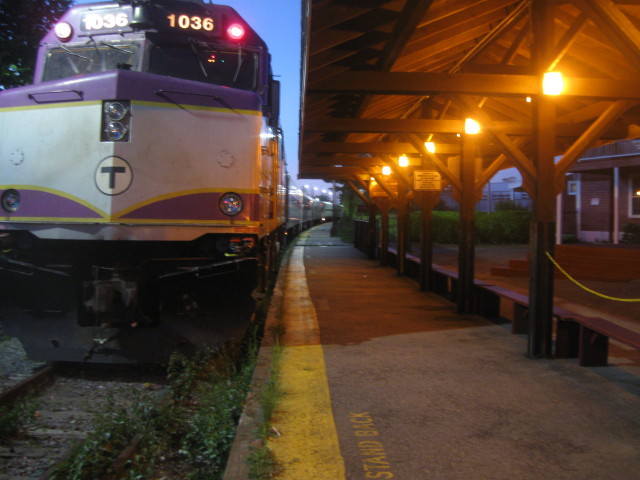
Our train #9001 was
leaving on time on track
10. We needed to hustle
to track 10.
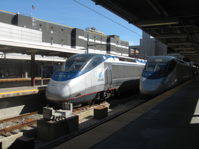
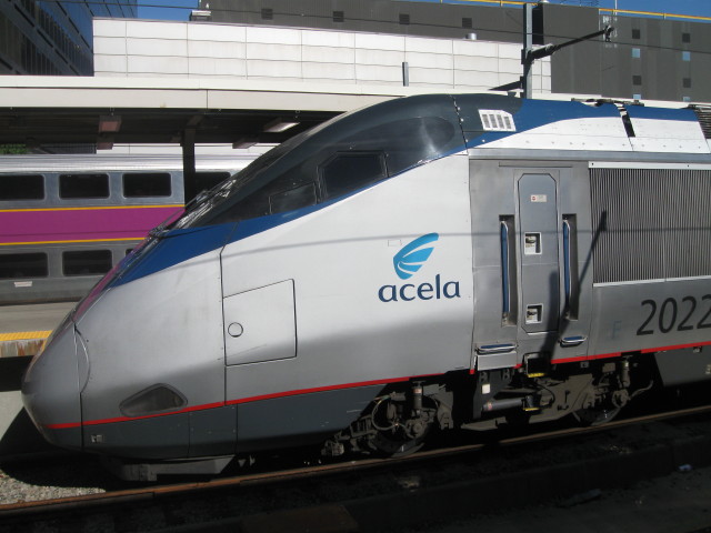
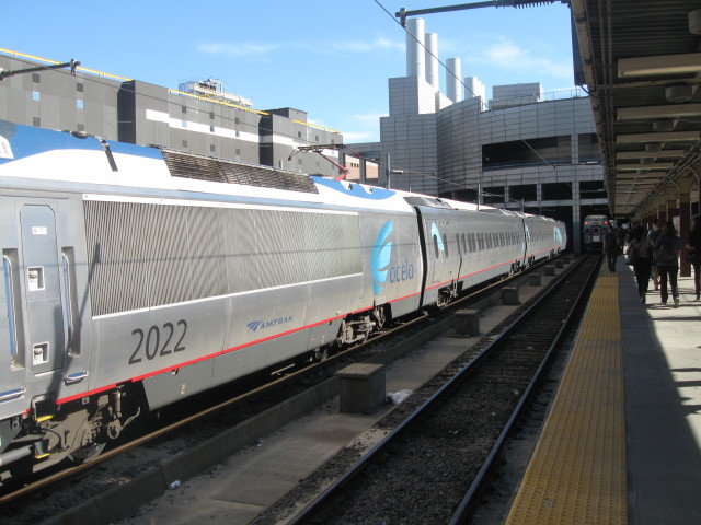
Boston South Station is
the northern terminus of
the Acela from
Washington DC. to
Boston.
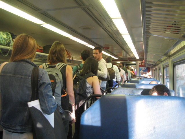
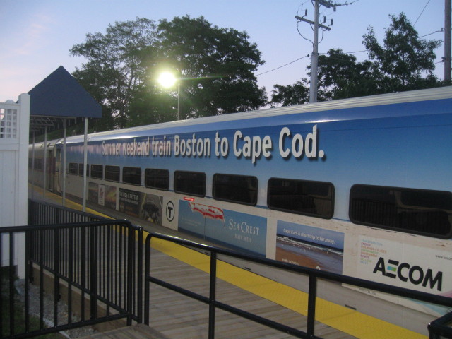
We found our train and
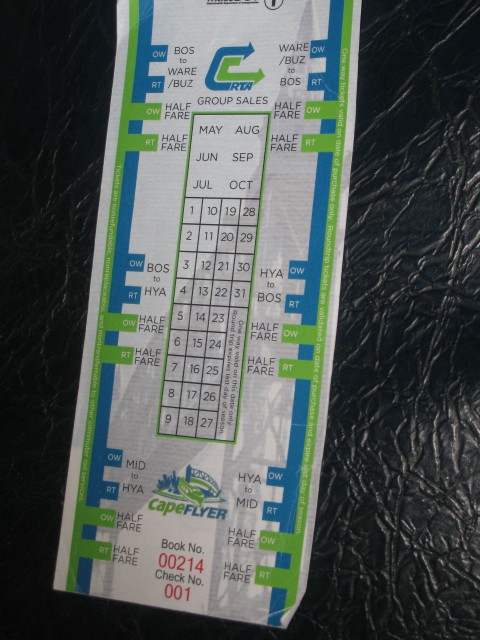
boarded the CapeFlyer
and grabbed a couple
empty seats as the
train was almost sold
out with weekend
travelers.
CapeFlyer's weekend
service is from
Boston's South Station
to Hyannis, Cape Cod
with stops in
Braintree, Brockton,
Middleborough, Wareham
and Buzzards Bay.
Friday Night the
CapeFlyer leaves
Boston at 5:50 pm and
arrives in Hyannis at
8:15 pm, it then
returns at 9:00pm
arriving in Boston at
11:18pm. By going on
Friday we were able to
get this special
mileage round trip
with only a 45 minute
lay over.
Saturday/Sunday
schedule leaves Boston
at 8:00am and arrives
in Hyannis at 10:20am
and returns leaving
Hyannis at 6:40pm,
arriving in Boston at
9:02pm. Great if you
want to spend a day or
two on the Cape.
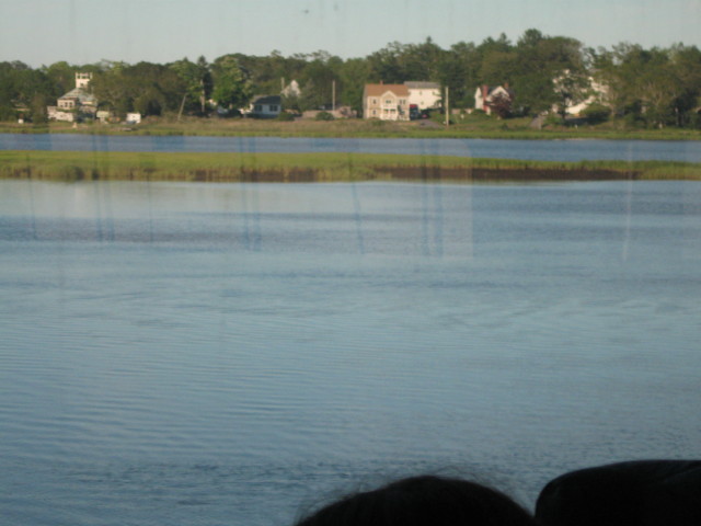
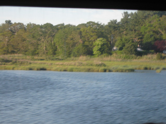
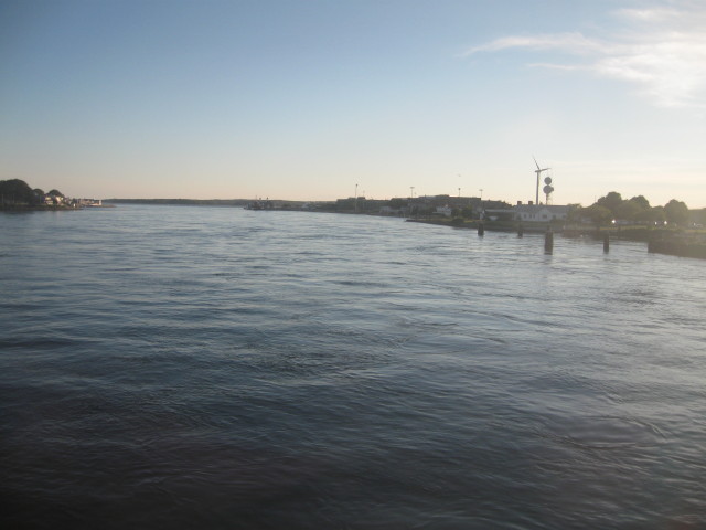
The scenery was great
and we saw a few dried
cranberry bogs.
Sitting across the
aisle from us was a
lady with her two
children, a teenage
girl and a younger
brother. The young boy
had his scanner radio
listing to railroad
traffic and was giving
his family current
info as to what was
happening. I told
Chris he's a young
"foamer" for sure.
Later I talked to them
after we had arrived
in Hyannis. They were
down here for the
weekend and always
like taking the train
to travel here.
A big crowd queuing to
leave at Buzzards Bay.
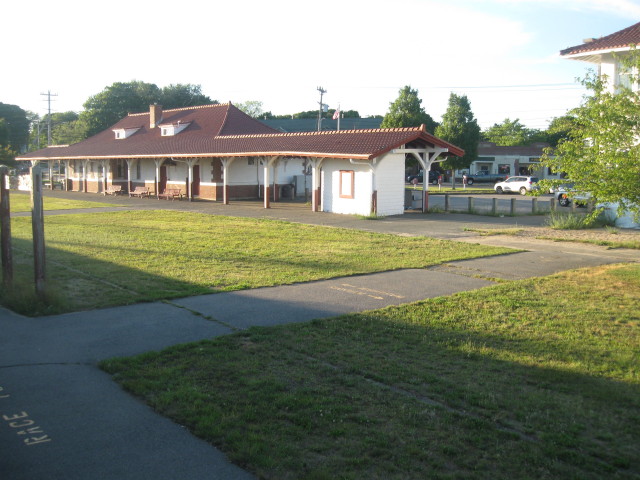
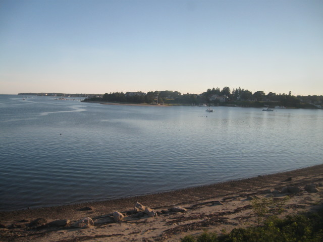
Buzzards Bay Station.
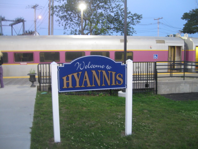
We arrived in Hyannis on
time at 8:15pm.
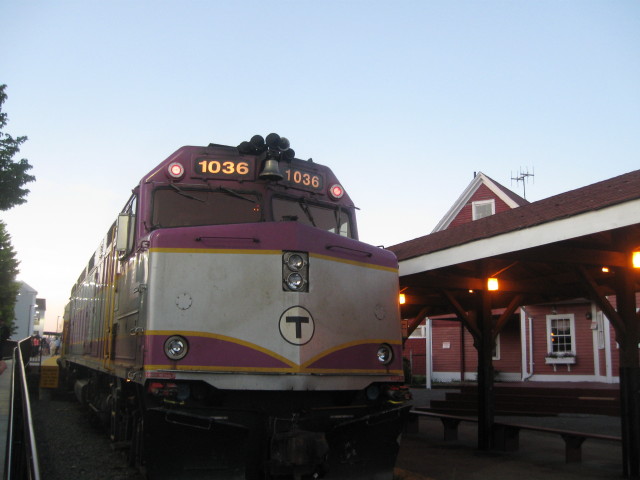
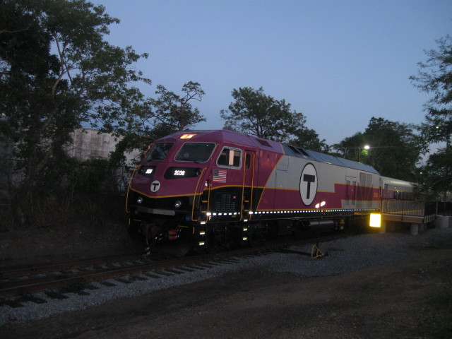
This loco will be on
point for our return
trip.
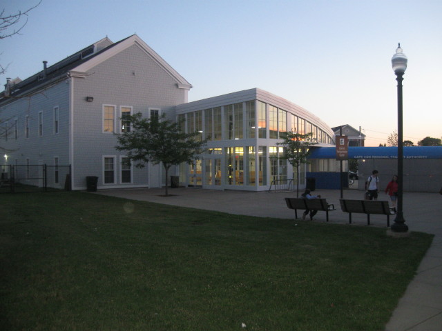
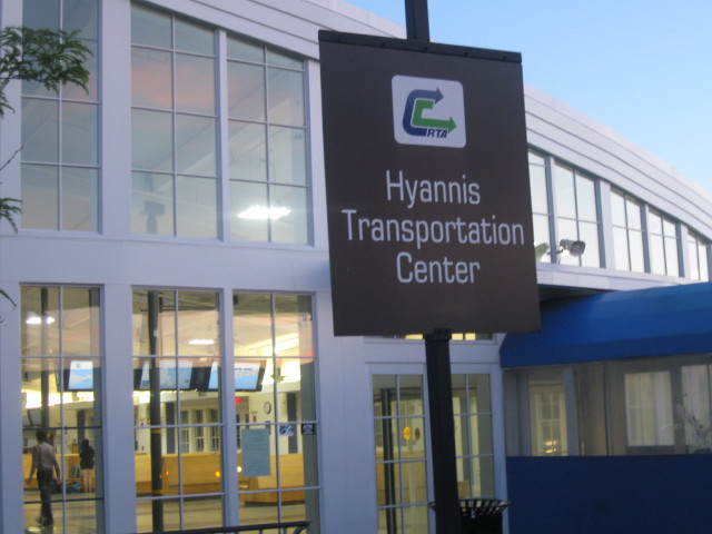
Cape Cod Regional
Transit Authority.
At the station shortly
before departure at
9:00pm.
Our train to Boston
left on time with
plenty of empty seats,
some cars were
completely empty.
Maybe a total of three
other passengers. We
arrived on time at
South Station at
11:20pm then proceeded
down stairs to the Red
Line. We took the Red
Line to the end at
Alewife station, using
our Charlie Ticket
once more, retrieved
our car in the parking
structure. From there
we drove to our motel
in Shrewsbury, Ma and
this trip was not
pleasant. There was
construction, detours,
and rain while trying
to navigate unknown
roads. It was late
when we arrived at our
motel room and our
heads hit the pillows
very shortly
thereafter. It had
been a long day for
both.
Tomorrow we will visit
the Essex Steam Train,
Shore Line Trolley
Museum and ride Metro
North in Connecticut.