Search Railroad Sites For:
London & Lake Erie Map

South Western Traction Company System Map

Map courtesy W. Glen Curnoe - Used with Permission

This map was received from Glen Curnoe via Al Howlet and Rob Sterne. I am indebted to them for providing me with this excellent resource. 
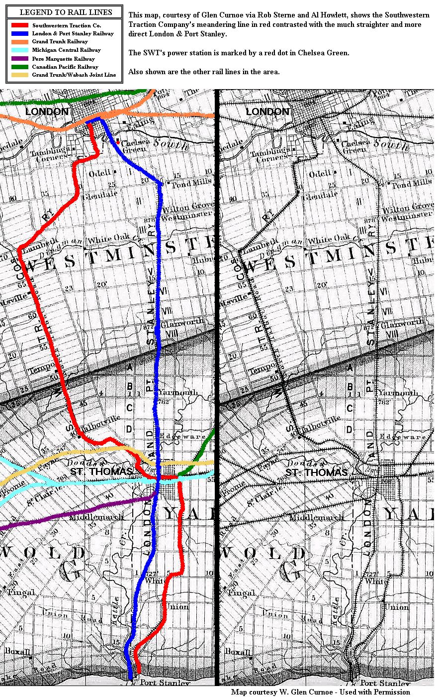
The meandering route of the South Western Traction Line can be seen starting in London to the West of the rather straight-running London and Port Stanley, and after passing through Lynhurst and entering St. Thomas, crosses over to the east side of the L&PS via Talbot Street and continues south to Port Stanley on the east side of Kettle Creek.

Map showing railroads in the region - Pre 1909

Last Update May 16, 2008

Return Home

Any questions, comments, pictures, etc - Please e-mail me Dan MacKellar


  Free Web Hosting Since 1996. Join & Become Part of the TrainWeb's Railroad Community.