This page follows along the original route across the Bear River canyon as seen to the right in the map above. Note, between 1901 and 1908
the mainline between Long Ravine and Coleman was built on a new alignment. The new route across the Bear River canyon is to the left.
Major features of this original line include Gables Trestle, Bear River Trestle, You Bet Tunnel, Greenhorn Trestle, and Shebleys Trestle.
The original alignment was left in place as the You Bet Branch until 1910.
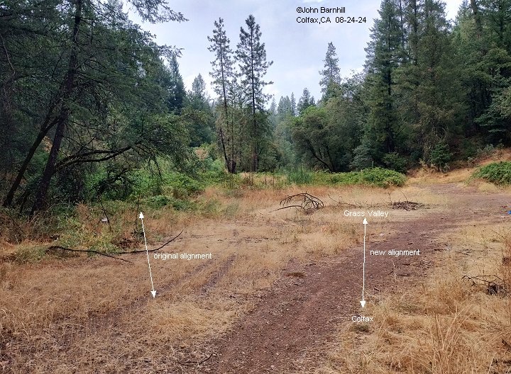
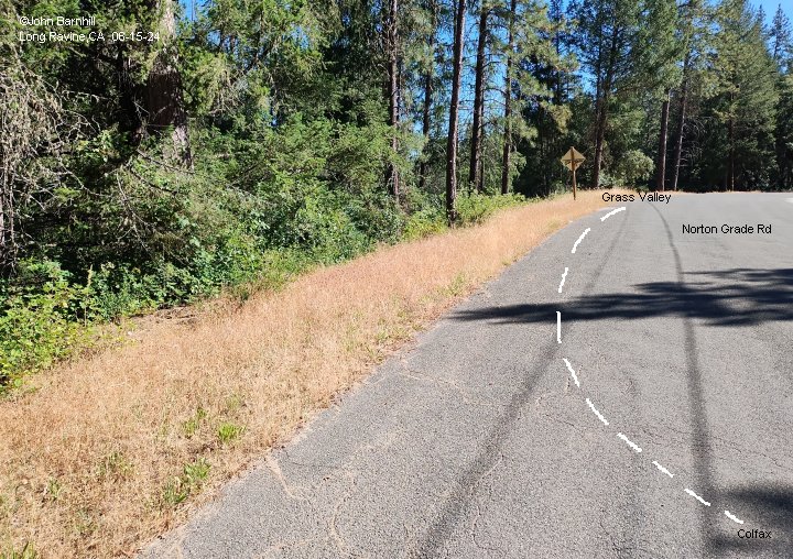
1. Located at the end of the large cut where the large trestles over I80 stand, this is the junction where the new alignment
and the original alignment separate. Much of the original line is so overgrown that access is nearly impossible.
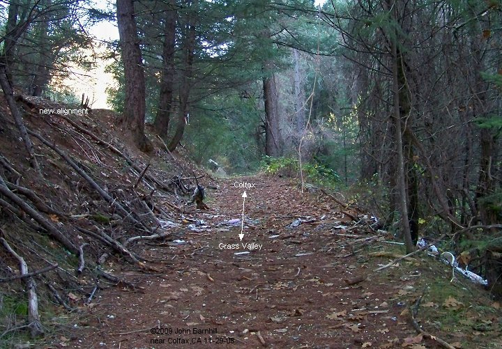
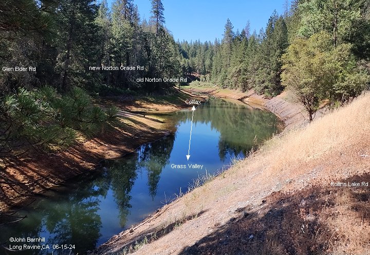
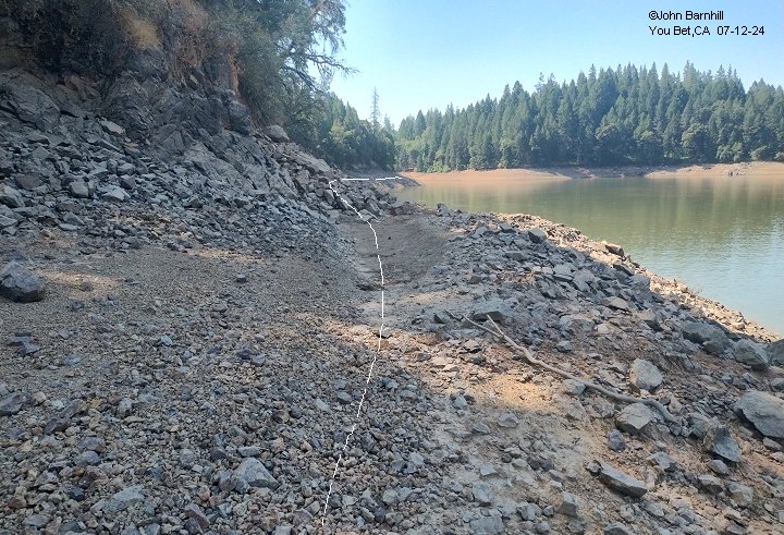
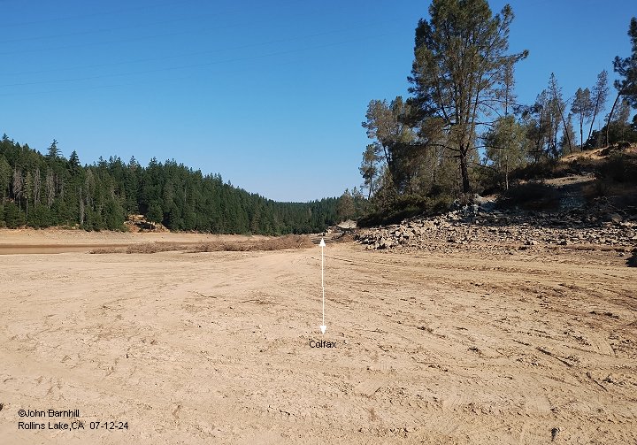
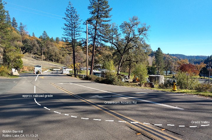
2. Just a few hundred feet from Norton Grade Rd along the original line. View looks towards Colfax. Not much further up,
there was a small trestle crossing the ravine. Note also, the new alignment is just above on the left.
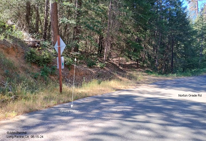
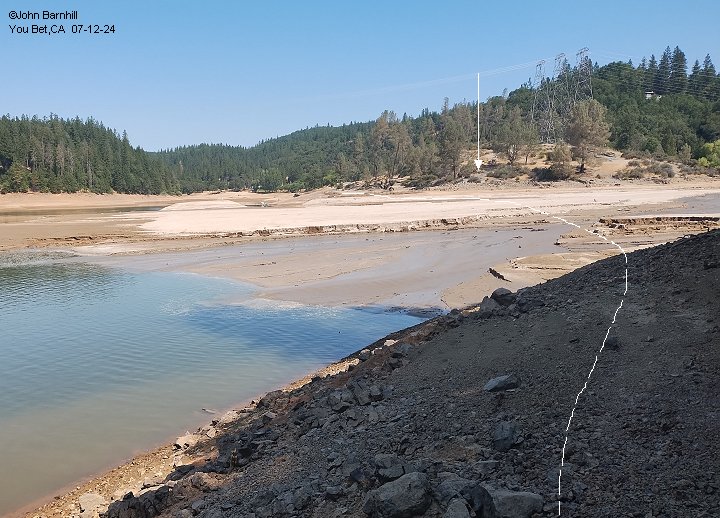
3. This image looks towards Colfax as well from just off of Norton Grade Rd.
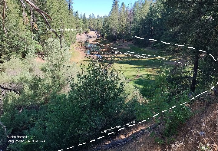
4.-5. North and south views on Norton Grade Rd showing the approximate route of the original railroad. Here Norton Grade was
re-aligned on a large fill due to construction of Rollins Lake. This buried the original line and obliterated the new railroad grade.
6. This view looks north down the side pond of Rollins Lake from the current Norton Grade Rd. The orignal railroad and Norton Grade Rd are marked on the image.
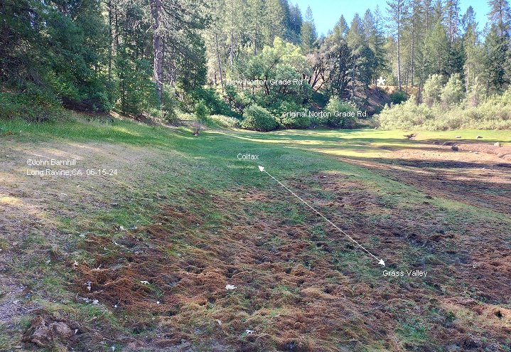
7. View back south towards the previous photo showing the old line and road locations.
8. Approching the new alignment of Hwy 40/Rollins Lake Rd. Hwy 40 was also relocated on a fill for the construction of the lake.
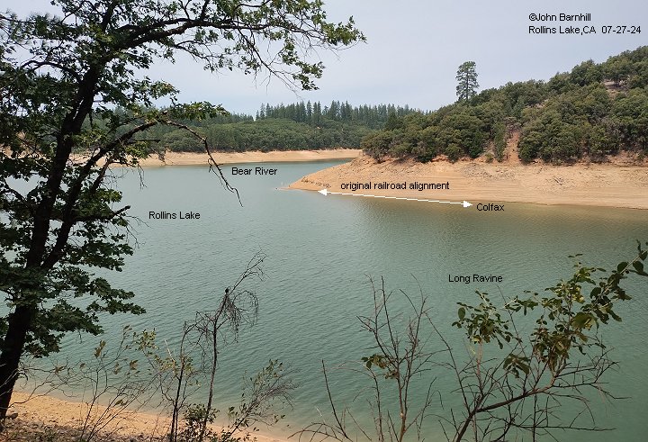
9. Taken from Hwy 40/Rollins Lake Rd looking back up the side pond towards the previous images and eventually Colfax.
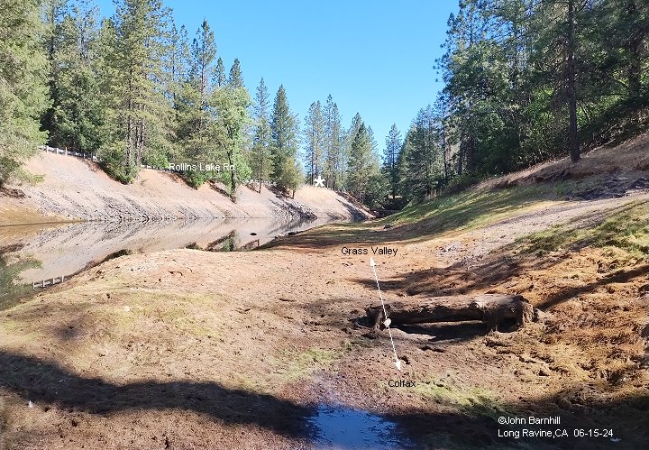
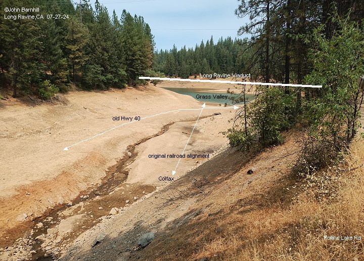
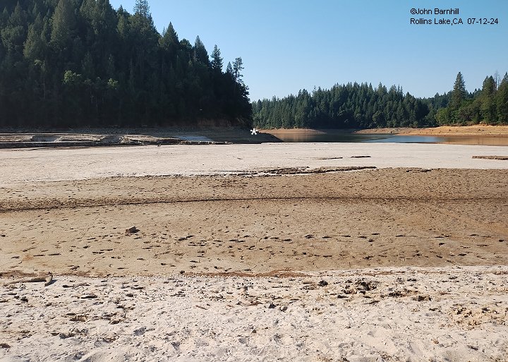
10. View from Hwy 40/Rollins Lake Rd looking north into the bottom of Rollins Lake, this image shows the old railroad and Hwy 40 during low water.
Also marked is the location of the steel Long Ravine Viaduct built during the relocation of the railroad.
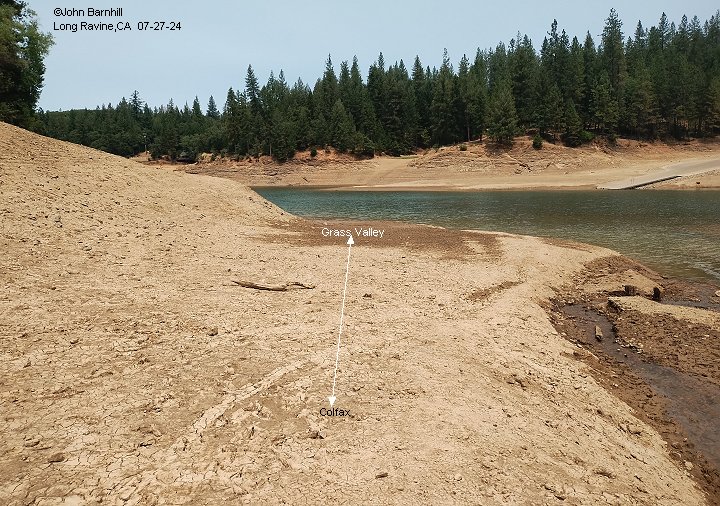
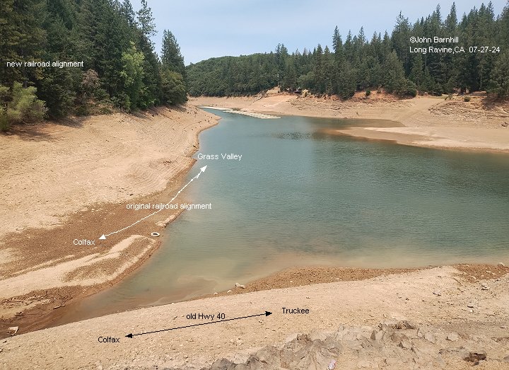
11.-12. These opposite views were taken well below the waterline of Rollins Lake near the intersection of the old and new railroads and old Hwy 40.
13. View from the parking area along the new Hwy 40/Rollins Lake Rd, now called "Freeloaders", looking north along Long Ravine. Somewhere in the water stood Gable's trestle.
14. This view was taken from the new railroad alignment. Low water has just exposed the old railroad at the point it turns north into the Bear River canyon from Long Ravine.
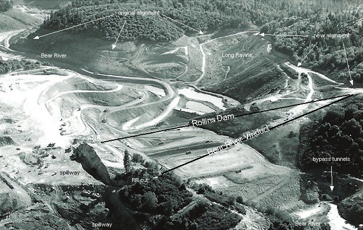
15. NID construction photo marked with several features. The point in the previous photo is clearly visible.
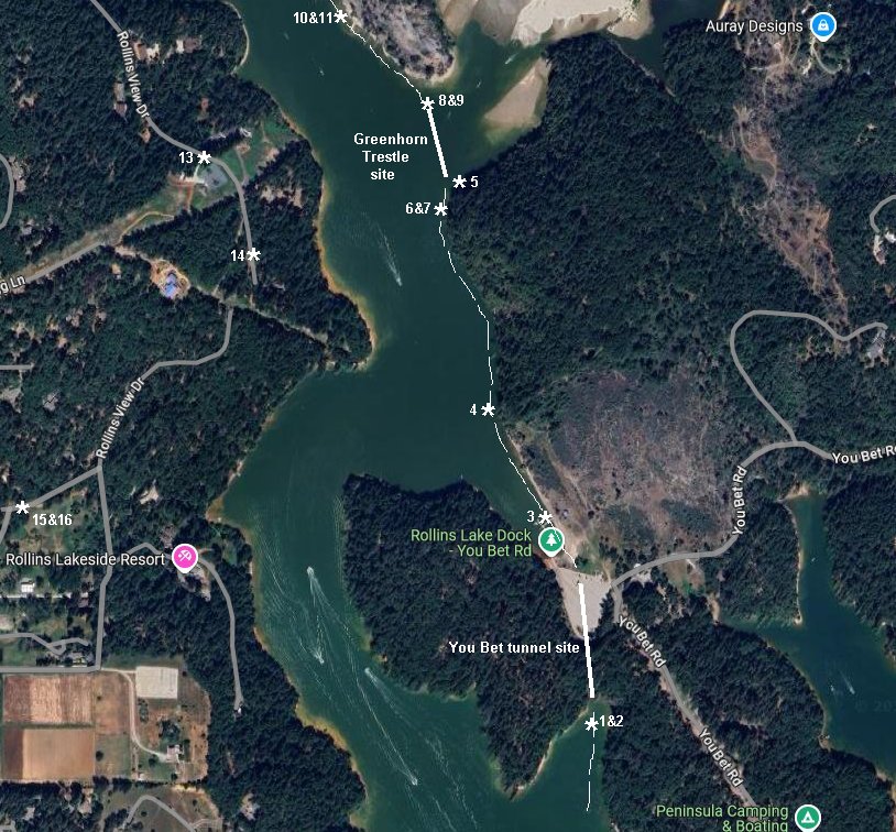
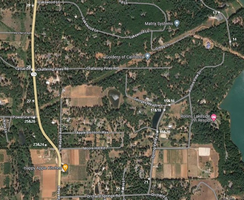
16.-17. Google satellite and USGS lidar images marked with photo locations. The Red line is the original railroad alignment, followed on this page.
The Green line is the new aligment. Yellow line indicates the original Norton Grade Rd and the Blue line is the original Hwy 40.
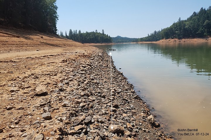
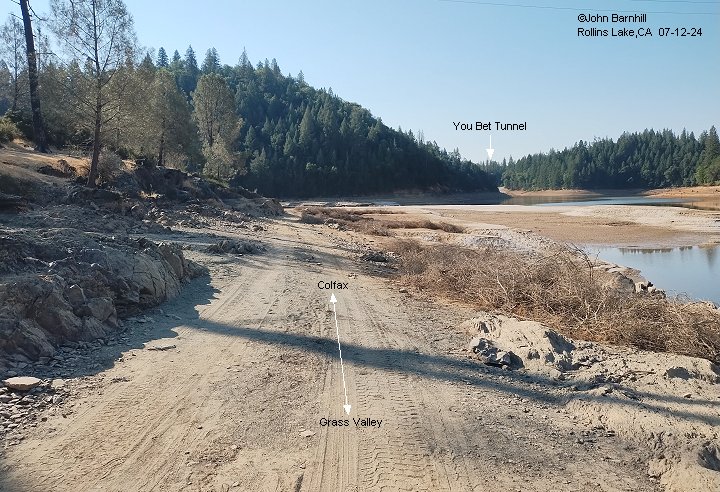
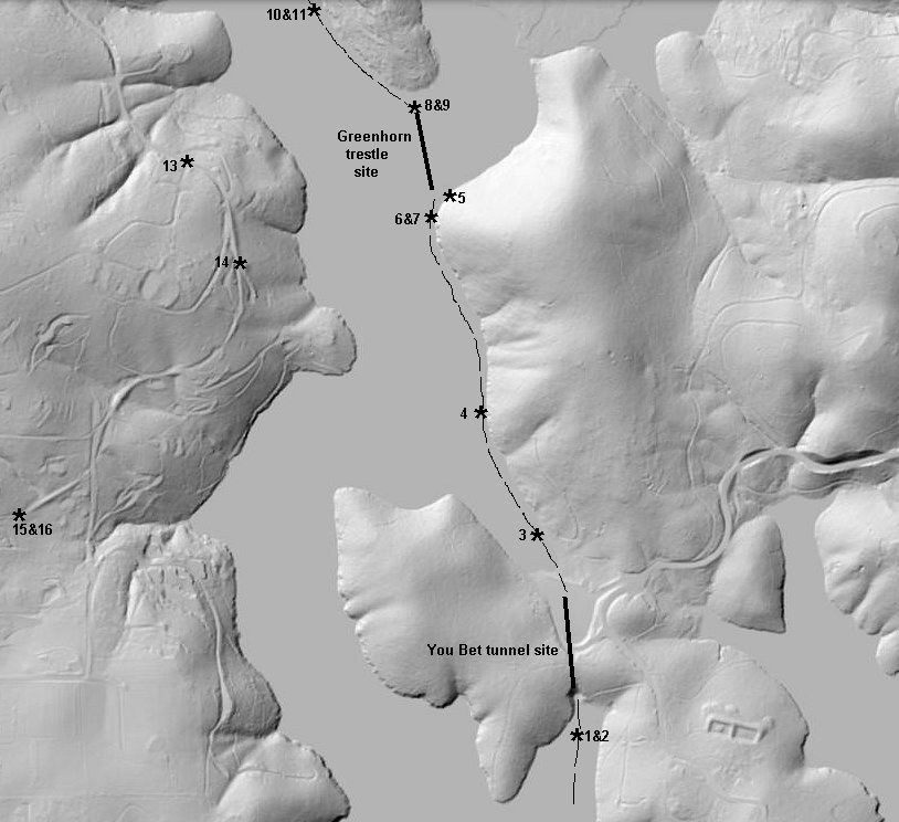
1. This low water image looks south from near the south portal of the You Bet tunnel. The dark rocks are the roadbed indicated by several track bolts found.
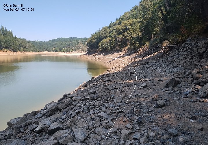
2. The south portal of You Bet tunnel is completely blocked in by silt and driftwood.
3. Somewhere in this image is the north portal of the You Bet tunnel. It was completely destroyed and is buried under the parking area for the Peninsula Campground boat ramp.
4. Looking north a little further up the line, the water level changes and wave action has made picking out the original railroad grade nearly impossible.
The only clue are the myriad of track bolts and spikes along this section.
6. This image looks back south from the southern end of the Greenhorn trestle site toward You Bet tunnel.
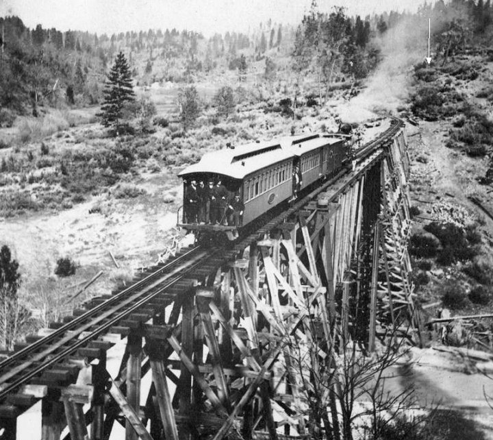
5.&7. 1880s and 2024 images looking north across Greenhorn trestle. Note the arrow indicating the same rock in both photos.
It is simply amazing how Greenhorn Creek has silted the entire canyon full over the years! This site is usually under water now.
8. Looking back south across the trestle site.
9. Opposite view of image 8 as the line continues towards Shebleys.
10. A little further north looking back towards the trestle site.
11. From the same spot as image 10 looking towards Shebleys across the Greenhorn Access boat ramp.
7.-8. Google satellite and USGS lidar images marked with photo locations.
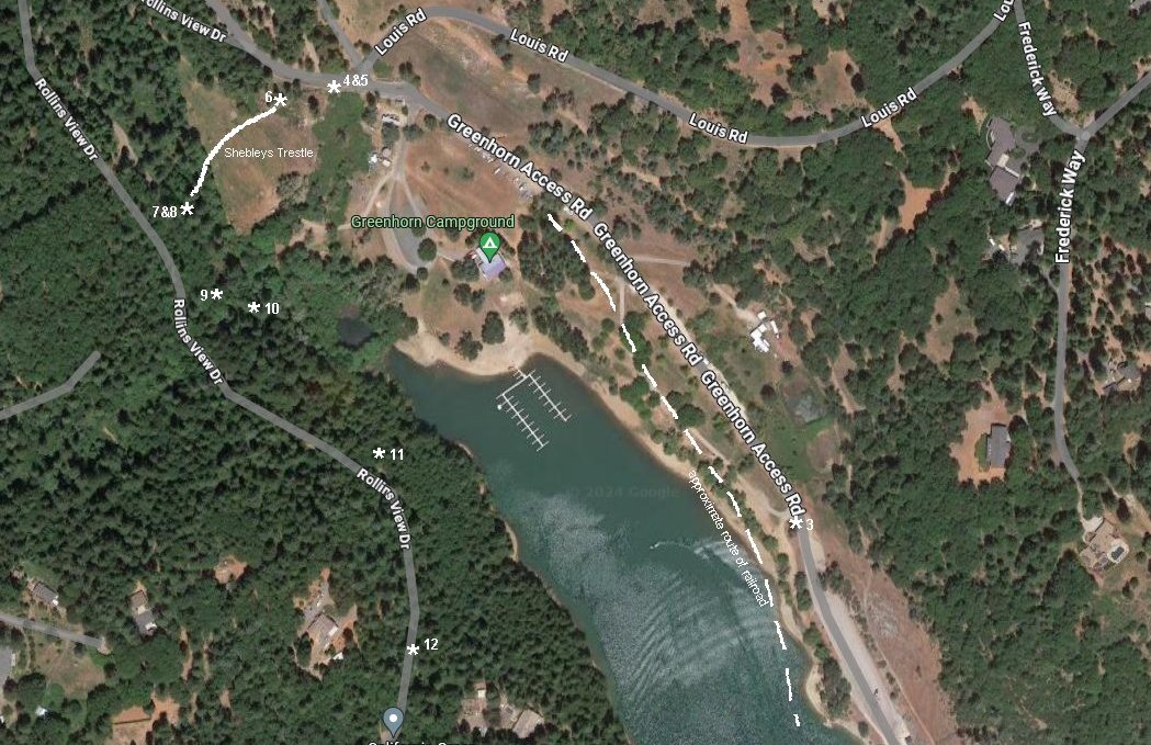
Shebleys/Greenhorn Access Campground
On its climb out the the Bear River drainage, the line made a complete U-turn to the south at Shebleys, now Greenhorn Access campground.
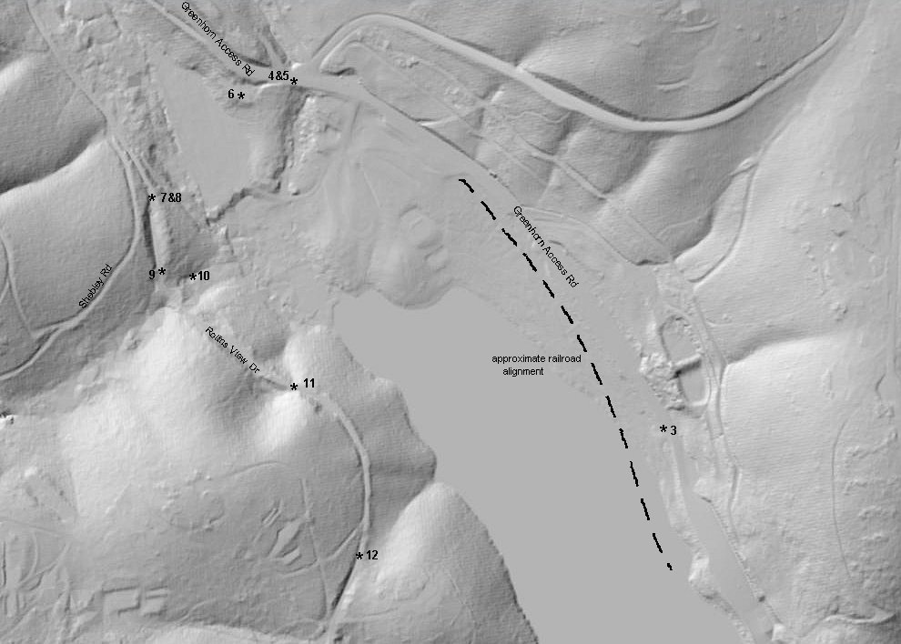
1.-2. USGS lidar and Google satellite views marked with the locations of the accompanying images.
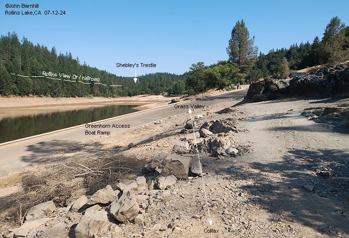
3. Taken near the Greenhorn Access boat ramp, this image shows the approximate location where the line emerges from Rollins Lake.
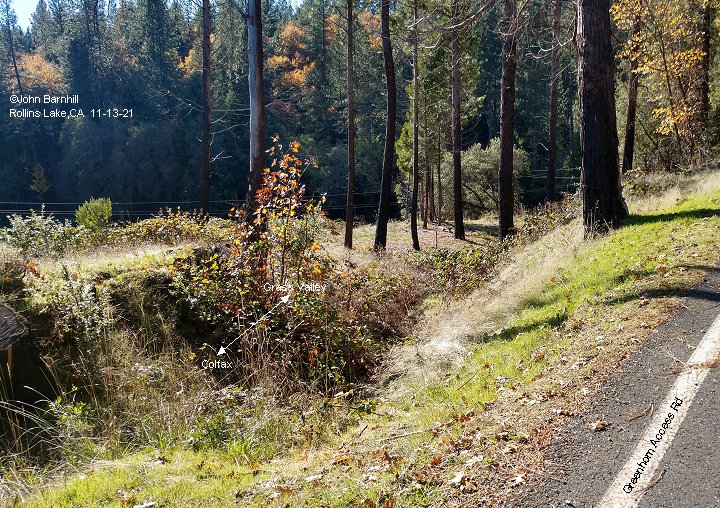
4. This image looks back south towards image 3 from near the Shebleys Trestle site.
5. View from the same location as image 4 looking towards Shebleys Trestle site.
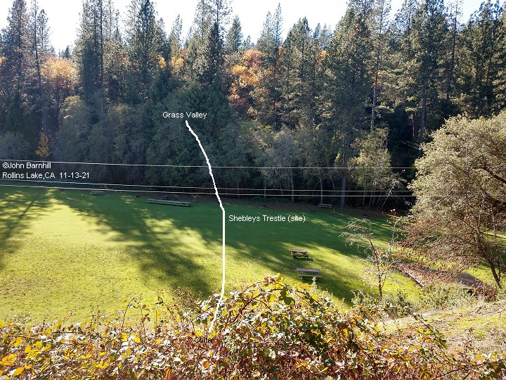
6. Approximate location of Shebleys Trestle looking railroad north.
7. Looking back, railroad south, across the site of Shebleys Trestle.
8. The line now travels geographically south while climbing railroad north towards Chicago Park. This is the opposite view of image 7.
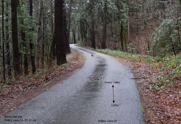
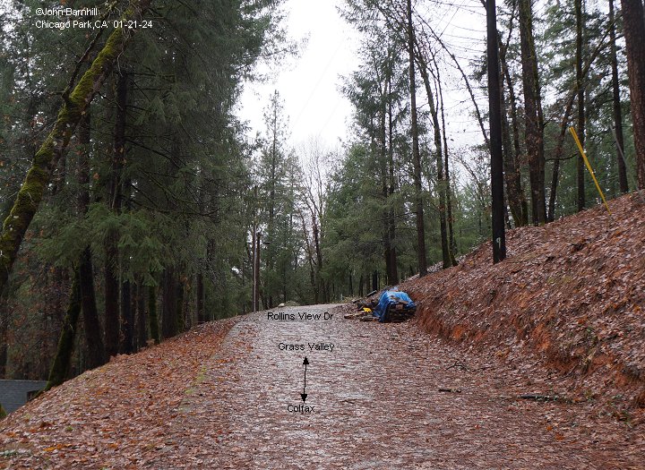
9.-12. The right of way now follows Rollins View drive over a series of fills and through several cuts.
Image 10 is a culvert below the fill in image 9.
Chicago Park
Entering Chicago Park, the line makes another sweeping U-turn back to the north and then onwards towards Coleman.
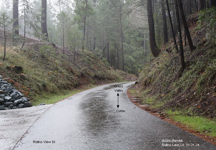
13.-14. Two more views along Rollins View Drive. Both look geographically south while at the same time look railroad north.
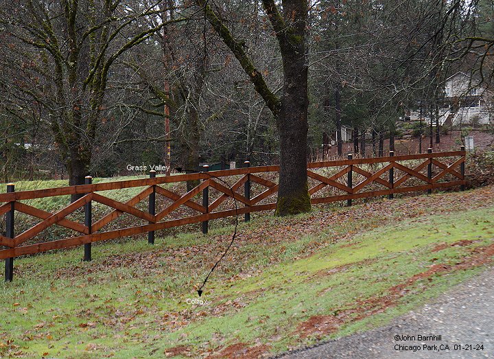
15.-18. These views are taken along Spring Valley Dr near the intersection with Georges Meadows. I suspect the fill was raised
slightly at this end to form a dam for the pond seen in the images and on maps.
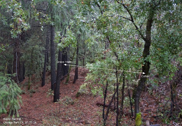
19.-20. Opposite views taken at the southern end of the dam seen in the previous images.
21. The line begins its turn back to the north here on this fill.
22. At Reese Ln is the large cut forming the apex of the u-turn back north. This view looks back towards the previous image.
The rest of the cut has been filled in. An early iteration of Chicago Park station also stood near here.
Between here and the next image, the right of way is either inaccessable or non-existant.
23. A large cut is now crossed by Hwy 174 opposite Moore Hill Rd. This view is railroad south.
24. Opposite view from image 23. A very nice fill between Hwy 174 and Powerline Rd.
Another early version of Chicago Park station stood near here.
25. Looking south from Powerline Rd towards the fill in the previous image.
26. Northward view from Powerline Rd into a small cut.
27. View from the north end of the cut looking back south through it.
* USGS Lidar and Google satellite images marked with photo locations.
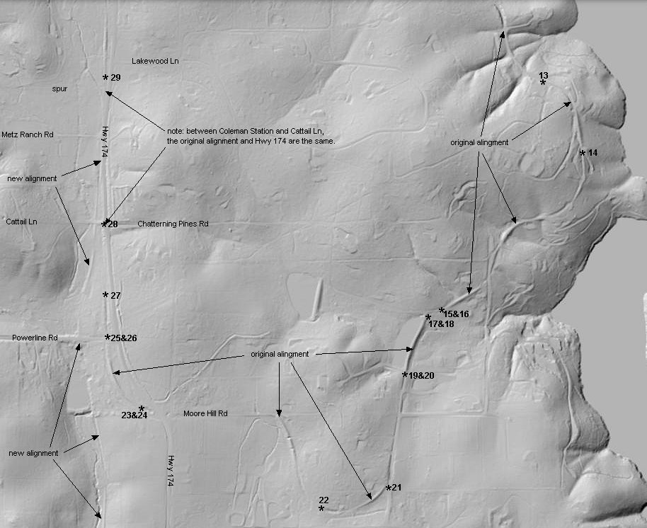
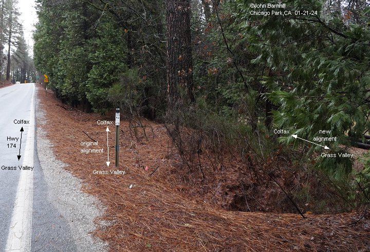
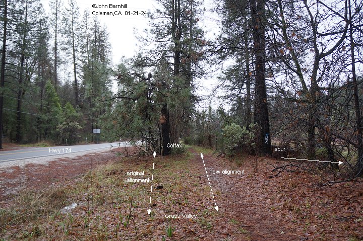
28. Looking south at Cattail Ln. This is where Hwy 174 and the original alignment diverge. Best seen in person.
29. Again looking south, this time at Coleman station. This is where the new and original alignments diverge.
Note, from here to Cattail Ln, Hwy 174 and the original alignment are the same. These locations are marked on the above lidar and satellite views.