TrainWeb.org Facebook Page
Baltimore Light Rail Photo Tour


Baltimore Light Rail
Modern day photo tour

Accompanying each photo below are:

Click a photo to see a larger view. Please send your comments and corrections to Steve.


<< Previous (north) | THIS PAGE: Linthicum to Cromwell | Next (BWI spur) >>

1938_Aerial
Photo courtesy Johns Hopkins University

1938 Aerial
Mile: 6-7 Date: Apr 1938
Ease: View: N (right)
Area: BLR: 92
Map: Topographic Maps

South of Maple Road (to the left on this aerial) the ASL's original alignment had consisted of a series of gentle S curves. When the WB&A pushed through in 1907, it convinced the ASL to swap land and straighten its track in order to make room.

A little more than a decade later, the upstart WB&A would buy out the ASL. That was not a good business move, however, since automobiles and the Great Depression would soon follow and put the WB&A out of business by 1935.


MTA 5016
NEW! late-Mar 2024

MTA 5016
Mile: 6.7 Date: Oct 2023
Ease: A- View: N
Area: B+ BLR:
Map: AA 2 F 8 Topographic Maps

Southbound MTA 5016 has just passed the highest point along the main line south of Baltimore city.


Linthicum Station

Linthicum Station
Mile: 6.7 Date: Jul 2021
Ease: A- View: NE
Area: B+ BLR:
Map: AA 2 F 8 Topographic Maps

Light rail's Linthicum Station sits atop the old ASL right of way.


Drop Offs
NEW! late-Mar 2024

Drop Offs
Mile: 6.7 Date: Oct 2023
Ease: A- View: SE
Area: B+ BLR:
Map: AA 2 F 8 Topographic Maps

I am familiar with this area yet unsure what this sign at Linthicum Station intends to communicate. I can't imagine a visitor from out-of-town making sense of it.

Hotel Drop-Offs At North Linthicum. It might mean any of the following:

  • this is where hotels drop off guests presumably headed to BWI Airport
  • this is not where hotels drop off guests because this is not North Linthicum Station
  • "station" is not mentioned, so perhaps hotel drop-offs happen elsewhere in North Linthicum
  • for some reason, I should care where drop-offs happen
  • maybe I can meet hotel drop-offs at this sign?
  • if I've arrived here from BWI Airport and expect a hotel to pick me up, that might happen at the drop off location, which could be at this sign or at some other place
or something else. Vagueness renders this sign useless.


Cicada Damage

Cicada Damage
Mile: 6.7 Date: Jul 2021
Ease: A- View: E
Area: B+ BLR:
Map: AA 2 F 8 Topographic Maps

Year 2021 saw the emergence of Brood X 17-year cicadas that lay eggs in tree stems. As seen in the background, the stems dry, turn brown, then fall to the ground where the next generation crawls out and buries itself for 17 years. The eggs inside this stem, however, got snagged by the catenary and didn't make it to ground level.


Shipley
Photo credit James P. Shuman

Shipley
Mile: 6.8 Date: May 1936
Ease: A- View: SE
Area: B+ BLR: 93
Map: AA 2 E 8 Topographic Maps

shipley zoom After the ASL / WB&A consolidation ended in failure, the bondholders picked up the pieces and in 1935 continued service along what once had been ASL's bread and butter route, the one between Baltimore and Annapolis, where B&O and Pennsylvania RRs did not offer competing service. James Shuman was at Shipley to record the then-infant Baltimore & Annapolis Railroad (B&A).

Many of the smaller stations were flag stops: ASL/WB&A did not stop unless there were passengers looking to board (or depart). Prior to electrical illumination, passengers waiting at such a station at night would set a "torch" of newspaper aflame so the operator could spot them in darkness.

Link: station 1950


MTA 5035

MTA 5035
Mile: 6.7 Date: Jul 2021
Ease: A- View: SE
Area: B+ BLR:
Map: AA 2 F 8 Topographic Maps

MTA 5035 negotiates the same curve. Tha ASL's Shipley Station was immediately ahead on the left.


Shipley Station
Photo courtesy HH Harwood collection

Shipley Station
Mile: 6.8 Date: Jan 1950
Ease: B+ View: NW
Area: A- BLR:
Map: AA 2 E 8 Topographic Maps

Baltimore & Annapolis (B&A) was one of the Annapolis Short Line's successors. As B&A's only freight engine at photo time, electrically-powered number 18 seen here was kept busy before the overhead wires were removed and B&A went diesel. Shipley Station was located within the northwest quadrant of the line's intersection with Camp Meade Road (MD 170).


MTA 5046

MTA 5046
Mile: 6.9 Date: Sep 2021
Ease: A View: N
Area: A- BLR:
Map: AA 2 E 8 Topographic Maps

MTA 5046 approaches the Camp Meade Road grade crossing. The taller green bushes at right occupy the site of Shipley Station.


MTA 5007

MTA 5007
Mile: 6.9 Date: Sep 2021
Ease: A View: N
Area: A- BLR:
Map: AA 2 E 8 Topographic Maps

block number 09 Northbound MTA 5007 holds up traffic for a brief period.

The 09 represents the "block number", also known as a "run number", an identifier that is unique among the trains operating at that time. It helps determine if a train is on schedule, and facilitates communication between the operator and central control.

Per Todd Sestero, the devices displaying this number are the only part of a light rail car's hardware that was manufactured by the same company that made that part for Baltimore's PCC streetcars during the first half of the 20th century.

Link: Todd's site has aerial photos of this stretch


Tensioner

Tensioner
Mile: 6.9 Date: Sep 2021
Ease: A View: SW
Area: A- BLR: 61
Map: AA 2 E 8 Topographic Maps

The Camp Meade Road grade crossing is one of the easiest places to examine a catenary tensioner up close. Note also the utility box at left at which we'll take a closer look in a moment.


Weights

Weights
Mile: 6.9 Date: Sep 2021
Ease: A View: SW
Area: A- BLR:
Map: AA 2 E 8 Topographic Maps

The weights keep the catenary taught as it lengthens or shortens depending on catenary temperature. Each plate weighs about 15 pounds, which makes this stack's total close to 1000 pounds.


Indicator Lamp

Indicator Lamp
Mile: 6.9 Date: Sep 2021
Ease: A View: S
Area: A- BLR:
Map: AA 2 E 8 Topographic Maps

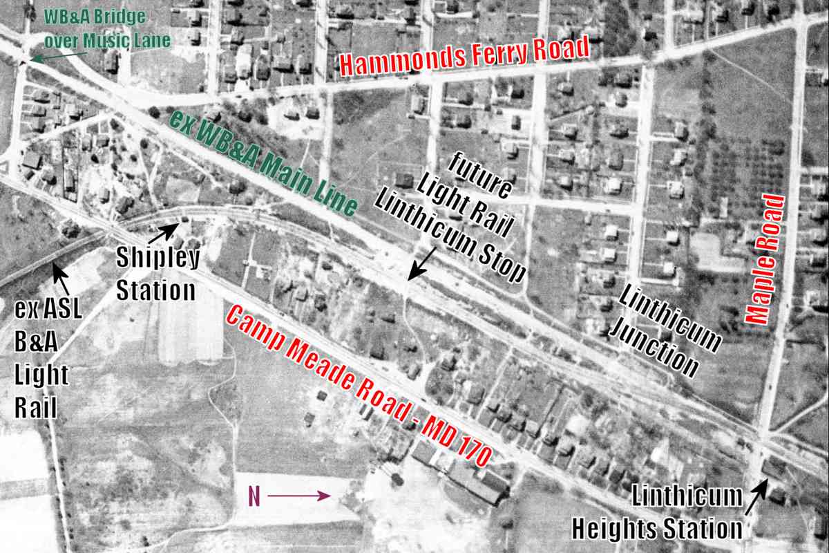
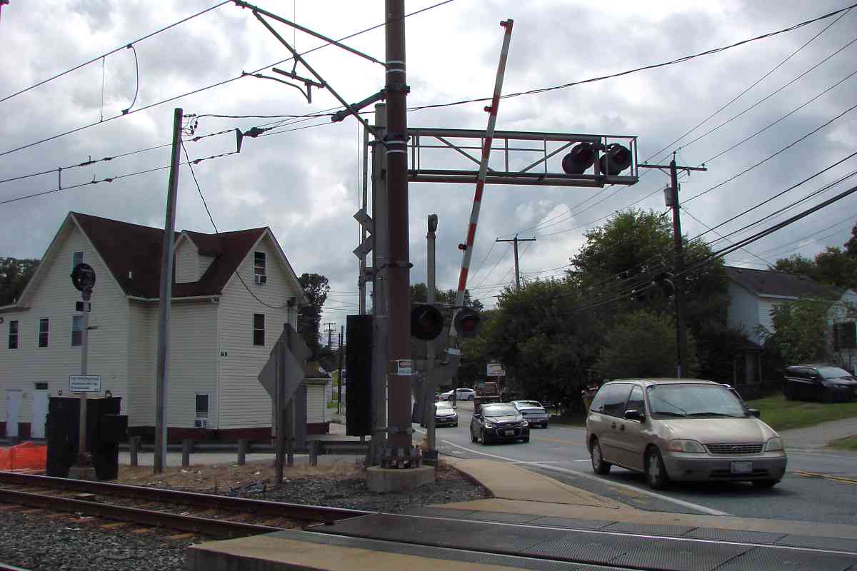
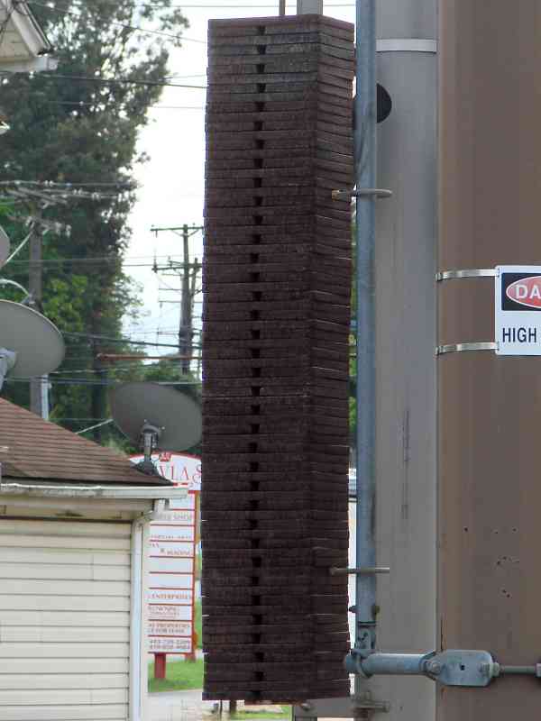
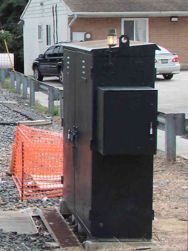
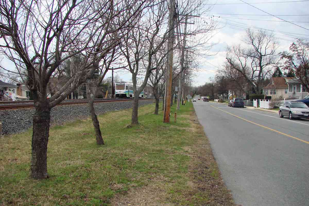
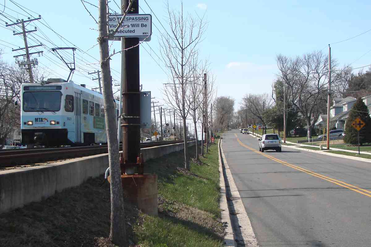
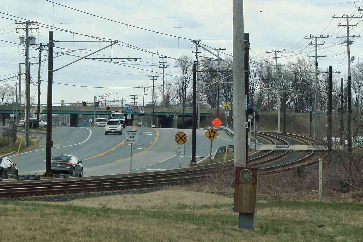
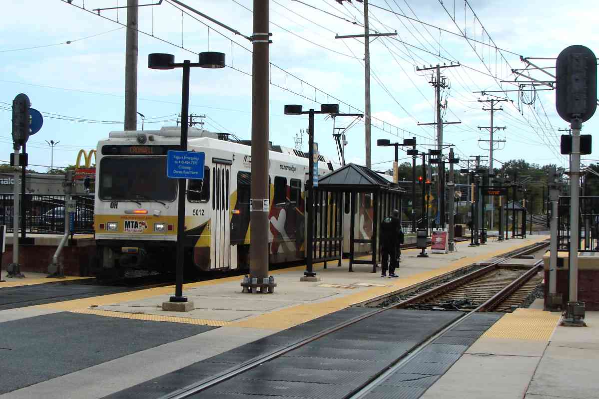
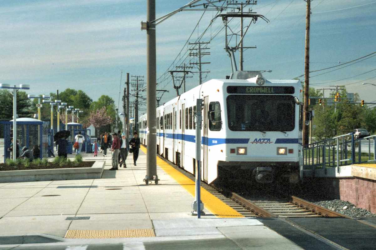
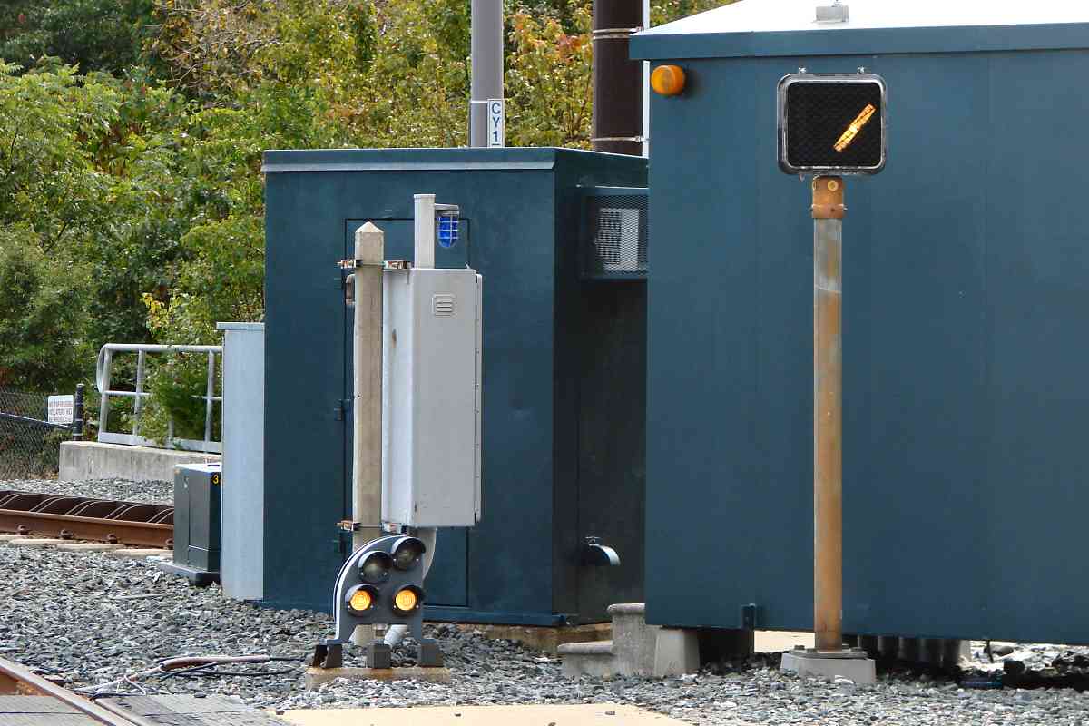
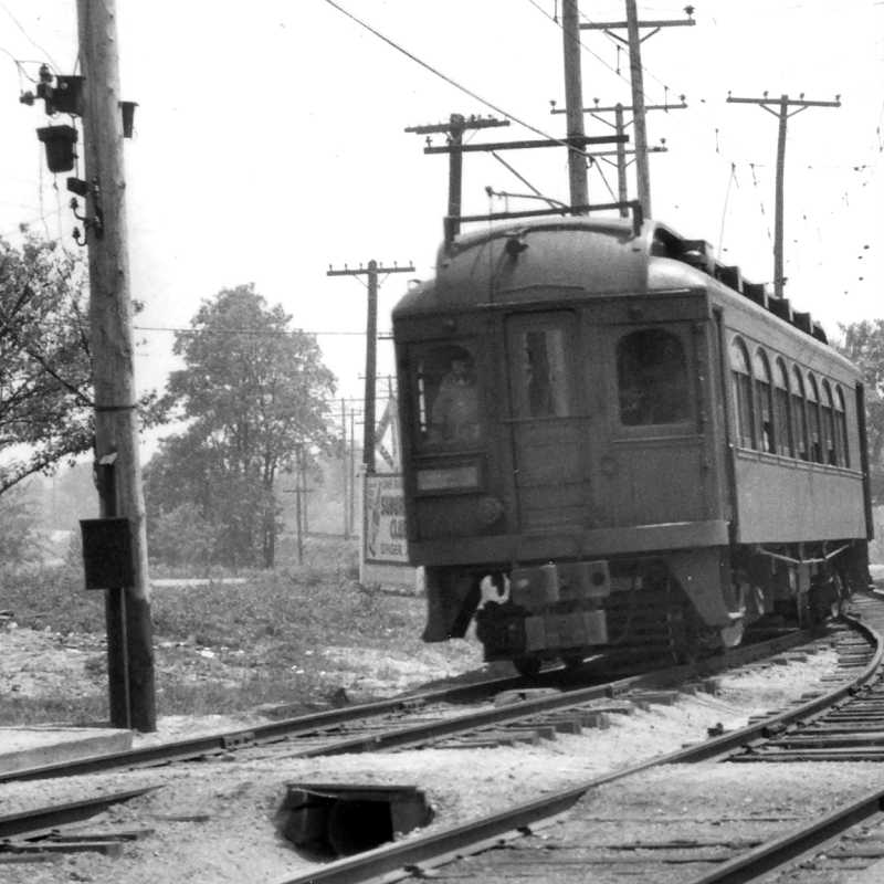
When the lamp atop this utility box is lit, so should be the grade crossing's warning signals. If the signals malfunction, this lamp confirms the circuitry is working at least that far. Or, if a train operator sees the lamp unlit, he can report the grade crossing needs repair.

The lamp is a throwback to the early days of electricity when meters to check current and voltage were not so commonly available. When automated grade crossings were introduced during the early 20th century, they were one of the more complex applications of circuitry. Elevators were, and still are, another. I knew an old-time electrician who would test voltage by briefly touching bare live wires: he'd twitch then report, "Yep, 220," for example.


MTA 0000

MTA 0000
Mile: 6.9 Date: Sep 2021
Ease: A View: SE
Area: A- BLR:
Map: AA 2 E 8 Topographic Maps

At photo time, at least one railcar was going incognito (running without an exterior number) hence the 0000 in this panel's title. In this photo, the unit also lacks completed destination and run number signage, though they might have been obscured by flicker that's too slow for the camera.

This northbound is approaching one of the system's few X-shaped track crossovers; light rail uses them only where room is limited. The X-shape results in a track diamond at the center, and appears to complicate the wiring.


MTA 5046

MTA 5046
Mile: 6.9 Date: Sep 2021
Ease: A View: SE
Area: A- BLR:
Map: AA 2 E 8 Topographic Maps

MTA 5046 has a green light to proceed to BWI Junction. The two thickest poles support overhead power lines that are not part of light rail.


BWI Junction
Photo credit HH Harwood

BWI Junction
Mile: 7.1 Date: Jan 1998
Ease: B View: N
Area: B BLR:
Map: AA 2 F 9 Topographic Maps

An initially-single-tracked spur to BWI Airport (left) opened in 1997. It was built along a new right of way, that is, one not formerly used by a railroad. The next tour page will cover that spur.


To Cromwell

To Cromwell
Mile: 7.1 Date: Jul 2021
Ease: B View: SE
Area: B BLR:
Map: AA 2 F 9 Topographic Maps

Both the main line and spur were later double tracked. Both MTA 5033 and this page will continue to follow the former ASL line south to Cromwell terminal. This junction lacks a leg that would permit trains to proceed directly from Cromwell to BWI.


MTA 5051

MTA 5051
Mile: 7.3 Date: Oct 2021
Ease: A- View: NW
Area: B BLR:
Map: AA 2 F 9 Topographic Maps

In this reverse, deep zoom view, southbound MTA 5051 is moving through BWI Junction. The number 384 on the pole at left is a milepost of sorts: it expresses 38400 feet south of Baltimore Street, which is a little over 7 miles.


MTA 5020

MTA 5020
Mile: 7.3 Date: Oct 2021
Ease: A- View: NW
Area: B BLR:
Map: AA 2 F 9 Topographic Maps

green middle Northbound 5020 has yet to update its destination sign that is still showing Cromwell, the terminal from which it departed a few minutes earlier.

A signal guarding the junction has been modified from the usual three-lamp version into a two-lamp, red/green-only version. Rather than simply cover the middle (amber) lamp, green was moved up and the bottom lamp was covered. This odd choice suggests it was done perhaps to confirm the usual amber lamp is not simply malfunctioning or obscured. There are others like it near the Gilroy Road Station.


Glendale Avenue

Glendale Avenue
Mile: 7.3 Date: Oct 2021
Ease: A- View: SE
Area: B BLR:
Map: AA 2 F 9 Topographic Maps

Glendale Avenue is the first grade crossing since Camp Meade Road. Cars 5001 to 5035 began service before 1993. Cars like this 5046 were part of a second batch that entered service during 1997.


Interurban Look

Interurban Look
Mile: 7.5 Date: Mar 2018
Ease: A- View: SE
Area: B BLR: 52
Map: AA 2 G 10 Topographic Maps

Light rail maintained the general look and feel of the interurban lines that preceded it. Automobile roads often parallel one or both sides of an interurban or trolley line, as seen here.


Orchard Road 1985
Photo credit HH Harwood

Orchard Road 1985
Mile: 7.8 Date: 1985
Ease: A- View: NW
Area: B BLR:
Map: AA 2 G 11 Topographic Maps

During its final years, B&A operated at least one special for fans, hence these passenger cars just north of Ferndale. At photo time, the cars belonged to Railroad Passenger Cars, aka RRP, a local leasing group.

Link: more about RRP


Orchard Road 2018

Orchard Road 2018
Mile: 7.8 Date: Apr 2018
Ease: A- View: NW
Area: B BLR:
Map: AA 2 G 11 Topographic Maps

Now MTA 5021 transports passengers through the same location.


Low Bridge 1985
Photo credit HH Harwood

Low Bridge 1985
Mile: 8.0 Date: Sep 1985
Ease: A View: N
Area: B BLR:
Map: AA 2 G 11 Topographic Maps

Before light rail, B&A hauled boxcars full of Canadian paper to a printing facility in Ferndale.

Links: 1986, 1987, 1987


Low Bridge 2018

Low Bridge 2018
Mile: 8.0 Date: Mar 2018
Ease: A View: N
Area: B BLR:
Map: AA 2 G 11 Topographic Maps

To the surprise of many, this very non-standard rail bridge was rehabbed and kept in service by light rail. You can even drive under it, if your vehicle isn't tall, where Hollins Ferry Road meets Baltimore Annapolis Boulevard. I believe this is light rail's only bridge with wooden supports.


Ferndale Station

Ferndale Station
Mile: 8.2 Date: Oct 2021
Ease: A- View: S
Area: B BLR:
Map: AA 2 H 11 Topographic Maps

Ferndale (and BWI) are the system's only fully-island stations, i.e. no side platforms.

Link: 2003


Ferndale 1985
Photo credit HH Harwood

Ferndale 1985
Mile: 8.3 Date: 1985
Ease: A- View: N
Area: B BLR:
Map: AA 2 H 11 Topographic Maps

By 1985, B&O had not operated a passenger special through to Navy football in Annapolis for decades, so it was a surprise when on this day unit 6972 rolled into Ferndale. It was likely substituting while B&A's usual engine number 50 was otherwise busy or being repaired. This might be the last day a B&O engine rode these rails.


Ferndale 2018

Ferndale 2018
Mile: 8.3 Date: Mar 2018
Ease: A- View: N
Area: B BLR:
Map: AA 2 H 11 Topographic Maps

At the same location, where Ferndale Road meets Baltimore Annapolis Boulevard, light rail has replaced heavy diesels with MTA 5040. The white building at right is present in both the old and the new views.


MTA 5034

MTA 5034
Mile: 8.5 Date: Apr 2018
Ease: A View: SE
Area: B BLR:
Map: AA 2 H 12 Topographic Maps

Given how uncommon full-car ad wraps are, they must be pricey. The grade crossing is that of South Broadview Boulevard.


I-97

I-97
Mile: 8.6 Date: Mar 2018
Ease: A View: SE
Area: B BLR:
Map: AA 2 H 12 Topographic Maps

After a private grade crossing, light rail proceeds under Intrastate, umm, Interstate 97. The end of the line is a half mile ahead.


Maintenance Facility

Maintenance Facility
Mile: 9.1 Date: Oct 2017
Ease: A View: W
Area: B BLR:
Map: AA 7 J 1 Topographic Maps

Car storage and maintenance facilities are often found at the terminals PTS-61-C of commuter rail lines, and light rail is no exception. The sign states this location to be within the Glen Burnie zip code.

From time to time various maintenance-of-way equipment is parked here. Plasser American's PTS-61-C was developed as a combination dynamic track stabilizer and catenary measuring system.


Ballast Car

Ballast Car
Mile: 9.1 Date: Oct 2021
Ease: A View: W
Area: B BLR:
Map: AA 7 J 1 Topographic Maps

This diminutive car hauls crushed stone to track repairs, or wherever more ballast is needed.

"Lifting Eyes Inside" refers to eye bolts on the inside of the unit by which a crane can lift it off the tracks.

Link: 1987


Off Duty

Off Duty
Mile: 9.2 Date: Oct 2021
Ease: A- View: W
Area: B BLR:
Map: AA 7 J 1 Topographic Maps

"Not In Service" does not necessarily mean "needs repair". The phrase is also used for trains that are not carrying passengers. Left-to-right the three cars are 5014, 5031, and 5047.

Link: 2003


Cromwell Station

Cromwell Station
Mile: 9.2 Date: Oct 2021
Ease: A- View: SE
Area: B BLR:
Map: AA 7 J 1 Topographic Maps

Preparing to reverse direction, MTA 5012 has turned off its red tail lights and turned on its white headlights. Its destination sign has not yet been updated, so still reads Cromwell.

Since the Annapolis Short Line (ASL) did not have a station here, there was no obvious moniker for light rail to adopt. Dorsey Road was one early candidate, and during the system's early years Glen Burnie was employed. However, the site of the ASL's Glen Burnie station lies almost a mile south, so light rail settled upon Cromwell. I'd have chosen North Glen Burnie, or if too long, then N Glen Burnie since in my opinion that name is better known as a location than is Cromwell.


MTA 5038

MTA 5038
Mile: 9.2 Date: May 1999
Ease: A- View: N
Area: B BLR: 96
Map: AA 7 J 1 Topographic Maps

Light rail service began here at the southernmost of the system's stations on May 20, 1993. Cars like MTA 5038 were built by ABB Traction, the U.S. division of Asea Brown Boveri, as seen here in original livery.


Signals

Signals
Mile: 9.2 Date: Oct 2021
Ease: A View: S
Area: B BLR:
Map: AA 7 J 1 Topographic Maps

Pennsylvania-Railroad-style dwarf signals, like the one nearest the ground, are found where they can direct a train into a light rail yard. This one is displaying stop, that is, no entry into the yard. The pole-mounted signal's diagonal line means caution.


Bumpers

Bumpers
Mile: 9.2 Date: May 1999
Ease: A- View: SE
Area: B BLR: 33
Map: AA 7 J 1 Topographic Maps

Baltimore Light RailLink ends at the bumper posts... for now. The track clearly has been configured to permit future expansion southeast toward Annapolis along what had been the Annapolis Short Line's route. That route is presently followed by the B&A Trail.


<< Previous (north) | THIS PAGE: Linthicum to Cromwell | Next (BWI spur) >>

Or, return to main page

Copyright Notice