TrainWeb.org Facebook Page
Catonsville Short Line Photo Tour


Catonsville Short Line
Modern day photo tour

Accompanying each photo below are:

Click a photo to see a larger view. Please send your comments and corrections to Steve.


<< Previous (east) | THIS PAGE: Charlestown to Catonsville | End of tour || main index

Map
Photo courtesy Johns Hopkins University

Map
Mile: Date: Oct 1952
Ease: View: N (up)
Area: T6:
Map: Ba 42 Topographic Maps

This tour continues generally west (left) from near milepost 2 at the right edge of this map, which is where Part 1 left off.

Black lines trace various railroad alignments; where they lack perpendicular lines rails had previously existed but are no longer extant as of 2015. This aerial photo from 1952 pre-dates construction of the I-695 Baltimore Beltway.


Map 1982
Image courtesy Johns Hopkins University
NEW! early-Feb 2023

Map 1982
Mile: Date: 1982
Ease: View: N (up)
Area: T6:
Map: Ba 42 Topographic Maps

Maryland State Highway maps circa 1980 included lots of details, such as Interstate exit/entry ramps and, useful for our purposes, bridges such as the CSL crossing over the Beltway.

The only photo I have seen of the bridge is a low resolution one from 1957 that is not worth showing here. If you know of another, please send me a link.


Maiden Choice Lane

Maiden Choice Lane
Mile: 1.9 Date: Aug 2015
Ease: B+ View: SW
Area: B- T6:
Map: Ba 41 H 3 Topographic Maps

Since no rail artifacts are to be found at Maiden Choice Lane we'll have to continue to follow the path west.


Culvert

Culvert
Mile: 2.0 Date: Aug 2015
Ease: B+ View: SW
Area: B- T6:
Map: Ba 41 H 3 Topographic Maps

This culvert is so small I suspect it has been modified from its original railroad form.


Paradise Station
Photo courtesy Smithsonian Institution
NEW! early-Feb 2023

Paradise Station
Mile: 2.3 Date: ~1890
Ease: A- View: NW
Area: A- T6:
Map: Ba 41 G 3 Topographic Maps

An eastbound from Catonsville is slowing to stop at Paradise Station. The station was located northwest of the grade crossing near the intersection of Paradise and Prospect Avenues.

Link: source photo


Paradise Avenue

Paradise Avenue
Mile: 2.3 Date: Aug 2015
Ease: A- View: NW
Area: A- T6:
Map: Ba 41 G 3 Topographic Maps

Lookout for the Locomotive 
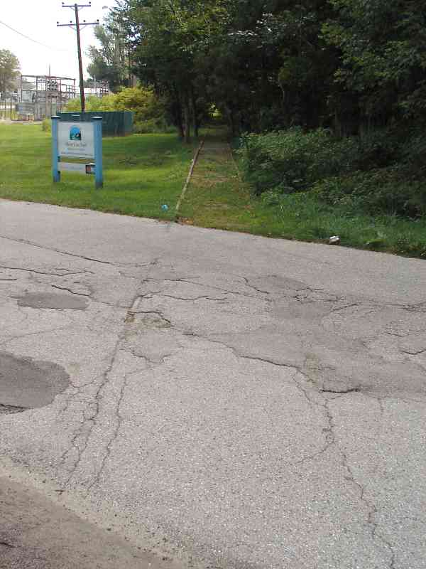
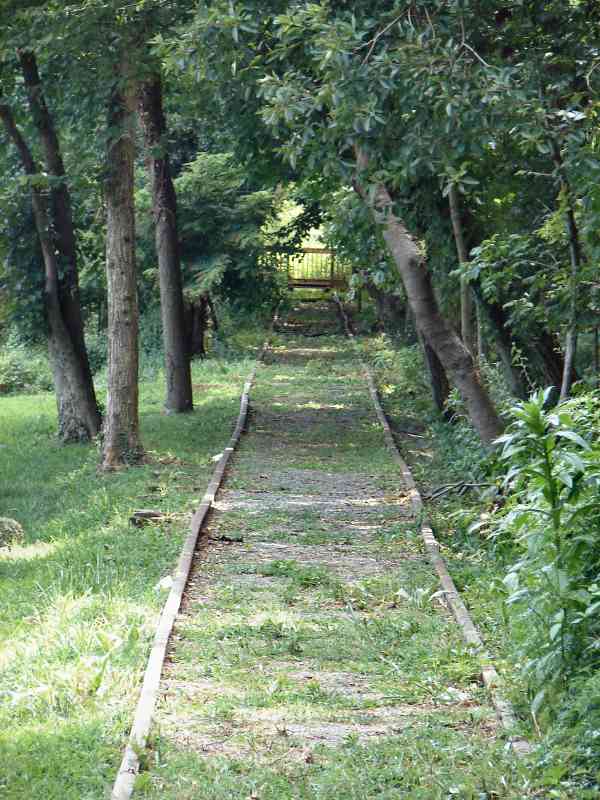
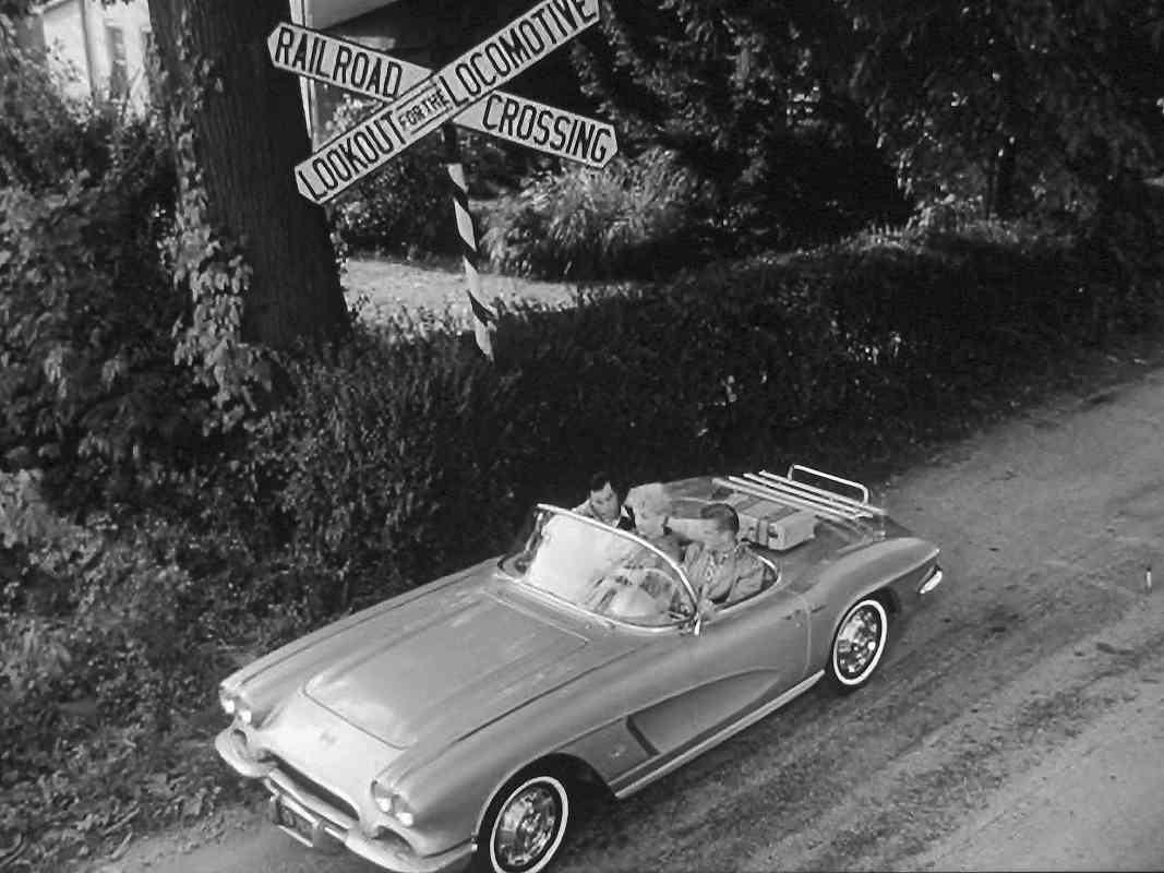
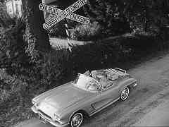
That intersection, with the railroad, appears at the opening of 1961's Route 66 TV Show, Season 2, episode 8, "A Bridge Across Five Days". You may be able to find the opening on youtube. It took Netflix four tries to deliver a working DVD from which I could make screen caps 
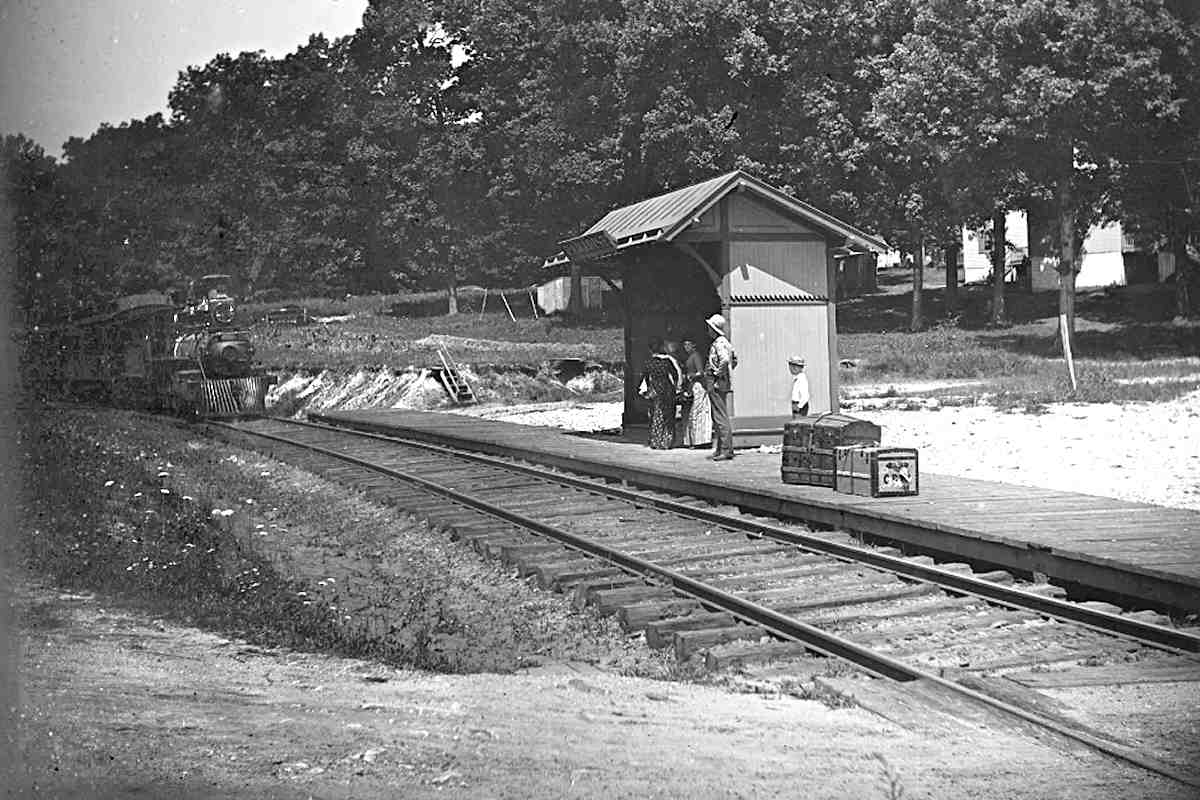
(fair use). From them we learn the CSL used "Railroad Crossing, Lookout for the Locomotive" style signage. CSL tracks

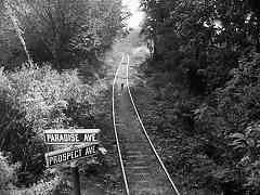
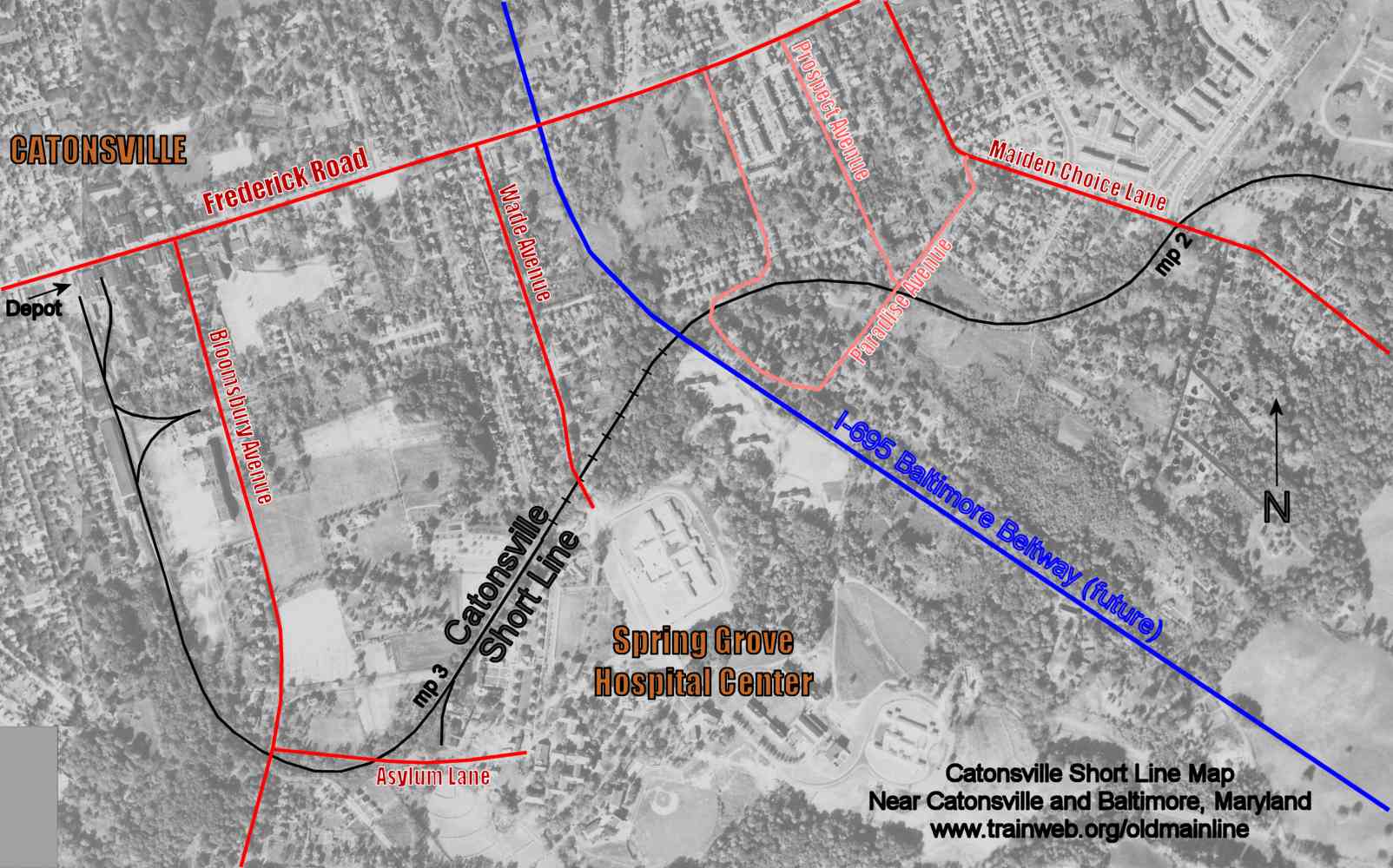
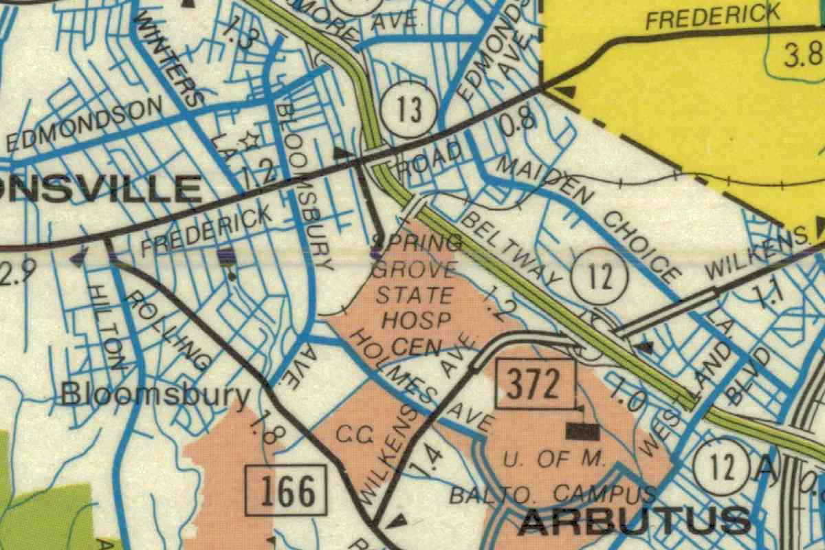
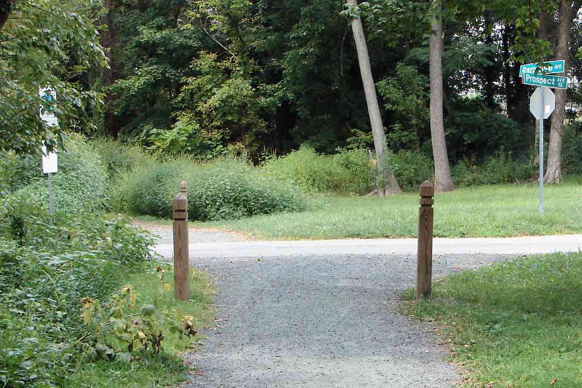
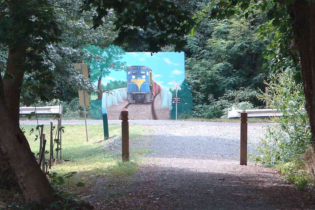
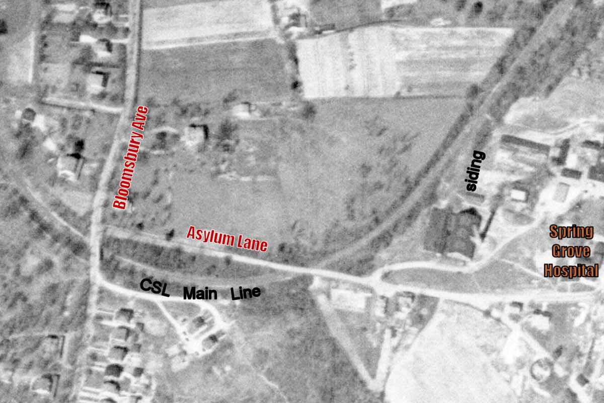
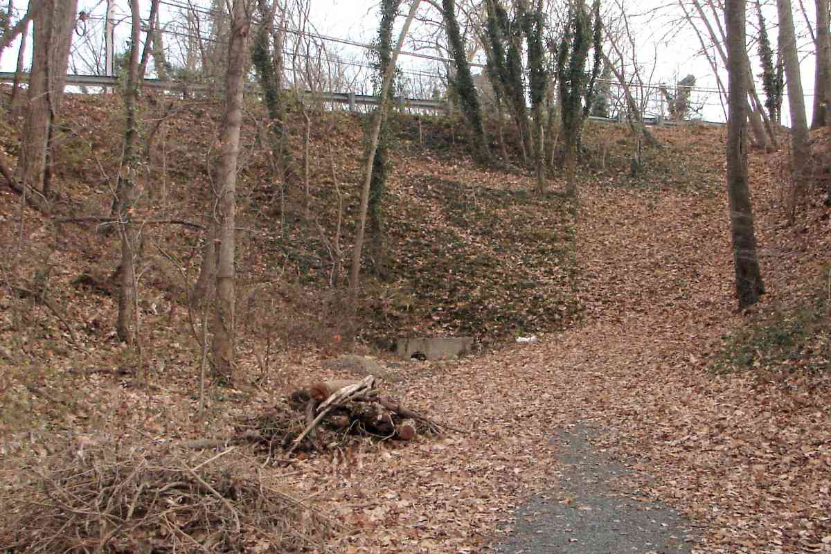
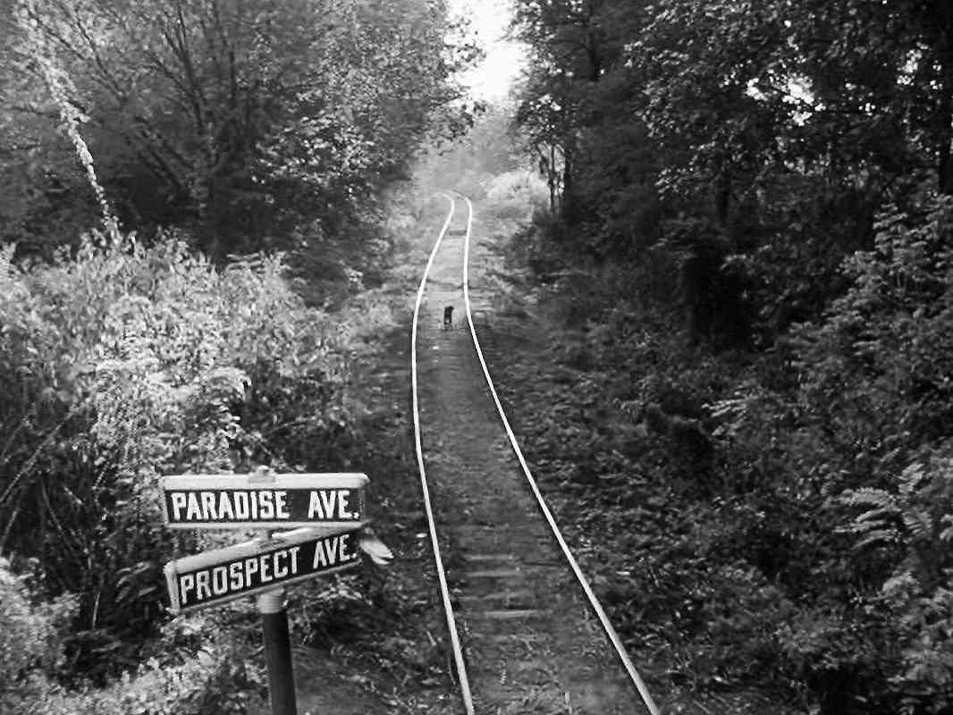
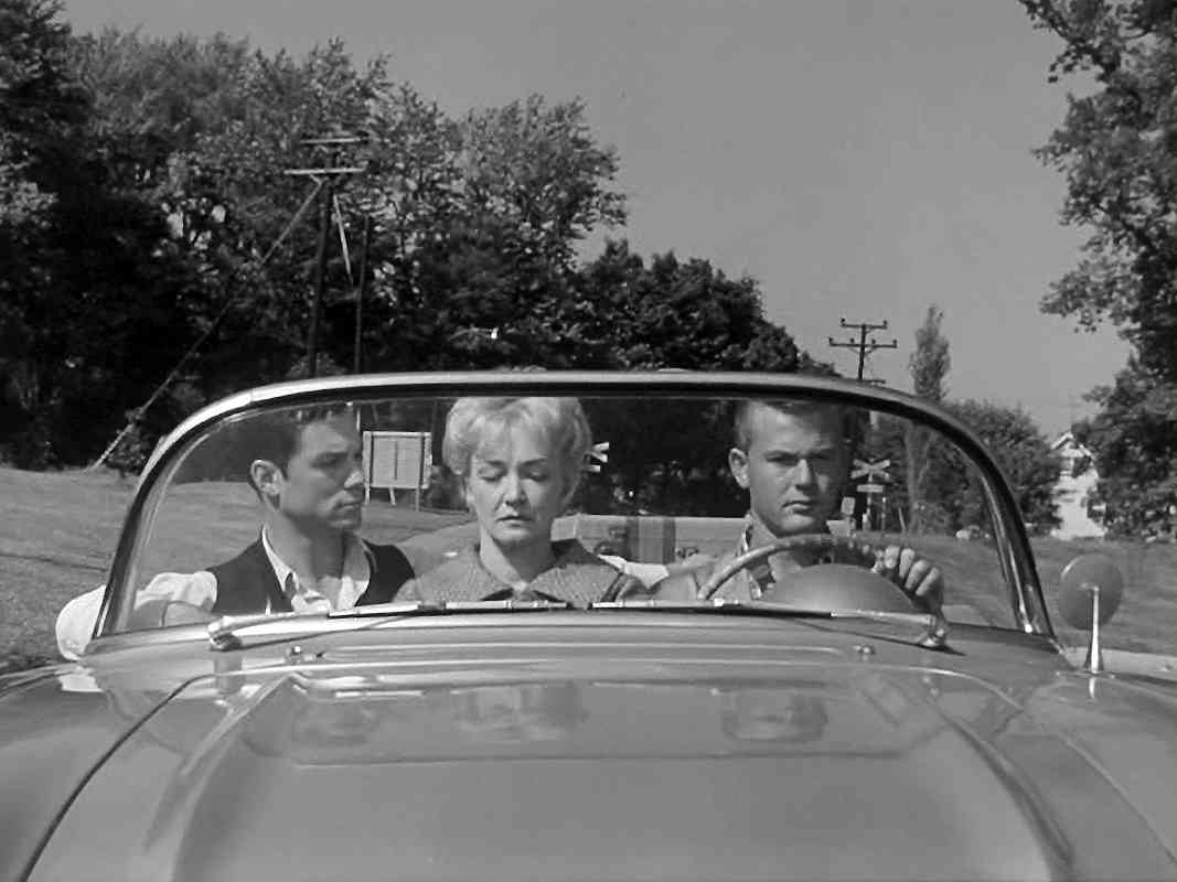
Nitpicky filming notes: in the scene with the railroad crossbuck, Tod and Buz are bringing a woman to Spring Grove State Hospital (indeed the facility's real name) via Paradise Avenue, but 1) their car is facing away from the hospital, and 2) by this time the Baltimore Beltway had severed Paradise Avenue's entrance to the hospital. When the camera pans to the CSL tracks, it is looking east, away from the hospital. A dog on the tracks observes the filming, likely an accidental extra. Those street signs were Baltimore-standard issue from the 1940s into the 1960s, third-generation I believe.


House

House
Mile: 2.4 Date: Aug 2015
Ease: B View: W
Area: A- T6:
Map: Ba 41 G 3 Topographic Maps

Trains had rolled within sight of the residents along this segment,

Link: trail status 2012


Mural

Mural
Mile: 2.5 Date: Aug 2015
Ease: A View: W
Area: A- T6:
Map: Ba 41 G 3 Topographic Maps

mural closeup The eastern portion of the trail ends at Shady Nook Avenue where this mural by Edward Williams recalls the CSL of the 1960s. Enduring rails embedded in the pavement extend up to the painting but no farther because the depicted single-track bridge that had spanned the I-695 Baltimore Beltway was removed during the 1980s due to a Beltway widening project. Lacking that bridge the Short Line Trail must detour north then over the Beltway via Frederick Road. Nitpicky: the rails had curved opposite to those depicted by the mural.


From I-695

From I-695
Mile: 2.6 Date: Dec 2015
Ease: A View: SW
Area: B+ T6:
Map: Ba 41 F 3 Topographic Maps

To my surprise, on the Beltway's other (west) side a segment of CSL track was visible from the Outer Loop roadway. Before sound barrier construction of 2016 removed it, during non-leaf season one could see it just after the on-ramp merging from Frederick Road.


Birch Drive

Birch Drive
Mile: 2.6 Date: Jul 2015
Ease: B+ View: N
Area: B+ T6:
Map: Ba 41 F 3 Topographic Maps

You could obtain a different-angle view of that same rail segment from Birch Drive. Baltimore Beltway traffic zooms past in the bright area on the right. Due to sound barrier construction, this segment is no longer extant, but other rusty CSL track remains in the trees.


Mound East

Mound East
Mile: 2.6 Date: Jul 2015
Ease: B View: NE
Area: B+ T6:
Map: Ba 41 F 4 Topographic Maps

The next 2000 feet or so of CSL traces the northwest boundary of Spring Grove Hospital Center which dates to 1797, the second-oldest continuously-operating psychiatric hospital in the United States. The hospital moved to these grounds in 1852, about 30 years before the railroad arrived.


Mound West

Mound West
Mile: 2.6 Date: Jul 2015
Ease: B View: SW
Area: B+ T6:
Map: Ba 41 F 4 Topographic Maps

The right-of-way was graded into a mound along the south bank of a tiny creek.


Wade Avenue

Wade Avenue
Mile: 2.7 Date: Jul 2015
Ease: A View: SW
Area: B T6:
Map: Ba 41 F 4 Topographic Maps

More rails-stuck-in-asphalt at Wade Avenue, which becomes Maple Avenue within the hospital grounds on the left. Maple Avenue

In this Route 66 screen cap (fair use), the characters are driving south on Maple Avenue, having recently crossed the railroad whose crossbucks are visible in the background. The episode also shows Baltimore streetcars, plus industry along Key Highway with the Domino Sugar sign in the background. To learn more about the city's streecars, I recommend Herb Harwood's book Baltimore Streetcars The Postwar Years.

Link: modern photos of Route 66 episode locations


Cleared

Cleared
Mile: 2.7 Date: Jul 2015
Ease: A View: SW
Area: B T6:
Map: Ba 41 F 4 Topographic Maps

Beyond Wade Avenue, volunteers cleared the tracks of brush to yield the only stretch of CSL that retains much of its original appearance.

If trains had stopped at the hospital, they likely would have done so near the pedestrian bridge in the distance at the old entrance to the facility.

Link: hospital stop


Path

Path
Mile: 2.9 Date: Aug 2015
Ease: B View: SW
Area: B T6:
Map: Ba 41 F 4 Topographic Maps

This path runs parallel to a brushier one with utility poles on the right. Utility poles are usually good indicators of a railroad alignment so the CSL may have run there rather than here. Old aerial photos are not clear enough to resolve that uncertainty. The concrete block on the left does not have the look of a railroad artifact.


Siding

Siding
Mile: 3.0 Date: Dec 2015
Ease: B+ View: S
Area: B T6:
Map: Ba 41 F 5 Topographic Maps

Aerial photos do make clear that the power plant constructed around 1930 had its own siding for coal delivery via train. Hopper cars were pushed onto a trestle so their coal could be unloaded via gravity (see photo linked below). Though often called "power plants" private facilities like this typically generated not electricity but rather steam for heating.

It was common before the 20th century for each building of a group to have its own heat source, perhaps a small coal furnance or even wood fireplaces. During the early 20th century, a centralized power plant like this one with distributed steam was deemed easier to maintain than many smaller, scattered systems. However, what is old is new again: by the 21st century many of these plants have been shuttered as buildings have returned to the individual heat source approach via reliable and efficient heat pumps that, as a bonus, can shift over to cooling during the summer.

Links: very similar view in 1966, info


Power Plant

Power Plant
Mile: 3.1 Date: Aug 2015
Ease: A View: N
Area: B T6:
Map: Ba 41 F 5 Topographic Maps

Before becoming disused, during 1970 the power plant converted from coal to piped or trucked-in oil as a fuel source, costing the CSL an important customer.


1938 Aerial
Photo courtesy Johns Hopkins University

1938 Aerial
Mile: Date: Apr 1938
Ease: View:
Area: T6:
Map: Ba 41 F 5 Topographic Maps

After the power plant, the CSL curves sharply at it heads for downtown Catonsville, which is off the top-left edge of this photo.


Curve

Curve
Mile: 3.1 Date: Aug 2015
Ease: A- View: W
Area: B T6:
Map: Ba 41 E 5 Topographic Maps

One or two pieces of rail can still be spotted elsewhere along this fence that marks where the CSL had run.


Asylum Lane

Asylum Lane
Mile: 3.1 Date: Dec 2015
Ease: A View: W
Area: B T6:
Map: Ba 41 E 5 Topographic Maps

The CSL had crossed Asylum Lane at this high point of the road. There are no embedded rails to be found here.


Bridge Drain

Bridge Drain
Mile: 3.2 Date: Dec 2015
Ease: B View: W
Area: B T6:
Map: Ba 41 E 5 Topographic Maps

If Bloomsbury Avenue had not been grade separated originally, it was by 1938 as evidenced by the shadow in the aerial photo above. Beware of plenty of poison ivy in this area.


Trail Resumes

Trail Resumes
Mile: 3.3 Date: Dec 2015
Ease: B View: SE
Area: B T6:
Map: Ba 41 E 5 Topographic Maps

Now we're looking back to Bloomsbury Avenue from the west. The Catonsville Rails to Trails group indicates the bridge still exists, its "tunnel" below merely covered over with drains installed below at each end. They plan to reopen it for pedestrians. A different source says the Bloomsbury bridge collapsed around 1980.


Culvert

Culvert
Mile: 3.4 Date: Dec 2015
Ease: B View: SW
Area: B T6:
Map: Ba 41 E 4 Topographic Maps

This is not a tunnel, but rather the only (?) remaining CSL stone culvert. It has been modified to tie into the storm sewer system. (This photo was edited to remove graffiti.)


Hercules

Hercules
Mile: 3.4 Date: Dec 2015
Ease: B View: N
Area: B T6:
Map: Ba 41 E 4 Topographic Maps

Either the CSL curved very suddenly or someone very strong was here.


Loading Docks

Loading Docks
Mile: 3.5 Date: Dec 2015
Ease: A View: N
Area: B T6:
Map: Ba 41 E 4 Topographic Maps

The trail ends where downtown Catonsville's businesses begin. During CSL days the doors here facilitated Johnson Chemicals loading/unloading freight cars. These are the same doors seen from a different angle in the 1966 photo linked below. Certain of the darkened cracks in the pavement may reflect CSL rails buried beneath.

Link: 1966


wye
Photo courtesy Johns Hopkins University

Wye
Mile: Date: Apr 1938
Ease: View:
Area: T6:
Map: Ba 41 E 4 Topographic Maps

A short distance south of the CSL's Catonsville terminus a wye was available for turning engines around.

Evan Yakas, who called my attention to the wye, wrote:

    "...the 1943 (aerial photo) set goes into Catonsville just enough to see where the wye was. However, in the picture it is removed and the current road is there... it's actually Bloomingdale Ave. I assume then that sometime between 1937/8 and 1943, this wye was removed and the road was made. Even on the old aerial photos, it is hard to see. I'm wondering when it actually stopped being used, and if it was abandoned years before.

    "Now, if you go to historicaerials.com and look at some of the topo maps, the 1934 map shows the wye there. The 1944 map looks like it only shows the northern section of the wye (but according to the picture I mentioned above, it was gone by this time). The 1953 map shows the wye gone and the road there. Maybe only the northern part of the wye was used toward the end of its service?"


Bloomingdale Avenue

Bloomingdale Avenue
Mile: 3.6 Date: Dec 2015
Ease: A View: W
Area: B T6:
Map: Ba 41 E 4 Topographic Maps

Now Bloomingdale Avenue sits atop the bottom and northeast leg of the Y.

The building in the distance is the same one seen on the left in the 1966 photo linked below.

Link: 1966


Split

Split
Mile: 3.6 Date: Dec 2015
Ease: A View: N
Area: B T6:
Map: Ba 41 E 4 Topographic Maps

The CSL's Catonsville passenger depot had been located in the distance near the red car. Initially the CSL had ran directly from here to the station. The railroad later added track that split off to the right from near the green dumpsters to serve Wilson's Lumber. Those tracks are seen in the photo linked below.

Link: 1966


Catonsville Depot
Photo via Baltimore County Public Library

Catonsville Depot
Mile: 3.8 Date: ~1887
Ease: A View: SW
Area: B+ T6:
Map: Ba 41 E 3 Topographic Maps

At left is the building that would house Wilson's Lumber, at center is Library Hall, and on the right is the CSL's Catonsville Depot built about 1884.

Link: more about this photo


Depot Site

Depot Site
Mile: 3.8 Date: Aug 2015
Ease: A View: S
Area: B+ T6:
Map: Ba 41 E 3 Topographic Maps

A decaying Catonsville Depot survived longer that the other buildings, nestled on the west side of what is now Bill's Music. In this photo that spot is on the right, roughly where the red minivan is parked. For orientation, in the distance beyond the minivan is the building with tbe loading dock doors illustrated earlier.

For reference, note the utility poles, and the two wires connecting them.


Final Days
Photo credit John McGrain via Baltimore County Public Library

Final Days
Mile: 3.8 Date: Nov 1974
Ease: A View: N
Area: B T6: 341
Map: Ba 41 E 3 Topographic Maps

The depot was a very weary 90 years old by 1974. I believe the large utility pole and two wires looping from it are the same seen in the prior photo which looks almost the opposite direction.


Site 2015

Site 2015
Mile: 3.8 Date: Dec 2015
Ease: A View: N
Area: B T6:
Map: Ba 41 E 3 Topographic Maps

This more recent view roughly duplicates that of the 1974 photo above. At the center of the gravelled area beyond the red car lies a circle of stones inside of which I expected to find a plaque in memory of the depot, but at photo time only rocks occupied it.


The Catonsville Short Line tour ends here. Thanks for following along!

Related info you may enjoy: Catonsville Rails to Trails, area resident comments,
list of active Short Lines, a few more photos, or this site's Penn Line tour.

<< Previous (east) | THIS PAGE: Charlestown to Catonsville | End of tour || main index

For more tours here now, select from the map: clickable map

Or, return to main page for other tours

Copyright Notice