TrainWeb.org Facebook Page
B&O Metropolitan Branch Photo Tour


B&O Metropolitan Branch
Modern day photo tour

Accompanying each photo below are:

Click a photo to see a larger view. Please send your comments and corrections to Steve.


<< Previous (east) | THIS PAGE: Germantown to Bucklodge | Next (west) >>

Sign
Photo courtesy Dave Hiteshew

Sign
Mile: 26.0 Date: Nov 2007
Ease: A View: E
Area: A IC2:
Map: Mo 18 E 4 Topographic Maps

Great Seneca Highway says, "CSX who?"


Germantown Station 1969
Photo courtesy HH Harwood

Germantown Station 1969
Mile: 26.4 Date: Jul 1969
Ease: B+ View: W
Area: A IC2: 211
Map: Mo 18 E 3 Topographic Maps

Silos of Liberty Mill tower over Germantown Station which would be destroyed before the revitalization MARC would bring during the next decade.

Link: 1985


Germantown Station 2008
Photo courtesy Dave Hiteshew

Germantown Station 2008
Mile: 26.4 Date: Jul 2008
Ease: A View: S
Area: A IC2:
Map: Mo 18 E 3 Topographic Maps

In this more recent view, the reconstructed station looks more model than real. MARC passenger waiting shacks have been nicely designed to match the station's 1891 architecture.


Flashers
Photo courtesy Dave Hiteshew
NEW! late-Apr 2022

Flashers
Mile: 26.4 Date: Jun 2008
Ease: A- View: N
Area: A IC2:
Map: Mo 18 E 3 Topographic Maps

Warning flashers like those found at grade crossings were installed to alert platform dwellers about approaching trains. For reasons unknown to me, the flashers were later removed.


CSX 3134

CSX 3134
Mile: 26.4 Date: Oct 2014
Ease: A- View: E
Area: A IC2:
Map: Mo 18 E 3 Topographic Maps

Sadly, the freights don't stop to pick up passengers.

Link: 1910


Weigh Station
Photo courtesy Dave Hiteshew

Weigh Station
Mile: 26.4 Date: Nov 2007
Ease: B+ View: NE
Area: A IC2:
Map: Mo 18 E 3 Topographic Maps

Before Liberty Mill could ship out flour via B&O, it had to grind it, and before that the incoming grain had to be weighed. About 40 years have elapsed since last use, but this weigh station remnant survives.


CSX 5494
Photo courtesy Dave Hiteshew

CSX 5494
Mile: 26.7 Date: Jul 2008
Ease: B View: W
Area: A IC2:
Map: Mo 18 D 3 Topographic Maps

Ever wondered how track ties that mark culvert locations get their pearly whites? Well, here's the paint crew at work (note the white pail) as an eastbound mixed freight rolls by.

Initially I was puzzled: why is there a culvert under what appears to be a high spot? The answer is the high spot represents fill added by B&O when in 1927 it straightened the Met, here moving it slightly north of the original.


Culvert
Photo courtesy Dave Hiteshew

Culvert
Mile: 26.8 Date: Jul 2008
Ease: B View: SE
Area: A IC2:
Map: Mo 18 D 3 Topographic Maps

This is the culvert with the freshly painted tie. The unique tilework is erosion control.


Elevation

Elevation
Mile: 27.5 Date: Oct 2014
Ease: B+ View: E
Area: A IC2:
Map: Mo 18 B 2 Topographic Maps

This reverse zoom view shows the increasing elevation of the current tracks since Liberty Mill Road (most distant, about a mile back at Germantown Station) to Germantown Road, then Father Hurley Boulevard (closest).


CPLs
Photo courtesy Dave Hiteshew

CPLs
Mile: 27.5 Date: Jul 2008
Ease: B+ View: W
Area: A IC2:
Map: Mo 18 B 2 Topographic Maps

These dark CPLs were merely resting. The G sign indicates "Grade" and modifies the meaning of the signal lights such that, for example, a train can proceed slowly through a red signal so as to avoid stopping on a hill which might be steep enough to prevent a stopped train from moving again without assistance.


AMTK 75
NEW! late-Apr 2022

AMTK 75
Mile: 27.5 Date: Feb 2022
Ease: B+ View: W
Area: A IC2:
Map: Mo 18 B 2 Topographic Maps

About 2010 CSX swapped out the CPLs for these signals, which are "approach activated" within the block occupied by the train. Since there is no train in the block on the camera's side of the signals, the facing signals are unlit. IMO, they should be lit as a way to warn anyone near the tracks that a train is approaching. The signals in question illuminated only after this locomotive passed them.


Milepost 28
Photo courtesy Dave Hiteshew

Milepost 28
Mile: 28.0 Date: Jul 2008
Ease: B View: W
Area: A IC2:
Map: Mo 18 A 1 Topographic Maps

yet another improvised Met milepost


Little Seneca Creek
Photo courtesy Dave Hiteshew

Little Seneca Creek
Mile: 28.0 Date: Jul 2008
Ease: B- View: N
Area: A IC2: 171
Map: Mo 18 A 1 Topographic Maps

The bridge at Little Seneca, one of B&O's earlier such applications of steel, proved a maintenance headache, so in 1927 the railroad realigned a short distance downstream onto this substantial concrete bridge, number 29A, that continues in use now. Claims that during non-leaf season remnants of the steel bridge's stone abutments can be glimpsed through this arch are not true. The stones visible are instead part of flood control.


GCFX 3059

GCFX 3059
Mile: 28.2 Date: Oct 2014
Ease: B View: W
Area: A IC2:
Map: Mo 17 K 1 Topographic Maps

CSX 47 follows the lead engine. Stock tip: when you see your local railroad renting engines like this, it means demand is high, and therefore it's time to buy the stock. Had you bought CSX shares during October 2014 you would have almost doubled your money in about 2 years.

Link: more GCFX 3059


Seneca Viaduct
Photo courtesy HH Harwood collection

Seneca Viaduct
Mile: 28.3 Date: ~1920
Ease: B View: E
Area: A IC2:
Map: Mo 17 K 1 Topographic Maps

The realignment mentioned above was B&O's choice to replace this bridge across Little Seneca Creek. The single-track original was a 600-foot look timber monster that survived only about 25 years before this steel structure replaced it in 1896. It would endure only slightly longer.


CSX 623
Photo courtesy Dave Hiteshew

CSX 623
Mile: 28.9 Date: Nov 2007
Ease: B+ View: E
Area: A IC2:
Map: Mo 17 H 1 Topographic Maps

Old paint CSX 623 along with CSX 8368 and LMS 7925 are about to cruise across the Clarksburg Road bridge at Boyds, Maryland.

Link: more CSX 7925


Clarksburg Road
Photo courtesy Dave Hiteshew

Clarksburg Road
Mile: 28.9 Date: Nov 2007
Ease: B+ View: W
Area: A IC2:
Map: Mo 17 H 1 Topographic Maps

The guardrail of the Clarksburg Road bridge appears to be the 1928 vintage original. Also of note is the stairway, an accoutrement unlikely found on a more recent structure. At the top of the stairway had been B&O's second Boyd Station, a frame structure.


Boyd Station
Photo credit Al Holtz
B&O History Collection
NEW! late-Apr 2022

Boyd Station
Mile: 28.9 Date: Mar 1962
Ease: A- View: NW
Area: A IC2:
Map: Mo 17 H 1 Topographic Maps

Per the station's sign, B&O used the name Boyd rather than Boyds. In 1928 this took the place of the original masonry station that had been sited across the tracks from this one, where the MARC parking lot now is. That masonry station appears within the tour of the original alignment.

Change for: original alignment tour at this site


Foundation
Photo courtesy Dave Hiteshew

Foundation
Mile: 28.9 Date: Nov 2007
Ease: A- View: NW
Area: A IC2:
Map: Mo 17 H 1 Topographic Maps

This concrete foundation's shape, size, and tracks proximity, plus brick platform join together to say they had been part of Boyd Station. The frame station survived into the 1990s. Unseen on the left, a small waiting shack now serves passengers of MARC trains.


Boyds MARC Station
Photo courtesy Dave Hiteshew

Boyds MARC Station
Mile: 28.9 Date: Aug 2008
Ease: A View: NW
Area: A IC2:
Map: Mo 17 H 1 Topographic Maps

Passenger service that began with B&O is now provided by MARC. Train stations were some of the last places to host pay telephones. Subsequent to the main photo, train-themed bicycle posts were added. bike post

B&O's original brick Boyds station had been where the commuter parking lot now is (behind the photographer).

One of the signs in this photo points to a pedestrian underpass.

Link: Boyds Historical Society


Underpass
Photo courtesy Dave Hiteshew

Underpass
Mile: 28.9 Date: Nov 2007
Ease: A- View: N
Area: A- IC2:
Map: Mo 17 H 1 Topographic Maps

If the sign is correct about the 1931 construction date that means this underpass was added after the new Met alignment above had been open a few years.

On the right are two doorways blocked off by railroad ties. Perhaps they once led to stairways up to platforms between the tracks.


Split
Photo courtesy Dave Hiteshew

Split
Mile: 28.9 Date: Nov 2007
Ease: A- View: NW
Area: A- IC2:
Map: Mo 17 H 1 Topographic Maps

The last bits of autumn color were on display during this Thanksgiving weekend afternoon. My research indicates the original and newer Met alignments ran side by side into the shadows ahead before going their separate ways (old to the left, new to the right).


DS Tower Remains
Photo courtesy Dave Hiteshew

DS Tower Remains
Mile: 29.5 Date: Aug 2008
Ease: B View: SE
Area: A IC2:
Map: Mo 8 G 13 Topographic Maps

DS Tower ~1950 
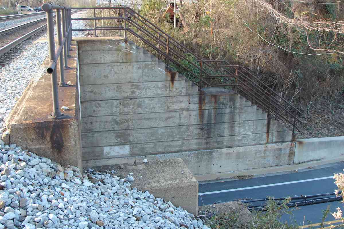
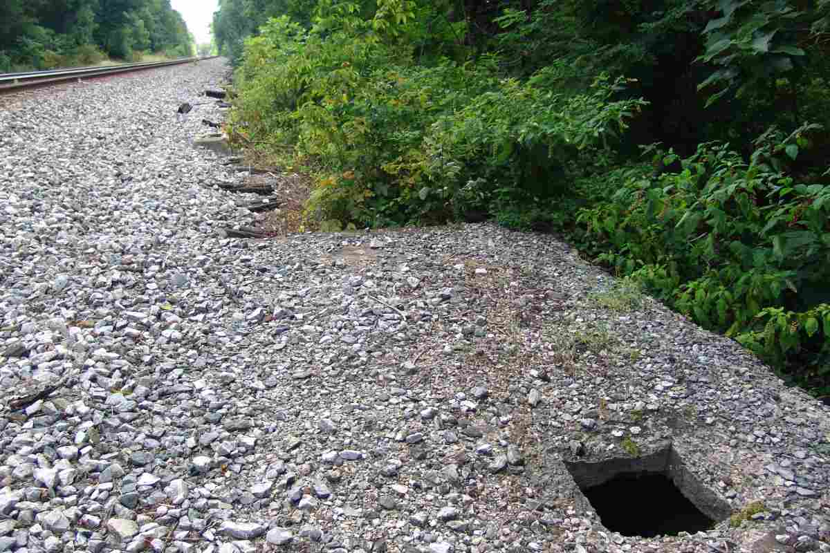
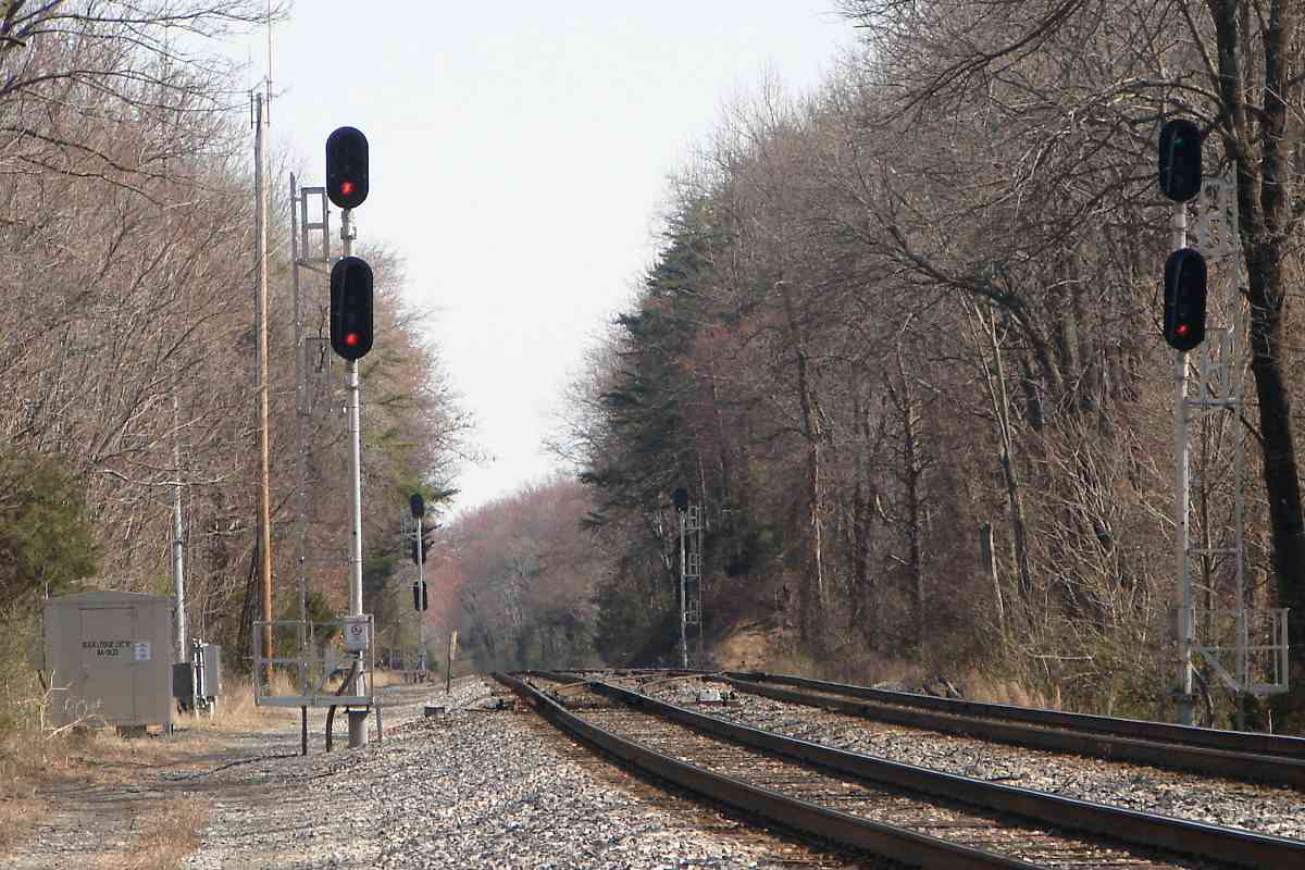
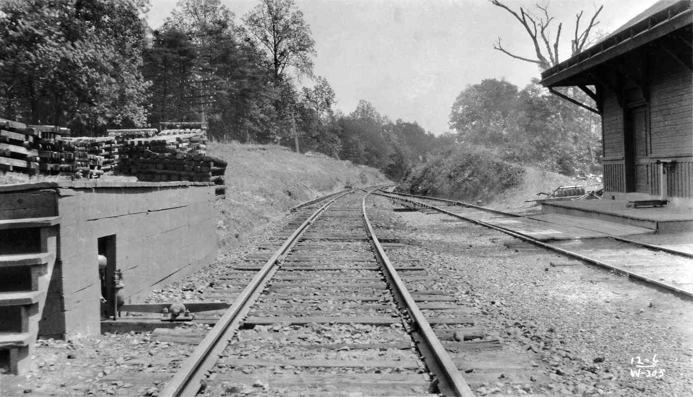
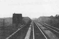
When you see evenly spaced remants perpendicular to the rails like those at upper left, you know they once had supported an interlocking (switch mechanism) operated from a nearby tower. The square hole marks where DS Tower once stood.

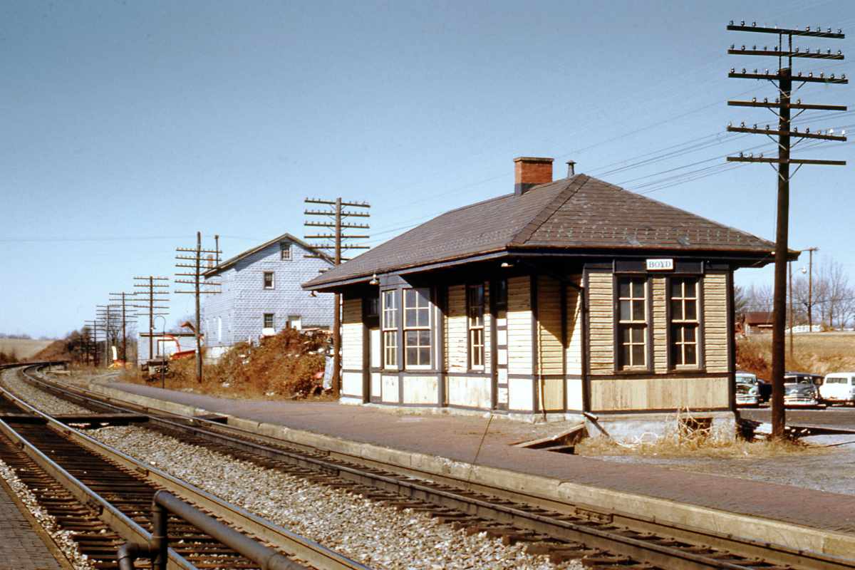
The photo of DS Tower at right (credit pending) looks northwest around 1950.

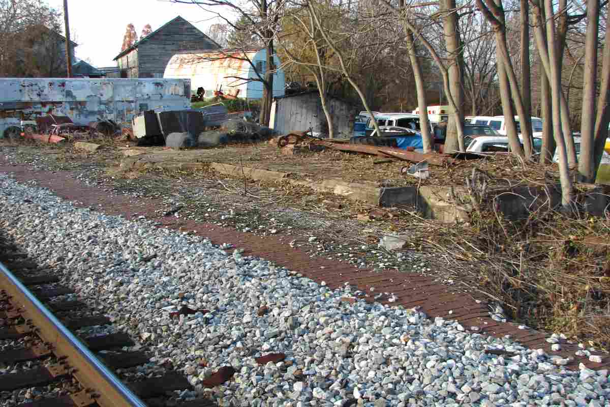
When the railroad no longer needed DS Tower, explosives were used to tip it back into the woods, where various remains can still be found. 
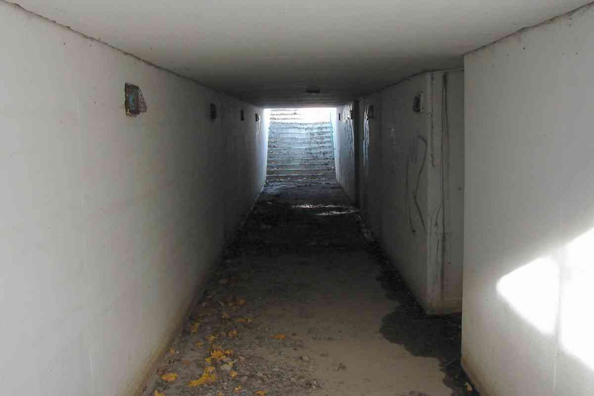
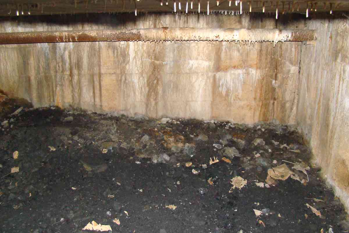
The concrete foundation survived the demolition. What's in the hole?


Basement
Photo courtesy Dave Hiteshew

Basement
Mile: 29.5 Date: Oct 2008
Ease: B- View: ?
Area: A IC2:
Map: Mo 8 G 13 Topographic Maps

Why, the basement of course!


CPLs
Photo courtesy Dave Hiteshew

CPLs
Mile: 29.9 Date: Aug 2008
Ease: B View: W
Area: A IC2:
Map: Mo 8 F 13 Topographic Maps

Four soon-to-be-retired CPLs tower over crossovers.


Bridge 31A
Photo courtesy Dave Hiteshew

Bridge 31A
Mile: 30.1 Date: Aug 2008
Ease: B View: SW
Area: A IC2:
Map: Mo 8 E 13 Topographic Maps

For a few miles west of Boyds, the original and current alignments run in close proximity as evidenced by several bridges and culverts. Here the original stone portion has been repurposed into a road while the rails got a new bridge contiguous. It is not clear to me what year the old right-of-way was disused here, but 1906 (the date stone on Waring Viaduct back at mp 24.7) is a candidate.


Newer

Newer
Mile: 30.1 Date: Apr 2017
Ease: B- View: S
Area: A IC2:
Map: Mo 8 E 13 Topographic Maps

This is the all-concrete, newer, inlet side. The bridge is numbered 31A.


New Signals

New Signals
Mile: 30.2 Date: Mar 2017
Ease: B View: E
Area: A IC2:
Map: Mo 8 E 13 Topographic Maps

New signals guard the crossovers. That's milepost 30 between the signals, while the new equipment box is stenciled mile 30.23. There's some measuring funkiness in this vicinity because the current alignment is about 0.2 miles shorter than the original, but the original milepost locations have been preserved.


CSX 5005

CSX 5005
Mile: 30.3 Date: Mar 2017
Ease: A View: N
Area: A IC2:
Map: Mo 8 E 13 Topographic Maps

You don't see this livery often any longer.

Link: more CSX 5005


Single Track
Photo courtesy B&O Museum

Single Track
Mile: 30.5 Date: Jun 1912?
Ease: ? View: W
Area: A IC2:
Map: Mo 8 E 12 Topographic Maps

Since double tracking of the Met was not completed until 1928, the single track passing through a rock cut ahead dates this Buck Lodge photo earlier, but later than the original alignment that is off photo left. This means here B&O abandonded the original alignment for a new single-track alignment, possibly in 1906 when other work was being done. Double track along the second alignment here would not come until later.

The 30.5 at photo botton right matches the milepost, W might indicate the direction of view (West), and 12-6 might represent June 1912.


Double Track
Photos courtesy Dave Hiteshew

Double Track
Mile: 30.5 Date: Aug 2008
Ease: B View: W
Area: A IC2:
Map: Mo 8 E 12 Topographic Maps

Chessie 1981 Adjacent double track, rusty siding rails here display a forging date of May 1927, and connecting segments from 1981 are labelled with the less commonly seen "Chessie System" attribution.

B&O's Bucklodge Station stood on the left until about 1960.

Link: more Bucklodge


Engineer Exam

Engineer Exam
Mile: 30.9 Date: Mar 2017
Ease: B View: N
Area: A IC2:
Map: Mo 8 C 12 Topographic Maps

Take a look at the full size image above and tell me which track is getting the green signal, Track 1 (left) or Track 2 (right)? CSX 72

You knew it: of course it's a trick question, or rather poor positioning of signals. From a distance only one of a pair of signals is visible, and due to the curvature of the rails that signal appears to be controlling Track 2 (right). However as you see at right the real Track 2 signal is instead full red. CSX 72 and CSX 5391 get a breather while an Amtrak passenger train, which will arrive directly, gets the green to go around the freight via Track 1 on the left.


Non-Iron Horse
Photo courtesy Dave Hiteshew

Non-Iron Horse
Mile: 31.1 Date: Sep 2008
Ease: C+ View: S
Area: A IC2:
Map: Mo 8 C 12 Topographic Maps

This locomotive unit generates one horsepower, sufficient to carry a rider under the brick and stone dual-arch Bucklodge Branch bridge.


Concrete Extension
Photo courtesy Dave Hiteshew

Concrete Extension
Mile: 31.1 Date: Aug 2008
Ease: C+ View: N
Area: A IC2:
Map: Mo 8 C 12 Topographic Maps

When B&O finished double tracking the Met during the 1920s, many of the old structures needed widening. Here concrete was shaped to mimic the original arch's style.


Interior
Photo courtesy Dave Hiteshew

Interior
Mile: 31.1 Date: Aug 2008
Ease: C View: N
Area: A IC2:
Map: Mo 8 C 12 Topographic Maps

The extension was added to the south side, the outlet end, of the bridge.


<< Previous (east) | THIS PAGE: Germantown to Bucklodge | Next (west) >>

Or, return to main page for other tours.

Copyright Notice