TrainWeb.org Facebook Page
B&O Metropolitan Branch Photo Tour


B&O Metropolitan Branch
Modern day photo tour

Accompanying each photo below are:

Click a photo to see a larger view. Please send your comments and corrections to Steve.


<< Previous (east) | THIS PAGE: Boyds to Bucklodge | Next (west) >>

Map East Boyds
Photo courtesy Google

Map East Boyds
Mile: 28 to 29 Date: 2016
Ease: View: N (up)
Area: A IC2:
Map: Mo 17 J 1 Topographic Maps

West of Seneca, B&O's original, single-tracked route here ran between the current alignment and Clopper Road. The magenta line marks that speculative path. We'll be following it generally westward, from right to left on this map.

The magenta "1st" and arrow points to my guess of the location of B&O's original brick Boyds station that opened in 1886. The black "2nd" shows where a new wood-frame station was added in 1927 after the route was realigned. That station was torn down during the 1990s.


Cross

Cross
Mile: 28.5 Date: Oct 2014
Ease: B View: NW
Area: A IC2:
Map: Mo 17 K 1 Topographic Maps

The original alignment emerges from the trees on the right. When the new alignment arrived on the scene, it crossed the old one by bending from left to right here. That would help explain the degree of track curvature, more than most places on the Met.


Reverse

Reverse
Mile: 28.7 Date: Jun 2017
Ease: A- View: E
Area: A- IC2:
Map: Mo 17 J 1 Topographic Maps

Now we're looking back, standing on top of what had been the original alignment, and what track maps say survived as a spur into the Grove Cement company. At the site I found no evidence of rails having been here previously but, of course, they may have been cleared out some years ago.


Clopper Road

Clopper Road
Mile: 28.8 Date: Jun 2017
Ease: A View: W
Area: A IC2:
Map: Mo 17 J 1 Topographic Maps

Along the edge of what had been Grove Cement, Clopper Road is too hilly to have been railroad grading. Beyond, however, the original alignment curved in from the treed area on the right parallel to Clopper Road near the road signs.


Clarksburg Road

Clarksburg Road
Mile: 28.8 Date: Apr 2017
Ease: A View: S
Area: A IC2:
Map: Mo 17 H 1 Topographic Maps

There was no need for grade separation in 1870 when rails first crossed Montgomery County farmland. Bridge 30A (ahead) dates to 1928. Just beyond is Clopper Road. The first station at Boyds was a brick structure located off-photo right.


Boyds Station
Photo courtesy B&O Museum

Boyds Station
Mile: 28.9 Date: 1892
Ease: A View: W
Area: A IC2: 172
Map: Mo 17 H 1? Topographic Maps

Here is that station, equipped with the typical signal tower of the era. Boyds is named for a B&O contractor who began to farm here after helping to build the Met. The brick station was demolished during 1928.

This old photo shows what appears to be a grade crossing behind the station, likely that of White Grounds Road. An 1878 Hopkins map suggests the station was on the south side of the tracks.


Best Guess

Best Guess
Mile: 28.9 Date: Jun 2017
Ease: A View: W
Area: A IC2:
Map: Mo 17 H 1 Topographic Maps

former grade crossing This MARC parking lot now occupies the site of the original Boyds Station. This view roughly duplicates the 1892 one above. What had been the grade crossing is now a pedestrian underpass (stairs at left side of photo at right). Note the utility wires overhead: they are often found at grade crossings and, once installed, subsequent wires follow the same route for decades.

Note the 20th century wood frame station is not the subject here. Its brick platform can still be found off photo right.


Boyd Stations
Photo credit pending
NEW! early-Aug 2023

Boyd Stations
Mile: 28.9 Date: 1928
Ease: A View: NW
Area: A IC2:
Map: Mo 17 H 1 Topographic Maps

This photo shows the guess was correct: the original brick Boyds Station was on the south side of the tracks (left), and its wood frame replacement was nearer the camera on the north (right).


1908 USGS

1908 USGS
Mile: 28.5 to 31 Date: 1908
Ease: View: N (up)
Area: IC2:
Map: Topographic Maps

This USGS topographic map predates the new alignment. The black squares represent buildings. Unfortunately, it does not show a black square at either of the two locations I've posited for the station (MARC Stop and south of DS Tower).


Zoom Back

Zoom Back
Mile: 29.2 Date: Mar 2017
Ease: B+ View: SE
Area: A IC2:
Map: Mo 17 G 1 Topographic Maps

Deep zoom looks back to the current MARC rail stop at Boyds. The brick station had been just beyond the waiting shack. The original alignment would have approached the camera, likely reaching near the small evergreen bush at right.


Diverge

Diverge
Mile: 29.2 Date: Mar 2017
Ease: B+ View: NW
Area: A IC2:
Map: Mo 17 G 1 Topographic Maps

After briefly touching alignments, the original veered left and for about two miles stayed on the southwest side of what would become the current alignment. This location is marked by the rightmost magenta arrow on the map below.


Map West Boyds
Photo courtesy Google

Map West Boyds
Mile: 29 to 31 Date: 2008
Ease: View: N (up)
Area: A IC2:
Map: Mo 8 F 13 Topographic Maps

Boyds is at bottom right. The rightmost arrow points to where the original and current alignments diverge. We will follow the original alignment as it snakes through the trees on the southwest side of the active railroad. It is about 0.2 miles longer than the current alignment.

Though not part of this tour page, DS on the map marks where B&O's DS Tower had stood. The question mark below it illustrates where one B&O train schedule places the first Boyds Station. Expecting to find nothing of note there, with permission of the current landowner I explored...


Rubble

Rubble
Mile: 29.5 Date: Jun 2017
Ease: B- View: W
Area: A IC2:
Map: Mo 8 G 13 Topographic Maps

Lo and behold, at that spot there are now these piles of old concrete and brick, likely disturbed as part of recent nearby construction. Porcelain Insulator The worn path is the circa 1870 alignment. This rubble may represent cleanup of trackside remnants of DS Tower that had stood about 500 feet off photo right.

I also spotted a broken porcelain insulator, my first such find. While it does not reveal anything about the station, it does suggest a railroad's telegraph wires had been nearby. Porcelain was a popular type during the mid/late 1800s when the line was built but soon gave way to the prosaic glass insulator.


Drilled

Drilled
Mile: 29.8 Date: Jun 2017
Ease: B View: SW
Area: A IC2:
Map: Mo 8 F 13 Topographic Maps

Cuts and fills were needed along the way. Boulders like this reveal the 1870-technique of drilling into stone then using explosives to break it apart.


Elevations

Elevations
Mile: 30.1 Date: Apr 2017
Ease: B View: E
Area: A IC2:
Map: Mo 8 E 13 Topographic Maps

This photo compares the elevations of the two alignments. The original, which has been repurposed into a partially paved road, can be glimpsed at bottom right. As will be seen at Bucklodge Road, the newer alignment was raised to facilitate elimination of grade crossings.


Double Stack

Double Stack
Mile: 30.1 Date: Apr 2017
Ease: B View: E
Area: A IC2:
Map: Mo 8 E 13 Topographic Maps

A train of double stack containers makes it easy to see the newer aligment is about 20 feet higher than the original. The two run side by side here, with the lower alignment also narrower due to single tracking.

By photo time, the Met's height-limiting tunnels were notched to permit passage of double stack trains. Notching has not (yet) been done the Old Main Line's tunnels.


Creek

Creek
Mile: 30.1 Date: Apr 2017
Ease: B View: NE
Area: A IC2:
Map: Mo 8 E 13 Topographic Maps

It is unclear if this Seneca Creek tributary had received a stone arch bridge. If so, obviously the arch is no longer, replaced by a flat slab perhaps when B&O repurposed the old alignment into an access road to DS Tower; portions of the alignment-turned-road are of an aged asphalt surface. Beyond, the masonry bridge of the adjacent current alignment takes the shape of an arch.


Ex-Crossing

Ex-Crossing
Mile: 30.2 Date: Mar 2017
Ease: A- View: NW
Area: A IC2:
Map: Mo 8 E 13 Topographic Maps

At first glance I thought the original alignment climbed the hill at the white truck, but quickly realized it is too steep. Instead the route had proceeded west past the gate on the left beyond the orange traffic cone.


Bucklodge Road

Bucklodge Road
Mile: 30.3 Date: Mar 2017
Ease: A View: NE
Area: A IC2:
Map: Mo 8 E 13 Topographic Maps

Had motorcycles been around in 1870, the nearer one would have been bumping over rails at the long-gone Bucklodge Road grade crossing. Above, CSX 5391 is helping return trash empties from Dickerson.


Fill

Fill
Mile: 30.5 Date: Mar 2017
Ease: B View: W
Area: A IC2:
Map: Mo 8 D 13 Topographic Maps

Farm roads are never so smooth, straight, and filled so as to level dips. Railroad alignments, however, are.


Disused Culvert

Disused Culvert
Mile: 30.5 Date: Mar 2017
Ease: B- View: S
Area: A IC2:
Map: Mo 8 D 12 Topographic Maps

A box culvert still does its thing beneath all that fill. The current alignment is behind the photographer where this creek instead gets a large concrete pipe.


1948 Ford

1948 Ford
Mile: 30.8 Date: Mar 2017
Ease: B- View: W
Area: A IC2:
Map: Mo 8 D 12 Topographic Maps

Ford F Series trucks were popular with farmers. This example has likely been oxidizing here for about 50 years. I am told that originally it was green in color and had lettering of an area appliance business.

If this cut looks narrow, it's because it was never more than single-tracked.


Culvert
Photo courtesy Dave Hiteshew

Culvert
Mile: 31.0 Date: Aug 2008
Ease: C View: N?
Area: A IC2:
Map: Mo 8 C 12 Topographic Maps

A significant fill was needed past the cut. This original box culvert lies at the bottom. The current alignment employs a pipe.


Rejoin

Rejoin
Mile: 31.0 Date: Mar 2017
Ease: B- View: W
Area: A IC2:
Map: Mo 8 C 12 Topographic Maps

Past the culvert, we get close enough to again see the original alignment which is rejoined a short distance ahead where both share a crossing of the Bucklodge Branch.


Arched Culvert
Photos courtesy Dave Hiteshew

Arched Culvert
Mile: 31.1 Date: Sep 2008
Ease: C View: W
Area: A IC2:
Map: Mo 8 C 12 Topographic Maps

outlet 
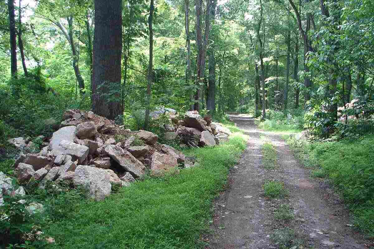
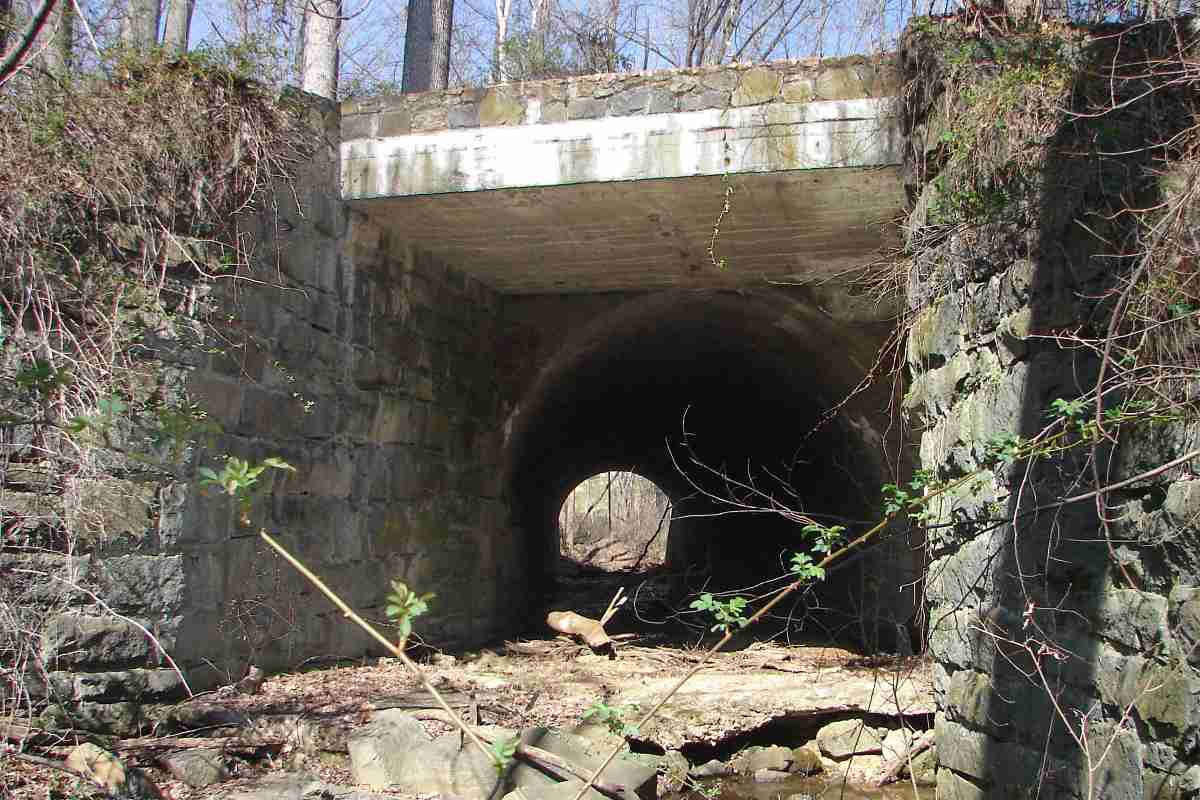
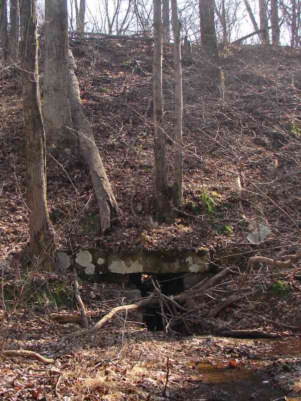
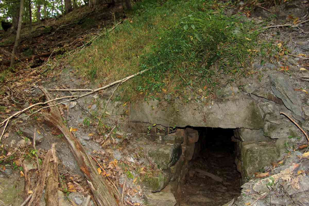
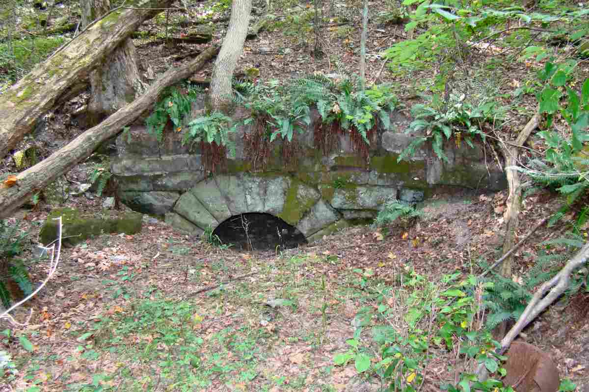
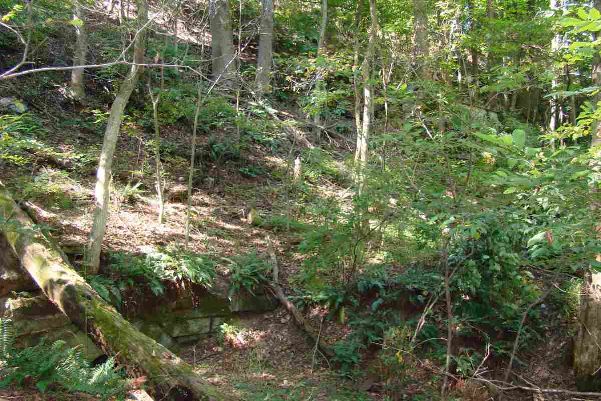
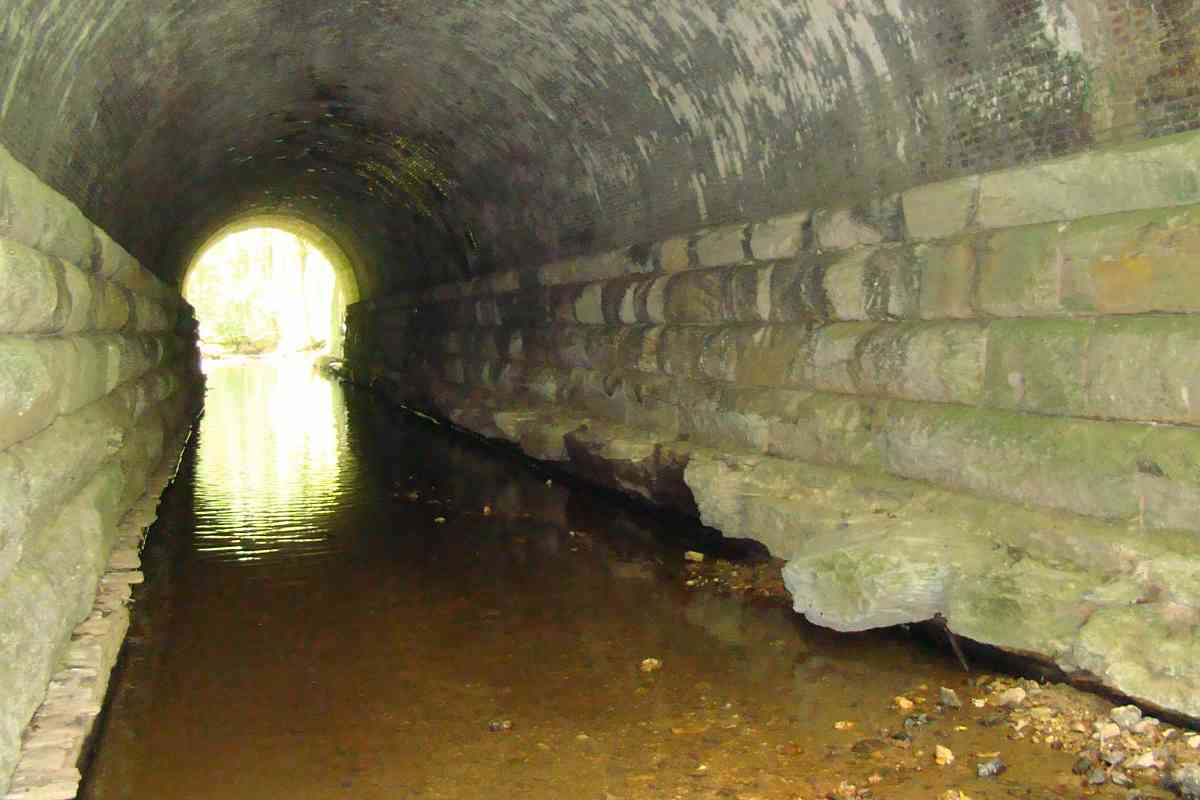
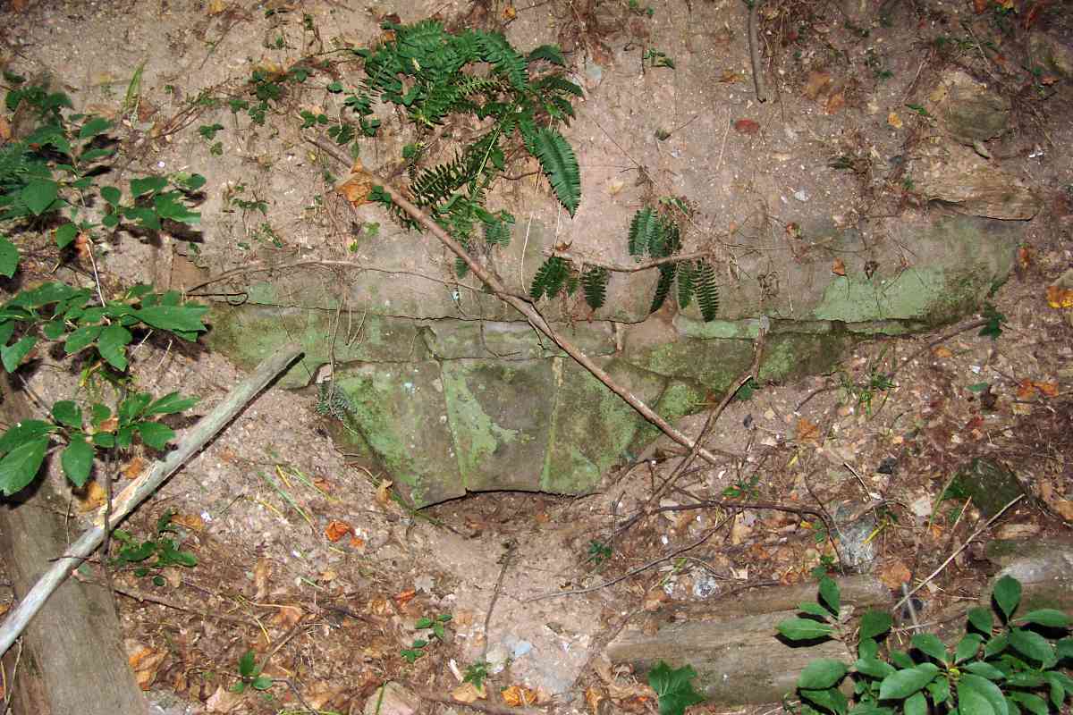
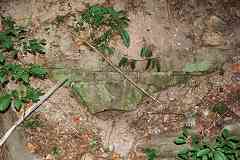
The first of several stone arched culverts is no longer doing much culverting. Its exposed stones total about 4 feet high.

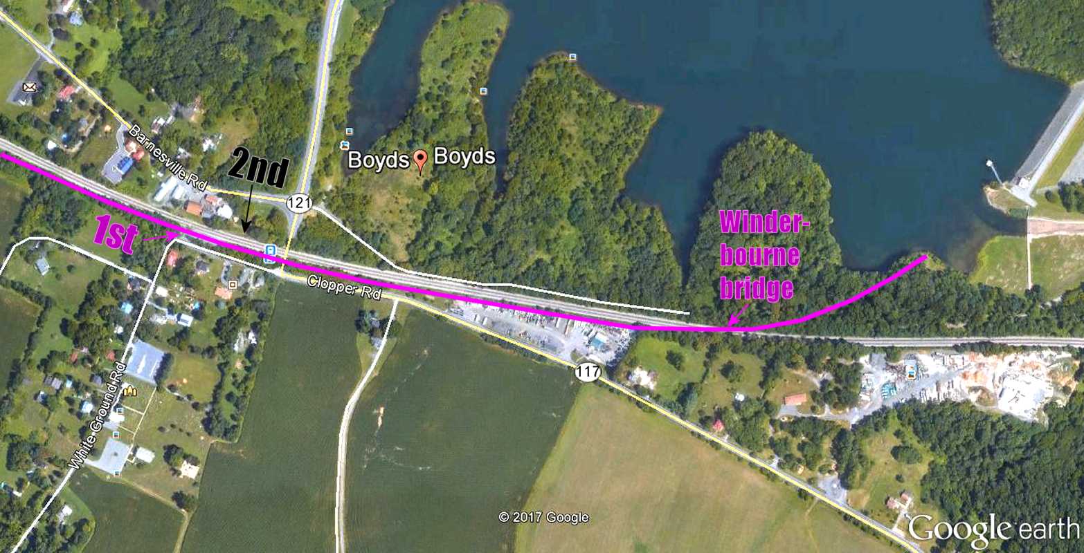
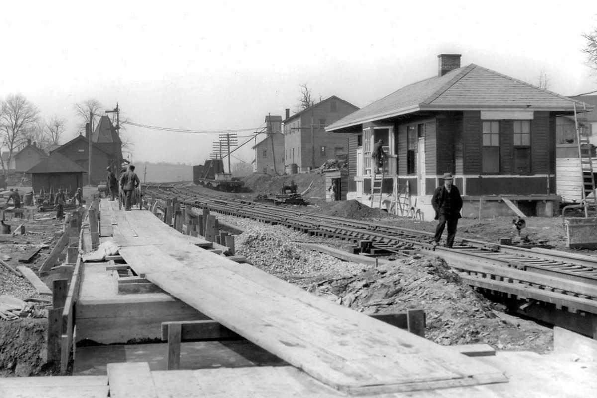
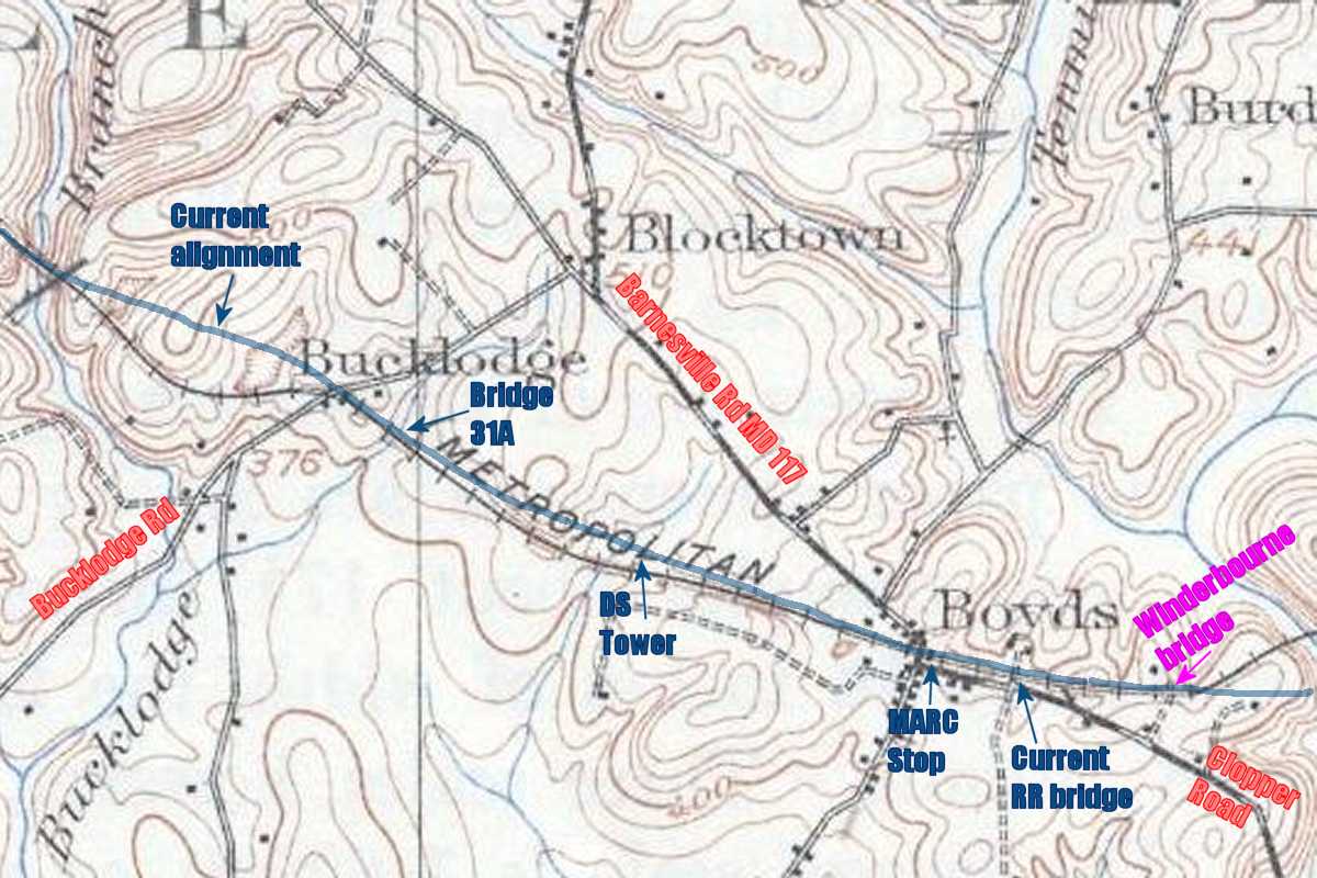
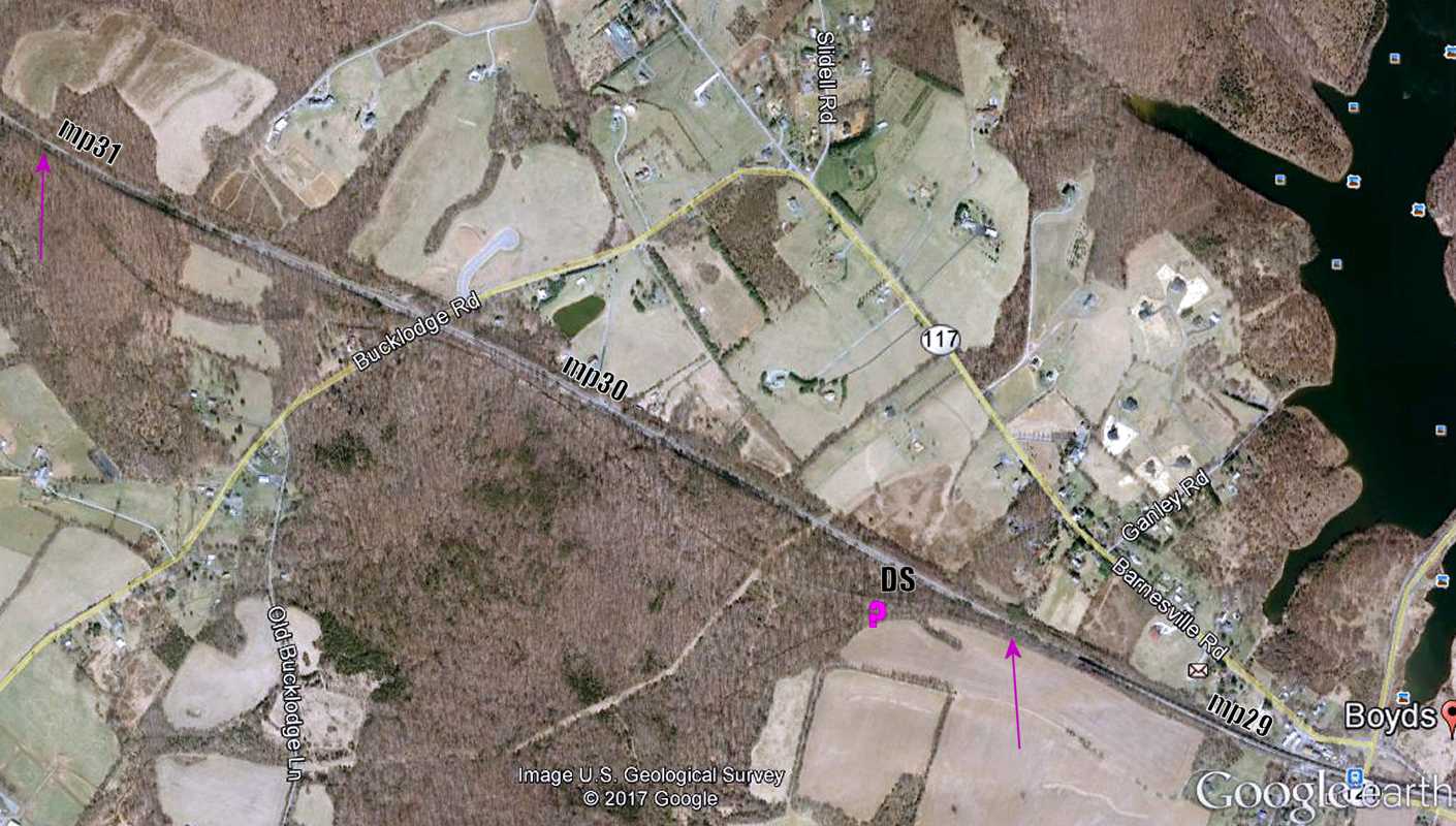
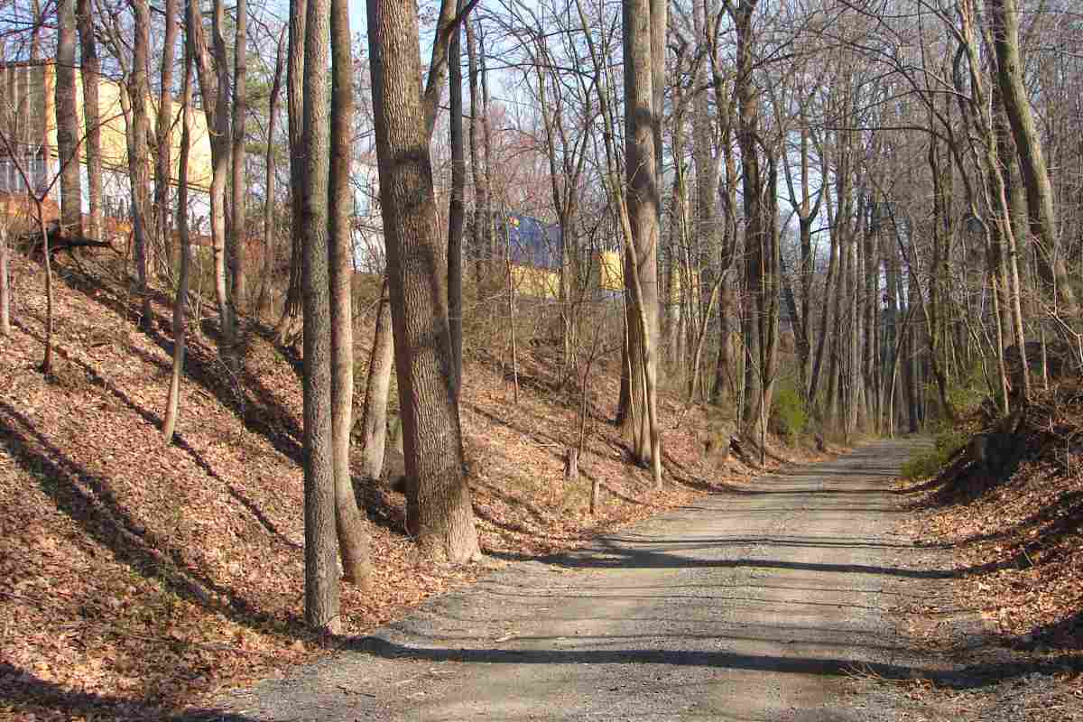
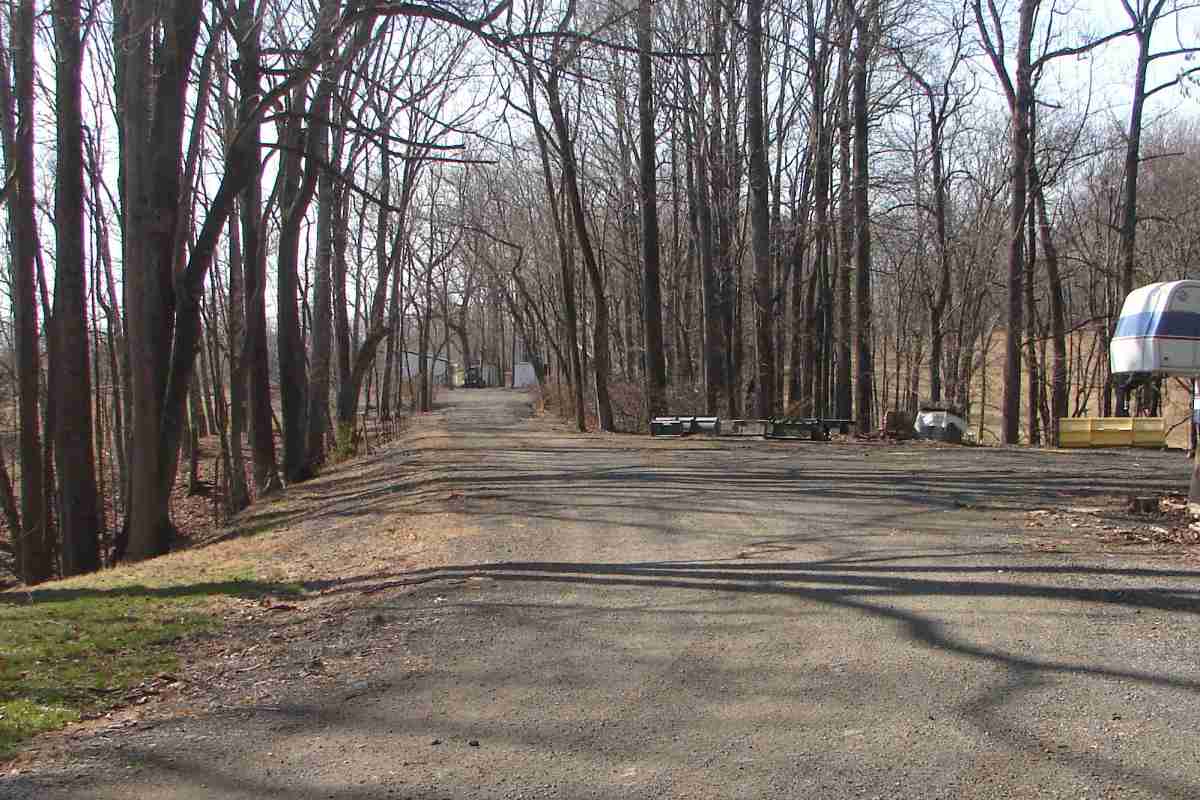
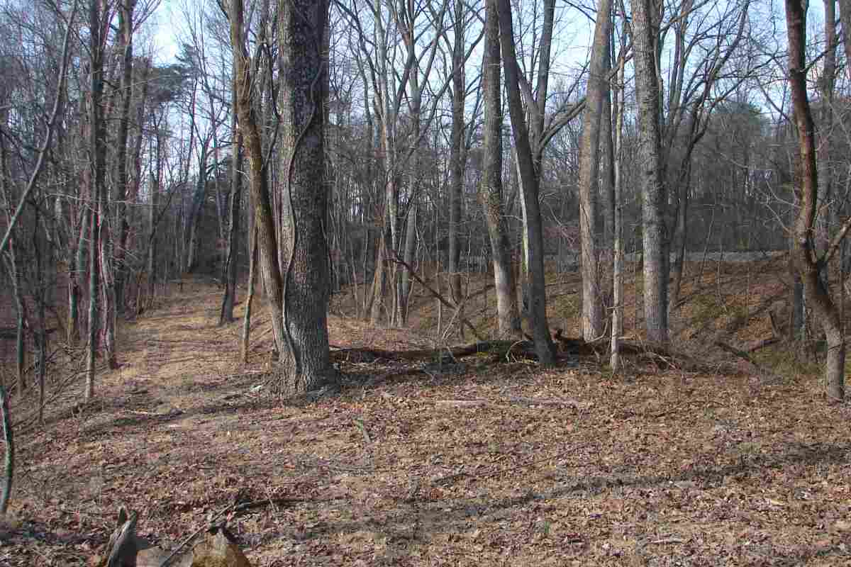
B&O began construction of the Metropolitan Branch during 1866 about 2 miles west of here at Barnesville, the highest point on the line, presumably because that meant fewer bridges would be needed immediately.

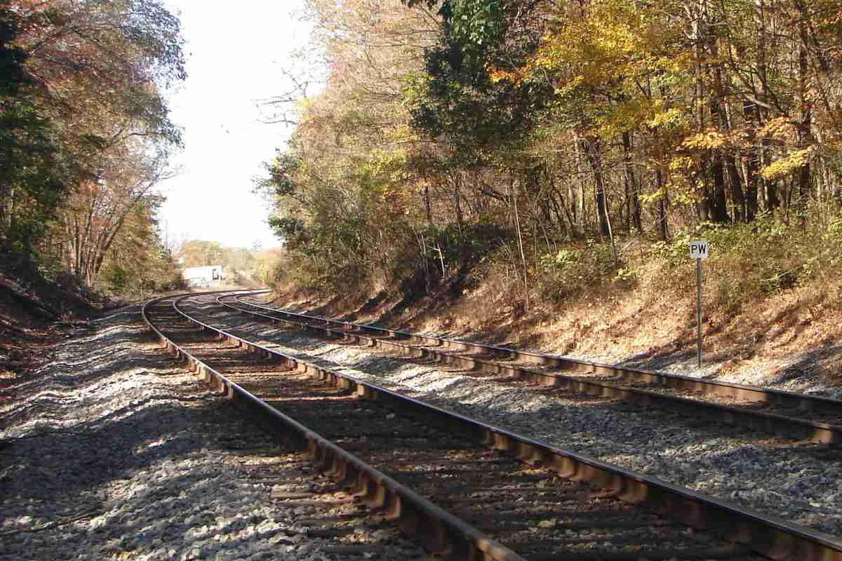
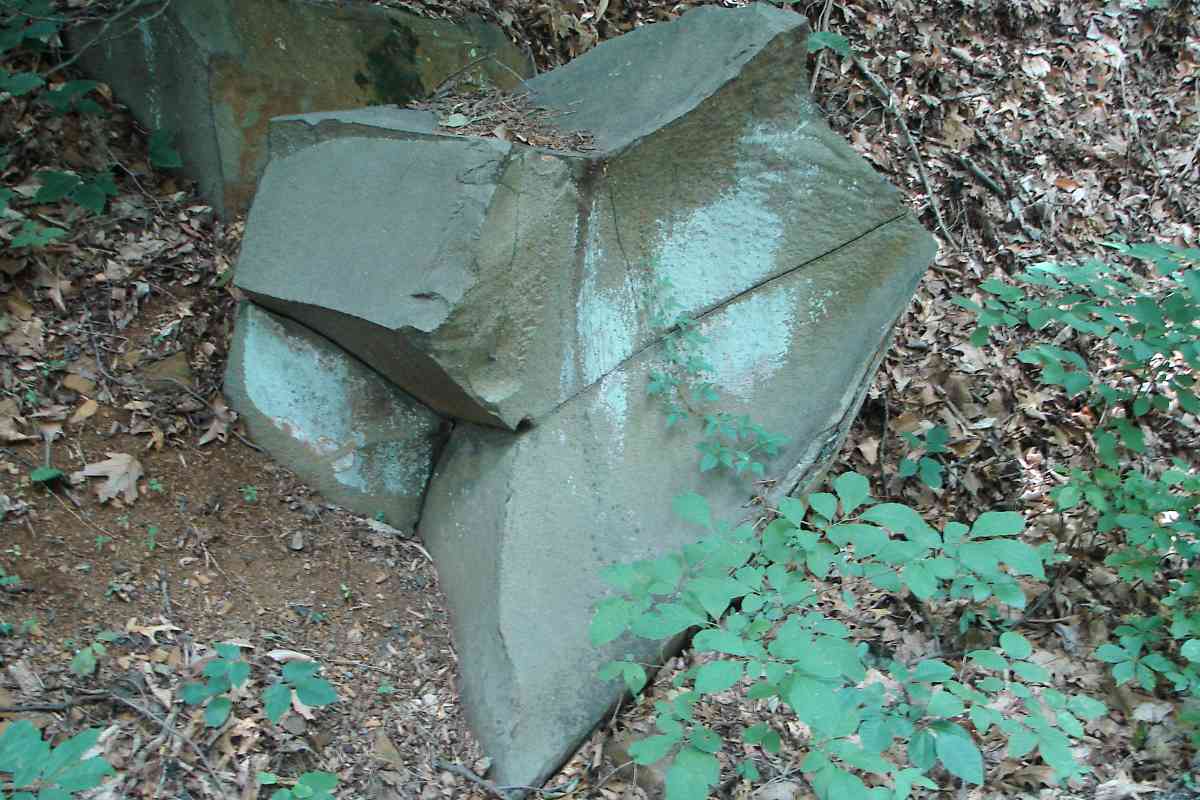
All the culverts in the vicinity of Barnesville exhibit this style, a hallmark of the Met's oldest building efforts. Construction paused in 1869 for a few years, and when it resumed the culverts reverted to the more expedient box style.


Culvert and Bridge
Photo courtesy Dave Hiteshew

Culvert and Bridge
Mile: 31.1 Date: Sep 2008
Ease: C View: W
Area: A IC2:
Map: Mo 8 C 12 Topographic Maps

I speculate the dry culvert of the prior photo, seen here at lower-left, proved insufficient for the Bucklodge Branch so B&O soon built a full-fledged bridge next to it and re-routed the stream.

The top of that bridge can be glimpsed through the leaves at upper right.


Non-Iron Horse
Photo courtesy Dave Hiteshew

Non-Iron Horse
Mile: 31.1 Date: Sep 2008
Ease: C View: S
Area: A IC2:
Map: Mo 8 C 12 Topographic Maps

The arched culvert lost its job to this behemoth, the most substantial single-arch masonry bridge on the line. My guess is this bridge dates to the 1870s when Met construction resumed. One of a similar design along the Old Main Line has "1873" carved into its stone. This bridge remains in railroad use, having been lengthened on its other side to support double track above.


Erosion
Photo courtesy Dave Hiteshew

Erosion
Mile: 31.1 Date: Aug 2008
Ease: C View: S
Area: A IC2:
Map: Mo 8 C 12 Topographic Maps

This erosion is evidence the Bucklodge Branch was rerouted. When streams are forcibly rerouted they do not have the benefit of prior centuries of wearing the streambed down to a sturdy, resistive base and thus quickly erode the new, man-made, softer route.

Presumably CSX regularly checks these bridges and has determined the erosion has not (yet) undermined the bridge's support walls to a dangerous extent.


Sellman Road

Sellman Road
Mile: 32.3 Date: Mar 2017
Ease: A View: W
Area: A IC2:
Map: Mo 8 A 10 Topographic Maps

West of Bucklodge Branch, Sellman Road parallels the tracks and on maps has the appearance of a disused B&O alignment. The steepness of this hill, however, convinced me otherwise.


green reflections

<< Previous (east) | THIS PAGE: Boyds to Bucklodge | Next (west) >>

Instead, you can resume back along the active line.

Or, return to main page

Copyright Notice