TrainWeb.org Facebook Page
B&O Metropolitan Branch Photo Tour


B&O Metropolitan Branch
Modern day photo tour

Accompanying each photo below are:

Click a photo to see a larger view. Please send your comments and corrections to Steve.


<< Previous (east) | THIS PAGE: Dickerson Spur | Next (west) >>

Dickerson Spur - Brief Historical Background:


Spur Start

Spur Start
Mile: 37.1 Date: Dec 2012
Ease: B View: SE
Area: A IC2:
Map: Fr 44 C 12, Mo 6 H 6 Topographic Maps

To begin, we'll glimpse back to the bridge that carries Mouth of Monocacy Road over the tracks, the site at which the final photo of the prior tour page was snapped. The CPL-style signals guarding the crossovers here gave way to these signals in the 2000s. The lead to the generating station peels off to the right.


Generator
Photo courtesy Dave Hiteshew

Generator
Mile: 37.0, spur 0.0 Date: Jul 2008
Ease: B View: SW
Area: A IC2:
Map: Fr 44 C 12, Mo 6 J 6 Topographic Maps

You won't find one of these at every switch: a 30kW backup generator, Olympian brand. Someone was thinking ahead to avoid an embarrassing chicken-and-egg type problem: if the plant is out of fuel and unable to produce electricity, the switch would not be powered, and thus the railroad could not bring more fuel to the plant!

I am surprised a switch that can also be manually operated was not chosen, so I suspect there may be regulations against their use along mainline track.

An Olympian generator of a very different type can be found at the other end of the spur...


Backout

Backout
Mile: 37.0 Date: Dec 2012
Ease: B View: S
Area: A IC2:
Map: Fr 44 C 12, Mo 6 H 6 Topographic Maps

Hey, we're just in time to watch a set of empties get very slowly pushed back out of the spur and onto mainline track -but wait- these are not coal hoppers...

According to Wikipedia, these are trash container cars hauled as part of a unit train, one in which all cars are headed from a single location to another single location. Unit train D765 runs daily, except Sunday, between the Montgomery County Resource Recovery Facility (MCRRF), which is a waste-to-energy power plant adjacent to the Dickerson Generating Station, and Montgomery County's Shady Grove Transfer Station (MCSGTS).


Watching

Watching
Mile: 37.0 Date: Dec 2012
Ease: B View: S
Area: A IC2:
Map: Fr 44 C 12, Mo 6 H 6 Topographic Maps

Per regulations, a crewmember is stationed at the forward-moving end of the train, watching progress and keeping in radio contact with the locomotive operator.

The 40-foot double-stack containers sit in National Steel Car Company-built well cars first built for NEMX (Ogden Martin Systems of Montgomery) in 1995. The containers' NEAU reporting mark stands for Seacube Containers.


Pushers

Pushers
Mile: 37.0 Date: Dec 2012
Ease: B View: S
Area: A IC2:
Map: Fr 44 C 12, Mo 6 H 6 Topographic Maps

Several minutes elapse before pushing units CSX 8533 and CSX 5360 emerge, representing locomotive models SD50-2 and ES44DC respectively.


CSX 8533

CSX 8533
Mile: 37.1 Date: Dec 2012
Ease: B View: NW
Area: A IC2:
Map: Fr 44 C 12, Mo 6 H 6 Topographic Maps

The cars are pushed onto and across the rail bridge over the Monocacy River. The number of cars varies with trash supply to be picked up; on this cloudy, late autumn day the empties numbered approximately 40. After the train has cleared the spur, the mainline track switch is reset and the crewmember climbs aboard for the trip.


Departure

Departure
Mile: 37.0 Date: Dec 2012
Ease: B View: S
Area: A IC2:
Map: Fr 44 C 12, Mo 6 H 6 Topographic Maps

Free refills await at the MCSGTS about 17 rail miles east in Derwood.


Crossing
Photo courtesy Dave Hiteshew

Crossing
Mile: 37.0, spur 0.3 Date: Jul 2008
Ease: B+ View: SW
Area: A IC2:
Map: Mo 6 H 7 Topographic Maps

Along the spur is this grade crossing with Mouth of Monocacy Road. The road leads to the C&O canal trail at the confluence of the Monocacy and Potomac Rivers.

Link to other picture: 2010


Bridge

Bridge
Mile: 37.0, spur 0.4 Date: Dec 2012
Ease: B View: SW
Area: A IC2:
Map: Mo 6 H 7 Topographic Maps

The Little Monocacy River valley is spanned by this bridge that dates to the late-1950s construction of the spur.

A 1908 USGS map shows a different spur bridging this valley about a mile upstream, but I have doubts, and have not yet visited to check.


37B2
Photo courtesy Dave Hiteshew

37B2
Mile: 37.0, spur 0.5 Date: Jul 2008
Ease: B View: ?
Area: A IC2:
Map: Mo 6 H 7 Topographic Maps

No fresh paint here: even the 37B/2 bridge number is rusting away.


Detectors

Detectors
Mile: 37.0, spur 0.5 Date: Dec 2012
Ease: B View: SW
Area: A IC2:
Map: Mo 6 H 7 Topographic Maps

Various detectors monitor whether trains have cleared this crossing. In the distance coal hoppers await either unloading or reloading. Note the incline peaks this side of the yard... a gentle slope beyond lets gravity help keep the cars in the yard.


Derail
Photo courtesy Dave Hiteshew

Derail
Mile: 37.0, spur 0.9 Date: Jul 2008
Ease: C View: W
Area: A IC2:
Map: Mo 6 G 8 Topographic Maps

If a car somehow escapes unexpectedly, derails will stop it from rolling back to the mainline. This derail appears to have a lever for manual operation.


Yard
Photo courtesy Dave Hiteshew

Yard
Mile: 37.0, spur 1.1 Date: Jul 2008
Ease: C View: SW
Area: A IC2:
Map: Mo 6 G 9 Topographic Maps

Air conditioners humming in July have helped to nearly empty this yard of coal. At right is the tallest of the generating station's stacks, some 700 feet high.


PEPX 236
Photo courtesy Dave Hiteshew

PEPX 236
Mile: 37.0, spur 1.1 Date: Jul 2008
Ease: C View: SE
Area: A IC2:
Map: Mo 6 G 9 Topographic Maps

The Potomac Electric Power Company has/had private rail stock under the PEPX reporting mark. Marks ending in X indicate the owner is not a "common carrier", a company (or person) licensed to transport goods for others.


Unloading
Photo courtesy Google

Unloading
Mile: 37.0, spur 1.5 Date: 2007?
Ease: View:
Area: IC2:
Map: Mo 6 F 9 Topographic Maps

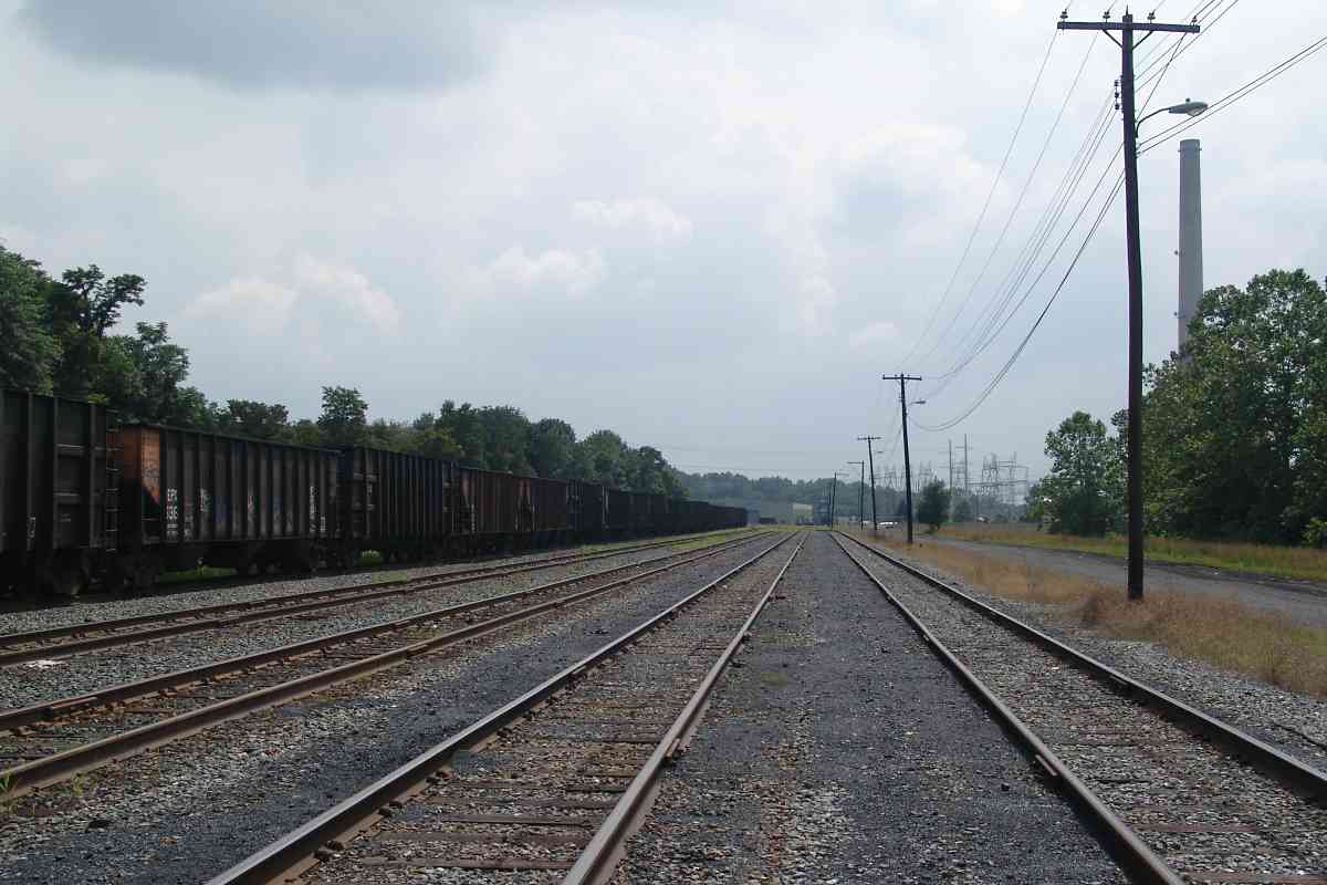
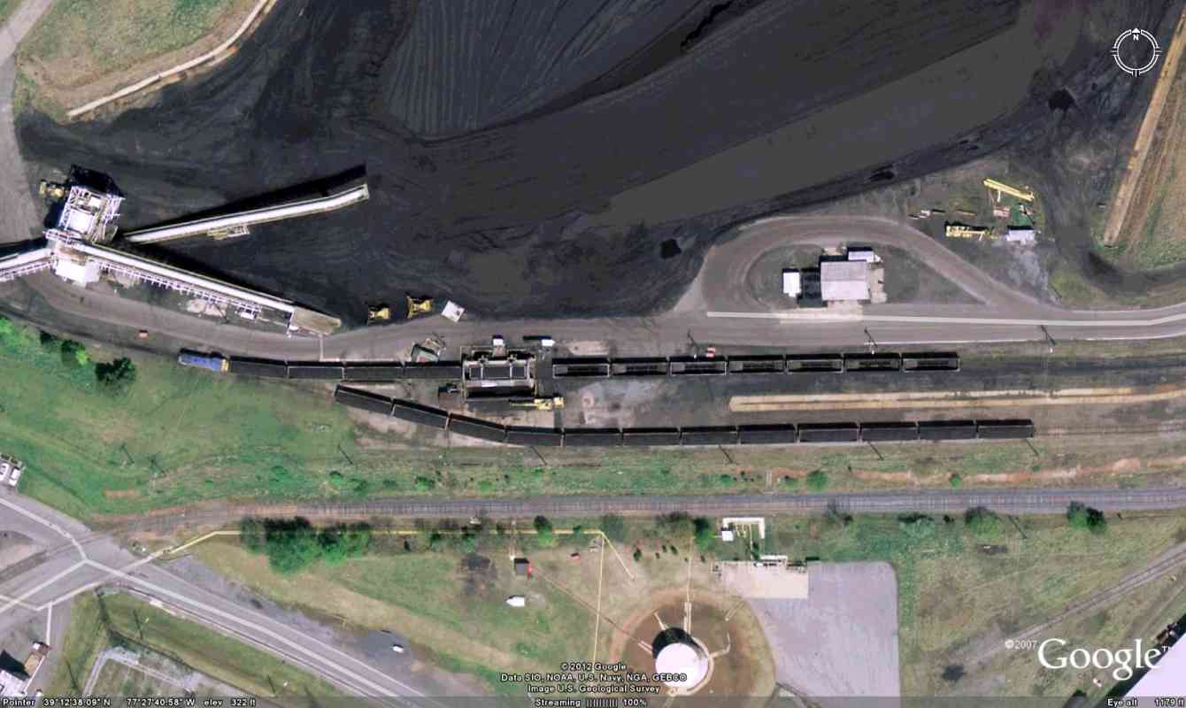
Beyond the yard is the coal offloading area. This satellite view shows the hoppers are each picked up and turned to pour out their coal, which is then stored in an open-air mound. I am suprised a gravity-drop method, never at risk of an outage, is not employed.

Unseen at left is the power plant, and its return of cooling water to the Potomac River. In the 1990s the output path was transformed into the world's only heated, artificial whitewater course. Canoe and kayak paddlers have used it to train for the Olympics.

The next tour page returns to the mainline.

Links: dumping a coal hopper (video), Dickerson Whitewater Course


<< Previous (east) | THIS PAGE: Dickerson Spur | Next (west) >>

Or, return to main page for other tours.

Copyright Notice