TrainWeb.org Facebook Page
B&O Metropolitan Branch Photo Tour


B&O Metropolitan Branch
Modern day photo tour

Accompanying each photo below are:

Click a photo to see a larger view. Please send your comments and corrections to Steve.


<< Previous (east) | THIS PAGE: Monocacy to Point of Rocks | Next (west) >>

Milepost 37
Photo courtesy Dave Hiteshew

Milepost 37
Mile: 37.0 Date: Nov 2007
Ease: B View: NW
Area: A IC2:
Map: Fr 44 C 12, Mo 6 J 6 Topographic Maps

Back at the mainline, the Met expands on its collection of "odd" mileposts: the one for 37 employs the less-common flat-top shape for the digit 3.


Monocacy River Bridge

Monocacy River Bridge
Mile: 37.1 Date: Dec 2012
Ease: B View: NW
Area: A IC2:
Map: Fr 44 C 12 Topographic Maps

The Met's longest bridge is this 700-some foot long structure spanning the Monocacy River that dates to 1903.

Detour: Old Main Line at Monocacy River


WM 4353
Photo courtesy Herb Harwood

WM 4353
Mile: 37.2 Date: Apr 1979
Ease: B View: E
Area: A IC2: 210
Map: Fr 44 C 12 Topographic Maps

In the original 1873-version, Bollman trusses supported single track. Heavier locomotives necessitated in 1893 the addition of more stone supports, such as the one in the center in this photo. About 10 years later the Bollman design was removed, the concrete extension added, and a double-track steel bridge installed; it is the one still on-duty today.

During the days of Chessie as a holding company, the locomotives retained their individual heritage. Probably pushing B&O caboose C3034 eastbound are WM (Western Maryland) 4353 and B&O 7613.


Reflections
Photo courtesy Dave Hiteshew

Reflections
Mile: 37.2 Date: Dec 2007
Ease: B- View: NE
Area: A IC2:
Map: Fr 44 C 12 Topographic Maps

The multi-color stonework of the pier at the left suggests certain stones have been replaced.


C&O Canal Aqueduct
Photo courtesy Dave Hiteshew

C&O Canal Aqueduct
Mile: 37.1 Date: Nov 2007
Ease: B- View: SW
Area: A IC2:
Map: Fr 44 C 12 Topographic Maps

Downstream, the C&O Canal's Aqueduct across the Monocacy is a beautiful multi-arch granite structure; at 516 feet it is the longest of the canal system. The last boat floated through in 1924 before flooding that year damaged the canal beyond repair.

Link: info from National Park Service


Arches

Arches
Mile: 37.2 Date: Dec 2012
Ease: B View: NW
Area: A IC2:
Map: Fr 44 B 13 Topographic Maps

Restoration work after more flooding in 1972 and again in 2005 has helped preserve the aqueduct.

The arches are shallower than those of B&O's stone bridges because the loads were not as heavy and typically the canal traversed at a lower elevation, one which left less clearance above waterways that feed the Potomac.

Link: C&O Canal virtual tour


Canal

Canal
Mile: 37.2 Date: Dec 2012
Ease: B View: SE
Area: A IC2:
Map: Fr 44 B 13 Topographic Maps

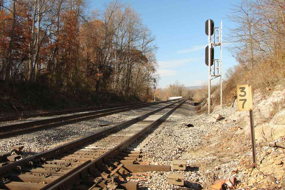
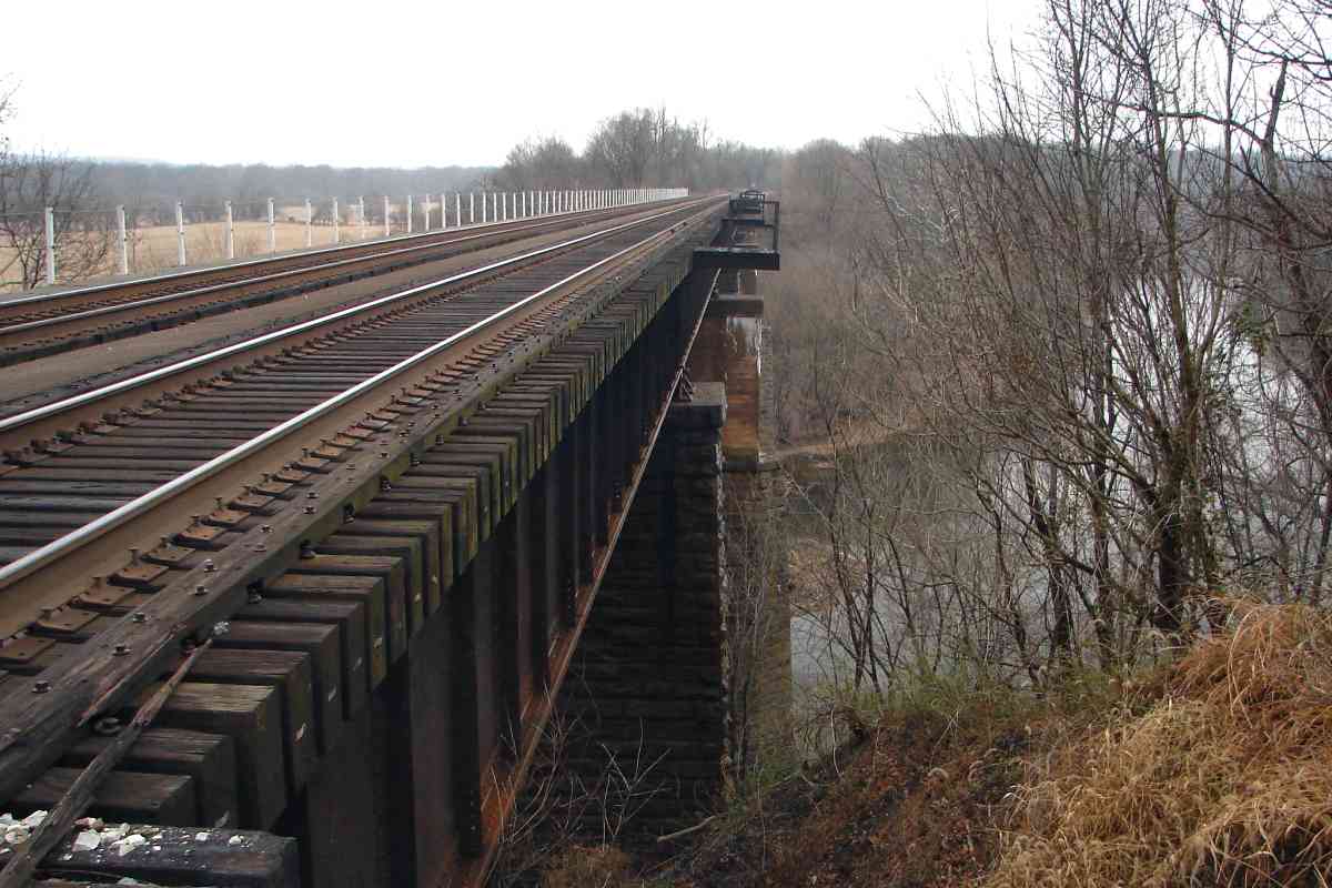
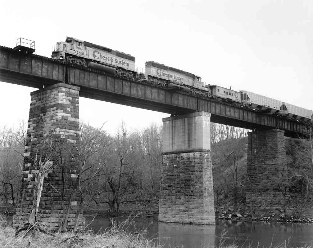
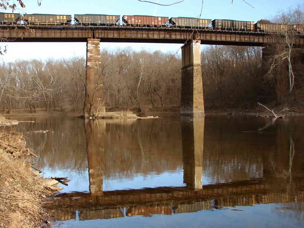
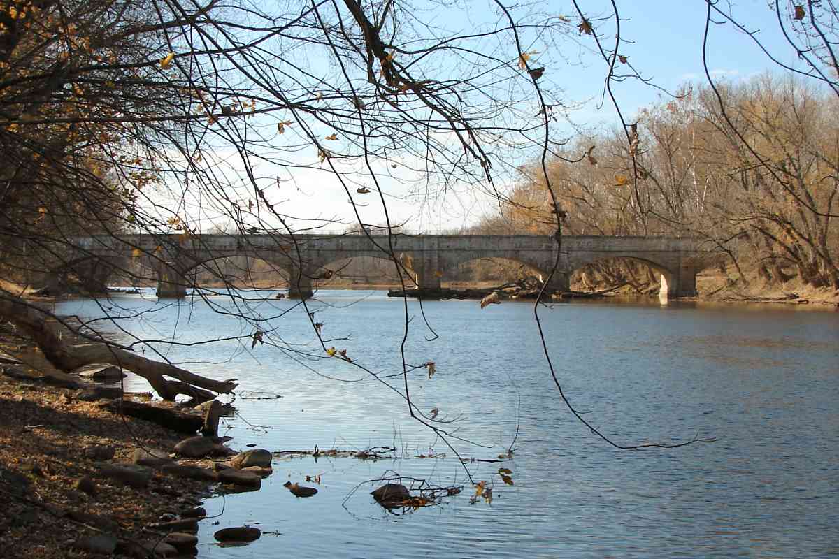
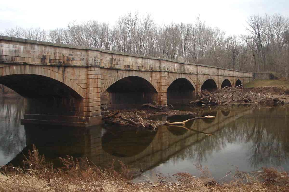
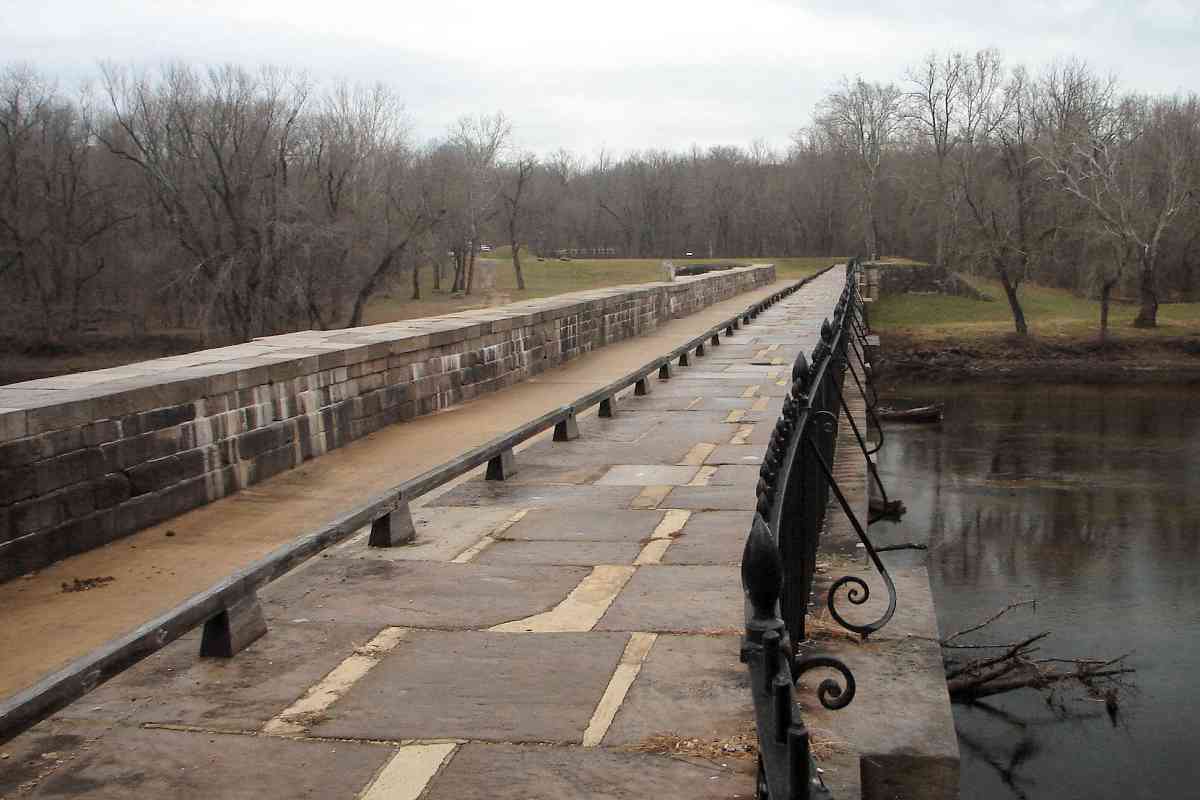
The canal's towpath (photo center) is a popular hiking and biking route, though you would not know it on this quiet, gray December day. The photographer is standing atop the aqueduct's thick stone walls which rose about 6 feet above the canal's trough (photo left), no longer filled with water here.

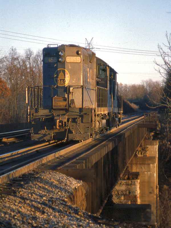
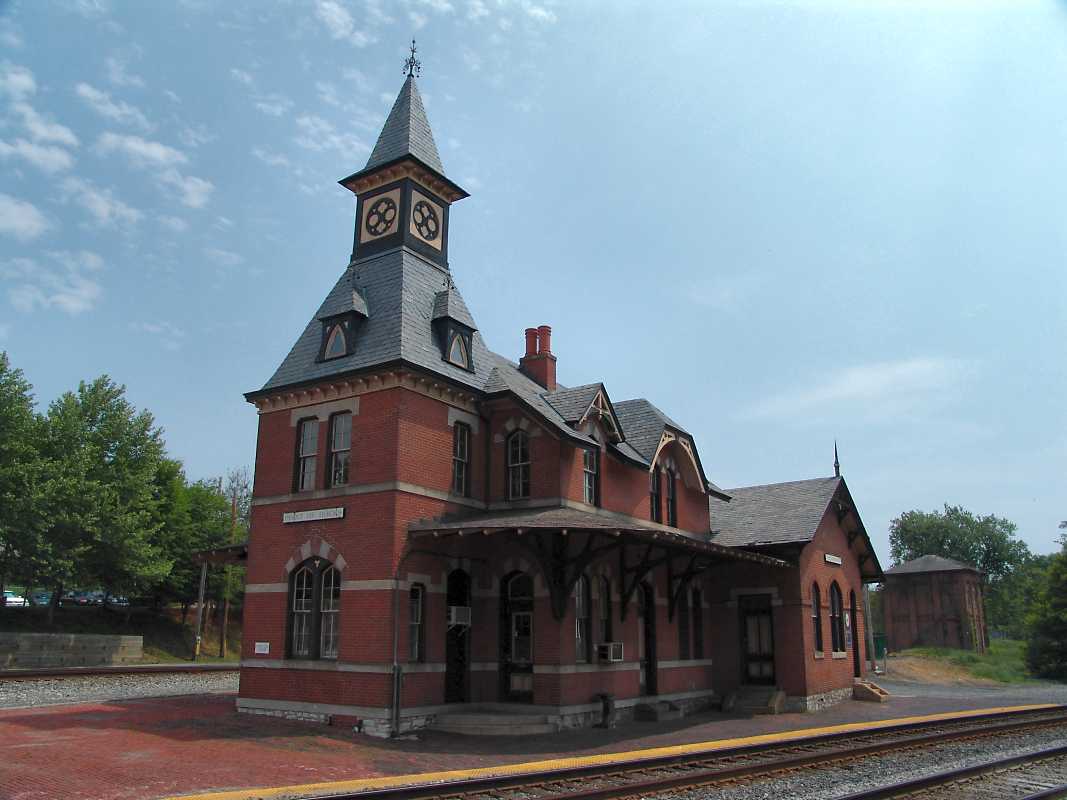
Though B&O's Metropolitan Branch did not parallel the canal here until about 1870, the Old Main Line did elsewhere, and reached Cumberland, Maryland 8 years before the C&O did, rendering the canal virtually obsolete from the outset. Even so, the canal would remain in operation for about a century.


B&O 6459
Photo courtesy B&O History Collection
NEW! late-Jan 2022

B&O 6459
Mile: 37.2 Date: Dec 1978
Ease: A View: E
Area: A IC2:
Map: Fr 44 C 12 Topographic Maps

Returning to trackside, here's a look back to the Monocacy River bridge as B&O 6459 rolls across during one of the earliest sunsets of the year.


Wisconsin Central
Photo courtesy Dave Hiteshew

Wisconsin Central
Mile: 37.2 Date: Jun 2008
Ease: C View: SE
Area: A IC2:
Map: Fr 44 C 12 Topographic Maps

CSX 4735 leads a mixed freight that includes Wisconsin Central grain cars. WC is now a subsidiary of Canadian National Railway. When the Wisconsin Central Railroad defaulted in 1893, B&O acquired its Grand Central Station in Chicago.

Link: Grand Central Station


CSX 221

CSX 221
Mile: 37.8 Date: Oct 2017
Ease: B View: E
Area: A IC2:
Map: Fr 44 J 12 Topographic Maps

Here's CSX 221 working the Met again.


MARC 31

MARC 31
Mile: 38.2 Date: Oct 2017
Ease: B View: E
Area: A IC2:
Map: Fr 44 H 12 Topographic Maps

CSX shares the Met with MARC commuter trains. MARC 31 is a MotivePower model MP36PH-3C.


Nolands Ferry
Photo courtesy Dave Hiteshew

Nolands Ferry
Mile: 38.4 Date: Jun 2008
Ease: A View: NE
Area: A IC2:
Map: Fr 44 H 11 Topographic Maps

In the mid-1700s, Philip Noland operated one of several Potomac River ferries, and this road still meanders to the long-disused crossing. American Indians fished the Potomac at least as early as the 1500s; paths through the forest to their fish weirs became roads followed by European colonists, and later became roads to ferries. Record of some of these routes, though now infrequently used, are preserved via B&O bridges like this.


Culverts
Photo courtesy Dave Hiteshew

Culverts
Mile: 38.8 Date: Jun 2008
Ease: A View: NW
Area: A IC2:
Map: Fr 44 G 11 Topographic Maps

Numerous culverts and other crossings exist near and between mileposts 39 to 40. This one, at the intersection of Chick Road and Nolands Ferry Road, has a highway culvert that empties into a railroad culvert. About 1000 feet west, another similar B&O culvert is painted with number 40A, and beyond that is a small, very crude all-stone box culvert.

Link to other pic: 2009


High Boxes

High Boxes
Mile: 38.9 Date: Oct 2017
Ease: A View: W
Area: A IC2:
Map: Fr 44 G 10 Topographic Maps

The Potomac River, about a quarter mile south (left), is well known for floods, hence CSX has raised this circuit box and its sibling (distance) above the high water mark of previous events.


WM 3799
Photo courtesy B&O History Collection
NEW! late-Jan 2022

WM 3799
Mile: 39.x Date: Oct 1981
Ease: A View: NW
Area: A IC2:
Map: Fr 44 F 10 Topographic Maps

WM and Chessie livery complement autumn leaves. As of 2022, WM 3799 is still on duty in the form of CSX road slug 2361.


CSX 5335
Photo courtesy Dave Hiteshew

CSX 5335
Mile: 39.2 Date: Jun 2008
Ease: A View: W
Area: A IC2:
Map: Fr 44 F 10 Topographic Maps

The green growth between the closer pair of rails is not a sign of disuse but rather evidence that summer, with its heat and dryness, has not yet arrived. CSX 5335 and CSX 7860 enjoy the hazy sunshine of a late spring day.


Tuscarora Creek
Photos courtesy Dave Hiteshew

Tuscarora Creek
Mile: 39.4 Date: Jun 2008
Ease: B View: E
Area: A IC2:
Map: Fr 44 F 10 Topographic Maps

Originally a B&O signature-style Bollman bridge spanned the creek, but now it's this more-than-century-old structure numbered 40B with a builder's plaque that reads "Built by the Pennsylvania Steel Co. Steelton PA. 1903". plaque

Corrosion and paint have softened all of the lettering such that the year might instead be 1908; judge for yourself via the inset. The five-year difference is significant: if 1903, this ties for the oldest extant B&O bridge of this style. There is a similar bridge dated 1907 in the English Consul area of Baltimore, and one clearly dated 1903 that CSX inherited from the Western Maryland. Per Harwood, the Met bridge across the Monocacy River dates to 1903 but I have not seen a photo of its builder's plaque.


Widened

Widened
Mile: 39.4 Date: Oct 2017
Ease: B View: W
Area: A IC2:
Map: Fr 44 F 10 Topographic Maps

A concrete addition that widens this bridge support reminds that the Met originally was single-tracked here. Similar additions are found at most of the bridges along this stretch.

Detour: Old Main Line at Tuscarora Creek


New Design Road
Photo courtesy Dave Hiteshew

New Design Road
Mile: 39.6 Date: Jun 2008
Ease: A View: SW
Area: A IC2:
Map: Fr 44 E 10 Topographic Maps

At New Design Road, CSX 2680 blurs past the only driveable dirt road under the Met. That's bridge 40C.


Box
Photo courtesy Dave Hiteshew

Box
Mile: 39.8 Date: Jul 2008
Ease: B View: NW
Area: A IC2:
Map: Fr 44 E 9 Topographic Maps

This disused equipment box awaits scrapping following removal of CPL signals that once stood on the adjacent concrete pads. The box is stenciled "I97I28, SIG.3990-91, TUSCARORA,MD."


Measured Mile
Courtesy CSX

Measured Mile
Mile: 40.0 Date: 2016
Ease: View:
Area: IC2:
Map: Fr 44 F 10 Topographic Maps

The bold lines on a CSX Timetable show the stretch between mileposts 39 and 40 as a measured mile, one of only two along the Metropolitan Subdivision. A "measured mile" is an accurately measured distance that permits operators to test and calibrate equipment such as locomotive speedometers. Normally trackside "S" signs show the start and end of a measured mile, but at last check they were missing at mileposts 39 and 40. This timetable page is Copyright 2016 CSX, and included here under Fair Use guidelines.


Milepost 41
Photo courtesy Dave Hiteshew

Milepost 41
Mile: 41.0 Date: Jul 2008
Ease: C View: W
Area: A IC2:
Map: Fr 44 B 8 Topographic Maps

Notable railroading artifacts are surprisingly few between mileposts 40 and 42.


Track
Photo courtesy Dave Hiteshew

Track
Mile: 42.2 Date: Sep 2007
Ease: B View: E
Area: A IC2:
Map: Fr 43 K 7 Topographic Maps

What appears to be an excised track segment sits across from where the Adamstown Cutoff once split from the Met. CSX 8735, 8134, 2641, and 8642 are approaching.

Detour: Adamstown Cutoff tour page


Helpers
Photo courtesy Dave Hiteshew

Helpers
Mile: 42.5 Date: Sep 2007
Ease: B View: NW
Area: A IC2:
Map: Fr 43 J 7 Topographic Maps

Helper engines CSX 8514 and CSX 8528 drift back to Brunswick to await their next push job. The track that bends to the right connects to the Old Main Line to Baltimore. Yes, we're getting close to Point of Rocks.


Wye
Photo courtesy Dave Hiteshew

Wye
Mile: 42.6 Date: Sep 2007
Ease: B View: NW
Area: A IC2:
Map: Fr 43 H 6 Topographic Maps

This wye at Point of Rocks lets trains switch between the Met and the Old Main Line. On the left afternoon commuters from DC are heading home aboard a MARC train.


Shop
Photo courtesy Dave Hiteshew

Shop
Mile: 42.7 Date: May 2007
Ease: B+ View: N
Area: A IC2:
Map: Fr 43 H 6 Topographic Maps

East of Point of Rocks station is this disused structure built in the early 1900s that previously housed a maintenance shop and railroad superintendent's office.


Interior
Photo courtesy Dave Hiteshew

Interior
Mile: 42.7 Date: May 2007
Ease: B+ View: ?
Area: A IC2:
Map: Fr 43 H 6 Topographic Maps

While awaiting a new purpose, it houses little more than this.


CSX 8748
Photo courtesy Dave Hiteshew

CSX 8748
Mile: 42.7 Date: Sep 2007
Ease: A- View: W
Area: A IC2:
Map: Fr 43 H 6 Topographic Maps

We have arrived at Point of Rocks, Maryland, where the Met and Old Main Line join forces... or split apart depending on which way you are headed. The OML was the first here (1832). KG Tower had stood on the left.


Passengers
Photo courtesy Dave Hiteshew

Passengers
Mile: 42.8 Date: Sep 2007
Ease: A View: W
Area: A IC2: 173
Map: Fr 43 H 6 Topographic Maps

Passengers from Washington, DC exit at Point of Rocks, MD while others remain onboard as the MARC train continues west to Martinsburg, WV.

Links: 1985, roof damaged by Feb 2010 snow, more 2010 snow pics


Station
Photo courtesy Dave Hiteshew

Station
Mile: 42.8 Date: May 2007
Ease: A View: NE
Area: A IC2: 172, 173, 344, 397
Map: Fr 43 H 6 Topographic Maps

A wide-angle lens distorts shapes but gets the whole Point of Rocks station into view. Portions of the building date to 1875; that's the disused shop building behind. The Met continues west, but its milepost numbering takes a leap, as will be explained on the next tour page.

Links to older pictures: 1977, 1984 pic group


<< Previous (east) | THIS PAGE: Monocacy to Point of Rocks | Next (west) >>

Or, return to main page for other tours.

Copyright Notice