TrainWeb.org Facebook Page
B&O Metropolitan Branch Photo Tour


B&O Metropolitan Branch
Modern day photo tour

Accompanying each photo below are:

Click a photo to see a larger view. Please send your comments and corrections to Steve.

MCSGPFaTS
Photo courtesy Dave Hiteshew

MCSGPFaTS
Mile: 19.5, 0.5 siding Date: Oct 2008
Ease: C+ View: S
Area: B IC2:
Map: Mo 19 J 12 Topographic Maps

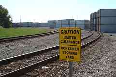
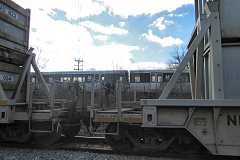
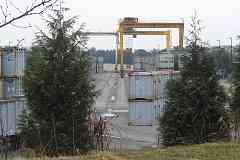
At Montgomery County's Shady Grove Processing Facility and Transfer Station (MCSGPFaTS) trucks and county residents bring in trash and recyclables, which are loaded into containers like these. The facility's Mi-Jack Travelift stacks the containers and shifts them between carriers.

Per the link below, the station does not accept "railroad tires". I suppose that's a typo.

Link: basic info


Container Yard
Photo courtesy Dave Hiteshew

Container Yard
Mile: 19.5, 0.4 siding Date: Oct 2008
Ease: C+ View: S
Area: B IC2:
Map: Mo 19 J 12 Topographic Maps

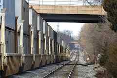
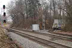
When enough trash carriers are filled, they are pushed out in double stacks onto the Met, as seen below. They then wait for escort 18 miles west to Dickerson Generating Station where the trash is incinerated as fuel for electricity generation.


NEAU 833

NEAU 833
Mile: 19.1 Date: Feb 2022
Ease: B+ View: NW
Area: B+ IC2:
Map: Mo 20 A 13 Topographic Maps

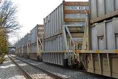
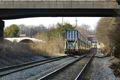
Here is one of those trash trains, pausing on the Met at Derwood, east of Shady Grove.

NEAU is a reporting mark of Seacube Containers. The stack cars bear a NEMX reporting mark of Ogden Martin Systems of Montgomery.


National Steel Car

National Steel Car
Mile: 19.1 Date: Feb 2022
Ease: B+ View: NW
Area: B+ IC2:
Map: Mo 20 A 13 Topographic Maps

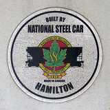
The containers were built by National Steel Car of Hamilton, Ontario.


Restricting

Restricting
Mile: 19.1 Date: Feb 2022
Ease: B+ View: NW
Area: B+ IC2:
Map: Mo 20 A 13 Topographic Maps

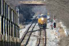
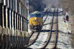
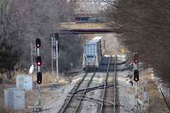
The white light of the distant signal indicates Restricting. Moments earlier, the signal dsplayed Stop because the barely visible MARC train had recently passed.


Metro

Metro
Mile: 19.1 Date: Feb 2022
Ease: B+ View: SW
Area: B+ IC2:
Map: Mo 20 A 13 Topographic Maps

The Washington Metro Red Line runs adjacent. Between the two lines, B&O's Derwood Station had previously stood on the left.


CSX 3094

CSX 3094
Mile: 19.1 Date: Feb 2022
Ease: B+ View: S
Area: B+ IC2:
Map: Mo 20 A 13 Topographic Maps

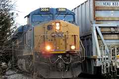
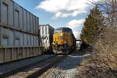
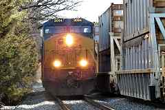
The trash, but not trashy, escort has arrived from the east. CSX has used symbols D765 and L112 for this trash run.


CSX 854

CSX 854
Mile: 19.1 Date: Feb 2022
Ease: B+ View: NW
Area: B+ IC2:
Map: Mo 20 A 13 Topographic Maps

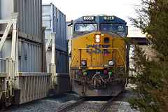
The pair of engines heads west past the containers...


Climb Aboard

Climb Aboard
Mile: 19.1 Date: Feb 2022
Ease: B+ View: NW
Area: B+ IC2:
Map: Mo 20 A 13 Topographic Maps

... where a worker climbs aboard, perhaps after removing a FRED from the west end car...


Hang On

Hang On
Mile: 19.1 Date: Feb 2022
Ease: B+ View: NW
Area: B+ IC2:
Map: Mo 20 A 13 Topographic Maps

... and rides to the east end of the containers...


Pause

Pause
Mile: 19.1 Date: Feb 2022
Ease: B+ View: NW
Area: B+ IC2:
Map: Mo 20 A 13 Topographic Maps

... where the engines pause.


FRED

FRED
Mile: 19.1 Date: Feb 2022
Ease: B+ View: NW
Area: B+ IC2:
Map: Mo 20 A 13 Topographic Maps

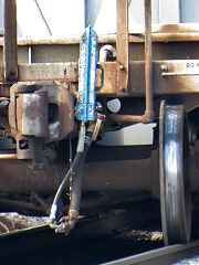
The pause allowed the worker to hang a blue-painted Flashing Rear End Device on the end of the train.


Beyond Crossovers

Beyond Crossovers
Mile: 19.1 Date: Feb 2022
Ease: B+ View: NW
Area: B+ IC2:
Map: Mo 20 A 13 Topographic Maps

The pair of engines travels back to the west end...


Switched Tracks

Switched Tracks
Mile: 19.1 Date: Feb 2022
Ease: B+ View: NW
Area: B+ IC2:
Map: Mo 20 A 13 Topographic Maps

... where it can switch tracks...


Away They Go

Away They Go
Mile: 19.1 Date: Feb 2022
Ease: B+ View: NW
Area: B+ IC2:
Map: Mo 20 A 13 Topographic Maps

... then couple to the containers, and pull them away.


Bye

Bye
Mile: 19.1 Date: Feb 2022
Ease: B+ View: NW
Area: B+ IC2:
Map: Mo 20 A 13 Topographic Maps

The next track change will be to the spur to the Dickerson Generating Station.


CSX 7691

CSX 7691
Mile: 32.0 Date: Apr 2017
Ease: B View: E
Area: A IC2:
Map: Mo 8 A 10 Topographic Maps

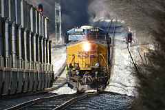
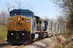
Here's a different trash train as it nears Dickerson.


Dickerson Spur

Dickerson Spur
Mile: 37.0 Date: Dec 2012
Ease: B View: S
Area: A IC2:
Map: Fr 44 C 12, Mo 6 H 6 Topographic Maps

That's the spur to the generating station on the right. To see more about it, continue with the Dickerson Spur tour.


Return to main page for other tours.

Copyright Notice