TrainWeb.org Facebook Page
B&O Photo Tour


B&O Marley Neck Branch
Modern day photo tour

Accompanying each photo below are:

Click a photo to see a larger view. Please send your comments and corrections to Steve.


<< Previous (west) | THIS PAGE: Curtis Bay to Cabin Branch | Next (east) >>

Brief Historical Background: Marley Neck Branch

Map

Map
Mile: Date: (Apr 1964)
Ease: View: E (up)
Area: IC2:
Map: Ba 43 Topographic Maps

The Marley Neck Branch mileposts decline numerically as the route proceeds generally southeast, the direction of this tour, left to right on this map.


BX Tower

BX Tower
Mile: 7.9 Date: Jun 2001
Ease: B View: W
Area: B- IC2:
Map: Ba 43 D 9 Topographic Maps

the railroad has shifted the Marley Neck Branch's mileposts several times over the past 100 years. Since the westernmost of its mileposts 0 was here at BX (Brooklyn) Tower, this is where we'll begin the tour. The tower closed July 16, 1985, leaving the building to deteroriate for the next 25+ years until CSX razed it during 2014. Some references call this BA Tower.

From here the Marley Neck Branch proceeds behind the photographer into Curtis Bay Yard.


Curtis Bay Yard

Curtis Bay Yard
Mile: 7.8 Date: Feb 2015
Ease: B View: E
Area: B- IC2:
Map: Ba 43 D 9 Topographic Maps

From the northwest corner of the yard, Marley Neck Branch traffic generally rides one of the three center tracks. The track with the tank and the track to its left both lead to CSX's Curtis Bay car repair shop.

The name "Curtis" was applied to this area in the original land grant dating to 1663.


Blue Stop

Blue Stop
Mile: 7.8 Date: Feb 2015
Ease: A View: SE
Area: B- IC2:
Map: Ba 43 D 9 Topographic Maps

The line of equipment waiting repair is marked off by this blue flasher.


Blue Flag

Blue Flag
Mile: 7.8 Date: Jun 2001
Ease: A- View: E
Area: B IC2:
Map: Ba 43 D 9 Topographic Maps

Years before blue flashers came along, blue flags or signs like this were employed as a warning.

Link: meaning of blue flag


I-895

I-895
Mile: 7.6 Date: Apr 2015
Ease: A View: SE
Area: B IC2:
Map: Ba 43 E 9 Topographic Maps

As seen from I-895, the Baltimore Harbor Tunnel Thruway, Marley Neck trains are challenged to find an unoccupied route through Curtis Bay Yard.


Impressionism

Impressionism
Mile: 6.7 Date: Jul 2015
Ease: A- View: NW
Area: C+ IC2:
Map: Ba 43 F 11 Topographic Maps

Summer heat applies an artistic brush to this deep zoom back from the Patapsco Avenue vicinity to the I-895 bridge. After passing through Curtis Bay Yard, Marley Neck traffic uses either of the foreground tracks.


Dumper

Dumper
Mile: 6.7 Date: Jul 2015
Ease: A- View: SE
Area: C+ IC2:
Map: Ba 43 F 11 Topographic Maps

The dumper (red building) south of the yard turns full cars into empties that then pause at a lower level awaiting their next refill.

On the right, the Marley Neck Branch ignores the hubbub and focuses on its hazy, ultimate goal of the tall stacks of the Brandon Shores Generating Station over 4 miles distant. Its snaking route will require more than 6 miles of track.

CSX once designated this location BBR (Marley Neck) milepost 0 but has since renumbered the mileposts in the opposite direction.

Tour: Curtis Bay Branch at coal dumper


Emptied

Emptied
Mile: 6.7 Date: Jan 2015
Ease: A View: N
Area: C IC2:
Map: Ba 43 G 12 Topographic Maps

Looking back into the Curtis Bay Piers on this day finds maintenance crews, including the yellow crane at distant left, occupying the branch. The Marley Neck Branch skirts the west side of the coal operation.


Milepost 6

Milepost 6
Mile: 6.0 Date: Jan 2015
Ease: A View: N
Area: C IC2:
Map: Ba 43 G 12 Topographic Maps

B&O measured the distance into the branch; CSX now does the opposite, measuring from the branch's end at the power station. I favor B&O's approach since the end has the greatest chance of changing via extensions or cutbacks, and such changes do not alter the mileposts.


Truck

Truck
Mile: 6.0 Date: Jan 2001
Ease: A View: N
Area: C IC2:
Map: Ba 43 G 12 Topographic Maps

"Get a load of this!"


Benhill Avenue

Benhill Avenue
Mile: 6.0 Date: Jan 2015
Ease: A View: NE
Area: C IC2:
Map: Ba 43 G 13 Topographic Maps

The truck is about to remove itself from the Marley Neck Branch at the Benhill Avenue grade crossing. Behind, black hills of coal tower at the piers.


Andard Avenue

Andard Avenue
Mile: 5.9 Date: Jan 2015
Ease: A View: W
Area: D+ IC2:
Map: Ba 43 G 13 Topographic Maps

This siding that peels east from the branch has been chillin' since these industrial concerns closed decades ago. Many buildings are spray painted "No Strippin" while a few are being renovated for new occupants. Economic cycles are inexorable.

Link: why the strippin'


Birch Avenue

Birch Avenue
Mile: 5.9 Date: Jan 2015
Ease: B View: SE
Area: C IC2:
Map: Ba 43 G 13 Topographic Maps

The bridge spanning Birch Avenue is in good shape, but adjacent retaining walls are not, leading to the street's closure.


Through

Through
Mile: 5.9 Date: Jan 2015
Ease: B View: S
Area: C IC2:
Map: Ba 43 G 13 Topographic Maps

Another siding peels left from the branch and in the past travelled through a building for loading/unloading without exposure to the elements, but now goes around the building to the water at Ferry Point.

The branch curves to the right, a curve we'll see from the opposite direction in the next photo.


Private

Private
Mile: 5.6 Date: Jul 2015
Ease: A- View: E
Area: C IC2:
Map: Ba 43 F 13 Topographic Maps

Of this stretch, Eugene Leache writes:

    "One major industry at Curtis Bay was the Standard Wholesale Phosphate and Acid Works, which during the 1930's and 1940's was the largest contact-process sulphuric acid plant in the world. It would become merged into Olin Mathieson Chemical Corporation in the 1950's. As the plant's technology gradually became antiquated, it became increasingly uneconomical to run, and the plant was shutdown in the 1980's (as I recall). My father worked there from the late 1930's until the 1980's, less 5 years spent in the army, including service in the Pacific Theatre of WWII. He retired with the salubrious title of 'Superintendent of the Acid Works'.

    "The plant's main office was at 5501 Pennington Ave - I assume that the chemical works were in close proximity. Although my memories are hazy, I recall my father talking about railcars - and it seems reasonable that some feedstocks were shipped in by rail - though I know that liquified sulphur was also brought in by marine tanker. And I imagine that finished chemical products would likely have been shipped out by rail as well.

    "The plant also produced agricultural fertilizers: I don't know if bulk product was shipped, but bagged fertilizer was, and it would have been a candidate for rail shipment as well. Notes:

    • "1. Standard Wholesale Phosphate and Acid Works was owned by George Armistead Whiting, a direct descendent of Major George Armistead, who commanded Fort McHenry against the British in 1812.
    • "2. Re liquified sulphur shipments: the plant either had been serviced by and/or was scheduled to be serviced by the tanker Marine Sulphur Queen, lost with all hands off the coast of Florida in February 1963."

Link: more site history


Pennington Avenue

Pennington Avenue
Mile: 5.5 Date: Jun 2015
Ease: A View: N
Area: C IC2:
Map: Ba 43 F 13 Topographic Maps

celery king 
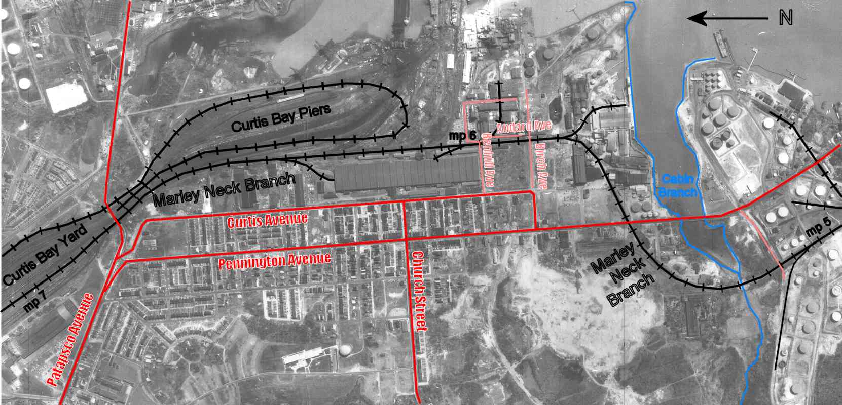
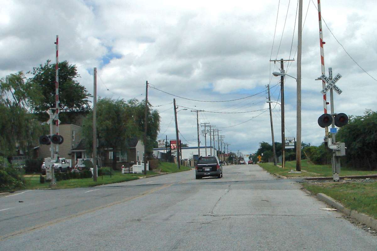
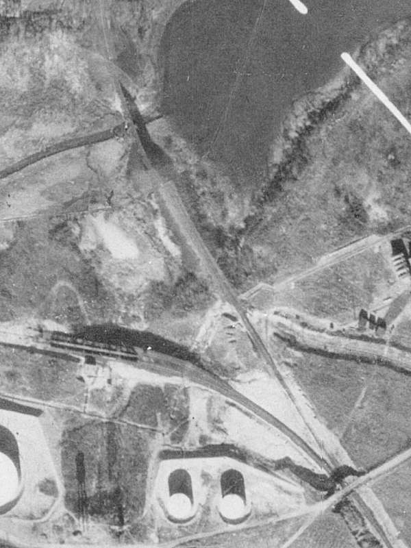
What appears to be a nicely-kept private home sits on the left. To the home's southeast, a steady stream of heavy trucks pause at this grade crossing then roar as they accelerate and pound across it. To the east petroleum tanks ooze. To the south Valley Proteins, an animal rendering facility, emits a stench so ungodly that if The Burger King visited he'd immediately abdicate to vegetarianism. Oh, and on the north the Fantasies strip club lets out its partiers at 2 AM.

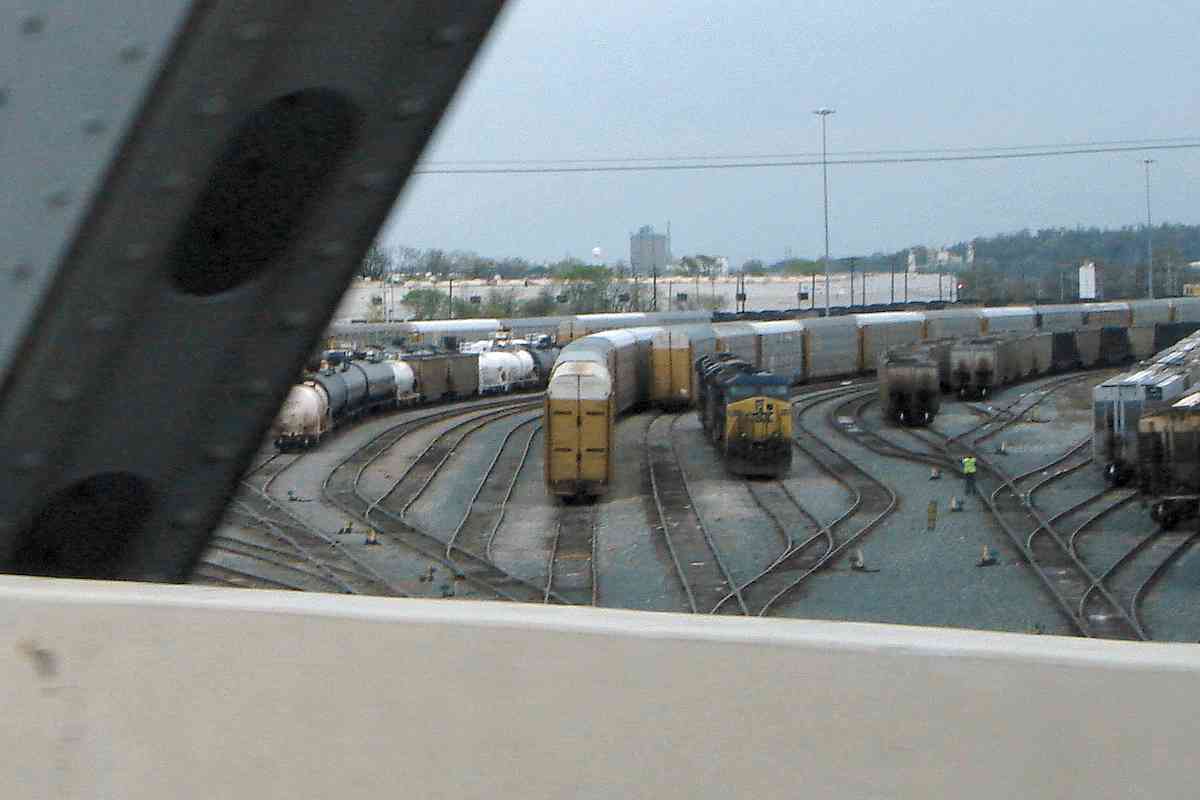
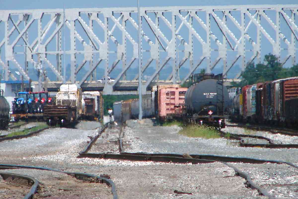
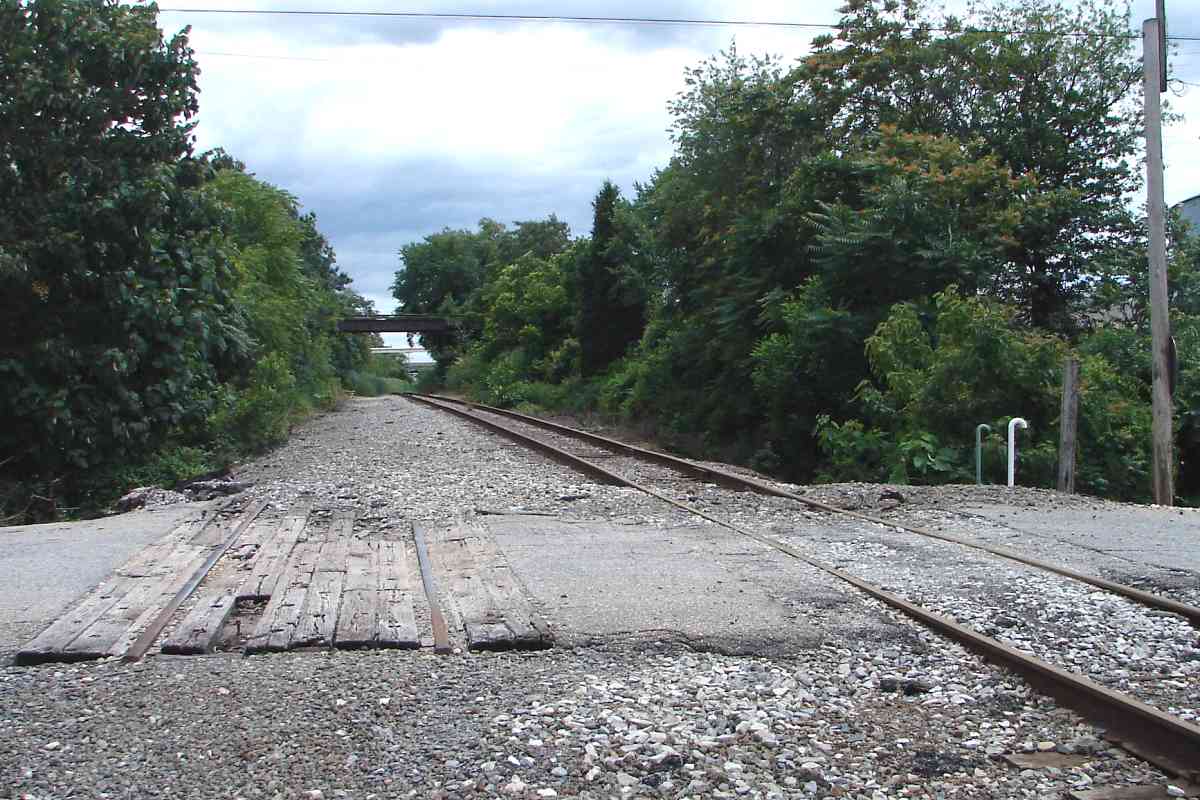
The railfan at the home gloats, "Yeah, but look! I have trains running past my window! Sometimes."


Less Industrial

Less Industrial
Mile: 5.5 Date: Jul 2015
Ease: A- View: W
Area: C IC2:
Map: Ba 43 F 13 Topographic Maps

After two miles of industry, beyond Pennington Avenue the branch finally sees green trees. Note the concrete slabs cater-corner, remnants of the previous grade crossing materials. The trucks crush the pavement into submission in short order.


Cabin Branch Creek

Cabin Branch Creek
Mile: 5.2 Date: Mar 2015
Ease: C View: SE
Area: C IC2:
Map: AA 3 E 6, Ba 43 A 12 Topographic Maps

Thirty vertical feet of fill, the most significant along the branch, were needed to span Cabin Branch Creek. This may not be the original bridge, see below.


Aerial 1927

Aerial 1927
Mile: Date: 1927
Ease: View:
Area: IC2:
Map: AA 3 E 6, Ba 43 A 12 Topographic Maps

This 1927 photo shows a more exposed Cabin Branch bridge at upper left, one not likely to have been concrete.


Double Track

Double Track
Mile: 5.1 Date: Jun 2015
Ease: B View: S
Area: C+ IC2:
Map: AA 3 E 6 Topographic Maps

This grade crossing reveals vestiges of double-track days. More fully erased is a siding that had peeled off to the right into a tank farm, as seen in the 1927 aerial photo above.


Pipeline

Pipeline
Mile: 5.1 Date: Jun 2015
Ease: B View: SE
Area: C+ IC2:
Map: AA 3 E 6 Topographic Maps

It looks like a culvert but it's a pipeline. Adjacent newer pipes dispense with the formality of concrete and simply run under the tracks.


More to Come

More to Come
Mile: 5.2 Date: Mar 2015
Ease: B View: S
Area: C+ IC2:
Map: AA 3 E 6 Topographic Maps

In Part 2 we'll go where Streetview and Streetside vans do not for a look closer at the old bridge ahead, an in-service swing bridge, plus miles worth of other items the Marley Neck Branch has in store, most of which you can't see anywhere else online...


<< Previous (west) | THIS PAGE: Curtis Bay to Cabin Branch | Next (east) >>

Or, return to main page for other tours

Copyright Notice