TrainWeb.org Facebook Page
B&O Photo Tour


B&O Curtis Bay Branch
Modern day photo tour

Accompanying each photo below are:

Click a photo to see a larger view. Please send your comments and corrections to Steve.


<< Previous (west) | THIS PAGE: Cliffords to Curtis Bay | Next (east) >>

Map
Photo courtesy Johns Hopkins University

Map
Mile: Date: (Apr 1964)
Ease: View:
Area: IC2:
Map: Ba 43 Topographic Maps

The Curtis Bay Branch mileposts decline as the route proceeds generally east, the direction of this tour. The zero milepost is at the right edge of this map.


Empties

Empties
Mile: 1.2 Date: Feb 2015
Ease: A- View: E
Area: D IC2:
Map: Ba 43 A 9 Topographic Maps

Just around the bend from the end of Curtis Bay tour page 1, the last of a mile-long train of coal empties rumbles westward past the camera. On a typical day a railfan at this spot can count over 1000 coal cars rolling by. Much of the swampy land here has been set aside as parks; in the distance, nearer than the signals, note the handrail of a bridge where the Patapsco River disgorges into the Chesapeake Bay.


Patapsco River

Patapsco River
Mile: 0.8 Date: Mar 2015
Ease: A View: N
Area: B- IC2:
Map: Ba 43 B 9 Topographic Maps

The biggest obstacle to accessing Curtis Bay was B&O's old nemesis, the Patapsco River; this section was known as Ferry Branch when the railroad arrived in 1882. This is B&O's easternmost crossing of the river, and it was the longest, too, before I-895 landfilled the east bank. More distant than the railroad bridge is the river crossing of Potee Street, which will soon intersect the railroad.


Looking East
Photo courtesy Todd Sestero
NEW! early-Jul 2023

Looking East
Mile: 0.7 Date: 2007
Ease: A- View: E
Area: B- IC2:
Map: Ba 43 C 9 Topographic Maps

Via its Big Green Signs, I-895 becomes visible at Potee Street. CSX had not yet replaced these B&O CPL signals at photo time.

Link: source photo


Potee Street

Potee Street
Mile: 0.6 Date: Mar 2015
Ease: A View: S
Area: B- IC2:
Map: Ba 43 C 9 Topographic Maps

This is not the first B&O bridge at this location: originally a shorter one had spanned a creek, but during the 1920s that creekbed was transformed into Potee Street. Those light rectangular patches hide B&O heralds on this 1953 version of the bridge.


Hanover Street

Hanover Street
Mile: 0.5 Date: Jul 2011
Ease: A View: S
Area: B- IC2:
Map: Ba 43 C 9 Topographic Maps

Hanover Street pre-dates the railroad, and look, we've caught the end of yet another train of coal empties.

The Baltimore and Curtis Bay Railway began streetcar service here on May 28, 1892. The streetcars ran across Long Bridge to Light Street at what is now Ferry Bar Park in Baltimore. The southeast terminal was located at Patapsco and Pennington Avenues.


Signals
NEW! early-Jul 2023

Signals
Mile: 0.2 Date: Mar 2023
Ease: A View: NW
Area: B IC2:
Map: Ba 43 D 9 Topographic Maps

I-895 and the railroad are at the same elevation for a short distance, permitting a view of three-tracks-worth of signals


BX Tower

BX Tower
Mile: 0.2 Date: Jun 2001
Ease: B View: W
Area: B- IC2:
Map: Ba 43 D 9 Topographic Maps

BX (Brooklyn) Tower oversaw the entrance and exit of Curtis Bay Yard. It closed July 16, 1985 and the building deteroriated for the next 25+ years. Some references call this BA Tower.

Link: 1988


Grade Crossing
Photo courtesy Johns Hopkins University

Grade Crossing
Mile: 0.1 Date: Apr 1938
Ease: View: N (up)
Area: IC2:
Map: Ba 43 D 9 Topographic Maps

Prior to the 1950s arrival of the Harbor Tunnel Thruway, Chesapeake Avenue had cut across the tracks here on a diagonal, just east of BX Tower. By 1948 then-new Frankfurst Avenue, which stayed on the north side of the tracks, became the main drag and the grade crossing was deemphasized.


BX Razed

BX Razed
Mile: 0.1 Date: Feb 2015
Ease: A View: SW
Area: B- IC2:
Map: Ba 43 D 9 Topographic Maps

A bleak, frigid winter day looks all the more bleak without BX Tower: CSX razed it during 2014. That raze and raise sound alike but mean the opposite is one of the wonders of the English language.


End OS

End OS
Mile: 0.1 Date: Feb 2015
Ease: B View: W
Area: B- IC2:
Map: Ba 43 D 9 Topographic Maps

No, this is not the work of the Microsoft Windows Support Team, nor Emerald City haters.

Begin OS and End OS signs mark a stretch of track in which a train operator can punch in a code to electrically operate a PAS (power assisted switch) between the signs. As you may guess, in the past switches were operated manually and mechanically, sometimes remotely from a tower where to alter a particular switch an employee would yank on one lever from a long row. For CSX, OS means "On Switch".


LED Signal

LED Signal
Mile: 0.1 Date: Feb 2015
Ease: B- View: SW
Area: B- IC2:
Map: Ba 43 D 9 Topographic Maps

This LED signal, emitting piercing green (and amber and red) photons, exhibits a design not found elsewhere in the region suggesting its installation may be for trial purposes.


Curtis Bay Yard

Curtis Bay Yard
Mile: 0.0 Date: Feb 2015
Ease: B View: E
Area: B- IC2:
Map: Ba 43 D 9 Topographic Maps

Opposite the LED signal the tracks do math: they divide and multiply their way to Curtis Bay Yard. The distant bridge carries I-895, the Harbor Tunnel Thruway, over the western neck of the yard. Because the bridge towers over most everything in the vicinity it makes a good reference point for photos below.

We have reached what the railroad considers the start of the Curtis Bay Branch (we've been touring the opposite direction, eastward from the main at Zepp's Bridge). From here east CSX calls it Curtis Bay Yard plus the Marley Neck Industrial Track. If this is confusing, don't worry since the branch start and end points are not terribly important for tour purposes.


From I-895
NEW! early-Jul 2023

From I-895
Mile: -0.1 Date: Nov 2022
Ease: A View: NW
Area: B IC2:
Map: Ba 43 D 9 Topographic Maps

CSX 5412 and family are partially visible from westbound I-895. The Baltimore stack more readily seen from I-95 at I-395 can be found above photo center.


I-895

I-895
Mile: -0.2 Date: Jun 2011
Ease: A View: W
Area: B IC2:
Map: Ba 43 E 9 Topographic Maps

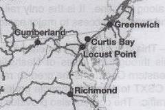
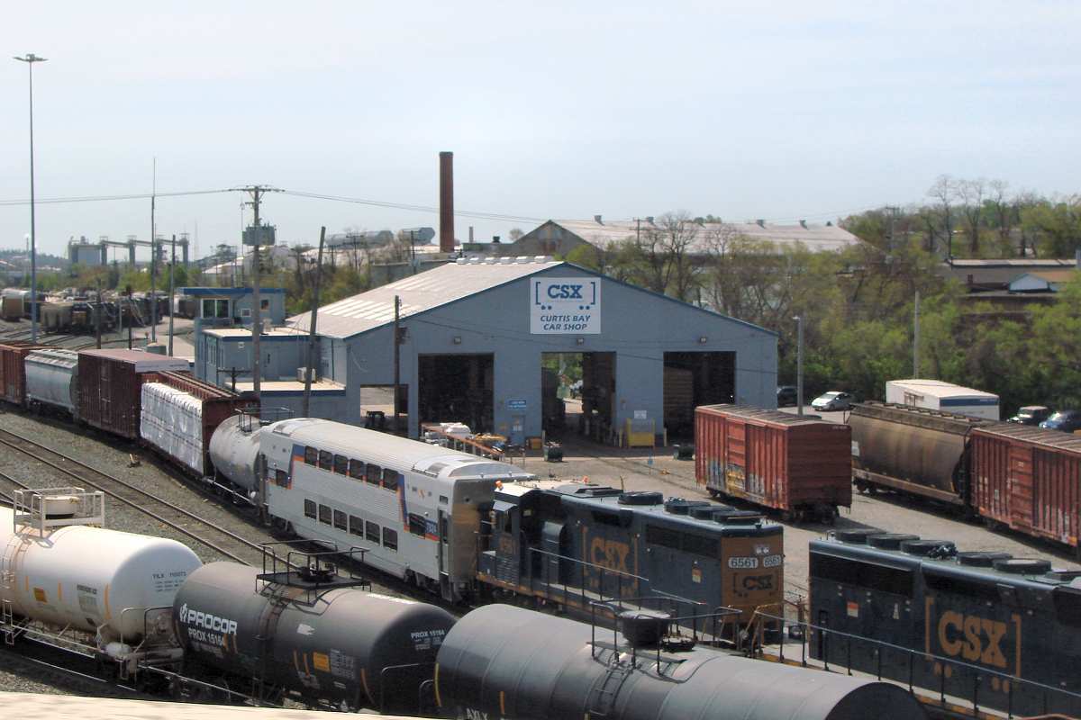
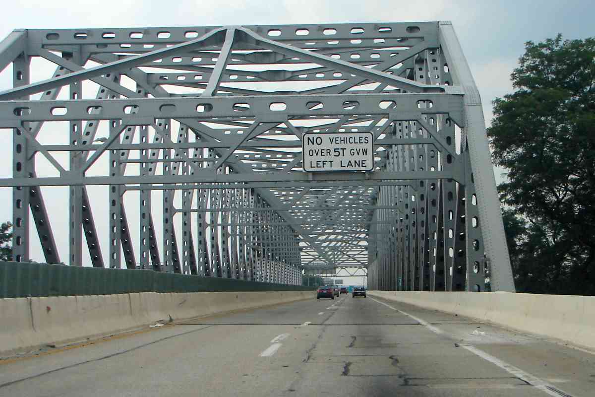
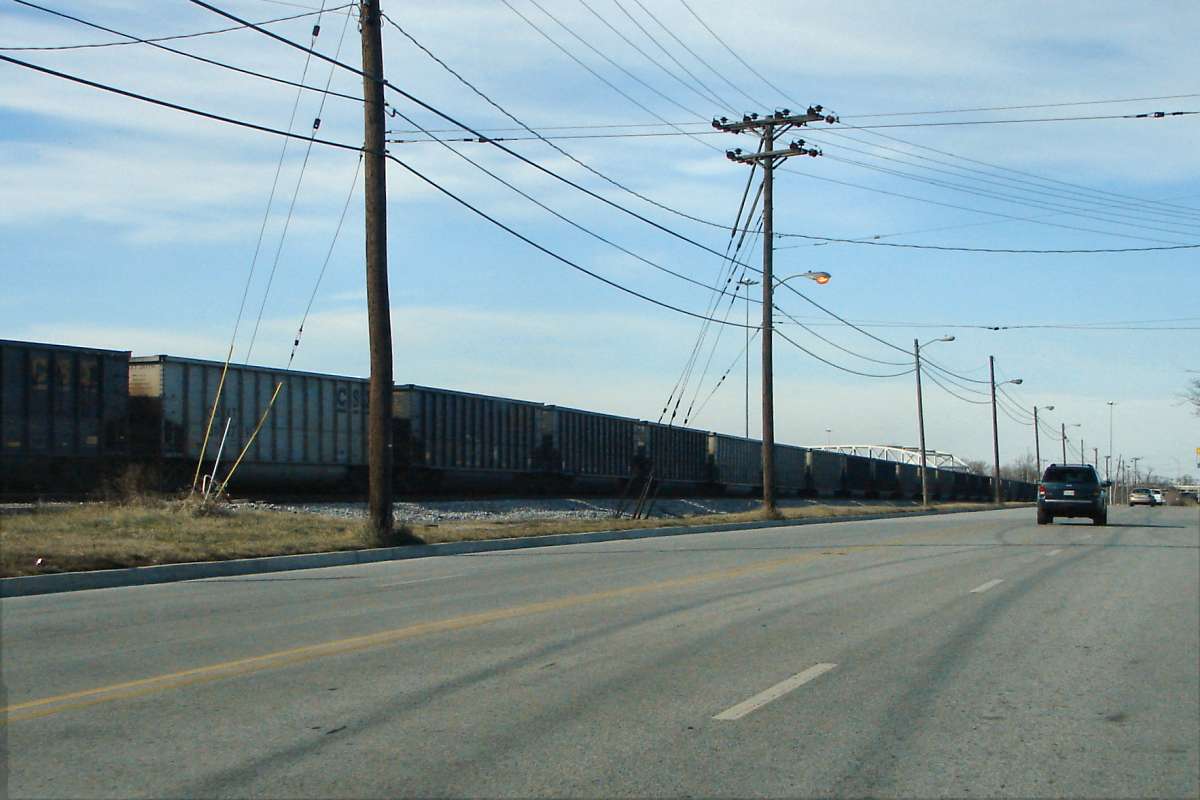
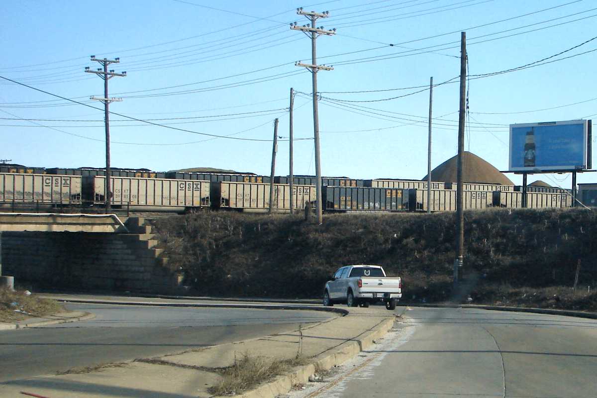
Efforts to see railroad action from the I-895 bridge are poor westbound, and marginal eastbound, instead one needs to navigate and explore via the local roads. It's cheaper, too, since there's no way to cross this span without paying the Harbor Tunnel toll, $4 each way as of 2015, ten times what it was when the Harbor Tunnel Thruway opened Thanksgiving Weekend 1957. Yes, the opening was 72 hours too late to handle the pre-turkey day travel crunch.

The $4 toll is roughly in line with inflation since 1957, however the bonds that paid for tunnel construction should have been fully repaid years ago. Now where is that money going?

I-895 is chronically underutilized due to the toll and due to the intentional lack of exit ramps, a design that perhaps made sense in 1950, but that is now outdated. Meanwhile, the nearby I-695 Beltway is routinely overloaded, and its interchange with I-95 difficult. An entry ramp from I-695's inner loop to westbound I-895 south of Hollins Ferry Road would ease that congestion. Also inexpensive since no elevated roadway is needed would be exit ramps from eastbound I-895 to Hammonds Ferry Road as well as to eastbound Patapsco Avenue.


Glimpse
Updated early-Jul 2023

Glimpse
Mile: -0.2 Date: Apr 2022
Ease: A View: SE
Area: B IC2:
Map: Ba 43 E 9 Topographic Maps

Eastbound you can glimpse Curtis Bay Yard between onrushing girders. One does not often see a CSX engine adjacent a MARC car.

Before the railroad expanded and I-895 barged through, this was the site of the town of Masonville. The town name still appears on some road signage.


Map East
Photo courtesy Johns Hopkins University

Map East
Mile: Date: (Apr 1964)
Ease: View:
Area: IC2:
Map: Ba 43 Topographic Maps

This map covers the yards served by the Curtis Bay Branch. Note the aerial photo is from the 1960s and therefore does not reflect changes since that time.


Car Shop

Car Shop
Mile: -0.4 Date: Jan 2015
Ease: A- View: N
Area: B- IC2:
Map: Ba 43 E 9 Topographic Maps

For those who want to purchase authentic CSX-brand merch, CSX has a shop. Well, not exactly since this is repair shop. A tiny sliver of the I-895 bridge appears at photo left edge.

Before B&O expanded the yards during the early 1950s, Chesapeake Avenue had connected through under the tracks here. The shop dates to the mid-1960s.

Links: 1947 "tunnel" pic, 1966 inside


Waiting

Waiting
Mile: -0.4 Date: Jan 2015
Ease: A- View: E
Area: C+ IC2:
Map: Ba 43 E 9 Topographic Maps

Waiting to see the car shop doctor...


Blue Safety

Blue Safety
Mile: -0.4 Date: Jan 2015
Ease: A View: N
Area: B- IC2:
Map: Ba 43 E 9 Topographic Maps

The various signs near the car shop display:

  • Entering Hard Hat Area Do Not Go Outside of Green Area Without Hard Hat
  • CSX Transportation Property - No Parking - Violators Towed At Owners Expense
  • Brake Stick Use is Mandatory
  • High 5 - Briefing Fouling Shoving Switching Securing - Baltimore Division
Eveything is color coordinated to CSX (and Freemason) blue and gold, the blue inherited from B&O. Many of B&O's earliest organizers were Freemasons.


Grade Crossing

Grade Crossing
Mile: -0.4 Date: Jun 2001
Ease: B- View: NW
Area: B- IC2:
Map: Ba 43 F 9 Topographic Maps

Now we're on the other (east) side of the yard. By now you recognize the I-895 bridge, but less obvious at the left edge is the slanting roof of CSX's Car Shop seen earlier.

The tracks crossing Shell Road at grade lead to Seawall Yard and port docks off to the right. This is the busiest grade crossing in the Curtis Bay area.

Detour: Seawall Branch


Hogs

Hogs
Mile: -0.4 Date: Apr 2015
Ease: B- View: S
Area: B- IC2:
Map: Ba 43 F 9 Topographic Maps

Like hogs bound for the slaughterhouse, at the southern end of the yard coal cars are herded toward the pier. The coal is either transfered directly to ships or distributed via the distant towers for temporary open-air storage in huge mounds.

Curtis Bay is CSX's largest yard in the area. It's difficult to get a feel for the size because there are so few high spots from which to view it. This photo, like the previous, is from a ramp from Shell Road to I-895, an awkward spot to reach on foot and not a recommended railfanning location.


Shell Road

Shell Road
Mile: -0.7 Date: Jan 2015
Ease: A View: NW
Area: B- IC2:
Map: Ba 43 F 10 Topographic Maps

Back at track level, Shell Road parallels the yard's east side. The tracks closest to the camera are the main ones to the coal pier which in this view is behind us. This is the last we'll see of our reference I-895 bridge, now more distant.

Shell Road is likely named for the oil company. Many petroleum companies have distribution facilities at neighboring Fairfield and Wagners Point, among them Sunoco, Kinder Morgan, and Colonial.


Patapsco Avenue

Patapsco Avenue
Mile: -1.0 Date: Jan 2015
Ease: A View: E
Area: B- IC2:
Map: Ba 43 F 10 Topographic Maps

For the bottleneck of three Patapsco Avenue bridges, the yard's 50+ tracks trim down to seven. In this view, the yard is on the left, the piers on the right.

Link: 1947


North Entrance

North Entrance
Mile: -1.2 Date: Jan 2015
Ease: A View: S
Area: B- IC2:
Map: Ba 43 G 11 Topographic Maps

CSX 4601 CSX 4601 is the poster boy for safety at Curtis Bay Piers, which is ironic since this ex-Conrail unit was battered in an accident, or perhaps as iconoclastically as the Great Sphinx.

Different methods are used to transfer of coal from rails to ships depending on whether ships are being loaded directly or the coal is being held at the pier awaiting the next ship. Most ships that depart here are bound for Europe, but some make a trip through the Suez Canal to Pacific Ocean border countries.


Welcome

Welcome
Mile: -1.2 Date: Jan 2015
Ease: A- View: S
Area: B IC2:
Map: Ba 43 G 11 Topographic Maps

CSX birdhouse This sign welcomes visitors to the "safest and most evironmentally friendly terminal". It's not clear how those superlatives are measured, but 470 work safe days (in a row?) sounds good. Signs like these seem at odds with the demands of a job, for example, there's always some sort of deadline encouraging faster work, which usually forces cutting corners and doing things less safely.

Opposite the sign is this CSX purple martin birdhouse. Perhaps houses for bluebirds and goldfinches would better fit the corporate colors, but it's a start. The marshes of Stonehouse Cove teem behind the birdhouse.


Dumper

Dumper
Mile: -1.3 Date: Jan 2015
Ease: B View: S
Area: B IC2:
Map: Ba 43 G 11 Topographic Maps

This dumper turns full coal cars and spills their contents onto a conveyor that whisks the coal directly to a waiting ship. During cold weather residual water can freeze the coal into the car, necessitating thawing by steam or radiant heat.

Link: view into dumper


Resting

Resting
Mile: -1.3 Date: Apr 2015
Ease: B View: W
Area: B- IC2:
Map: Ba 43 H 11 Topographic Maps

It's not spring that has made the dumper more colorful, instead it's merely the lack of glare when viewed from the east side of Stonehouse Cove.

During the first half of the 20th century, beyond the dumper on the right had been the Maryland Car Wheel Works, provider of railcar wheels to the B&O and other railroads in the area.


Cranes

Cranes
Mile: -1.3 Date: Jan 2015
Ease: B View: S
Area: B IC2:
Map: Ba 43 G 11 Topographic Maps

When active, these cranes can scoop up coal left by previous trains and give it a ride onto a ship.


Loading

Loading
Mile: -1.3 Date: Apr 2015
Ease: B View: S
Area: B- IC2:
Map: Ba 43 H 11 Topographic Maps
coal pouring

Depending on the cargo ship, different sets of cranes and conveyors are employed to transport the export coal the final leg of its journey for its first bon voyage.

The closeup at right shows coal pouring from the conveyor into the ship's hold.

Links: 1951, 1952


Damage
Photo courtesy Baltimore Sun
NEW! early-Jul 2023

Damage
Mile: -1.5 Date: Dec 2021
Ease: View: SE
Area: IC2:
Map: Ba 43 G 12 Topographic Maps

Methane buildup led to an explosion at one of the coal transfer towers during 2021.

Link: source photo


South Entrance

South Entrance
Mile: -1.8 Date: Jan 2015
Ease: A View: NE
Area: C+ IC2:
Map: Ba 43 G 12 Topographic Maps

Curtis Bay Piers sign 
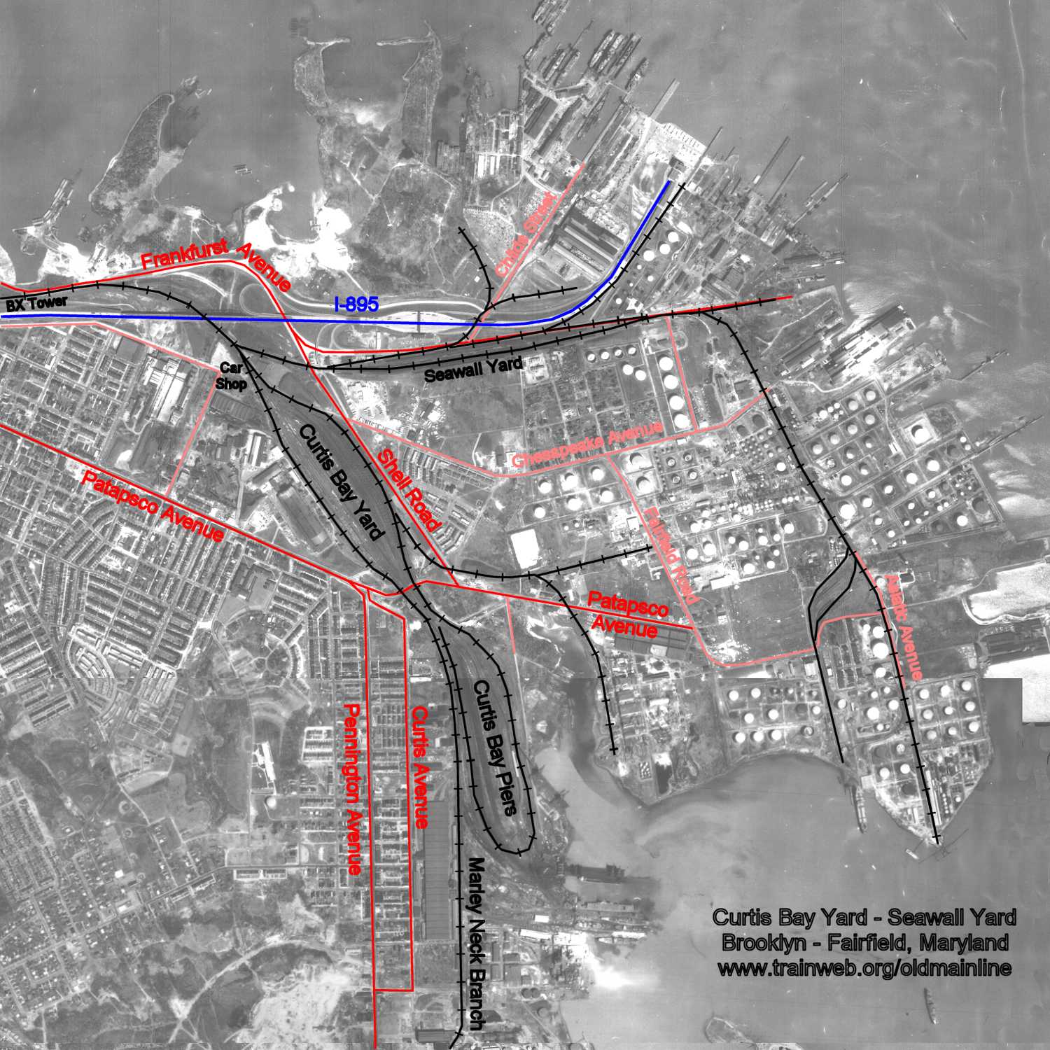
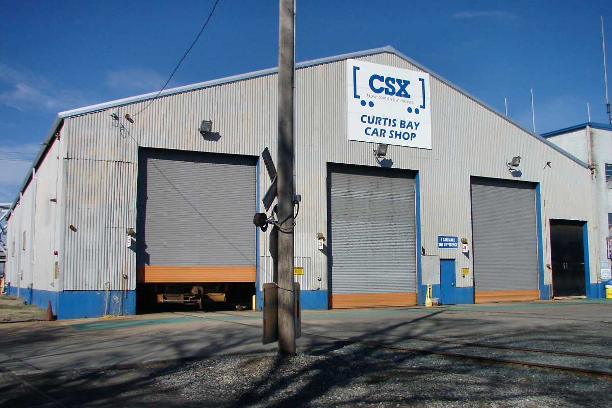
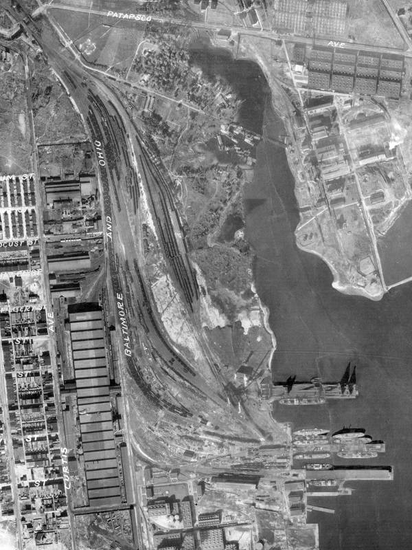
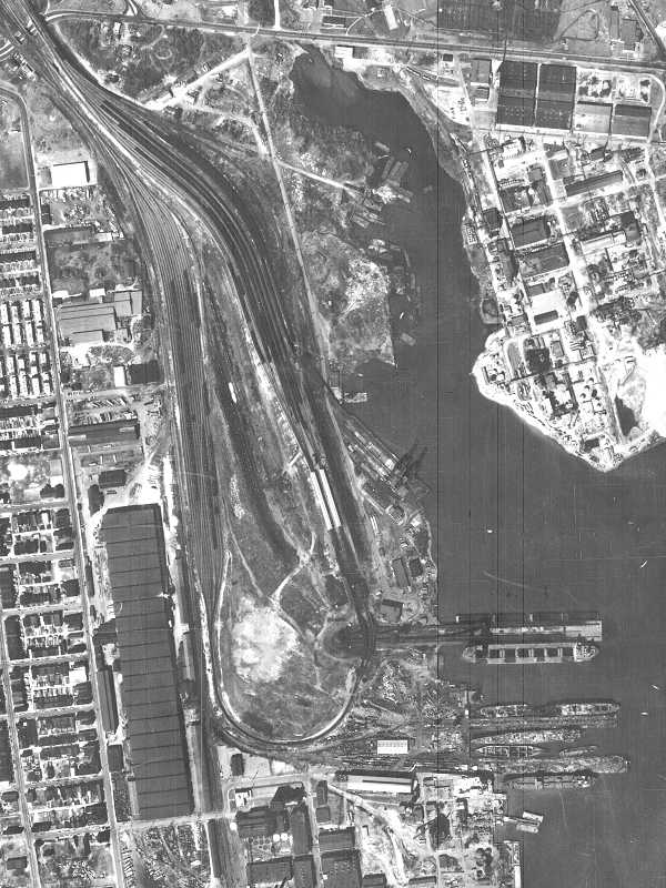
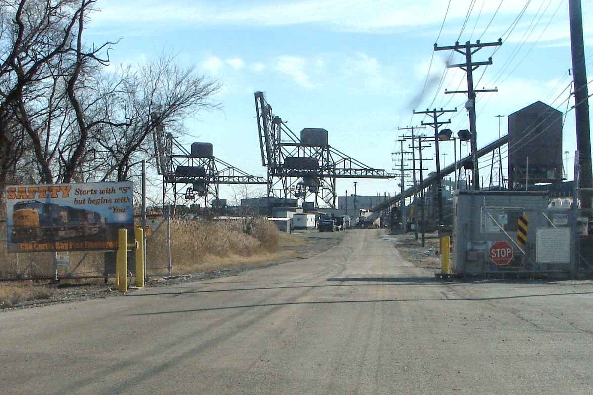
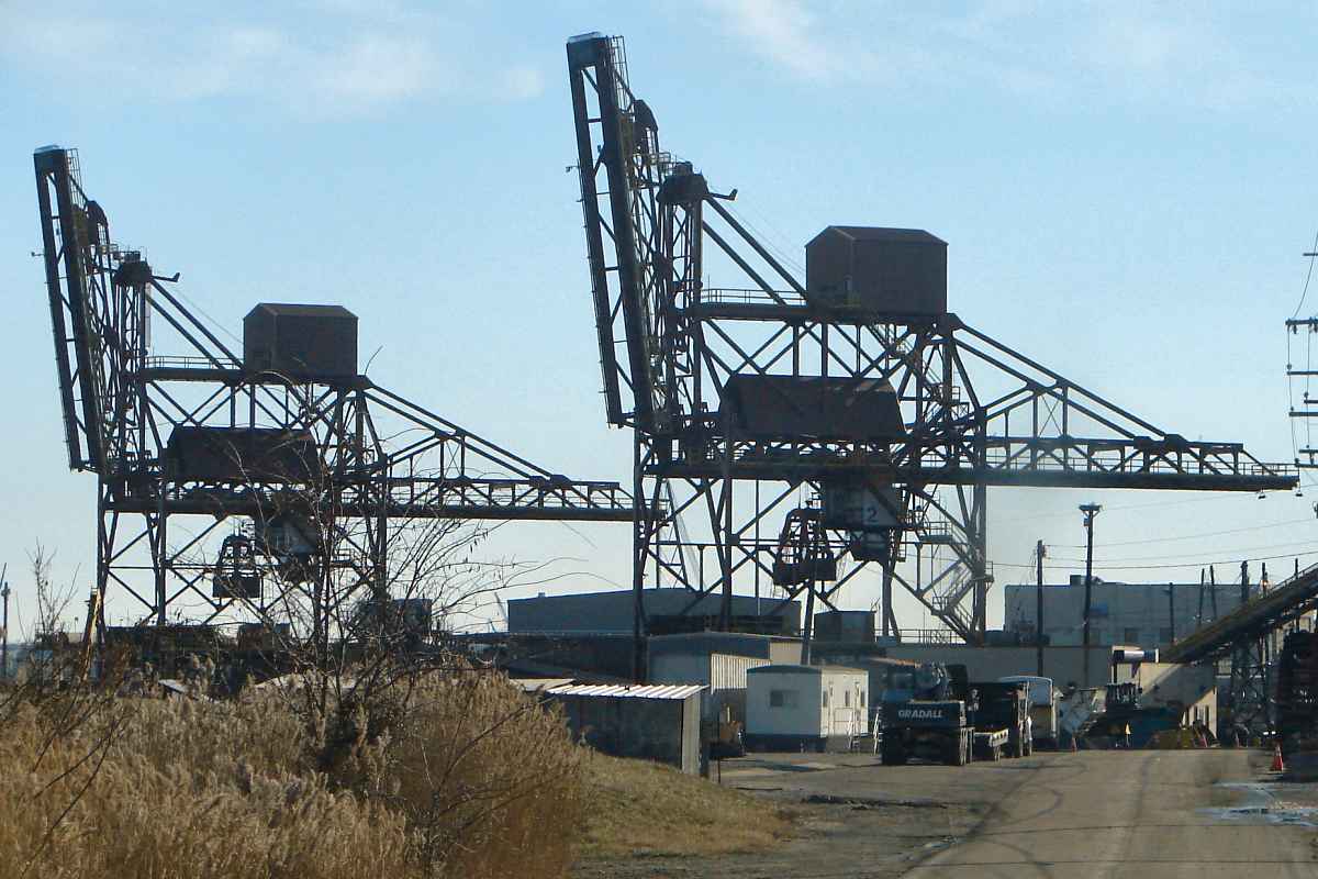
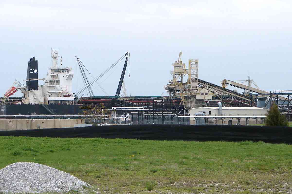
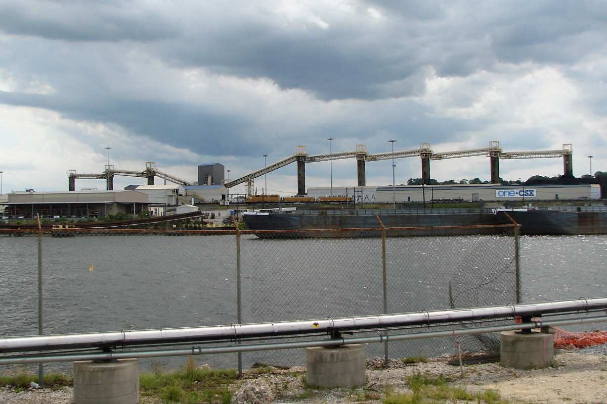
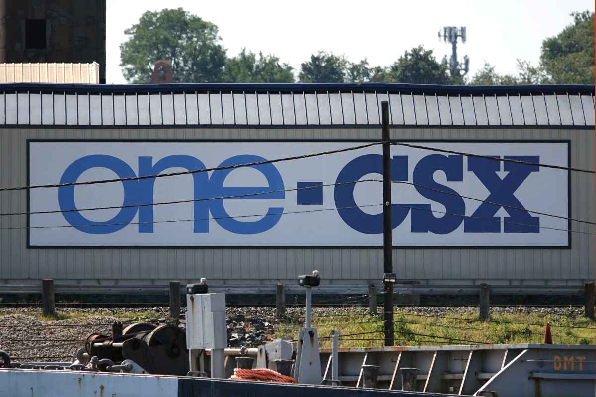
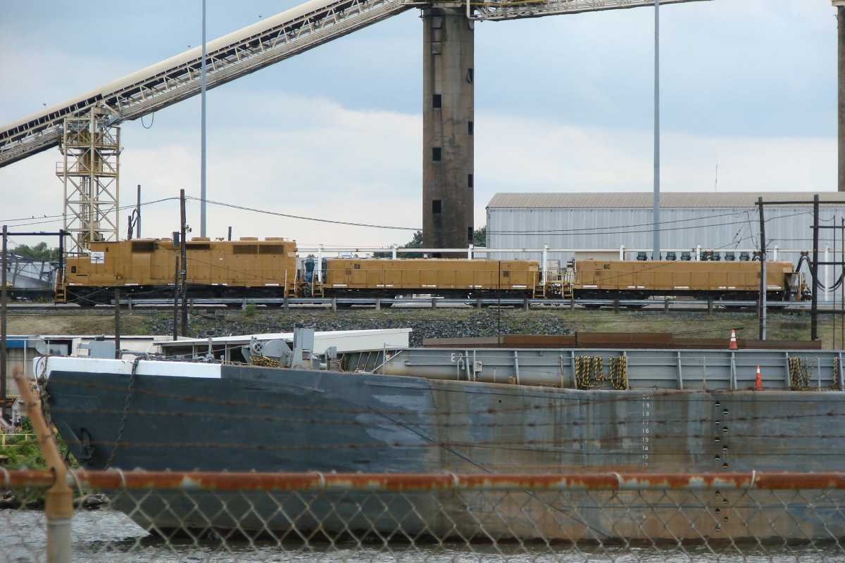
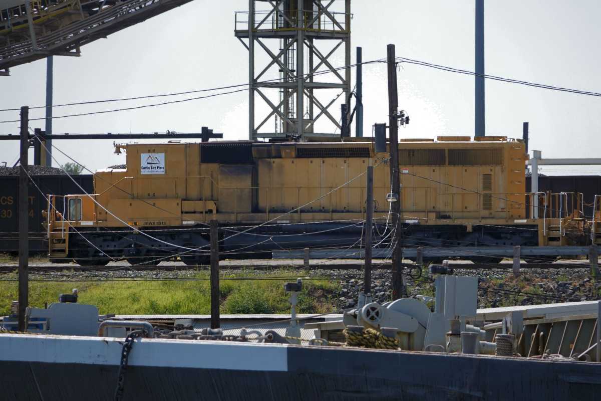
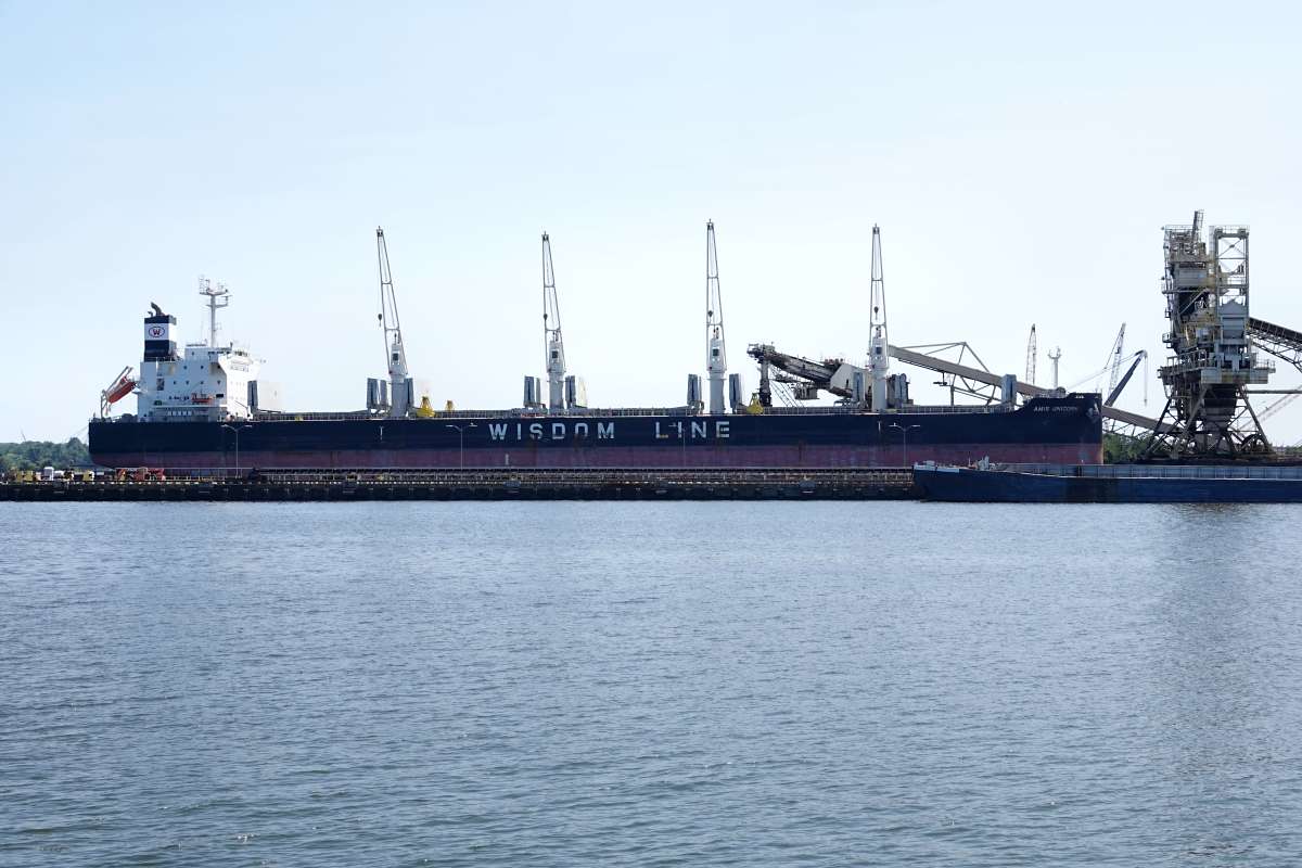
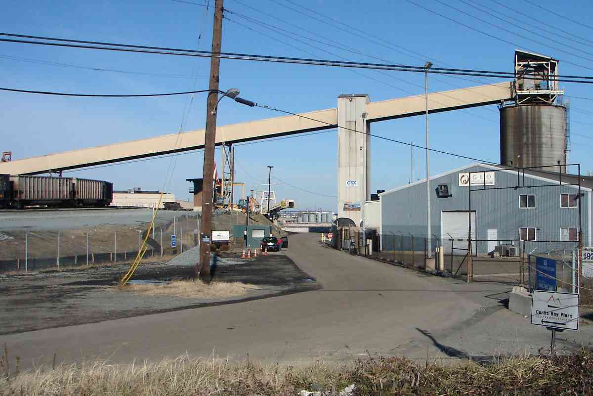
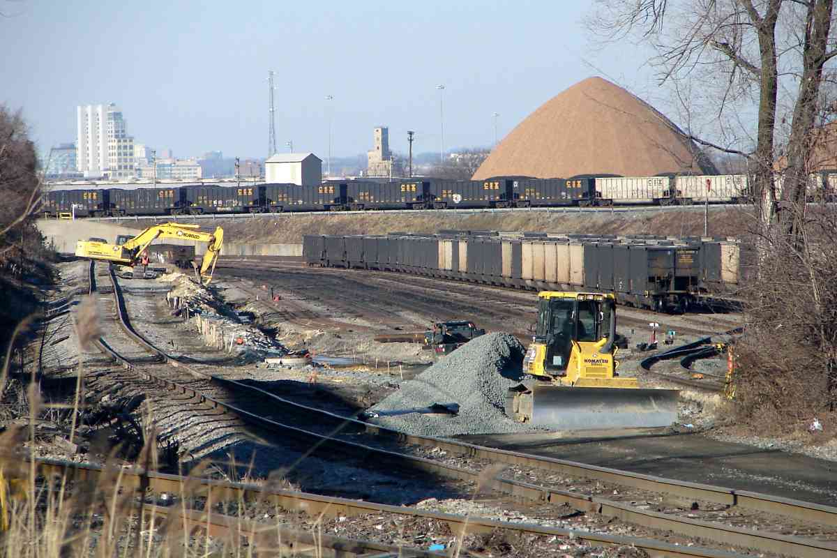
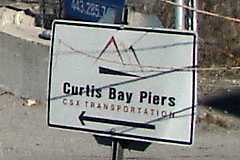
The Piers are a large operation, so large that looking back from the public streets near the South Entrance we find nothing that had been visible from the North. The facility, where the tracks form a large loop that trains travel clockwise, is the better part of a mile in length. The loop dates to the late 1960s.

The Curtis Bay Piers logo includes mountain shapes, which is quite appropriate...


Coal Mountain

Coal Mountain
Mile: -1.8 Date: Jan 2015
Ease: A View: N
Area: C+ IC2:
Map: Ba 43 G 12 Topographic Maps

... since CSX can make mountains out of coal hills. *rimshot*

When after World War II people opted to travel by auto rather than train, coal became a relatively more important rail customer. C&O was better positioned than B&O in coal country, and consequently was in better financial shape when the two (plus WM) were combined into Chessie System during 1973.

Link: yard slugs 2014


Coal Tower

Coal Tower
Mile: -1.8 Date: Jan 2015
Ease: A View: N
Area: C+ IC2:
Map: Ba 43 G 12 Topographic Maps

coal closeup The coal cars in the foreground had been recently emptied. Unseen on the right others were being emptied, one by one, then added onto the string of empties such that the ones here would make room by rolling to the left, pausing, then rolling again, about two car-lengths per minute.

Freshly dumped coal is conveyed to the top of these towers where it is poured so as to flow by gravity out the windows scattered in the concrete columns. The 8 such towers at this facility were built during the 1970s.


Emptied

Emptied
Mile: -1.9 Date: Jan 2015
Ease: A View: N
Area: C+ IC2:
Map: Ba 43 G 12 Topographic Maps

North and west of the coal mountain emptied cars huddle in return areas before they can bum a lift back into the Appalachians. coal closeup

The buildings over 3 miles distant at upper left are the same silos-to-condos seen in the Locust Point Tour. Locust Point has faded for railroad purposes, and even CSX gets confused, for years depicting it in their Annual Report (right) as south of Curtis Bay whereas actually the reverse is true. Someone noticed this mention because CSX corrected the map in their 2016-published report.

The track in the foreground skirts the pier entirely because it is headed south (behind us) for Marley Neck and Hawkins Point, a tour of which is linked below.


<< Previous (west) | THIS PAGE: Cliffords to Curtis Bay | Next, Marley Neck Branch tour (east) >>

For more, see Todd's Railfan Guide of South Baltimore.

Return to main page for other tours

Copyright Notice