TrainWeb.org Facebook Page
Old Main Line Photo Tour


B&O Old Main Line
Modern day photo tour

Accompanying each photo below are:

Click a photo to see a larger view. Please send your comments and corrections to Steve.


<< Previous (east) | THIS PAGE: Woodstock | Next (orignal) >>

Tranquil
NEW! early-Sep 2025

Tranquil
Mile: 21.2 Date: Jan 2003
Ease: C View: NW
Area: A IC2:
Map: Ba 31 F 6, Ho 6 G 12 Topographic Maps

The Patapsco River presents a tranquil scene toward sunset. The narrowness of the valley permits the Old Main Line (left) to be perched well above the river. Six miles upstream, the valley opens and the railroad is forced closer to water level, something that became a problem during 1972's floods.


Box Culvert
NEW! early-Sep 2025

Box Culvert
Mile: 21.3 Date: Nov 2015
Ease: C View: N
Area: A IC2:
Map: Ho 6 G 11 Topographic Maps

Some stones look dry fit while others give the appearance of deteriorated mortar. This culvert exhibits an uncommon masonry style, thus I am unsure what period it dates from.


Woodstock Road

Woodstock Road
Mile: 21.7 Date: Nov 2015
Ease: A- View: W
Area: A IC2:
Map: Ho 6 F 11 Topographic Maps

We arrive at Woodstock Road, the first grade crossing in about five track miles. A B&O station once stood at photo center.


Aerial 1937
Photo courtesy Johns Hopkins University

Aerial 1937
Mile: 21.7 Date: Dec 1937
Ease: View: N (up)
Area: IC2:
Map: Ho 6 F 11 Topographic Maps

This 1937 aerial shows Woodstock Road curving sharply to the west (upstream) to reach its bridge across the Patapsco River. The largest building below photo center had housed the general store and post office. To its west (left) stood B&O's Woodstock Station.

About 1980, the largest building made way for a new Woodstock Road alignment. A new Woodstock Road bridge opened downstream of the old in 1982; it is still extant as of 2025.

Link: 1898 view SE toward railroad


Woodstock Station
Photo credit Charles Francis Peach, Jr.

Woodstock Station
Mile: 21.8 Date: ~1910
Ease: A View: SW
Area: A IC2: 132, 296
Map: Ho 6 F 11 Topographic Maps

At the time of this photo, the photographer was standing at the original Woodstock Road grade crossing.

Woodstock's was a surprisingly large station before a fire during the 1940s claimed it; the ruins are not present in an August 1952 set of aerials. Photos that Historicaerials.com date to 1957 show some type of structure at the site.

The 1884 Baldwin-designed station resembled the version that survives at Sykesville, which will be seen later in the tour.

Link: corrected 1949 image from BCPL


Woodstock

Woodstock
Mile: 21.8 Date: Jul 2000
Ease: A View: NE
Area: A IC2: 296
Map: Ho 6 F 11 Topographic Maps

CSX was performing track maintenance during the summer of 2000, hence the ties and supplies stacked here. The cans held nails. The supplies are roughly at the site of B&O's Woodstock Station.

The previous Woodstock Road alignment turned west to pass behind (south of) the station, then turned north and descended to a bridge located about 500 feet upstream of the present-day span.


Woodstock Signals

Woodstock Signals
Mile: 21.8 Date: Jun 2005
Ease: A View: W
Area: A IC2: 296
Map: Ho 6 F 11 Topographic Maps

These signals were new at the time of the photo.


Woodstock Signals 2025
NEW! early-Sep 2025

Woodstock Signals 2025
Mile: 21.8 Date: Feb 2025
Ease: A View: W
Area: A IC2: 296
Map: Ho 6 F 11 Topographic Maps

These signals are approach activated, which means if they are lit, a train is in the vicinity. Except in this case, no train arrived. I am unsure of the purpose of the concrete blocks.


Woodstock Road

Woodstock Road
Mile: 21.8 Date: May 2002
Ease: B View: S
Area: A IC2:
Map: Ba 31 D 5, Ho 6 E 11 Topographic Maps

These bridge remains just west of Woodstock look like they might have been for a railroad spur, but they are actually part of the former Woodstock Road bridge.

Reader Dave Bittner shared some memories:

    "I want to comment on the Woodstock Road entry, where you are showing the stone remains of the old bridge supports. I grew up in Howard County, and as a kid in the 70s we used to travel to Granite regularly to visit my grandfather. I'm guessing it was the mid 70s, and the old bridge had been washed away by Hurricane Agnes. You could still see the twisted remains of the bridge in the river, as I recall, and there was a single lane temporary military style bridge crossing the river. I remember being scared of crossing that bridge, with the thunking of the wood deck under our car as we passed, and that it was a strictly one car at a time bridge."

The view above looks across the river from the Baltimore county side while the small, old picture at the site linked below looks toward the Baltimore county side.

Link: Granite Historical Society


West End Davis

West End Davis
Mile: 22.0 Date: Oct 2011
Ease: B View: E
Area: A IC2:
Map: Ho 6 E 11 Topographic Maps

Looking back to Woodstock shows the west end of the two-mile-long siding that began west of Davis Tunnel; the railroad calls this location W.E. Davis (West End Davis) or simply West Davis.

If these tracks appear perched on a shelf, it is because they are. The original alignment had swung to the right, farther from the river.


Bridge 22

Bridge 22
Mile: 22.2 Date: Oct 2011
Ease: B- View: E
Area: A IC2:
Map: Ho 6 E 11 Topographic Maps

A short distance west of Woodstock is where you can find this substantial arched stone bridge. The mortarless construction had fooled me into thinking this was a circa-1830 original, however... see the next photo.


Former
Photo courtesy Dave Hiteshew

Former
Mile: 22.2 Date: Nov 2014
Ease: B- View: E
Area: A IC2:
Map: Ho 6 E 11 Topographic Maps

These crumbling remains suggest this had been the original bridge. By rebuilding closer to the river, B&O eased the curve here. I estimate the work was done about 1838 with other similar realignment efforts in this vicinity.

An old B&O train schedule says the "Maryland Spar and Flint Company" was once located near here, but I could find no remaining evidence of it, unless these stones represent a siding. I doubt that is the case, however, since sidings are usually placed where they do not require construction of a separate bridge.


Track Maintenance

Track Maintenance
Mile: 22.3 Date: Jul 2000
Ease: B- View: S
Area: A IC2:
Map: Ho 6 E 10 Topographic Maps

The ballast tamper stops here! If you look closely, you can see evidence of recent CSX track maintenance here. The ballast is correctly tamped into place In the foreground (you can see the ties). A little farther in the distance, the ballast is scattered over the ties. This is where the ballast tamper machine stopped. Farther ahead, new ballast is heaped in the middle of the track, where it has been dumped awaiting tamping.

Thanks to the nearby river and quiet of the Patapsco State Park, this is an excellent area for those who are into bird watching as well as train watching.


Sinkhole

Sinkhole
Mile: 22.4 Date: Oct 2011
Ease: B- View: SE
Area: A IC2:
Map: Ho 6 D 10 Topographic Maps

Part of a culvert below has collapsed allowing fill and ballast to funnel down. I suspect CSX put a priority repair tag on this before it could expand and undermine the rails. There are about 10 stone culverts and bridges within the 2.5 mile stretch between Woodstock and Marriottsville.


CSX 895

CSX 895
Mile: 22.5 Date: Jun 2019
Ease: B- View: NW
Area: A IC2:
Map: Ho 6 D 10 Topographic Maps

Coal pushes CSX 895 and CSX 3078 downhill through lush Patapsco Valley State Park late-spring greenery.


Pick Up Sticks
NEW! early-Sep 2025

Pick Up Sticks
Mile: 22.9 Date: May 2005
Ease: C View: NE
Area: A IC2:
Map: Ho 6 D 9 Topographic Maps

Culverts and small bridges abound between Woodstock and Marriottsville, only a few of which are depicted in this tour. It appears B&O regraded the track significantly higher compared to the original because many culverts are topped by repurposed crossties that bulwark the mounded ballast. In this case, however, those ties gave way and splintered down to the culvert's inlet.


Small Arch

Small Arch
Mile: 23.2 Date: Jun 2000
Ease: C View: W
Area: A IC2:
Map: Ho 6 D 8 Topographic Maps

Here's a closeup of a smaller arched bridge, this one located just downstream of the forks of the Patapsco. The sharply hewn stones and lack of mortar point to original circa-1830 construction.


CSX 501

CSX 501
Mile: 23.2 Date: Jun 2019
Ease: B- View: N
Area: A IC2:
Map: Ho 6 D 8 Topographic Maps

This time, instead of coal, it's automobiles headed downhill.


Ziggurat
Photo courtesy Dave Hiteshew
Updated early-Sep 2025

Ziggurat
Mile: 23.3 Date: Nov 2006
Ease: C View: SW
Area: A IC2:
Map: Ho 6 D 8 Topographic Maps

ziggurat inlet Jun 2019 Ziggurat is the name that pops into my mind when I see this interesting stepped culvert discovered by Dave Hiteshew and his dad. To my knowledge, this is the only example along the OML of a culvert design with the opening up high plus stones to guide the water downhill.

The input end (right), which looks like a standard box culvert, can be a challenge to find.


Bridge 23

Bridge 23
Mile: 23.6 Date: May 2005
Ease: C+ View: W
Area: A IC2:
Map: Ho 6 C 8 Topographic Maps

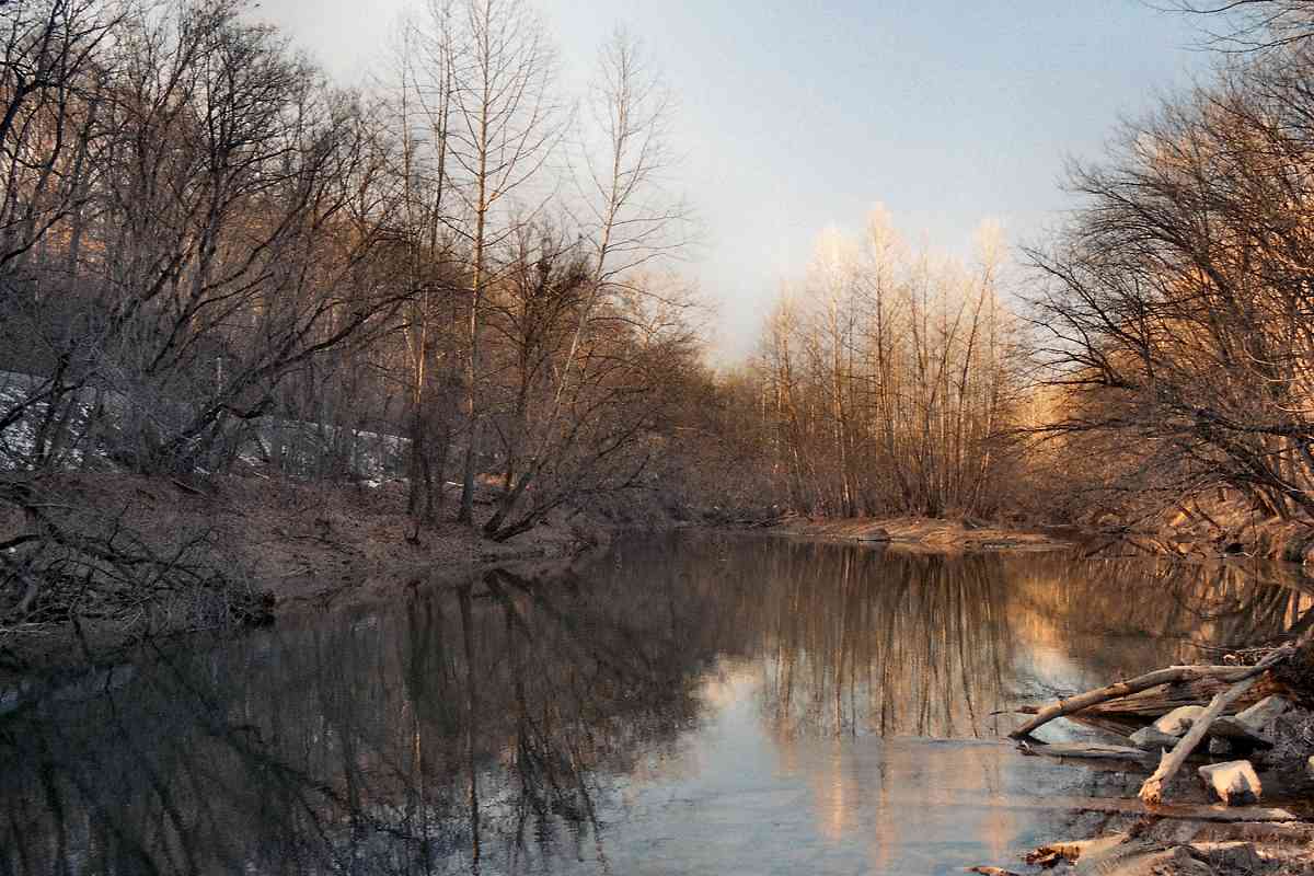
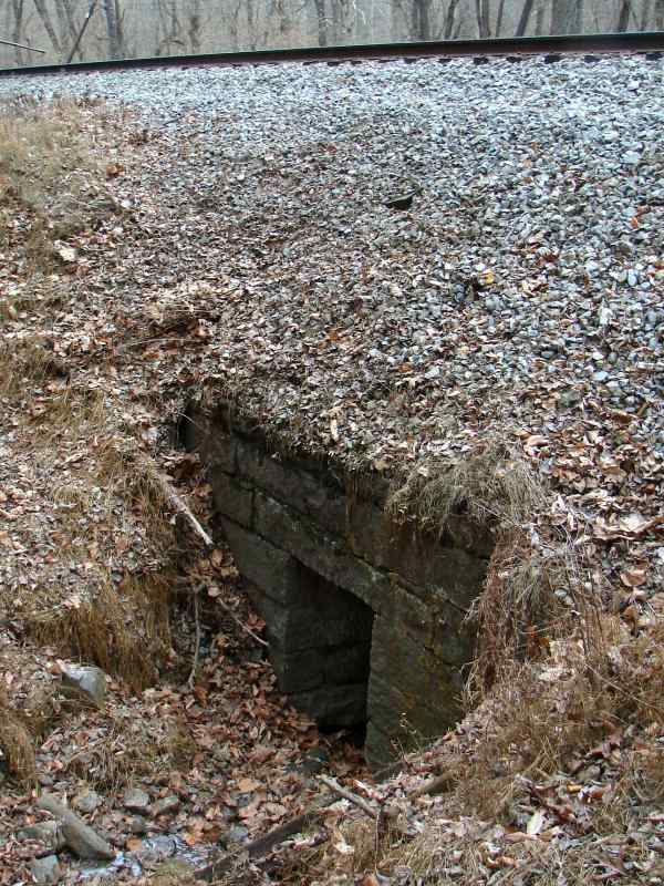
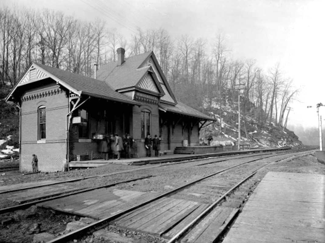
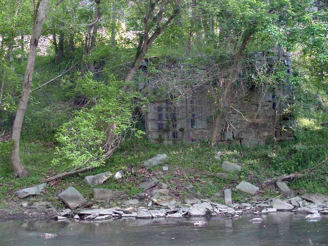
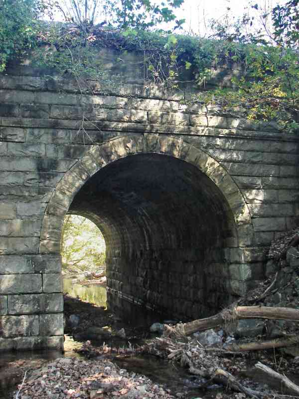
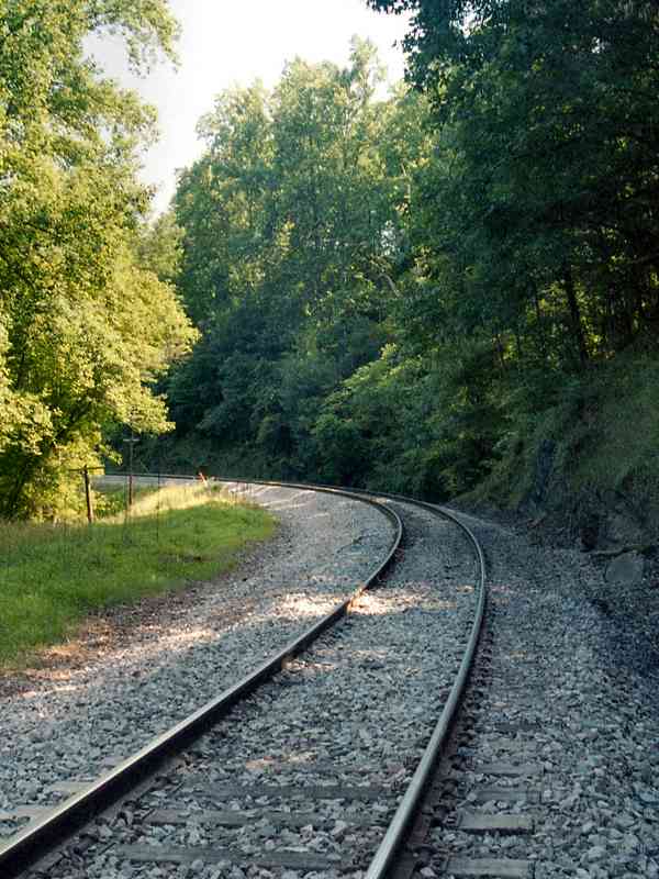
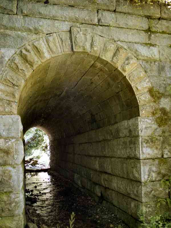
The segment between Woodstock and Marriottsville has plenty of attractions for the arched bridge fan. This third one is unusual in that it sits deep in a pond on the downstream side. The tracks can be seen above.

In his book The Great Road, author James Dilts tells how the Irish laborers, who around 1830 were building the track in this area, went on a rampage when their pay was delayed yet again. In one night, they managed to destroy all the track they had built from here to Sykesville, some five miles west. In what was the first troop transport by train for military purposes, the Baltimore militia was called out on that rainy night, and slogged the last five miles to Sykesville on foot to quell the riot. In the end, B&O paid the workers for both their initial 10-months of work, as well as the cost of rebuilding the destroyed mileage.
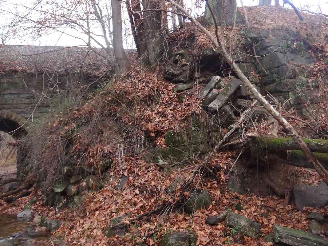
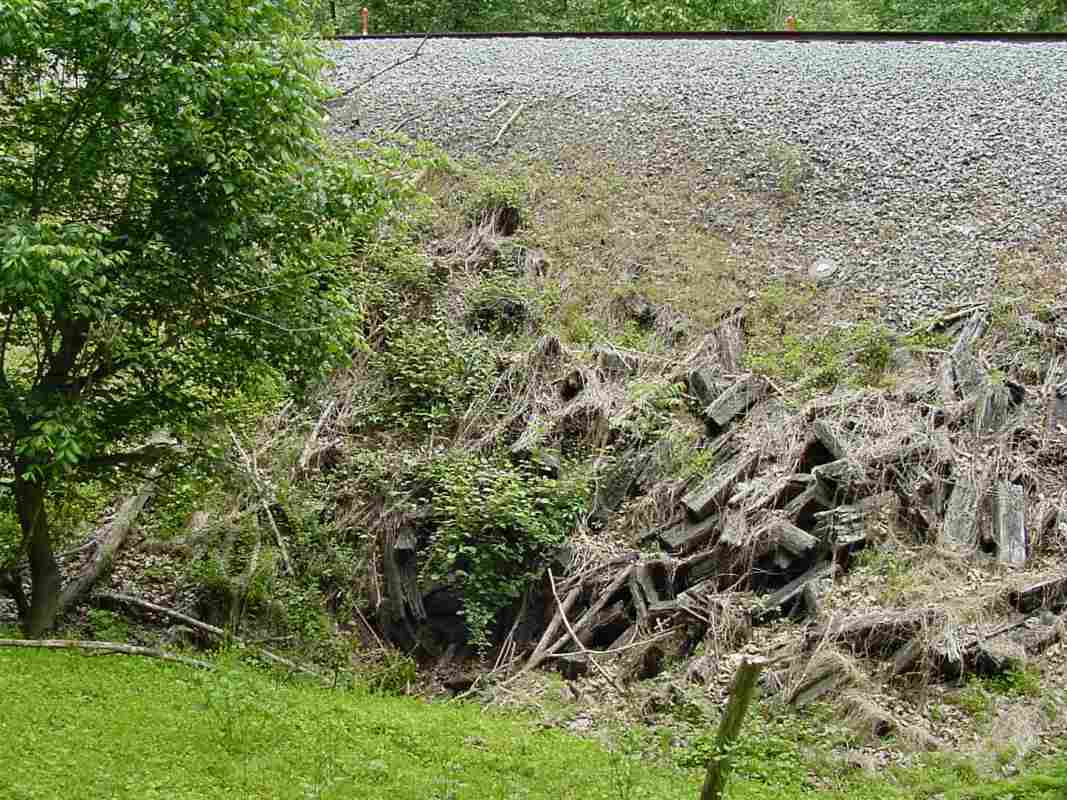
After the incident, B&O gave up on stone stringers and switched to wood stringers on wood crossties from this vicinity westward. Strap rail was affixed to the wood all the way to Harpers Ferry.


<< Previous (east) | THIS PAGE: Woodstock | Next (original) >>

Or, return to main page

Copyright Notice