TrainWeb.org Facebook Page
Old Main Line Photo Tour


B&O Old Main Line
Modern day photo tour

Accompanying each photo below are:

Click a photo to see a larger view. Please send your comments and corrections to Steve.


Davis - Brief Historical Background:

Map

Map
Mile: 17.8 to 20.3 Date: Nov 2006
Ease: View:
Area: IC2:
Map:

This map depicts the area from Daniels west to Davis at the left. The Patapsco River weaves through the middle, separating Baltimore and Howard counties. Green marks the 1830 alignment, magenta 1838, and black the current.


Evelations

Elevations
Mile: 19.7 Date: Apr 2014
Ease: C View: NW
Area: A IC2:
Map: Ho 6 K 13 Topographic Maps

The Patapsco State Park path west from Daniels that follows B&O's original south-bank-of-the-river alignment leads you here. Notice how the current tracks are perched at a higher elevation than the original, which during the 1800s had proceeded forward near the gap in the trees at photo center.


Old and New

Old and New
Mile: 19.7 Date: Apr 2014
Ease: C View: SE
Area: A IC2:
Map: Ho 6 K 13 Topographic Maps

The reverse (downstream) view includes Dorsey tunnel at distant left, and Eureka Bridge nearer. The pile of new ties are evidence of CSX trackwork in the near future.


Meet

Meet
Mile: 19.7 Date: Apr 2014
Ease: C View: W
Area: A IC2:
Map: Ho 6 K 13 Topographic Maps

Turning around to look west again... prior to Davis Tunnel (east portal seen in the distance) the OML negotiated a path around the hill. This is roughly the location those tracks would have met with today's.

The green (original) and magenta lines diverge slightly due to a small realignment that I'm guessing took place around 1838, the time of other similar improvements in this area.


Line Run

Line Run
Mile: 19.8 Date: Apr 2014
Ease: C View: NE
Area: A IC2:
Map: Ho 6 J 13 Topographic Maps

At Line Run, streamside hewn stone relics and mounded earth indicate the original alignment had been here (green). A short distance downstream (magenta), a fine arched bridge survives, evidence of a second alignment, now also disused.


Line Run Bridge

Line Run Bridge
Mile: 19.8 Date: Dec 1999
Ease: C View: N
Area: A IC2: 341
Map: Ho 6 J 13 Topographic Maps

The disused Line Run bridge can be found along the abandoned second alignment just northeast of Davis Tunnel. Adding to the suspicion that this bridge is not the original alignment are the buttresses and excellent dry fit of stonework, signs of the work of an experienced crew. Compare this photo with the nearly identical one in Impossible Challenge II, page 341.


Mound

Mound
Mile: 19.8 Date: Apr 2014
Ease: C- View: S
Area: A IC2:
Map: Ho 6 J 13 Topographic Maps

If, from the mound and few remaining bridge stones of the original alignment, you follow Line Run back to the active rails, you'll find another arched bridge. It's newer, as evidenced by the mortared stone blocks, and dates to the same time period as the nearby Davis Tunnel which lurks beyond the right edge of this photo.


Around

Around
Mile: 19.8 Date: Apr 2014
Ease: C- View: NW
Area: A IC2:
Map: Ho 6 J 13 Topographic Maps

West of Line Run the 1830 and 1838 alignments merge and proceed around the hill.


Davis Tunnel

Davis Tunnel
Mile: 20.1 Date: Jan 2003
Ease: C View: E
Area: A IC2:
Map: Ho 11 J 1 Topographic Maps

As seen from the other side of the hill, looking back to Davis Tunnel's west portal, the original alignment came around the hill, swung further "inland" from the river (off-photo, left), and then rejoined the current right of way behind the photographer. In-line signals have taken the place of the CPLs here.


Deep Culvert

Deep Culvert
Mile: 20.2 Date: Jan 2003
Ease: C View: E
Area: A IC2:
Map: Ho 11 J 1 Topographic Maps

The shelf above this culvert illustrates how the 1830 alignment sat at a lower elevation. When B&O built the tunnel route, they kept this culvert and lengthened it toward the river. Davis Tunnel is off in the distance.


Culvert

Culvert
Mile: 20.2 Date: Dec 1999
Ease: C View: NE
Area: A IC2:
Map: Ho 11 J 1 Topographic Maps

Another view of the culvert; this one just missed qualifying for an arched structure. This irregular stones and lack of mortar flag it as original circa 1830 construction.

According to a 1917 B&O Station list, a siding here was named "Fannie R. Frost." I suspect B&O kept its original alignment active as a siding for the Frost Quarry that was a third of a mile up the hill behind the photographer.


Frost Siding
Photo courtesy Johns Hopkins University
NEW! mid-Mar 2020

Frost Siding
Mile: 20.2 Date: Dec 1937
Ease: C View: N (up)
Area: A IC2:
Map: Ho 11 H 1 Topographic Maps

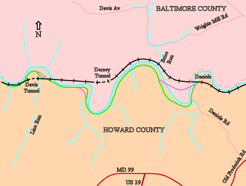
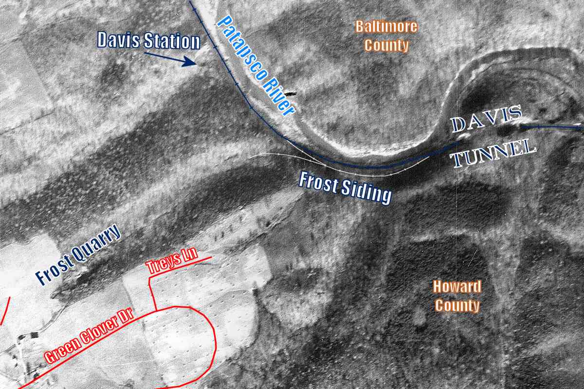
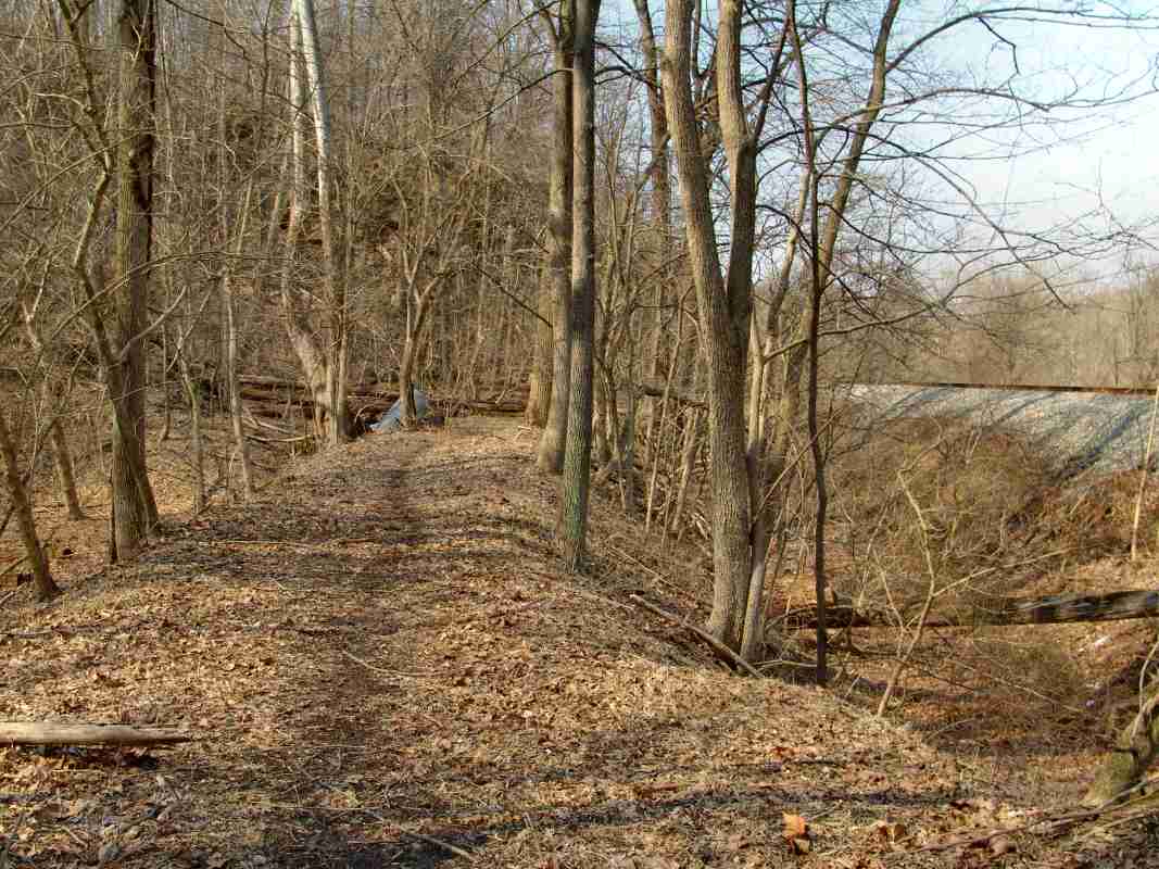
In addition to the siding, this aerial photo from 1937 hints a short stub peeled west from the siding, and curved toward the quarry, as traced by the thin white lines. As reference, modern roads are sketched in red. 
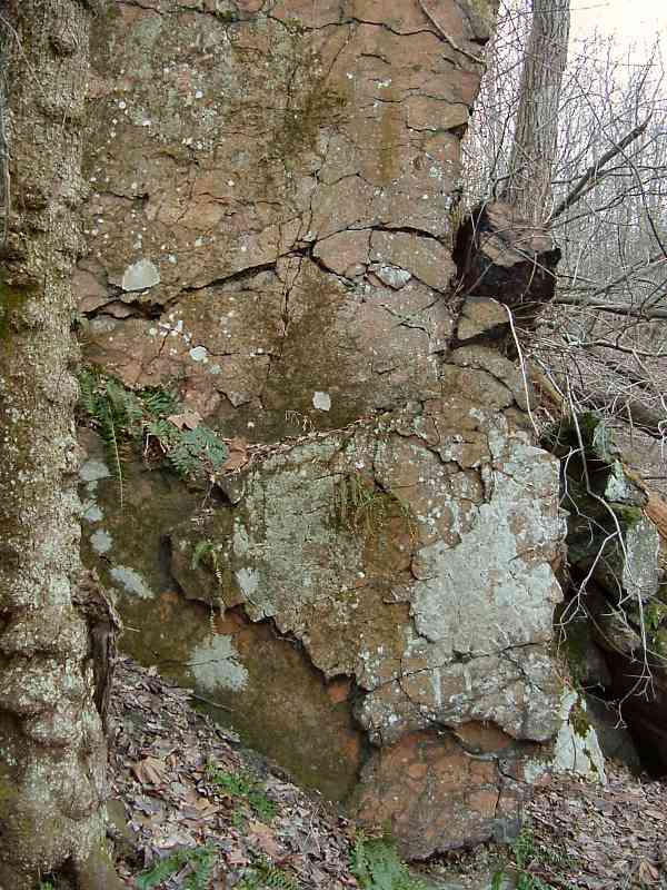
The shadowed area that would have resulted from digging into the hillside is presumed to be the Frost Quarry; operation probably had ceased by the time of this aerial photo. The marked location matches that in the following description.

Edson S. Bastin's Economic Geology of the Feldspar Deposits of the United States (USGS/Dept. of the Interior Bulletin 420) dated 1910 states of the Frost Quarry:

    "The largest quarry in this region is about half a mile south of Davis station and 1-1/2 miles southeast of Woodstock, on the Frost Farm, and is operated by the Golding Sons Company of Trenton, N.J.

    "This quarry is located in a pegmatite deposit of a character somewhat different from those described above. In April, 1908, this quarry was about 450 feet long by 100 wide by 65 in maximum depth, its greatest dimension trending about N. 60° E. The feldspar is of two varieties...

    "In this quarry a steam drill is used and a derrick is operated by a hoisting engine. The material is hauled about a quarter of a mile to the railroad and is shipped to Trenton, N.J. and Wilmington, Del."

A reader named John says:

    "My statements below are derived from 'Minerals of the Washington, D.C. Area'; by Lawrence R. Bernstein; 1980; Dept of Natural Resources; Maryland Geological Survey; Educational Series #5; Pages 56, 57 and 58. feldspar

    "I am certain the name 'Fannie R. Frost' siding is directly related to the name of the quarry referenced in the above citation. The name of this 'abandoned' quarry is the 'Fannie Frost Feldspar Quarry'. It is located approximately 1/3 of a mile South of the Old Main Line inside the Patapsco State Park property close where your photo was taken.

    "I frequently visit this area and often run into Geologists (pretty sure they are hobbyists) searching for minerals like titanite at the quarry. According to Bernstein, It was operated in the early part of the 20th century for feldspar. I'm curious if/how/where items like feldspar from the quarry where loaded onto the trains."

Reader Phil Stackhouse contributed the following historical background:

    "Fannie R(isteau) Frost (1865-1957) was my great aunt, sister to my grandmother Kate Frost Stackhouse and lived on and managed the ancestral Frost farm which was adjacent to the railroad at that location. So the simple answer may be that the siding was simply named for the adjacent landowner. As you probably know, besides the station stops along the Main Line, there were any number of 'flag' stops - called that because the train would stop only if flagged down. They were used for both passenger service and freight. There were also regular milk stops along the route for the morning and evening milk trains going to Baltimore. One of the regular flag stops on this section of the road was for the Frost farm and it may be this location that gave the siding its name.

    "I am intrigued by the reference to a Fannie Frost Feldspar Quarry. I know the location of this quarry and from family stories, believe that stone was shipped from it on the railroad. But I've never heard it referred to by that name. Aunt Fannie was a school teacher by profession and while very capable of running the farm as well, I suspect that she knew little of quarrying. I grew up in an extended family on that property that included Aunt Fannie and one of her sisters, but never heard them mention the quarry. She died in 1957 and as I was still fairly young at the time, don't remember all the stories. I haven't been back to the quarry for many years and was surprised to hear from your correspondent John that others even know of its existence.

    "It might also be of interest that my grandfather Samuel Dorsey Stackhouse and his brother William were rail agent, postmaster and storekeepers at Woodstock from 1881 until ca. 1887. Both of them married Frost sisters that I am sure they must have met as customers in the store. I have all of the store records for those years as well as the rail ticket sales records for some."


Three
Photo courtesy Dave Hiteshew
NEW! mid-Mar 2020

Three
Mile: 20.2 Date: Nov 2007
Ease: C View: N
Area: A IC2:
Map: Ho 11 H 1 Topographic Maps

This photo shows three alignments, the closest, with its washed-out culvert, is likely the stub track toward the quarry. The mound in the middle is probably the original alignment, with an intact culvert. Most distant is the active railroad.

With three alignments plus two, or is it three, streams in this vicinity, and surviving culverts for most of them, it's tough keeping track of which culvert is which.


Curved
Photo courtesy Dave Hiteshew
NEW! mid-Mar 2020

Curved
Mile: 20.3? Date: Mar 2007
Ease: C? View: E
Area: A IC2:
Map: Ho 11 H 1? Topographic Maps

After multiple visits spanning 20 years by three photographers, none of us are quite sure any longer exactly where this curved culvert is. Of interest is the similarly-curved stone structure toward photo upper right. That might be a Frost Quarry artifact.


Rejoin
Photo courtesy Dave Hiteshew

Rejoin
Mile: 20.3 Date: Mar 2007
Ease: C View: NW
Area: A IC2:
Map: Ho 11 H 1 Topographic Maps

Ahead the two/three alignments rejoin and stay together until a series of other Old Main Line straightening projects near Woodstock, including one that created McKeldin falls.


Continue along the current alignment from Davis Tunnel

Or, return to main page


Copyright Notice