TrainWeb.org Facebook Page
Old Main Line Photo Tour


B&O Old Main Line
Modern day photo tour

Accompanying each photo below are:

Click a photo to see a larger view. Please send your comments and corrections to Steve.


<< Previous (east) | THIS PAGE: Daniels to Davis | Next (west) >>

Defect Detectors

Defect Detectors
Mile: 18.1 Date: Oct 2000
Ease: C View: NW
Area: A IC2:
Map: Ba 32 B 8, Ho 12 D 0 Topographic Maps

On the west shore of the Daniels bridge are these automated defect detectors. The flaps on the left are a dragging equipment detector while the scanner on the right checks for hot axle bearings.

There's no easy way to get here: it's a hike from both east and west, unless you want to wade across the river, or risk crossing the bridge on foot (definitely NOT recommended!).

Link: sound recording of detector (340K WAV file)


Cut

Cut
Mile: 18.1 Date: Mar 2014
Ease: C View: W
Area: A IC2:
Map: Ba 32 B 8, Ho 12 D 0 Topographic Maps

This hill was one reason B&O spent its first 80 years going around (left).


Brice Run

Brice Run
Mile: 18.5 Date: Apr 2014
Ease: B View: NE
Area: A IC2: 204
Map: Ho 12 C 0, Ba 32 A 8 Topographic Maps

The 1906 alignment is straighter than the older ones, but is not without streams to cross, such as Brice Run.


Mist

Mist
Mile: 18.5 Date: Oct 2004
Ease: B- View: W
Area: A IC2:
Map: Ba 32 A 8 Topographic Maps

Mist after a freak October hail storm rises off Brice Run bridge.


Ballast Train

Ballast Train
Mile: 18.7 Date: Apr 2014
Ease: B- View: NW
Area: A IC2:
Map: Ho 12 B 0, Ba 32 A 8 Topographic Maps

As seen from across the river, this MoW train is dropping stone ballast. Another crew will follow later and scoop the ballast under the rails where needed to level them. A crew member walks alongside the slowly moving train to monitor the action, opening and closing hopper doors as needed via remote control. The doors are electrically powered, hence the solar panels on the sides and tops of these cars.

Link: four-second video of the action (MPG format)


Dorsey Tunnel, East

Dorsey Tunnel, East
Mile: 19.0 Date: Dec 1999
Ease: C View: W
Area: A IC2:
Map: Ba 31 K 8 Topographic Maps

At mp 19 you'll find Dorsey (Dorsey's Run) Tunnel, one of the most inaccessible OML tunnels. It is the OML's third longest (1022 feet) and, with neighbor Davis Tunnel, the newest (1906). The gentle 4 degree curve at the east portal makes this a great location to obtain a head on engine photo (if you want to wait for a train).

Link: reverse view from inside tunnel 1912


Dorsey Tunnel, West

Dorsey Tunnel, West
Mile: 19.3 Date: Dec 1999
Ease: C View: E
Area: A IC2:
Map: Ba 31 K 8 Topographic Maps

And, here's the Dorsey Tunnel's west portal.

Excavations in the hill through which the tunnel passes could be remnants of mining, and/or Bodley's Mill that an 1838 map of a proposed canal "to the Potomak" places here.


CSX 263

CSX 263
Mile: 19.5 Date: Dec 1999
Ease: C View: E
Area: A IC2:
Map: Ba 31 J 8 Topographic Maps

CSX 263 roars out of Dorsey Tunnel.

Link: More pics of this locomotive


To Davis Tunnel

To Davis Tunnel
Mile: 19.5 Date: Dec 1999
Ease: C View: W
Area: A IC2:
Map: Ba 31 J 8 Topographic Maps

As CSX 263 sped past, I spun 180 degrees and shot this photo of the train as it crossed the bridge back into Howard County, bound for Davis Tunnel in the distance.

This track segment is particularly interesting because you can stand midway and view both the Dorsey and Davis tunnels, which are separated by a distance of about 1 mile.


CSX 3352
NEW! late-Feb 2018

CSX 3352
Mile: 19.5 Date: May 2017
Ease: C View: E
Area: A IC2:
Map: Ba 31 J 8 Topographic Maps

Seventeen-plus years later I reprised the photo pair during a boldly colorful, glorious spring day.


Short Train
NEW! late-Feb 2018

Short Train
Mile: 19.5 Date: May 2017
Ease: C View: W
Area: A IC2:
Map: Ba 31 J 8 Topographic Maps

Trains short enough to fit between the two tunnels are less common than the mile-plus coal drags for which the OML is famous.


Concrete Culvert
NEW! late-Feb 2018

Concrete Culvert
Mile: 19.6 Date: May 2017
Ease: C- View: N
Area: A IC2:
Map: Ba 31 J 8 Topographic Maps

This uncommon culvert style dates to the early 1900s construction of the shorter, tunnelled alignment. Even with the big tree it still works.


Eureka Bridge

Eureka Bridge
Mile: 19.7 Date: Dec 1999
Ease: C+ View: NE
Area: A IC2:
Map: Ho 6 K 13, Ba 31 H 8 Topographic Maps

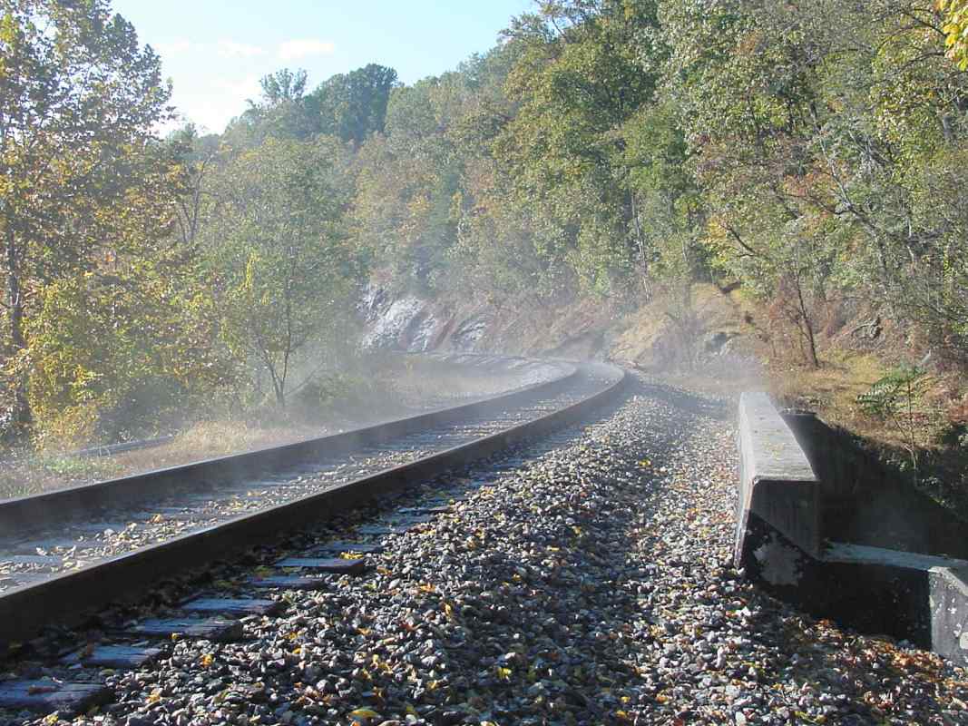
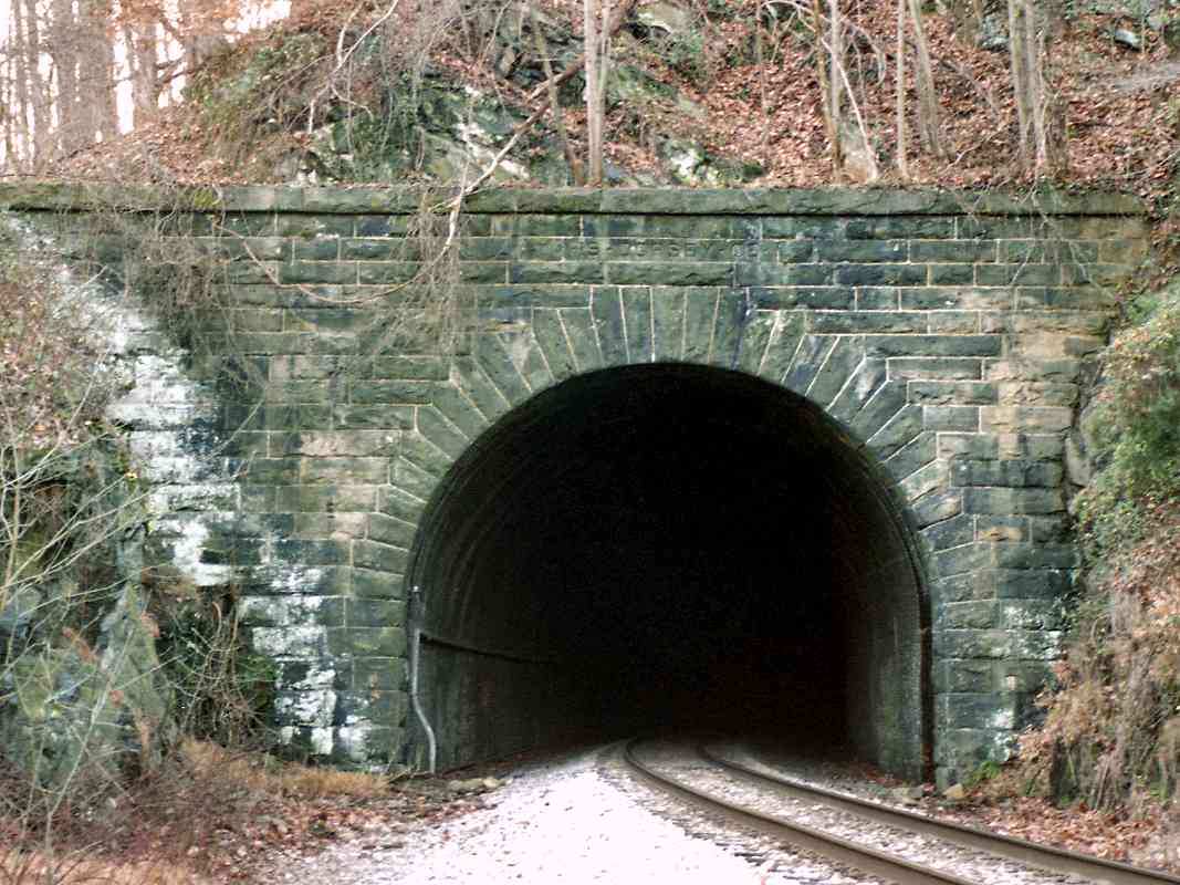
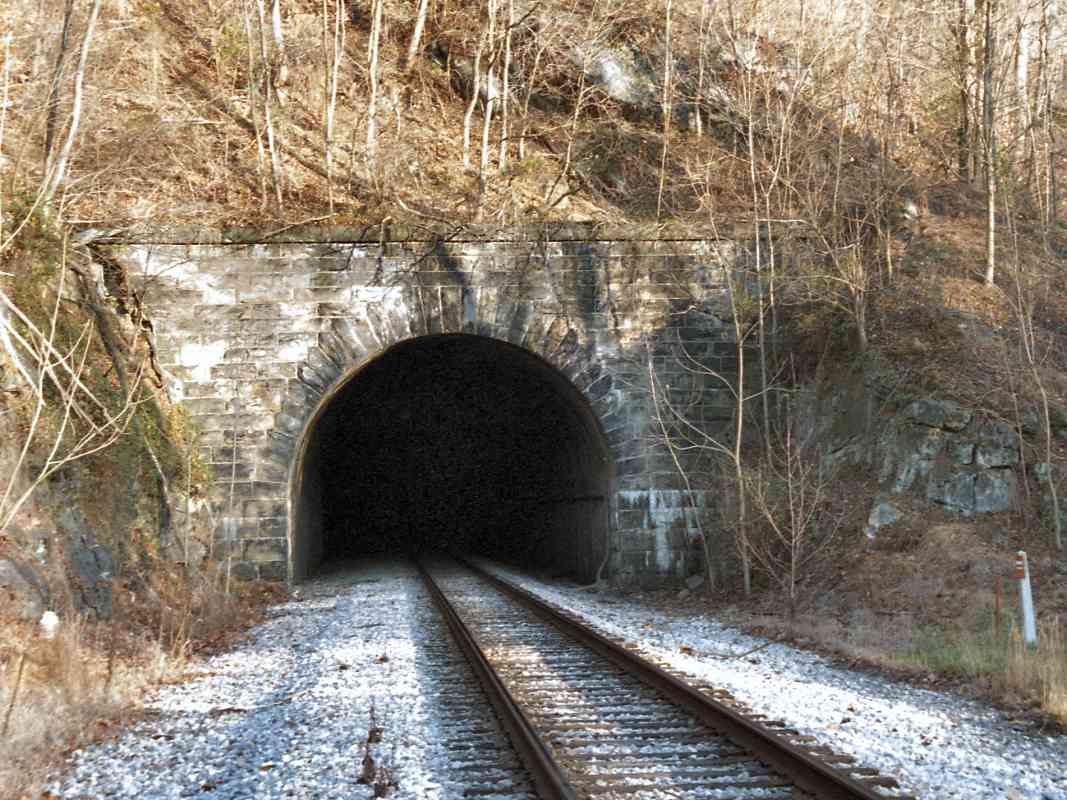
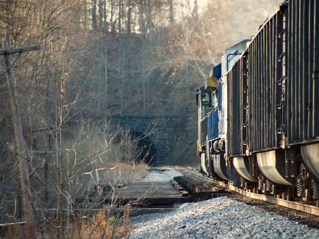
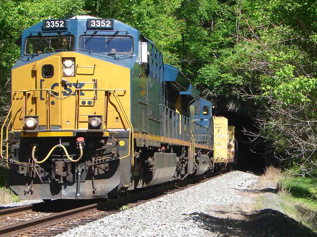
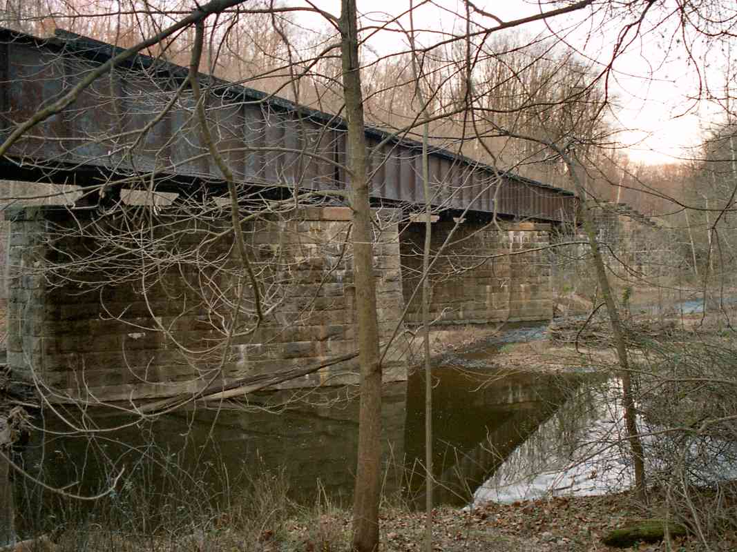
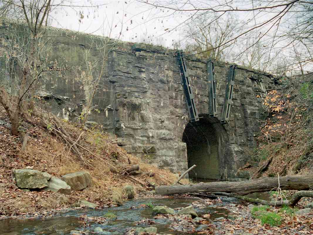
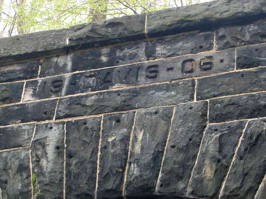
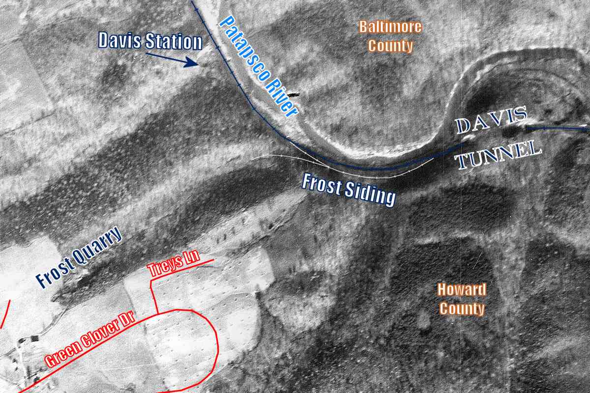
Tucked inconspicuously between Dorsey and Davis tunnels, and spanning the Patapsco River, is Eureka Bridge. An old B&O station list claims the Eureka Mining and Operating Company was located near here, but I have not been able to find any remains of it. Immediately west of the bridge, the current route briefly rejoins the original.

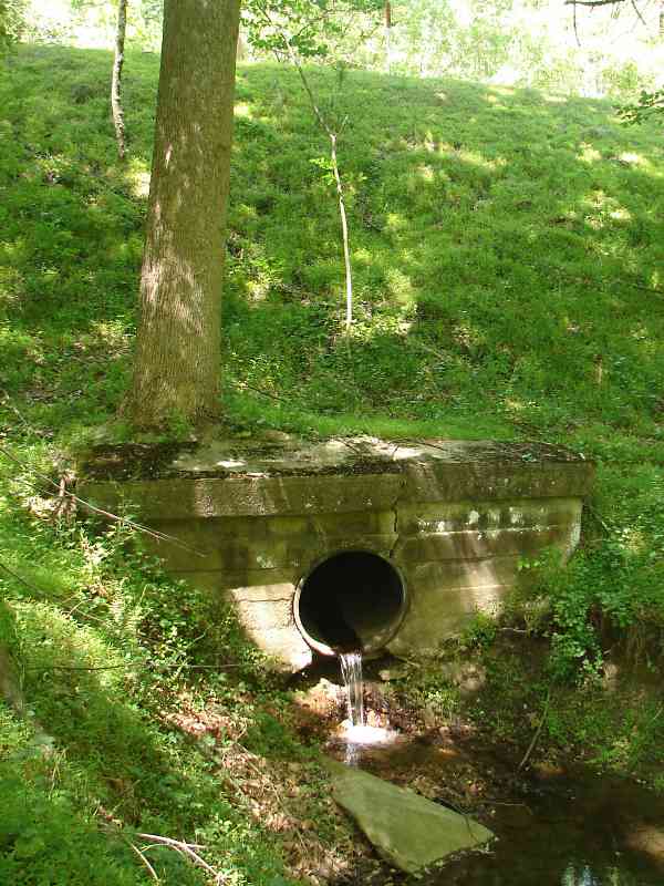
The lower-right portion of this photo suggests a waterfall, but in reality is just the reflection of trees and sky.

Contributor Dave Hiteshew may have found the Eureka Mine:

    "We explored the long way around the hill with the Dorsey Tunnel. From east heading west, there seems to be a very obvious flat, treeless shelf, which eventually splits into 2 or 3 levels. We found 2 square wall sections which look like foundations, and several large dug-out holes, and several large piles of rubble. At least 1 pile looked like it was all pieces of pink granite. Maybe this was the mining company's area?"


Greenery
NEW! late-Feb 2018

Greenery
Mile: 19.7 Date: May 2017
Ease: C View: E
Area: A IC2:
Map: Ho 6 K 13, Ba 31 H 8 Topographic Maps

Before Eureka Bridge supports double tracks again, the clearance in the tunnels will have to be increased.


Line Run Bridge

Line Run Bridge
Mile: 19.8 Date: Apr 2014
Ease: C View: N
Area: A IC2:
Map: Ho 6 K 13 Topographic Maps

This bridge over Line Run was constructed as part of the same effort that bored the nearby Davis Tunnel.

If you follow this stream north to the river, you'll find another arched bridge. It's older and marks the location of a previous alignment. The stones on the left bank you can glimpse in the distance through the arch are remnants of an even earlier alignment, the original. It might have been cannabalized to build the bridge in the foreground.


Davis Tunnel, East

Davis Tunnel, East
Mile: 19.8 Date: Dec 1999
Ease: C+ View: W
Area: A IC2:
Map: Ho 6 K 13, Ba 31 H 8 Topographic Maps

date Davis Tunnel was the last of the early 20th century Old Main Line tunnels to be completed. The original route heads to the right in this photo and meanders around the hill. Note that Davis Tunnel is not marked on most editions of the ADC street maps.

The siting of Davis Tunnel is unusual in that a natural break in this hill exists less than 400 feet south (left). Had the realignment been routed there, not only would its track have been straighter, but also a simple cut, rather than a tunnel, would have sufficed. Perhaps B&O had trouble obtaining the land there.

Detour: follow the disused original alignment
Link: 2004 pic


Davis Tunnel, West

Davis Tunnel, West
Mile: 20.0 Date: Jan 2003
Ease: C View: NE
Area: A IC2:
Map: Ho 11 J 1 Topographic Maps

Here's the west portal of Davis Tunnel. This tunnel is just shy of 500 feet in length, and opens to the 9200-foot Davis siding. Seen here is one of two B&O CPL signals that were removed since the time of this photo.


Coal Drag

Coal Drag
Mile: 20.3 Date: Nov 2000
Ease: C View: NW
Area: A IC2:
Map: Ho 11 H 1 Topographic Maps

Davis Station Typical Patapsco River winter scenery is shown here as CSX 713 leads an eastbound coal drag. The siding stretches between Davis Tunnel and Woodstock.

A 1917 B&O Station List places Davis Station to the left of the coal hoppers, not far from the most-visible utility pole. The remoteness of Davis Station (upper left) had probably led to its closure by the time of this 1937 aerial photo. There are no known photos of the station from ground level. The only extant evidence I have found is a shelf of land for an access road along the south side of Davis Branch.


Davis Branch Bridge

Davis Branch Bridge
Mile: 20.5 Date: Nov 2000
Ease: C View: SE
Area: A IC2:
Map: Ho 6 H 13 Topographic Maps

Finally, here's another original stone arched bridge still in use (the first since that over Sucker Run back near Ellicott City).

This 1830-era stone arch bridge over the Davis Branch receives support from steel braces. The abutments also show signs of shoring up, so perhaps this bridge was damaged in a storm.

The stream may have been named for the Davis family who lived in this vicinity. A shelf of land follows the stream down to the railroad.

Link: Henry Gassaway Davis bio


Milepost 21
NEW! late-Feb 2018

Milepost 21
Mile: 21.0 Date: Nov 2015
Ease: C+ View: NW
Area: A IC2:
Map: Ho 6 H 12 Topographic Maps

Though not readily discerned through the trees, right of the milepost, across the Patapsco River on the Baltimore County side are remains of Putney's Bridge.

During the 1800s a spur began here, crossed the river, and ran 2-miles to the Guilford & Waltersville Granite Company, which is the subject of the next tour page.


<< Previous (east) | THIS PAGE: Daniels to Davis | Next (west) >>

Or, return to main page

Copyright Notice