TrainWeb.org Facebook Page
Old Main Line Photo Tour


B&O Old Main Line
Modern day photo tour

Accompanying each photo below are:

Click a photo to see a larger view. Please send your comments and corrections to Steve.


<< Previous (east) | THIS PAGE: Fairgrounds | Next (return to main line) >>

Switch

Switch
Mile: spur 0.3 Date: May 2009
Ease: B+ View: SW
Area: B IC2:
Map: Ba 42 C 11 Topographic Maps

After splitting off the main line, the spur to the site of B&O's 1927 Fair of the Iron Horse soon bifurcates. This tour page follows the spur generally south and west.


WM 1834
Photo credit Art Campbell

WM 1834
Mile: spur 0.4 Date: Jan 1981
Ease: A- View: E
Area: B IC2:
Map: Ba 42 B 11 Topographic Maps

During 1981 this Chessie System caboose inherited from the Western Maryland was in the lead as a train backed into the spur. On its side it is numbered WMC1834.

Link: Chessie WM cabooses


2018

2018
Mile: spur 0.4 Date: Jan 2018
Ease: A- View: E
Area: B IC2:
Map: Ba 42 B 11 Topographic Maps

This was the same spot during 2018.


B&O 5074
Photo credit Art Campbell
NEW! early-May 2023

B&O 5074
Mile: spur 0.4 Date: Jan 1981
Ease: A- View: E
Area: B IC2:
Map: Ba 42 B 11 Topographic Maps

Doing the pushing was B&O 5074, an EMD model NW2.


Flagman
Photo credit Art Campbell

Flagman
Mile: spur 0.4 Date: Jan 1981
Ease: A- View: S
Area: B IC2:
Map: Ba 42 B 11 Topographic Maps

A flagman alerts drivers on Hollins Ferry Road.


Signals

Signals
Mile: spur 0.4 Date: Jan 2018
Ease: A- View: S
Area: B IC2:
Map: Ba 42 B 11 Topographic Maps

Here's the same grade crossing during 2018. Signals were added to it around 1990.


Hollins Ferry Road
NEW! early-May 2023

Hollins Ferry Road
Mile: spur 0.5 Date: Jul 2022
Ease: A View: E
Area: B IC2:
Map: Ba 42 B 11 Topographic Maps

CSX 2058 and CSX 6530 were caught sneaking along the spur on a summer afternoon.

Links: Sun mistakes this crossing for the much busier one at Mt. Winans, 2013


TBM 200403

TBM 200403
Mile: spur 0.5 Date: May 2009
Ease: A- View: S
Area: B IC2:
Map: Ba 42 B 11 Topographic Maps

Traffic on the spur ain't what it used to be, so it has become a handy place to park MoW equipment.


Aloft
Photo courtesy BCPL

Aloft
Mile: Date: 1927?
Ease: View: SE
Area: IC2:
Map: Ba 42 A 11 Topographic Maps

Ironically, prior to hosting the Fair of the Iron Horse, during 1910 this land, plus the city, saw Baltimore's first airplane demonstration. This area was then known as Patapsco Farm.

Link: 1910 Air Show


Farewell
Photo credit B&O RR

Farewell
Mile: Date: 1927
Ease: View: NE
Area: IC2:
Map: Ba 42 A 12 Topographic Maps

Another aerial view foretells of the transport technology that would supplant rail as the top choice for long distance passenger travel. In a way, for travelers this celebration was instead the Farewell to the Iron Horse, particularly the steam-powered species.


Fairgrounds Map
Photo credit B&O RR

Fairgrounds Map
Mile: Date: 1927
Ease: View:
Area: IC2:
Map: Ba 42 A 11 Topographic Maps

In less than a year, B&O transformed 1000 acres of what was called Halethorpe Field into a site with room for tens of thousands of attendees. At the top of the map, along the main line note the passenger platforms for people arriving and departing via train. The only surviving evidence of the platforms is a wider-than-usual right of way in the vicinity of HX Tower.


Crowds
Photo courtesy The Baltimore Sun

Crowds
Mile: spur 0.8 Date: 1927
Ease: View: N
Area: B IC2: 264
Map: Ba 42 A 11 Topographic Maps

HX Tower (distance) was ideally positioned to witness the Fair's parade of the history of transportation in America, with emphasis on steam locomotives, particularly those of B&O, of course. The railroad had preserved only a few of its earliest locomotives so the gaps were filled with reproduction pieces made in Baltimore. Many of these reproductions remain on display today at the B&O Museum.

Note the stone arch bridge in the distance... approximately 1950 it was either replaced, or filled in and a new bridge built adjacent to allow a widened Halethorpe Farms Road under the tracks.

Links: 1927, 1927, 1927, 1927, more Sun photos


Hall of Transportation
Photo courtesy The Baltimore Sun

Hall of Transportation
Mile: spur 0.8 Date: 1927
Ease: View: SE
Area: B IC2:
Map: Ba 42 A 11 Topographic Maps

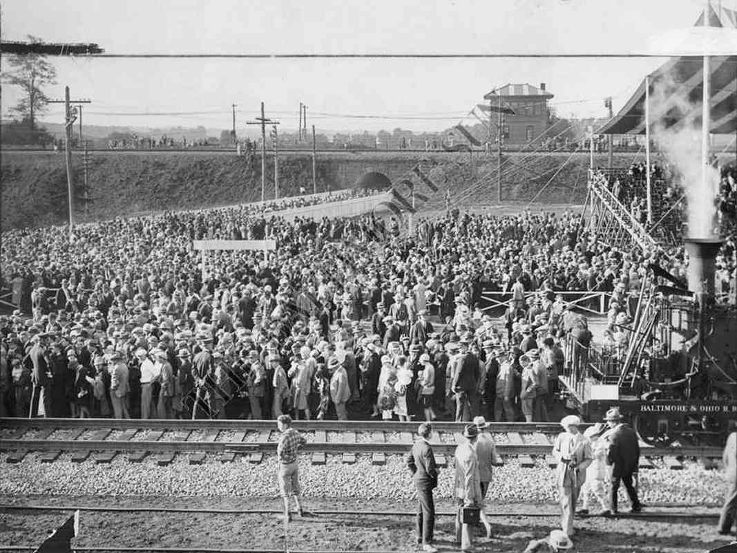
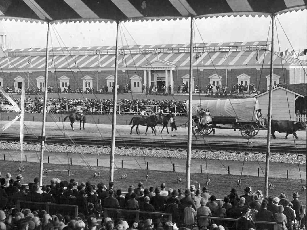
The pageantry ran from September 24 to October 8, 1927. After the Fair, the B&O kept the paraded equipment here, 
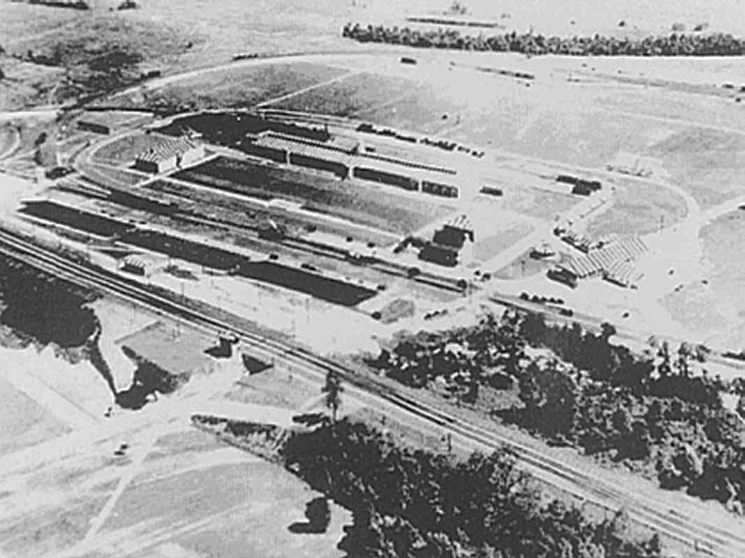
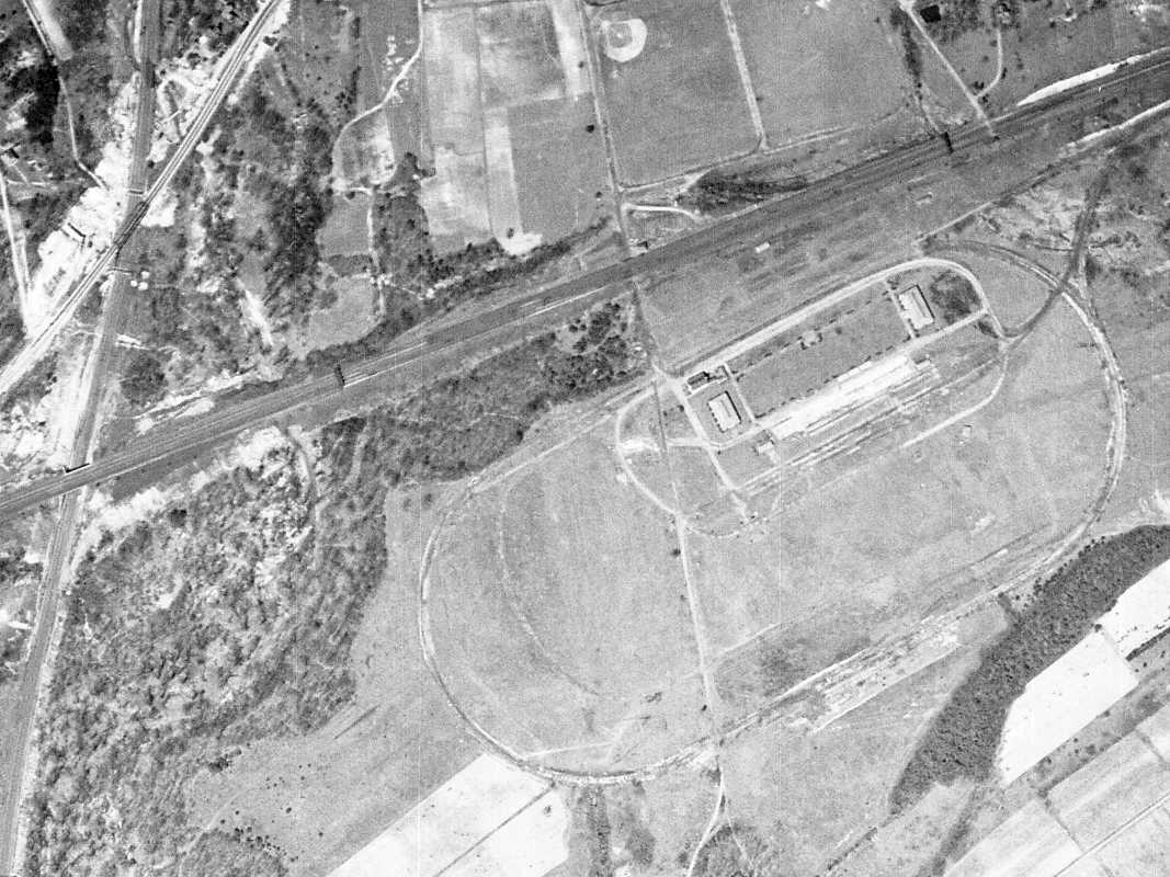
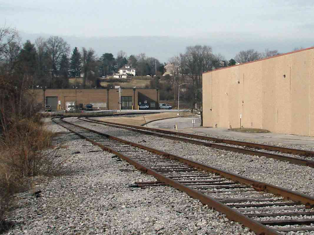
within the "Hall of Transportation" seen across the tracks, a structure that it boasted was fireproof. Fireproof perhaps, but on August 13, 1935 a storm leveled the building and destroyed about half the collection inside. B&O moved the surviving equipment to Bailey's Roundhouse in Baltimore, then during 1953 to the current Museum site.

Link: extensive, excellent Fair info at rgusrail.com


1926 Aerial
Photo courtesy Johns Hopkins University

1926 Aerial
Mile: Date: winter 1926-1927
Ease: View: N (up)
Area: IC2:
Map: Ba 42 A 11 Topographic Maps

This was the scene shortly before B&O commenced construction of the fairgrounds. The aerial photos below step through time to show how the area has changed. HX Tower is the building casting a shadow above photo center in each photo of this sequence.


1938 Aerial
Photo courtesy Johns Hopkins University

1938 Aerial
Mile: Date: Apr 1938
Ease: View: N (up)
Area: IC2:
Map: Ba 42 A 11 Topographic Maps

By 1938 the Fair was just a memory, but many of its structures survived, the notable exception being the Hall of Transportation that had blown down in a storm less than three years prior. The white rectangular area right of photo center shows where that had been.

The largest of the Fair's track ovals was 6000 feet in diameter. The intersection of the oval with Halethorpe Farms Road near photo center is where present-day Hollins Ferry Road meets Halethorpe Farms Road. An oval of railroad track is not something one finds many places.


1953 Aerial
Photo courtesy Johns Hopkins University

1953 Aerial
Mile: Date: Feb 1953
Ease: View: N (up)
Area: IC2:
Map: Ba 42 A 11 Topographic Maps

By World War II, B&O encouraged industry to move into the area, thus repurposing and extending the life of the spur it had built. Note a new spur on the north side of the main line as well.

At photo bottom, new power lines were staking their place just prior to the arrival of the Baltimore Tunnel Thruway.


1964 Aerial
Photo courtesy Johns Hopkins University

1964 Aerial
Mile: Date: Apr 1964
Ease: View: N (up)
Area: IC2:
Map: Ba 42 A 11 Topographic Maps

By 11 years later the Thruway had been completed, but Hollins Ferry Road did not yet cross the spur. Halethorpe Farms Road now extends south and under the Thruway in order to provide access to Patapsco State Park.


1994 Aerial
Photo courtesy Google

1994 Aerial
Mile: Date: Apr 1994
Ease: View: N (up)
Area: IC2:
Map: Ba 42 A 11 Topographic Maps

By 1994 many sidings have been removed.


2018 Aerial
Photo courtesy Google

2018 Aerial
Mile: Date: Oct 2018
Ease: View: N (up)
Area: IC2:
Map: Ba 42 A 11 Topographic Maps

At the time of this writing, this is the most recent aerial view available.


1989 Map

1989 Map
Mile: Date: Jan 1989
Ease: View: NW (up)
Area: IC2:
Map: Ba 42 B 11 Topographic Maps

Though this 1989 drawing includes trackage that by that time had fallen into disuse, it illustrates roughly the maximum spread of B&O rail service post-Fair.

As of 2019 track no longer exists (has been pulled up) east of Terminal Corp, nor at BTSC, Jefferies or Transit Storage. The rails end west of "Field 1 2 3" at a scrap metal facility.

Roadway Maps like this, and lots more cool B&O history materials, are available from The B&O Railroad Historical Society.


Rust

Rust
Mile: spur 0.6 Date: Jan 2018
Ease: A- View: N
Area: B IC2:
Map: Ba 42 C 11 Topographic Maps

Despite the rust, as of 2019 trains do rumble through from time to time. This location is near what had been the east side of the Fair's track oval.


Ties

Ties
Mile: spur 0.6 Date: Jan 2018
Ease: A- View: N
Area: B IC2:
Map: Ba 42 C 11 Topographic Maps

In some places only the crossties remain.

Link: 1985


After Fair

After Fair
Mile: spur 0.7 Date: Jan 2018
Ease: B+ View: NE
Area: B IC2:
Map: Ba 42 B 11 Topographic Maps

Forging dates on these rails from Beth Steel include May 1937, and might reflect when the first post-Fair industry arrived here.

The track on right to businesses along Hollins Ferry Road had once extended over a half mile east, but is now disused.


Small Yard

Small Yard
Mile: spur 1.0 Date: Apr 2009
Ease: A View: E
Area: B IC2:
Map: Ba 42 B 12 Topographic Maps

The stretch east of Halethorpe Farms Road served as a yard as railcars arrived and others waited to be pulled out. It's seen hosting dozens of railcars in the 1964 Aerial above.


Halethorpe Farms Road

Halethorpe Farms Road
Mile: spur 1.0 Date: Jan 2018
Ease: A View: S
Area: B IC2:
Map: Ba 42 B 12 Topographic Maps

Halethorpe Farms Road crosses the tracks then ends at Patapsco State Park. Despite the closed entry gate, a sign dutifully displays the clearance under the Baltimore Harbor Thruway.


End of Spur

End of Spur
Mile: spur 1.0 Date: Jan 2018
Ease: A View: W
Area: B IC2:
Map: Ba 42 B 12 Topographic Maps

CSX extended the spur about 500 feet west during 2017 to a new ending within a scrap metal facility. Even if the irony has not gone unnoticed, trains continue to roll, even during the 2027 Bicentennial of the Iron Horse.


<< Previous (east) | THIS PAGE: Fairgrounds | Next (return to main line) >>

Or, return to main page

Copyright Notice