TrainWeb.org Facebook Page
Old Main Line Photo Tour


B&O Old Main Line
Modern day photo tour

Accompanying each photo below are:

Click a photo to see a larger view. Please send your comments and corrections to Steve.


<< Previous (east) | THIS PAGE: Camden Jct to Monumental | Next (spur) >>

Camden Cutoff

Camden Cutoff
Mile: 2.9 Date: Dec 2003
Ease: A- View: N
Area: B IC2:
Map: Ba 42 F 6 Topographic Maps

After passing Curtis Bay Junction, the OML descends to soon meet another CPL junction, that with the Camden Cutoff, what is now the main line, seen at photo bottom. The OML's original curving route out of Baltimore was an early problem for B&O, and in 1867 at this location it built the Cutoff, a straight shortcut that shaved about 2 miles off the trip to Camden Station, new at that time. The Cutoff runs through Mt. Winans Yard, which as of 2020 is no longer often used as a yard.

The colorful engine trio (CSX 7891, CEFX 2805, HLCX 7187) is passing a CPL showing "restricting" that tells the operator about entering unsignalled trackage. CSX has since replaced that CPL (right) with color light signals.


Narrows
Updated mid-Feb 2023

Narrows
Mile: 3.0 Date: Dec 2003
Ease: A- View: SW
Area: C IC2:
Map: Ba 42 F 6 Topographic Maps

siding As seen from the Gable Avenue grade crossing at the southwest end of Mt. Winans Yard, the various tracks combine to fit under Patapsco Avenue. OML milepost 3 stands at the right, where erosion had suspended a long-disused track midair adjacent. An 1898 atlas places B&O's West Baltimore Station in the southeast quadrant of the grade crossing. A similar view from 2011 with newer signals is at left.

The tracks converge immediately ahead at Camden Junction.

Link: 2000


Camden Junction
NEW! mid-Feb 2023

Camden Junction
Mile: 3.1 Date: Jan 2023
Ease: B+ View: NE
Area: B IC2:
Map: Ba 42 F 6 Topographic Maps

Looking reverse-to-tour-direction, the train in the main photo is roughly CSX 958 where the colorful engine trio had been in the top photo. The OML, milepost BAN 3.1 as measured from Mt. Clare Station (now B&O Museum), and Camden Cutoff, milepost BAA 3.3 as measured from Camden Station, meet near the photog.

"Camden Cutoff" is historical terminology. Now its route to the right of CSX 958 is simply the main line.

Change for: this site's Camden Cutoff tour


Aerial 1972
Photo courtesy Johns Hopkins University
NEW! mid-Feb 2023

Aerial 1972
Mile: 3 Date: Mar 1972
Ease: View: N (up)
Area: IC2:
Map: Ba 42 F 6 Topographic Maps

Camden Junction is at center. It appears the Gable Avenue grade crossing (upper right) was still fully open in 1972. Jan 2023

At the junction, a siding curved northwest to a business that opened around 1950. That siding saw a fair amount of use prior to disconnection during the 2000s. Rails remain embedded in pavement, however, as seen at right January 2023.

Patapsco Avenue, which runs diagonally across the lower left of the 1972 view, bridged over the railroad around 1960.


Mt. Winans Yard

Mt. Winans Yard
Mile: 3.3 Date: Feb 2000
Ease: B+ View: NE
Area: B IC2: 117
Map: Ba 42 E 6 Topographic Maps

Patapsco Avenue is a convenient perch to look back where we've been. The OML is on the extreme left, today's active main line tracks on the right (being negotiated by some coal) and a then-active yard in between. These CPLs are no more. Now that the OML has joined that of the Camden Cutoff, the Mile data will reference the latter's mileposts.

Link: 2022


Deep Cut

Deep Cut
Mile: 3.4 Date: Feb 2000
Ease: B+ View: SW
Area: B IC2: 36
Map: Ba 42 E 6 Topographic Maps

Looking the other direction from the present day Patapsco Avenue bridge, we can see the northern end of the Deep Cut. The Deep Cut dug through the ridge that separates the Gwynns Falls and Patapsco River. The original effort turned out to be much greater than the railroad had anticipated.

At 68 feet deep and 3000 feet long, the cut is more impressive when you learn it was accomplished by hand. Work around the clock involving hundreds of men continued for for well over a year to carve a notch in Maryland's sticky clay. It came close to bankrupting the fledgling railroad, and work stopped about 6 feet above what was needed for a gradually sloping route from Mt. Clare down to the Patapsco River. The minor grade to climb over the Deep Cut is not a problem for modern locomotives.


Green and Red

Green and Red
Mile: 3.6 Date: Sep 2019
Ease: B View: NE
Area: B IC2:
Map: Ba 42 E 7 Topographic Maps

As seen from Hammonds Ferry Road, an eastbound train of Waste Management empties has passed through the Deep Cut, near where a CSX crew is repairing a switch. The distant buildings are part of downtown Baltimore's skyline.

An 1898 atlas shows Hammonds Ferry operated on the downstream side of the subsequent Hammonds Ferry Road bridge across the Patapsco River.

Link: 2006


Lansdowne
Updated mid-Feb 2023

Lansdowne
Mile: 3.7 Date: Feb 2017
Ease: B View: S
Area: B IC2:
Map: Ba 42 E 7 Topographic Maps

During the 2010s, these signal bridges replaced a smaller signal looking NE array.

From about 1950 to 2000, a siding had peeled from here to serve B. Green on the west side; prior to Green, one would have found the Excelsior Brick Company, founded by John A. Knecht. Now Lansdowne Station shopping center occupies the area, and the disconnected siding, with rails forged 1988, lies in pieces (at right, January 2023).

Links: siding intact 1983, 2007


CSX 8770

CSX 8770
Mile: 4.1 Date: Nov 1999
Ease: A- View: SW
Area: B IC2:
Map: Ba 42 E 7 Topographic Maps

Lansdowne presents the first easy location for active train spotting along the OML. The neighborhood is mostly blue collar residential. This is a comfortable, but not scenic, area to observe CSX action. In the photo, CSX 8770 poses with CSX 7304 still in Conrail paint while awaiting a signal to proceed into Baltimore.


Signals
NEW! mid-Feb 2023

Signals
Mile: 4.1 Date: Jul 2022
Ease: A View: NE
Area: B IC2:
Map: Ba 42 E 7 Topographic Maps

The route is paralleled by Hammonds Ferry Road for some distance. Dec 2003 The view at left from December 2003 shows this was one of the line's first places CSX installed its color light signals. The railroad has tinkered with the signals in this vicinity ever since. During the 2010s, CSX moved milepost 4 east a bit to match the main line distance.

I'm surprised CSX did not retain the design of B&O's CPL signals. In a CPL, the lights are lit in pairs, green: top and bottom, red: left and right, amber: in between. The angle of the pair of lights provided a second way for an engineer to know the state of the signal, something particularly useful when due to distance or weather the color is not easily discerned.


CSX 4559
NEW! mid-Feb 2023

CSX 4559
Mile: 4.2 Date: Aug 2022
Ease: A View: SW
Area: B IC2:
Map: Ba 42 E 7 Topographic Maps

SD70 overhaul CSX 4559 was overhauled at the Huntington Locomotive Shop during 2021. Its overhaul sticker (right) depicts a model SD 70 with a matching number (4559).

The white sticker reads, "Do Not Supply Refrigerator With Ice. Refrigerator Is Not Equipped With A Drain." The warning sticker reads, "Warning! Autostart Equipped - Always disable the Automatic Engine Start/Stop system before performing any work on the diesel engine or on related electrical amd mechanical equipment. Failure to do so may result in unexpected engine startup or shutdown with risk of personal injury or death."


MOW

MOW
Mile: 4.2 Date: Apr 2009
Ease: A- View: N
Area: B IC2:
Map: Ba 42 E 8 Topographic Maps

Adjacent to parallel Hammond's Ferry Road, Maintenance-of-Way vehicles SC200702 and TBM 200101 take a break from track work on a rainy spring day.

The site of Coursey Station, sometimes spelled Courcey, is on the left.

Links: 1983, 1983, 1991, 2003, 2006 in snow


Caboose Row
Updated mid-Feb 2023

Caboose Row
Mile: 4.2 Date: Jun 2002
Ease: A- View: SE
Area: B IC2:
Map: Ba 42 E 8 Topographic Maps

Until improvements to Hammonds Ferry Road forced their move in late 2007, a row of cabooses sat stranded on the southeast side of the tracks. Most, if PRR crossbuck not all of the cabooses, were sold off to individual collectors. This was the view from where Sulphur Spring Road had crossed the tracks. Whether that at right had been the actial crossbuck at this location is unknown. The building at the far end of the cabooses was built in 1953 upon the site of B&O's former Lansdowne Station but was not owned by the railroad. It was razed in 2018.

A nearby underground pedestrian walkway is dated 1967, which probably reflects the year the grade crossing closed. Around the same time, the construction of Baltimore Beltway interchange #10 obliterated the original intersection of Sulphur Spring Road with Washington Boulevard (US 1).

Links: Lansdowne Station, 2005 caboose row

Detour: end caboose at new location


CSX 8722

CSX 8722
Mile: 4.4 Date: Dec 2003
Ease: B View: NW
Area: B IC2:
Map: Ba 42 D 8 Topographic Maps

CSX inherited a group of locomotives from Conrail. Such units were renumbered and had their white digits repainted in yellow before undergoing a full repaint into CSX livery. This unit had been CR 5755.


Bridge 6A
Updated mid-Feb 2023

Bridge 6A
Mile: 4.6 Date: Feb 2017
Ease: C View: NW
Area: B- IC2:
Map: Ba 42 D 9 Topographic Maps

6A inlet Shallow-arched bridge 6A over Roberts Run is not entirely original, having been extended outward on the inlet side (photo right) via a concrete addition that likely dates to the 1950s realignment to support a then-new Baltimore Beltway. The stones at this side may date to circa 1830 but mortar suggests they were subsequently refit. The ADC maps omit Roberts Run.


Realigned

Realigned
Mile: 4.6 Date: Sep 2019
Ease: B View: SW
Area: B IC2:
Map: Ba 42 D 9 Topographic Maps

Above bridge 6A, the clear area on the left reveals a previous alignment, one replaced when the Baltimore Beltway (ahead) cut under and necessitated a rail bridge. The bridge was built on the northwest (right) side of B&O's original alignment.


Beltway 1957
NEW! mid-Feb 2023

Beltway 1957
Mile: Date: Sep 1957
Ease: View: N (up)
Area: IC2:
Map: Ba 42 D 9 Topographic Maps

The bright areas show the extent of work for the Baltimore Beltway. At photo center, it appears the railroad (dark line crossing the bright) does not yet have a new bridge, but the ground has been cleared for one along the railroad's northwest side. For reference, Sulphur Spring Road is the bright horizontal line near the top center, and the Harbor Tunnel Thruway is the curved route near the bottom. The Beltway's Hollins Ferry Road figure-8 exit ramps are taking shape between the Thruway and railroad.


Baltimore Beltway

Baltimore Beltway
Mile: 4.7 Date: Apr 1999
Ease: B+ View: N
Area: B IC2:
Map: Ba 42 D 10 Topographic Maps

A bridge to span the Baltimore Beltway near exit 9 (Hollins Ferry Road) dates to the carving of the Beltway here during the latter 1950s. Six through lanes were later shoehorned under the bridge where four had been by removing the median and shortening the exit lane to Holling Ferry Road.

Link: July 4, 1962 aerial


Beltway Crossing

Beltway Crossing
Mile: 4.7 Date: May 2009
Ease: B View: NE
Area: B IC2:
Map: Ba 42 D 9 Topographic Maps

Trackside with wet camera lens at the Beltway crossing... dry days were few and far between during the spring of 2009.

Mileposts 4 and 5 had been about 1000 feet too close until CSX shifted milepost 4 east around 2015. Mileposts 6 and 7 remain 1700 feet too far apart. Some of this weirdness likely originates with the construction of the Camden Cutoff during the 1850s.


Distillery
Updated mid-Feb 2023

Distillery
Mile: 4.9 Date: May 2009
Ease: B View: NW
Area: B IC2:
Map: Ba 42 C 10 Topographic Maps

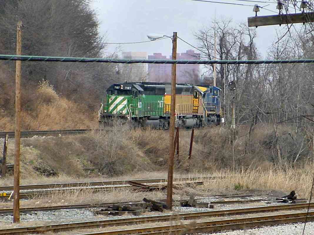
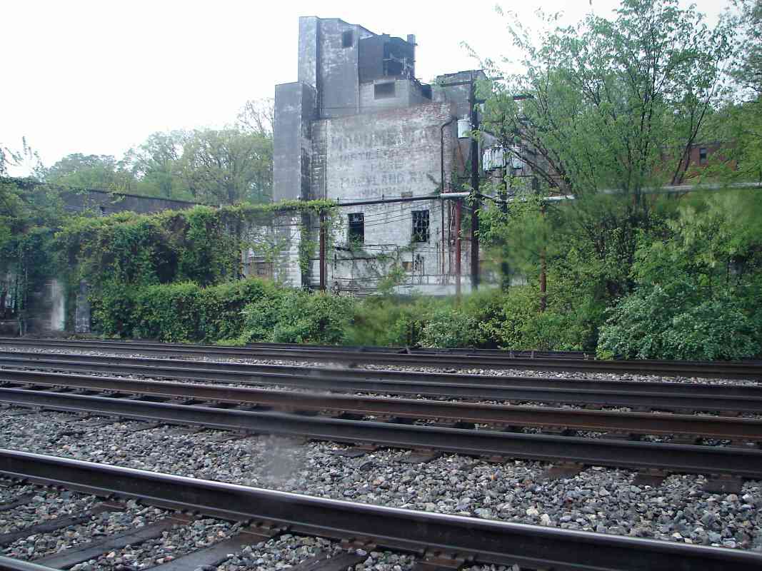
With proximity to shipping by both rail and sea, this area a few miles from Baltimore became a hub of liquor distilling in Maryland. Rye whiskey was the most popular form of whiskey in the northeast, and the un/loading Maryland style, less spicy but brighter than its Pennsylvania cousin, was a top seller. Monumental, Heilman, and Calvert were just a few of the distilleries in this vicinity. As of 1915, this was the home of the Standard Compressed Yeast Company, while B&O's Monumental Station stood near the photographer.

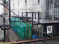
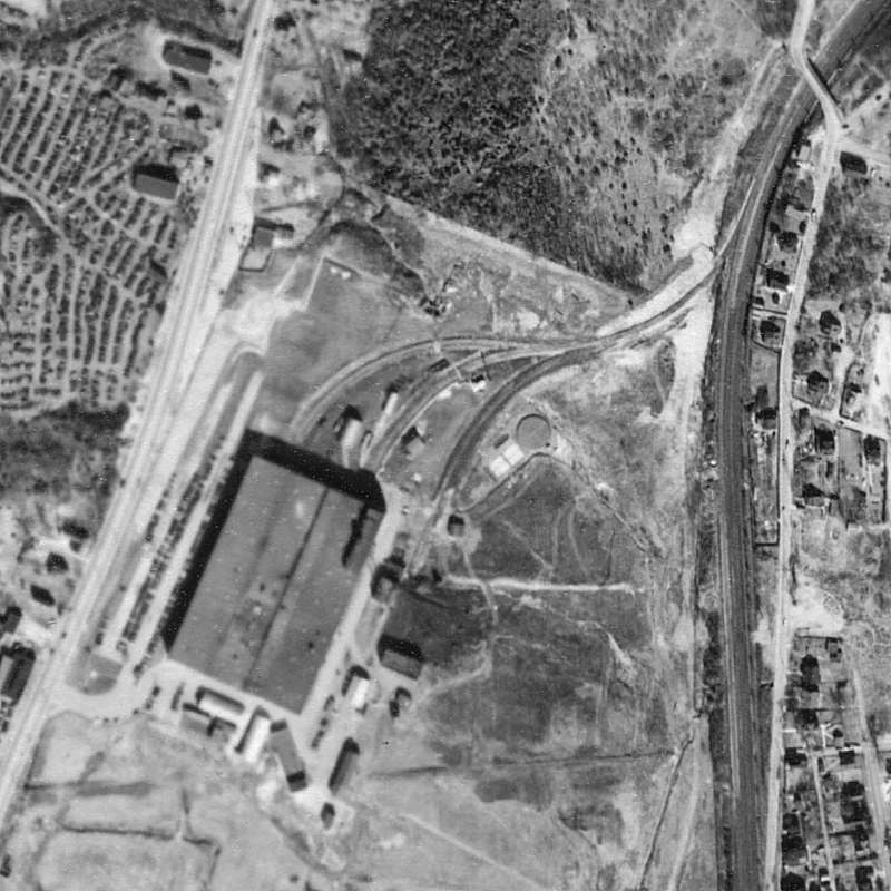
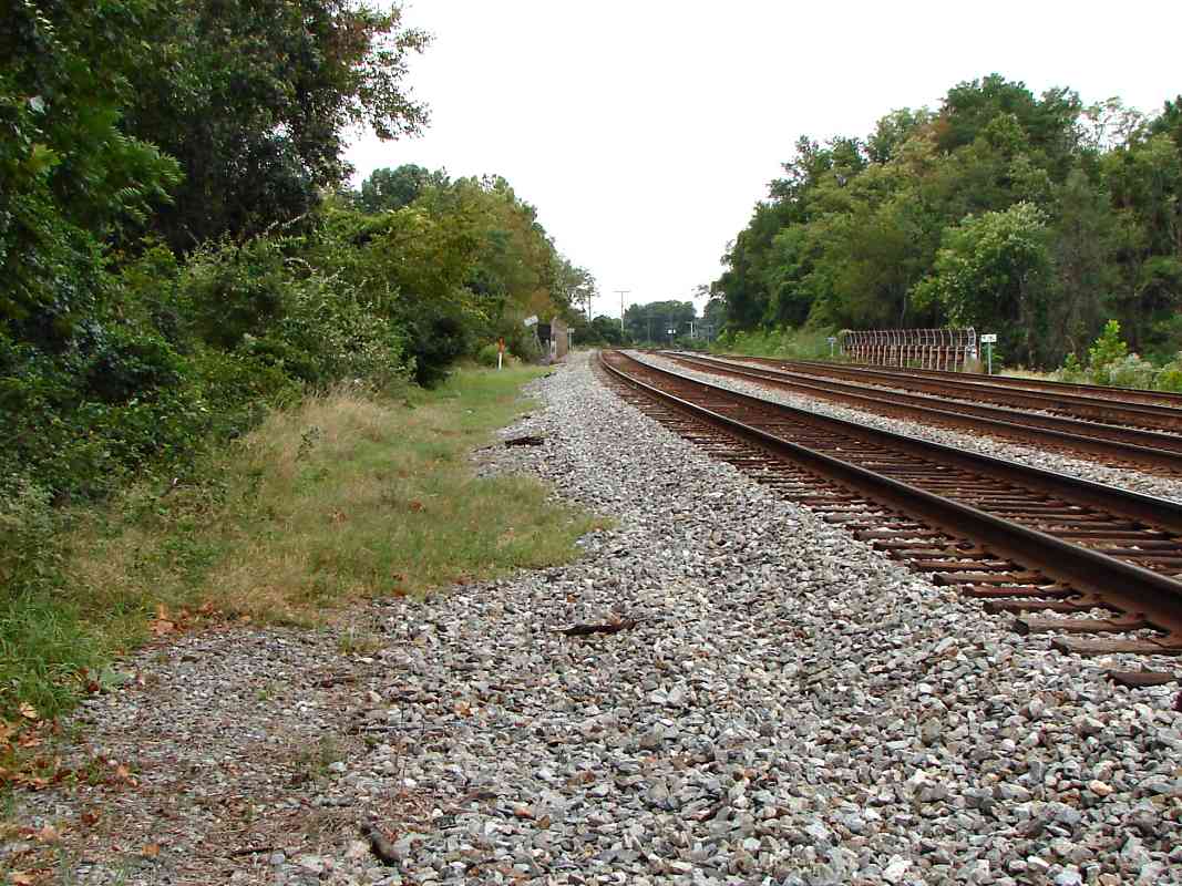
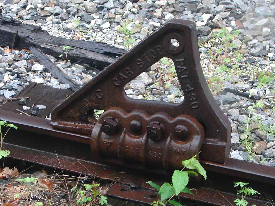
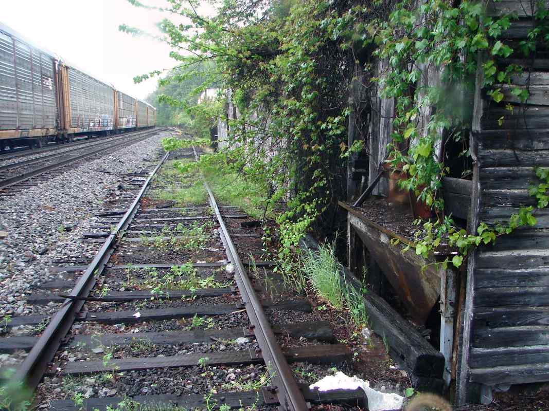
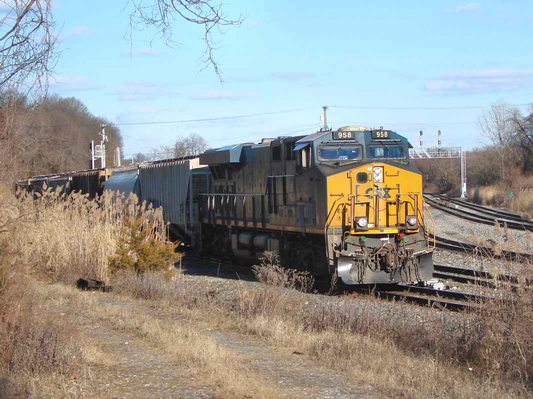
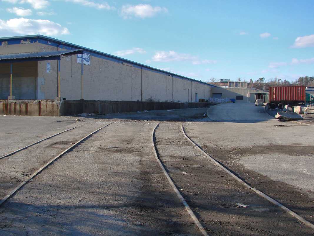
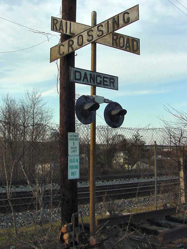
As seen at right, some distillery un/loading docks had rails of their own on which wagons likely rolled.

In 1919 the 18th Amendment to the United States Consititution (Prohibition) forever changed distilling in Maryland, and put the smaller companies out of business for good. Soon after Prohibition was repealed Calvert was purchased by Seagram's. Others, such as Monumental, resumed operation, but like their ad here, gradually faded away and were bought out or reorganized. Monumental continues now under the name Majestic Distilling Company but ceased producing Maryland Rye in 1972. As of 2022, Iron Bull Distillery operates here.

Link: Iron Bull


Car Stop

Car Stop
Mile: 4.9 Date: May 2009
Ease: B View: SE
Area: B IC2:
Map: Ba 42 C 10 Topographic Maps

Along the distillery's siding, this Q&C brand car stop hangs on. Q&C, a Chicago-based manufacturer of railway equipment founded by Charles F. Quincy, merged into the Quincy, Manchester, Sargent Company in 1906. This car stop, which likely predates that merger, was installed to prevent cars from rolling off the end of the siding. This is just one of various car stop and bumper post designs. When Iron Bull distillery moved in it put this bumper back into use.

"PAT 430" appears to indeed refer to US Patent Number 430 (three digits!) by Peter Henry Dreyer dated October 18, 1837 in regard to a "Mode of Construction and Fastening of Iron Rails on the Timbers of Railways." US patent numbering that began in 1836 had reached 10 million by 2016.


Chute
NEW! mid-Feb 2023

Chute
Mile: 4.9 Date: May 2009
Ease: B View: SW
Area: B IC2:
Map: Ba 42 C 10 Topographic Maps

This appears to be a chute to facilitate unloading of bulk materials from a hopper via gravity. I have not seen another like it. It was removed when Iron Bull remodeled the disillery around 2020.


Widest

Widest
Mile: 5.1 Date: May 2009
Ease: B View: SW
Area: B IC2:
Map: Ba 42 C 10 Topographic Maps

Excluding rail yards, the four tracks plus a spur here illustrate the Old Main Line at its widest. This spur sprang to life for access to the hosting grounds of B&O's Fair of the Iron Horse in 1927; the spur remains active now to serve local businesses along and near Hollins Ferry Road.

During this route's earliest years, and almost certainly prior to the opening of the Washington Branch in 1835, this stretch likely supported fewer than four tracks. The Baltimore Iron Company had mined in this vicinity.

Link: Baltimore Iron Company


<< Previous (east) | THIS PAGE: Camden Jct to Monumental | Next (spur) >>

Or, return to main page

Copyright Notice