TrainWeb.org Facebook Page
B&O Photo Tour


B&O Philadelphia Branch
Modern day photo tour

Accompanying each photo below are:

Click a photo to see a larger view. Please send your comments and corrections to Steve.


<< Previous (west) | THIS PAGE: Bayview to Poplar | Next (east) >>

Philadelphia Branch - Brief Historical Background:

Bayview Yard West

Bayview Yard West
Mile: 89.2 Date: Aug 2016
Ease: A View: W
Area: B RBL:
Map: Ba 36 B 11 Topographic Maps

csx 3258 I-895 provides an obstructed view, but it's the best place from which to peer into CSX's Bayview Yard in Baltimore. The Baltimore Belt Line meets the Philadelphia Branch along the north side of the yard, the two rightmost tracks in this view. The distant train is ready to bend photo left onto the Sparrows Point Branch which was originally part of the route to Philadelphia.

Nearer, a relatively new CSX 3258 illustrates the distinctive roofline of GE model ET44AH units. CSX 789 stands behind.

Link: more CSX 3258 pics


1937 Aerial
Photo courtesy Johns Hopkins University

1937 Aerial
Mile: Date: 1937
Ease: View: N (up)
Area: B- RBL:
Map: Ba 43 K 2 Topographic Maps

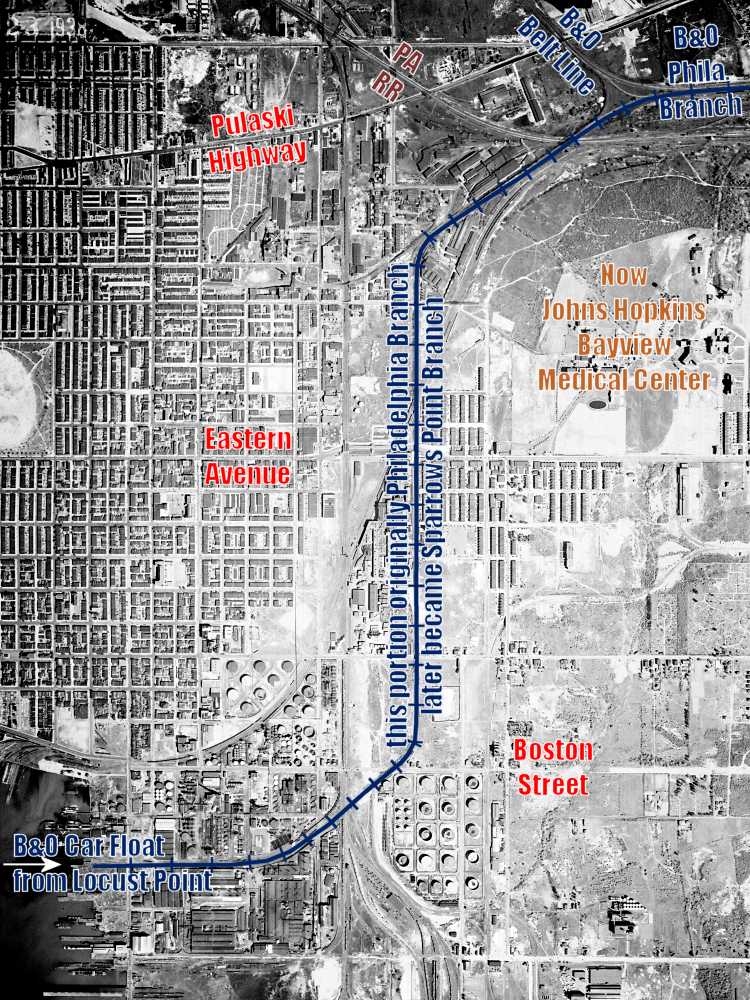
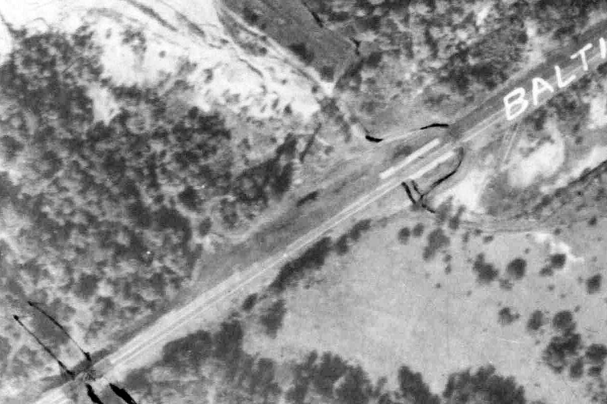
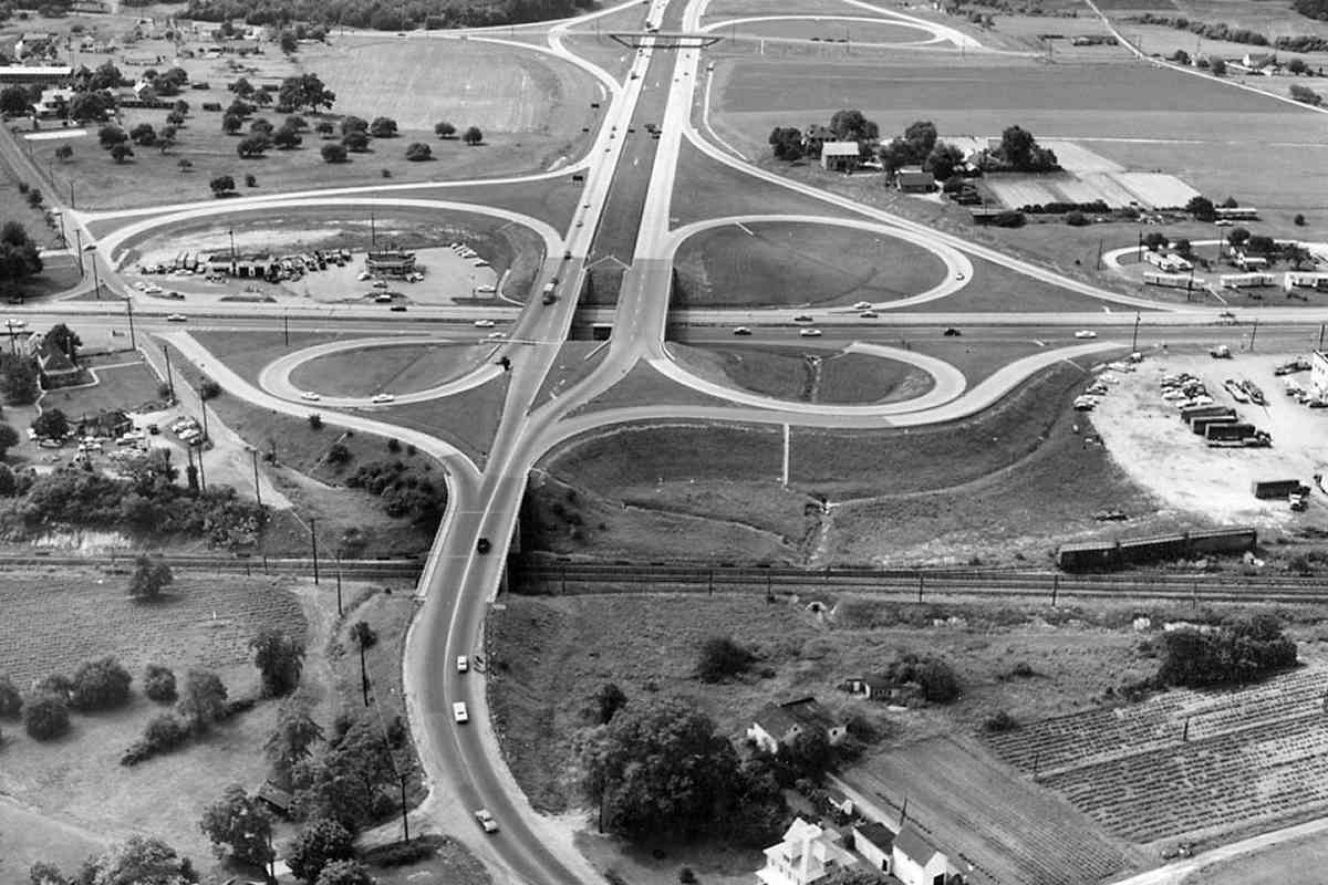
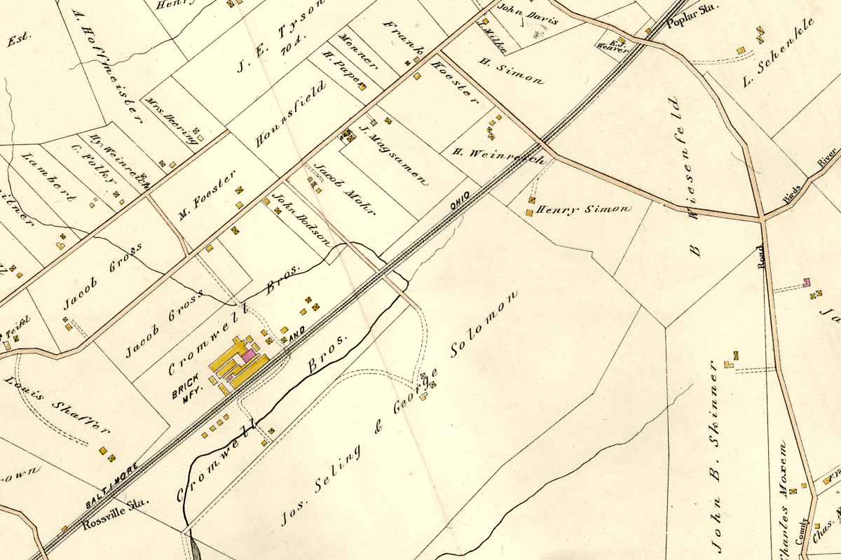
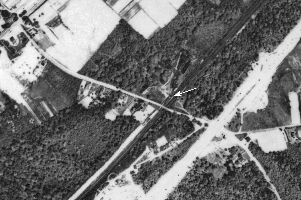
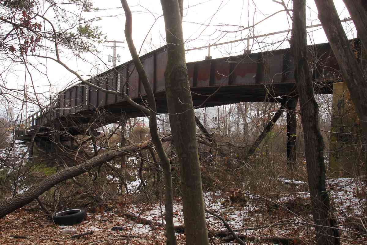
B&O rushed the Philadelphia Branch into operation before it could complete the Baltimore Belt Line, a rail connection to/from the rest of the railroad in downtown Baltimore. Consequently from roughly 1885 to 1895, B&O instead floated railcars across Baltimore Harbor. At that time 
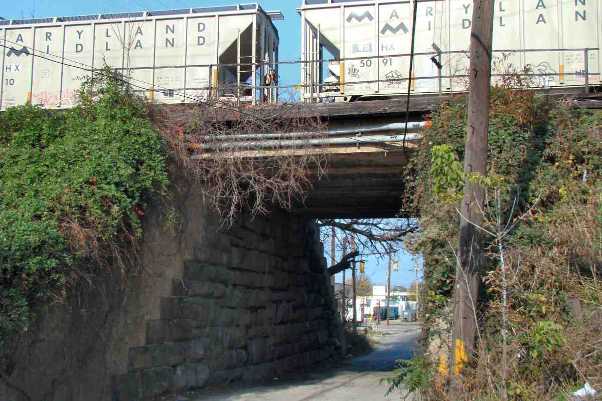
the Philadelphia Branch began in the Canton area (lower left of this aerial), then tracked generally north to Bayview (or, Bay View as it was spelled), then northeast to Philadelphia.

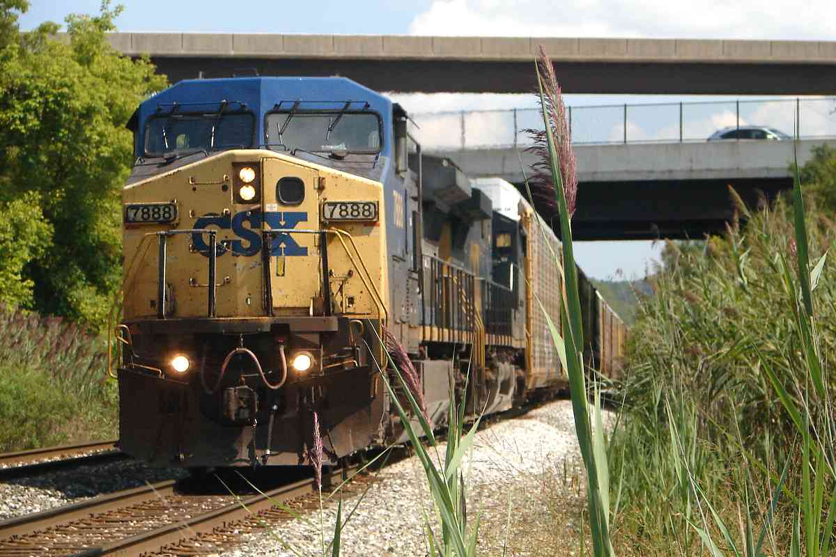
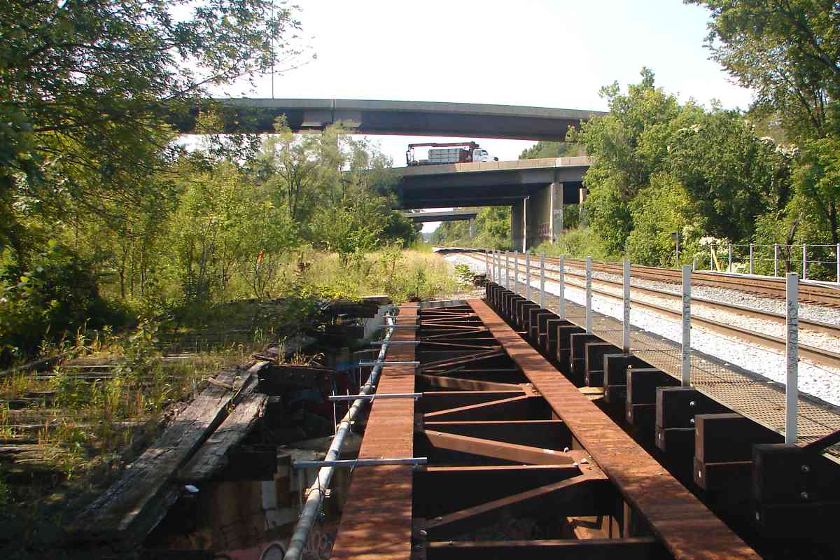
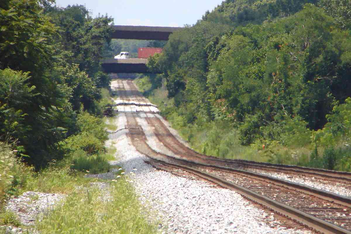
When the Belt Line was finished and connected from the west into Bayview, 
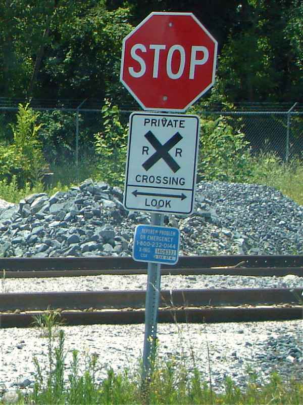
B&O repurposed the track between Canton and Bayview into the Sparrows Point Branch, the subject of a separate tour at this site.


Bayview Yard East

Bayview Yard East
Mile: 89.2 Date: Nov 2016
Ease: A View: E
Area: B RBL:
Map: Ba 36 B 11 Topographic Maps

Peering the opposite direction from I-895 finds the through tracks on the left.

Link: ~1960


Erdman Avenue
Photos courtesy Dave Hiteshew

Erdman Avenue
Mile: 88.6 Date: Jan 2008
Ease: A View: SE
Area: B- RBL:
Map: Ba 36 C 11 Topographic Maps

herald 1943 When Bethlehem Steel and related industry got busy for WW II, North Point Boulevard was widened and connected to Erdman Avenue. The tiny one-lane underpass was supplanted by this bridge.

This is one of the few places within Baltimore City that the B&O capitol dome herald is (was?) visible. Holes in the concrete suggest a CSX sign had been covering it previously.


North Point Road
Photo courtesy Dave Hiteshew

North Point Road
Mile: 88.5 Date: Nov 2009
Ease: A View: NW
Area: B- RBL:
Map: Ba 36 C 11 Topographic Maps

This photo shows why a new underpass was needed. This is the only one-lane railroad underpass for public use that remains active within Baltimore City. Three tracks cross on top, up from one or two as the pre-1927 concrete addition would attest.

Maryland Midland Railway (MMID) is a Class III carrier owned mostly by the Genesee & Wyoming. MMID connects with CSX at Highfield and Emory Grove (Maryland).


Labeled Switch
Photo courtesy Dave Hiteshew

Labeled Switch
Mile: 88.5 Date: Jan 2008
Ease: B+ View: W
Area: B- RBL:
Map: Ba 36 C 8 Topographic Maps

When trains keep winding up on the siding rather than in Bayview Yard, this is what you do.


Bayview Yard West

Bayview Yard West
Mile: 88.4 Date: Aug 2017
Ease: B- View: SW
Area: B- RBL:
Map: Ba 36 D 11 Topographic Maps

Deep zoom peers back across North Point Road into the eastern side of Bayview Yard. Beyond stand tall catenary poles of NS's adjacent Bayview Yard.


Herring Run

Herring Run
Mile: 88.3 Date: Aug 2017
Ease: B- View: W
Area: B RBL:
Map: Ba 36 D 11 Topographic Maps

During dry summers Herring Run doesn't run all that much, but the trains still do. Note the thicker/taller crossties, standard issue for bridges.


CSX 7888

CSX 7888
Mile: 88.2 Date: Aug 2017
Ease: B- View: NE
Area: B RBL:
Map: Ba 36 D 10 Topographic Maps

As it crossed under I-95 at the Moravia Boulevard ramps, this westbound was slowing to stop in Bayview Yard. Milepost 88 is in this vicinity, about 0.2 miles west of where it should be.

A 1915 atlas places B&O's Herring Run Station on the left.


Herring Run Station
Photo courtesy Johns Hopkins University
NEW! mid-Jun 2023

Herring Run Station
Mile: 88.1 Date: 1927
Ease: View: N (up)
Area: RBL:
Map: Ba 36 D 10 Topographic Maps

B&O's relatively-inaccessible Herring Run Station has received little coverage in historical accounts. This is the only photo of it online (rectangle at center). I-95 now crosses overhead where it had stood between Herring Run (left) and Moores Run (right). The dark lines at those streams appear to be ink marks on the aerial photo.


Moores Run

Moores Run
Mile: 88.0 Date: Aug 2017
Ease: B View: SW
Area: B RBL:
Map: Ba 36 E 10 Topographic Maps

I was expecting old aerial photos to depict four active rail lines, but instead those photos suggest CSX built a new double-track bridge adjacent to the former and left the old in place. That is likely to have happened during the 1980s while I-95 (distance) was built.

Link: 1988


68th Street

68th Street
Mile: 87.4 Date: Jul 2016
Ease: A View: SW
Area: B RBL:
Map: Ba 36 G 9 Topographic Maps

rr_crossing sign From the 68th Street grade crossing we can look back to where the line goes under I-95 and over Moores Run. An 1898 atlas places Druid Station near here. A 1915 atlas shows this area as the home of Champion Brick Company.

Private railroad crossing signs like this often lack the standard yellow background.

More than many other east coast cities Baltimore favors naming, rather than numbering, streets making 68th Street the highest numbered in the county.

Link: Todd's site describes 2013 derailment here


Redhouse Run
Photo courtesy Dave Hiteshew

Redhouse Run
Mile: 87.1 Date: Jan 2008
Ease: B- View: N
Area: B RBL:
Map: Ba 36 G 9 Topographic Maps

With marshy land all around, getting a photo of the Redhouse Run bridge is not easy. It's even less easy to see the bridge.


CPLs
Photo courtesy Dave Hiteshew

CPLs
Mile: 87.0 Date: Jan 2008
Ease: A- View: NE
Area: B RBL:
Map: Ba 36 G 9 Topographic Maps

Team Hiteshew documented the line a couple years before CSX tore out its iconic B&O CPL signals. This may be the last photo anyone snapped of this pair that stood near Rosedale Avenue's former grade crossing. Chesaco Road bridges in the distance.


Trolley Tracks

Trolley Tracks
Mile: 87.0 Date: Aug 2017
Ease: A- View: SE
Area: B RBL:
Map: Ba 36 G 9 Topographic Maps

The signals are new but old rails (magenta highlight) embedded in concrete and perpendicular to CSX's suggest a trolley once ran along Rosedale Avenue, perhaps to the cemetery at Philadelphia Road. Though the surviving utility poles boost my conjecture, old aerial photos lack sufficient resolution to show such a trolley, and I can find no mention of it online. Anyone know more about these rails? B&O trains of the past did stop at Rosedale Station in the northeast quadrant here.


Batavia Farm Road

Batavia Farm Road
Mile: 86.4 Date: Jul 2016
Ease: A View: SE
Area: B RBL:
Map: Ba 36 H 8 Topographic Maps

maybe now "No Jake Brakes" refers to disallowed use of a truck braking system that can be noisy. As explained at the first link below, the Jacobs Vehicle Systems feels such signs are an improper use of their trademark.

The more distant sign warns of trains beyond the bend. I've not seen the "one could be now" phrasing before. Unfortunately the sign provided false hope: no trains passed during my visit.

Links: the backstory, explanation of how the brakes work


CSX 973
NEW! mid-Jun 2023

CSX 973
Mile: 86.4 Date: Nov 2022
Ease: A View: W
Area: B RBL:
Map: Ba 36 H 8 Topographic Maps

CSX 973 is eastbound out of Bayview Yard. Chesaco Road bridges in the distance.

A circa 1900 plan that did not materialize would have had a Canton Railroad branch cross B&O near here on its way to Towson where it would have connected with the Maryland & Pennsylvania.


PGC
NEW! mid-Jun 2023

PGC
Mile: 86.4 Date: Mar 2023
Ease: A View: SW
Area: B RBL:
Map: Ba 36 H 8 Topographic Maps

This PGC logo looks so Soviet Kukuruzshchik that I expected it to represent the Peoples Grower Cooperative. Instead, it was for the Producers Grain Corporation that operated from 1938 to 1989. In another bit of history, PLCX was a reporting mark of the Pullman Transport Leasing Company that was created by the Pullman Company known for making sleeping cars.

Link: PGC model


CSX 815
NEW! mid-Jun 2023

CSX 815
Mile: 86.4 Date: Mar 2023
Ease: A View: E
Area: B RBL:
Map: Ba 36 H 8 Topographic Maps

Westbound CSX 815 is rolling mixed freight downhill. Todds Lane is the distant grade crossing.


Contractors Road

Contractors Road
Mile: 85.5 Date: Jul 2016
Ease: A View: NE
Area: B RBL: 38
Map: Ba 36 K 6 Topographic Maps

Unlike the Old Main Line, this line is straight and mostly level. The I-695 Baltimore Beltway and its ramps span overhead in the distance. Contractors Road is a small suriving segment of a colonial-era road between Baltimore and Philadelphia. It appears on 1927 maps as Old Philadelphia Road.


Beltway Endpoint
Photo courtesy Baltimore Sun
NEW! mid-Jun 2023

Beltway Endpoint
Mile: 85.2 Date: 1962
Ease: View: NW
Area: RBL:
Map: Ba 37 A 6 Topographic Maps

Grade separation of Golden Ring Road (left) happened by the 1930s. By 1962, this new bridge over the railroad led Golden Ring Road onto the nascent I-695 Baltimore Beltway. On the right, a B&O siding served local businesses for a few more years before being pulled up.

US 40 traverses left to right, as does MD 7 in the background. This would remain a Beltway endpoint until 1977's Key Bridge opening. Note an uncommonly productive use of the land within one cloverleaf loop.


Stemmers Run
Photo courtesy Dave Hiteshew

Stemmers Run
Mile: 84.8 Date: Jan 2008
Ease: B View: NW
Area: B RBL:
Map: Ba 37 B 4 Topographic Maps

Bridge 6B carries trains over Stemmers Run. Stone supports of this style are often found where B&O had originally installed a Bollman bridge.


Rossville Boulevard
Photos courtesy Dave Hiteshew

Rossville Boulevard
Mile: 84.6 Date: Jan 2008
Ease: A View: E
Area: B RBL:
Map: Ba 37 B 4 Topographic Maps

emblem Though its art deco appearance suggests greater age, the bridge over Rossville Boulevard dates to 1966 when it was the replacement for Golden Ring Road which was severed by I-695. It is one of the newer original bridges on the line. CSX has deigned to permit the B&O emblem to slowly fade away, revealing the bridge may have not yet been (re)painted .


Transition
Photo courtesy Dave Hiteshew

Transition
Mile: 84.6 Date: Jan 2008
Ease: B View: NE
Area: B RBL: 171
Map: Ba 37 B 4 Topographic Maps

A CPL signal tower had ruled the track bottleneck found Between Rossville Boulevard and US 40. Previously a spur diverged to the right to serve Pulaski Industrial Park. B&O's Rossville Station had been on the left.


Atlas 1898
Photo courtesy Johns Hopkins University
NEW! mid-Jun 2023

Atlas 1898
Mile: 84-83 Date: 1898
Ease: View: N (up)
Area: RBL:
Map: Ba 37 F 1 Topographic Maps

The stretch between Rossville (left) and Poplar (right) Stations was home to Cromwell Brothers brickyard.

Link: brickyard info


Poplar Station
Photo courtesy Johns Hopkins University
NEW! mid-Jun 2023

Poplar Station
Mile: 82.8 Date: May 1938
Ease: View: N (up)
Area: RBL:
Map: Ba 37 F 1 Topographic Maps

Poplar Station (arrow) stood in the northwest quadrant of Middle River Road grade crossing. The bright stripe on the right is US 40 under construction. BR Tower had stood in Poplar.

Link: BR Tower


Mohrs Lane Bridge
Photos courtesy Dave Hiteshew

Mohrs Lane Bridge
Mile: 82.1 Date: Jan 2008
Ease: A View: SE
Area: B+ RBL:
Map: Ba 29 G 13 Topographic Maps

view NW view SE view NW timbers

Having been on duty for almost a century, by 2008 bridge 9B for Mohrs Lane was on its last legs. It was doomed as soon as the decision to double stack trains was made, and allowed to deteriorate enough to be closed to vehicles and removed in 2011. It was the last survivor of its kind along the line in Maryland.

Link: Bridgehunter entry


<< Previous (west) | THIS PAGE: Bayview to Poplar | Next (east) >>

Or, return to main page

Copyright Notice