TrainWeb.org Facebook Page
Trolley Photo Tour


Rhode Island Avenue Trolley
Modern day photo tour

Accompanying each photo below are:

Click a photo to see a larger view. Please send your comments and corrections to Steve.


<< Previous (index) | THIS PAGE: Hyattsville to Beltsville | Next (east) >>

Brief Historical Background: Rhode Island Avenue Trolley

Hyattsville Then
Photo courtesy HH Harwood collection

Hyattsville Then
Mile: Date: ~1957
Ease: View: SW
Area: IC2:
Map: PG 12 D 5 Topographic Maps

In 1899, the newly organized City & Suburban Railway decided to extend further northeast out of Washington, DC the Rhode Island Avenue streetcar line it had acquired from the Columbia & Maryland Railway. The route chosen largely paralleled that of B&O's Washington Branch. Before the year ended, they reached Hyattsville.

This view from the 1950s looks back toward the District and shows DC Transit car number 1300. At bottom left are B&O's Washington Branch tracks. The B&O station in Hyattsville is unseen behind the photographer.


Hyattsville 2004

Hyattsville 2004
Mile: Date: Apr 2004
Ease: A View: SW
Area: C IC2:
Map: PG 12 D 5 Topographic Maps

A fortuitous gap in a row of pine trees lets us enjoy almost the same view a half century later.

The trolley's right of way has been paved over by a widening of Rhode Island Avenue, and the overhead wires are fewer, but a surprising number of items are little changed. The row of shops is still there, and the tall evergreen tree behind the shops appears mystifyingly similar.

Street parking remains available adjacent to the shops, and the automobiles are contemporary to the photo. One of the surviving utility poles still carries the same arrangement of wires overhead. If you look closely, in the distant left you'll note B&O's CPL signals survive near a now-closed grade crossing.

Link to older pic: 1940


Hyattsville Station
Photo courtesy Library of Congress

Hyattsville Station
Mile: Date: Jun 1940
Ease: A View: SW
Area: C IC2:
Map: PG 12 D 4 Topographic Maps

A Library of Congress photo that depicts the then-new grade Sep 2017 elimination bridge at Hyattsville happens to capture at its edge a Capital Transit trolley, as well as the line's Hyattsville passenger waiting shack.

The new bridge obscures B&O's Hyattsville Station that was adjacent to the trolley.

As of 2017 the foundation of the shack remained extant, surrounded by yellow poles of no obvious purpose.

Link: LoC source photo


DC Transit
Photo credit Al Holtz,
B&O History Collection
NEW! early-Dec 2022

DC Transit
Mile: 33.2 Date: Sep 1956
Ease: A View: NE
Area: B- IC2:
Map: PG 12 D 4 Topographic Maps

The DC Transit name was new at photo time, but service along Rhode Island Avenue was in its final operating years. Car 1572 is stopped near the end of Hamilton Street. B&O's JD Tower stands on the right.

Note the horizontal metal pipes that hold up the trolley wire.

Link: ~1930


Leftovers
Photos credit Marty Hager
NEW! early-Dec 2022

Leftovers
Mile: 33.2 Date: Feb 2012
Ease: B View: NE
Area: B- IC2:
Map: PG 12 D 4 Topographic Maps

Feb 2009 Anyone who has replaced a muffler on their car knows rusty bolts are notoriously difficult to loosen. The speediest way to remove the trolley wire holders, without damaging the pole, looks to have been to cut or break them off, leaving dregs like these.

The holes in the wooden pole may suggest otherwise, but there are no Acorn Woodpeckers in this region.


B&O 1312
Photo credit Al Holtz,
B&O History Collection
NEW! early-Dec 2022

B&O 1312
Mile: 33.2 Date: Jul 1963
Ease: A View: NE
Area: B- IC2: 179
Map: PG 12 D 4 Topographic Maps

By 1963 the trolley was gone, but its utility pole route has lingered into the 2020s, parts of which are now a paved walking trail.

Link: 1978


Ladders
NEW! early-Dec 2022

Ladders
Mile: 33.2 Date: Nov 2021
Ease: A View: NE
Area: B- IC2:
Map: PG 12 D 4 Topographic Maps

Apparently, the trolley trail is reserved for walkers and ladder carriers. The Monk in me wants to lengthen the crossties and rotate that marking just a bit clockwise. (Monk was a TV show detective who dealt with OCD he deemed "a blessing and a curse.")


Madison Street Then
Photo credit HH Harwood

Madison Street Then
Mile: Date: 1950
Ease: View: SW
Area: IC2:
Map: PG 12 E 3 Topographic Maps

Harwood captured CTC 766 at Madison Street between Hyattsville and Riverdale. It was here the trolley and B&O were at their closest; their rights of way were essentially adjacent for about a mile northeast and southwest of this spot.

Circa 1900, WB&A gained control of this line, and began constructing a power generating plant in Hyattsville, perhaps at this location. The project ended with a 1903 bankruptcy, but WB&A did manage to extend the line from Berwyn/Branchville to Laurel.

Link: ~1940


Madison Street 2004

Madison Street 2004
Mile: Date: Apr 2004
Ease: B+ View: SW
Area: C IC2:
Map: PG 12 E 3 Topographic Maps

Some 50 years later, the trolley right of way was found consumed by brush, but the site continued to host a utility pole convention.

The building in the foreground right is gone, but the taller one behind may survive (I was unable to match it exactly). The electrical substation looks to have expanded.

As a side business of sorts, many of the early 20th century electric railway companies were the first to sell power to local businesses and homes. Their facilities were later absorbed into the likes of PEPCO and BGE.


CTC 766
Photo credit HH Harwood

CTC 766
Mile: Date: 1950
Ease: View: S
Area: IC2:
Map: PG 12 E 3 Topographic Maps

This is the same location as the prior photo, just a different angle, and a better view of the trolley car. By the time of this photo, B&O had significantly cut back its local passenger service, surrendering to the post-WWII boom in automobile sales. Freight, like that seen at left, became a larger portion of the traffic on the Washington Branch.

Within the city of Washington, overhead power lines were prohibited by law, so an underground system was employed. Outside the city, there were no such limitations, and the railways opted for the cheaper overhead wires.

Reader Vernon Tyler wrote to clarify:

    "Might I submit the explanation is not precisely correct. AFAIK, the 'District Commission' set the rules on the housekeeping within DC. The applicable rule actually read - more or less - within three (?) miles of the Capitol. Look at the maps and note where the plow pits were sited. Seventh Street line, just above U Street, NW."


MARC

MARC
Mile: Date: Apr 2004
Ease: B+ View: S
Area: C IC2:
Map: PG 12 E 3 Topographic Maps

What's old is new. This modern view from the same spot shows the disused ROW crowded with brush, and not freight but passenger travel in the form of a MARC (Maryland Area Regional Commuter) train riding the ex-B&O tracks.


View North

View North
Mile: Date: Apr 2004
Ease: B+ View: N
Area: C IC2:
Map: PG 12 E 3 Topographic Maps

Spin around for a view in the opposite direction and you get less brush (as well as better sun position for photography) plus the always helpful, ol' ROW-marking utility poles. The paved trolley trail was still a few years in the future.


Riverdale

Riverdale
Mile: Date: Nov 2003
Ease: A View: S
Area: B+ IC2:
Map: PG 12 E 2 Topographic Maps

At Riverdale, B&O and the RI Avenue trolley were separated by the width of the building seen here. Trolley tickets were sold at the white building until the trolley ceased operation during the 1950s. After that for a time the building was home to Griff's famous subs and house of pizza, and later the book store seen here.

Link: 1964


Bridges

Bridges
Mile: Date: Apr 2004
Ease: A View: N
Area: B IC2:
Map: PG 12 E 2 Topographic Maps

Less than a half mile north of downtown Riverdale this strangely angled railing caught my attention. Its construction plus that of the adjacent road and rail bridges looks to date from the 1960s, after trolley service had ended.

Rhode Island Avenue is on the left, while immediately adjacent on the right and perched higher are the CSX railroad tracks.

Rhode Island Avenue has a decidedly schizophrenic nature. It strides boldly out of DC into Hyattsville on 6 lanes, then disappears for a mile or two, only to reappear at Riverdale in the wimpy form seen here. Like some confused dashed line, it will disappear and reappear twice more before reaching College Park.

Reader Greg Hager sent this correction:

    "In the photo marked Bridges you said that the trolley line ran down Rhode Island Ave just to left of the picture. This is not correct. It actually ran behind the buildings that are just visible to the left side of the picture.

    "If you back up to the parking lot by the Riverdale MARC station, if you look north (under the highway bridge) the Trolley line curved to the left. It passed where the west end of the bridge is anchored, behind the towing company. There should be a line of power poles still there and if you can follow it some of the graded right of way as well. All in all you have a great site please keep up the good work."


Calvert Hills
NEW! early-Dec 2022

Calvert Hills
Mile: Date: Mar 2022
Ease: A View: W
Area: A IC2:
Map: PG 7 E 13 Topographic Maps

Landowners, especially those who wanted to develop their land, were more than happy to have railroads run through it. The relatively quick commute to Washington made possible by the trolley helped boost Calvert Hills.


Paint Branch Parkway
NEW! early-Dec 2022

Paint Branch Parkway
Mile: Date: Nov 2021
Ease: A View: NW
Area: B+ IC2:
Map: PG 7 E 12 Topographic Maps

I attempt to include at least one photo like this on each tour page because I often receive emails that say something like, "I didn't know where you were talking about until I saw that familiar road pic."

The trolley walking path is popular enough to be guarded by its own traffic signal where it crosses Paint Branch Parkway. Around 1990, the parkway took the place of a B&O spur to the University of Maryland. There must have been some special wiring for the trolley here so the taller freight trains could pass under, but I have yet to see a photo of that crossing.


Near Paint Branch Then
Photo courtesy HH Harwood collection

Near Paint Branch Then
Mile: Date: 1947
Ease: View: N
Area: IC2:
Map: PG 7 E 11 Topographic Maps

Then: CTC 540 leaps a tributary of the Paint Branch stream. The trolley bridge is a combination of stone and steel. To my eye, the relatively short distance above the water says this spot had never employed an arched stone bridge.


Near Paint Branch 2004

Near Paint Branch 2004
Mile: Date: Apr 2004
Ease: B+ View: N
Area: B+ IC2:
Map: PG 7 E 11 Topographic Maps

Now: In 2001, the old bridge was rehabbed and given new life as a walking trail within Paint Branch Park.


Branchville Loop Then
Photo credit HH Harwood

Branchville Loop Then
Mile: Date: 1948
Ease: View: N
Area: IC2:
Map: PG 7 F 9? Topographic Map

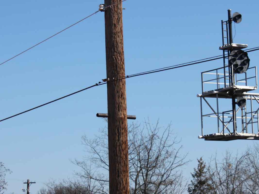
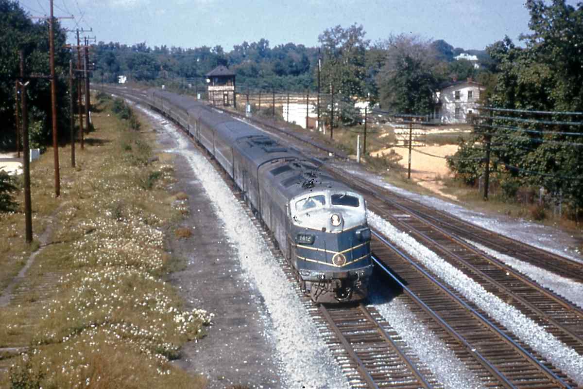
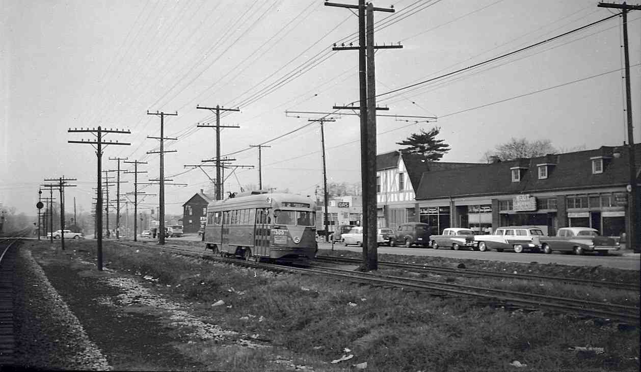
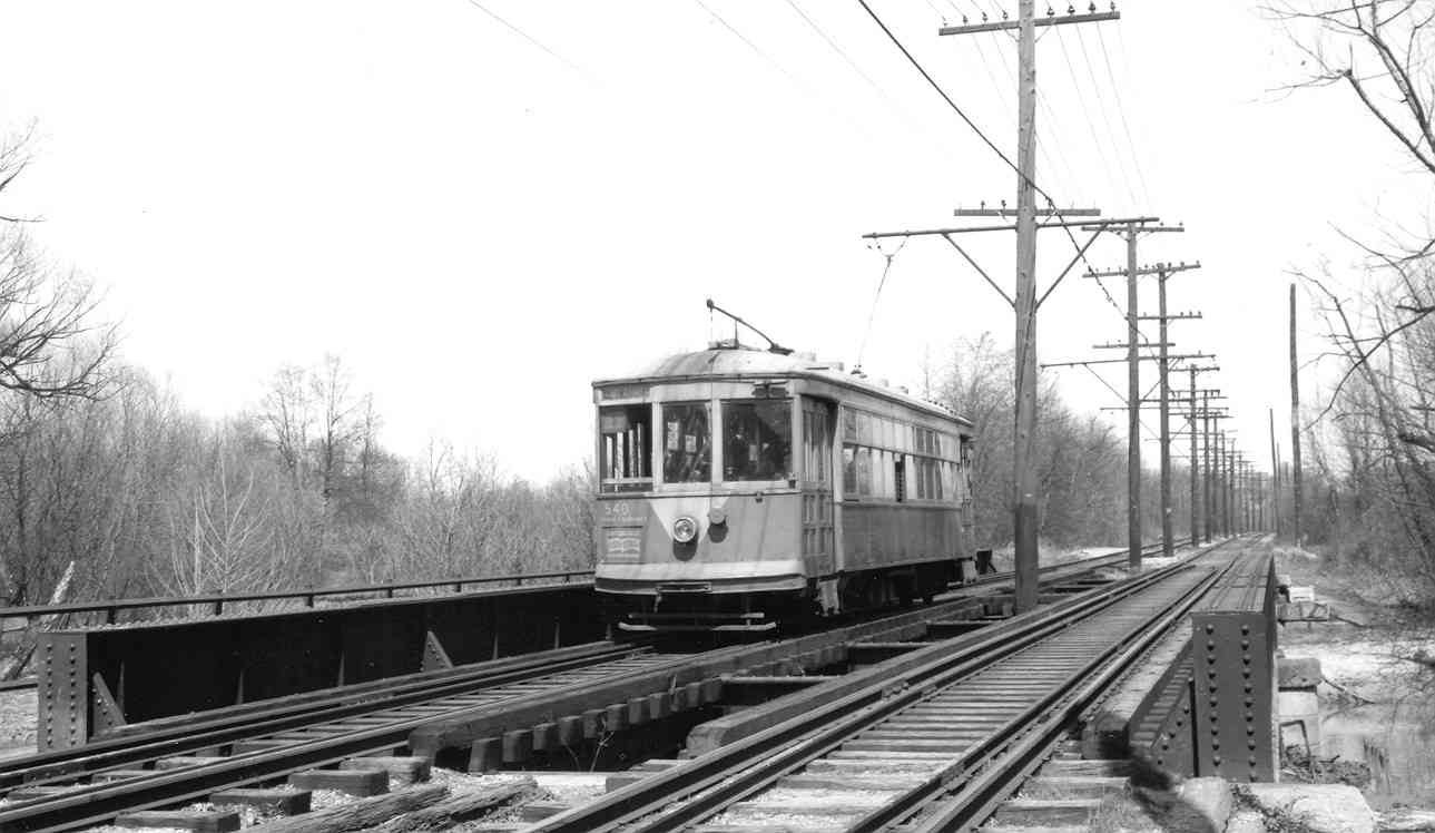
Competition from automobiles (and buses) resulted in a series of cutbacks in trolley service to the more distant suburbs.

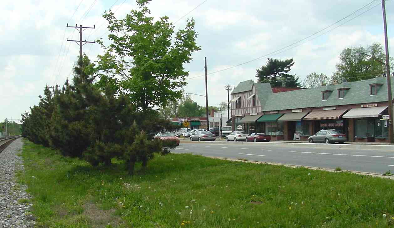
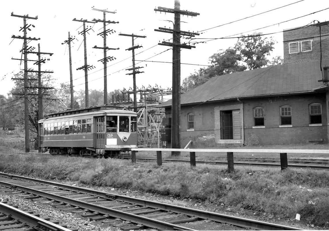
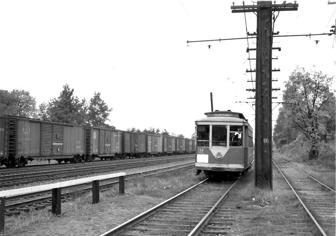
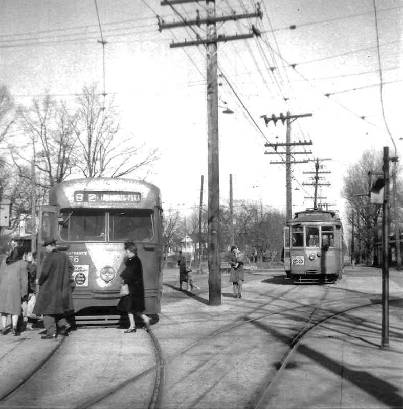
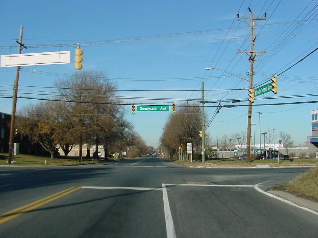
At the time of this photo, the loop seen here was new, having been added to accomodate PCC cars, like the one at left, which could be controlled from only one end. The older cars (right) had operator controls at each end; in the late 1940s they became relegated to shuttle service from here up to Beltsville.

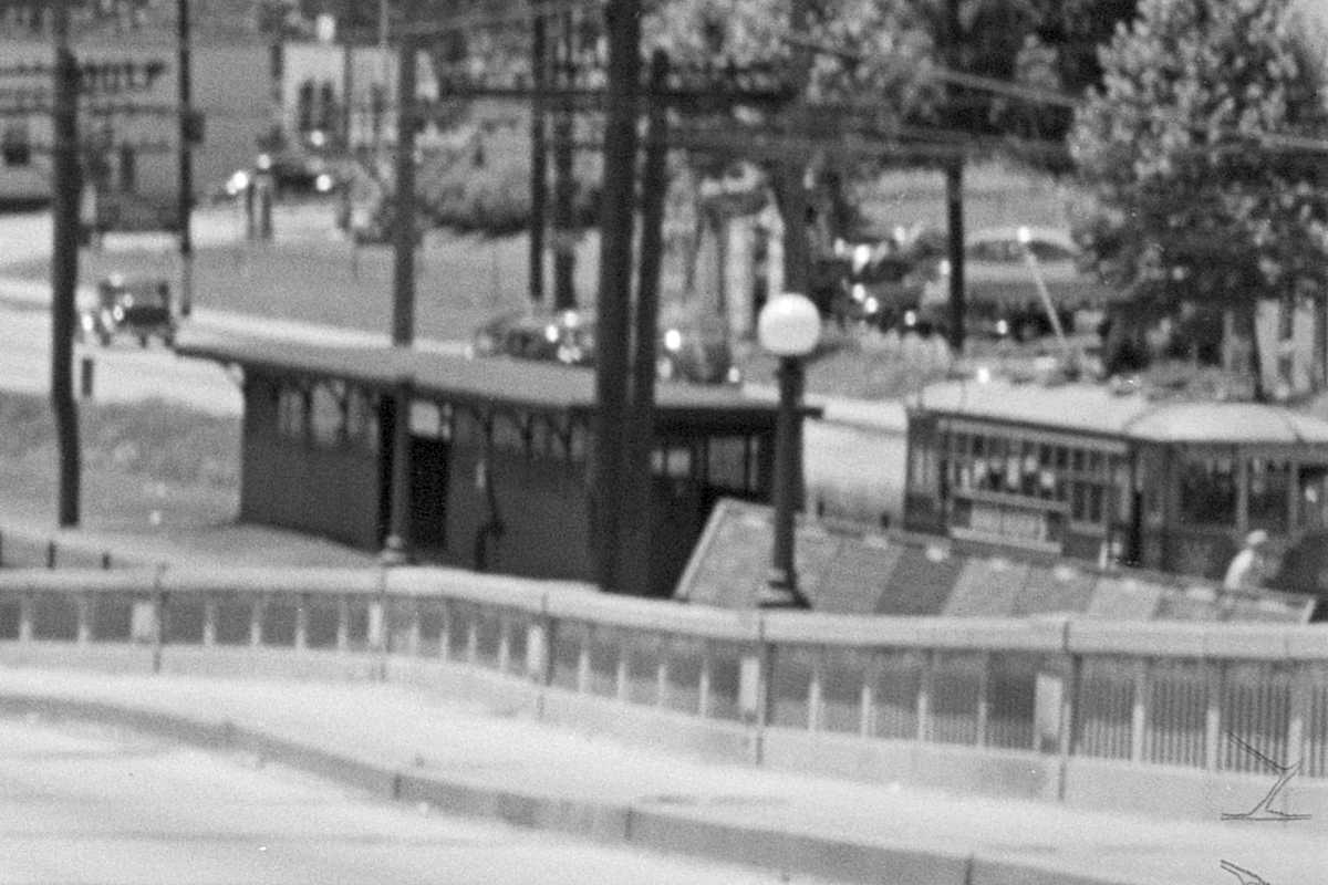
In this chilly winter morning scene commuters transfer from the shuttle to the newer vintage PCC car to complete the trip to DC. As you might guess, this (purposely?) added inconvenience must have done little to encourage 
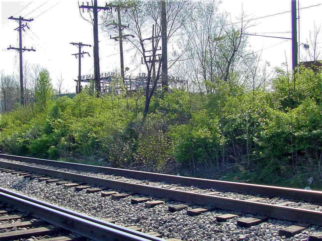
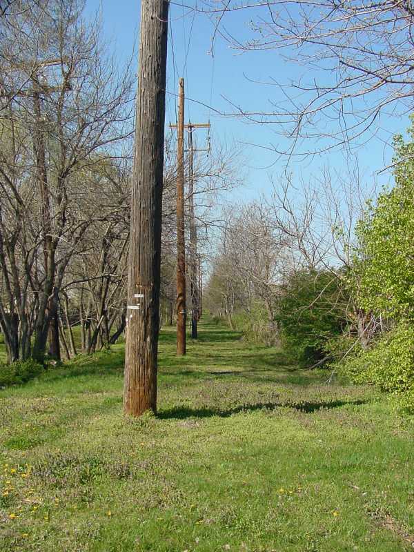
ridership, and by the 1950s the shuttle to Beltsville ceased, leaving Branchville Loop the end of the line.

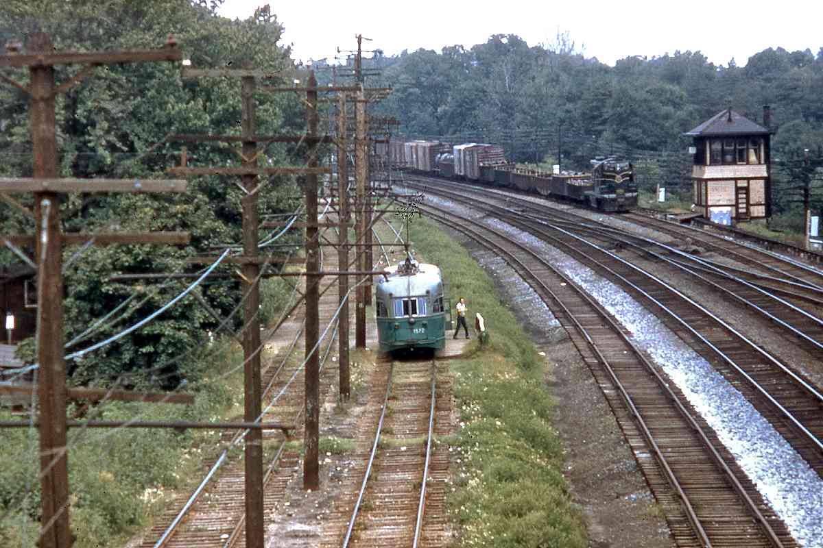
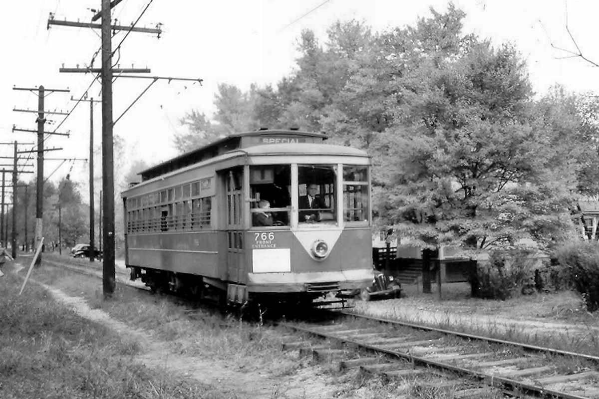
PCC stands for Presidents' Conference Committee, a 1930s group tasked with promoting the design of newer, better looking streetcars to lure riders. The cars became a common standard in many US cities, then spread to Europe and the USSR. PCC cars can still be found in operation in cities such as Prague. (Thanks to Herb Harwood for this PCC info.)


Branchville 2004

Branchville 2004
Mile: Date: Apr 2004
Ease: A View: N
Area: B IC2:
Map: PG 7 F 9 Topographic Maps

The curved brickwork hints the Branchville Loop had been near. The Loop was centered about 250 feet north of this spot, where today one finds the median of Rhode Island Avenue between Greenbelt Road and Branchville Road; in this view that's the green patch across the street.

Reader Deane Mellander wrote about the location:

    Steve: I located a 1960 map of P.G. County that shows the trolley line. It confirmed my recollection that the Branchville loop was just north of the original intersection of Greenbelt Road and Rhode Island Avenue. That would put the loop right between the H and V on the topo map, underneath the intersection of Rhode Island Ave. and Rt. 193 (the realigned connection of Greenbelt Road to University Blvd.). I think that the loop would have been up near the white building just to the right of the trees, if the photo was taken at the old Greenbelt Road intersection.

Reader Phil Fisher added:

    Read with great interest your treatise on the Trolley system. I lived a half mile from the Branchville area (specifically, Oak Springs which was a development between Branchville and Daniels Park, bordered by Rhode Island Avenue on the east and Route 1 on the west) from 1950 to 1963 and remember the area quite well. I walked passed the 'turnaround' everyday on my way to school. The turnaround began not more than 10-20 feet north of Greenbelt road, but not as far as University Blvd which wasn't there at the time. There was a row of 3-4 stores on the west side of the turnaround that included Johnson's Drug Store and Becca's Bakery (13 in a dozen). There was a Sinclair gas station on the West side. It was a real treat to see the trolley go by in the rain because of the sparks that were generated on the overhead lines. When it was time for Univ. Blvd. to be built, it turned out that the old Johnson family home - a large frame structure - was in the right of way. That, too, was an event as it was burned down by the Branchville fire department for a training exercise.

Links to older pics: ~1955, 1956, 1957


Branchville Stores
Photo credit HH Harwood

Branchville Stores
Mile: Date: 1948
Ease: A View: N
Area: B IC2:
Map: PG 7 F 9 Topographic Maps

Another with fond trolley memories is Gail Johnson:

    I just saw the youtube film of the 82 Streetcar ride & it is wonderful. My father & mother owned Johnson's Drug Store (1949) & the other stores in the small strip mall at the Branchville Loop. Mr. Becka rented his bakery from my parents. My grandfather had a grocery store near the same area (dating back to the early 1900's) & my uncle had an auto repair shop (Rising Sun Motors is still there). The current 7-11 at the intersection of Rt. 193, R.I. Ave. & Greenbelt Rd. is where my parents' stores were located. My grandfather's home was the one that the firemen used for training once the State bought it via eminent domain to make the new Rt. 193 extension under Rt. 1 thru Greenbelt. As a child, I remember the streetcars turning around in front of the house & the sparks flying as my bedroom was on the second floor. My grandfather was a streetcar driver before he was a store owner. My father (now 89) rode this streetcar line down to McKinley Tech.

Highly recommended video (youtube): 82 Trolley line (1950s)


Residential
Photo credit HH Harwood

Residential
Mile: Date: 1950
Ease: View: SW?
Area: IC2:
Map: PG 7 G ? Topographic Maps

CTC 766 rolls through a residential area, perhaps the neighborhood north of University Boulevard known as Hollywood. If you can identify the exact location, please contact me.


Sunnyside Avenue

Sunnyside Avenue
Mile: Date: Dec 2003
Ease: A View: N
Area: B IC2:
Map: PG 7 G 4 Topographic Maps

North of College Park, outside the Washington I-495 Beltway and approaching Beltsville, Rhode Island Avenue assumes a two-lane form, obliterating evidence the trolley had been the first to take this straight path. Further ahead is the busy intersection with US 1.


<< Previous (index) | THIS PAGE: Hyattsville to Beltsville | Next (east) >>

Or, return to main page

Copyright Notice