TrainWeb.org Facebook Page
WB&A Photo Tour


Washington, Baltimore and Annapolis Railway
Modern day photo tour

Accompanying each photo below are:

Click a photo to see a larger view. Please send your comments and corrections to Steve.


<< Previous (southwest) | THIS PAGE: Linthicum to Patapsco River | Next (north) >>

Airport 1964
Photo courtesy Johns Hopkins University

Airport 1964
Mile: Date: Apr 1964
Ease: View: N (right)
Area: EH:
Map: AA 2 Topographic Maps

WB&A had cut a nearly straight route (blue green line) through the grounds of what is now BWI Marshall Airport. For easier viewing, this aerial image from 1964 is rotated such that north, the general direction of this tour, is to the right.

Maryland 170 had passed through the center of the town of Wellham Crossroads. The airport's control tower would later be placed about 400 feet south southwest of that crossroads. WB&A had passed about 1000 feet east of the crossroads.

As measured by number of passengers, during 2014 BWI ranked as the 23rd-busiest airport in North America and the 75th-busiest airport in the world. Ongoing airport expansion had by 1990 erased virtually all evidence of WB&A within the airport boundaries.

The tip of the arrow numbered 1 marks the photo location and view direction of the "North of Airport" photo below. Similarly, 3 marks the location of the "MD 170" photo below.


North of Airport

North of Airport
Mile: Date: Oct 2017
Ease: A View: W
Area: A EH:
Map: AA 2 E 10 Topographic Maps

On the north side of the airport, this lane closure arrow near the intersection of MD 162 and MD 170 happens to not only stand where WB&A WB+A herald trains had previously operated, but also points their way to Baltimore. This seems an appropriate place to haul out the arrow-wielding WB&A herald.

I had hoped the culvert on the right would be one repurposed from WB&A so we'd have an artifact, but no such luck. It is in the proper location though. Off photo right, one of many BWI parking lots covers the old right of way; during 2018 I hear Elon Musk recommends Satellite Parking.

Terrain levelling at an airport is very effective at obliterating whatever had been there prior.


Light Rail

Light Rail
Mile: Date: Jun 1999
Ease: A View: SW
Area: A EH:
Map: AA 2 D 10 Topographic Maps

"They will never forget WB&A, 'till somebody new comes along."

At this grade crossing with MD 170 during 1999, the new railroad kid in airport town was this spur of Baltimore's light rail. It was Oct 2017 less than two years old at the time of the above photo looking from the operator's cabin.

The year 2017 photo at right looks the opposite direction. A century earlier we might have seen a WB&A train crossing the distant tracks. If you look closely you'll notice those light rail tracks rise higher than does MD 170 parallel on the left...


MD 170

MD 170
Mile: Date: Oct 2017
Ease: A View: NE
Area: A EH:
Map: AA 2 E 10 Topographic Maps

The higher land on both sides of MD 170 here is a remnant of WB&A trains bridging over the road, as seen in the next photo.


anatopism
Photo courtesy Johns Hopkins University

Anatopism
Mile: Date: Apr 1938
Ease: View: N (up)
Area: EH:
Map: AA 2 E 10 Topographic Maps

To my surprise, one of a handful of WB&A grade separations in Anne Arundel County was found here in the midst of expansive farm fields that predate BWI airport. But why bridge over the road?

A clue comes from MD 170's other name: Camp Meade Road. During the early 20th century MD 170 was the main road connecting Baltimore with Fort Meade, which was especially busy during World War I, an era during which WB&A was near its peak. As such MD 170 was one of the first roads to be paved in the county, plus one of WB&A's few grade separations in this area.

This 1938 photo, taken shortly after WB&A went into receivership, appears to show a ramp connecting the railroad and road. That may have been a then-recent addition to facilitate the hauling away for scrap value the dismantled WB&A bridges and rails. WB&A is the more vertical of the two bright lines.

From Wikipedia: "An anatopism is something that is out of its proper (common) place. The concept of anatopism is less widely familiar than that of anachronism, perhaps because much that is anatopistic is also anachronistic. Yet the distinction is a valid one; not all that is anatopistic is necessarily also anachronistic."


Breadcrumbs

Breadcrumbs
Mile: Date: Oct 2017
Ease: A View: NE
Area: A- EH:
Map: AA 2 E 9 Topographic Maps

Where a diverted Hammonds Ferry Road has taken over WB&A's right of way, things normalize: utility poles resume leading the way. At the low spot ahead, WB&A had bridged over what is now Music Lane; the concrete supports of the bridge survived into the 1950s until the construction of BWI airport prompted the rerouting of many roads here. Until that time, Music Lane had connected with Cedar Avenue that ran east to B&O at Curtis Bay.


Not Crossing

Not Crossing
Mile: Date: Oct 2017
Ease: A View: NE
Area: A- EH:
Map: AA 2 E 8 Topographic Maps

The striped pedestrian walkway marks where Hammonds Ferry Road and WB&A would have crossed if the railroad had not favored grade separation. The WB&A re-configured Hammonds Ferry Road into an S-shape that passed under the tracks where one now finds Music Lane. Additional re-routing of Hammonds Ferry Road would occur when Friendship/BWI airport arrived.

Ahead, the old WB&A right of way briefly traverses a treed stretch that is now part of the BWI hiking/biking trail, as well as the Eastcoast Greenway.


By Any Other Name

By Any Other Name
Mile: Date: Oct 2017
Ease: B View: S
Area: A- EH:
Map: AA 2 E 8 Topographic Maps

Looking back from the other side of the treed stretch shows Baltimore's Light RailLink (left) from Glen Burnie is about to join the fun. For the next four miles toward Baltimore (behind the photographer), Annapolis Short Line (ASL) and WB&A trains had run side-by-side, with WB&A on the west side.

Those adjacent operations endured from 1908 until 1921 when WB&A bought out ASL and connected the two rail systems just north of here at what they dubbed Linthicum Junction. WB&A rebranded the ASL as the North Shore Division, and often used it for slower traffic (freight).

Per the list below, through the years, rail service here has operated under many names. The names most commonly used by the public have been the Annapolis Short Line, B&A, and Light Rail.

1880-1887 Baltimore and Annapolis Railroad
1887-1893 Annapolis and Baltimore Short Line
1894-1908 Baltimore & Annapolis Short Line
1908-1921 Maryland Electric Railways Company
1921-1935 North Shore Division of WB&A (purchase of ASL by WB&A)
1935-1985 Baltimore and Annapolis Railroad Company
1986-1992 no railroad operation
1993-2016 Baltimore Light Rail
2016-present Baltimore Light RailLink

Link: Maglev project buys WB&A franchise


Linthicum Stop

Linthicum Stop
Mile: Date: Oct 2017
Ease: B View: NE
Area: A- EH:
Map: AA 2 E 8 Topographic Maps

MTA 5045 This Linthicum stop is the southermost one before the light rail bifurcates into a line to Glen Burnie, and one to the airport, now behind us. This train is bound for the latter. Each of these two articulated cars is 95 feet long. Cars like 5045 exhibiting the MDOT logo, rather than MTA, on the front have been overhauled to extend their life.

Light RailLink began operation here during 1993. In this and certain other places the standard-gauge tracks follow the ASL right of way, in others WB&A, and sometimes in between, as is convenient for clearance purposes. Thus for the next four miles this becomes a combined tour of all three rail systems.

Link: Light Rail at Roads to the Future


Maple Road

Maple Road
Mile: Date: Jan 2018
Ease: A- View: E
Area: A- EH:
Map: AA 2 F 7 Topographic Maps

ba herald WB&A was not without grade crossings, and car 5050 demonstrates that remains the case for Light RailLink. In case you were wondering, both halves of these articulated cars are numbered the same.

Why the B&A herald you ask?


Linthicum Heights Station

Linthicum Heights Station
Mile: Date: Jan 2018
Ease: A View: N
Area: A- EH: 99
Map: AA 2 F 7 Topographic Maps

That is because WB&A had this Linthicum Heights station at Maple Road. B&A subsequently provided passenger service here through 1950. The original structure underwent renovation during 1985 and at photo time housed an accountant's office.

WB&A had run on the other (left, west) side of the station.

Link: dozens of Maryland train station pics


Marker

Marker
Mile: Date: Jan 2018
Ease: A View: SW
Area: A- EH:
Map: AA 2 F 7 Topographic Maps

This nearby marker details:

"Benson-Hammond House - Built circa 1820, the Benson-Hammond House is the headquarters of the Ann Arrundell County Historical Society and is open to the public.

"Annapolis and Baltimore Short Line - Organized in 1880, the Annapolis and Baltimore Short Line ran its first steam-powered passenger train in 1887. It was purchased by the Washington, Baltimore and Annapolis Electric Railroad in 1921. The Linthicum Depot was built in 1907 and restored in 1985."

Though the above implies Linthicum Heights Station was built by ASL, multiple sources instead report it was by WB&A.

Link: more about this marker


Twin Oaks Road

Twin Oaks Road
Mile: Date: Jan 2018
Ease: A View: SW
Area: B+ EH:
Map: AA 2 F 7 Topographic Maps

Some midday trains consist of a single articulated car, in this case MTA 5041. Using the terms "train" and "consist" for a single car just does not feel right.

Light Rail began operation during the 1990s as a single track line; double-tracking would wait until the arrival of Federal funding during 2004.

The sign warns of Danger High Voltage Moving Trains. Do we need to give these a wider berth than ordinary moving trains?

Link: ~1930 near here?


MTA 5023

MTA 5023
Mile: Date: Jan 2018
Ease: A View: NE
Area: B+ EH:
Map: AA 2 F 7 Topographic Maps

Car 5023, one of few remaining yet to be overhauled, heads north toward the Baltimore Beltway I-695 overpass. In this vicinity Light RailLink shifts from running atop the old right of way of ASL to that of WB&A.


1953 Beltway
Photos courtesy Johns Hopkins University

1953 Beltway
Mile: Date: Feb 1953
Ease: View: N (up)
Area: EH:
Map: AA 2 F 7 Topographic Maps

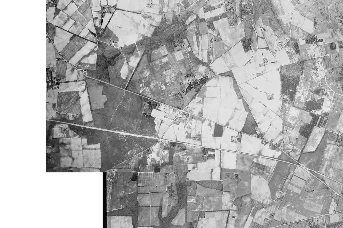
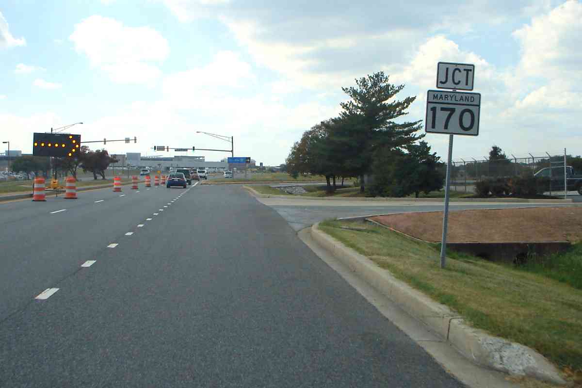
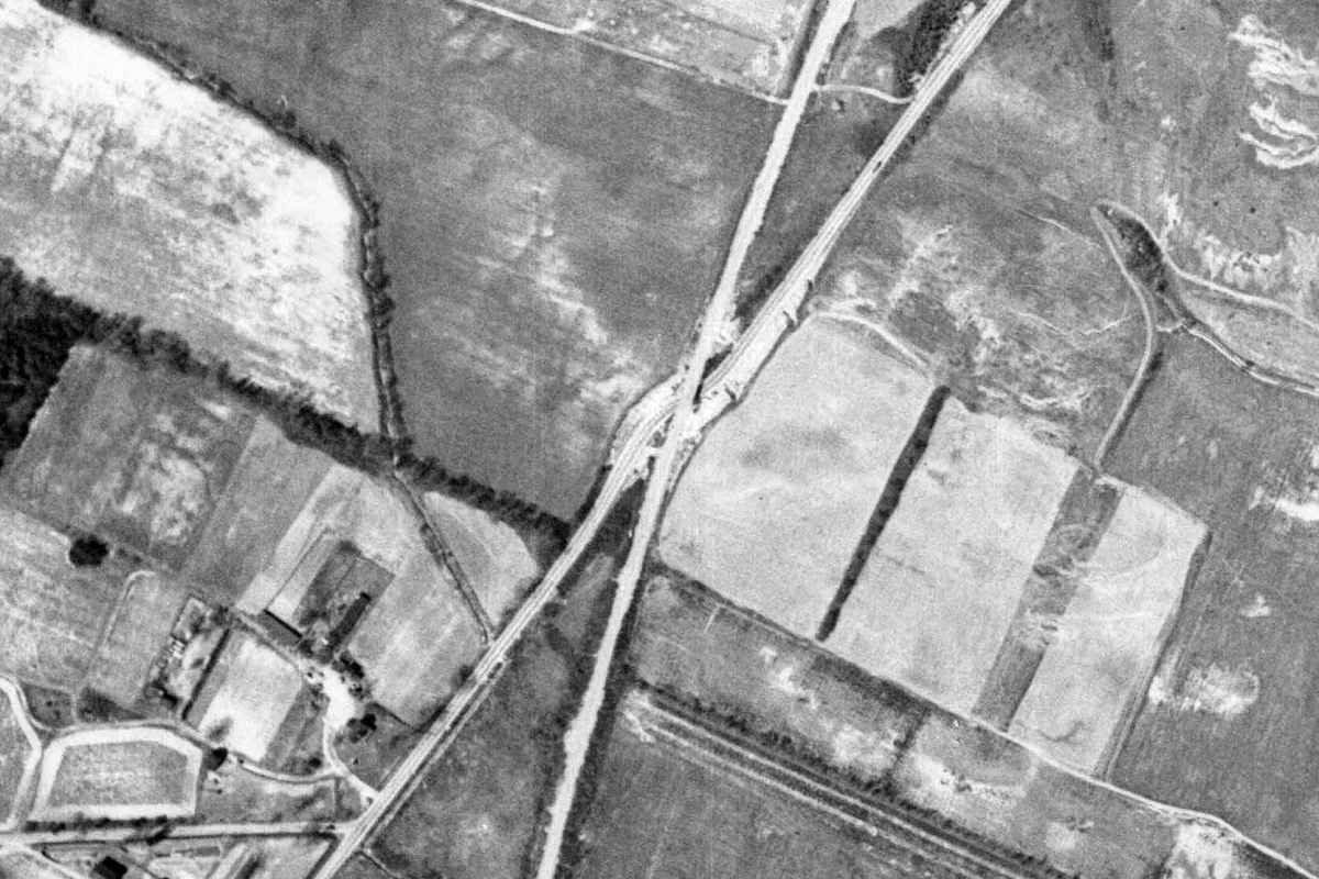
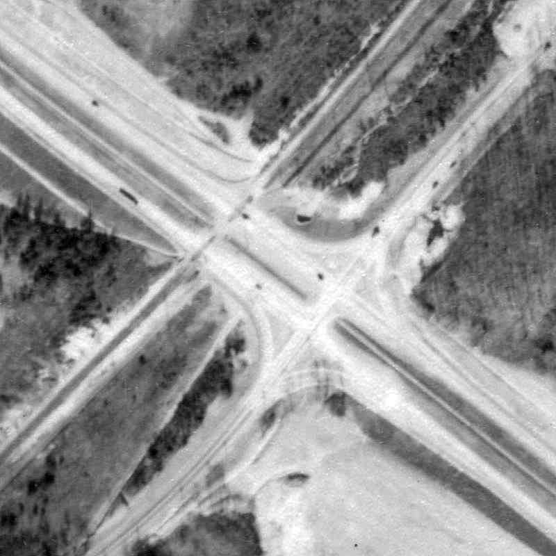
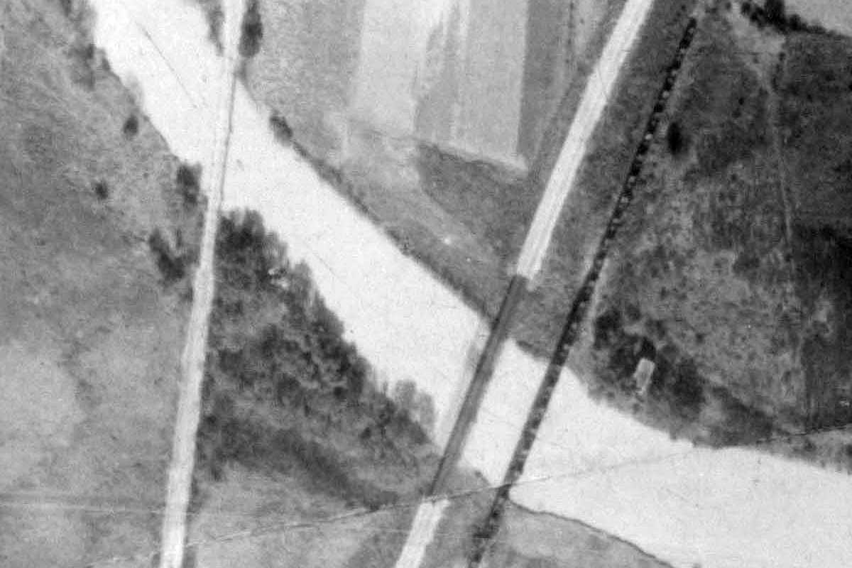
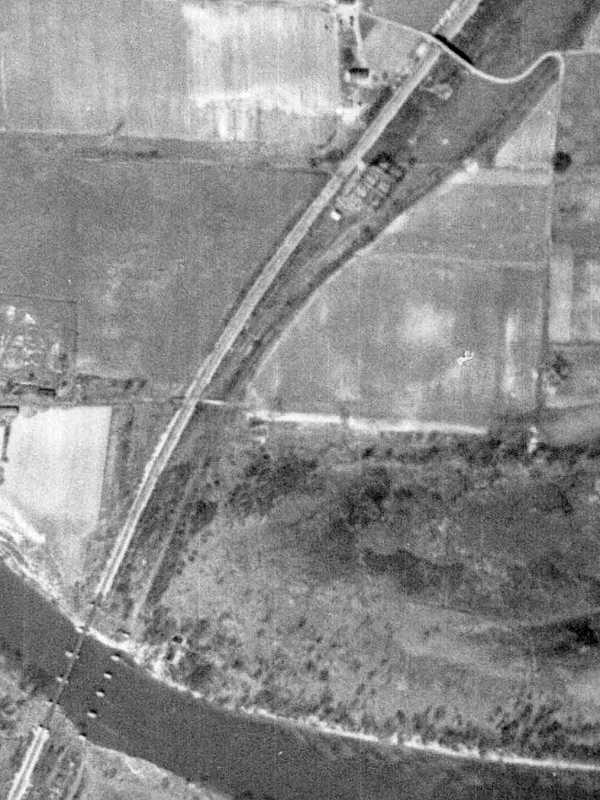
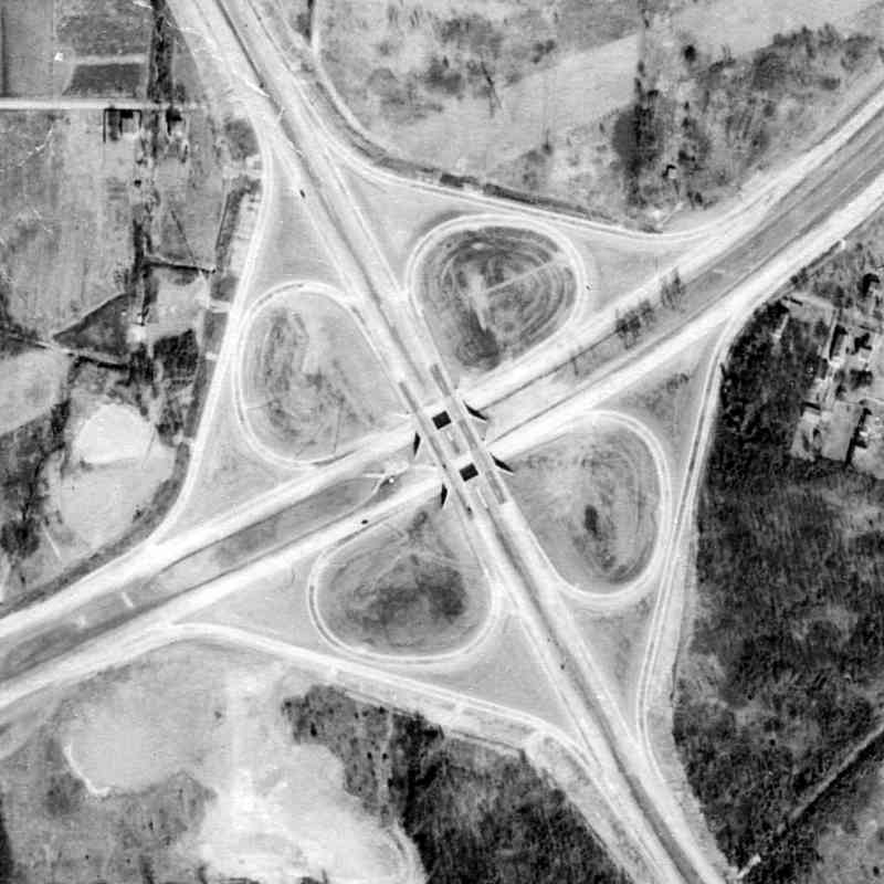
When new during 1953, the first section of Baltimore's Beltway met B&A (ex WB&A) tracks at grade with, according to readers, gates and signal lights. That's the nascent Beltway running upper-left to lower-right, intersecting on the left is B&A running on the WB&A alignment, and on the right is MD 170, Camp Meade 
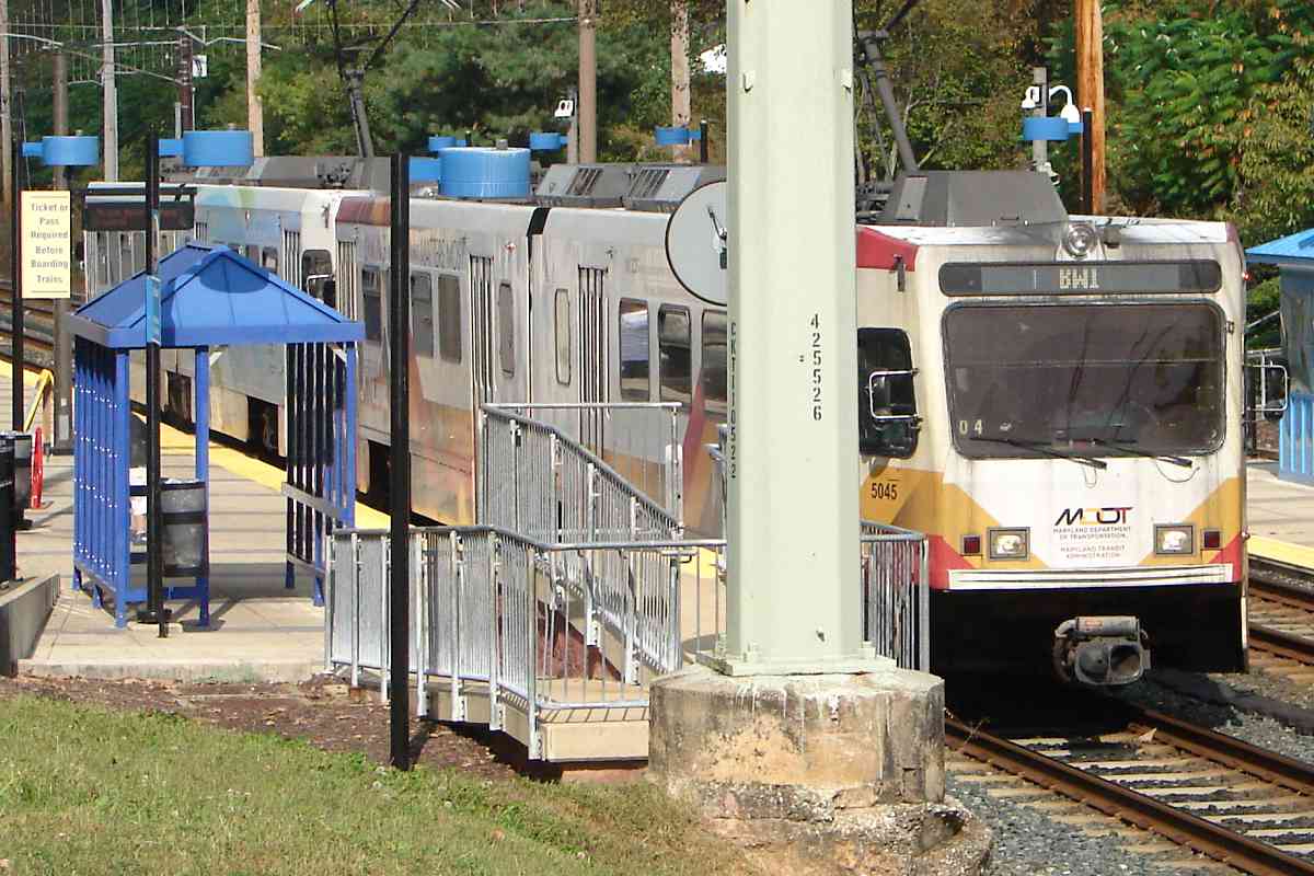
Road. ASL does not appear because B&A had erased it prior to 1953.
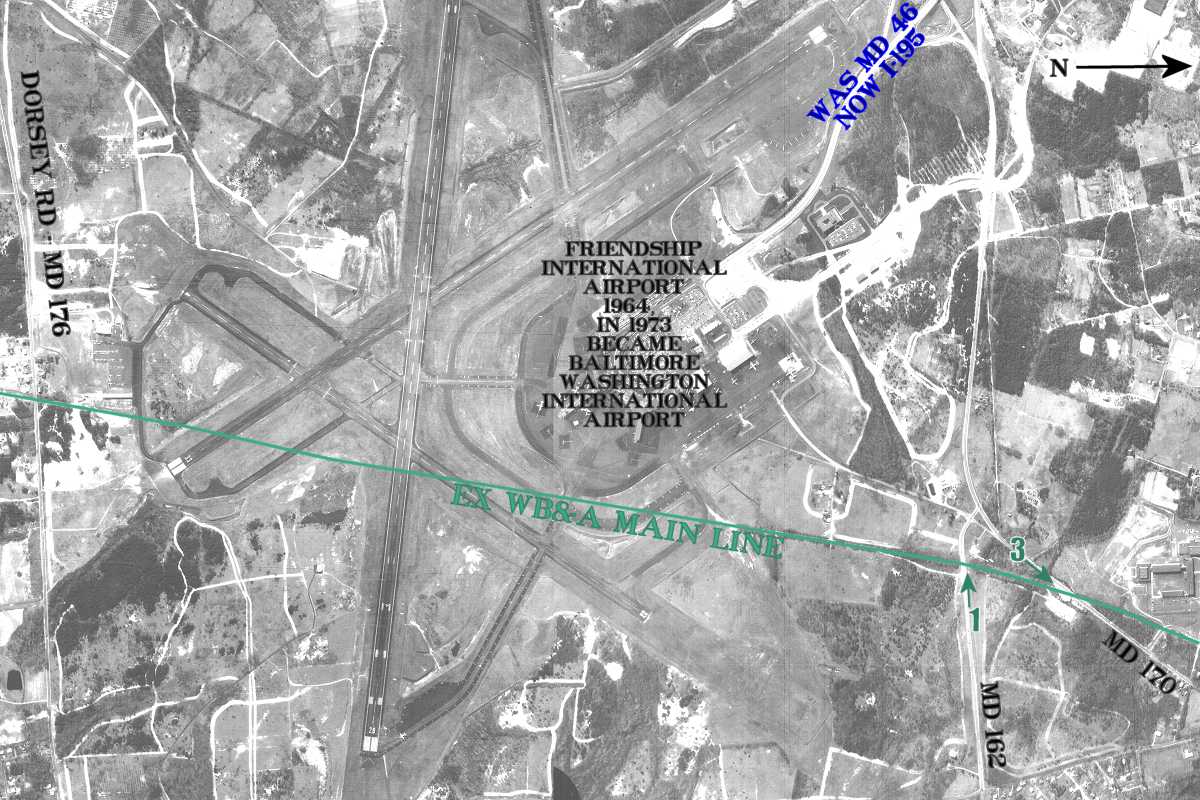
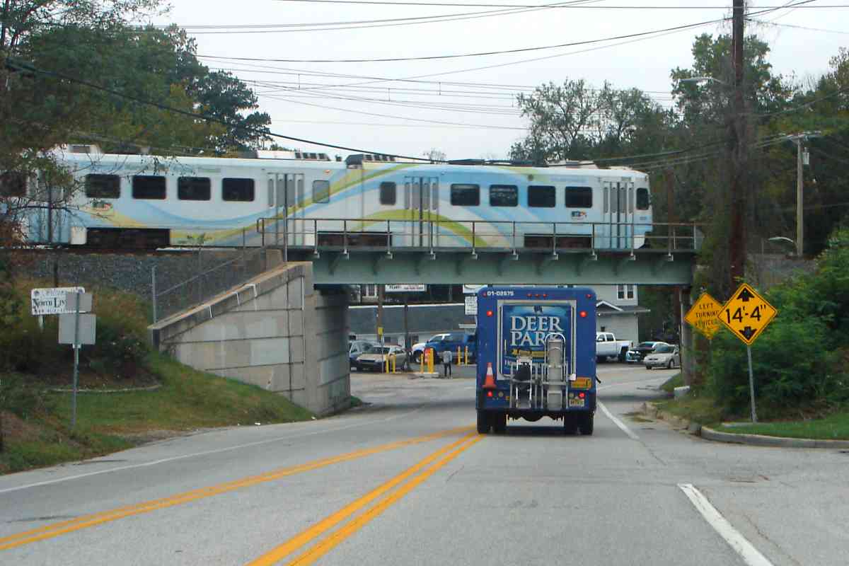
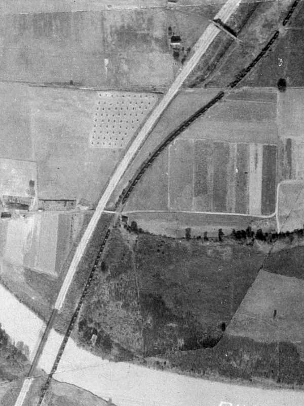
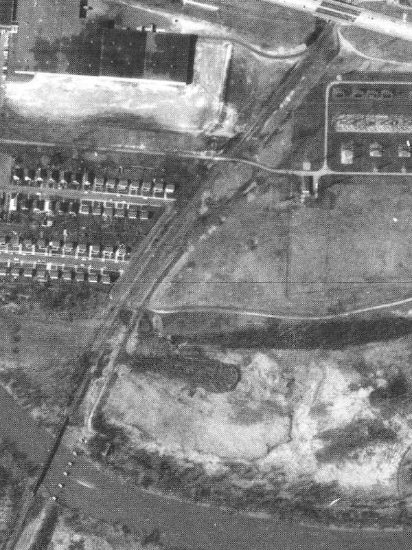
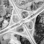
first cloverleaf At its northwest end the less-than-two-mile stretch of Beltway connected Nursery Road with Baltimore-Annapolis Boulevard at its southeast end, and between met the B-W Parkway at a full-cloverleaf interchange (left). The B-W Parkway's second cloverleaf opened later at MD 175. The area's first full cloverleaf interchange appears to he that for MD 150 and MD 151, one Wikipedia information dates to circa 1943.

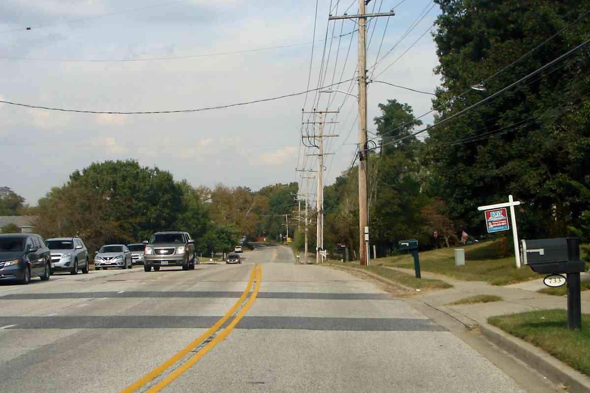
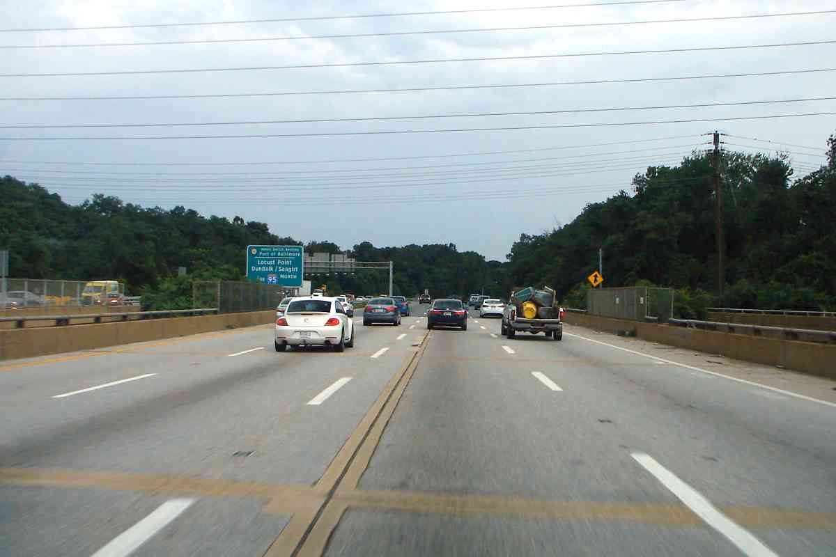
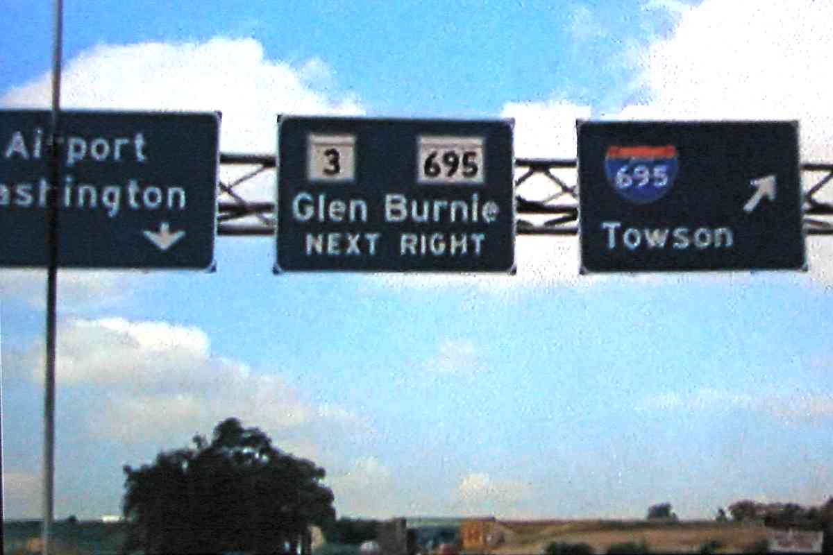
I count three vehicles. Now there are a wee bit more at most hours. The cloverleaf interchange was patented by Marylander Arthur Hall in 1916; New Jersey built the first one in the US about 1930.
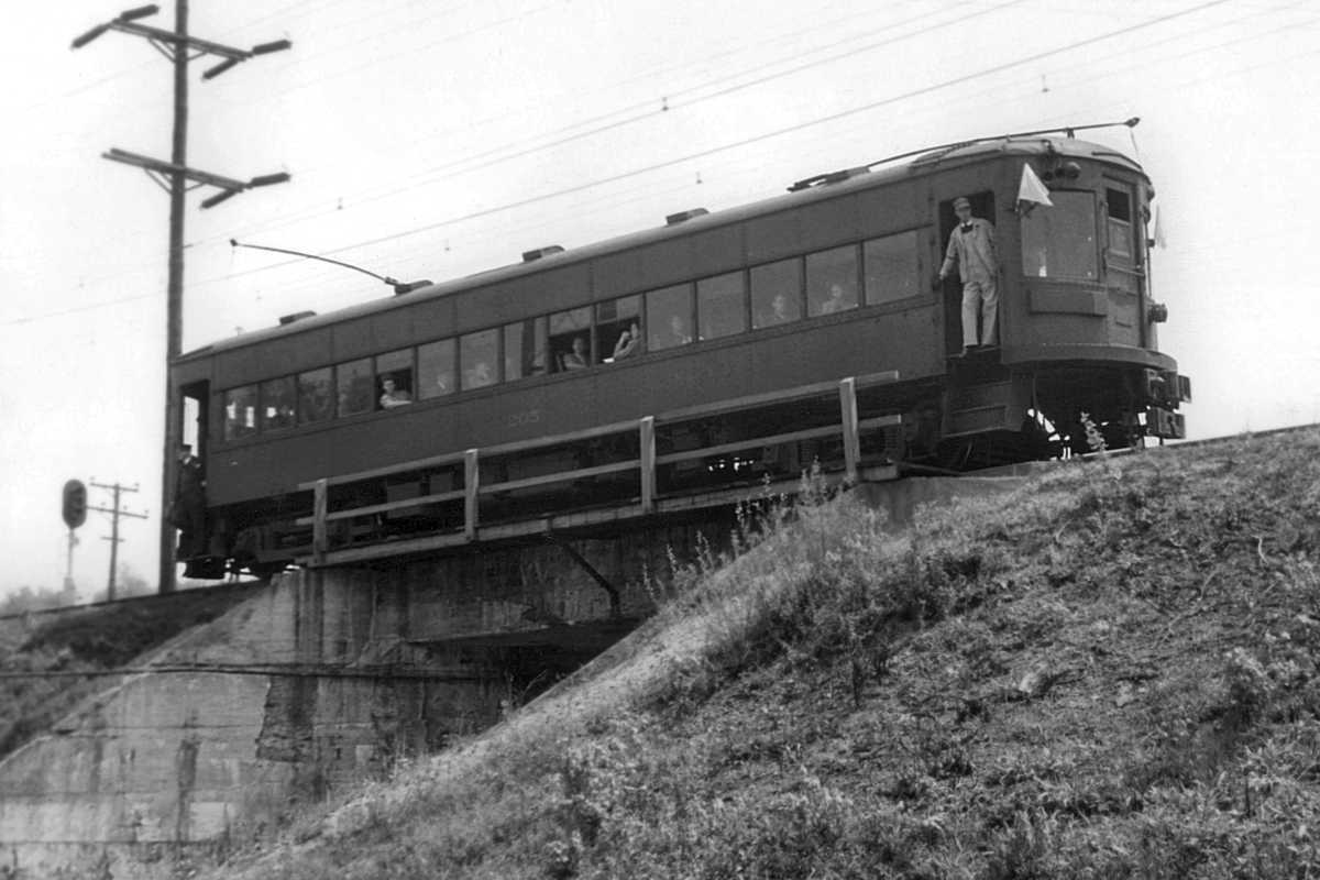
Movin On 1975 Those 1950s bridges were still on duty during 1975 when the Movin' On episode "From Baltimore to Eternity" was filmed on location. In this screen shot (fair use) the camera is looking southwest on the B-W Parkway, approaching the Beltway (distance). In 1975 the Baltimore Beltway had not yet been completed full-circle and the section from here east was not up to Interstate Highway standards, hence the Maryland 695 sign. Even though the road has since been upgraded, it officially remains Maryland 695 despite the I-695 shields posted. I am told a few Maryland 695 signs remain extant during 2018 but I have not found where.

Link: 1950s and 1960s Beltway photos


MD 695 I-695

MD 695 I-695
Mile: Date: Jul 2016
Ease: A View: NW
Area: B+ EH:
Map: AA 2 F 7 Topographic Maps

Road surface open joints that are a hazard to motorcyclists are evidence the Beltway has grown much wider than it was during 1953 and 1975. Numerous wires overhead remind that electric trains passed below -- and still do.


North Linthicum Stop

North Linthicum Stop
Mile: Date: Oct 2017
Ease: A- View: NE
Area: B EH:
Map: AA 2 G 6 Topographic Maps

Cars 5018 and 5052 stop at North Linthicum where Light RailLink squeezes between some high ground (left) and what was the ASL right of way (right).

Link: ~1940 same spot?


Egg Arch
NEW! late-Aug 2021

Egg Arch
Mile: Date: Jun 2001
Ease: B View: NW
Area: B EH:
Map: AA 2 G 6 Topographic Maps

Previously, I thought this culvert over an unnamed creek was of light rail construction, but there's one of similar shape south of Odenton that's not part of the light rail line. Consequently, I now believe this one originates with WB&A during the early 1900s, with some fresher concrete added around 1990 as preparation for light rail.


Baltimore-Annapolis Blvd

Baltimore-Annapolis Blvd
Mile: Date: Oct 2017
Ease: A View: NW
Area: B EH:
Map: AA 2 G 6 Topographic Maps

Light RailLink uses WB&A's bridge over Baltimore-Annapolis Boulevard, aka MD 648. This bridge, visible in a 1938 aerial, likely dates to the 1908 construction of the line. The same photo suggests the adjacent ASL, whose tracks had been pulled up by then, had not been grade separated.


MTA 5041

MTA 5041
Mile: Date: Jan 2018
Ease: B+ View: SW
Area: B- EH:
Map: AA 2 H 5 Topographic Maps

This reverse view makes the side-by-side alignments more evident. A half hour earlier we observed this same unit at Twin Oaks Road; here 5041 is about to stop at Nursery Road while negotiating its way back to Hunt Valley, Maryland north of Baltimore.


Nursery Road Stop

Nursery Road Stop
Mile: Date: Jan 2018
Ease: B+ View: N
Area: B- EH:
Map: AA 2 H 5 Topographic Maps

The Nursery Road stop is the northernmost in Anne Arundel county. ASL's Pumphrey Station had been in this vicinity though I have not been able to nail down the exact spot.

sign This sign memorializes a prior station: "Welcome to the Historic Pumphrey Community - Home of the original Pumphrey Railroad Station Baltimore & Annapolis Short Line March, 1887 - January, 1950.

"This site is dedicated to the residents of Pumphrey by the Maryland Transit Administration on August 26, 2006.

"Robert L. Ehrlich, Jr., Governor - Michael S. Steele, Lt. Governor - Robert L. Flanagan, Secretary - Lisa L. Dickerson, MTA Administrator and CEO"

Link: light rail needs more riders


Patapsco River

Patapsco River
Mile: Date: Jan 2018
Ease: B+ View: NE
Area: B- EH: 79
Map: AA 2 H 4 Topographic Maps

Though ASL's bridge here was gone by 1938, more than 80 years later its concrete supports soldier on without purpose. WB&A's bridge (left), however, has a new lease on life...


Thawing

Thawing
Mile: Date: Jan 2018
Ease: B+ View: N
Area: B- EH:
Map: AA 2 H 4 Topographic Maps

Around 1990, WB&A's 1908 bridge across the Patapsco River was rehabbed and re-double-tracked for Light Rail. That's car 5052 leading 5018 into Baltimore County during one of January 2018's few mild days.


Downstream

Downstream
Mile: Date: Jun 2001
Ease: A View: SE
Area: B- EH:
Map: AA 2 H 4 Topographic Maps

Here's another view, this time looking downstream from Annapolis Road from what had been Sweetser's (or Switzer's) Bridge across the Patapsco.


Freight
Photo courtesy Johns Hopkins University

Freight
Mile: Date: 1927
Ease: View: N (up)
Area: EH:
Map: AA 2 H 4 Topographic Maps

Though people were snapping photos of the bridge long before me, this view from 1927 may be the first aerial photo of it (middle).

During 1927 the old ASL bridge (right) was still in use, relegated by its new WB&A owners to freight, such as these (empty?) coal hoppers. Six span the bridge where the river is 240 feet wide, making each hopper 40 feet long. Most railcars are now 50 or 60 feet long, but then 40 was a common length.


1927 Aerial
Photo courtesy Johns Hopkins University

1927 Aerial
Mile: Date: 1927
Ease: View: N (up)
Area: EH:
Map: AA 2 H 4 Topographic Maps

Unzooming on the same 1927 photo shows the train has been broken into segments, leaving room at each grade crossing, even small private ones of farms. Various rules and laws require that trains not block grade crossings for an "unreasonable" duration. Some jurisdictions consider anything more than 15 minutes to be unreasonable. I do not know what duration, if any, Maryland law specified in 1927. This train might have sat idle on the ex-ASL line for a few hours -- or a few weeks as car storage.


1938 Aerial
Photo courtesy Johns Hopkins University

1938 Aerial
Mile: Date: Apr 1938
Ease: View: N (up)
Area: EH:
Map: AA 2 H 4 Topographic Maps

Between August 1935 and April 1938, ASL's track was sold for scrap, and the bridge B&A inherited from WB&A appears reduced to single track. At top, what looks to be a grade separation bridge to connect the farms on either side of the track was there in 1927 and still was in 1938. It will not endure until 1964...


1964 Aerial
Photo courtesy Johns Hopkins University

1964 Aerial
Mile: Date: Apr 1964
Ease: View: N (up)
Area: EH:
Map: AA 2 H 4 Topographic Maps

By 1964 development intruded on the farms in the form of housing, factories, and roads. At top, the Harbor Tunnel Thruway, I-895, has mounded over ASL's right of way but does bridge the still-active B&A (ex-WB&A) tracks.

That bridge now spans Light RailLink...


<< Previous (southwest) | THIS PAGE: Linthicum to Patapsco River | Next (north) >>

Or, return to main page

Copyright Notice