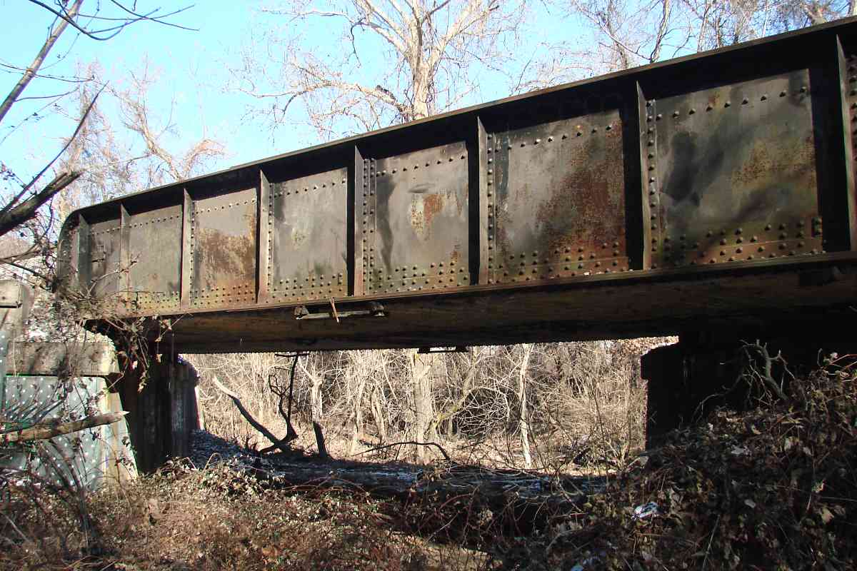
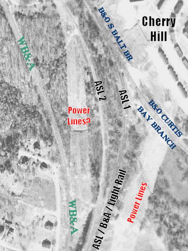
TrainWeb.org Facebook Page
WB&A Photo Tour


Washington, Baltimore and Annapolis Railway
Modern day photo tour

Accompanying each photo below are:

Click a photo to see a larger view. Please send your comments and corrections to Steve.


<< Previous (south) | THIS PAGE: Patapsco River to Westport | Next (north) >>

B&A 50
Photo credit HH Harwood

B&A 50
Mile: Date: Sep 1985
Ease: C View: NW
Area: B- BLR: 10
Map: Ba 42 H 12 Topographic Maps

The Baltimore & Annapolis kept active for 50 years the route it had acquired from WB&A. Harwood reflected in 1985 on B&A engine 50 making one of its final runs across the Patapsco; the 1950-built engine became part of the B&O Museum's collection after B&A ceased operation during 1986.

Link: at museum


Patapsco River
Photo credit John H. Brinckmann

Patapsco River
Mile: Date: Jan 1950
Ease: B View: SW
Area: B- BLR: 27, 40
Map: Ba 42 H 12 Topographic Maps

Another significant 50 was 1950: within a month of this photo B&A would cease passenger service.

As evidenced by this photo, the Patapsco River bridge has been revised several times. Here it may still be in its original WB&A form, topped by gauntlet track according to Harwood, and different supports from that seen in the 1985 photo above. The bridge structure changed again when Light Rail took over.


I-895

I-895
Mile: Date: Oct 2017
Ease: A View: N
Area: B BLR: 90
Map: Ba 42 H 11 Topographic Maps

MTA 5032 About a half mile north of the Patapsco River and a mile east of 295, echoes of ASL come in the form of electricity being transmitted (top, right) along its otherwise-vanished right-of-way.

Meanwhile, the adjacent WB&A right-of-way still has not only electricity but also trains, having survived the construction of the Baltimore Harbor Tunnel Thruway (I-895, distance) under which a Light RailLink train is about to pass.


Georgia Avenue

Georgia Avenue
Mile: Date: Oct 2017
Ease: A View: E
Area: B BLR: 89
Map: Ba 42 J 10 Topographic Maps

look for trains sign North of I-895, Light RailLink trackage nudges east from WB&A to where ASL had run. Access to Southwest Area Park comes via the trains, of course, as well as Georgia Avenue.

The grade crossing's warning lights are obscured by vegetation until one gets closer, but there's also a Look for Trains sign... as if real railfans need such reminders!


MTA 5002

MTA 5002
Mile: Date: Oct 2017
Ease: A View: S
Area: B EH:
Map: Ba 42 J 10 Topographic Maps

Good thing railfans are nothing if not obedient: looking yields this view of a northbound train. Light RailLink employs a variety of signal designs. That standing at right is a crossing gate indicator.

Link: Signals of the Baltimore Light Rail System


Deception

Deception
Mile: Date: Oct 2017
Ease: A View: N
Area: B EH:
Map: Ba 42 J 10 Topographic Maps

Looking for trains over here is not as productive. This adjacent but uneven, cleared path looks like former railroad but actually is not. Light RailLink's Baltimore Highlands stop is on the left.


Train Approaching

Train Approaching
Mile: Date: Oct 2017
Ease: A- View: NE
Area: B EH:
Map: Ba 42 J 10 Topographic Maps

The sign exhibits a shortage of exclamation marks as ad-wrapped car 5027 slows to stop at Baltimore Highlands.


Ex-ASL

Ex-ASL
Mile: Date: Oct 2017
Ease: A- View: NE
Area: B EH:
Map: Ba 42 J 10 Topographic Maps

Comparisons of old and modern aerial photos confirm Light RailLink is on ASL turf here, and the parking lot on the left is where WB&A had operated, in fact WB&A's Rosemont stop had been a short distance ahead.


Rosemont
Photo credit HH Harwood

Rosemont
Mile: Date: Jan 1950
Ease: B+ View: N
Area: B BLR: 89
Map: Ba 42 K 9 Topographic Maps

Here you can see the two rights-of-way side-by-side. A B&A freight at right waits on ex-ASL trackage for this flagged passenger special to continue south first. By this time, passenger service to Rosemont was in its final weeks.

As of 2017 the house on the left remained extant at Alabama Avenue.

Links: 1910, 1988, 1988


Follow the Wires

Follow the Wires
Mile: Date: Oct 2017
Ease: A- View: S
Area: C+ BLR: 88
Map: Ba 42 K 9 Topographic Maps

Beyond Rosemont, looking back, note how some of the wiring veers to the northwest (right), a relic of the ASL's second alignment in this vicinity. WB&A curved similarly; in this view that happened a bit farther from the camera. This feels like a good place for a map...


Four Lines
Photos courtesy Johns Hopkins University

Four Lines
Mile: Date: Apr 1964
Ease: View: N (up)
Area: EH:
Map: Ba 42 Topographic Maps

1953 Light RailLink here follows ASL's original alignment in which it shared trackage with B&O's South Baltimore Branch. After B&O grew uncomfortable with such coziness, B&O built for ASL a nearby alignment that on these maps is labeled ASL 2. Patapsco Avenue runs just inside the Baltimore City / County line.

Only utility lines still follow the ASL 2 alignment as of 2018. WB&A steered clear of the fray by cutting its own alignment on the southwest side. The aerial zoom at left dates to 1953 by which time the WB&A alignment had been abandoned but before Patapsco Avenue had been constructed.


Pipeline

Pipeline
Mile: Date: Oct 2017
Ease: B View: N
Area: C+ EH:
Map: Ba 42 K 9 Topographic Maps

The clearing from the pipe to Light RailLink's Patapsco stop's driveway ahead illustrates where WB&A previously had trackage. I do not know if the pipeline crosses or follows the WB&A route here.


Patapsco Stop

Patapsco Stop
Mile: Date: Oct 2017
Ease: A- View: NE
Area: C+ EH:
Map: Ba 42 K 9 Topographic Maps

coal train Here is the Patapsco stop for reference. Note in the zoom view one can glimpse part of a CSX coal hopper on the way to Curtis Bay found a few miles east (right).

Since this is primarily a WB&A tour, ordinarily these two photos would not be included, however 1) this area is crowded with railroads old and new, 2) WB&A operated less than 200 feet off photo left, and 3) such comparing and contrasting long ago kept my History class professor happy.


Patapsco Avenue

Patapsco Avenue
Mile: Date: Oct 2017
Ease: A View: E
Area: C+ EH:
Map: Ba 42 K 8 Topographic Maps

The entrance (foreground) to the Patapsco stop invokes the old WB&A route that, from the perspective of this tour, ran right-to-left. The distant bridge over Patapsco Avenue originally belonged to the B&A but is now traversed by Light RailLink. The bridge dates to Patapsco Avenue's arrival around 1960.


B&O 5051
Photo credit T.H. Arnold
NEW! early-Nov 2018

B&O 5051
Mile: Date: Nov 1935
Ease: View: E?
Area: EH:
Map: Ba 42 K 8? Topographic Maps

Army-Navy football events, plus horse racing days at Bowie during November 1935, found B&O equipment operating on WB&A trackage. The precise location of this photo is lost to time, but is thought to be in a neighborhood named English Consul found between the location of the October 2017 photo above and the one below.


Ex-ROW

Ex-ROW
Mile: Date: Oct 2017
Ease: A- View: SE
Area: C+ BLR: 29
Map: Ba 42 J 8 Topographic Maps

By now you know better than to think this unlevel dirt road is ex-right-of-way, you're close though. Where trees have grown up parallel on the right is where the B&A last operated around the time the rusting car in the foreground was manufactured. A circa 1950 Ford? Can anyone ID it more precisely?


Mound

Mound
Mile: Date: Oct 2017
Ease: B+ View: NW
Area: C EH:
Map: Ba 42 J 7 Topographic Maps

Looking the opposite direction finds mounded earth graded into a flat strip, now we have former WB&A right-of-way. A 1915 atlas places the WB&A's English Consul Station on the left.

Mounded earth for a pitcher was found ahead off photo left when beginning during the 1930s Westport Stadium became home of the Baltimore Elite Giants, a Negro League Baseball team that played into the 1950s. Into the 1960s the site served as a NASCAR race track. Aerial photos show the stadium gone by 1972.

Link: Westport Stadium


Curtis Bay Branch

Curtis Bay Branch
Mile: Date: Jan 2018
Ease: B- View: SW
Area: C- EH:
Map: Ba 42 J 7 Topographic Maps

The mound leads to this underpass of the B&O's Curtis Bay Branch with a builder's plaque stating "1907 - Built By - Baltimore Bridge Company - Baltimore, Md." The Baltimore Bridge Company was formed from Smith, Latrobe and Company, founded by Charles Shaler Smith and Benjamin H. Latrobe, Jr., the latter known as designer of the B&O's Thomas Viaduct.

bracket Clearance is now limited here because the opening has been filled with material washed down from the vicinity of Westport Stadium that sits on a high bluff behind the photographer.

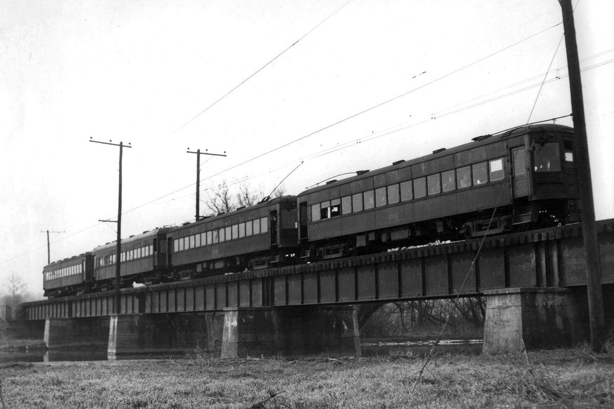
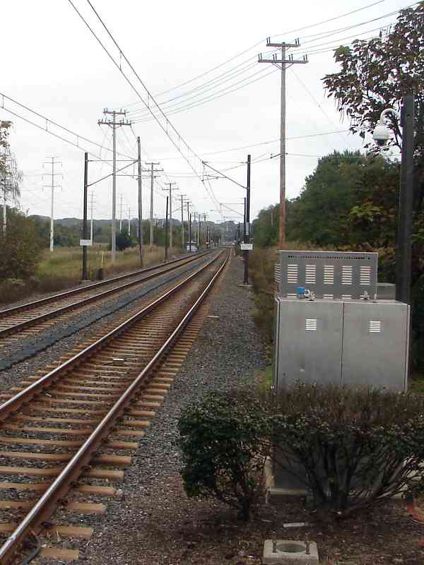
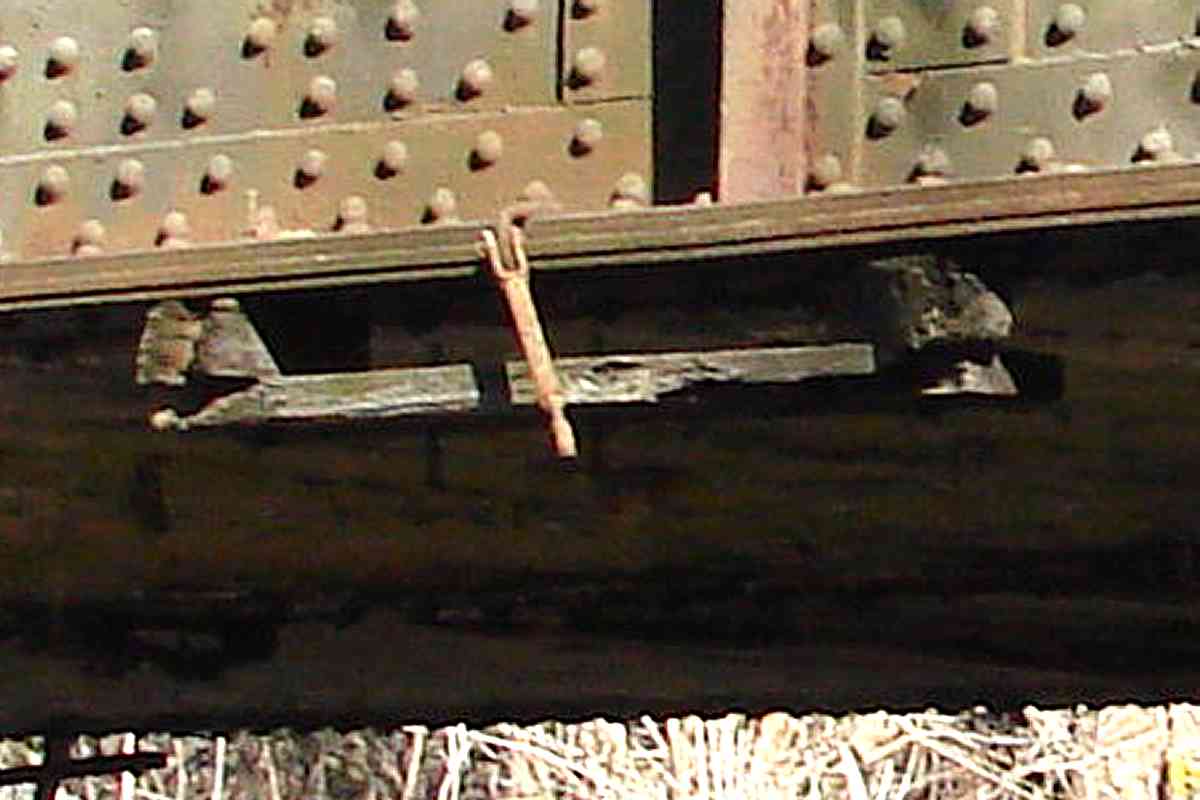
Though they have gone unused since about 1950, three of the four brackets that once held WB&A catenary (overhead power lines) remain secured to this largely-forgotten bridge.

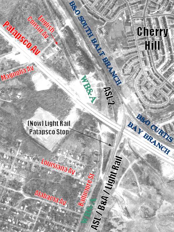
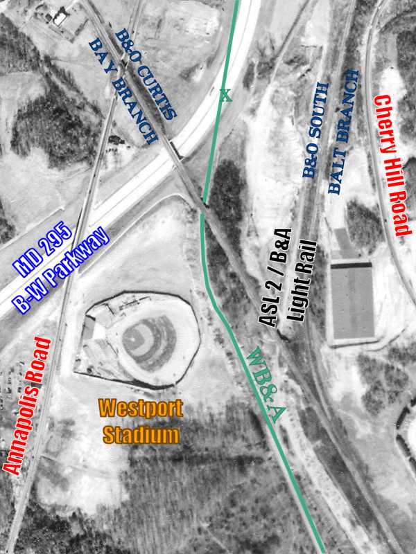
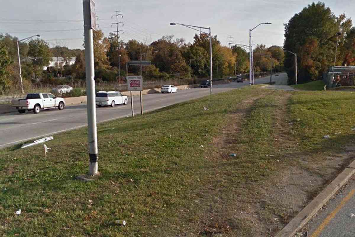
As if to intentionally make locating the railroad more difficult, USGS topographic maps omit WB&A until 1953 by which time the B-W Parkway had already erased all but a few artifacts in this area.

Change for: 
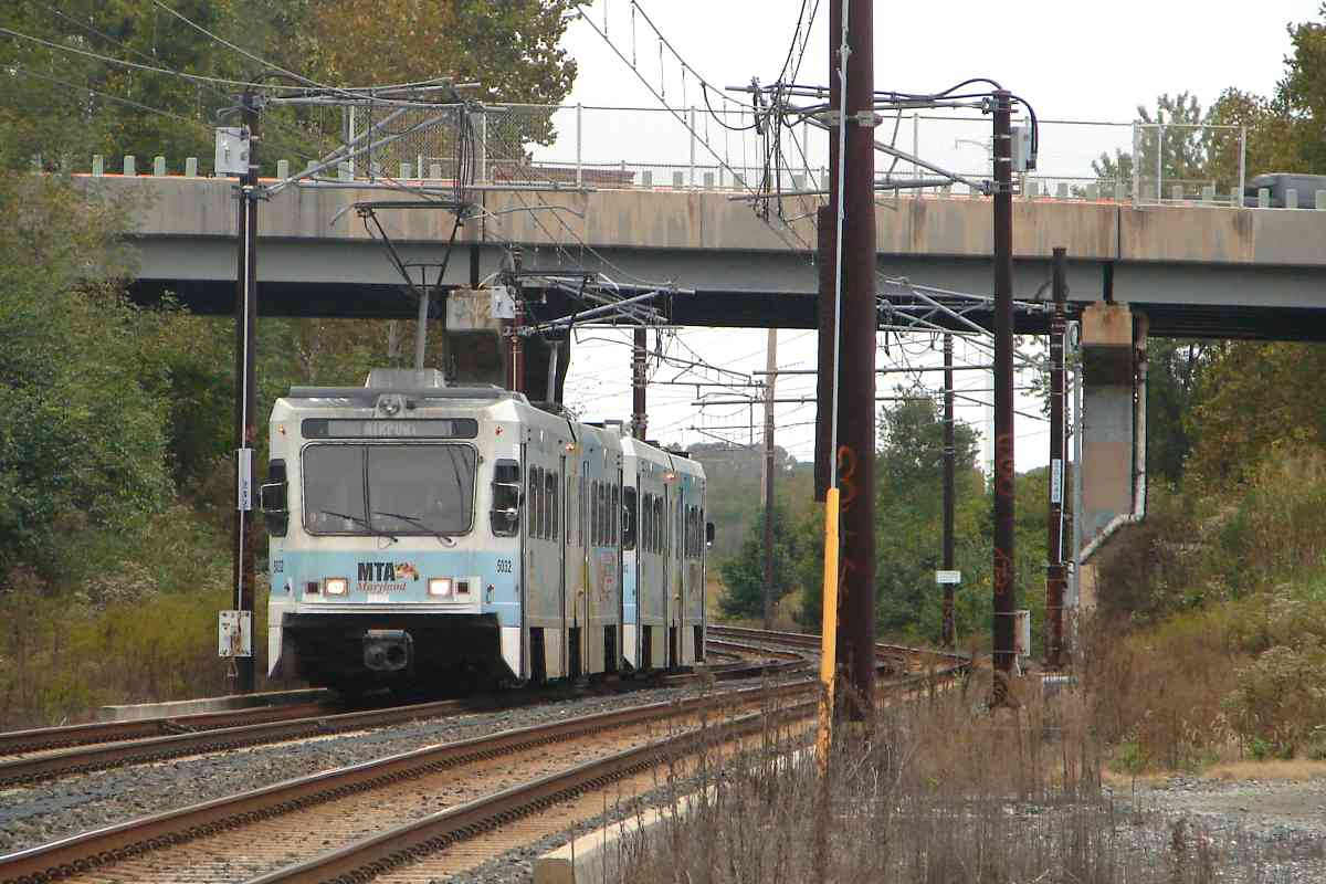
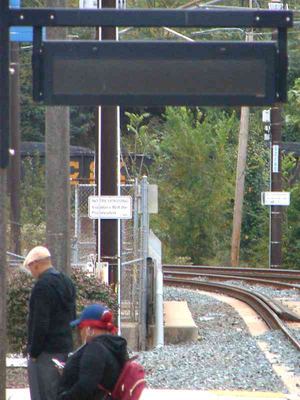
Curtis Bay Branch tour at this site


Severed
Photo courtesy Johns Hopkins University

Severed
Mile: Date: Feb 1953
Ease: View: N (up)
Area: EH:
Map: Ba 42 J 7 Topographic Maps

When the B-W Parkway pushed through about 1951 it severed the ex-WB&A connection between points south and Baltimore. To reroute, the B&A employed connections to the B&O's South Baltimore Branch both east of Westport Stadium plus, as we will tour later, just north of Gwynns Falls.

The B&O had invested in the B&A, hence the two maintained the business relationship needed for track sharing. During busy times, such as for Navy football games at Annapolis, the B&O sent its own trains down the B&A tracks.

The blue green x marks the spot of the next photo.


MD 295

MD 295
Mile: Date: Mar 2018
Ease: A View: N
Area: B EH:
Map: Ba 42 J 6 Topographic Maps

This shows the WB&A's route (blue green line) relative to the B-W Parkway starting about 0.6 miles south of its Westport exit.

The overpass ahead carries Waterview Avenue and Annapolis Road over the parkway.


From Annapolis Road
Photo credit R. W. Janssen

From Annapolis Road
Mile: Date: Jan 1950
Ease: View: S
Area: C+ EH:
Map: Ba 42 J 5 Topographic Maps

Annapolis Road had originally spanned WB&A just south of where it does during 2018. This is the pre-B-W-Parkway view back from Annapolis Road to the location of the prior photo.

Partly obscured by the more distant of the two cars is Westport's passenger shack. Within a few weeks passenger service here would be gone, as would all train service soon thereafter, to make way for construction of the B-W Parkway that now parallels on the left.


But Not Forgotten
Photo courtesy Google

But Not Forgotten
Mile: Date: Oct 2016
Ease: A View: S
Area: C+ EH:
Map: Ba 42 J 6 Topographic Maps

Replicating the prior overhead photo for an exact then-now pair has not been feasible since about 1951 when the original Annapolis Road bridge was replaced as part of B-W Parkway construction -- but this view from the Annapolis Road exit ramp is not too far off.

More than just the letters W and B remain of the railway, as we'll see when this tour concludes with a previously-unexpected fifth page.


<< Previous (south) | THIS PAGE: Patapsco River to Westport | Next (north) >>

Or, return to main page

Copyright Notice