TrainWeb.org Facebook Page
WM Photo Tour


Western Maryland Railway
Modern day photo tour

Accompanying each photo below are:

Click a photo to see a larger view. Please send your comments and corrections to Steve.


<< Previous (index) | THIS PAGE: Port Covington to Westport | Next (west) >>

Brief Historical Background: Ex-Western Maryland Railway

Map

Map
Mile: Date: (Apr 1964)
Ease: View: N (up)
Area: IC2:
Map: Ba 43 Topographic Maps

This aerial photo from 1964 captured the Western Maryland's operation near its peak at Port Covington, WM's eastern terminus in Baltimore. After crossing under a Hanover Street bridge, WM's rails coming from the west (left) fanned out to serve a power plant, several separate waterfront docks, tall silos and other typical yard features such as a roundhouse. Only a small fraction of those rails remain, key ones drawn in black on the map. Newer features, such as Interstate 95 and the Baltimore Sun's printing facility, are overlaid for location reference.


Aerial 1924
Photo courtesy Johns Hopkins University
NEW! late-Jul 2022

Aerial 1924
Mile: -2.0 Date: 1924
Ease: View: NW
Area: IC2:
Map: Ba 43 D 6 Topographic Maps

This aerial captures Port Covington during the Roaring Twenties. The Hanover Street Bridge (left) only eight years before had replaced 1856's Long Bridge that had extended Light Street off the tip of land near lower left. This portion of Light Street is now named West Peninsula Drive. Railroad grade separation of Light and Hanover Streets was still in the future.

WM's Spring Garden Swing Bridge crosses Middle Branch at upper left. This tour page will reach it by proceeding generally west (left) after starting near the right side of this photo.


From I-95

From I-95
Mile: -1.6 Date: Mar 2015
Ease: A View: E
Area: B IC2:
Map: Ba 43 C 4 Topographic Maps

The Key Highway exit from elevated Interstate 95 North provides an easy vantage point of the northeastern corner of WM's Port Covington Yard. This segment of I-95 is built over the edge of WM's coal car area for the Gould Street Generating Station, which is the tall stack and red brick building at photo center.

The large vessel at distant right floats on waters of Winans Cove where the Patapsco River widens into the Chesapeake Bay. As the tour will show, the rails of WM served many docks at the Cove.

Note the tracks between the power station and the I-95 ramp. That's the next stop of the tour...


East End

East End
Mile: -1.9 Date: Feb 2016
Ease: A View: SE
Area: B IC2:
Map: Ba 43 C 4 Topographic Maps

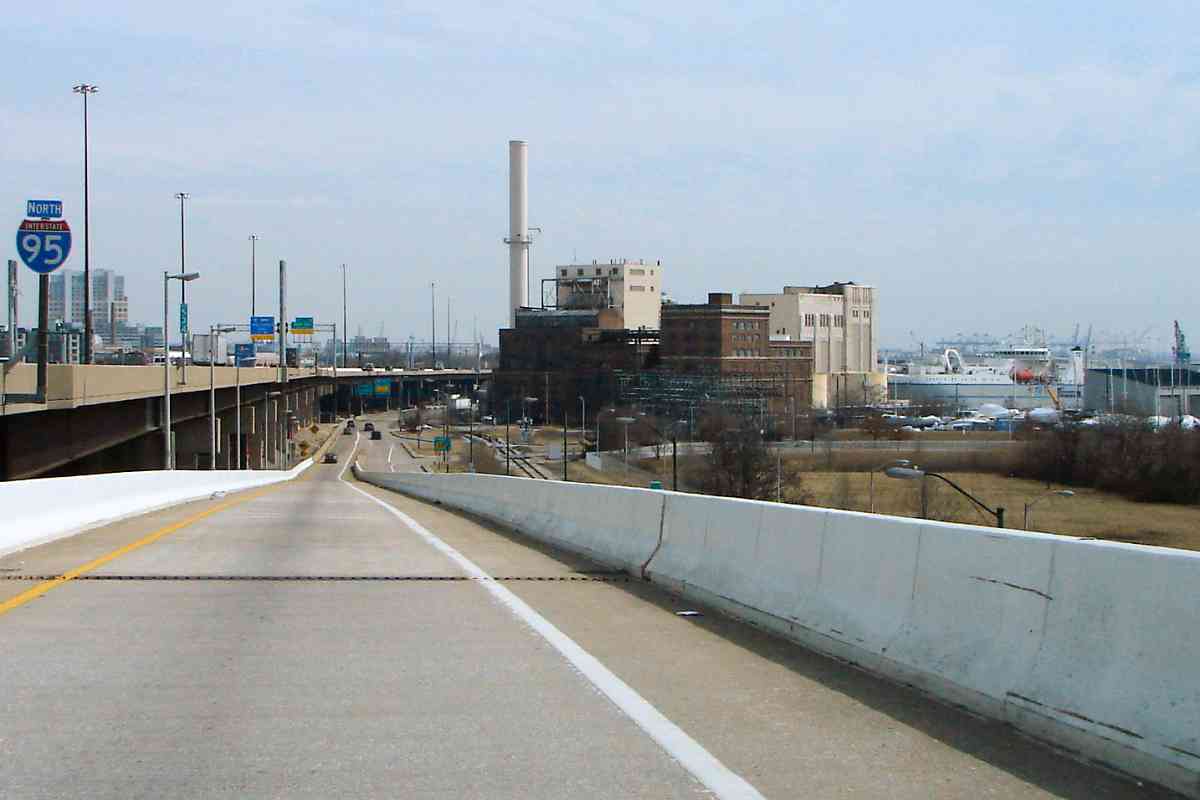
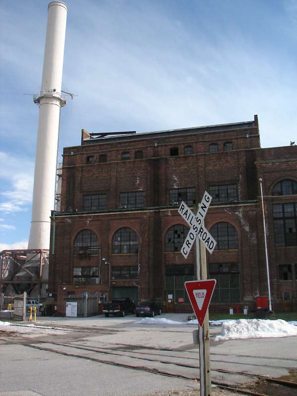
The Gould Street Generating Station began operation in 1905 and for most of its early life burned coal, later switching to natural gas. The station was decomissioned in 2019, then demolished during 2020.

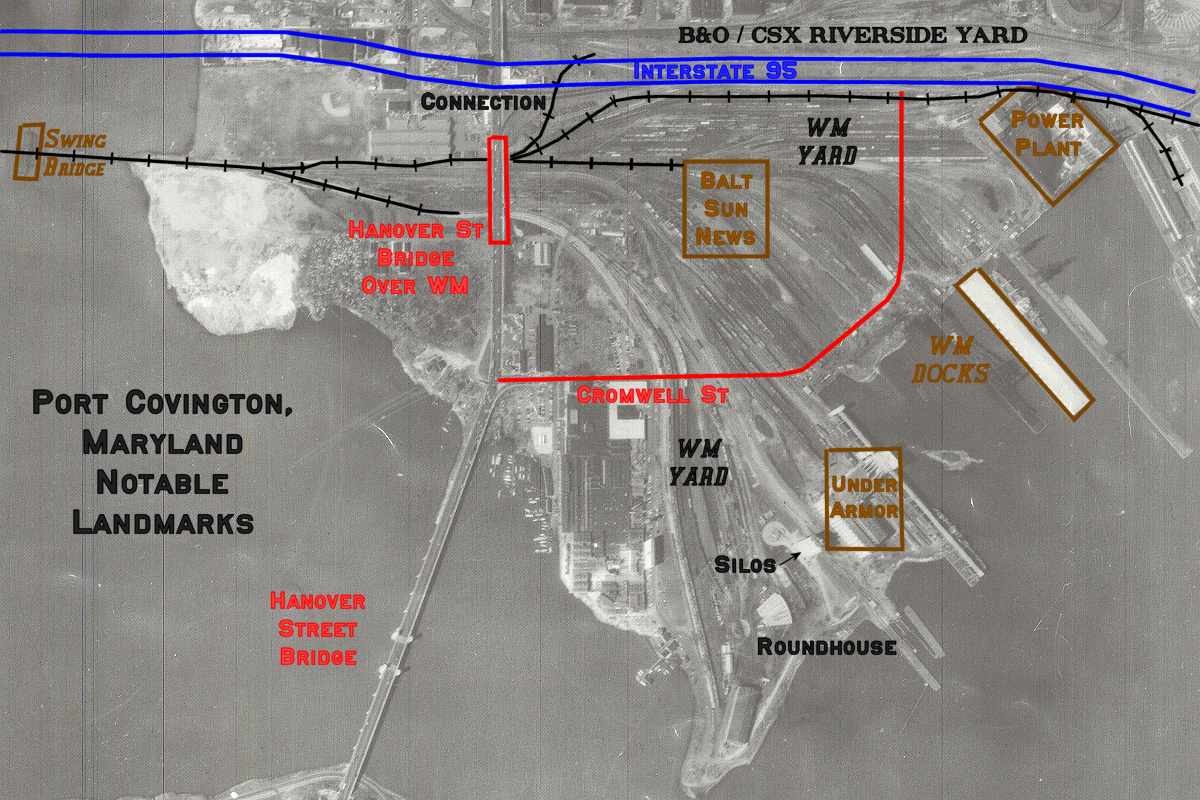
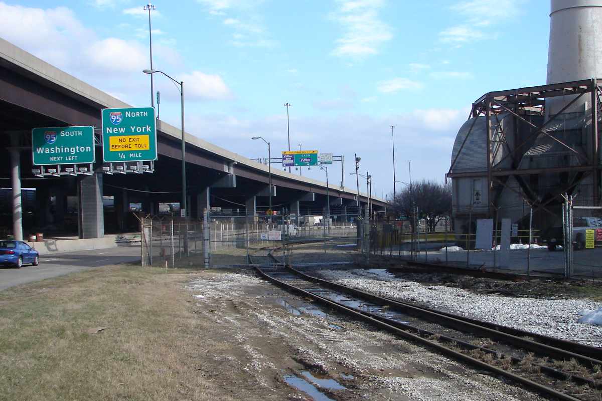
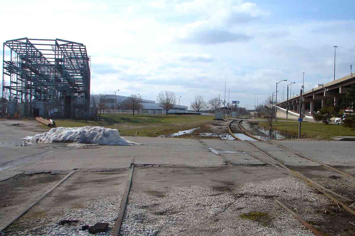
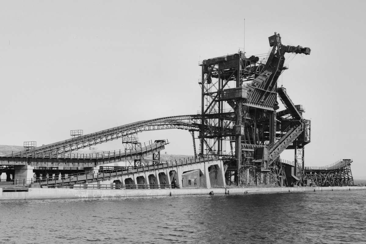
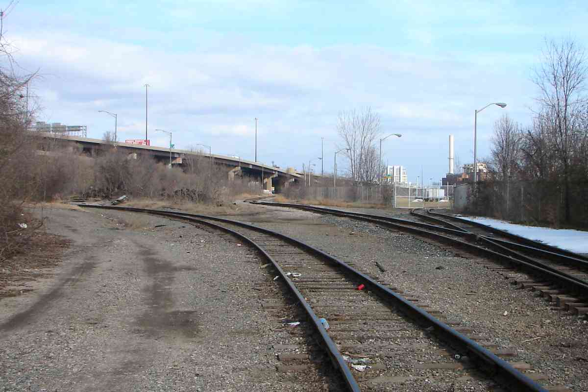
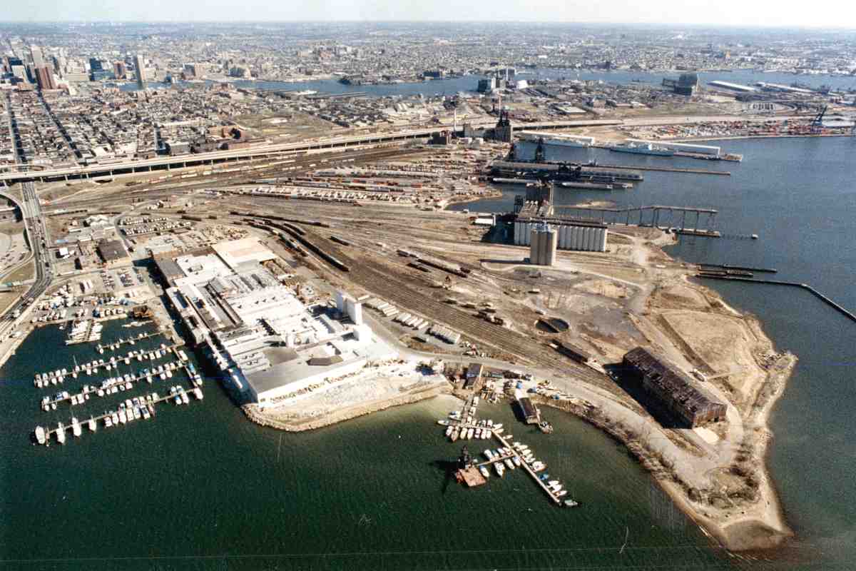
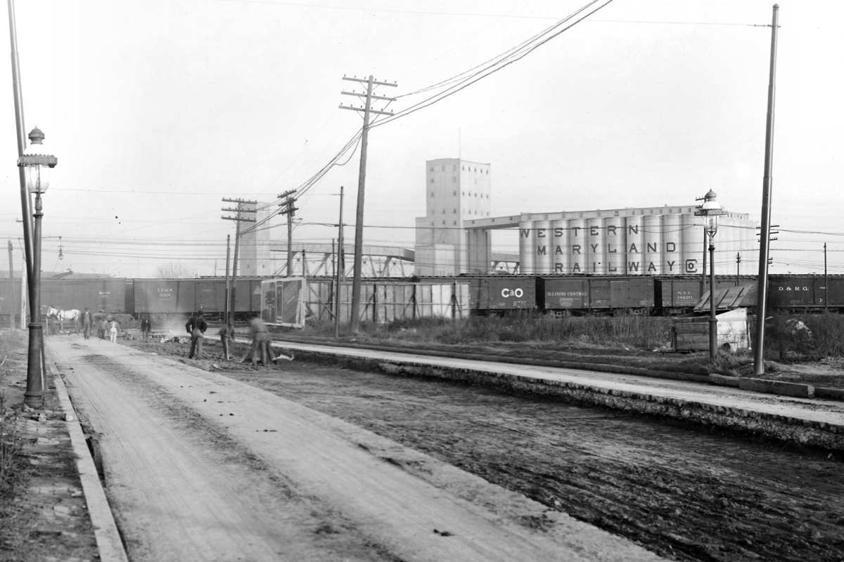
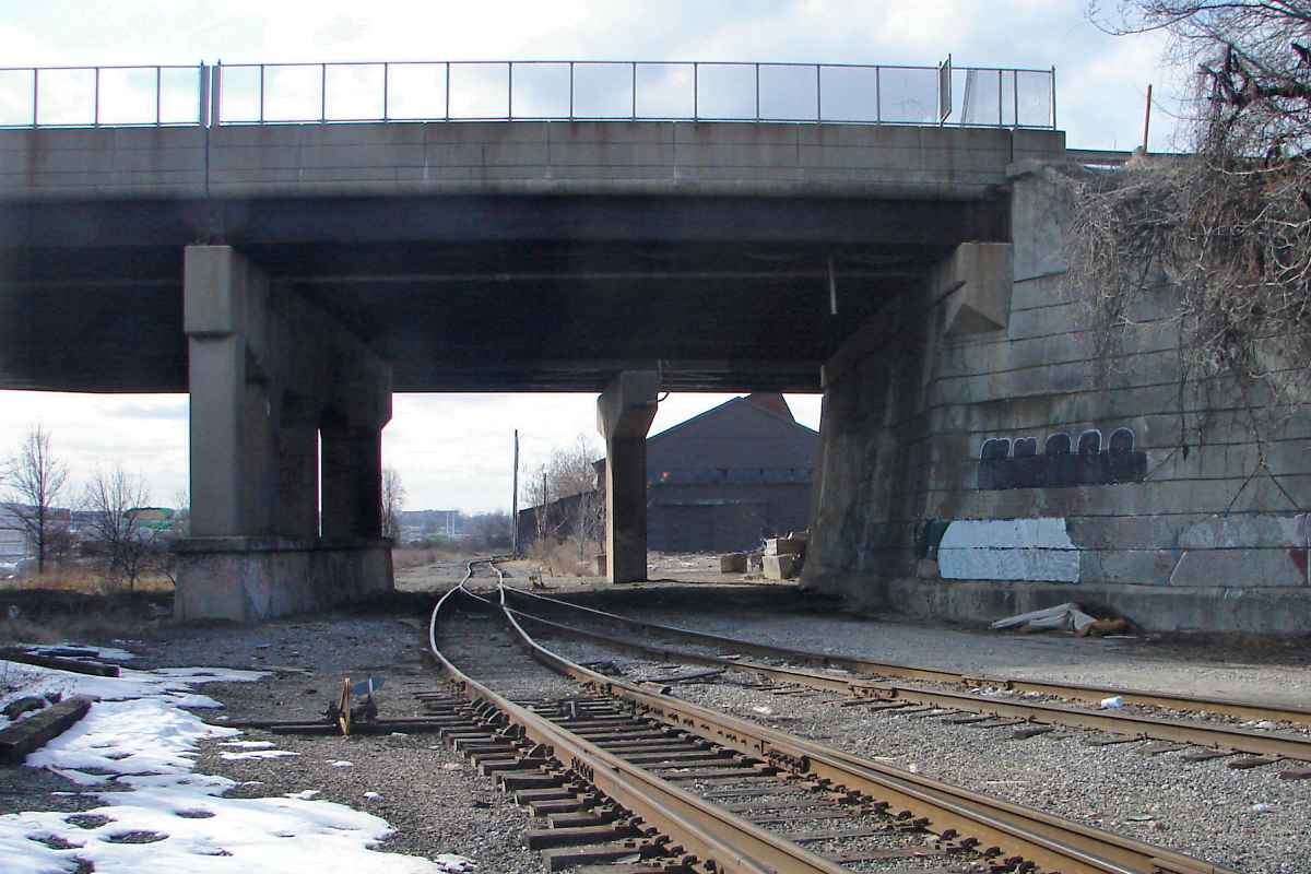
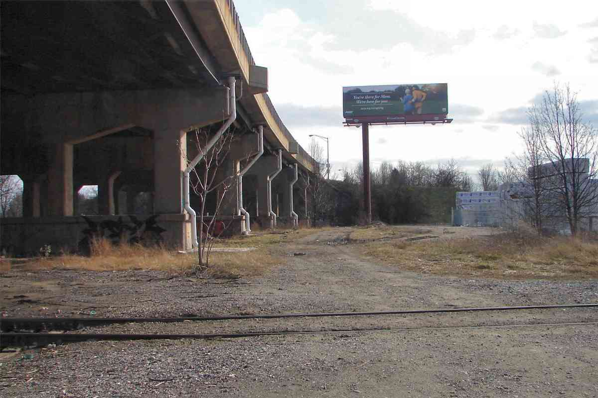
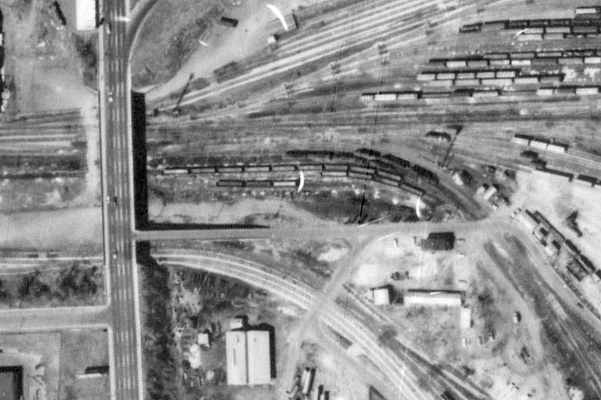
The other side of the building had been WM's easternmost reach. These rails are part of the primary surviving tracks through the Port area. For identification this tour calls them the "main line".

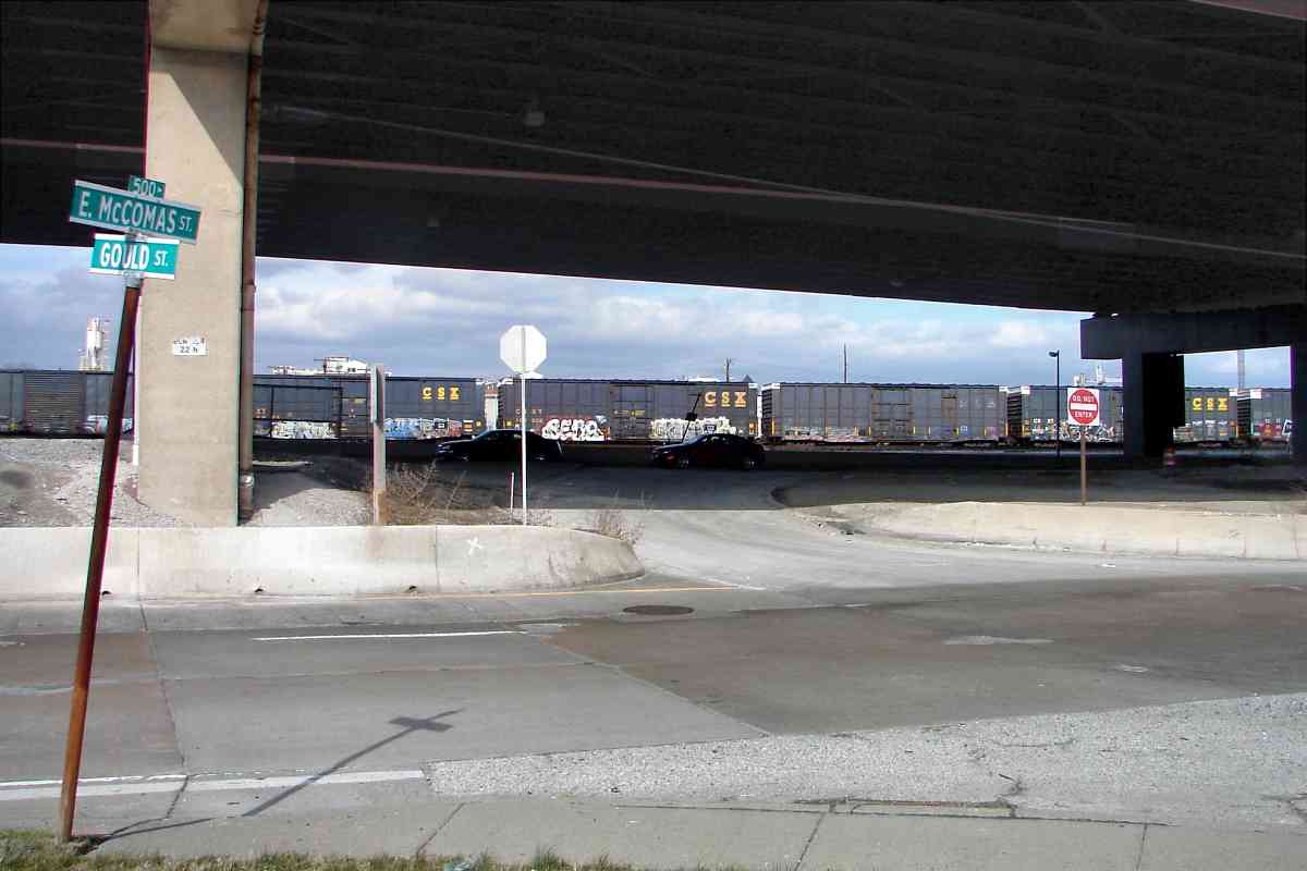
I do not know WM's approach to milepost numbering, so this tour references distance relative to CSX's Hanover Subdivision, the current name for much of WM's former trackage in Maryland. CSX puts the Hanover Subdivision's milepost 0 in Westport and counts upward west of there. Since Westport is about 2 miles west of here, this tour uses negative mile numbering to begin.

Links: ~1940, power station interior


Fence

Fence
Mile: -1.9 Date: Feb 2016
Ease: A View: E
Area: B IC2:
Map: Ba 43 C 4 Topographic Maps
m.p.a.

B&O had served facilities east of the power plant, but those tracks were severed during the 1980s by the completion of I-95 through Baltimore City. As a substitute, an extension was built from what had been WM, that now, per the sign, falls under control of the M.P.A. (Maryland Port Administration).


TE Subcom

TE Subcom
Mile: -2.0 Date: Feb 2016
Ease: A View: E
Area: B IC2:
Map: Ba 43 D 4 Topographic Maps

Dependable A spur from the MPA tracks reaches TE SubCom, aka Tyco Electronics Subsea Communications LLC.

Huge ships such as the Tyco Dependable drop fiber optic communications cables upon the Atlantic Ocean seabed. Some of those cables come ashore in this vicinity, and may be among those tapped by the NSA's clandestine surveillance program known as PRISM. This helps explain the fencing and the general nervousness about visitors. If you railfan in Port Covington, particularly with a camera in hand, be prepared to be spied upon and questioned.

Links: track the Tyco Dependable, 1986 pic


CSX Riverside

CSX Riverside
Mile: -1.9 Date: Feb 2016
Ease: A View: N
Area: B IC2:
Map: Ba 43 C 4 Topographic Maps

turntable B&O's / CSX's Riverside Yard was little scathed by I-95's arrival but did get a new engine turntable out of the deal. In the photo above it's behind the coal cars and unseen off the right edge.

That turntable is accessible from Riverside Yard. The photo of it on the right looks southwest back toward Gould Street and the power plant (the tall stack).


Looking West

Looking West
Mile: -1.9 Date: Feb 2016
Ease: A View: W
Area: B IC2:
Map: Ba 43 C 4 Topographic Maps

At Gould Street, embedded rails hint more had been here. Indeed here many tracks had bottlenecked down to a few, with only the one on right, the "main line", still capable of train traffic. The white building at distant left houses printing equipment of the Baltimore Sun newspaper.

Link: aerial by Baltimore Sun 1940


Cape Washington

Cape Washington
Mile: -1.9 Date: Feb 2016
Ease: A- View: SE
Area: B IC2:
Map: Ba 43 D 5 Topographic Maps

At Winans Cove along Port Covington's southeast edge, where previously the WM had loaded and unloaded cargo, large ships still tie up. The Cape Washington is part of the US Ready Reserve Force (RRF) that can be called into action upon short notice. One of its main duties is to transport military vehicles, but while pierside hosts various scientific experiments onboard.

Link: track the Cape Washington


WM Docks

WM Docks
Mile: -1.9 Date: Feb 2016
Ease: A- View: S
Area: B IC2:
Map: Ba 43 D 5 Topographic Maps

These WM docks had been roof-covered for all-weather train offload/onload operation but since the 1980s have been left to deteriorate. Segments of steel rails remain on top. Those sharp-eyed will recognize the coal towers of CSX's Curtis Bay Piers some three miles in the distance.

Link: 1929


Under Armour

Under Armour
Mile: -1.9 Date: Feb 2016
Ease: A- View: SW
Area: B IC2:
Map: Ba 43 D 5 Topographic Maps

Plans from the 1990s to develop Port Covington into a shopping and casino mecca disintegrated after developers failed to attract more than Walmart to the site. Awkward access plus failure to put to good use the Port's most attractive aspect -- its water views -- doomed that plan from the start.

In 2015 the burgeoning Under Armour company purchased large land tracts at Port Covington as well as Westport with smarter ideas for mixed use, including housing. Across from the WM docks, Under Armour's presence is already stenciled onto the side of the former Walmart, with lots more to come.

Link: what went wrong


Yards

Yards
Mile: -1.7 Date: Feb 2016
Ease: A View: NW
Area: B IC2:
Map: Ba 43 C 6 Topographic Maps

Thirty years ago this view would have presented a sea of rusting WM rails awaiting dismantling. Have you seen in old photos WM's towering silos here? They had stood at the right edge of this photo. Now parking lots dominate the scene.


Looking Back

Looking Back
Mile: -1.4 Date: Feb 2016
Ease: B View: E
Area: C+ IC2:
Map: Ba 43 B 4 Topographic Maps

Looking back from the other side of those parking lots shows I-95 on the left and the Power Plant's stack in the distance. The rightmost track is the newest.

Link: GE Insulator factory ~1950


Baltimore Sun

Baltimore Sun
Mile: -1.4 Date: Feb 2016
Ease: B View: SE
Area: C+ IC2:
Map: Ba 43 B 4 Topographic Maps

That newest track brings industrial-sized rolls of newsprint through the gates and directly into The Baltimore Sun's printing plant.


Connection

Connection
Mile: -1.4 Date: Feb 2016
Ease: B View: NE
Area: C+ IC2:
Map: Ba 43 B 4 Topographic Maps

The closure of WM's swing bridge across the outlet of Gwynns Falls meant there was no longer a way for trains to get in and out of Port Covington. Competitors B&O and WM had never exchanged traffic at the Port, but their merger together with C&O into the Chessie System created a very-'80s-style détente that permitted construction of the connection seen here. This connection to/from the B&O/CSX Riverside Yard snakes under McComas Street (foreground) and I-95 (background).


From Riverside

From Riverside
Mile: -1.5 Date: Jan 2015
Ease: B View: W
Area: B- IC2:
Map: Ba 43 C 4 Topographic Maps

Here's the connection (curving double track left of center) as seen from Riverside Yard.


Hanover Street

Hanover Street
Mile: -1.4 Date: Feb 2016
Ease: B View: W
Area: C+ IC2:
Map: Ba 43 B 4 Topographic Maps
ramp

The connection swings in from the right and under the Hanover Street bridge to join the "main line". In the past an automobile ramp led down from this bridge into the WM yard. That ramp was located off the left edge of this photo and proceeded east.

The 1972 aerial photo at left shows the ramp, which no longer exists, tracing a left-right path at photo-center.


Sole Survivor

Sole Survivor
Mile: -1.4 Date: Feb 2016
Ease: B View: S
Area: C+ IC2:
Map: Ba 43 B 4 Topographic Maps

This Hanover Street bridge spanned the western neck of the WM yard. At the operational peak many WM tracks crossed under this bridge, but now only the one in the foreground survives.

With little remaining rail traffic there has been discussion of removing this bridge and returning to a grade crossing, while a different plan retains the bridge and adds an extension of Baltimore's light rail system underneath it to Port Covington.

Links: Port history, Library of Congress' photos


TDSI

TDSI
Mile: -1.4 Date: Feb 2016
Ease: B View: W
Area: C+ IC2:
Map: Ba 43 B 4 Topographic Maps

West of Hanover Street, Total Distribution Services Inc., a division of CSX, operates a bulk materials transfer facility. Mass quantities of forest products (wood) are offloaded from trains and transferred onto trucks. Note the railcars at center.


Donaldson Street

Donaldson Street
Mile: -1.2 Date: Feb 2015
Ease: A- View: E
Area: B- IC2:
Map: Ba 43 B 4 Topographic Maps

Even though TDSI has co-opted what maps show as a public street, employees are unwelcoming to railfans. The tracks seen here were left behind by WM.


Entry

Entry
Mile: -1.0 Date: Feb 2016
Ease: B View: E
Area: B- IC2:
Map: Ba 43 A 4 Topographic Maps

switch Entry into TDSI occurs here from the "main line". To arrive here rail traffic negotiates a Z shape: east into Riverside Yard (top of the Z), west via the connection (middle of the Z) onto the "main line", then east again (bottom of the Z) through the gate seen in this photo. A nearby disused switch displays a forging year of 1978.


Cable Crossing

Cable Crossing
Mile: -1.0 Date: Feb 2016
Ease: B View: W
Area: B- IC2:
Map: Ba 43 A 4 Topographic Maps

Rather than zig-zagging as CSX currently does, WM had easier access via its Spring Garden Swing Bridge. The cable crossing sign is in position for train operators to read -- who have no ability to act upon such information. So, why the cable crossing sign? A similar sign graces the opposite shoreline.

Link: 1986


Swing Bridge

Swing Bridge
Mile: -1.0 Date: Feb 2016
Ease: B View: W
Area: B- IC2:
Map: Ba 43 A 4 Topographic Maps

This photo celebrates the swing bridge's 100th birthday. Once the last WM train left Port Covington sometime during the 1980s, the bridge was turned and left in its open position.

Since then many have wondered what to do with the bridge. When it became clear the big trains were not returning, some suggested repurposing the bridge into a pedestrian trail or light rail crossing. Neither has been done as of the date of this photo, but now that Under Armour has purchased land on both shores here the bridge may finally get a second turn.


Spring Swing

Spring Swing
Mile: -1.0 Date: 2001
Ease: A- View: N
Area: B- IC2:
Map: Ba 43 A 6 Topographic Maps

Fifteen years prior on a fine spring day the bridge was a bit less rusty. The nearly-1000-foot tall antenna mast poking high at upper left is 6 miles distant atop "TV Hill".

Link: TV Hill mast


Signal

Signal
Mile: -1.0 Date: Feb 2016
Ease: B View: W
Area: B- IC2:
Map: Ba 43 A 4 Topographic Maps

closeup Like any self-respecting railroad, the Western Maryland had its own style of signals.

Some WM signals in the area remained in use into the 2000s, but since then new-owner CSX has been on a signal standardization spree, tearing out these old designs just as it has done to the B&O's distinctive CPL signals. The example seen here, not in operating condition, is the last standing in the area.

Along former B&O trackage, CSX replaced the CPLs with an in-line color light signal variety, however it has not installed such replacements along this ex-WM line, at least not within Baltimore City. Instead the line is currently unsignalled.


First
NEW! late-Jul 2022

First
Mile: -0.9 Date: Apr 2021
Ease: B View: S
Area: B- IC2:
Map: Ba 43 A 3 Topographic Maps

WM's wooden trestle between land and swing bridge predates everything else man-made in view, the roads, the trucks, the plane, the buildings, etc.


Swing Bridge 2

Swing Bridge 2
Mile: -0.8 Date: Mar 2015
Ease: A View: S
Area: B IC2:
Map: Ba 43 A 4 Topographic Maps

Here's the double-tracked swing bridge as seen from I-95 north. The total pipeline length of the bridge, the swiveling center portion plus wooden trestle approaches, is over 2000 feet. CSX has a similar swing bridge along its Marley Neck Industrial Track south of Curtis Bay that is operational though only single track.

The 1972 aerial photo at right captured the bridge in its closed position. The pipeline north of the bridge foretells the route I-95 would mimic about a decade later.


Swing Bridge 3
NEW! late-Jul 2022

Swing Bridge 3
Mile: -0.7 Date: Mar 2021
Ease: B View: SE
Area: B- IC2:
Map: Ba 42 K 4 Topographic Maps

It's big enough to be seen from many places.


Fenced

Fenced
Mile: -0.5 Date: Feb 2015
Ease: A- View: NE
Area: D+ IC2:
Map: Ba 42 K 4 Topographic Maps

Bridge viewing from Westport, the west side of the estuary, is not as easy because access has been fenced off for years. The concrete ramp in the foreground belongs to the Baltimore light rail system.

Link: aerial by Baltimore Sun


Westport Generating Station
Photo courtesy Baltimore Sun
NEW! late-Jul 2022

Westport Generating Station
Mile: -0.5 Date: ~1930
Ease: View: E
Area: BLR:
Map: Ba 42 K 4 Topographic Maps

After coming ashore on this, the western side of Spring Garden Bridge, WM trains would pass Consolidated Gas & Electric's Westport Generating Station (power plant). The building was demolished during 2008, but not before serving as the filming location of the final drug bust in The Wire.

Dual cranes at the shore suggest most fuel coal was delivered by ship rather than by train. The three railcars on a short, curved siding near the pile of coal may have carted away ash. Coal was transported inside via a custom wagon system on rails.

The WM and B&O's South Baltimore Branch (SBB) intersect at lower left. After the bridge was closed to rail traffic, CSX curved the former WM line to the right so it would join the SBB near the trees at bottom, as seen in the next photo.

Links: 1996, aerial photo, interior, interior, interior


Join

Join
Mile: -0.5 Date: Feb 2015
Ease: B+ View: SE
Area: D+ IC2:
Map: Ba 42 K 4 Topographic Maps

The trees are gone, but here's the join location. Previously, the Annapolis Short Line and B&O had joined near here. In the background, light rail leaps over the freight line.

Change for: Baltimore Light RailLink tour at this site, or Annapolis Short Line tour at this site


Split

Split
Mile: -0.5 Date: Feb 2015
Ease: B+ View: NW
Area: D+ IC2:
Map: Ba 42 K 4 Topographic Maps

The view opposite that of the prior photo shows the connection with the WM veering to the west (left). The tracks on the right are part of diamonds CSX's South Baltimore Branch (SBB) that leads to the main line and Camden Station.

That veer track dates to after 1980. Before then the double-tracked WM and B&O South Baltimore Branch met at a double diamond located between the fence and green house at main photo right. Those diamonds are found at photo-center of the 1972 aerial view at right which also reveals a connection between WM and B&O. The Annapolis Road grade crossings of both lines are at photo left, and the power plant is off photo bottom right.

Change for: South Baltimore Branch tour at this site


Annapolis Road

Annapolis Road
Mile: -0.4 Date: Jun 2015
Ease: A View: SE
Area: C+ IC2:
Map: Ba 42 J 4 Topographic Maps

Here's an opposite view from WM's Annapolis Road grade crossing. In the past the WM tracks did not veer to the right but plied a straight route off the left edge of this photo on their way to the Spring Garden Swing Bridge.

Links: 1989, 1996


CSX 8857

CSX 8857
Mile: -0.4 Date: Jun 2015
Ease: A View: W
Area: C+ IC2:
Map: Ba 42 J 4 Topographic Maps

That's the MD 295 (aka B-W Parkway) overpass ahead. CSX 8857 was formerly CR 6500. CSX 4027 and 7711 trail behind.

As the WM tour continues on the next page, we will do like this eastbound train and bring items from the west for you to enjoy.

Link: in 2001 as CSXRAIL


<< Previous (index) | THIS PAGE: Port Covington to Westport | Next (west) >>

Or, return to main page for other tours

Copyright Notice