Michigan's Upper Peninsula
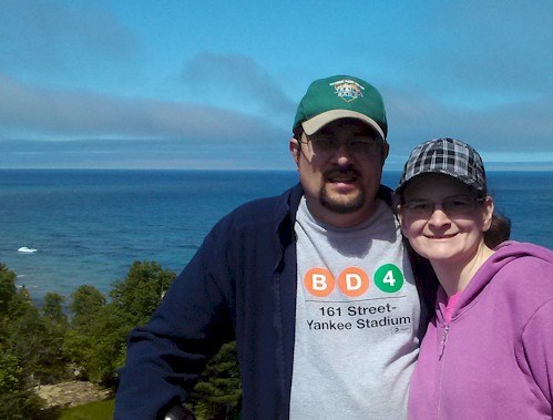
By Robert & Kandace Tabern, Email: rtabern@yahoo.com
July 22-23, 2014
http://www.trainweb.org/outsidetherails/UpperMichigan2014/
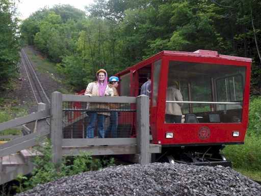 Co-author Kandace Tabern gets ready to re-board the Quincy and Torch Lake Cog Railway for a trip up the hill.
(Photo by Robert Tabern)
Having resided in the Milwaukee, Wisconsin area for quite some
time, we are frequent riders on Amtrak's Hiawatha Service down to
Chicago, Illinois. So frequent, in fact, that we almost hate to admit
having memorized the timetable for the route's seven daily round trips
(reduced to six on Sundays). But, if you look on the back of the
timetable, you might notice a little-known bus connection between
Milwaukee, Wisconsin and the Upper Peninsula of Michigan.
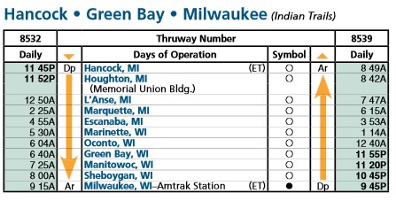
The rear of Amtrak's Hiawatha timetable shows an overnight bus connection to the Upper Peninsula of Michigan
(Courtesy: Amtrak, Spring/Summer 2014 Timetable)
After a glance at the timetable... one question quickly came to
mind for us. Was there anything interesting to do when one gets up all the way to
Hancock, Michigan? A quick online search found the answer -
YES! Not only was there an interesting railroad-related site
we wanted to check out... there appeared to be some very beautiful
National Park Service units in the area worth a visit, too. We
contemplated actually taking the overnight Amtrak Thruway bus (operated
by Indian Trails) from Milwaukee, Wisconsin to make this trip report as
authentic as possible for public transportation enthusiasts, but, in
the end, opted to drive to Hancock, Michigan in our personal vehicle to
give us the most flexibility when it came to visiting the locations we
had mapped out.
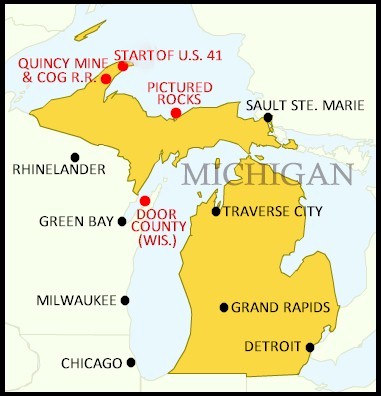 A map showing the location of sites described in the trip report
(Map designed by Robert & Kandace Tabern)
After
driving all night for 375 miles (and nearly seven hours) from Milwaukee,
Wisconsin, our very first stop was at a location just northeast of Copper
Harbor, Michigan. Here stands the northern terminus of historic U.S.
Highway 41, in a modest cul-de-sac near Fort Wilkins State Park. While
this location is very out-of-the-way for the majority of Upper
Peninsula tourists... it was on our bucket list... as Robert lived
along U.S. 41 for all but about five years of his life. U.S. 41
is a major north-south highway that runs 2,000 miles between Miami,
Florida and the Upper Peninsula of Michigan. It travels through
Michigan, Wisconsin, Illinois, Indiana, Kentucky, Tennessee, Georgia,
and Florida. There is a historic marker at this location mentioning
U.S. 41 follows the path of early Native American trails.
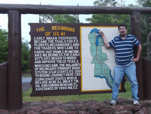 Co-author Robert Tabern poses at the sign marking the beginning of U.S. Route 41
(Photo by Kandace Tabern)
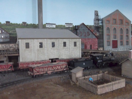
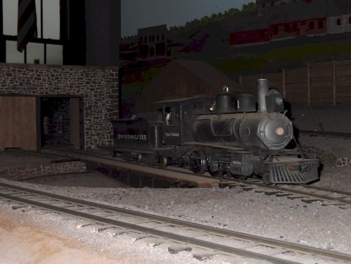
 Photos from the model railroad exhibit in the Quincy Mine museum
(Photo by Robert & Kandace Tabern)
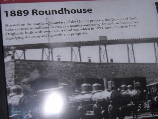
When Quincy Mine ended copper production in 1945, one of the mine's
shafts was the world's deepest, at 9,260 feet. Today, nearly 70 years
later, most of the levels of the mine have filled up with water,
however the seventh level remains open for tourists to enter and get a
taste of the conditions miners had to deal with on a daily basis. The most
exciting part of the tour for us was the ride to the mine entrance
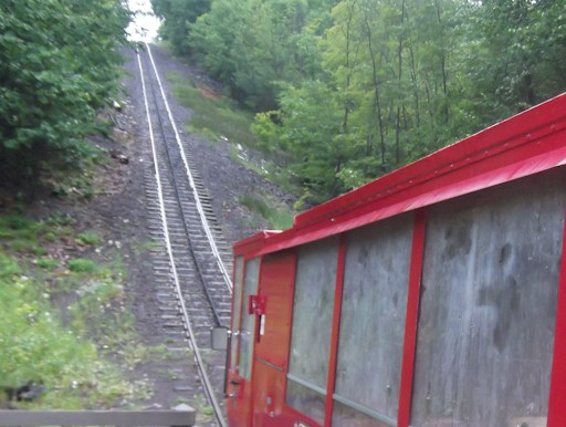
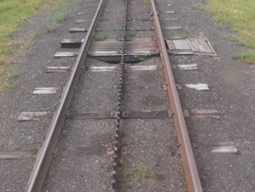
on the Quincy and Torch Lake Cog Railway. Before the current tram was
added, tourists were transported to the entrance by van (not as much fun!). The Quincy and
Torch Lake Cog Railway was constructed in 1996 and 1997 and is a
half-mile long, three-foot narrow gauge railway. Its tram car, designed by
Phil Quenzi, and built by Royale Construction, Inc. of Kearsarge,
Michigan, has a capacity of 28 people and travels at a maximum grade of
35%. It is also one of the few rack railways in the United States.
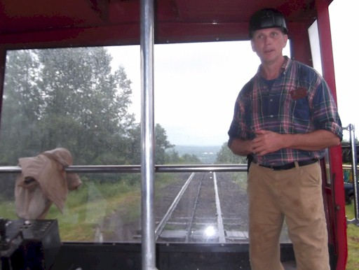
At the entrance to the Quincy Mine, visitors get off the cog
railway and are given a comprehensive tour inside the mine's tunnels;
this includes a combination of a short walk and a tractor-driven wagon
ride. Our tour guide, Tom, showed us some of the advances in mining
technology over the years and explained what a hard life the miners had
trying to remove pieces of copper. The tour ends with a cog railway
ride back up
the hill and time to explore some of the surface buildings.
Quincy Mine gives visitors the options of taking the surface tour only,
surface tour and cog railway ride, or the "complete" tour with the
surface tour, cog railway ride, and the underground tour. If you do the
full tour at Quincy Mine, we recommend that you spend about three
hours at the site to take everything in.
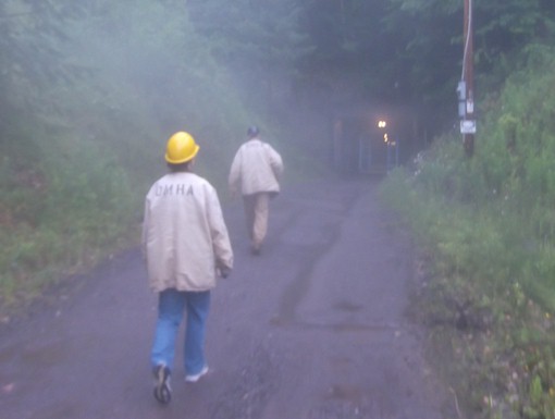
 A few views from the Quincy Mine Tour; all guests are provided with hard hats and jackets
(Photos by Robert Tabern)
After the Quincy Mine Tour, we headed south for a short distance
on U.S. 41 in order to make a quick stop in Houghton, Michigan at the
Visitor Center and Headquarters for Isle Royale National Park. Isle
Royale is an isolated island national park located in the middle of
Lake Superior between Michigan and Minnesota. A trip out to Isle Royale
has always been on our "bucket list" and is something we are planning
to tackle on a separate trip later this summer (stay tuned for the blog
post!!), so we wanted to stop and get some brochures and tips for
traveling there. There are basically three options for getting out to
Isle Royale... a 6 hour boat ride from Michigan... a 1.5 hour boat ride
from Minnesota... or a 30 minute sea plane ride from Michigan. The sea
plane was out of our budget range ($300+ per person) and Robert's
stomach probably would not handle a 6 hour one-way boat ride... so we
decided we will be doing the 1.5 hour boat ride from the Minnesota side
later this summer. There is a good movie produced by the National Park
Service and a lot of maps and other literature at the Visitor Center...
it's worth the stop if you want to learn more about going to Isle
Royale.
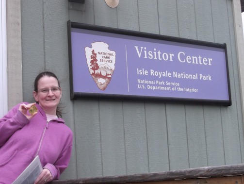 Kandace shows off her Junior Ranger badge obtained at Isle Royale National Park
(Photo by Robert Tabern)
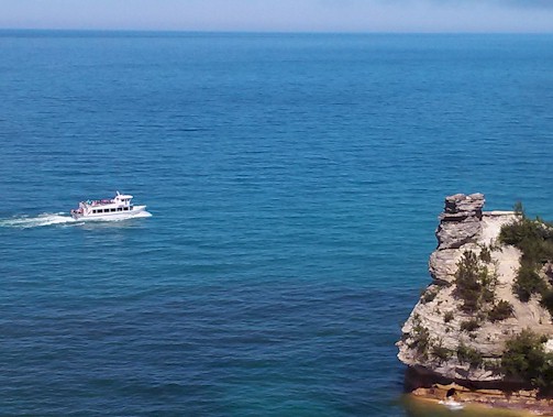
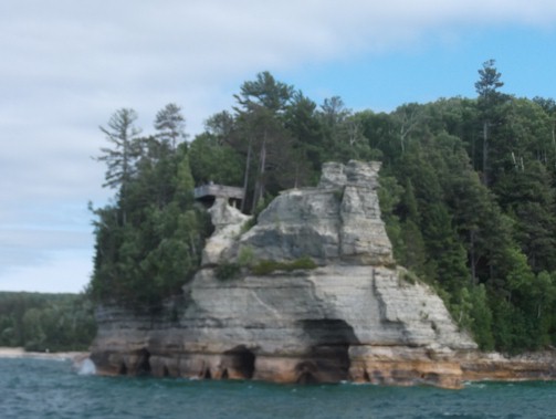
From Houghton, Michigan we headed east a few hours to Pictured
Rocks National Lakeshore, near Munising. The park boundary runs for
around 40 miles along the shoreline of Lake Superior and features
spectacular scenery of the hilly shoreline, with various rock
formations, natural archways, waterfalls, and sand dunes. The most
scenic part of the park, in our opinion, is Pictured Rocks Cliffs,
northeast of Munising; some of the cliffs rise to 200 feet directly
above the lake water level. The cliffs have been naturally sculpted
into shallow caves, arches, and even formations that resemble castles.
While one can hike to see some of the formations, the best way to view
them, by far, is taking a boat ride out on Lake Superior with the crew
from Pictured Rocks Cruises.
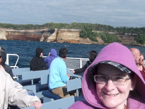
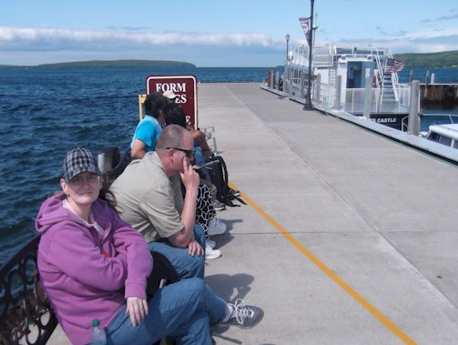 Kandace and other passengers waiting for a boat cruise with Pictured Rocks Cruises
(Photo by Robert Tabern)
Upon our arrival, we had the chance to meet John Madigan, who is the
General Manager of Pictured Rocks Cruises. He explained that Pictured
Rocks Cruises operates a full schedule of narrated tours of the
Pictures Rocks National Lakeshore cliffs from mid-May to mid-October.
Each cruise is 2.5 to 3.0 hours long and travels approximately 40 miles
round trip. Mr. Madigan explained that the departure times and
frequency of cruises vary depending on the season and that visitors can
check the company's website (link provided below) for the complete
schedule. All cruises depart from the city dock at the north end of Elm
Avenue in downtown Munising. Mr. Madigan also told us that Pictured
Rocks Cruises is an authorized National Park Service concessionaire;
some summer cruises even feature narration from a National Park Service
ranger. We chose the 5:00p.m. cruise which took us out to see the
formations and Spray Falls.
We were ready to call it a night after our long drive north,
copper mine tour, and boat ride on Lake Superior. We noticed that
Munising mainly had chain hotels that all wanted at least $130/night or
more for a standard room. To save a little bit of money, we got a tip
from locals to check out the Christmas Motel, located about five miles
east of Muinising, in the small town of Christmas, Michigan. We both
like staying in family-run 1950's-style motels versus chain hotels...
so this was something we decided to check out. We were quite impressed
with the small motel which was half the price of the chain motels in
Munising!! It was very clean and the owners were very friendly; they
even had a fire pit in the back of the motel which can be used by
guests. We both were very pleased with this motel and would definitely
stay there the next time we return to the Upper Peninsula. The only
downside is they have less than 10 rooms and the owners explained they
do fill up quite soon in the season; we were only able to get a room
because of a last-minute cancellation.
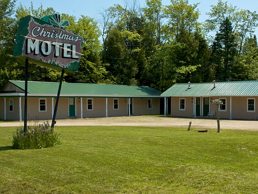 The Christmas Motel provides comfortable and clean lodging at half the price of its competition
(Courtesy: Christmas Motel)
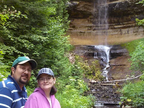
After getting the chance
to explore Pictured Rocks National Lakeshore by boat the day before, we
decided to spend some time that following morning exploring the park's
natural areas on foot. We got up early and made stops at Munising Falls
and Miners Falls. Munising Falls is located just outside of the city
limits and is a very short walk from the parking lot. You are looking
at a 1.2-mile round trip hike to view Miners Falls, but it was a lot
less crowded and in more of a natural setting than Munising Falls. From
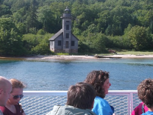
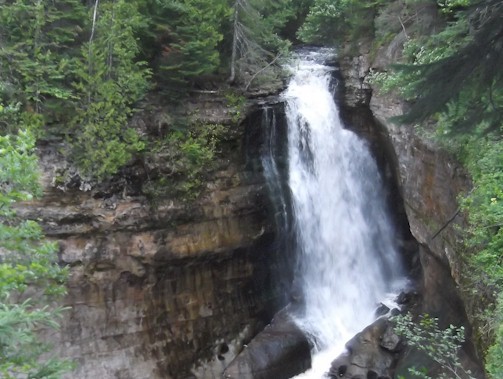
there we grabbed breakfast and headed out on a 3.2-mile round trip hike
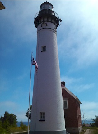
to Au Sable Lighthouse. There is no other way to get out to the
lighthouse, except by taking this trail. Be sure to stop off at the
viewpoints to see some shipwreck remains! The National Park Service
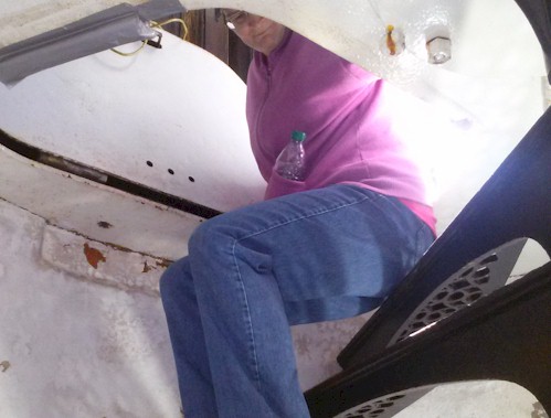
staffs the lighthouse during the summer months with volunteers who
explain what early lighthouse keepers had to deal with; the highlight
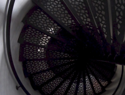
of the tour was walking up the steps to the top of the lighthouse,
which is still used today by the U.S. Coast Guard.
After the walk and tour of Au Sable Lighthouse, it was time to hit the
road and head back south to our home near Milwaukee, Wisconsin. Of
course we made a quick detour over to Door County, Wisconsin to stop
and pick sweet cherries at Paradise Farms Orchard. Sweet cherries are
delicious and something we both enjoy, but the season is very short for
the "u-pick" cherries; this season they were only open for just over a
week. We hit it just right! We must of had fun there because we ended
up picking over 25 pounds worth of their sweet cherries! Check
out Paradise Farms the next time you are in Northeast Wisconsin. We had
a fun time at our last stop... and at every stop... on this quick trek
north to the Upper Peninsula of Michigan!

 Got cherries? Yes, we do, in Door County, Wisconsin on the way home!
(Photos by Kandace Tabern)
LINKS FOR THIS REPORT
End of U.S. Route 41 | Quincy Mine Tour Information |
Isle Royale National Park
Pictured Rocks National Lakeshore |
Pictured Rocks Cruises (boat tour information)
Christmas Motel |
Au Sable Lighthouse Tours |
Paradise Farms Cherry Orchard