TrainWeb.org Facebook Page
CPR Galt Sub TTR Zone Maps

Canadian Pacific Railway / Toronto Terminals Railway
ZONE MAPS
 

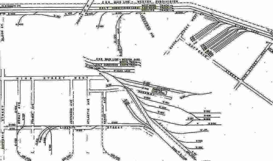
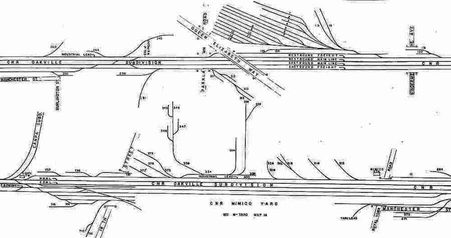
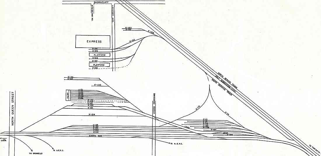
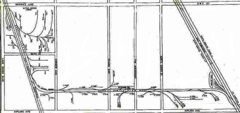
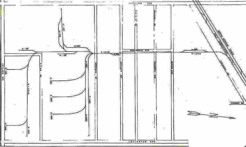
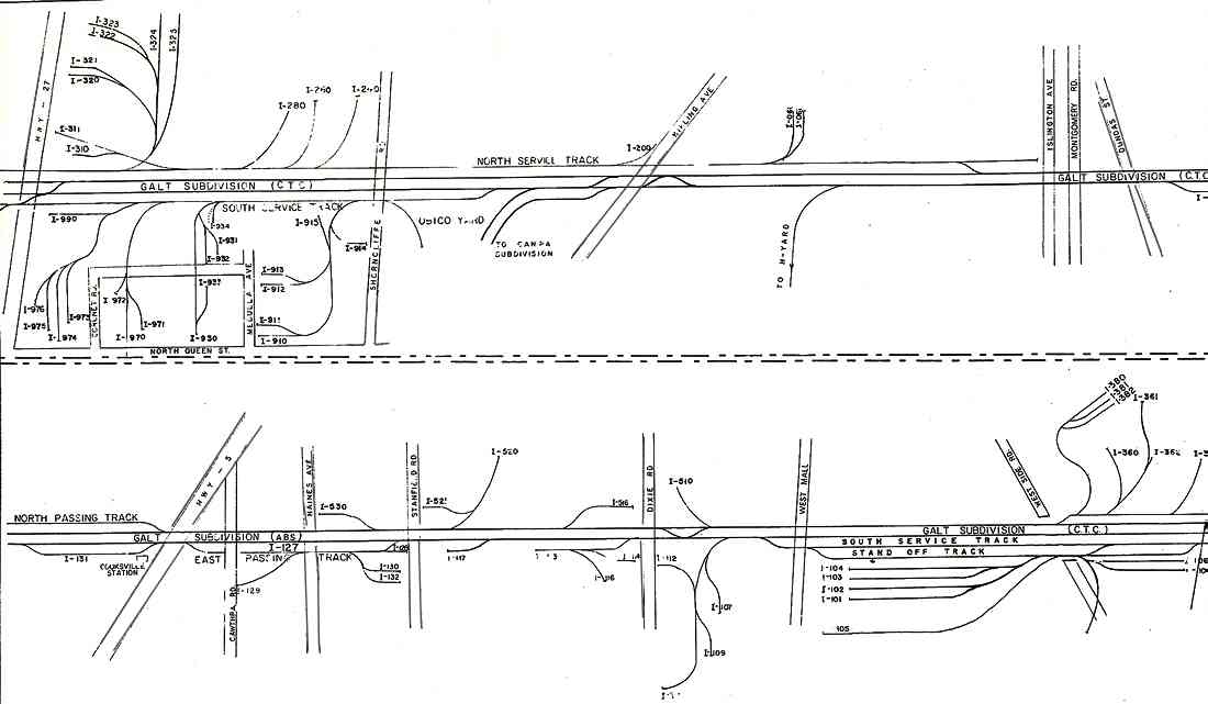
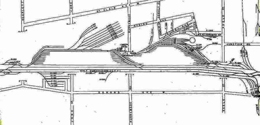
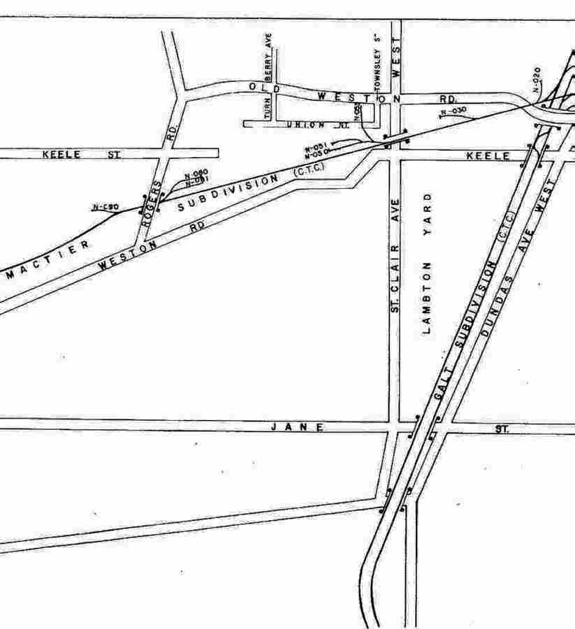
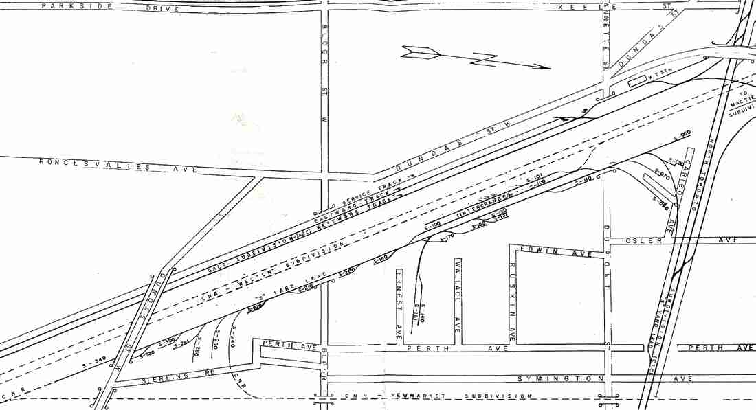
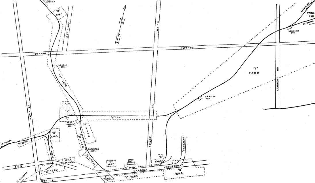
Below are SUBDIVISION NOTES and LINKS for the CPR Zone Maps Galt Sub Toronto Area. All maps are authentic Canandian Pacific Railway track schematic maps dating between 1962 and 1971. The Galt Subdivision herein does not reveal the current track schemes.

These schematic maps are 'aged' so reproduction here has been a challenge.

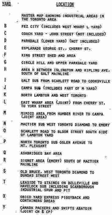
Omitted maps (because not directly related to the Galt Sub) are: L&B Yard, Fez City, Queens Wharf (L Yard), George & Cherry Streets (E Yards), King Street Shed & area (F Yard), South Mimico & Yard area (M Yard), Industrial areas off the MacTier Sub. East & Channel Lead, Keating Yard & Basin & Dock Lead.

The Zone Maps are more historical now than ever as most of these track schematics have been heavily changed or do not even exist today. Several maps have purposely left out details.


(click on link below or scroll down / use BACK button)

[ Yard Industrial Designations | Parkdale Industrial Area | Obico Multi-Modal Terminal ]

[ Lambton Industrial Areas (1966) | See also Canpa Sub Detour Maps ]


[ Canadian National Railways Zone Maps ]

[ Return to RGB's Telegraph Site -or- GO Transit Motive Power Website ]


Parkdale Industrial Area

ZONE:

Parkdale - G Yard
Top Yard, Hill and Circle Area (1966)

Parkdale - M Yard
Ontario Food Terminal, Canpa Sub

Return to top
OBICO Multi-Modal Terminal

ZONE:

OBICO Multi-Modal Terminal (1971)

Lambton M & J Yard (1965) /
Canpa Sub

Return to top
Lambton Industrial Areas

ZONE:

Lambton - H Yard (1968)

Lambton - I Yard (1965)

Lambton - K / O Yards (1965)

Lambton - N Yard (1968)

Lambton - S Yard (1968)

Return to top
Industrial Yard Designations

ZONE:

Yard Designation Areas

Yard Designation Locations
by Zone Name

Return to top

[ Return to RGB's Telegraph Site -or- GO Transit Motive Power Website ]