TrainWeb.org Facebook Page
B&O Photo Tour


B&O Baltimore Belt Line
Modern day photo tour

Accompanying each photo below are:

Click a photo to see a larger view. Please send your comments and corrections to Steve.


<< Previous (index) | THIS PAGE: Howard Street Tunnel | Next (east) >>

Brief Historical Background:

PSINet Stadium

PSINet Stadium
Mile: (BAK 96.5) BAA 0.5 Date: Mar 2001
Ease: B View: S
Area: B RBL:
Map: Ba 43 A 2 Topographic Maps

We begin the Baltimore Belt Line tour at the spot B&O did, just south of its Camden Station where CSX 746 powers a coal drag past PSINet Stadium, still decorated to celebrate the 2001 Superbowl Championship of the Baltimore Ravens. To avoid sun glare, the best time to take a photo here is during the morning or on a cloudy day.

PSINet was a flash-in-the-pan Internet Service Provider that both grew too fast and spent too freely on acquisitions such as stadium naming rights. The year before this photo, PSINet's stock price had topped $60 per share, but by the time CSX 746 arrived here that price had cratered to just 18 cents, followed a few months later by the company filing for bankruptcy. The stadium is now named for M&T Bank.

Link: CSX 9999 in 2017


Looking North

Looking North
Mile: (96.5) Date: Mar 2001
Ease: B View: N
Area: B RBL:
Map: Ba 43 A 2 Topographic Maps

The tracks divide here so on the left commuter trains can still serve Camden Station while eastbound freights like this one head for the Howard Street Tunnel. Despite massive construction expense, a tunnel was B&O's only viable option in 1890 for connecting Camden Station with points northeast.

This is the same spot as the prior photo but looking the opposite direction. By now, CSX 746 is deep in the Howard Street Tunnel while the final coal car follows along. Baseball is nearby too: that's Oriole Park at left beyond the Ostend Street bridge.

Declining need for B&O's extensive Camden complex, what had been its primary facility in downtown Baltimore, led to change. Starting in the 1980s, much of the excess was torn down or repurposed while the I-395 spur into the city from I-95 was built over part of the old rail yards.

Links: 1991, 1991


Then/Now
Photo (top) courtesy Bill Manzke
via rr-fallenflags.org

Then/Now
Mile: (96.5) Date: 1977 / Oct 2016
Ease: B View: N
Area: B RBL:
Map: Ba 43 A 2 Topographic Maps

The Chessie Steam Special operated during 1977 and 1978 to celebrate less zoom the 150th anniversary of the B&O Railroad. The spot where Reading 2101 was captured during 1977 has changed so much as to be virtually unrecognizable. B&O's brick warehouse and the Bromo Seltzer Tower survive to anchor the comparison.

The lower-half of this photo mashup was snapped from the light rail stop at M&T Stadium. To further illustrate how much this area has changed, at right is another photo from the stop, with less zoom. Had B&O's HB Tower still been standing, it would have been ahead on the left, partly under the leftmost ramp.

Links: Chessie Steam Special, HB Tower 1974, 1983


Howard Street Tunnel

Howard Street Tunnel
Mile: (96.5) Date: Mar 2001
Ease: B View: N
Area: B RBL:
Map: Ba 43 A 2 Topographic Maps

The Howard Street Tunnel (entrance at distant left), a key component of B&O's route to the northeastern cities of Philadelphia and New York, was an exceedingly expensive construction undertaking in part because B&O had instead directed its earlier expansion efforts toward the midwest.

During those mid-1800s decades, Baltimore grew into the second most populous United States city, one that left little room for a new surface railroad route. Consequently, B&O had little choice but to tunnel under the city, first northward from Camden, then east, as will be illustrated by this tour.

The costly project drove B&O into bankruptcy. When it emerged from receivership in 1899, the new owners hailed from Chicago: Armour (meat packing), Field (department stores) and Hill (northwestern railroads). Pennsylvania Railroad purchased control just two years later. That short-lived relationship was broken apart by anti-trust legislation of 1906.

Link: Sun Newspaper on tunnel history


New Portal

New Portal
Mile: (96.5) Date: Mar 2001
Ease: B View: N
Area: B RBL:
Map: Ba 43 A 2 Topographic Maps

Engines working to haul coal uphill expel enough heat to distort this image. Heat was not the main concern in the 1890s, smoke was. CSX 4421 is an ex-Conrail unit.

To head northeast before the tunnel opened, B&O floated railcars across the harbor from Locust Point to Canton. The trip between Washington and New York took 9 to 10 hours in 1869. Amtrak presently traces the equivalent route in about 3 hours.


From Ramp

From Ramp
Mile: (96.5) Date: Oct 2016
Ease: A View: N
Area: B RBL:
Map: Ba 43 A 2 Topographic Maps

The ramp from I-395 to Russell Street yields this view of Howard Street Tunnel's modern portal and downtown.

To create space for I-395 above it, the tunnel was extended southward, toward the camera, by about a quarter mile of boxy concrete in 1982. More room was needed subsequently for light rail, so the tunnel gained 50 additional feet with this concrete portal during the early 1990s.

Link: security cameras make the following less likely now 1983


MARC Platforms

MARC Platforms
Mile: (96.5) Date: Oct 2016
Ease: A View: N
Area: B RBL:
Map: Ba 43 A 2 Topographic Maps

Looking slightly left (west) of the prior view brings B&O's Camden Station into sight at distant left. You didn't see this polished image of Baltimore in The Wire. Camden is a terminal for MARC (Maryland Area Regional Commuter) trains, hence the long platforms that occupy the space B&O's had decades ago.

When the tunnel first opened, there were no diesel locomotives, of course, but rather steam-powered ones. B&O's engineers knew steam locomotives put out too much smoke for use in a mile-long tunnel, so they contracted with General Electric for then-new electric locomotives, powerhouse equipment and an electrical distribution system. Revolutionary at the time, it was also prescient as diesel-electrics are now the norm both inside tunnels and out.

Link: LoC 1970s


Original Portal
Photo courtesy Library of Congress

Original Portal
Mile: (96.3) Date: 1971
Ease: B View: N
Area: B RBL: 148
Map: Ba 43 A 2 Topographic Maps

Camden Station platforms are on the left. This view to the original south portal (prior to the tunnel's concrete extension) shows the width of the cut leading down into the tunnel: it provided room on the sides for the electric locomotives to wait to tie on. Those electric "motors" (as they were known) were the first employed by a mainline railroad.

The spot from which this photo was taken now resides a short distance inside the tunnel extension. I do not know if this full width was preserved along the extension.

Links: 1895, 1937, 1976, LoC source photo


Camden Station 2002

Camden Station 2002
Mile: (96.2) Date: Jun 2002
Ease: A View: N
Area: B+ RBL:
Map: Ba 43 A 1 Topographic Maps

Here's the south face of Camden Station as seen from I-395. The right end of the light rail train is over the Howard Street Tunnel's now-buried original south (railroad west) portal.

With Camden at its southern end, Howard Street has long been a main thoroughfare, beginning with horse-drawn carriages and streetcars, as well as cable cars, trolleys, buses, plus light rail and, of course, B&O/CSX underneath.

Links: Baltimore's cable cars, 1983, then-now views from Bromo Seltzer tower


Camden Station

Camden Station
Mile: (96.2) Date: Sep 2016
Ease: A View: N
Area: B+ RBL:
Map: Ba 43 A 1 Topographic Maps

A more recent photo shows a hotel has sprung up nearby. The station underwent extensive restoration while Oriole Park was being built.

Link: 1982 Camden Station photos


South Portal
Photo courtesy Library of Congress

South Portal
Mile: (96.1) Date: Mar 1971
Ease: View: N
Area: RBL: 91
Map: Ba 43 A 1 Topographic Maps

The Howard Street Tunnel opened equipped with double track. A gauntlet track was added between the two in 1937 for use by taller trains. Smashboards protected it into the 1960s. Note the South Portal is railroad west of the North Portal.

Once taller trains became the norm, the track was reduced to single, and centered for greatest headroom. Track lowering performed during 1984 permitted autoracks 19 feet 2 inches in height to squeeze through. However, consist height kept growing.

Modern "double stack" container trains are even taller, 20 feet 2 inches, too tall to pass through the pre-2025 tunnel. Double stacks are so popular this tunnel had become a significant freight traffic hindrance for CSX. Since alternate routes are much lengthier, the Howard Street Tunnel Project modified the tunnel during 2025 to increase clearance.

Links: 2011 MDOT report (PDF), LoC source photo


New Meets Old
Photo courtesy HAER
NEW! Oct 2025

New Meets Old
Mile: (96.0) Date: 2021
Ease: View: N
Area: RBL:
Map: Ba 43 A 1 Topographic Maps

Let's step into the tunnel.

The 1982 concrete extension meets the original stone masonry here. The next panel's photo was taken a few paces ahead but more than a century before.


When New
Photo courtesy Md Historical Society
NEW! Oct 2025

When New
Mile: (96.0) Date: 1895
Ease: View: N
Area: RBL: 91
Map: Ba 43 A 1 Topographic Maps

Two people are made to look small by the immense Howard Street Tunnel.

Thomas Edison's electric light bulb patent was but 15 years old when the tunnel opened. Electricity not only powered lamps along the walls, but also a motorized electric locomotive via supply lines seen here at the top of the tunnel's overhead arch. This supply system was replaced by a ground-level third rail in 1902.


Inside
Photo courtesy Library of Congress

Inside
Mile: (96.0) Date: 1971
Ease: View: S
Area: RBL:
Map: Ba 43 A 1 Topographic Maps

This reverse view was snapped from about where the two people were standing in the panel above. Camden Street crosses unseen overhead. The current concrete portal is located at the curve just beyond the distant Lee Street bridge over the tracks.

Unseen in the darkness on the right is a platform that links with Camden Station. I would guess it has not been used by passengers since the 1940s. When this tunnel opened at 1.4 miles in length, it was the longest soft-earth tunnel in the country.

Link: LoC source photo


Blueprint
Image courtesy CSX
NEW! Oct 2025

Blueprint
Mile: Date: 1895
Ease: View:
Area: RBL:
Map: Ba 35 A Topographic Maps

The tunnel's roof is lined with three to eight rings of brick, with most spots receiving five.

The sidewalls and roof were constructed first because that was the proven "German method" suitable for soft soils. Once in place, the tunnel's interior was excavated and an inverted-arch floor added.


New Meets Old
Photo courtesy HAER
NEW! Oct 2025

New Meets Old
Mile: (95.8) Date: 2021
Ease: View: S
Area: RBL:
Map: Ba 35 A 13 Topographic Maps

B&O planned to add a station underneath the Lombard Street intersection, hence the extra tunnel width here, but never completed the effort. The section from here back to the south portal was created via the cut-and-cover digging method. From here north (behind the photog), about a mile of tunnel was bored through mostly sand and clay at depths approaching 100 feet.

A water main that predates the tunnel runs immediately above this spot. CSX noted excessive water infiltration during 2001; that was followed by a train derailment July 18, 2001.


2001 Fire
Photo courtesy Baltimore Sun

2001 Fire
Mile: (95.9?) Date: Jul 2001
Ease: View: N?
Area: RBL:
Map: Ba 35 A 13 Topographic Maps

The 2001 derailment precipitated a fire that could not be reached for days to be extinguished. The fire caused the leaky 40-inch water main above to fully rupture, but even that water did not douse the flames.

The incident called attention to the bottleneck represented by the aging tunnel. It advanced the idea that the 1890s tunnel needed replacement or improvement, including the ability to handle tall, double-stacked consists.


Lombard Street

Lombard Street
Mile: (95.9) Date: Sep 2016
Ease: A View: N
Area: C+ RBL:
Map: Ba 35 A 13 Topographic Maps

This intersection of Howard and Lombard Streets marks the location of the worst of the derailment and fire. Light rail on Howard Street complicated fire-fighting efforts.

That the old tunnel suffered minimal damage in the event suggests with basic maintenance it is sturdy enough to soldier on into the 22nd century. Work to increase clearance by lowering the tunnel's floor was performed during 2025.

Link: 1983


Precast Slabs
NEW! Oct 2025

Precast Slabs
Mile: 93.7 Date: Mar 2025
Ease: A View: NE
Area: C RBL:
Map: Ba 35 A 8 Topographic Maps

As part of 2025's Howard Street Tunnel Project, precast thick concrete slabs were placed on trains at the former Huntingdon Yard for hauling into the tunnel. The satellite-dishlike item onboard is a cement mixer.

Detour: more photos from Huntingdon Yard at this site


Slab Installation
Photo courtesy Trade Press Media
NEW! Oct 2025

Slab Installation
Mile: (~95.5) Date: 2025
Ease: View:
Area: RBL:
Map: Ba 35 A 12 Topographic Maps

Custom machinery helped install the precast slabs as the new track base inside the tunnel. A total of 1188 slabs were installed at an average rate approaching 10 per day. Perforations in the slabs permit water to drip down to an updated drainage channel below. The slabs are intended to last into the 22nd century.

The project's goal was to lower the central tunnel floor by at least 18 to 24 inches. The slabs take the place of the original tunnel base that was an inverted arch made of brick and concrete.


Plus Concrete
Photo courtesy Trade Press Media
NEW! Oct 2025

Plus Concrete
Mile: (~95.5) Date: 2025
Ease: View:
Area: RBL:
Map: Ba 35 A 12 Topographic Maps

To save vertical space, the slabs are designed for use with minimal stone ballast, which has not yet been added in this photo. Slab wings angle up toward the tunnel walls. They help stabilize the walls and resist upwelling of the soil below. They also relegate the tunnel to single track for the foreseeable future.

Concrete was poured to fill the gap between the wings and slab walls. The slope of that concrete, destined to become damp and slippery from dripping water, will make inspecting a stuck train fairly difficult.


Madison Street

Madison Street
Mile: (95.0) Date: Sep 2016
Ease: A View: N
Area: C RBL:
Map: Ba 35 A 11 Topographic Maps

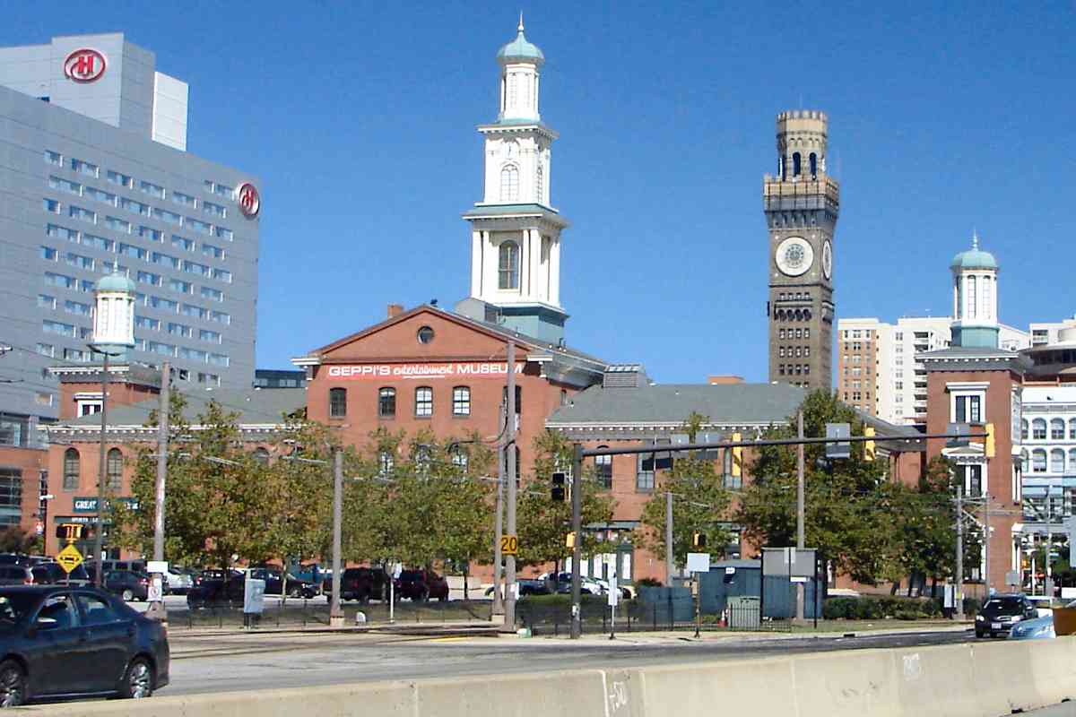
Above the tunnel, it was thought the light rail would revitalize the Howard Street corridor, a casualty of road changes and riots during the 1960s, but progress has been very slow. Over fifty years later, there remain many unoccupied buildings and storefronts.

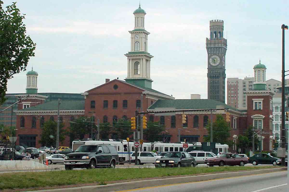
As the city's prime shopping district, the Howard Street corridor centered at Lexington Street had attracted sign all the popular department stores of the era as well as many family-owned shops. After the riots, many shoppers moved away -- the city's population declined by more than 13% (over 100,000) between 1970 and 1980 -- eroding the tax base, and leaving Baltimore financially strapped, with the expected decline in city services and quality of life.

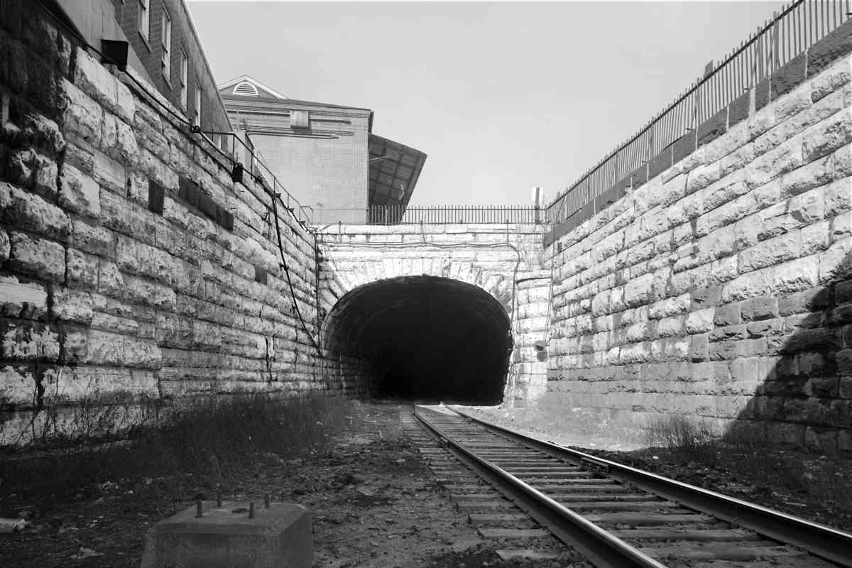
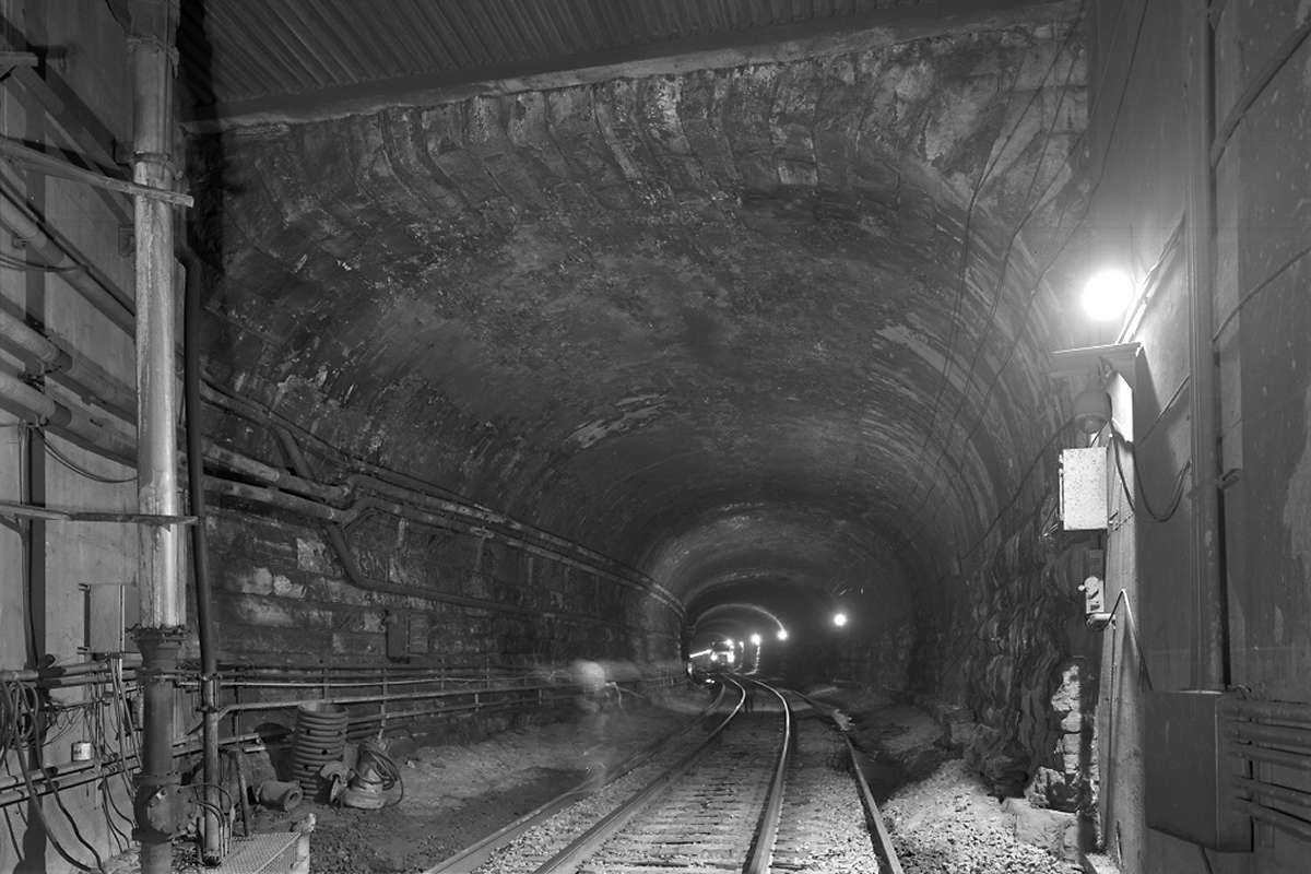
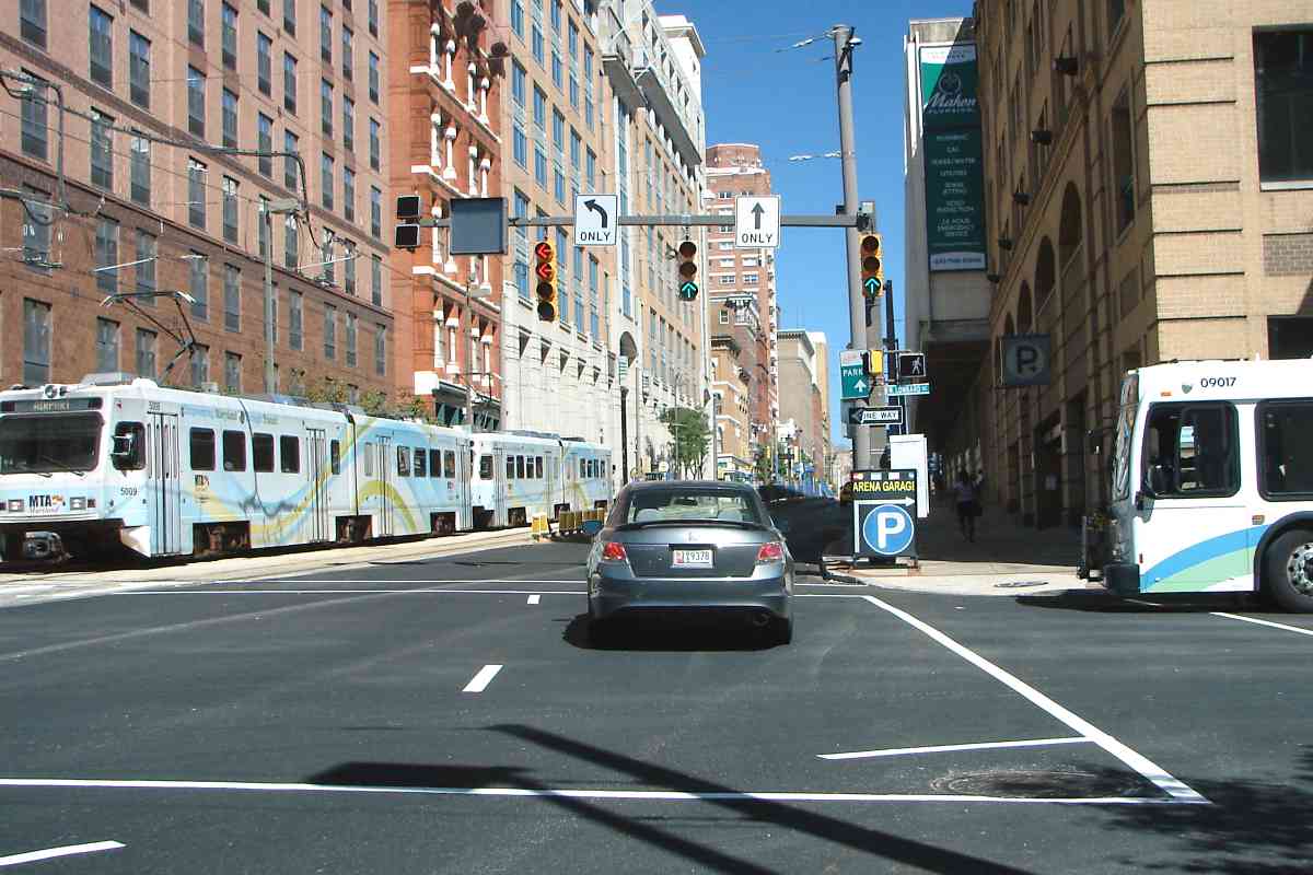
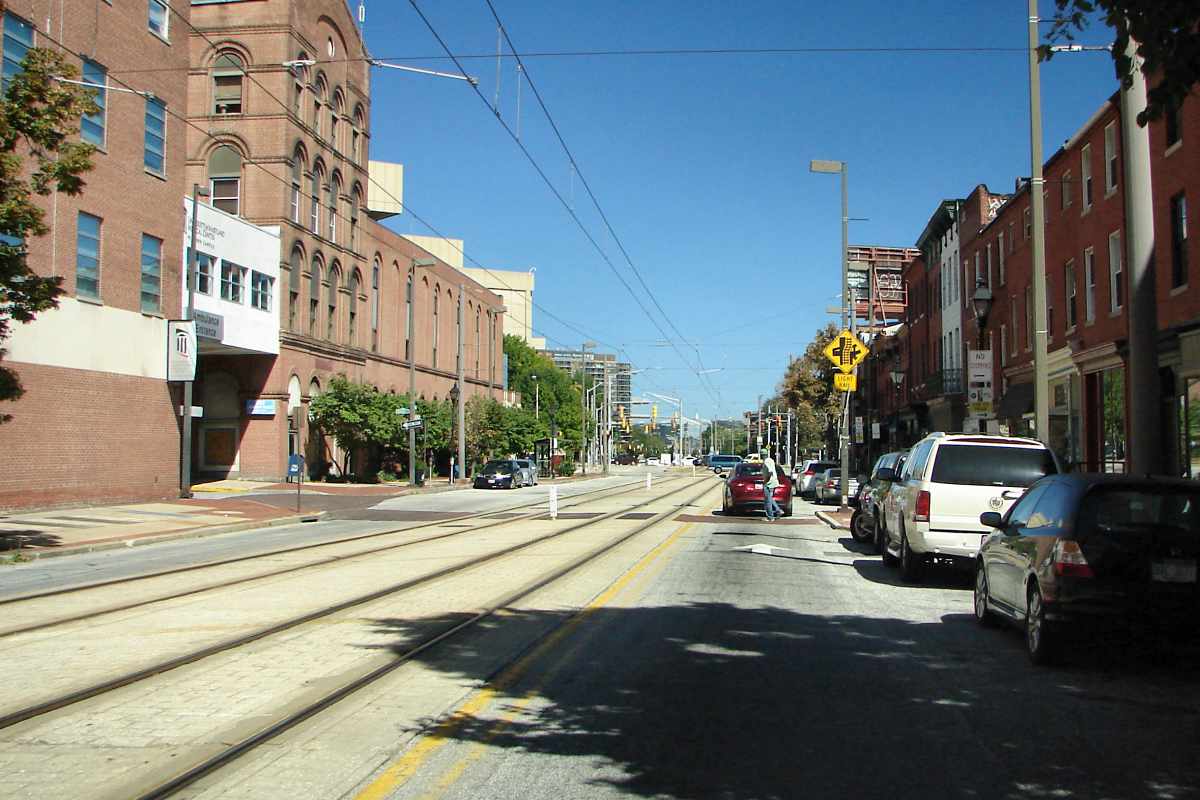
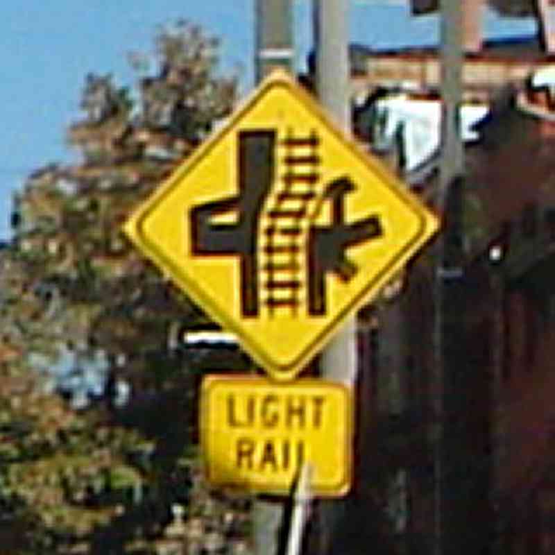
Light rail and autos awkwardly share Howard Street. Just past Madison Street, the one-of-a-kind sign at right warns drivers a complex intersection lies ahead. 
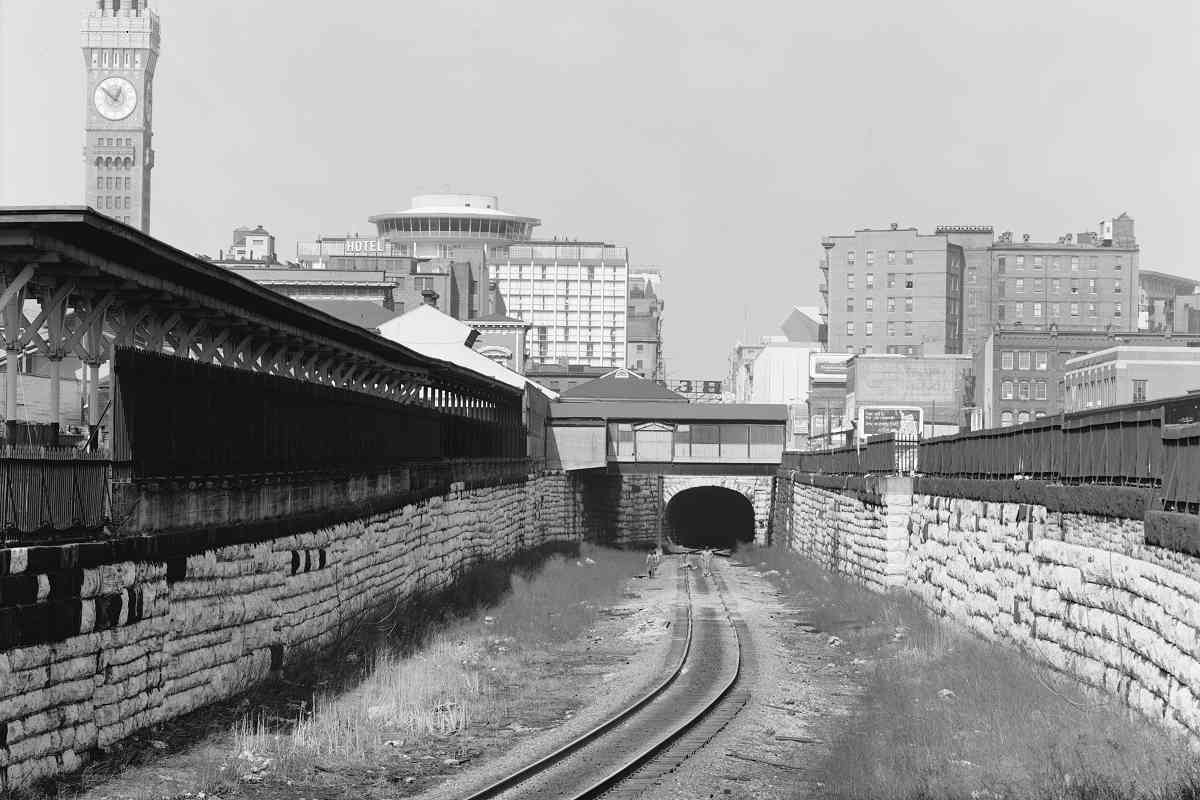
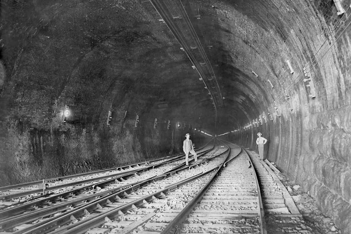
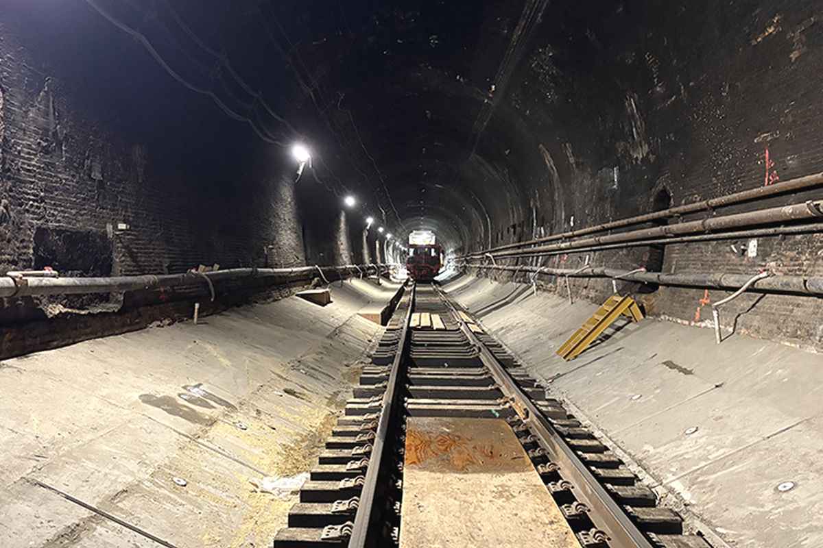
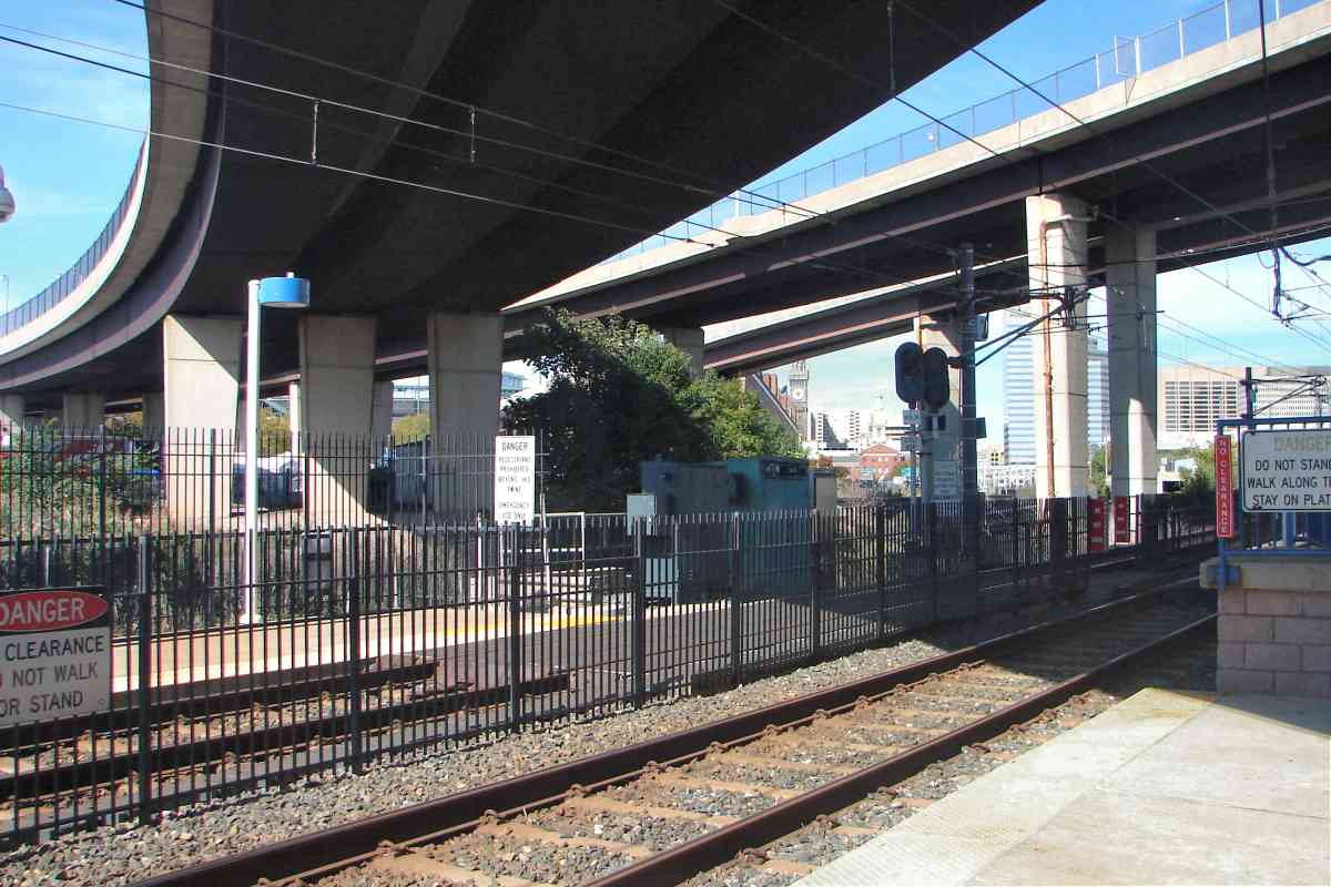
The tunnel is 49 feet below the surface here, the deepest it gets.

Links: 1961, 1968 riots
Change for: Baltimore light rail tour at this site


Widens
Photo courtesy HAER
NEW! Oct 2025

Widens
Mile: (94.7) Date: 2021
Ease: View: S
Area: RBL:
Map: Ba 35 A 11 Topographic Maps

The bored tunnel ends near Preston Street. North from there, it widens to a bellmouth that was created via the cut-and-cover digging method.


Looking Out
Photo courtesy HAER
NEW! Oct 2025

Looking Out
Mile: (94.7) Date: 2021
Ease: View: N
Area: RBL:
Map: Ba 35 A 10 Topographic Maps

This was the appearance at the tunnel's limestone north (railroad east) portal a few years before floor lowering commenced. The uphill grade from the other portal to here averages 0.8%.


<< Previous (index) | THIS PAGE: Howard Street Tunnel | Next (east) >>

Or, return to main page

Copyright Notice