Click a photo to see a larger view. Please send your comments and corrections to Steve.
|
| |||||||||||
| ||||||||||||
Photo courtesy Wikimedia |
| |||||||||||
| ||||||||||||
|
| |||||||||||
| ||||||||||||
Photo courtesy Library of Congress |
| |||||||||||
| ||||||||||||
|
| |||||||||||
| ||||||||||||
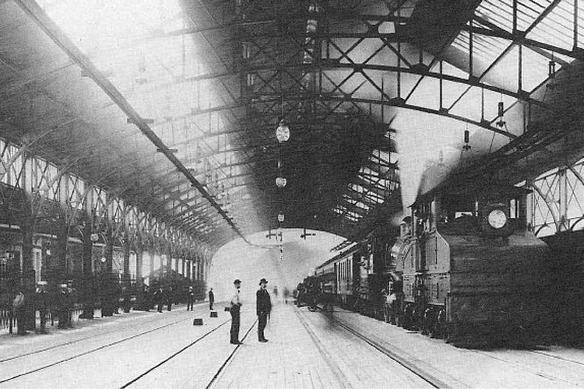
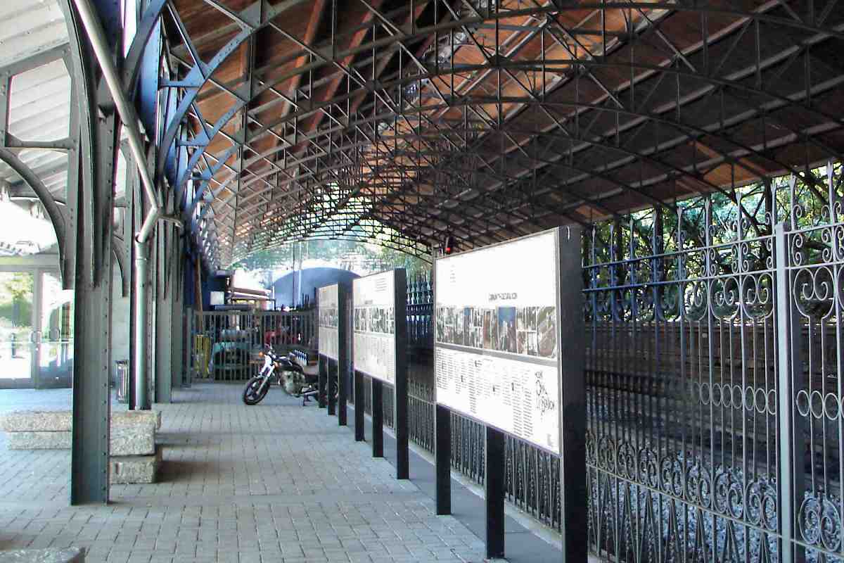
Photo courtesy Wikimedia |
| |||||||||||
| ||||||||||||

|
| |||||||||||
| ||||||||||||
|
| |||||||||||
| ||||||||||||
|
| |||||||||||
| ||||||||||||
|
| |||||||||||
| ||||||||||||
Photo courtesy Smithsonian Institution |
| |||||||||||
| ||||||||||||
|
| |||||||||||
| ||||||||||||
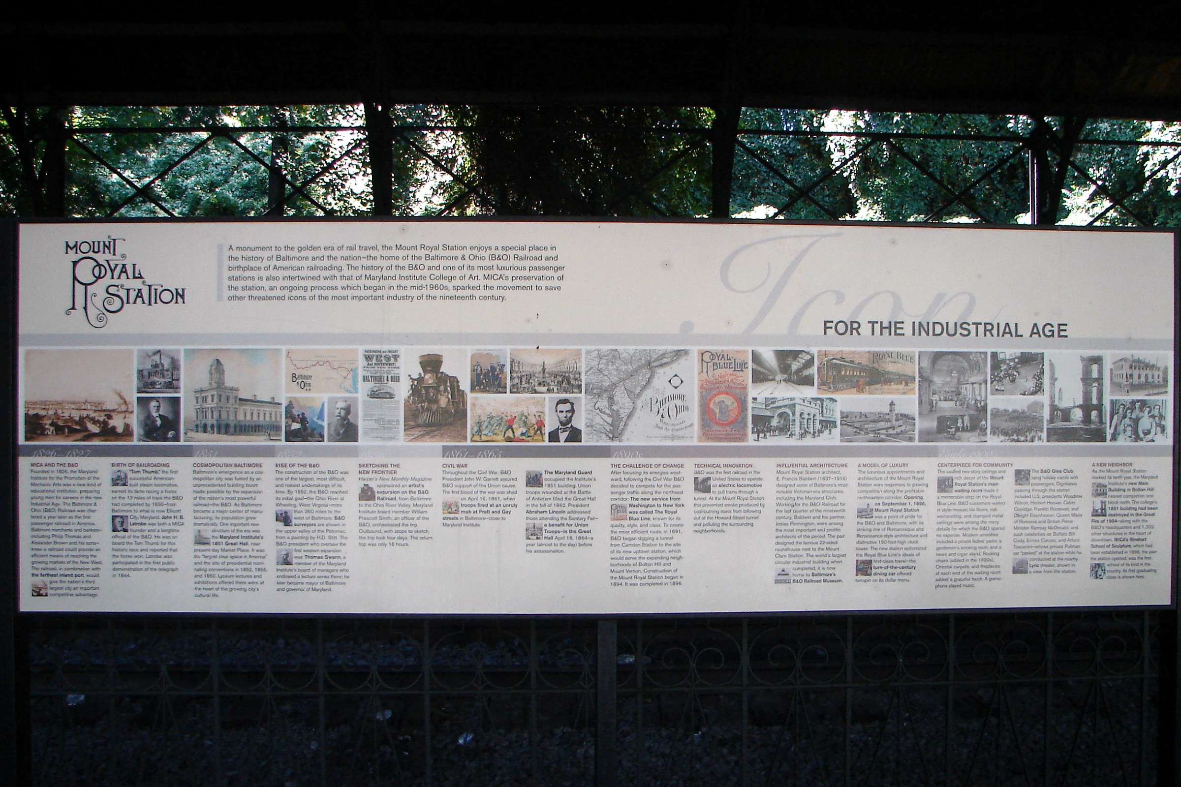
Photos courtesy Johns Hopkins University |
| |||||||||||
| ||||||||||||
Photo courtesy Library of Congress |
| |||||||||||
| ||||||||||||
|
| |||||||||||
| ||||||||||||
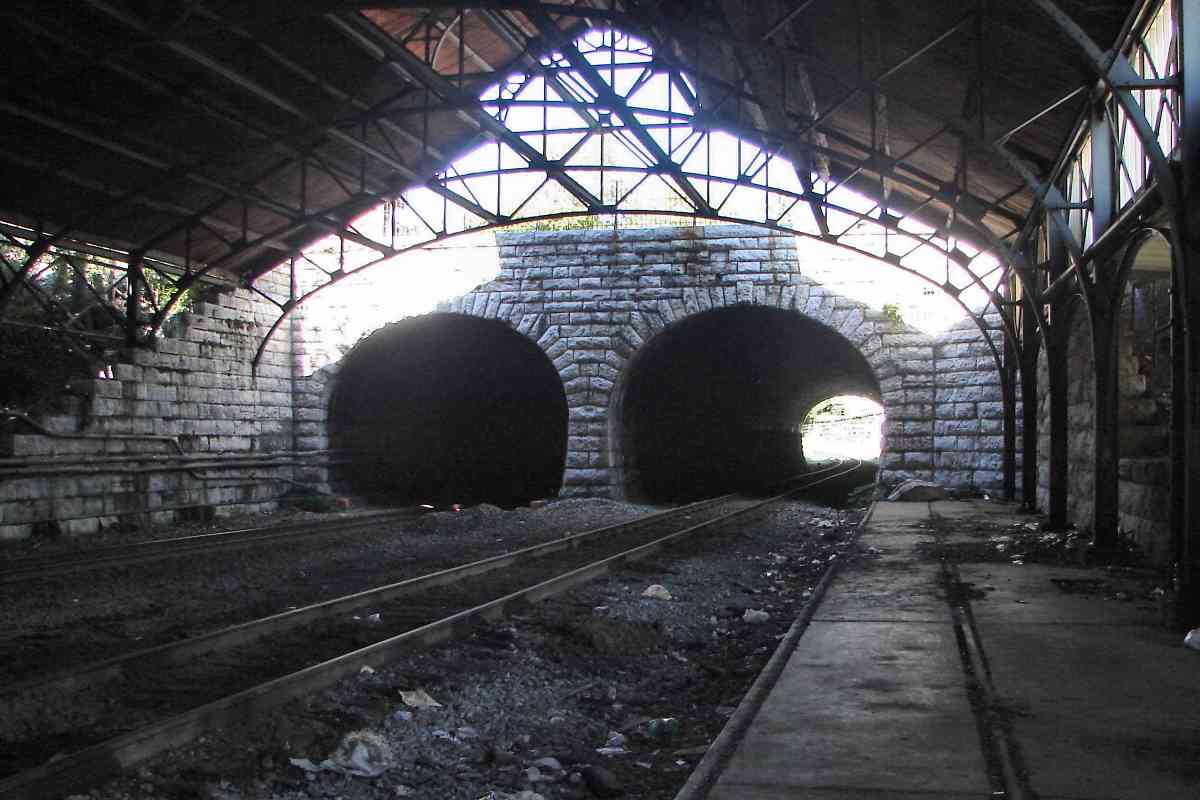
Photo courtesy Library of Congress |
| |||||||||||
| ||||||||||||
|
| |||||||||||
| ||||||||||||
|
| |||||||||||
| ||||||||||||
|
| |||||||||||
| ||||||||||||
|
| |||||||||||
| ||||||||||||
|
| |||||||||||
| ||||||||||||
|
| |||||||||||
| ||||||||||||
|
| |||||||||||
| ||||||||||||
|
| |||||||||||
| ||||||||||||