TrainWeb.org Facebook Page
Baltimore Light Rail Photo Tour


Baltimore Light Rail
Modern day photo tour

Accompanying each photo below are:

Click a photo to see a larger view. Please send your comments and corrections to Steve.


<< Previous (north) | THIS PAGE: Penn Station to Camden Station | Next (south) >>

MTA 5004

MTA 5004
Mile: 0.2 spur Date: Nov 2018
Ease: A- View: NW
Area: B+ BLR:
Map: Ba 35 B 10 Topographic Maps

This train is preparing to depart Penn Station.

Link: 1998


Interior

Interior
Mile: Date: Jun 1999
Ease: View:
Area: BLR:
Map: Topographic Maps

While still newish, car interiors had this appearance as seen from the articulation area where the car's two halves are joined. Considering both front and back halves, there is seating for 84 people; standing patrons can boost the total capacity to about 200.


Departure

Departure
Mile: 0.2 spur Date: Jun 1999
Ease: B+ View: NW
Area: B+ BLR: 61
Map: Ba 35 B 10 Topographic Maps

The operator has received the go ahead to depart.


Ramp

Ramp
Mile: 0.2 spur Date: Nov 2018
Ease: A- View: NW
Area: B+ BLR:
Map: Ba 35 B 10 Topographic Maps

The ramp at left leads to the bridge over I-83/JFX. Provisions were made in the ramp for double tracking, but such expansion might be waiting for track to be added so trains leaving Penn can turn north.


Over I-83
Photo credit HH Harwood

Over I-83
Mile: 1.4 Date: Dec 1997
Ease: B+ View: NE
Area: B- BLR: 20
Map: Ba 35 A 10 Topographic Maps

Curiously, the bridge over I-83 has room for double track only at its western (near) end.


To Penn Station

To Penn Station
Mile: 1.3 Date: Sep 2016
Ease: A- View: N
Area: B- BLR:
Map: Ba 35 A 10 Topographic Maps

The big 10 is the speed limit for trains like this one headed for Penn Station. The big arches in the background belong to the Howard Street Bridge.

Link: 2002


From Above

From Above
Mile: 1.3 Date: Sep 2016
Ease: B View: S
Area: C BLR:
Map: Ba 35 A 10 Topographic Maps

The first stop after departing Penn Station is Mount Royal Station below where one finds MTA 5044 and MTA 5001.


Mount Royal Station

Mount Royal Station
Mile: 1.3 Date: Jun 1999
Ease: A- View: S
Area: B- BLR:
Map: Ba 35 A 10 Topographic Maps

This is the operator's view. The push-button controls atop the curved pole at right permit the operator to change the setting of nearby track switches.

The "tunnels" at right are merely underpasses for CSX trains at Mount Royal Avenue. Into the 1960s, the B&O had a Mount Royal Station of its own at the clock tower straight ahead.


B&O Mount Royal

B&O Mount Royal
Mile: 1.3 Date: Sep 2016
Ease: B View: S
Area: C BLR: 66
Map: Ba 35 A 10 Topographic Maps

The former B&O station plus its trainshed are landmarked. The station building is now part of the Maryland Institute College of Art. Light rail crosses over the ex-B&O, CSX line here with much less fanfare than at The Box.

Change for: B&O Baltimore Belt Line tour at this site


Mount Royal Avenue

Mount Royal Avenue
Mile: 1.2 Date: Sep 2016
Ease: A- View: NE
Area: B- BLR:
Map: Ba 35 A 10 Topographic Maps

From the vicinity of the trainshed, one can look back to light rail's station. That's MTA 5028 on the left followed by MTA 5025. Values in the 5000s echo those used by Baltimore's beloved Brill semi-convertible streetcars during the first half of the 20th century.


Dolphin Street
Photo credit HH Harwood

Dolphin Street
Mile: 1.1 Date: Apr 1993
Ease: A View: SE
Area: C BLR: 51
Map: Ba 35 A 10 Topographic Maps

At Dolphin Street, light rail turns to follow Howard Street, a route formerly plied by streetcars and trolley buses, per the photo linked below. From here, light rail, and this tour, will continue south over a mile until Howard Street ends at I-395 adjacent Camden Yards Station.

Links: 1947, Why Baltimore Likes its Trolley Coaches


Preston Street
Photo credit HH Harwood

Preston Street
Mile: 1.0 Date: Mar 1994
Ease: B View: E
Area: C BLR:
Map: Ba 35 A 11 Topographic Maps

Many state offices are in the Preston Street vicinity. During busier hours, cars often travel in pairs, as seen here. Each car is about 95 feet in length, and stations long enough to handle the infrequently-used three-car set.


Meyerhoff
Photo credit HH Harwood

Meyerhoff
Mile: 1.0 Date: Jun 1995
Ease: B View: SE
Area: C BLR:
Map: Ba 35 A 11 Topographic Maps

Though its articulated halves can make it look like two cars, the equipment crossing Preston Street below is considered a single car.

More-traditional fanfares can be found inside the circular Joseph Meyerhoff Symphony Hall, home of the Baltimore Symphony Orchestra.

Link: BSO music site


Cultural Center
Photo credit HH Harwood

Cultural Center
Mile: 1.0 Date: Mar 2002
Ease: B View: N
Area: C BLR:
Map: Ba 35 A 11 Topographic Maps

For its stop, light rail employs the more generic "Cultural Center".

Link: 2009


MLK Boulevard
Photo credit HH Harwood

MLK Boulevard
Mile: 0.8 Date: Mar 2002
Ease: B View: S
Area: C BLR:
Map: Ba 35 A 11 Topographic Maps

At Martin Luther King Boulevard, light rail switches to street running for the next mile plus.


Madison Street
Photo credit HH Harwood

Madison Street
Mile: 0.6 Date: Apr 1993
Ease: A View: N
Area: C BLR:
Map: Ba 35 A 11 Topographic Maps

Notice light rail's lack of standard railroad crossties here. Intead of ties, track construction involved pouring large areas of concrete, with troughs into which rails were dropped and then sealed.

Unseen below is the B&O's Howard Street Tunnel now used by CSX. Where the tunnel is close to the surface, light rail employed a special cushioning underlay beneath its tracks. In this vicinity, however, the tunnel is about 40 feet below.

Links: 1968 riots, 1968 photos


Mayfair Theater
Photo credit HH Harwood

Mayfair Theater
Mile: 0.4 Date: Apr 1993
Ease: A View: S
Area: C BLR:
Map: Ba 35 A 12 Topographic Maps

What had been a vaudeville house reopened in 1941 as Mayfair Theater, here decorated in memory of jazz and swing singer Billie Holiday who grew up in Baltimore, and died at too young an age.


Saratoga Street
Photo credit HH Harwood

Saratoga Street
Mile: 0.2 Date: Feb 1998
Ease: A View: N
Area: C BLR: 51
Map: Ba 35 A 13 Topographic Maps

Despite the deserted scene, automobiles and light rail do co-exist, somewhat uncomfortably, along Howard Street.

One of the goals of placing light rail on Howard Street was to help revitalize a corridor that has been underutilized since even before the riots of the 1960s. After World War II, traffic commissioner Henry Barnes changed many former north-south streets from two-way to one-way flow. Shopkeepers' desire for Howard to remain two-way was honored, but the result was drivers favored the one-way streets, and traffic at the stores along Howard then began its seemingly inexorable decline.

Links: 1939, 1946, 2009


Lexington Street
Photo credit HH Harwood

Lexington Street
Mile: 0.2 Date: 1990s
Ease: A View: S
Area: C BLR: 12, 44, 62
Map: Ba 35 A 13 Topographic Maps

In the era before malls, Howard at Lexington had been the center of the city's primary shopping district. This ornate building had housed Stewart's Department Store. Others such as Hochschild, Kohn plus Hecht's and Hutzler's had purveyed their wares in this vicinity as well.

Links: ~1950. 1961, Hecht's, Stewart's, Lexington shopping, Sun Dept Store pics


Fayette Street
Photo credit HH Harwood

Fayette Street
Mile: 0.1 north Date: Feb 1998
Ease: A View: N
Area: C BLR: 23
Map: Ba 35 A 13 Topographic Maps

MTA 5031 rolls north at Fayette Street. Lamp-laden decorative arches brought more light at night.

Howard Street has a long history of railroading. The Baltimore & Susquehanna ran trains along it starting during the 1830s to connect Bolton Station (Mount Royal) with B&O facilities near present-day Camden Station.

Links: 1940s, 1992


Baltimore Street
Photo credit HH Harwood

Baltimore Street
Mile: 0.0 Date: Feb 1998
Ease: A View: N
Area: C BLR:
Map: Ba 35 A 13 Topographic Maps

Baltimore Street, the historic dividing line between the city's north and south, is milepost 0. South from here, the tour's "Mile" values will increase.


Lombard Street

Lombard Street
Mile: 0.1 south Date: Sep 2016
Ease: A View: N
Area: C BLR: 54
Map: Ba 35 A 13 Topographic Maps

On May 15, 1989, this was the location of light rail's ceremonial groundbreaking, with the system's indefatigable cheerleader, Governor Schaefer, officiating.

Hidden beneath this intersection is an expanse carved by the B&O for an underground station, a project that was never completed.


Pratt Street
Photo credit HH Harwood

Pratt Street
Mile: 0.2 Date: May 1992
Ease: B View: S
Area: B- BLR: 64
Map: Ba 43 A 1 Topographic Maps

The canyon of tall buildings opens up at Pratt Street where one finds the beautifully restored B&O Camden Station that dates to the 1850s.

Link: LoC's Camden Station Pic Group


Convention Center
Photo credit HH Harwood

Convention Center
Mile: 0.3 Date: Feb 1998
Ease: A- View: N
Area: B BLR:
Map: Ba 43 A 1 Topographic Maps

Upon its completion in 1911, Baltimore's iconic Bromo Seltzer Tower was the tallest structure within 40 miles. The tower's architectural style, inspired by the Palazzo Vecchio in Florence, Italy, is readily visible from light rail's Convention Center stop.

The building closest to the camera, often considered Baltimore's finest surviving example of iron-front architecture, is the former home of the Robbins Paper Company.

Link: ~1915


Camden Yards

Camden Yards
Mile: 0.3 Date: Jun 1999
Ease: B View: S
Area: B BLR:
Map: Ba 43 A 1 Topographic Maps

Next we reach Camden Yards, and the heart of B&O rail activity that had covered nearly two square miles in this vicinity. The red brick building at right is a former B&O warehouse; baseball's Oriole Park is on its other side. The site remains a transportation hub served by both light rail and MARC (Maryland Area Regional Commuter).

At photo top, note the illuminated white bar. This type of a light rail signal is employed where motorists could become confused by a red-yellow-green signal.

Link: 2009


Position Light Signals

Position Light Signals
Mile: 0.3 Date: Jun 2021
Ease: B View:
Area: B BLR: 54
Map: Ba 43 A 1 Topographic Maps

These are the three possible displays of what are sometimes called Position Bar Signals. The horizontal line means stop, the diagonal caution, and the vertical proceed. They mimic the basic instructions conveyed by railroad sempahore signals of yore.

Link: Todd's guide to light rail signals


Train Coming

Train Coming
Mile: 0.4 Date: Jun 2021
Ease: B View: E
Area: B BLR:
Map: Ba 43 A 1 Topographic Maps

Camden might be the location at which the most pedestrians walk across light rail, hence special "Train Coming" signage. Note at right the uncommon use of an ordinary street sign for an Interstate (I-395) highway. This is where Howard Street transitions to I-395. Those looking for I-83 are to instead head east.


Dick Trainor

Dick Trainor
Mile: 0.4 Date: Jun 2021
Ease: B View: S
Area: B BLR:
Map: Ba 43 A 1 Topographic Maps

A project like redesigning Baltimore's downtown required the work of many people, including Richard Trainor, whom this plaque honors:

    The Camden Yards Light Rail Station is dedicated to Richard H. "Dick" Trainor (1929-1997) for his outstanding public service and leadership in the construction of transportation and public facilities throughout the state of Maryland. He began his career as a construction inspector with the State Highway Administration, and his 40 years of exemplary public service culminated in his appointment as Secretary of the Maryland Department of Transportation and Chairman of the Maryland Transportation Authority from 1987 to 1991. During his distinguished career, he also served as Chief of the Interstate Division for the city of Baltimore, Deputy Director of Public Works for the city of Baltimore and the first Commissioner of Transportation for the city of Baltimore.

    Mr. Trainor played a key role in bringing numerous public works projects to fruition. Several are visible from this site: the Baltimore Light Rail System, the Maryland Rail Commuter (MARC) System, the Baltimore Convention Center, the National Aquarium, the Fort McHenry Tunnel, and the Seagrit Marine Terminal, among others. These milestones in human progress are testimony to his vision and hard work. He inspired us with his dedication and will be remembered for his accomplishments, humanity and sense of humor.

    Parris H. Glendening, Governor
    William Donald Shaefer, Comptroller - Richard N. Dixon, Treasurer
    John D. Porcari, Secretary of Transportation and
    Chairman of the Maryland Transportation Authority
    Maryland Transportation Authority Members
    Rev. Dr. William C. Calhoun, Sr. - Carolyn W. Evans - William E. Freas, Jr.
    Louise P. Hoblitzell - John B. Norris, Jr., P.E. - Walter E. Woodford, Jr., P.E.
    Thomas L. Osborne, Executive Secretary - Ronald L. Freedland, Administrator
    Maryland Transportation Authority - Mass Transit Administration


Triple Play

Triple Play
Mile: 0.4 Date: Jun 2021
Ease: B View: S
Area: B BLR:
Map: Ba 43 A 1 Topographic Maps

For those keeping score at home, left-to-right: MTA 5043 + 5052, 5005, BaltimoreLink MTA 11087 bus bridge and 5025. MARC similarly has room for three trains at platforms.

During the summer of 2021, repair work on Howard Street trackage reduced through trains to about one per hour. Consequently, during the period, most northbounds terminated here at Camden Yards where the MTA offered a free "bus bridge" around the track work.


MTA 801
Photo credit HH Harwood

MTA 801
Mile: 0.4 Date: Feb 1994
Ease: B View: N
Area: B BLR: 54
Map: Ba 43 A 1 Topographic Maps

Unit 801 became a Camden fixture after catenary icing during January 801 Apr 2016 1994 stranded passengers on the long bridge across the Middle Branch of the Patapsco River (photos follow on the next tour page). Eight-oh-one is a rare model CR-8 60-ton Plymouth Locomotive Works diesel-hydraulic stationed here as a rescue locomotive. It was borrowed from Baltimore's subway system, and later returned; it normally resides at the subway's yard, as seen through brush at right during 2016.

MARC's green paint scheme was merely leftover Burlington Northern livery that came with such second-hand engines MARC purchased during its early years.

MTA 5008 is bound for Glen Burnie. When told, "To get a driver's license, everyone has to visit Glen Burnie," the teenaged new resident replied, "Whoa, that must be one busy dude." (For out-of-state readers: the town of Glen Burnie is the location of Maryland's Motor Vehicle Administration headquarters.)

Links: MTA 801, Plymouth locomotives, more Plymouth locomotives


Wet Paint
Photo credit HH Harwood

Wet Paint
Mile: 0.4 Date: Jun 1992
Ease: B View: S
Area: B BLR: 47
Map: Ba 43 A 1 Topographic Maps

Two months after light rail opened to passengers, finishing touches were still being applied, per the Wet Paint sign at left.

MARC 81 is an EMD model F9PHA that previously had been B&O 937 built in 1952.


MDOT 7100
Photo credit HH Harwood

MDOT 7100
Mile: 0.5 Date: Jun 1993
Ease: A- View: NE
Area: B BLR: 25
Map: Ba 43 A 1 Topographic Maps

MDOT 7100 is an ex-B&O EMD F7A model that as of 2021 can be found at the B&O museum. By photo time, 7100 had been depowered, and relegated to use as a control cab for a MARC engine pushing from the opposite end of the train. Prior to MARC, service was operated under the Maryland Department of Transportation (MDOT) name. That's MTA 5017 on the right.

Link: MDOT 7100


MTA 5025

MTA 5025
Mile: 0.5 Date: Jun 2021
Ease: A- View: NE
Area: B BLR:
Map: Ba 43 A 1 Topographic Maps

Despite the passage of 28 years since the photo above, the city's skyline looks remarkably similar. MARC's platforms here were lengthened around year 2000. At first I thought light rail's Big Flag paint was gaudy, but it has become more appealing with time.

In my experience, light rail can be trusted for safe, regular service, the system is nicely maintained, and the employees are routinely helpful and polite. If you are visiting, it's a great way to and from BWI Airport and Penn Station.


MARC 69s
Photo credit HH Harwood

MARC 69s
Mile: 0.5 Date: Jun 1993
Ease: A- View: SE
Area: B BLR:
Map: Ba 43 A 1 Topographic Maps

Green MARC 69 is one of the former Burlington Northern units. Blue MARC 32, which began life as NYC 3051, was later renumbered MARC 69, hence the plural in this panel's title. The unit was later transferred to CSX, who renumbered it 9699 to pull its track geometry train. As of 2021, this locomotive is still in active use by CSX.

Apparently there aren't enough digits to go 'round, because many MARC locomotives numbered under 100 have had their numbers recycled and reused on completely different MARC locomotives.

Oh yeah, almost forgot: there's a light rail train in the background. Sandwiched between light rail and MARC is CSX's route to/from its Howard Street Tunnel.

Links: MARC 69, MARC 32


Camden 1971
Photo courtesy Library of Congress

Camden 1971
Mile: 0.7 Date: ~1971
Ease: View: NE
Area: BLR:
Map: Ba 43 A 2 Topographic Maps

From this...

Link: LoC source photo


Camden 1993
Photo credit HH Harwood

Camden 1993
Mile: 0.6 Date: Apr 1993
Ease: A View: NE
Area: B BLR: 35
Map: Ba 43 A 2 Topographic Maps

... to this in about 20 years.

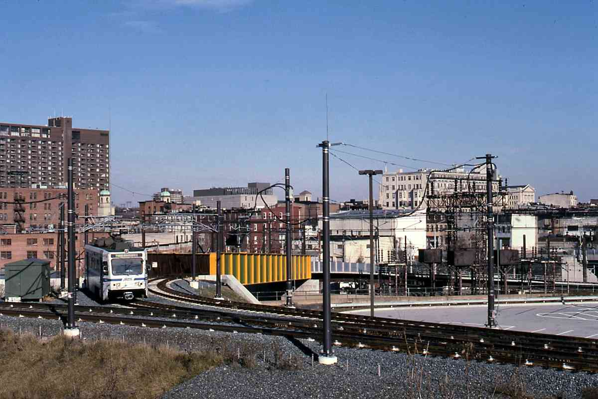
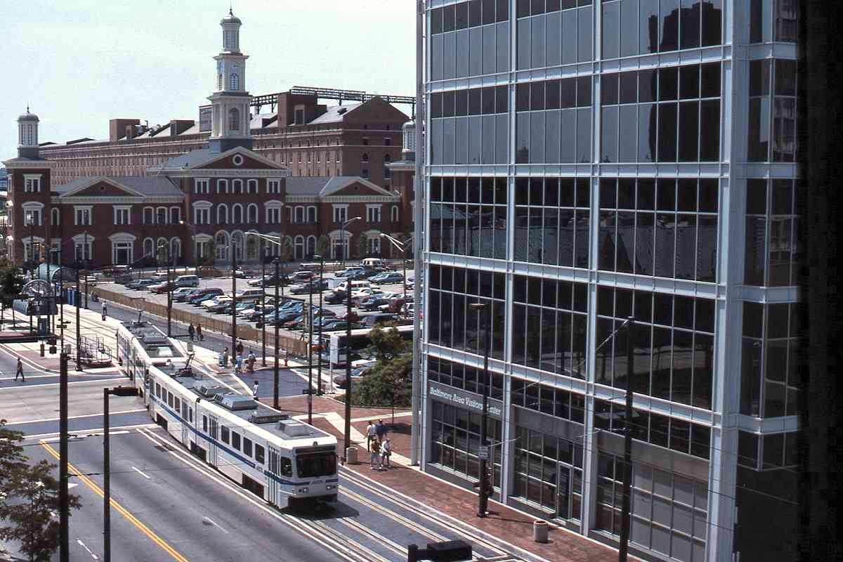
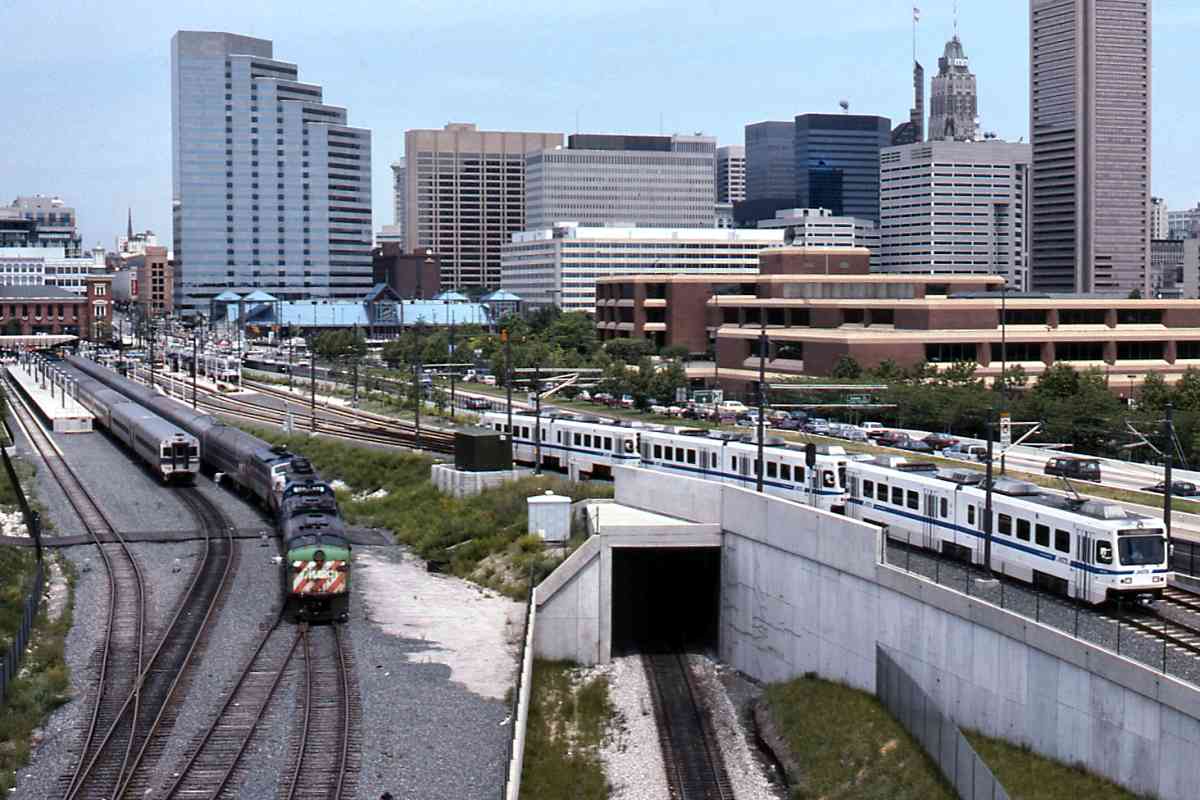
The reimagining of Camden from tired rail yard into a sports complex, with road and rail access into a revitalized downtown, was a major success story for Baltimore, a city that can use every such story it can get.

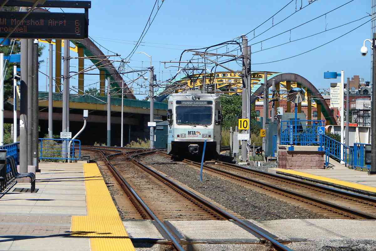
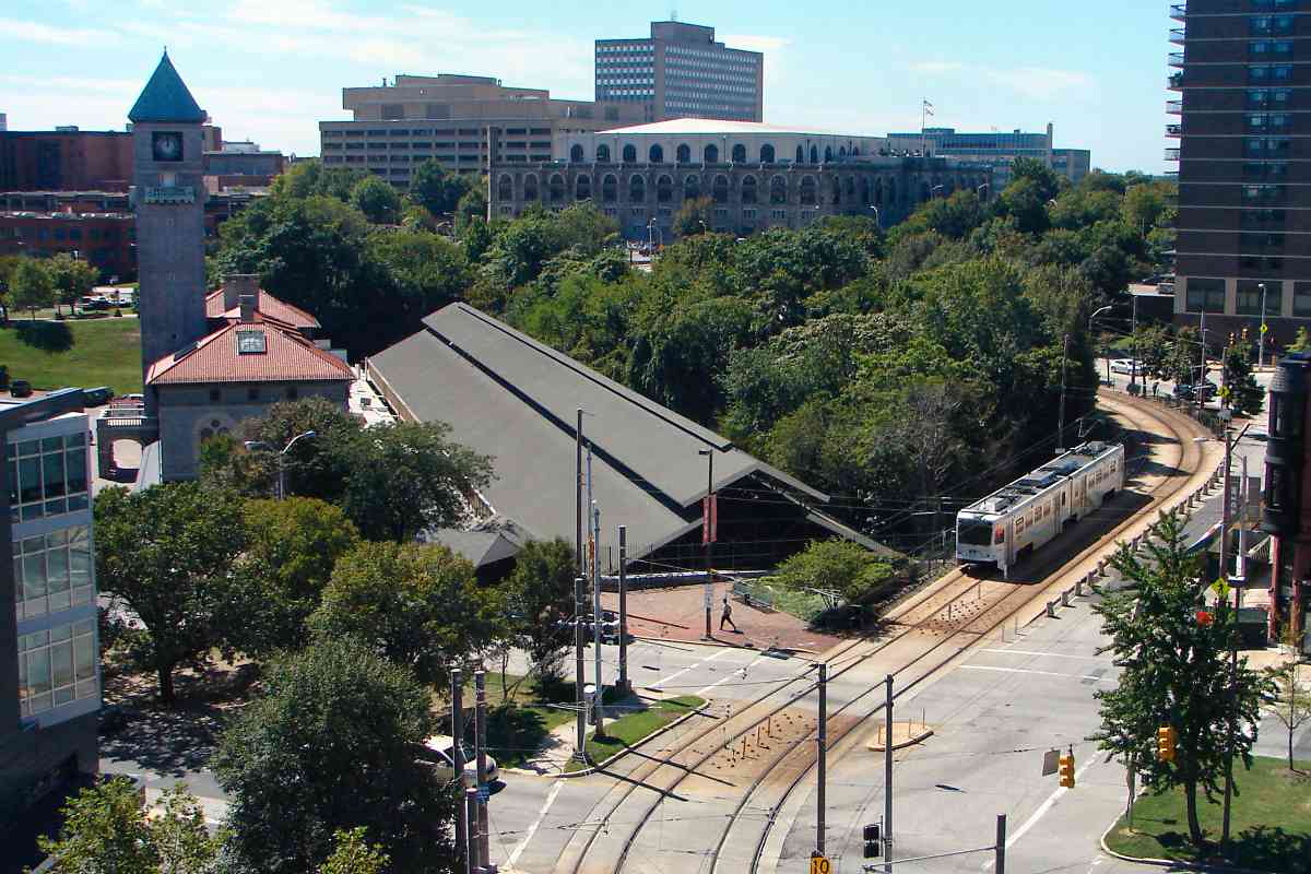
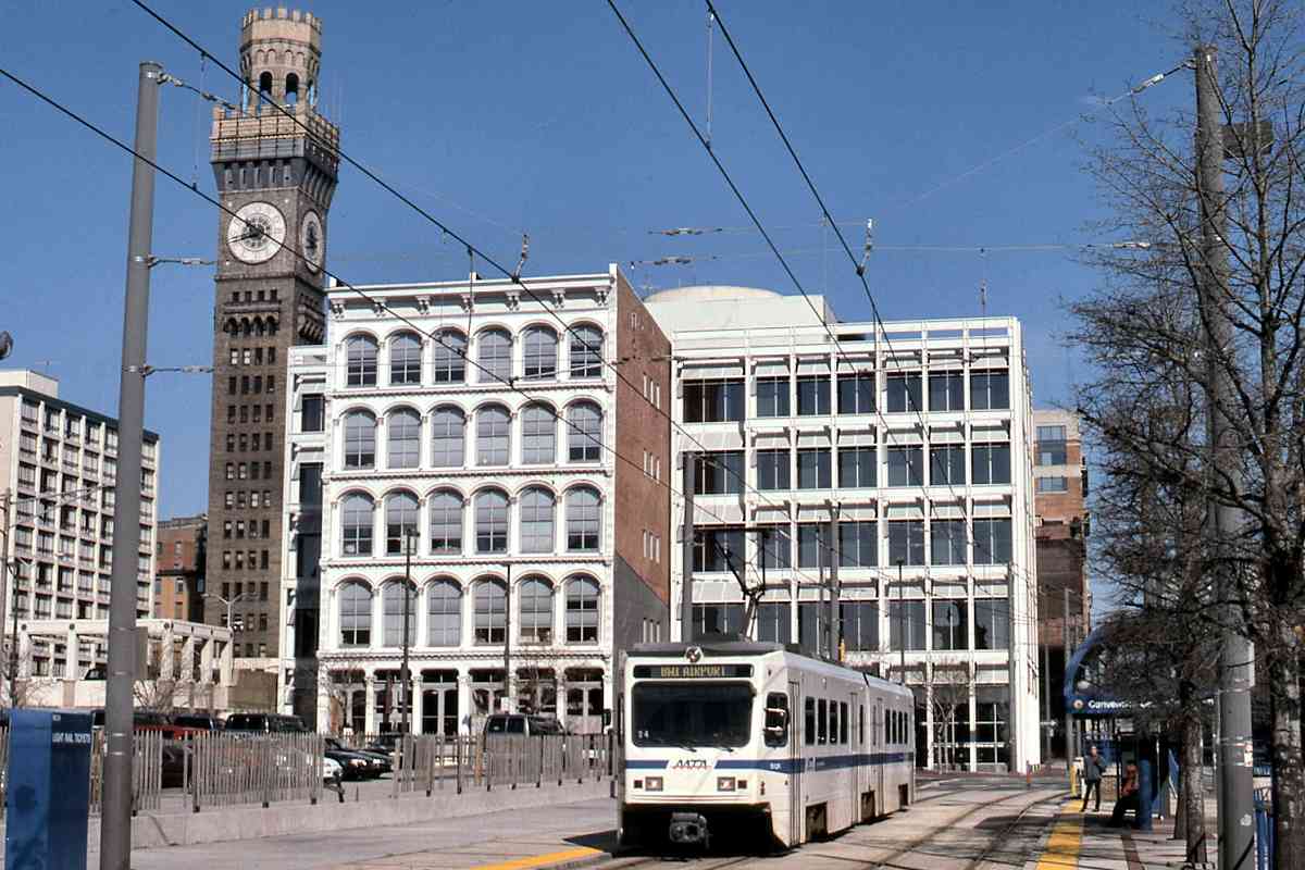
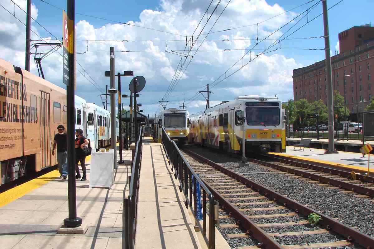
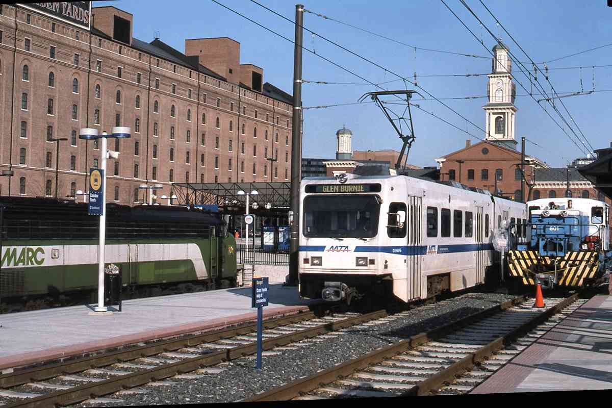
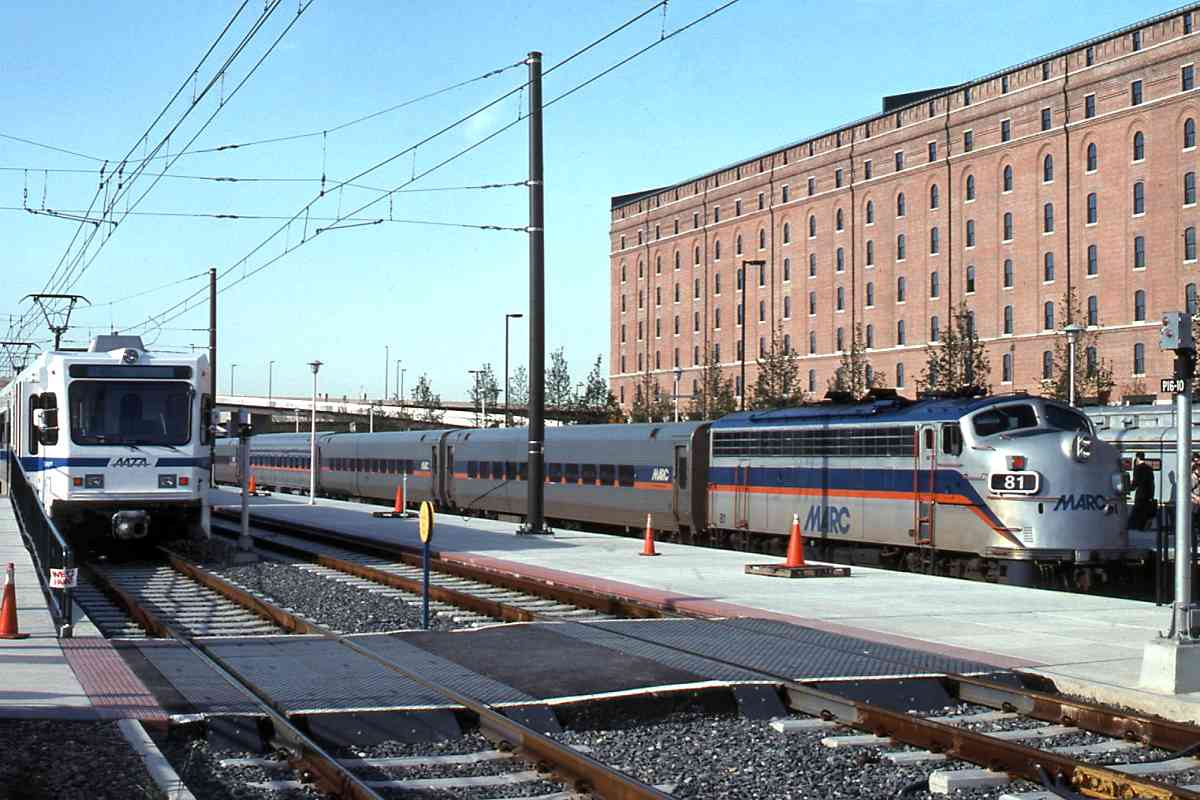
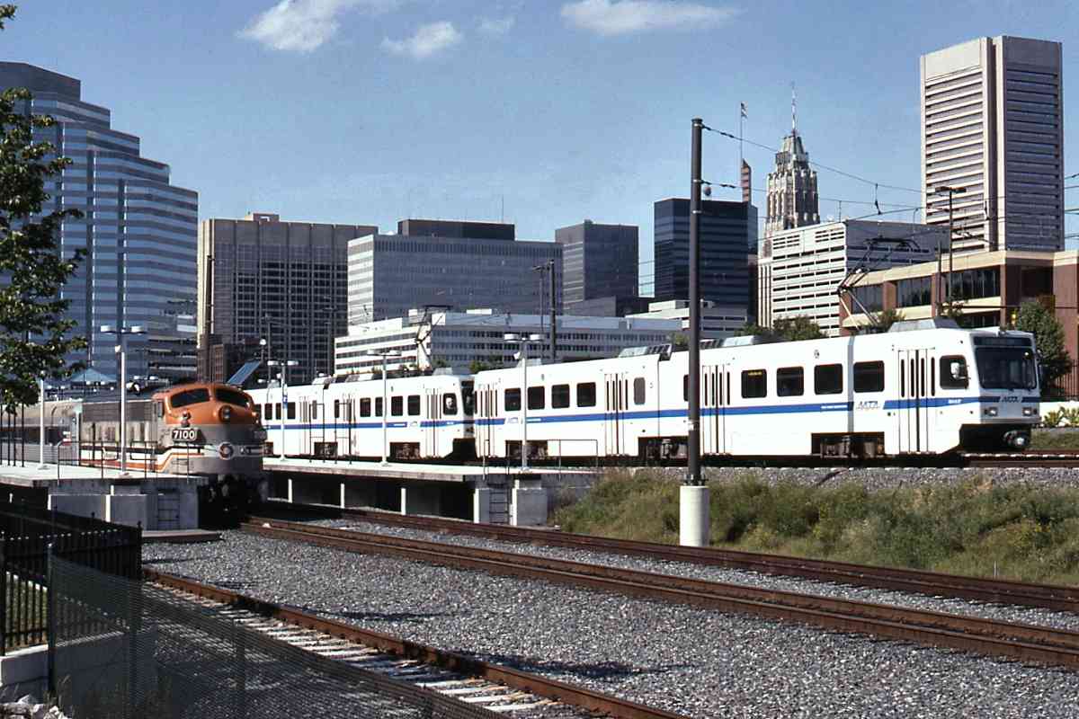
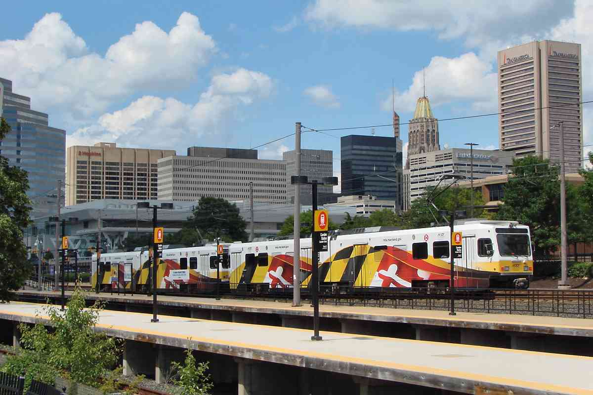
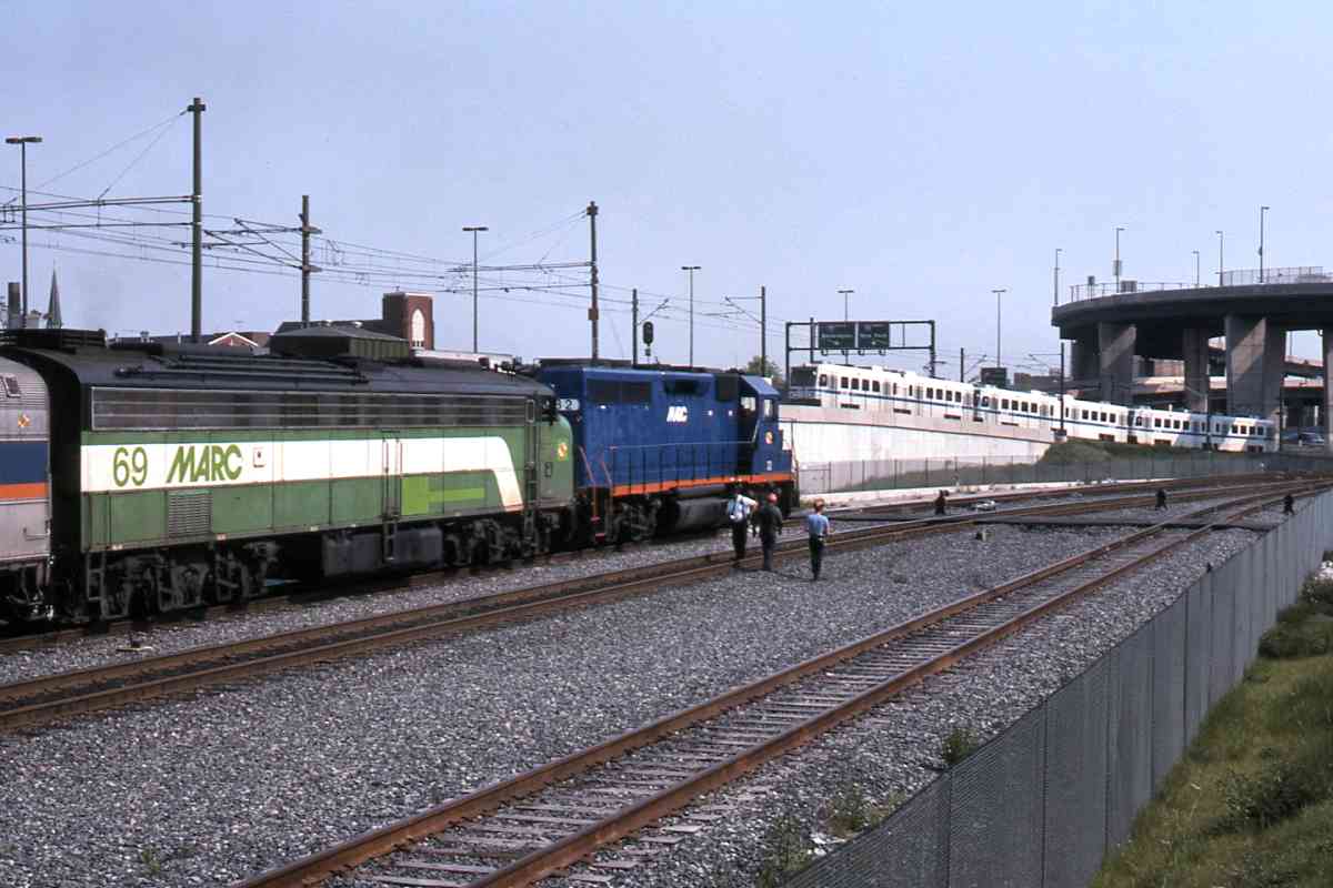
Pictured here are Oriole game "baseball special" trains operated by MARC and lighr rail. It's for sporting events that light rail is more likely to run the otherwise uncommon three-car sets, as seen here. The black 
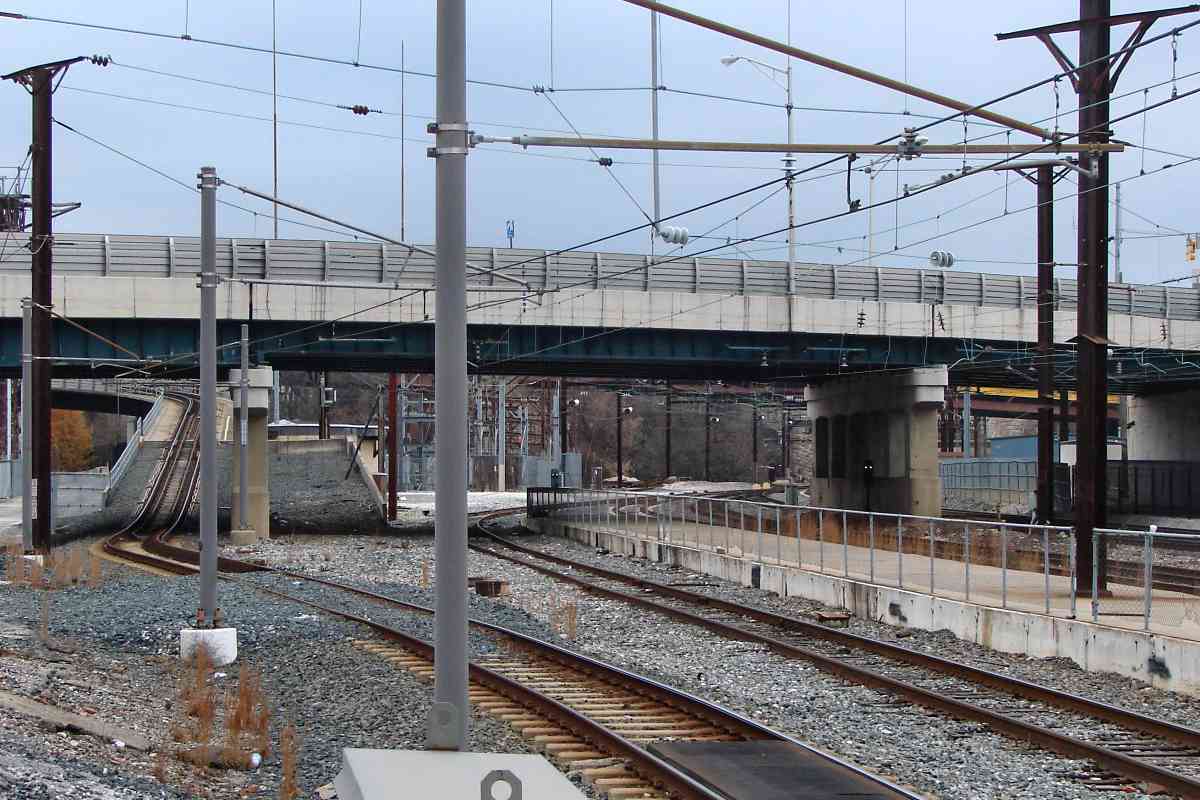
square near center is the Howard Street Tunnel's south portal, which during the reimagining was relocated south a bit to create room for light rail above.

Special thanks to Herb Harwood who contributed over 100 light rail photos to this tour, and supplied interesting history details. Via decades of study and photography, he has assembled an amazing storehouse of rail history knowledge, and most graciously shares it. If you like the content at this site, get one or more of Herb's books; all are meticulously-researched, wonderfully-written, lavishly-illustrated must-reads in this field.

Change for: Baltimore Belt Line tour at this site


<< Previous (north) | THIS PAGE: Penn Station to Camden Station | Next (south) >>

Or, return to main page

Copyright Notice